The Isle of Wight Coastal Footpath
 |
 |
|
IntroductionThe Isle of Wight Coastal Path follows the coastline of the Isle of Wight for 71 miles, starting and ending in Cowes on the northern coast of the island. It is a varied walk, with some classic walking along high cliffs along the southern coast contrasting with, unfortunately, long road sections inland on the northern. At the westernmost extent of the island it visits the world-famous Needles, although a short diversion of the trail is needed to view them. |
The map. |
 |
 |
|
The Isle of Wight Coastal Path in sections
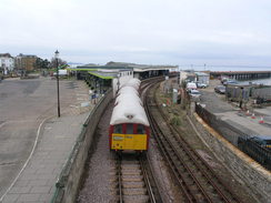
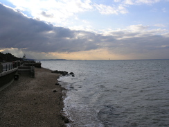
East Cowes to Ryde
Notes
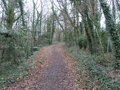
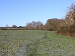
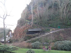
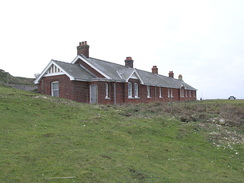
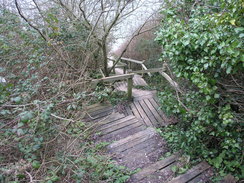
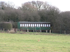
This leg of the trail is hardly classic walking, with the first three and a half miles to Wooton being along roads a distance away from the sea. The second stretch of the walk - between Wooton and ryde is easier going on the feet, although again the trails remains some distance from, and out of sight of, the sea.
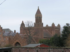
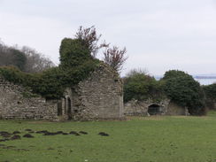
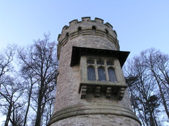
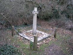
Having said that, there are still items of interest to be seen on the walk. The first stretch passes the grounds of Osborne House, Queen Victoria's holiday home on the island. Unfortunately the house remains out of sight. Later, the dramatic brick buildings of Quarr Abbey, which shines rosily in the sunshine. Just down the hill are the ruins of the old abbey, part of which has been built into a farm.
Directions
The Isle of Wght coastal path starts (or ends if being walked in the opposite direction) at the chain ferry landing in East Cowes, at SZ501955. Head up the A3021 Ferry Road, which starts to head inland through the town. The road soon curves to the right to head southeastwards. Continue along this road for 1.7 miles as it climbs uphill and curves around, passing the entrance to Osborne House and a roundabout (not marked on old OS maps) on the way. There is a pavement the entire time, although it is occasionally necessary to cross the road as the pavement swaps from one side to the other.
When a road junction is at SZ516933 turn left down Alverstone Road. Follow this road east-southeastwards for 1.5 miles until it ends at a road junction with Palmers Road at SZ537924. Turn left along Palmers Road for a few yards, and then turn right to head eastwards along Footways for a fifth of a mile until it ends at a T-junction. Turn left for a couple of yards, and then turn right down a footpath that initially heads down a driveway before squeezing past fences.
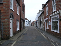
This footpath soon ends beside some garages; turn left down the access road to reach St Edmund's Walk. Turn right to head downhill along this road for about a hundred yards. Just after Whitehead Crescent comes in on the left (and before the road curves to the left), turn right past some garages. This leads to another path on the left, which can be followed downhill between fences. It becomes School Lane, which then ends at a T-junction with New Road. Turn right to head south along New Road, but before the main road is reached turn left along a footpath that soon ends at the Sloopm Inn on the (inaccurately-named) Mill Square beside Wooton Bridge.
Cross the bridge and continue uphill along the A3054 road. After a third of a mile, at SZ551921, turn left along another footpath. This heads north and then north-northeast for a third of a mile. At SZ553926 turn right along another footpath that brings you out onto the B3331 road. Turn left and follow this road as it heads northeastwards for a quarter of a mile, passing the entrance to Fishbourne ferry terminal on the way.
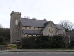
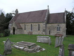
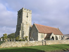
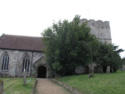
When the Fishbourne Inn is reached at SZ557928 turn right along a lane called Quarr Road. This heads in a rough easterly direction for a little over a mile. Quarr Road is left at SZ570925 as a path leads off to the left, joining a driveway beside some gates to reach a road in Binstead at SZ574927. Turn left along this road and follow it as it immediately swings to the right to meet another road. Turn left along this road and follow it northwards for about fifty yards to Binstead Church. The road curves to the right beside the church to head eastwards; as the road curves to the left continue straight on along another path.
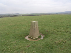
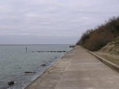
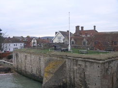
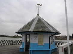
Follow this surfaced path eastwards as it descends down to a stream, with Ryde Golf Course on either side. It curves to the right slightly to head east-southeastwards; half a mile after the church it goes through some gates and reaches a complex road junction beside the A3054. Do not head towards the A3054, but instead turn half-left down a track called Spencer Road. This heads northeastwards downhill before curving to take a more easterly course. Continue along Spencer Road until it ends at a T-junction with St Thomas's Road at SZ590927 (1). Turn left and follow St Thomas's Road as it heads downhill and curves to the right to head northeastwards. Join the esplanade through Ryde; the bus and railway stations are a few yards away on the left.
(1) The map and some guides have the coast path turning left from Spencer Road down Buckingham Road from SZ590926; this road then curves around to reach St Thomas's Road slightly downhill from the route described above. The signs on the ground follow the route described above. There is little difference in either route.
 |
 |
|
 |
 |
|
 |
 |
|
 |
 |
|
 |
 |
|
 |
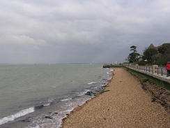
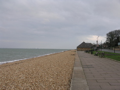
Ryde to Bembridge
Notes
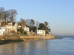
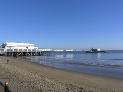
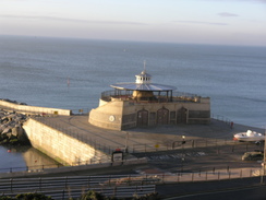
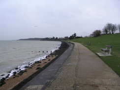
Leaving the dramatic Ryde pier behind, the trail follows the coastline eastwards out of the town, passing the strange Appley Tower, a stone-built folly. The promenade continues past Puckpool Point before joining a road into the village of Seaview; there are grand views over the Solent towards Portsmouth from this stretch, with many boats passing to and fro.
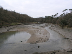
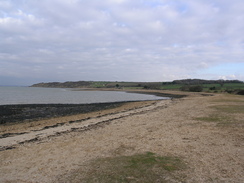
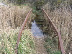
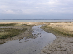
Sadly the coast is left behind at Nettlestone point, skirting inland past a hotel before rejoining the coast near the ruins of St Helen's Church. The Duver is then crossed, an area of what was once sand dunes, much of which has now been removed to leave marshland, to reach a stunning walk across a causeway to St Helens itself.
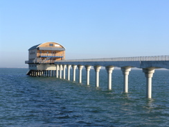
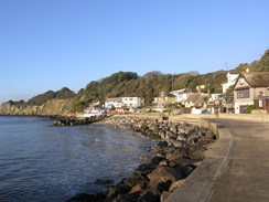
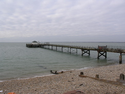
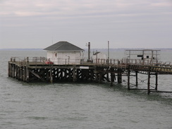
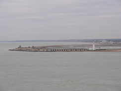
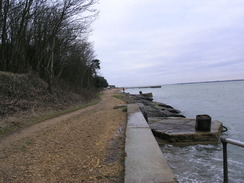
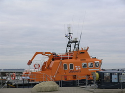
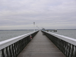
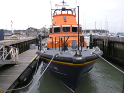
A long road walk follows along the southern edge of Bembridge Harbour, fortunately with a good pavement. The coast is then rejoined, literally, as the trail follows the foreshore southeastwards to reach the spectacular Bembridge lifeboat station, which sits out at the end of its very own pier.
Directions
This leg starts off at the bus station in Ryde. Leave the bus station and turn left to head eastwards along the road called the Esplanade for a little under half a mile, passing a roundabout on the way. At SZ600926 turn left along a promenade, following it as it passes a lake, a lifeboat station and Appley Tower on the right. 1.2 miles after leaving the road it passes Puckpool Point and reaches a Springvale Road beside a pub.
Continue straight on along Springvale Road (later Duver Road) for 0.6 miles until it curves sharply to the right at SZ625917. Here continue straight on along a promenade for a quarter of a mile until it ends at a road. Turn left and follow the road as it curves around, following the foreshore before curving to the right uphill, becoming the High Street. Head uphill along the High Street for a couple of hundred yards and then turn left along Pier Road.
When Pier Road meets the shore once more continue straight on along a path in front of some flats; it curves to the right to meet the road once more. Turn left and head south along the road until it ends, and then take a footpath that heads off to the left, angling down towards the sea. The path ends by some public toilets on Ferniclose Road. Turn right up the road and follow it as it curves to the left, becoming a track. It curves to the right once more to take a south-southwesterly course.
A quarter of a mile after the bend a junction with another path is reached on the left at SZ630902; turn left down this footpath and follow it southeastwards for a fifth of a mile until it meets a track by a golf course. Turn right to head south down this track; it passes the entrance to a caravan park on the right. At SZ632897 turn left across a stile to enter a field. Descend down the field to the southeast, aiming for the far corner. Cross a stile at the bottom and then turn left to head southeastwards with a stream on the left. The path emerges out onto Duver Road at SZ635894.
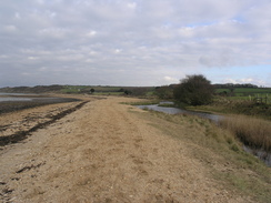
Turn right to follow The Duver as it twists and turns in a rough southerly direction for about a fifth of a mile, passing the entrance to a car park on the left. At SZ636891 turn right along a footpath that heads southwestwards across an area of boggy ground to meet Bembridge Harbour by the start of a causeway. Turn right and follow the causeway southwestwards; it eventually curves to the right just before joining dry land at a road. Turn left along this road with water on the left, and then turn right to head west with houses on the left. After a short distance turn right and then left to reach Latimer Road. Turn left and follow Latimer Road westwards for a few hundred yards until it ends at the B3395 road.
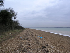
Turn left and follow the B3395 road as it follows the southern edge of Bembridge Harbour eastwards for a mile. It reaches the Pilot Boat Inn on the right; as the road curves to the right two tracks head more or less straight on; take the left-hand one of these and follow it uphill until it ends at Ducie Avenue. Turn left down the avenue and follow it for a short distance towards the sea. At the bottom take a path leading off to the right, which soon joins the foreshore.
Follow the foreshore for about 0.8 miles until it reaches the pier belonging to Bembridge Lifeboat, where this leg ends.
 |
 |
|
 |
 |
|
 |
 |
|
 |
 |
|
 |
 |
|
 |
Bembridge to Sandown
Notes
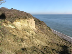
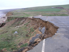
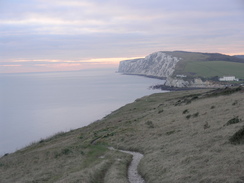
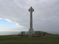
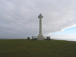
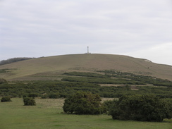
The trail leaves Bembridge by heading slightly inland, and therefore misses the easternmost point of the island. It rejoins the coast at the top of the cliffs near a pub, but only for a short distance - erosion has closed the clifftop path, and the diversion is again, sadly, along minor roads inland from the coast. Fortunately the coast is soon rejoined as it squeezes past the site of the old Bembridge School (surprisingly made famous by mentions in the film, 'The Mummy') before ascending up onto the chalk cliffs of Culver Down.
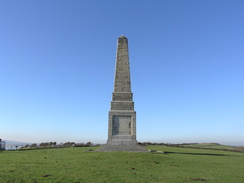
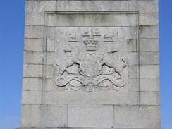
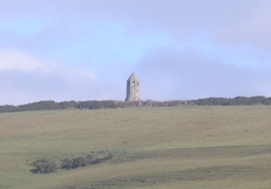
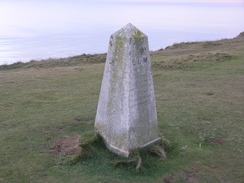
After visiting the Yarborough Monument and admiring the views out to sea, the trail descends across fields to reach a road near Sandown zoo. A promenade then runs alongside the road, leading into Sandown and the pier.
Directions
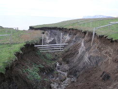
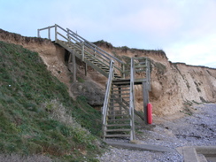
This leg starts off by the pier that leads to the Bembridge Lifeboat. Head southeast from the pier, passing through the car park to join a road, Fishermans Walk, which runs just inland of the shore. As it approaches a small golf course turn right down a narrow footpath southwestwards until it ends at Foreland Farm Lane. Turn left along this lane and follow it as it curves to the right, then turn left along Beachfield Road. This curves to the right to pass a coastguard building. Immediately after the building turn left to pass through the car park of the Crab and Lobster pub to reach a path beside the coast. The path curves to the right and runs along the top of the cliffs westwards before reaching a lane at SZ654872.The footpath along the tops of the cliffs from here has been shut due to landslips, so turn right to walk north up this road. Take the first road off to the left, Howgate Road, and follow that southwestwards for a little over half a mile until the road curves to the right at SZ645870. Pass a gateway and then turn left and follow a path back down to the clifftops. Once there, turn right to rejoin the path as it heads southwestwards, passing seawards of the old Bembridge school.
The path emerges out onto into a grassy area of a caravan park; continue on along the edge of the cliffs, passing a sloping track leading down to the beach, and on out of the park. The path curves to the left and then starts to climb up through some scrubland, taking a more westerly course. It emerges out onto grassland near the top of the ascent; make your way to a gap in the hedge and then turn half-right to head towards the Yarborough Monument.
From the monument turn left to head down towards the road. Turn right for a few yards, passing a cafe on the left, and then turn left down a footpath that heads across grassland to reach the clifftop path. Turn right and start following the path downhill for a little over a mile; it is never strays too far from the edge of the cliffs. It eventually reaches a car park, and then the B3395 road at SZ610849. Do not join the road, but instead take the promenade that runs alongside it for 0.6 miles, and then turn left down Avenue Road Slipway to reach the promenade once again.
The road soon ends at the sea once again; turn right and continue southwestwards along the promenade for half a mile, passing Sandown Pier, where this leg ends.
| |
 |
|
 |
 |
|
 |
 |
|
 |
Sandown to Ventnor
Notes
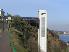
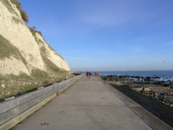
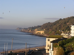
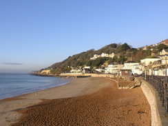
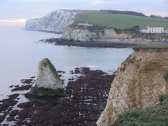
Instead of following the promenade southwestwards from Sandown, the trail climbs up onto the top of the cliffs and skirts the cliff edge instead, allowing great views out over the western English Channel. The trail runs either along minor roads or paths across grassland, and the going is easy despite a few dips and rises. It passes a fantastically ugly concrete cliff lift - little more than a brutal vertical shaft alongside the cliff - before reaching a road above Shanklin.
Paths and roads continue on along the top of the cliffs before descending along a zigzag path down Shanklin Chine. The foreshore is followed south for a short distance, before a long flight of App;ey Steps lead back up onto the cliffs. Sadly the cliffs are left behind for a while as the trail heads inland and follows roads south past Luccombe Village. A good path bypasses the village before entering a jumbled area of old landslipped land. The trail slowly descends, eventually reaching the end of a promenade. This offers good view over the sea as it winds its way under the cliffs to reach the small harbour in Ventnor.
Directions
This leg starts off at Sandown Pier. Head southwest from the pier for a couple of hundred yards; when the promenade ends at SZ596838, turn right to join a path that angles steeply uphill behind some apartments. It curves to the left once more to reach a path that runs along the top of the cliffs. Follow this for about one and a half miles as it follows the cliffs, initially southwestwards and then southwards.At SZ586817 it crosses Hope Road Approach; continue on up Eastcliff Promenade. When this ends continue on along the path southwards; it joins a road for a while, and when this curves to the right head straight on uphill along another path before joining Chine Avenue. Follow this downhill for a short distance; when it curves to the right continue on downhill along another path. This curves to the right past a pub, and then to the left once more, curving more before ending at the promenade at the base of the cliffs.
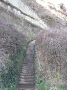
Turn right and follow the promenade southwards past the mouth of the chine. When Appley Steps are reached at SZ584808, turn right to ascend the long flight of steps onto the top of the cliffs. At the top the path turns to the right to head inland, becoming Popham Road. This swings to the left, and then turn left up Luccombe Road. Follow this road for half a mile; there is a path skirting through a field to the right for a short stretch, but the road is quiet enough for this not to be needed.
At SZ583300 the road splits; take the left-hand fork which soon becomes a path that heads through scrubland to seaward of Luccombe Village. It is easy to follow as it enters an area of landslip, now thoroughly populated with trees, eventually dropping down onto the end of a promenade at SZ578779.
Follow the promenade as it twists and turns southwestwards for a mile until it reaches Ventnor harbour at SZ563773.
| |
|
|
 |
 |
|
 |
 |
|
 |
 |
|
 |
 |
|
 |
 |
|
Ventnor to Chale
Notes
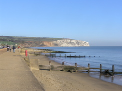
A spectacular stretch of path leads westwards out of Ventnor, climbing up onto small cliffs before descending to meet a promenade that leads to the beautiful little hamlet of Castle Cove. It then climbs up to pass the edge of the Ventnor Botanical Gardens. This is soon left behind and is followed by a superb roller-coaster ride along low cliffs, with great views out to sea. It eventually heads away from the sea, climbing uphill through the small village of St Lawrence and taking a steep path onto the top of the inland cliffs.
The next couple of miles are a superb stretch of trail, with expansive views out to sea over the landslipped land below. The main road is crossed to the south of Niton, after which the high cliffs and views are rejoined. The southernmost point of the island, St Catherine's Point, and its lighthouse, are visible on the low ground below, and the summit of St Catherine's Hill ahead to the right.
Sadly all good things come to an end, and the high cliffs end as they approach Blackgang. The trail itself heads inland to follow the main road, before diverting off along a short path to rejoin the main road near Chale Church.
Directions
This leg starts off on the promenade by Ventnor harbour. Follow the promenade westwards for a third of a mile beside the beach. When the Spyglass Inn is reached, turn right up a road that climbs above the pub. The road soon turns into a hairpin bend; here continue straight on westwards through a car park. A path starts seawards of the car park; continue on until ;Ventnor' is written in white letters on a bank to the right. Shortly after this turn right up another path that swings to the left and then starts to descend to meet the cliffs once more. Follow the path westwards as it crosses some grass and meets a track at SZ553770. Continue on down this track until it reaches a promenade that can be followed all the way to Castle Cove.
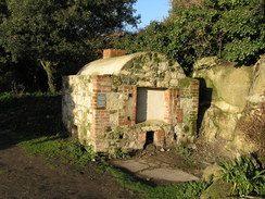
Pass in front of the buildings at the cove until a cafe is reached and then turn right up a path between buildings. It turns to the right before meeting another track; turn left along this to follow a path westwards along the top of the cliffs, passing to the seaward of the Ventnor Botanical Gardens. It leaves the gardens beside an old brick-built incinerator; continue on along a field with a hedge on the right. When the hedge ends continue straight on, aiming for a gap in a hedge that leads to a track.
Follow the track westwards past a house; when it ends continue straight on along a path for three quarters of a mile as it follows the edge of the cliffs. At SZ535761 a track is met; turn right and follow the track northwards. It soon reaches a track by some houses; continue on until the track ends at a T-junction. Turn left to follow a green track across a field; as it curves to the left turn right up another path. This climbs uphill before ending at Woolverton Road in St Lawrence.
Turn left and follow the road westwards; it soon ends at a T-junction. Here turn right up Old Park Road. This curves to the right before ending at the A3055 road. Turn right along this for a few yards, then turn left up Spindlers Road. When this ends at a T-junction with Seven Sisters Road, turn left to climb uphill along this road. The brow of the hill is reached after about a hundred yards; here turn right up a footpath opposite a driveway. The path heads through three and climbs up steps, eventually emerging out onto grassland at SZ530765.
A post marks a junction in the paths; turn left and start following the path westwards along the top of the cliffs. After 1.5 miles at SZ506760 the path curves to the right and starts to descend to meet a track. Turn right along this track, then left to descend down to the A3055 road.
Carefully cross the road and then turn right for a few yards uphill to reach a driveway. Turn left and follow this driveway as it curves to the right and ends; ignore the separate entrances to the house and join a footpath that runs past fields along the edge of the cliffs. SZ489766 is reached after a little over a mile; here the path curves sharply to the right (still following the cliff) to head inland. After a short distance a path heads on to reach a car park.
Go through the car park to the far left-hand corner. Here a footpath leads off to the left, curving around through some scrubland. It emerges out into a field; keep the hedge on the right and follow it around until a gap is reached. Cross a stile to reach the A3055 road. Turn left along the road and follow it downhill to a roundabout; at this turn right (second exit) and continue on northwestwards.. Shortly after the road curves to the right, turn left to join another footpath that heads northwestwards, initially with a fence on the left.
The path curves to the right and enters some woodland as it descends before ending at a road called The Terrace. Turn right down this road for a few yards to reach the A3055. Turn left to follow the road westwards, passing Chale Church on the right, where this leg ends.
 |
 |
|
 |
 |
|
 |
 |
|
 |
|
|
 |
 |
|
 |
 |
|
 |
 |
|
 |
Chale to Freshwater Bay
Notes
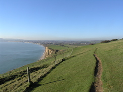
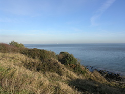
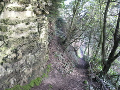
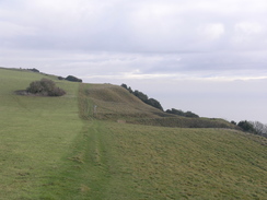
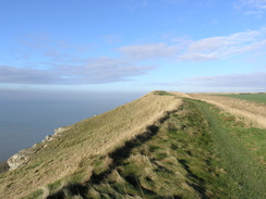
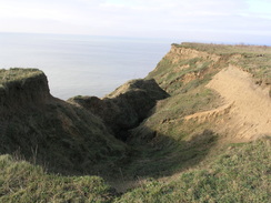
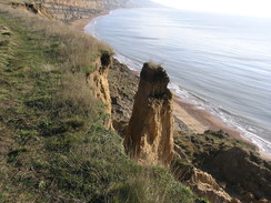
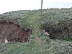
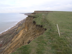
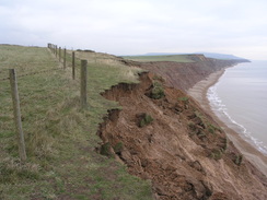
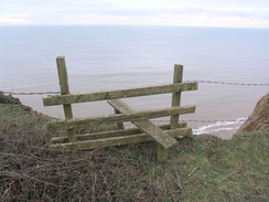
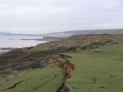
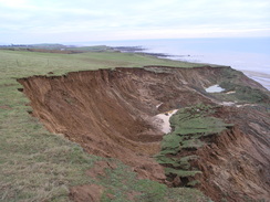
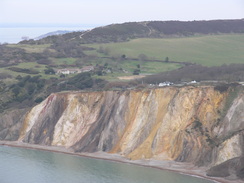
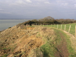
The trail follows Walpen Chine from near Chale Church back to the fast-eroding coast. The chine turns to parallel the coast for a distance, before plunging down through the soft cliffs to the beach below. This stretch of chine could well soon disappear as the cliffs erode. The trail then follows the clifftop for many miles, making a few occasional diversions inland to go around chines, or otherwise descend into them. Superb views out into the channel can be had on this, the most remote and wild stretch of the coastal path. The cliffs are surprisingly high, and you will need to take care not to head to close to the soft edges. In places you may need to make a diversion into neighbouring fields to avoid cliff falls, especially after stormy weather.
After Brookgreen the path heads between the low cliffs and the sea; the road has been diverted inland here as it was encroached by the cliffs. After Compton Chine the nature of the land alters as the trail climbs the flank of the chalk ridge of Compton Chine in company with the road. It diverts away from the road for the last stretch down into Freshwater Bay.
Directions
This leg starts off at Chale Church. At the church turn right to follow the A3055 road westwards; it curves to the right, and when a pub driveway comes in on the right, turn left down a footpath that runs westwards with a stream on the left. After a short distance a plank footbridge leads over the stream; continue on with the stream on the right until the top of the cliffs are reached. Cross another plank footbridge and start following the cliffs northwestwards.
These cliffs are subject to paid erosion, and the directions given below could change if there has been a cliff fall. Care should be taken, as some of the drops are severe. Follow the cliffs northwestwards for just under half a mile, passing the mouth of Walpen Chine; at SZ471780 the path turns to the right to head inland across a field to reach the main road once more.
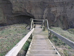
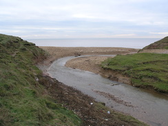
Turn left and follow the main road northwestwards for a hundred yards. When a car park is reached on the left, turn left to follow the northern bank of Whale Chine back to the cliff edge. Follow the cliffs northwestwards for 1.6 miles until Shepherd's Chine is reached at SZ447797. Turn right and follow the southern bank of the chine for a short distance until steps lead down to the left. Follow these to the bottom of the chine, cross the stream and then turn left to head westwards with the stream on the left.
Take a path that leads up to the right from the mouth of the chine. At the top follow the cliffs northwestwards for a couple of hundred yards to the next chine, then turn right to follow the chine inland until a track is reached at SZ445801. Turn left and follow this track back towards the cliff edge; head through a gap in a hedge on the right to reach the cliff edge once more.
Follow the cliff edge northwestwards for 1.8 miles; it climbs up to the trig pillar on Barnes High before slowly descending to meet Marsh Chine at SZ420816. Some steps lead down to a footbridge at the bottom of the chine. Cross the footbridge and head straight on, passing a couple of static caravans before turning to the right to take an access driveway uphill. As this swings to the left, turn left to rejoin the clifftop path.
Head along the coast for half a mile until a track comes in by hedges at SZ410821. Follow this track up to the main road, and then turn left to follow the main road westwards for about a hundred yards, passing in front of Isle of Wight Pearl. The road crosses a chine; when a car park is reached on the other side turn left and follow a footpath that heads back to the cliff top.
Turn right and follow the cliff top path for 1.6 miles until Brook Green is reached at SZ386834. Here the path leaves the cliffs; turn right, keeping a low ruined building (an old lifeboat hut) on the left. Join a track and follow it up to the main road. Just before the main road is reached turn left to walk parallel to the road until a car park is reached. Take a path that heads from the left-hand side of the car park to rejoin the clifftop path.
Continue on northwestwards along the clifftop path for about 1.5 miles; it passes a fast-eroding car park and then climbs uphill to avoid a large area of slumping. Compton Chine is reached at SZ367851; a stile leads across the fence to access a footbridge over the chine. Cross this, then angle back uphill to another stile that gives access to the clifftop path.
The path climbs up once more, approaching and then running alongside the main road as it climbs. It follows a little bank on the left-hand side of the road until the brow of the head is reached, and then it heads off to the left, descending downhill westwards. It slowly approaches the cliff edge, then runs alongside it as Freshwater Bay is approached. Eventually some steps lead off to the left; take these down to the beach. Follow the beach westwards for a few yards past the lifeboat station, then turn right to head inland to reach Gate Lane opposite a car park at at SZ346857.
| |
 |
|
 |
 |
|
| |
 |
|
 |
 |
|
 |
 |
|
 |
 |
|
 |
 |
|
 |
 |
|
 |
 |
|
 |
 |
|
 |
 |
|
 |
 |
|
 |
Freshwater Bay to Yarmouth
Notes
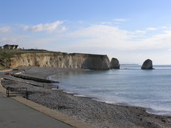
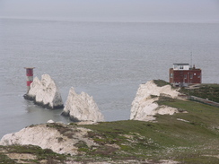
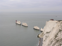
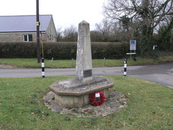
This stretch includes the world-famous Needles, the chalk pinnacles that mark the westernmost part of the island. The trail climbs up out of Freshwater Bay onto Tennyson Down, with good views out to sea. It passes the Tennyson Monument (erected in memory of Lord Tennyson) before heading across to West High Down. When the Coastguard cottaes are reached the trail diverts off along a track towards Alum Bay. If you wish to see the Needles or visit either the Old or New Battery, then a much-deserved diversion off the trail is needed.
A track takes you along to the cliffs above Alum Bay, which is dominated by the Needles Park, a tourist attraction. In the distance can be seen the chair lift that takes people down the famous striped cliffs to the bay below, from where boat rides operate in summer. A climb then takes you onto one of the hidden gems of the island's coast - Headon Hill, an area of moorland with good views of the sea. Sadly this has to be left behind, and a long descent leads northeastwards down to meet a promenade by the sea in Totland.
The promenade leads past the private Totland Pier and around Warden Point towards Colwell. It then heads way from the coast once more, following the main road and tracks to pass through a caravan park. A good track then leads through woodland to the south of Fort Victoria, sadly with no views of the sea. The trees end the trail continues onto the Norton Spit, then across the mouth of the River Yar via the Yar Bridge to reach the town of Yarmouth.
Directions
This leg starts off on the road that is squeezed between the car park and the sea in Freshwater Bay at SZ346857. Follow the road northwestwards as it starts to curve away inland; after a short distance some public toilets are reached on the left. Turn left down the track (signposted for Fort Redoubt).
Continue on southwestwards down this track for a short distance until a stile is reached on the right. Cross this, and take an obvious path that heads uphill in a rough westerly direction, aiming for a stile in the upper-left hand corner. Cross the stile and start following a path uphill westwards for nearly a mile, aiming for the Tennyson Monument and staying slightly away from the edge of the cliff.
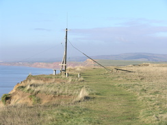
There is a path that follows the cliff edge from the monument, but the official coastal path heads downhill slightly to the right, aiming for a beallach. It passes a replica of Nodes Beacon at SZ318853 before climbing uphill west-southwestwards onto West High Down. Continue on along the crest of the hill for a little over a mile until a fence is reached near to the coastguard cottages at SZ300847, with a mast on the left and the cottages on the right. Turn right and follow the fence downhill past the cottages until a stile is reached.
Here my route diverted away from the coastal path for a short distance. Cross the stile and turn right to join a surfaced track that heads downhill. Follow it around a hairpin bend and then turn left to head down towards the Needles Old Battery. At the entrance to the battery turn left up some steps. The path immediately curves to the left to head uphill with a fence in close company on the right. It ends in the New Battery. Turn right to follow a road past a coastguard hut; the road curves to the left to reach the site of the rocket test stands. As this is reached turn right to reach the Needles viewpoint. From there, head back up the steps to the track, and follow it round past the coastguard hut to reach the New Fort. Pass through this and cross a stile to reach the coastal path once more.
A footpath angles downhill east-northeastwards; initially the gradient is gradual but it soon becomes steeper as it ends at a surfaced road at SZ302849. Turn right and follow this road as it heads east-northeastwards; after a third of a mile it turns sharply to the left to head northwards. It passes the car park of the Needles Park on the left before reaching a roundabout at SZ308854. Turn right at the roundabout and follow the B3322 eastwards for a couple of hundred yards.
Turn sharp left down a track leading to a golf pitch and putt course. Continue down this lane until a gate is reached; here join a footpath that angles off to the right. This path curves around between hedges, initially to the right and then the left before emerging out onto the site of the old Headon Fort at SZ307857. As soon as you enter the grassy area of the fort turn right along a steep chalk path that leads up onto Headon Warren.
Continue along path eastwards, staying slightly to the north (seaward) of the summit ridge. When the path forks take the left-hand fork and follow it as it passes seaward of Warren Cottage. A good path then descends with the edge of the cliffs close by on the left. The path eventually curves to the right before ending at Cliff Road at SZ319863.
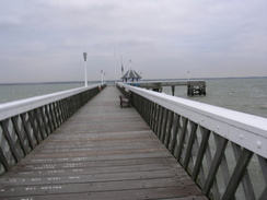
Follow this road as it winds downhill, curving to the left. After a couple of hundred yards a path leads off to the left; head down a slope to reach the top of a long flight of wooden steps that leads down to the foreshore at Widdick Chine. Turn right to join the seawall for a little over a mile; it passes Totland Pier and then curves to the right around Warden Point to reach the end of a road at Colwell Chine at SZ326878.
Turn right up Colwell Chine Road and follow it southeastwards for about a quarter of a mile until it ends at the A3054 road. Turn left and follow the road northeastwards for another quarter of a mile; when the road curves to the right turn left down a track that leads towards Brambles Farm. Continue along the track keeping the farm on the left until a junction in footpaths is reached; here turn right along a footpath that soon curves to the left to enter a holiday park. A few yards into the holiday park turn right to head eastwards up a driveway uphill; it leaves the park and ends at a junction with a lane called Monks Lane at SZ334885.
Turn left and follow the lane downhill north-northwestwards. It approaches the entrance to another holiday park; at the entrance turn right to take a path that follows the park's fence. It curves to the left before reaching a track. Turn right and follow this track northeastwards away from the park. The track enters some woodland; continue along it for about half a mile before it ends at Westhill Lane at SZ341897.
Continue straight on along the lane for about fifty yards; when it curves to the right take a footpath that leads off to the left. After a short distance this ends at a sea wall. Turn right and follow this seawall eastwards for about a quarter of a mile. When some marshland starts on the right, turn right down a track that heads southwards for a few yards before ending at the A3054 road.
Turn left and follow the A3054 in a rough easterly direction for about half a mile, crossing the Yar Bridge on the way. The road enters Yarmouth; turn left to walk through the bus station and at a roundabout turn left down Bridge Lane to head north back to the ferry landing at SZ354897.
| |
 |
|
 |
 |
|
 |
 |
|
 |
 |
|
 |
 |
|
 |
 |
|
 |
 |
|
 |
 |
|
 |
 |
|
 |
 |
|
 |
 |
|
 |
 |
|
 |
 |
|
 |
 |
|
 |
 |
|
Yarmouth to Shalfleet
Notes
The trail leaves the town of Yarmouth via the narrow High Street, before following a short stretch of promenade beside the sea. Sadly this leads onto a main road, on which the pavement soon ends. After Bouldnor it follows a track back to the coast, and then starts heading along the clifftop through Bouldnor Copse. Erosion shows its power on this coast as well, and care needs to be taken as the path has been rerouted in places.
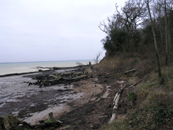
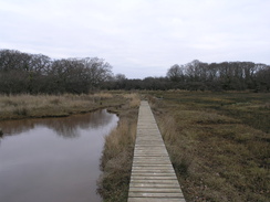
Views of the sea become sparse as the trail reaches the top of the hill, and it is only seen once more as it descends down towards Hamstead Point; look out for a small memorial in the copse to the right on the foreshore. The sea is soon left behind as the path starts down the western side of the Newtown River; the path stays on the foreshore for long periods, with some stretches of boardwalk to help. This stretch can be very slippery at times, so care needs to be taken.
The foreshore of the river is soon left behind, and tracks lead through some fairly pedestrian woodland, climbing and descending to cross the Ningwood Lake before reaching a main road. This is followed down to the small village of Shalfleet.
Directions
This leg starts off at the ferry landing in Yarmouth, at SZ354897. Turn left out of the ferry terminal and head east along Quay Street. When Pier Street is reached opposite The Bugle Inn, turn right and then take the first road off to the left, the High Street. Follow the High Street eastwards for a fifth of a mile; after the last house on the left, turn left to join the promenade.
Follow the promenade eastwards for a third of a mile; when a patch of scrubland is reached at ST363897, turn right to ascend some steps up onto the A3054 road. Turn left and follow this road as it curves eastwards through Bouldnor for about half a mile; the pavement soon ends, but the verges are wide enough to allow you to safely walk along them. At SZ371897 turn left down an unsurfaced track called Victoria Road.
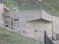
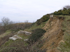
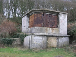
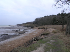
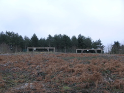
This soon ends at the coast. Turn right to join a footpath that starts heading eastwards through woodland along the top of the cliffs; due to erosion it is best to be careful and follow the obvious paths and keep away from the edge. It soon descends to meet the foreshore before climbing up once more, slowly ascending with the remains of a concrete bunker - part of a battery - up the hill to the right, which might be obscured by trees. The path becomes easy to follow as it runs along the top of the cliffs, although they descend down to disturbed landslips rather than the sea.
Eventually it emerges from the woodland at SZ387905. A path heads eastwards with a hedge on the left; it soon curves to the left to meet a track called West Close. Turn right and start following this eastwards; when a junction is reached turn left to head northeastwards along Cranmore Avenue for about a fifth of a mile until SZ391908. Turn right down a footpath with a driveway on the left; when the driveway ends continue on along the footpath as it heads eastwards across fields.
It skirts around to the south of Hamstead Farm, keeping the hedge on the left. Before another hedge is reached turn right to head eastwards with a hedge on the right. Continue roughly in the same direction across three fields until a track is reached at SZ398911. Head down this track northeastwards towards Hamstead Farm; keep the majority of the farm buildings on the right. Immediately after the farm, turn left down another track. This heads northeastwards, descending to meet the edge of the cliff and after half a mile reaches the foreshore by Hamstead Ledge.
Continue eastwards along the foreshore, passing Hamstead Point. At SZ408919 turn right up some steps and take a footpath that head south across a field, with a hedge on the left. It then continues across an area of marshland for a short distance before climbing up into another field. Head southeastwards across this field with the marshland a short distance away to the left. When a hedge is reached pass through it, then turn right to head south with the hedge on the right.
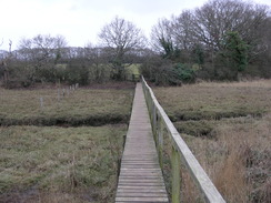
This emerges onto the edge of some more marshland at SZ411913. A set of boardwalks carries the path south along the edge of the marshland, before turning sharply to the left to head eastwards along the southern edge. The boardwalk soon ends and a muddy path continues on; this can be slippery after wet weather. It is a relief when the path turns to the right to enter a field, then turns left to follow a hedge on the left eastwards until it ends at a track at SZ414912, with a jetty a short distance away to the left.
Turn right and follow this track as it heads southwestwards, passing Lower Hamstead Farm on the left. After a quarter of a mile the track curves to take a more westerly course, and after further three-quarters of a mile it ends at a junction with another track at SZ400903. Turn left and follow the track southwards for a little over half a mile; it descends to cross Ningwood Lake.
Shortly after this the track starts to climb and curves to the right; as it does so take a footpath that heads off to the left, entering the trees. It soon descends to meet a footbridge over a stream; cross this and enter a field. Keep the hedge on the left as you head eastwards; at the corner of the field turn right and follow the hedge southwards until a stile is reached. Cross this stile to gain access to the A3054 road at SZ405892.
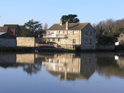
Turn left and started following this road eastwards for half a mile. Again there is no pavement, but the verge is wide enough to allow you to keep away from the traffic. The road enters Shalfleet; The New Inn at the junction of Mill Road is reached shortly after the church on the right at SZ414892; this is where this leg ends.
 |
 |
|
 |
 |
|
 |
 |
|
 |
 |
|
 |
 |
|
 |
 |
|
 |
 |
|
 |
 |
|
 |
Shalfleet to West Cowes
Notes
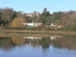
The trail crosses a stream at Shalfleet Mill, before following roads north towards Newtown, which was once a major harbour, and is dominated by the rather large Town Hall. Unfortunately the coast to the north of here is inaccessible due to an army range, so more roads (thankfully quiet) are followed eastwards and then northeastwards to the hamlet of Porchfield. Eventually the road is left behind and a footpath heads north towards Great Thorness, passing through a holiday park before rejoining the coast.
What follows is perhaps the best part of the trail on the northern coast of the island. It descends to pass along the foreshore in front of a beach, with some marshland inland. After crossing a stream it starts to climb along the cliffs, with good views out over the Solent and towards the mainland. Erosion has taken a toll here as well, so again you need to take care to make sure the path does not disappear beneath your feet.
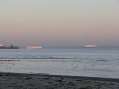
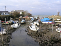
Eventually it descends to meet the tiny harbour where the Gurnard Luck runs into the sea, the boats tied up to the staithes in the river. Again the trail leaves the sea, climbing uphill along a quiet road before descending once more to meet the sea once more. The final few miles to West Cowes are superb, following a promenade that skirts the shoreline past Egypt Point. It is easy to see the car and passenger ferries ply their trade across the water as you walk.
The trail passes Cowes Castle, now the home of the Royal Yacht Squadron, and continues on into West Cowes. The last half-mile of the trail follows roads through the centre of West Cowes, passing the passenger ferry terminal to descend down to reach the chain ferry across the River Medina, directly opposite the start point of the trail in East Cowes.
Directions
This leg starts by the New Inn in Shalfleet at SZ414892. Turn left down Mill Road, passing the New Inn on the left. Follow this northwards for a couple of hundred yards. When the track splits just after a car park on the left, turn right to take a track that leads down towards Shalfleet Mill.
Keep the mill on the right as the track becomes a path that crosses a stream. Continue along the track on the other side as it climbs steeply; at the top it curves to the right to meet another track at about SZ416895. Turn left and follow this track eastwards for a few hundred yards until it ends at a T-junction with Corf Road.
Turn left and follow Corf Road northeastwards for nearly half a mile; shortly after it curves to the right turn left along Town Lane. Follow this northwards for 0.4 miles; it descends to cross the end of Causeway Lake and then climbs to pass to the left of the Town Hall. When a road comes in from the left shortly after this, turn right to go through a pedestrian gate beside a larger gate.
This footpath heads east-southeastwards across a series of long fields. Initially there are hedges on either side; it eventually opens out and the path becomes vague on the ground as it continues in roughly the same direction. It passes through a band of trees before reaching a road at SZ429903. Turn right and follow this road as it curves to the left to take a more easterly course. After a mile it curves to take a more northerly course, passing the Sportsman's Rest pub in Porchfield. Continue on for half a mile after the pub until he road starts to curve to the right at SZ451917.
Cross a stile and head north, initially with some woodland on the right. At the end of the field cross a stile and continue on with a hedge on the right, becoming a muddy track as it continues northwards. When a caravan park is reached, turn right to head south of South Thorn Farm to reach Thorness Lane at SZ451925. Turn left and follow this road as it heads northwards for a short distance before it curves to the left. Immediately after the bend turn right along another footpath that heads across some pasture before ending at a track in a holiday park.
Turn right and start following a track northeastwards through the park; there is good signage. The track passes the main park buildings on the right and continues northeastwards until the beach is reached at SZ454933. Turn right and start following the path as it runs between the beach on the left and the marshland on the right. When a concrete bridge across a stream is reached after 0.4 miles at SZ459936 turn right to cross the bridge, and then turn immediately to the left to join a footpath.
This footpath starts climbing uphill with a field on the right and the cliff edge on the left; it remains stuck to the cliff edge for over a mile, slowly climbing. Cliff erosion is a problem here, so care needs to be taken. It eventually starts to descend, curving to the right to reach a road beside the mouth of the River Grunard at SZ470953.
Follow this road as it heads eastwards parallel to the coast for half a mile, eventually heading uphill before ending at a junction with Worsley Road at SZ477955. Turn left along this road and follow it as it curves to the right; shortly after the bend turn left down a paved footpath. This descends to meet the same road; continue straight on along Shore Road. This crosses a stream and then curves to the left to head north, becoming Prince's Esplanade.
Prince's Esplanade soon meets the coast; leave the road and join the esplanade as it heads northeastwards along the coast for half a mile to Egypt's Point, becoming Egypt Esplanade on the way. Continue on eastwards for another half a mile until Cowes Castle is reached. The esplanade curves to the right and continues on southeastwards towards West Cowes.
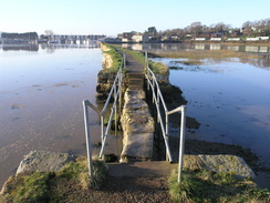
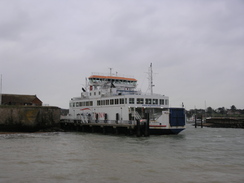
The esplanade ends at SZ495963. Turn right to had along a narrow lane that passes the Union Inn to reach the High Street in the centre of the town. Turn left along this road, and follow it as it winds southwards through the town. It crosses Beckford Road and becomes Birmingham Road, which in turn ends at a junction with the B3020 road. Turn left and follow this road as it immediately curves to the right, paralleling the shore to reach the floating bridge at SZ500955. This marks the end of the Isle of Wight coastal path.
| |
 |
|
 |
 |
|
 |
 |
|
 |
 |
|
 |
 |
|
 |
 |
|
 |
 |
|
 |
 |
|
 |
 |
|
 |
 |
|
 |
 |
|
 |
 |
|
Walk Accounts
The following are route descriptions of sections of the Fen Rivers Way:
- A good blog about the walk: http://dietrichpaul.wordpress.com/
- Facebook group: http://www.facebook.com/
- Mortiboy's website: http://www.mortiboy.co.uk/
- Wikipedia: Wikipedia
- HHGTTG guide to the coastal path: HitchHikers Guide
- Ryde to Cowes walking guide: http://www.redfunnel.co.uk/
- Cowes to Yarmouth walking guide: http://www.redfunnel.co.uk
- Yarmouth to Bightstone walking guide: http://www.islandbreaks.co.uk
- Bighstone to Niton walking guide: http://www.redfunnel.co.uk/
- Niton to Sandown walking guide: http://www.islandbreaks.co.uk/
- Sandown to Ryde walking guide: http://www.islandbreaks.co.uk/
