A Land's End to John O'Groats walk
Background
This page describes the current status of my walk between Land's End and John O'Groats. It is automatically generated and therefore whenever I complete or plan another leg this file gets updated accordingly.
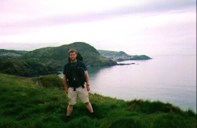
The walk is finished! I reached John O'Groats on Sunday the 17th August 2003, the last leg being part of my coastal walk around Brtitain. As I look back over the last four years and 1,600 miles, I feel a great sense of achievement, and a knowledge that every single blister was worth it, that the experience more than makes up for the pain. And now I can move on to my next challenge...
The walk statistics:
| Planned | Completed | To do | Percentage completed | |
|---|---|---|---|---|
| Distance | 1647.98 miles | 1647.98 miles | 0 miles | 100 % |
| Legs | 117 | 117 | 0 | 100 % |
| Total duration of walk | 29 days, 15 hours and 26 minutes |
| Stopped time | 15 days, 20 hours and 31 minutes |
| Shortest completed leg | Alperton to Paddington at 6.4 miles |
| Longest completed leg | Kearvaig to Durness at 23.8 miles |
| Average distance per leg | 14.08 miles |
| Walk number | From | To | Time | |
|---|---|---|---|---|
| Earliest start | walk 21 | Glastonbury | Wells bus station | 07.10 |
| Latest start | walk 76 | Kirk Yetholm | Morebattle | 15.30 |
| Earliest finish | walk 21 | Glastonbury | Wells bus station | 10.00 |
| Latest finish | walk 111 | Kearvaig | Durness | 19.19 |
Below is a map showing the route of the LE_JOG walk, showing the route that I followed.

Map of my Land's End to John O'Groats walk
Latest news:
(18/08/2003). Yesterday I reached John O'Groats, and completed my sectional Land's End to John O'Groats walk after four years and 1,600 miles. Although I have enjoyed the walk and I am exceedingly glad that I started it, I have now moved onto bigger things, and this sort of reduces the feelings of satisfaction that I should be getting from having finished. It is hard to get a sense of closure when I still have over 500 miles to walk on of my coastal walk around Brtitain.
(11/08/2003). I have now reached Durness on the north coast of Scotland, and am going to do the last few legs to John O'Groats in the next few days. Progress should be fairly rapid, and I am looking forward to finishing this long-standing trip.
(15/05/2002). Last week I finished off walking the section of route between Fort William and Cape Wrath. This now leaves the 100-mile stretch between Cape Wrath and John O'Groats to be walked, which should be able to be done later on in the year. It is a very nice feeling to see the end in sight after so long.
(02/01/2002). Another year has finished, so now is perhaps a good time to look back on progress on the walk. My plan at at the turn of the year had been to complete the section from Crieff to Ullapool; unfortunately foot-and-mouth restrictions meant that I could not get enough training done, and I ended up going to Australia for a holiday instead. I did manage to get the section from Crieff to Fort William completed later on in the year, so all-in-all I am relatively pleased with progress. This year I intend to complete the rest of the walk to John O'Groats in two sections; a three-week trip from Fort William to Durness and then a one-week walk along the top of Scotland to John O'Groats.
Click here for old news
Route changes:
Although I have now finished this walk, I had been considering altering the route in the following ways:- Instead of going from Waterbeach to Ely directly, alter the walk to go from Waterbeach to Newmarket (which I have already completed) and hence from Newmarket to Ely. I could also alter this by making the walk go from Newmarket to Shippea Hill station and thence onto Ely.
- My initial route up the west coast of Scotland had been to follow the Cape Wrath Trail, as devised by David Patterson. However after having evaluated the sparse route outlined in this book I decided to mostly follow the much more detailed (and slightly easier) route described in the book "North to the Cape". Since the two routes meet up in various places I have the option of going over to the Patterson route mid-walk if I choose.
- Whilst walking along the South West Coast Path I caught a ferry between Padstow and Rock. It would be nice to go back down there and walk around the estuary so I can accurately claim that I have walked all the way.
The walk in full:
| No. | From | To | Distance | Status | |
|---|---|---|---|---|---|
 |
1 | Land's End | Zennor | 16.5 | Completed |
 |
2 | Zennor | Gwithian | 14.4 | Completed |
 |
3 | Gwithian | Perranporth | 16.5 | Completed |
 |
4 | Perranporth | Newquay | 14.8 | Completed |
 |
5 | Newquay | Padstow | 14.5 | Completed |
 |
6 | Padstow | Port Isaac | 11.1 | Completed |
 |
7 | Port Isaac | Boscastle hotel | 13.5 | Completed |
 |
8 | Boscastle hotel | Bude B and B | 15.2 | Completed |
 |
9 | Bude B and B | Elmscott | 13.8 | Completed |
 |
10 | Elmscott | Horns Cross | 15.5 | Completed |
 |
11 | Horns Cross | Barnstaple | 17.2 | Completed |
 |
12 | Barnstaple | Woolacombe | 11.9 | Completed |
 |
13 | Woolacombe | Combe Martin | 13 | Completed |
 |
14 | Combe Martin | Lynton | 13.6 | Completed |
 |
15 | Lynton | Porlock Weir | 13 | Completed |
 |
16 | Porlock Weir | Blue Anchor | 14.8 | Completed |
 |
17 | Blue Anchor | Crowcombe Heathfield | 12.6 | Completed |
 |
18 | Crowcombe Heathfield | Taunton | 11.5 | Completed |
 |
19 | Taunton | Langport | 15.9 | Completed |
 |
20 | Langport | Glastonbury | 11.3 | Completed |
 |
21 | Glastonbury | Wells bus station | 7.2 | Completed |
 |
22 | Wells bus station | Cheddar YHA | 11.3 | Completed |
 |
23 | Cheddar YHA | Farrington Gurney | 13.7 | Completed |
 |
24 | Farrington Gurney | Bath YHA | 12.6 | Completed |
 |
25 | Bath YHA | Devizes | 19.3 | Completed |
 |
26 | Devizes | Wooton Rivers | 14.9 | Completed |
 |
27 | Wooton Rivers | Holt Lodge (Kintbury) | 16.4 | Completed |
 |
28 | Holt Lodge (Kintbury) | Newbury station | 9.3 | Completed |
 |
29 | Newbury station | Reading station | 19.6 | Completed |
 |
30 | Reading station | Marlow | 18.5 | Completed |
 |
31 | Marlow | Slough | 16.3 | Completed |
|
32 | Slough | Alperton | 16.7 | Completed |
 |
33 | Alperton | Paddington | 6.4 | Completed |
 |
34 | Paddington | Mile End | 8.3 | Completed |
 |
35 | Mile End | Enfield Lock station | 12.7 | Completed |
 |
36 | Enfield Lock station | Harlow Town | 12.6 | Completed |
 |
37 | Harlow Town | Bishop's Stortford | 9.8 | Completed |
|
38 | Bishop's Stortford | Great Chesterford station | 14.9 | Completed |
 |
39 | Great Chesterford station | Cambridge Station | 16.8 | Completed |
 |
40 | Cambridge Station | Waterbeach | 7.6 | Completed |
 |
41 | Waterbeach | Ely Station | 10.9 | Completed |
 |
42 | Ely Station | March station | 22.9 | Completed |
 |
43 | March station | Peterborough station | 20.3 | Completed |
 |
44 | Peterborough station | Stamford | 16.5 | Completed |
 |
45 | Stamford | Oakham | 16.8 | Completed |
 |
46 | Oakham | Melton Mowbray | 10.6 | Completed |
 |
47 | Melton Mowbray | Bingham | 16.1 | Completed |
 |
48 | Bingham | Nottingham | 13.5 | Completed |
 |
49 | Nottingham | Long Eaton | 10.3 | Completed |
 |
50 | Long Eaton | Willington | 14 | Completed |
 |
51 | Willington | Doveridge | 12.6 | Completed |
 |
52 | Doveridge | Thorpe | 14.9 | Completed |
 |
53 | Thorpe | Matlock station | 13 | Completed |
|
54 | Matlock station | Pomeroy | 16.9 | Completed |
|
55 | Pomeroy | Castleton | 14 | Completed |
 |
56 | Castleton | Edale | 9 | Completed |
 |
57 | Edale | Crowden | 16.5 | Completed |
 |
58 | Crowden | Standedge | 11.7 | Completed |
 |
59 | Standedge | Mankinholes | 14.2 | Completed |
 |
60 | Mankinholes | Ponden | 12.7 | Completed |
 |
61 | Ponden | East Marton | 13.4 | Completed |
 |
62 | East Marton | Malham | 9.2 | Completed |
 |
63 | Malham | Horton-in-Ribblesdale | 14.7 | Completed |
 |
64 | Horton-in-Ribblesdale | Hawes YHA | 14 | Completed |
 |
65 | Hawes YHA | Keld YHA | 12.9 | Completed |
 |
66 | Keld YHA | Baldersdale | 15 | Completed |
 |
67 | Baldersdale | Langdon Beck | 13.7 | Completed |
 |
68 | Langdon Beck | Dufton | 13.9 | Completed |
 |
69 | Dufton | Garigill | 15.4 | Completed |
 |
70 | Garigill | Slaggyford | 9.2 | Completed |
 |
71 | Slaggyford | Once Brewed | 18 | Completed |
 |
72 | Once Brewed | Bellingham | 15.4 | Completed |
 |
73 | Bellingham | Byrness | 14.7 | Completed |
 |
74 | Byrness | 18-mile bothy | 18.1 | Completed |
 |
75 | 18-mile bothy | Kirk Yetholm | 7.2 | Completed |
 |
76 | Kirk Yetholm | Morebattle | 6.7 | Completed |
 |
77 | Morebattle | Ancrum | 13.6 | Completed |
 |
78 | Ancrum | Melrose | 13.8 | Completed |
 |
79 | Melrose | Carfraemill | 14.7 | Completed |
 |
80 | Carfraemill | Tranent | 20.8 | Completed |
 |
81 | Tranent | Edinburgh Waverley station | 10.6 | Completed |
 |
82 | Edinburgh Waverley station | Dunfermline station | 17.4 | Completed |
 |
83 | Dunfermline station | Dollar | 12.9 | Completed |
 |
84 | Dollar | Auchterarder | 12 | Completed |
 |
85 | Auchterarder | Crieff | 9.7 | Completed |
 |
86 | Crieff | Head of Loch Lednock | 15.4 | Completed |
 |
87 | Head of Loch Lednock | Killin YHA | 11.3 | Completed |
 |
88 | Killin YHA | Gleann Meran | 18.1 | Completed |
 |
89 | Gleann Meran | Bridge of Orchy Hotel | 11.1 | Completed |
 |
90 | Bridge of Orchy Hotel | Kingshouse Hotel | 12.1 | Completed |
 |
91 | Kingshouse Hotel | Kinlochleven | 8.7 | Completed |
 |
92 | Kinlochleven | Fort William (Ness bridge) | 14.1 | Completed |
 |
93 | Fort William (Ness bridge) | Craigag Lodge (Glenfinnan) | 14.83 | Completed |
 |
94 | Craigag Lodge (Glenfinnan) | A' Chuil Bothy | 12.8 | Completed |
 |
95 | A' Chuil Bothy | Gairlochy B&B | 22.9 | Completed |
 |
96 | Gairlochy B&B | Laggan | 14.5 | Completed |
 |
97 | Laggan | Fort Augustus | 10.7 | Completed |
 |
98 | Fort Augustus | Alltsigh | 11.4 | Completed |
 |
99 | Alltsigh | Lewiston | 9.5 | Completed |
 |
100 | Lewiston | Beauly | 14.7 | Completed |
 |
101 | Beauly | Garve | 16.4 | Completed |
 |
102 | Garve | Black Bridge | 8.2 | Completed |
 |
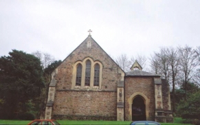
103 | Black Bridge | Croick Church | 19.6 | Completed |
 |
104 | Croick Church | Oykel Bridge | 10.7 | Completed |
 |
105 | Oykel Bridge | Inchnadamph | 18.2 | Completed |
 |
106 | Inchnadamph | Unapool | 10.2 | Completed |
 |
107 | Unapool | Scourie Hotel | 11.3 | Completed |
 |
108 | Scourie Hotel | Rhiconich Hotel | 10.25 | Completed |
 |
109 | Rhiconich Hotel | Sandwood Bay | 12.8 | Completed |
 |
110 | Sandwood Bay | Kearvaig | 13 | Completed |
 |
111 | Kearvaig | Durness | 23.8 | Completed |
 |
112 | Durness | Hope | 20.1 | Completed |
 |
113 | Hope | Bettyhill | 23.5 | Completed |
 |
114 | Bettyhill | Melvich | 21.3 | Completed |
 |
115 | Melvich | Thurso | 21.6 | Completed |
 |
116 | Thurso | Dunnet Head | 17.3 | Completed |
 |
117 | Dunnet Head | John O'Groats | 17.7 | Completed |
Old News
(30/08/2001). I have just come back from having walked between Crieff and Fort William. This means that I am well placed to start the walk northwards from Glenfinnan to the west or Spean Bridge to the east. Whilst I was on his walk I met three gentlemen who had attempted Patterson's route to Cape Wrath and failed, so it may be wise for me to look for an easier route northwards, or to split the three-week journey into three one-week trips.
(11/07/2001). No progress has been made this year due to the foot and mouth crisis closing off large parts of Scotland at the time that I wanted to be up there. My only real opportunity to do any of my LEJOG attempt this year now lies in August, when I am considering doing the section from Crieff to Spean Bridge. However I have not been doing much walking recently and so am very doubtful about whether I am fit enough for such a strenuous walk.
(02/02/2001). I have made my main walking target for this year the completion of the walk between Crieff and Ullapool. This will probably be completed in two legs; firstly from Crieff to Spean Bridge and then from Spean Bridge along the west coast to Ullapool. I intend the first of these to be completed in late April / early May, and the other to be done in June or July.
(28/11/2000). As of this weekend I have now walked all the way from Land's End to Crieff in Scotland. When I reached the YHA in Bath yesterday afternoon I was quite emotional, and I tried to think of all the legs that I have had to walk to get this far. Now only Scotland remains...
(27/09/2000). In the last couple of weeks I walked all the legs between Kirk Yetholm and Crieff, which was a marvellous way to start the Scottish section of the walk. I am now over 70% through the whole walk, and I could (if I want) be able to finish it next year with some careful use of holidays. The weather was relatively good for the whole trip, with only two of the ten days being wet.
(08/08/2000). I used an extended weekend to walk the legs between Taunton and Wells, which leaves only three legs to be walked before I have walked the entire length of England. I am not really in a hurry to do these legs, and I may leave them until later in the year. I may also extend them a bit and explore the area around Cheddar some more.
(31/07/2000). I have planned the walk between Kirk Yeltholm and Gleneagles in detail, which means that I am ready to walk this section if the opportunity arises this year. It also looks as if it may be quite an enjoyable walk - from the trek across the Lammermuir hills to the urban complexity of Edinburgh.
(24/07/2000). I did the Castleton to Edale section on Saturday,which now means that I have now completed the whole section of the walk from Bath to Kirk Yeltholm. This feels very nice, and I know that I have only six relatively easy days walking from Taunton to Bath to complete and then I have walked the entire English section of the walk.
(15/07/2000). No progress has been made recently, mainly due to my having been struck down with a particularly nasty bacterial tonsiltus for over two weeks. Unfortunately this has weakened me considerably, and so I am in two minds about whether or not I shall be able to attempt the week in Scotland I was planning to do later this month.
(04/06/2000). Yesterday I set out to complete the leg between Newbury and Reading, the last leg left to be completed in the whole section between Bath and Castleton. I managed to do it easily enough, but drove home early without doing another walk today due to (of all things!) an insect bite that has caused my whole right arm to become inflamed. Progress on the Land's End to John O'Groats walk has slowed as expected as the remaining legs become further away from my home, but I still remain on schedule to complete the whole of England by the end of the year.
(15/05/2000). I completed the 10-mile leg from Nottingham to Long Eaton on Saturday in some very hot weather. This means that I have now completed the whole walk from Reading to Castleton, which is a section of over 350 miles in length. This figure should rapidly increase as I fit together the few remaining sections in England to join up the completed legs.
(06/05/2000). Wow! Mega progress! During the last three weeks I have managed to complete all of the legs of the walk between Land's End and Taunton, which now means that I have only nine legs to go before I have finished all the English sections of the walk! I have, however, done less mileage than I had expected in getting to Taunton because I changed the route that I took. I therefore may create a couple of extra stages in England just to keep my mileage total up ;-)
(09/04/2000). Set out to do the Bingham to Gedling section yesterday, and felt fine in the nice weather so I continued on to the centre of Nottingham. This means that I only have to complete the very short section between Nottingham and Long Eaton to have walked the whole way between Reading and Castleton. It will have to wait for a few weeks though, as this walk was my final preparation for the three weeks walking starting next Sunday. All in all I am feeling very confident, and very, very fit.
(05/04/2000). Walked the legs between Bath and Newbury over four days starting last weekend. Although I did not get quite as far as I wanted (I was six miles short of Woolhampton) I did the required 60 miles walking. The difference was mainly due to stoppages of the canal and route diversions. Generally things went well, despite absolutely atrocious weather for the last two days. There is now a 19-mile section to be completed between Newbury and Reading, which I will do some weekend. Things are generally very positive.
(26/03/2000). Walked the March to Peterborough leg yesterday, which means that I have completed the task I set myself of completing all legs between Reading and Bingham and Long Eaton and Castleton by the end of March. I am also ready for the exertions of next weekend, when I will be working my way westwards from Bath towards (but not getting to) Reading.
(24/03/2000). I have slightly recalculated the Bath to Reading section, and it now takes 5 days of between 12.5 and 17 miles per day, rather than 6 days as previously calculated. The main reason behind this change is that tha places the walks stop each day fit better with where campsites and or B&B's are available.
(20/03/2000). Another weekend, and more walks completed. This weekend I managed to successfully finish the two stages between Doveridge and Matlock, passing through Derbyshire and a small piece of Staffordshire. It was a lovely walk in nice and unseasonably warm weather, although there was quite a hard frost overnight which my 4-season sleeping bag coped with admirably. Progress is now going quite fast, with the vast majority of the whole Reading to Scotland section completed. I will now concentrate on progressing on the southern end of the route to Reading, along with filling in the four remaining gaps in the northern sections.
(13/03/2000). Completed the Willington to Doveridge section yesterday morning, which means that I am slowly eating up the remaining uncompleted sections between Bingham and Castleton. There are now only four major legs to be done to allow this - the Bingham to Long Eaton and the Doveridge to Matlock legs. Hopefully, if I can find accommodation in Thorpe, I will do the latter two legs next weekend. Progress is really starting to speed up, and I can forsee myself spending the next three to four weekends doing various walks. My running total is now 544 miles completed, with 956 miles left to be walked.
(05/03/2000). Another successful weekend, with one long and another short walk completed, namely the sections between Melton Mowbray and Bingham and Cambridge and Waterbeach. Things are now starting to get back on schedule, and if I do the Willington to Doveridge section next Sunday then I will be slap-bang on schedule. I am also really enjoying the walking, which is a bonus as I was concerned that spending so much time trudging around the country may have disheartened me.
(28/02/2000). Over the last couple of weekends I have completed another couple of sections, these being the Long Eaton to Willington and the Alperton to Paddington sections. So although I am not progressing as fast as I was planning to, at least the sections are slowly being removed off the list. I have also received the book "The Famous Highland Drove Walk", and so I have consequently replanned the sections between Creiff and Spean Bridge from 5 days to 7 using the data held in that book. It is nice to see that my guesstimate for the distance, (91.39 miles, measured off a road map) is quite near the actual distance recorded in the book of 95.5 miles.
(06/02/2000). I completed the Great Chesterford to Cambridge section yesterday, meaning that I now only have 13 miles to go (in two legs) to finish off the entire Slough to Ely section. I intend to get those two stages completed this month, along with the March to Peterborough section.
(24/01/2000). I successfully completed the Reading to Slough section over two days this weekend and hence made a good start to the Bath to London section. For the immediate future I intend to stop progress to the north and the south and start filling in the gaps in the Reading to Melton Mowbray section, probably starting with the leg between Great Chesterford and Cambridge.
(15/01/2000). I have decided that since I did the Waterbeach to Great Chesterford section last year in a north to south direction instead of from south to north (like the rest of the walk) I cannot really count this section as being completed. For this reason I have chosen another route that heads from Great Chesterford to Cambridge. From there it is a simple 7 mile walk following the river Cam up to my flat in Waterbeach. The section of the walk between Land's End and Minehead have been replanned so that they now take a more realistic 19 days instead of the previous 14, which was going to be a very hard schedule to keep.
(09/01/2000). I managed to complete a leg eastwards from Slough to Alperton, although due to feeling ill I did not manage to continue on to Paddington. This leave s a 5.7-mile section that I will do sometime when I find myself with a few spare hours in London. The total distance completed is now at 459.45 miles, and I would like to get this up to over 500 miles by the end of February. The next section that I will look at doing are Alperton to Paddington (5.7 miles), March to Peterborough (19 miles) and Reading to Slough (33 miles).
(04/01/2000). Due to coming down with the flu on Christmas Eve (what a lovely time of the year to be ill) I did not manage to get any walks done during the christmas period. I have therefore decided that the next walk I will attempt will be the Slough to Paddington section, which I have recalculated to be near 20 miles in length. If I feel well enough I will attempt that section this coming weekend. I am going to leave the sections northwards from Melton Mowbray to Nottingham, Derby and Matlock until later in the year.
(13/12/1999). I have now completed the Stamford to Oakham section, and am now exactly halfway through completing the Ely to Gedling section of the walk. Hopefully next weekend I will be able to get the 10-mile Oakham to Melton Mowbray section walked, and then I will leave the other walks on this section for next year.
(28/11/1999). Yesterday I completed the Peterborough to Stamford section. This now brings the total distance walked up to a rather nice 418.3 miles. I have also decided that at christmas I am going to attempt to get some legs completed whilst I am in Derbyshire, namely the Castleton to Edale, Derby to Doveridge and Doveridge to Ashbourne sections. Next weekend I will be unable to do any walks due to the fact that it is the works christmas party and I must admit that walking with a hangover is not my idea of fun.
History of the walk
When I completed my Pennine Way walk I was elated but also rather disappointed, and decided that I needed a new challenge. I was currently living near Cambridge, and had family in southern Derbyshire, and I soon realised that these bases could be used to create a walk linking London to the southern end of the Pennine Way at Edale using day walks. I had lived in London for a few years, and the idea of conecting up three places that meant a great deal to me (East London, Cambridge and Derbyshire) appealed to me.
I had always wanted to walk from Land's End to John O'Groats and had assumed that it would take place after I had completed the Pennine Way. However the difficulty of taking ten weeks of work in which to do it was a major problem. After deciding to complete the walk from London to Edale, I realised that this could be used as a basis for a multi-visit (i.e. sectional) Land's End to John O'Groats attempt.
Because it was still my objective to do a one-trip Land's End to John O'Groats attempt I decided that the route for my sectional one must avoid the areas where the one-stop one would go. This was very difficult in some areas (such as the Bath / Bristol and the Fort William areas) but after looking at the Trail Walkers Handbook (published by the LDWA) I came up with a possible route that meant that there was as little duplication in the routes as possible.
The first section to be planned was the one from Mile End in London to Cambridge. I decided that this route could follow the River Lea northwards and then turn off to follow the canal to Bishop's Stortford. A couple of day's road walking would then get me to Great Chesterford and Cambridge.
The next section planned was between Cambridge and Bingham in Nottinghamshire. The first eighteeen miles of this planned itself, as I had walked alongside the River Cam up to Ely on several different occasions. I then decided to head westwards, following the Hereward Way to March, Peterborough, Stamford and then finally Oakham. A road walk northwards from Oakham would lead me to Melton Mowbray and then onto Bingham.
I then concentrated on planning the section between Land's End and Bath. I had three choices for this; following the South West Coast Path along the southern edge of Devon and Cornwall, going through the middle of the two counties or following the northern edge of the South West Coast Path. Since I wanted to reserve the central route for my one-trip Land's End to John O'Groats attempt and the southern route was too long, I plumped for following the north coast.
I then had to link Bingham, to the east of Nottingham, with the southern end of the Pennine Way. I wanted this walk to pass through three locations; Gedling, where a close friend of mine lives; Stenson, where I was born; and Doveridge (where my family have lived for many years). I therefore planned the route to head north out of Bingham to meet the River Trent, which could then be followed towards Nottingham. A diversion to the north would take me to Gedling and the it was a plod along city streets to the centre of Nottingham. From Nottingham I would head southwestwards towards Long Eaton, from where I could follow the Trent and Mersey Canal west to Stenson and then Willington. It was then a road walk to Doveridge. From Doveridge I would head north up the Staffordshire Way as far as Roceter, and then the Limestone Way to Matlock and Castleton, where a short stretch would allow me to get to Edale.
The only English section remaining to be planned was the walk from Bath to London. The initial part of this was easy, as the Kennett and Avon Canal leads east from Bath straight to Reading. From Reading the River Thames could be followed for a couple of days to Maidenhead, where a diversion of a couple of miles would get me to Slough. At Slough the Slough Branch of the Grand Union Canal could be followed all the way to the main canal, which would get me to Paddington in London. The Regent's Canal could then be used to get to Mile End. An alternative would have been to walk from Reading via the River Thames, but I wanted to include the Regent's Canal in my walk as I had walked along it many times before.
I was then left to plan the route through Scotland. The Pennine Way ends at Kirk Yetholm, just inside the Scottish Borders. I wanted to join this walk up with the start of the Famous Highland Drove Walk in Crieff, and it seemed obvious to pass through Edinburgh on the way. I therefore planned for the walk to follow St Cuthbert's Way to Melrose, and then to head north over the Lammermuir hills to Edinburgh. I could then cross the Firth of Forth via the Forth road bridge and head via Dunfermline and the Ochil Hills to Crieff.
From Crieff I wanted to get to Fort William on the west coast of Scotland, and the Famous Highland Drove walk seemed ideal to do this. Unfortunatey local conditions meant that when I reached Glen Coe I had to follow the West Highland Way north to Fort William instead, which was the route I was going to follow in my one-trip Land's End to John O'Groats walk. However on that trip I can use the Famous Highland Drove walk to get to Fort William.
At Fort William my one-trip walk heads up the Great Glen to the northeast. The obvious route avoiding this is to head north up the very northwestern tip of mainland Scotland at Cape Wrath using the Cape Wrath Trail. This is a very hard walk, and I have found a remarkably similar route in a book called "North to the Cape". I will decide later on which route I choose to use.
The last stage is to head east along the northern coast of Scotland from Cape Wrath on the western side to John O'Groats on the eastern. This is simply a case of keeping to roads or paths nearest to the sea for about a week.
All this planning left me with three main objectives;
- To walk from Land's End to John O'Groats;
- The walk has to go via Cape Wrath;
- The walk has to be a minimum of 1,500 miles long.
Links
Below are some of the WWW resources that I used when planning the walk.
