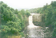
The walk statistics:
| Planned | Completed | To do | Percentage completed | |
|---|---|---|---|---|
| Distance | 259.9 miles | 259.9 miles | 0 miles | 100 % |
| Legs | 19 | 19 | 0 | 100 % |
| Total duration of walk | 5 days, 12 hours and 10 minutes |
| Stopped time | 4 days, 17 hours and 30 minutes |
| Shortest completed leg | 18-mile bothy to Kirk Yetholm at 7.2 miles |
| Longest completed leg | Byrness to 18-mile bothy at 18.1 miles |
| Average distance per leg | 13.67 miles |
 |
 |
|
The walk in full:
| No. | From | To | Distance | Status | |
|---|---|---|---|---|---|
 |
1 | Edale | Crowden | 16.5 | Completed |
 |
2 | Crowden | Standedge | 11.7 | Completed |
 |
3 | Standedge | Mankinholes | 14.2 | Completed |
 |
4 | Mankinholes | Ponden | 12.7 | Completed |
 |
5 | Ponden | East Marton | 13.4 | Completed |
 |
6 | East Marton | Malham | 9.2 | Completed |
 |
7 | Malham | Horton-in-Ribblesdale | 14.7 | Completed |
 |
8 | Horton-in-Ribblesdale | Hawes YHA | 14 | Completed |
 |
9 | Hawes YHA | Keld YHA | 12.9 | Completed |
 |
10 | Keld YHA | Baldersdale | 15 | Completed |
 |
11 | Baldersdale | Langdon Beck | 13.7 | Completed |
 |
12 | Langdon Beck | Dufton | 13.9 | Completed |
 |
13 | Dufton | Garigill | 15.4 | Completed |
 |
14 | Garigill | Slaggyford | 9.2 | Completed |
 |
15 | Slaggyford | Once Brewed | 18 | Completed |
 |
16 | Once Brewed | Bellingham | 15.4 | Completed |
 |
17 | Bellingham | Byrness | 14.7 | Completed |
 |
18 | Byrness | 18-mile bothy | 18.1 | Completed |
 |
19 | 18-mile bothy | Kirk Yetholm | 7.2 | Completed |
 |
|
|
Directions
There are many route descriptions produced for the Pennine Way; these do a better job of describing the route than I ever could. The main guides I used were the OS National Trail Guides, which come complete with strip maps of the route. Click on one of the links below to go to the Amazon page for each guide.
|
| 
|
| |
| |
Motivation
So what on earth motivated me to walk 260 miles with a 40-lb rucksack on my back? The answer is that for many years I had been suffering from a recurring, painful injury to my left ankle, and 'doing' the Pennine Way had always been an ambition.
When you have had an injury for such a long time and you finally believe that it may be fixed, you can do one of either two things; you can sit back and say "thank goodness"; or you can force yourself to reach your limits. I chose to do the latter, and fortunately did not cripple myself in the process.
During the stroll there were many times - especially when my back was bad - that I was ready to pack it in and give up. Each time, however, I said to myself "I'll continue until the end of today, and see what happens". Every time by the next morning I was ready and willing to do some more. I basically got through the early stages of the walk by taking it just one day at a time.
But the real motivation, of course, was the free half-pint that I received at the end of the walk 8-)
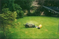
And what about anti-motivation? The following picture of my tent at Globe Farm in Standedge might give you an idea. Note the ultra-high quality diet of baked beans slowly cooking on my trangia.
| |
 |
|
Training
As listed in my 'walks' list, I did a great deal of training in the first seven months of 1999 to get myself ready for doing the Pennine Way. My last operation on my ankle had been in May 1998, and so I had had six months in which to get myself up to a reasonable level of fitness. When I decided in January to do the Pennine Way 'sometime in 1999' I realised that I would have to increase my fitness levels to a much higher level and also update much of my equipment. Hence I went on a buying and training spree that lasted up until the time that I set off.
It is my contention that anyone who is mildly fit can do the Pennine Way; indeed whilst I was doing it there was a gentleman of 74 and another of 70 doing it in stages. The main thing is not out-and-out fitness, but stamina; certainly the first stage from Edale and Crowden will sort out those who have stamina from those who do not.
 |
 |
|
Planning
I did an awful lot of planning when I was preparing for this walk. I did a great deal of research on the web and also got several books (including the two national trails guides which were indispensable) and all the 1:25,000 maps for the walk.
I only booked accommodation for the first three nights in advance. After that, I usually booked the accommodation for the next night the night before, and I only got stung once - whilst I was at Baldersdale I did not manage to book a place at Langdon Beck YHA for the next night. I did, however, get a very nice B&B instead. The main reason for doing this was that it was the first major walk of this distance that I have done, and I did not want to tie myself down to having to get to a certain place by a certain time. I also had room in my schedule to take days off, and I was not sure when (or if at all) I would want to use that facility.
The YHA do a 'Pennine Way Booking Service' that allow you to book all your accommodation ahead of schedule. This is a very good service, but does constrain you to be in a certain place by a certain time. If you have any doubt about your schedule, then this service may not be for you.
| |
 |
|
 |
|
|
Accommodation Guide
Below is a list of all the accommodation that I stayed at along with a few notes on each place. Note that these are all my own impressions from staying at them for a night; consequently ones that I rate as being good may be bad and vice versa.
I got all my accommodation information from the 'Pennine Way Accommodation And Camping Guide', edited by John Needham and published by the Pennine Way Association.
| Crowden. | The Camping & Caravanning Club Site. This was a pleasant site with good showers and on-site shop. |
| Standedge. | Globe Farm. B&B, but I camped. Not the best campsite in the world, but it did its job. |
| Mankinholes YHA. | This is a lovely old-fashioned YHA which is in style that all YHA's should be. The warden was very, very nice. |
| Ponden. | Ponden House. B&B, but I camped. This site would have been much better except for: a) Some Duke of Edinburgh award scheme were camping next to me and making noise into the early hours; and b) The water supply did not seem half as clean as I would have liked. |
| East Marton. | Sawley House. Excellent little site with shop and cafe adjacent. |
| Malham YHA. | A modern YHA in an old building. Good facilities, but lacking a certain something. |
| Horton-In-Ribblesdale. | The Golden Lion Hotel. I stayed in their excellent bunk room. Triple-deck bunks and wood everywhere. Just switch the showers on and convert the place into your very own Swedish sauna! |
| Hawes YHA | This was another quite nice YHA. Nothing exceptional. Hawes has a chip shop that is open on Sundays (useless fact #11342) |
| Keld YHA. | Another non-exceptional YHA. I arrived early yet still had to wait for the place to open at 17.00 - there was no inside waiting area. This youth hostel has since shut. |
| Baldersdale YHA. | A lovely hostel with excellent, welcoming staff and even home-made food. The best YHA on the route by a long way. |
| Langdon Beck. | Outdales B&B. An excellent friendly little B&B which made me very welcome after a very wet day. |
| Dufton YHA | This is a pretty YHA in a lovely village. It is quite an old-fashioned YHA, which I must say is something that I prefer. |
| The George & Dragon Inn, Garrigill | The George & Dragon Inn. This was a nice little B&B attached to the Inn. |
| Slaggyford. | Fellview Caravan Park. This park has a lovely owner, and is a fairly nice place. Note that contrary to other things that I had read the village has no shop or pub, so you have to bring everything with you. |
| Once Brewed YHA | A nice modern YHA, but quite antiseptic and characterless due to its modernity Still, it has a pub next door, so it is not that bad! |
| Bellingham YHA | A nice small and old-fashioned YHA. Stay in this one and you really could be in the 1950's. Very nice. Unfortunately, I believe that this has now been replaced with a bunkhouse. |
| Byrness YHA | A nice YHA in a nice little village. |
| Cheviots. | 18-mile bothy. A very simple bothy, but better than the alternative of camping out or doing the last 7.5 miles down into Kirk Yeltholm. |
 |
 |
|
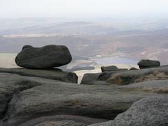
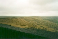
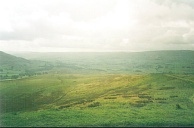
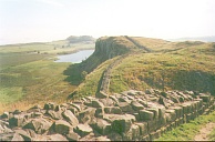
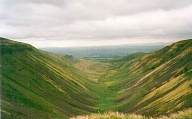
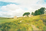
Routefinding
Much to my surprise I can honestly say that I did not get lost in a major way once during the whole walk. There were a few periods where I went off course, but only by a few hundred yards. I was expecting navigation to be a major hurdle, but it really turned out to be quite straightforward.
In general navigation in upland areas, such as the High Pennines, was fairly easy whilst the lowland areas was harder. This was very unexpected. Basically most (but not all) of the upland areas had good well-worn paths that were easy to follow an you only had to be careful at junctions and occasionally to check that you were still going in the correct direction.
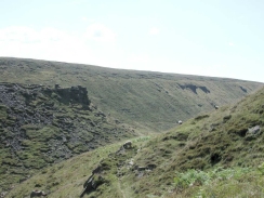
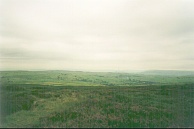
Lowland areas, however, were a different story. In some areas there were a multitude of paths that originated at one point, at others it was hard to find the stiles at the far sides of fields. In particular the section between Slaggyford and Greenhead was not the most scenic and was just a procession of climbing over stiles as you crossed the fields.
Signposting is fairly good throughout the route, except for the section between Alston and Greenhead. This also helped make navigation easier, although a couple of gentlemen doing the Way north to south complained that many of the fingerposts pointed in the wrong direction or were missing when travelling in that direction.
The two National Trail Guides were almost always good enough for route navigation. I carried all the relevant 1:25,000 maps with me, but rarely had the need to use them. I would, however, still take them with me, as there are circumstances when they would have been very useful. They also are allowing me to plan other walks around some of the interesting areas.
Health & Fitness
In my opinion, my level of fitness was adequate to do the Pennine Way. The first day to Crowden in particular was very hard, but later days that I expected to be hard (such as the one over Cross Fell from Dufton to Garrigill) were actually fairly easy.
Throughout the entire walk I did not suffer any major problems with blisters. I had blisters, but they were never troublesome enough to cause me to take my boots off mid-walk. Yet again Compeed plasters proved to be invaluable; whenever I got even a light hot spot I put one on to cover it.
The only major health problem I had on the walk was with my back developing soreness. I never really managed to track down exactly what was causing the problems, but it was probably down to the rapidly disintegrating nature of my pack. When I was in Cargrave I called into a chemists and they gave me some Hydrocortisone cream to treat it with; although there were days when it continued to give me trouble, it was not as bad as it had been.
Stages
In general the route that I chose (or more accurately the stages that I did the route in) was quite good. Potentially I could have done the walk in a couple of days less, but I am still glad that I did it in the 18.5 days that I did, as I was not in a hurry and could afford to take my time.
Two places where I could have extended the walk were the Hawes to Keld section, where I finished very early an had to wait outside for the hostel to open. It turned out that I could easily have walked on to the Tan Hill Inn. Likewise, I planned the Cross Fell section from Dufton to end early at Garrigill, but I was fit enough at the end to walk on to Alston. In general, however, I am very glad that I did the walk in the manner that I did.
There were some people trying to do it in a quicker time, yet to the best of my knowledge none of these people finished the walk (none of them signed any of the books in the bothy or the final one in the Border Inn). Doing an extra 5 miles after a strenuous 12-mile day may not seem much; but it generally causes you to get more fatigued and gain more niggling little injuries.
The people
The people that you meet on the way are what makes any long-distance walk. For this reason, I would like to say a big hello to all the people that I met on the way : Pete, Sam, Tony, Hazel, the Holmes family, and indeed everyone else whose names I have forgotten. One of the nicest things about the whole walk was meeting such a nice group of people. So, Greetings to all of you.
What next?...
So what is next in my plans? I stated at the end of my walk diary that I wanted to do the Pennine Way again next year, except this time perhaps with a few variations in route. Well, it would require me taking another three-week chunk of holiday, and I am not sure that I would be able to spare that. It would be nice, though.
So what else is there? In my opinion there are three bigger challenges to be done in hiking in Britain:
- The south-west peninsular coast path. This path follows the south-west coast all the way from Dorset to Somerset and passing through Devon and Cornwall en route. It is an extremely strenuous walk.
- Land's End to John O'Groats (LE-JOG). This is a walk from the southern extremity of the British mainland to the northern extremity. There is no 'official' path, and people vary the route to include things of their own interest.
- CoastWalk. This walk, rarely done, follows the coastline of either England and Wales, or, (even longer) the coastline of England, Wales and Scotland. The latter is over 5,000 miles long!
Of these, CoastWalk is frankly far too long and only done by insane people (see note below). The south-west peninsular coast path does not really interest me that much, and can be included in part in the LE-JOG walk. The LE-JOG walk is my fancied option, mainly because it is achievable (6 to 8 weeks walking and a minimum of 847 miles), but also because it was a dream of mine, along with the Pennine Way.
Having decided on doing LE-JOG, the question is how to do it. It is unlikely at the moment that I will be able to get 8 weeks off with the way things are at work at the moment, so I am intending to plan a LE-JOG work to be done in bite-size sections (to include the London to Kings Lynn and Pennine Way walks that I have already done or nearly done) and another one which could be done in one sitting along a totally different route. Details of these plans can be seen on my LE-JOG pages as I develop them.
Links
The Pennine Way is seen by many as being the premier long distance footpath in Britain. As such, there is much information available on it on the web. In this section of my site I have tried not to replicate other information, but give details of my own stroll. Below is listed the best information that I found on the web about the walk:
WWW resources
below are some of the WWW resources that I used when planning the walk.
- Ian Fisk's site about the Pennine Way
- A good description of the walk from a young boy's point of view.
- The Pennine Way Association website
- David Gibbin's comprehensive Pennine WAy site
- The Pennine Way Wikipedia page.
- John Butler's Pennine Way pages
Later note:
Four years after I finished the Pennine Way, I find it quite ironic that I said that anyone who walks around the coastline is insane, for on the 27th September 2003, I finished a 6,266.5 miles walk around the coastline of Britain. This, of course, makes me officially insane by my own reckoning!
