Walk #61: Reading to Marlow
 |
 |
|
General Data
| Date Walked | 22/01/2000 |
| County | Buckinghamshire, Berkshire, Oxfordshire |
| Start Location | Reading station |
| End Location | Marlow |
| Start time | 09.20 |
| End time | 16.35 |
| Distance | 18.5 miles |
| Description | This was a nice walk following the Thames Path eastwards. |
| Pack | Full Pennine Way kit. |
| Condition | The walk was quite hard going with the full pace that I was wearing. I have no blisters and my legs feel fine after a long soak in a bath. I also have absolutely no blisters. The outsides of my feet ache a little, and I am going to give them a little massage tonight and tomorrow morning. My shoulders are also a little red from the pack, which I find surprising as they gave me no trouble whilst I was walking. |
| Weather | A very changeable day greeted me when I reached Reading. On the train on the way into London there was long periods of heavy rain, so I was fearful for the day ahead. However in the end the day had periods without a single cloud in the sky others with heavy cloud. There was a minute of rain and at about 13.30 five minutes of hail, all accompanied by a bitter northerly wind. |
| OS map | Landranger number 175 (Reading & Windsor, Henley-on-Thames & Bracknell) |
 |
 |
|
Map of the walk
Maps courtesy of Google Maps. Route for indicative purposes only, and may have been plotted after the walk. Please let me have comments on what you think of this new format. For a detailed table of timings for this walk, please see the table file.
Notes
Another 16.5 miles completed today, which is slightly over 1% of the whole Land's End to John O'Groats walk. It is the first multi-day walk that I have done since I completed the Pennine Way, and also is the ramp-up for more serious walking later in the year.
The walk got to a slightly interesting start when shortly after joining the Thames I had to get a boat to take me a couple of hundred yards because the bridge over the junction between the Kennett and Avon Canal and the Thames was under repair. Apparently work is going to be ongoing until May, which I suppose keeps the boatman employed! It was quite nice actually getting a boat on the Thames, even if it was only for a short period.
Today's walk has shown me just how out of shape I am. My legs were okay at the end of the walk, but my feet were aching a great deal. This was done to either the fact that my new boots are not fully worn in or due to the strapping I put on the balls of my feet to prevent blisters causing me trouble. Depending on how my feet feel in the morning I may not apply any strapping and see how I end up.
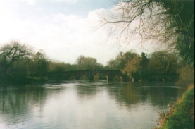
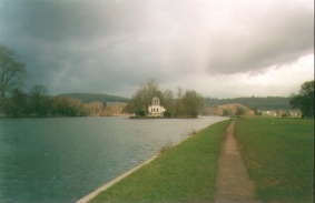
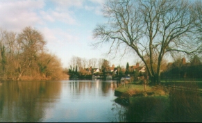
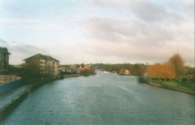
Generally however a nice walk with some nice scenery. The going was very muddy in places (which is hardly surprising in January!) but my new gaiters acted well in keeping my trousers relatively clean.
Directions
Navigation on this walk was very easy. The Thames Path is well signposted, and you only have to pay attention to where you have to cross from one bank of the river to the other. Even in the section where you leave the river for a while around the village of Shiplake there are plenty of way posts and markers to let you see the way.
There are a few good guidebooks covering this walk. The one I used is 'The Kennet and Avon Walk', by Ray Quinlan, published by Cicerone Press. I used this book because it also covers the Kennet and Avon Canal which is also on my walk. For the Thames Path section alone you can also use the Thames Path National Trail guide which includes 1:25,000 OS maps of the walk.
Distances
| From | To | Distance (m) | Ascent (ft) | Descent (ft) |
|---|---|---|---|---|
| Reading Station | Henley-on-Thames | 9.4 | 177 | 207 |
| Henley-on-Thames | Marlow | 9.1 | 236 | 243 |
This makes a total distance of 18.5 miles, with 413 feet of ascent and 450 feet of descent.
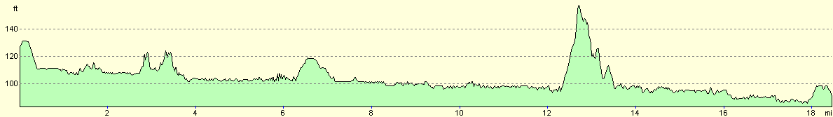
For more information on profiles, ascents and descents, see this page
Transport
There are railway stations at Reading (on the main line from London), Henley (on a branch from Tyford - a station on the main line between Maidenhead and Reading) and Marlow (on another branch from Maidenhead). There are also many local bus services feeding town along the route.
Disclaimer
Please note that I take no responsibility for anything that may happen when following these directions. If you intend to follow this route, then please use the relevant maps and check the route out before you go out. As always when walking, use common sense and you should be fine.
If you find any information on any of these routes that is inaccurate, or you wish to add anything, then please email me.
All images on this site are © of the author. Any reproduction, retransmissions, or republication of all or part of any document found on this site is expressly prohibited, unless the author has explicitly granted its prior written consent to so reproduce, retransmit, or republish the material. All other rights reserved.
Although this site includes links providing convenient direct access to other Internet sites, I do not endorse, approve, certify or make warranties or representations as to the accuracy of the information on these sites.
And finally, enjoy your walking!
This walk was mentioned in the following routes:
| My sectional Land's End to John O'Groats walk |
Nearby walks
| # | Title | Walk length (miles) |
|---|---|---|
| 10 | Waterbeach to Great Chesterford via Cambridge | 21.0 |
| 53 | Harlow Town to Bishop's Stortford | 9.8 |
| 63 | Great Chesterford to Cambridge | 16.8 |
|
|

|