Walk #4: Downham Market to Watlington
General Data
| Date Walked | 10/01/1999 |
| County | Norfolk |
| Start Location | Downham Market Station |
| End Location | Watlington Station |
| Start time | 10.30 |
| End time | 12.35 |
| Distance | 6.2 miles |
| Description | A walk from Downham Market to Watlington following the river bank. The only road walking was about 1km to the station in Watlington. |
| Pack | I carried a full pack minus my tent, with water, food and walking poles carried. |
| Condition | I feel fine after this walk. My knee was still aching from the previous day, but fortunately this got better as the day went on. I also have some very minor aches from the previous day's walk, but these were not bothersome in the least once I had warmed up. I finished off being able to jog the last 200 metres to the station, which is always a good sign that I was feeling fit. |
| Weather | Today was mainly sunny, with a few minutes of sleet early on. |
| OS map | Landranger number 143 (Ely & Wisbech, Downham Market) |
Map of the walk
Maps courtesy of Google Maps. Route for indicative purposes only, and may have been plotted after the walk. Please let me have comments on what you think of this new format. For a detailed table of timings for this walk, please see the table file.
Notes
I set off aiming to have a nice Sunday morning stroll northwards from Downham Market, following the River Great Ouse northwards. I was planning to walk as far as Kings Lynn, but as I was driving north my heart was not fully in it. The car park where I parked in Downham Market was not very busy when I arrived, and I soon walked downhill to the station before crossing the relief channel and gaining access to the narrow strip of land between the channel and the River Ouse.
The path headed north along a flood bank, and despite some snow flurries I quite enjoyed the walk. I was slightly tired after yesterday's walk but I otherwise felt okay as I approached the road bridge in the village of Stowbridge. I stopped on the bridge to have a look at the River Ouse when I started chatting to a lady who I met. We chatted for ten minutes, and I agreed to meet her in the local pub, the Heron (which is situated between the river and the relief channel) in a couple of hours.
The only downside to this was that it would not allow me to get to Kings Lynn in time, so I decided to cut the walk short and end at Watlington, where there was a station that would take me back to Downham Market.
I was glad to find that the path was easy to follow as it followed the river bank until it met a road immediately to the east of the strangely-named village of Wiggenhall St Mary Magdalen. The station at Watlington was then only a kilometre away to the east along the road, and it was relief that I found I got there only a few minutes before the train was due, which allowed me to get back to my car in time to meet the lady. It was a shame to have cut the walk short, but in the long run it was definitely worth it.
Directions
For more details on this walk, see my pages on the Fen Rivers Way.
Distances
| From | To | Distance (m) | Ascent (ft) | Descent (ft) |
|---|---|---|---|---|
| Downham Market Station | Watlington station | 6.3 | 59 | 59 |
This makes a total distance of 6.3 miles, with 59 feet of ascent and 59 feet of descent.
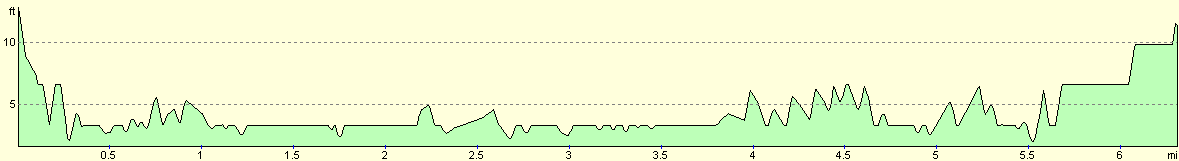
For more information on profiles, ascents and descents, see this page
Transport
There are regular train services between Watlington and Downham Market, which run on the electrified Kings Lynn to Cambridge and London Liverpool Street railway line.
Disclaimer
Please note that I take no responsibility for anything that may happen when following these directions. If you intend to follow this route, then please use the relevant maps and check the route out before you go out. As always when walking, use common sense and you should be fine.
If you find any information on any of these routes that is inaccurate, or you wish to add anything, then please email me.
All images on this site are © of the author. Any reproduction, retransmissions, or republication of all or part of any document found on this site is expressly prohibited, unless the author has explicitly granted its prior written consent to so reproduce, retransmit, or republish the material. All other rights reserved.
Although this site includes links providing convenient direct access to other Internet sites, I do not endorse, approve, certify or make warranties or representations as to the accuracy of the information on these sites.
And finally, enjoy your walking!
This walk was mentioned in the following routes:
| A walk around East Anglia |
Nearby walks
| # | Title | Walk length (miles) |
|---|---|---|
| 3 | Littleport to Downham Market | 14.0 |
| 28 | Kings Lynn to Watlington | 7.4 |
| 156 | Kings Lynn to Snettisham | 14.6 |
|
|

|