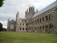
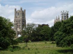
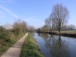
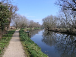
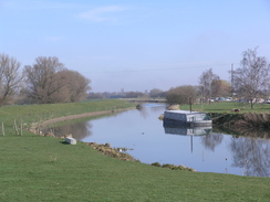
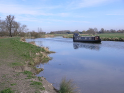
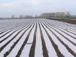
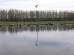
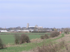
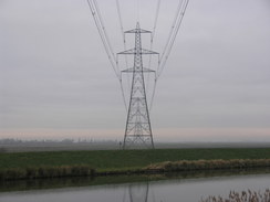
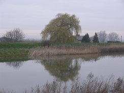
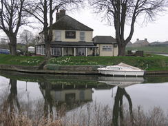
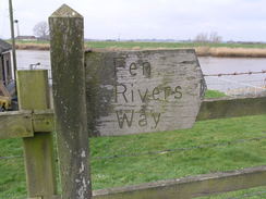
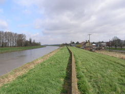
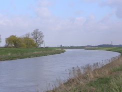
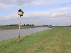
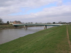
The Fen Rivers WayThe Fen Rivers Way is a 48-mile walk between Cambridge and Kings Lynn following the Rivers Cam and Great Ouse. The main route mainly follows the rivers' western banks, although there is an eastern alternative available between Cambridge and Ely. The route is mostly flat, with very little ascent or descent. It is best to walk the trail from south to north, mainly because for the last 5 miles into Ely you get to see Ely cathedral rising above the Fens like a ship ahead of you, the towers seeming like masts. It also follows the river downstream, which seems like a natural way of following a river. Since the Cambridge to King's Lynn railway follows the river all the way up to Kings Lynn, it is easy to walk short stretches and catch the train back to the starting point. The Fen Rivers Way makes quite a nice and easy amble on a warm summers day, and there are a few pubs in which you can have a wayside drink. However, on a windy day the raised banks beside the river can feel very exposed as the wind sweeps in from the Fens. On the other hand, if you pick a nice summer's day to do the walk then the opposite problem can occur, with lack of water being a problem. |
The map. |
 |
 |
|
 |
 |
|
The Fen Rivers Way in sections
Cambridge to Waterbeach
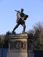
The Fen Rivers Way starts off at Cambridge railway station. Leave the station by the main entrance and start walking westwards up Station Road for a third of a mile until it ends at a junction with Hills Road beside the impressive war memorial. Turn right and follow Hills Road northwestwards towards the centre of the city for a third of a mile until the junction with the inner ring road is reached at TL454577, directly opposite the Catholic church. Turn right along Gonville Place for about fifty yards; after Regent Terrace heads off to the left, turn left to join a footpath that cuts diagonally across an area of grass called Parker's Piece, immediately passing some public toilets on the right.
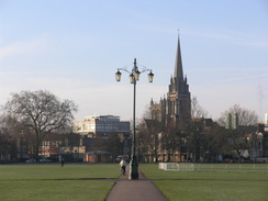
Head across Parker's Piece until it reaches a road called Parkside. Turn left to head northwestwards along this; it becomes Parker Street as it approaches the bus and coach station in the centre of the city. Just before this is reached, at a mini roundabout turn right up Emmanuel Road, following it in a rough northerly direction for about a quarter of a mile until it reaches a roundabout at TL454587. Carefully cross the road straight ahead, keeping the roundabout on the left. Ahead is an area of grass called Midsummer Common; cross a cattle / bike grate to join a surfaced path that leads on northeastwards from the road across the grass. Soon the path reaches some housing on the right; here it curves slightly to the right to head directly across the common to reach the southern bank of the River Cam beside the Cutter Ferry footbridge over the river at TL459590.
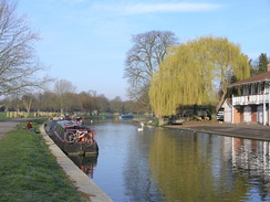
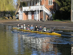
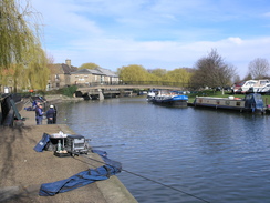
Turn right and start following the southern bank of the River Cam as it winds northeastwards out of the city. It soon passes under the Elizabeth Road bridge, which carries a dual carriageway overhead. A stretch of road walk follows, passing the elegantly-curved riverside bridge. Shortly after this Midsummer Common is reached. Continue on with the river on the left until the Green Man footbridge is reached at TL467598; here the western and eastern routes converge. The rest of this description relates to the western route. Cross over the bridge and turn right to follow Water Street east-northeastwards. Shortly after the Penny Ferry pub (currently closed - 2011) is reached, turn right to rejoin the river and the towpath.
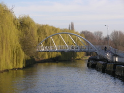
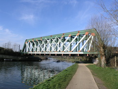
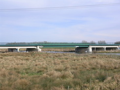
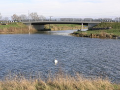
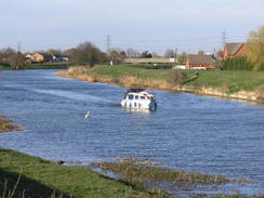
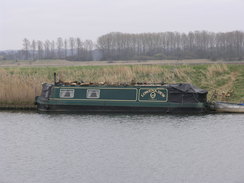
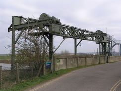
The towpath continues along the western bank of the river as it winds northwards for a little under two miles, passing under a railway bridge and then the A14 to reach Bait's Bite Lock a TL485620. There is a bridge at this lock that allows you to gain access to the eastern bank of the river, and there are footpaths that lead from here eastwards to Horningsea and southwards to Fen Ditton. This network of paths form part of the Fen Rivers Way. Two miles after Bait's Bite Lock you reach Clayhithe bridge. Immediately before the bridge is reached, turn left and follow a path that runs towards Waterbeach with the road on the right; it soon swings to the right, with some woodland on the left; it then swings to the left to continue northwestwards towards Waterbeach railway station. Just before the station car park is reached, turn right along a footpath to reach the road at TL501648.
 |
 |
|
 |
 |
|
 |
 |
|
 |
 |
|
 |
 |
|
 |
Waterbeach to Ely (western bank)
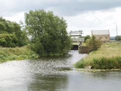
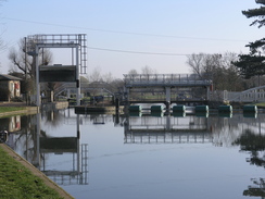
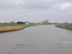
This leg begins at TL501648, immediately to the west of Waterbeach railway station. Take a bridleway that heads northeastwards for a couple of hundred yards until a junction is reached with another footpath. Here turn right, to head runs eastwards with a hedge on the left. Continue along the obvious footpath as it skirts a boatyard. When the hedge ends, the footpath curves to the right to rejoin the western bank of the River Cam. Here turn left and follow the river as it winds in a rough northerly direction for about half a mile until Bottisham Lock is reached at TL507656. Pass through a gate that leads to the surfaced path that leads across the lock; do not cross the lock or go down the slope to the left, but instead continue on along the western floodbank.
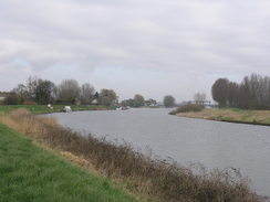
The rest of the walk is fairly easy; just continue following the Fen Rivers Way as it heads northwards; for most of the time this follows the top of the flood banking, but at TL526681 it drops down onto the floodplain and follows the riverbank for a little over a mile. The floodbank is rejoined at TL532696, just before Upware is reached on the other side of the river. The A1123 road is reached five miles after Bottisham Lock, with the arched Dimmock's Cote bridge to the right. Cross the road and continue on along the floodplain, immediately passing a farm on the left.
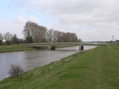
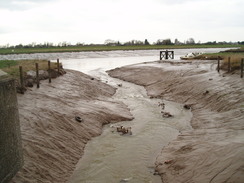
The only problem comes a mile and a half later, at the point where the Cam and Great Ouse rivers meet at Pope's Corner (TL534745). The Fish and Duck pub is a short distance away. Just before the rivers meet, the path leaves the riverbank and continues along a bank with a marina on the right, heading to an attractive arched footbridge arches over the Great Ouse, which allows you to cross the river safely. Continue on northwards along the western bank of the river; soon a grassed landing stage is reached, complete with a couple of benches. A couple of miles further north of Pope's Corner there is a little inlet called Braham Dock that needs crossing; simply follow the bank inland for about fifty yards to the railway line; a narrow path crosses the inlet using the side of the railway embankment, then turn right to head back along the northern bank of the drain to reach the river once more. A new bridge over the mouth of Braham Dock has recently been built, but the Fen Rivers Way markers still point the old route down the drain. I think that the route over the bridge is a perfectly sensible diversion, and cannot in any way be called cheating!
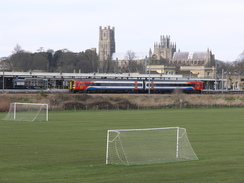
Half a mile further on the Ely to Bury St Edmunds railway line is reached; cross this with care and continue on for another 0.7 miles until the A142 road is reached on the outskirts of Ely at TL544793. The railway station lies a few yards away to the left.
 |
 |
|
 |
 |
|
 |
 |
|
 |
 |
|
 |
 |
|
 |
 |
|
 |
 |
|
 |
 |
|
Ely to Littleport
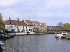
This leg starts off at the bridge carrying the A142 road over the Great Ouse immediately to the east of Ely railway station at TL544793. Turn left and follow the path northwards, with the river on the right. The path dives under a railway bridge and past a couple of marinas before reaching the Maltings, which is now a prettified commercial area, with some lovely views along the river. Walk past the Maltings for a short distance along Quayside past a little inlet on the right; then turn right to head towards a footbridge over the river.
Do not cross the bridge and instead turn left to start following the riverside path eastwards, initially squeezing between the river and a waterside building. After a few hundred yards it passes under a railway bridge and curves to the left to take a more northeasterly course. It soon starts curving away from the river bank, following a hedge on the left to reach the grounds of a factory. Here turn left to follow a footpath that runs north for a short distance with a depot on the right; this soon ends at a T-junction with a track called Kiln Lane.
Turn right and follow Kiln Lane as it twists and turns in a rough easterly direction; the depot is soon left behind on the right, and rhe pat continues between fences to reach a footbridge called Cuckoo Bridge that leads over the Roswell Pits, some flooded clay pits. Soon after the bridge the path jinks to the right, following a fence on the left, and then to the left to rejoin the riverbank. Head northeastwards for a few yards to reach a metal footbridge over the Great Ouse at TL561805. Use this to cross over to the eastern bank of the river, and then climb up onto the road and turn left.
Continue northeastwards along the road for 0.6 miles; it passes under a railway bridge before reaching the B1382 road in Queen Adelaide. Turn left along this road to cross the river and descend down the other side. Turn right to join a footpath that heads back to the river to rejoin the floodbank, with the river on the right. Continue on northwards for a little over three miles until a gate is reached. A series of other small gates follows as the path passes through a series of gardens belonging to homes on the left. At the last gate it turns to the left for a short distance to meet a road on the eastern outskirts of Littleport at TL576864, with Sandhills Bridge a few yards away to the right, and the Black Horse pub directly opposite.
 |
 |
|
 |
 |
|
 |
 |
|
 |
Littleport to Downham Market
This leg starts off by the Sandhill Bridge to the east of Littleport at TL576864. On the western side of the bridge, follow the road westwards towards the railway line for a short distance then turn right to join a footpath that squeezes between the railway line and the car park belonging to the Black Horse pub. Initially the path heads north with the railway line close by to the left; as the railway line curves to the left the path goes straight on alongside the river bank. A house is soon reached; the path squeezes between this and the river, before curving to the left to run along the southern bank of the inlet to near the railway line once more near the signal box. Turn right to follow a planed causeway across the water, with a building on the left, to reach a road immediately to the south of Littleport railway station at TL574873.
Turn right and follow this road as it heads in a rough north-northeasterly direction for a third of a mile until it reaches the A10(T). Turn right to cross the river via the bridge, and before a roundabout is reached turn left to join another footpath that follows the top of the floodbank northeastwards for 3.2 miles, trapped between the river on the left and the A10(T) on the right. The path eventually reaches Brandon Creek at TL607917. It then continues along the floodbank as it passes in front of the Ship Inn, before following the pub's driveway to return to the main road.
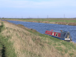
Join the main road and use the road bridge to cross Brandon Creek. Once on the northern side continue on for about fifty yards until a minor road leads off to the left (it is safer to walk this stretch along the top of the bank on the left than along the road). Turn left and follow the minor road as it skirts the eastern bank of the river northwards before rejoining the main road a little over half a mile later. Continue on northwards along the road; there is no pavement, but the verge is wide enough to safely walk this stretch. Just before Sedge Fen Road comes in from the right, the path turns left to rejoin the floodbank, squeezing along a narrow path between gardens; this path was very oergrown when I last walked the path in 2011. If it is still overgrown, the you can continue along the A10(T) for a short distance before joining the floodbank. Continue on the floodbank with the river on the left; it soon curves away from the main road. After 2.7 miles a road is reached beside Hillgay Bridge at TL604970.
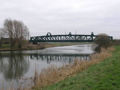
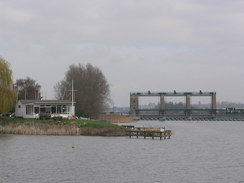
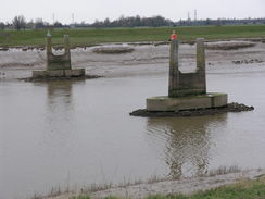
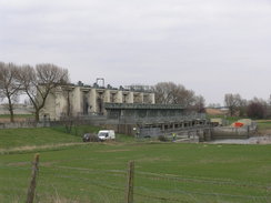
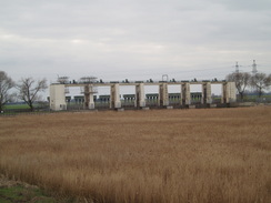
Turn left along the road to cross the river on a bridge, and then turn right to start following the banking, with a minor road on the left, in a rough north-northwesterly direction. At times the road runs along the bank, so it may be easier just to walk along the road. When a railway bridge is reached the bank leave the bank and join the road, rejoining the bank shortly after White House Farm. Continue on along the floodbank; Denver Sluice at TF587009 is reached nearly three miles after Hillgay Bridge.
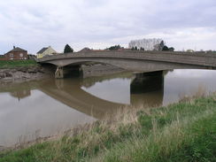
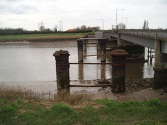
Follow the bank and road past the Jenyns Arms and use the road to cross the sluice. On the other side turn left to join a footpath that follows the eastern bank of the river in a rough northerly direction for 1.4 miles until the A1122 is reached beside Downham Bridge at TF597029. Downham Market railway station is half a mile to the northeast along the main road.
 |
 |
|
 |
 |
|
 |
 |
|
 |
 |
|
 |
 |
|
 |
 |
|
 |
 |
|
 |
 |
|
 |
 |
|
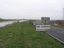
Downham Market to Kings Lynn
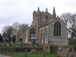
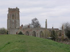
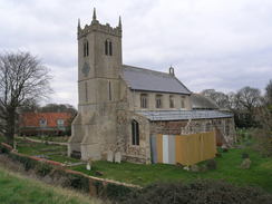
This leg starts off on the A1122 road at TF597029, half a mile to the southwest of Downham Market. Do not cross the river at Downham Bridge, and instead follow a footpath that runs along the eastern floodbank of the river, passing between the river and some houses on the right. After 2.7 miles it crosses a road to the west of Stowbridge (with the Heron pub a short distance to the right) and continues on for another 2.8 miles, reaching a road beside Magdalen Bridge at TF600113, to the northeast of Wiggenhall St Mary Magdalen. Cross the road and continue on for another couple of miles, passing a sewage works and close to the ruined church of Wiggenhall St Peter before reaching another road at TF596140, close to Wiggenhall St Germans church and the Crown and Anchor pub.
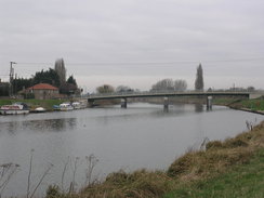
Cross the road and continue on along the eastern river bank as it heads in a rough northerly direction for another couple of miles until it reaches a sluice over the Relief Channel at TF604172. Cross the bridge beside the sluice to reach the eastern bank of the channel. Turn left to join a surfaced cycle path; follow this past some reed beds on the left. Do not head towards the power station to the south. The path soon rejoins the eastern bank of the river; after 0.8 miles it passes under the A47(T).
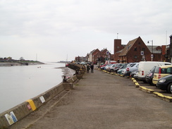
The path continues on northeastwards for a few yards to another road next to the Free Bridge over the river; on the other side continue on northeastwards along the cycle path for 0.6 miles until a bridge over the mouth of the River Nar is reached at TF617192. Cross the bridge and continue along a cycle path on the other side; after a short distance turn left along another footpath that runs along the northern bank of a channel to reach Boal's Quay. At the quay, turn right to cross a bridge over an inlet and continue along the quayside. The Fen Rivers Way ends on the Quay at TF616197.
 |
 |
|
 |
 |
|
 |
 |
|
 |
 |
|
 |
 |
|
 |
 |
|
 |
 |
|
 |
 |
|
The eastern route between Cambridge and Ely
The eastern route of the Fen Rivers Way leaves the main route by the Green Man footbridge over the Cam on Stourbridge Common at TL467598. Cross the footbridge and head south across a good path across Stourbridge Common. Just before a housing estate is reached, turn left along another surfaced path. This immediately heads through a hedgeline and continues on northeastwards across the common to a footbridge over a railway line at TL472598.
Cross the footbridge and continue on northeastwards across another field, angling back towards the river bank. As it meets the river it turns to follow it slightly north of eastwards, angling away from the river before entering the grounds of Hall Farm. Go through this and join the road in Fen Ditton. Follow this road eastwards for a short distance, with the church on the left, until the war memorial is reached. Here turn left along Church Street, passing the church on the left.
Church Street curves to the right to take a more northerly curse; as it swings to the left go through a gate into a recreation ground. Head straight on north-northeastwards across the grass; when a hedge is reached this is followed in the same direction with housing across the hedge on the left until a track, Field Lane, is reached. Turn left along this track and follow it for a short distance until it ends at the end of a road.
Turn right and take an obvious footpath across a field parallel to the river; after passing a cottage on the left it curves to the left to angle towards the river bank once more. The path is obvious as it heads under the A14. A third of a mile after passing under the bridge a track is reached just before Baits Bite lock is reached. Turn right to follow this track eastwards; as it curves to the right continue straight on with a hedge on the left until a road is reached at TL491618.
Turn left and follow the road northwards for 0.6 miles through Horningsea until the Manor House is reached at TL494627. Shortly after the road curves to the right, turn left along a track before turning to the right to enter a field. Head north across this field, joining a hedge on the left, and follow this through to another hedge. Continue north-northeastwards across a series of fields, reaching the road once more at TL497635.
Join the road and turn right to head southwards for a sort distance until a footpath leads off to the left. Follow this eastwards, and then turn left to follow it as it heads northeastwards for two-thirds of a mile until a junction with another footpath is reached at TL505642. Here turn left and follow the footpath as it heads northwestwards. When a junction in footpaths is reached in Clayhithe Farm turn half-right to reach the eastern bank of the river once more, immediately to the north of Clayhithe Bridge.
Follow the eastern bank of the river in a rough northerly direction for nearly a mile until Bottisham Lock is reached; a short distance on the entrance to Bottisham Lock is crossed by a bridge. Follow the flood banks northeastwards for 1.5 miles until Swaffham Lock is reached over the entrance to Swaffham Bulbeck Lode. Cross the footbridge over the lock and continue on along the floodbank in a rough northeasterly direction; it keeps away from the river for long periods. After two miles it joins a road; turn left and follow the road northwards for a few hundred yards until Burwell Lode is reached.
Cross the bridge over the lode and continue on for a few yards past the end of another inlet; immediately after this turn left to join another footpath that initially skirts the river for a short distance before heading through a car park and past the 'Five Miles from Anywhere' pub. Head through the car park of a marina, with the water off to the left. Cross a track at the end of the marina and head on along a footpath along the edge of a field. Shortly before the end of the field turn half-right to reach the northern edge of the field by a clump of trees.
Join a track that heads northwards with some trees on the left. Continue along this track, Fodderten Drove, for a mile until the A1123 road is reached at TL541722. Carefully cross the road and continue on for a little under half a mile until a junction with another track is reached. Turn left and follow this westwards for a third back to the riverbank. Turn right and follow the path as it runs north along the eastern bank of the river for 2.3 miles until the entrance to Soham Lode is reached at TL539764.
Cross the bridge over the lode and continue on along the banking for a mile until the Ely to Newmarket railway line is reached. Carefully cross the railway line and continue on along the banking for another three-quarters of a mile until the A142 is reached immediately to the east of Ely. Turn left along this road to cross the bridge over the river, where the main route of the Fen Rivers Way is rejoined. Ely railway station is a short distance further on to the west.
 |
 |
|
Transport
First Capital Connect services follow the river all the way from Cambridge to Kings Lynn, allowing you to break the walk into sections, the longest of which will be 12 miles from Littleport to Downham Market, and Waterbeach to Ely (although you could make the legs longer by jumping stations). The stations on the line are detailed below, in order northwards and with approximate distances from Cambridge:
| Station | Distance (miles) |
|---|---|
| Cambridge | 0 |
| Waterbeach | 6 |
| Ely | 18 |
| Littleport | 24 |
| Downham Market | 36 |
| Watlington | 42 |
| Kings Lynn | 48 |
Hence you can see that the walk can be split into anything between 2 and 6 days. The going is (obviously) quite flat, so it is relatively easy to split it into 2 24-mile walks, with the night being spent at Littleport. There is a campsite on the route just south of Littleport.
Details of train times can be found on the National Rail website.
Walk Accounts
The following are route descriptions of sections of the Fen Rivers Way:
- King's Lynn to Downham market (Jordanwalks)
- Downham Market to Denver Sluice (Jordanwalks)
- Denver Sluice to Brandon Creek (Jordanwalks)
- Littleport to Ely (Jordanwalks)
- Ely to Waterbeach (Jordanwalks)
- Fen Ditton to Waterbeach and Cambridge (Jordanwalks)
- Waterbeach to Ely (Britishwalks)
Other resources
I have not been able to find many resources about the Fen Rivers Way on the WWW. However, below are the few that I have found:
- A small site with some nice photos of the FRW under construction.
- Some more pictures of the way.
- More information on the trail at Duncan MacKay's website, including some historic maps showing the Fens before they were drained.
