Walk #304: Langstone to Tipner
 |
 |
|
General Data
| Date Walked | 22/12/2002 |
| County | Hampshire |
| Start Location | Langstone |
| End Location | Tipner |
| Start time | 08.50 |
| End time | 15.15 |
| Distance | 16.8 miles |
| Description | This was a very nice walk into Portsmouth, taking in the historic seafront and dockyard. |
| Pack | Today I carried my 30-litre Karrimor HotRock rucksack, which was filled with my packed lunch, waterproof leggings, water bottle and a couple of spare shirts, together with the usual assortment of odds and ends. |
| Condition | I feel reasonably fine after this walk, and have no major problems to report. My ankle ached slightly at the end, but perversely this was only after I had finished walking and was standing around waiting for Sam to pick me up. |
| Weather | Today's weather was better than yesterday's, as the fog had gone after a night of continuous heavy rain. There was still a thick layer of cloud overhead, but this was thinner in places although I never got to see the sun at all. The wind was virtually non-existent, and it was quite a mild (or even warm) day. |
| OS map | Landranger number 197 (Chichester & The South Downs, Bognor Regis & Arundel) and Landranger number 196 (The Solent & The Isle of Wight, Southampton & Portsmouth) |
 |
 |
|
 |
 |
|
Map of the walk
Maps courtesy of Google Maps. Route for indicative purposes only, and may have been plotted after the walk. Please let me have comments on what you think of this new format. For a detailed table of timings for this walk, please see the table file.
Notes
A few minutes after I started this walk I could feel that something was wrong with my left boot. A close examination showed that the sole of my boot had worn through at the heel, and a piece of the sole was flapping about. I checked the other boot and that had also worn through slightly, but not as much as the other one. I decided that they would be okay for this sort of walk, but they could well be dangerous on very hilly ground. I can also see that I am not walking properly - the outside rear of my boots are wearing out far faster than the inside which is a side effect of my gait due to my injured ankle.
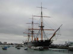
Portsmouth is very historic, and I walked slowly through the town as I kept on stopping to look at information boards and memorials. The largest item that I could see was HMS Warrior, England's first Ironclad warship, built in 1870. At first glance it looks like a wooden sailing ship, but it actually has a metal hull. It is slightly incongruous to see full sailing rig on a metal ship, but it shows well the technology in transition. (Later note: eight years later I got married on HMS Warrior, which gives me another reason to remember this walk with fondness). I could also have walked past HMS Victory and past the building housing the remains of the Mary Rose, but it would have been a route where I would have to have doubled back on myself through the dockyard, so I did not bother.
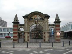
The route I followed through Portsmouth was along the Millennium Parade, which is marked on the ground by stones engraved with a representation of links of a chain. This was nice as it led past lots of information board, but unfortunately around the ferry port it led through a gateway blocked by some plywood, so I had to find my own way around towards the historic dockyards, which was not hard. The links of the chain represent a chain that was kept across the harbour that could be raised to block the harbour in times of war. I have been very impressed by Portsmouth, and I shall have to come back here some time to have a look around in detail, particularly the historic dockyard.
I managed to get to the place where Sam was going to pick me up at about a quarter past five, and so I waited for her to arrive. After I had been waiting for about twenty minutes I gave her a phone, and she had got lost. After seventy minutes and many phone calls she managed to find me and we could find somewhere to park. I find it quite amazing that Sam managed to drive around Portsmouth for seventy minutes without finding me considering that I was standing on one of four main roads out of the city - it was not as if I was on some nameless back street! I was not in a good mood by the time she came to pick me up, but it could have been worse - at least it was not raining!
It was nice to be able to see the Isle of Wight from the sea front in Portsmouth, and I could also see the three island forts, built in the 1860's. These are Spitbank Fort, Horse Sand Fort and No Mans Land Fort, and it was interesting seeing large ferries pass them I also saw a hovercraft come in from the Isle of Wight to Clarence Pier, and it was amazing how much faster the hovercraft was when compared with a traditional ferry, with a journey to the island taking only ten minutes by hovercraft.
The route through Portsmouth was massively effected by the presence of the ports and particularly the naval base, which cannot be entered and means that the northwestern portion of the city's waterfront cannot be walked around. I would love to be able to see some of the warships that must be in there - I have a penchant for large engineering, and warships are large engineering.
As of today I have walked a little over 1,400 miles, which is a nice target to have reached. By the beginning of the new year I should have walked over 1,500, which would mean that I would have only 4,000 miles more to go.
Directions
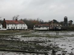
This walk starts at the Ship Inn in Langstone, beside the A3023 road. It follows the Solent Way for most of the day, which is a fairly well marked named footpath. Leave the inn's car park and cross the road by the public toilets. Head down a little path on the other side of the road that descend down into a little muddy stream before climbing up onto the trackbed of the old railway line that used to lead onto Hayling Island. Turn right to head northwards along the trackbed until it reaches a surfaced lane.
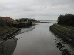
Turn left down the lane and follow it until it ends by a little tidal creek. Continue straight on and cross the creek using a bridge. On the other side of the bridge turn left and head southwards along the western side of the creek until it meets the sea. Follow the path as it heads westwards along the bank until it reaches another tidal creek, where it turns to the right to head inland to end at a surfaced road. At the road turn left to head southwestwards for a few hundred yards until a bridge over another creek is reached; here turn left and descend down to a surfaced footpath that runs on the western bank of the creek. The footpath leads to a car park by the sea before turning to he right and skirting the sea westwards until it meets the A27(T).
The path continues on for a few hundred yards, trapped between the A27(T) on the right and the sea on the left until the little promontory of Framington Marshes is reached. Follow the path as it turns to the left to head southwards for a couple of kilometres along the sea wall before turning to head westwards and then northwards around the marshes before ending at a car park beside the A27(T). Leave the car park along the access road which leads westwards beside the A27(T) until it reaches a large roundabout.
At the roundabout the footpath joins a cycle path and turns to the left to head southwards beside the A2030 road across a bridge over the Broom Channel. On the other side of the channel the footpath leaves the road and heads off to the left beside the sea. The footpath continues southwards beside the sea for a couple of miles, sometimes beside the A2030 and sometimes slightly away from it. Just past the golf course on Portsea Island the footpath leaves the road and crosses a park in Milton until a road is met beside a boatyard.
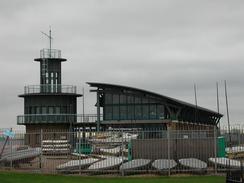
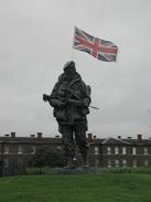
Turn right along the road along the Solent Way and then turn left down another road that ends, and then cross a small area of parkland before reaching Henderson Road. Turn left along this road and follow it as it curves around through Eastney and meets the sea. Continue along the road as it becomes Eastney Esplanade, passing the Royal Marine Museum as it follows the beach westwards. Later on the road becomes Southsea Esplanade until it reaches the South Parade Pier and becomes Clarence Esplanade. Continue along Clarence Pier but as it turns away to the right from the beach continue along a path past Southsea Castle until Clarence Esplanade is met once again on other side and leads to Clarence Pier.
From Clarence Pier follow the Millennium Promenade as it heads around the seafront through Portsmouth. Stones engraved with the links of a chain mark the promenade, and it can be followed around Spice Island towards the historic dockyard. At the tourist information office by the dockyard turn right down Queen Street that heads eastwards through Portsea until it ends at a main road. Turn left to head north-eastwards down the main road and follow it over three roundabouts, at the last of which it turns slightly to head northwards up to a larger roundabout that marks the start of the M275 motorway. Do not join the motorway but use the pedestrian subway to get onto Twyford Avenue, which is part of the A3 and heads northwards. The walk ends by a roundabout abut a kilometre further on.
Distances
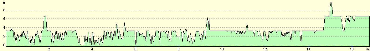
| From | To | Distance (m) | Ascent (ft) | Descent (ft) |
|---|---|---|---|---|
| Langstone | Anchorage Park | 6.4 | 98 | 98 |
| Anchorage Park | Portsea Castle | 5.5 | 49 | 52 |
| Portsea Castle | Tipner | 4.9 | 43 | 39 |
This makes a total distance of 16.8 miles, with 190 feet of ascent and 189 feet of descent.
For more information on profiles, ascents and descents, see this page
Accommodation
We parked on the roadside in Tipner, as we could not be bothered driving to a campsite.
Disclaimer
Please note that I take no responsibility for anything that may happen when following these directions. If you intend to follow this route, then please use the relevant maps and check the route out before you go out. As always when walking, use common sense and you should be fine.
If you find any information on any of these routes that is inaccurate, or you wish to add anything, then please email me.
All images on this site are © of the author. Any reproduction, retransmissions, or republication of all or part of any document found on this site is expressly prohibited, unless the author has explicitly granted its prior written consent to so reproduce, retransmit, or republish the material. All other rights reserved.
Although this site includes links providing convenient direct access to other Internet sites, I do not endorse, approve, certify or make warranties or representations as to the accuracy of the information on these sites.
And finally, enjoy your walking!
This walk was mentioned in the following routes:
| My walk around the coastline of Britain |
Nearby walks
| # | Title | Walk length (miles) |
|---|---|---|
| 301 | Pagham to West Itchenor | 19.4 |
| 302 | West Itchenor to Chidham | 14.9 |
| 303 | Chidham to Langstone | 16.0 |
|
|

|