Walk #762: Hay-on-Wye to Kington
 |
 |
|
General Data
| Date Walked | 03/04/2007 |
| County | Herefordshire, Powys |
| Start Location | Hay-on-Wye |
| End Location | Kington |
| Start time | 08.50 |
| End time | 16.16 |
| Distance | 14.7 miles |
| Description | This walk followed Offa's Dyke path as it headed northwarsd from Hay-on-Wye, including a superb stretch over the Hergest Ridge. |
| Pack | Today I carried my 80-litre Macpac Glissade rucksack, containing a North Face Blue Kazoo sleeping bag, my North Face Westwind tent, clothes, waterproofs and other camping items, including cooking gear. |
| Condition | I feel farily fine after this walk; the short distances of the last two days having helped my body recover from the long walk of the first day. I did have a little discomfort in my heels however, and hopefully this will clear up before tomorrow. |
| Weather | Today was mostly cloudy with only a few sunny periods throughout the day, and intermittent but short periods of light drizzle. The stiff breeze of the last few days was still present, and it was not as warm as it had been yesterday. |
| OS map | Landranger number 148 (Presteigne & Hay-on-Wye area) |
 |
 |
|
 |
 |
|
Map of the walk
Maps courtesy of Google Maps. Route for indicative purposes only, and may have been plotted after the walk. Please let me have comments on what you think of this new format. For a detailed table of timings for this walk, please see the table file.
 |
Notes
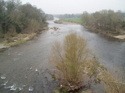
I woke up this morning having slept for eight or nine hours, which is far longer than I usually sleep and was a sign of how tired I was after yesterday's long stroll over the Black Mountains. Breakfast was prompt but not particularly filling, and I set off in no hurry as I only had a relatively short day's walk ahead. Once I eventually set off at ten to nine I headed through the town, passing the pretty clock tower before crossing the Wye via a road bridge, after which the path headed northwards along the western bank of the river. Initially many of the views were blocked out by trees, but soon the trail followed a path across fields and I could see much more of the river. As I crossed a stile I could see a group of other walkers in the distance ahead of me, and this gave me a target to try and catch up with them.
The path started to head away from the river and I said goodbye to the Wye, which I had been following on and off since the start of the trail in Chepstow. After joining a green lane between hedges the trail headed across another footpath northwards, and ahead of me I could clearly see the other walkers. Strangely one of them seemed to be carrying something, and as I caught up with them I saw that it was a large wooden cross hung over his shoulder. As I overtook them I chatted to them, and we walked together over a couple of fields. They were walking to a Holy Week retreat in Newport from Abergavenny, and apparently there are two other groups walking down from the north. They seemed like nice people, but as I was walking faster I overtook them and continued along the path.
The first steep climb of the day took me from the valley floor up onto the A348 road, and from there I got the last views of the Wye below me. The trail followed the road for a short distance, before heading steeply uphill along a surfaced track. It was a stiff ascent and I started to feel tired almost immediately, not a good sign so early in the day, but the gradient slackened once the trail headed off a footpath through trees with a deep gully to the right. There was a pretty barn in a field to my right, before the path descended down into the gully, crossing a stream on what would once have been a magnificent stone bridge, but now was a vegetation and moss covered mess.
A steep climb up a track took me up the other side of the gully, and I had to divert around fallen trees in a couple of places, which looked as though they had been there for some time. Again I felt tired during the ascent, but when it joined a road the gradient slackened and I could speed up once again for about a kilometre as I started to get chilly as I became exposed to the wind. At a road junction there was a minibus waiting, and a jovial man asked me if I had seen the Holy Week walkers and how far behind me they were. I gave him the answers and left him nervously looking at his watch as I left the road and followed the trail as it climbed up fields to join another road.
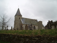
This road led quite steeply uphill,and after stepping onto a verge on the narrow road to allow a rubbish lorry past I struggled onwards. The road was soon left and a green lane took me over a slight summit before descending down to meet another road. More pleasant road and track walking followed as I descended down to reach the little village Newchurch, which was dominated by yet another pretty little church. As I was ahead of my self-imposed schedule I decided to stop off for a while, and I took my rucksack off before sitting down on a bench at a road junction near the church.
After a few minutes the minibus that I had seen a while before turned up and parked right in front of the church, and the gentleman who had been leading the walk got out and came over. One of their group takes it in turn to drive the van, and we talked for a long while about the group, the walk that they were doing and the period that he had spent living in Africa. It was an entertaining discussion, but eventually I had to say Goodbye as he was waiting for the others to arrive, and shouldered my rucksack before heading off as it started to drizzle lightly once again.
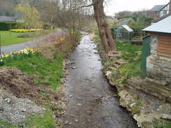
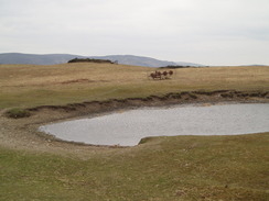
Initially the path dropped down to cross a bridge over a small river, before climbing steeply uphill onto the moorland. During the climb a walker passed me in the other direction, an American gentleman who was walking this part of Offa's Dyke as part of a longer walk. A superb walk across moorland followed, and I found myself sad when it ended as the path dropped down to meet a track by a farm, with a pleasant little poem attached on a gate.
A series of fairly undistinguished roads and fields followed, gently rising and falling with some reasonable views of the Hergest Ridge ahead. Eventually the path joined a road, and I followed this down into the tiny village of Gladestry. There was an Inn, the Royal Oak, marked on the map, and as it was thankfully open I nipped in and was immediately made to feel very welcome. I had a pint of bitter and a pint of orange and lemonade, which I used to wash down a couple of packets of salted peanuts. The landlord was repairing a couple of bar stools, and we chatted for a while about the smoking ban that had just come into force in Wales, and how this would affect his business as he was so close to the English border. He was actually very upbeat about the ban, and believed that food sales would go up to compensate for the loss of business from smokers.
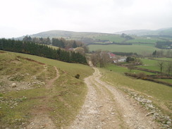
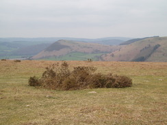
I had to tear myself away from the pub, and set off looking forward to the next ascent onto the Hergest Ridge, which had looked like it would be a good walk when I had seen it from afar earlier in the day. And so it proved; a steep walk up a minor road past some houses led onto a relatively gentle ascent along a track up some moorland that was absolutely superb, with some good views although the wind was still strong at times. Consequently I took my time and the climb seemed to take forever, and as the ridge walk continued to the left was the distinctive conical shape of Hanter Hill.
Before the old racecourse on the hill was reached I diverted off the path slightly to see if I could find the nearby trig pillar, but before I found it I could see it in the distance behind me; for once my navigation to a spot point had failed and I had totally missed the pillar. I could not be bothered to head back to the pillar, and instead crossed the site of the old Kington racecourse, and try as I might I could not make out the old tracks on the ground, which according to the guidebook are clearly visible. There is not much information about this racecourse on the Internet, so I have no idea when it was opened or last used.
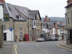
A clear path led downhill across the moorland with some more superb views, and although by this time my feet were aching once again I enjoyed the stroll across the moorland. This enjoyment ended the moment that the trail joined a surfaced road, and a long descent on hard tarmac followed, passing the gardens of Hergest Croft before reaching a road near Kington Church. I was booked into the Royal Oak pub for the night (coincidentally enough, the pub in Gladestry was also called the Royal Oak), and I headed down past the church to look for the pub.
I eventually found it right in the centre of the town after what seemed like a never-ending descent, and I was soon in my room, and the first thing I did was have a long and luxurious shower before relaxing in front of the television for a while. On Tuesdays the pub does not serve food in the evenings, and so after a while I went for a walk around Kington, which seemed like a pleasant enough town. Unfortunately, however, it seemed totally dead, and there were not many food outlets open and the few pubs that were serving food were either pricey or full. It was therefore a relief when I found a fish and chip shop, and I sat inside whilst I ravenously devoured a lovely cod and chips.
After this I went back to the Royal Oak and had a couple of points as I chatted to some of the locals; the bar was smoky, and I started to wish that the smoking ban was also in place in England as well. However despite this it was a good end to what had been a good day's walking.
Directions
| The walk is covered in detail in the Offa's Dyke National Trail Guide South (Chepstow to Knighton), by Ernie and Kathy Kay, and Mark Richards, ISBN 1-84513-274-2 published by Aurum Press Ltd. Click on the image to the right to go to the Amazon page for the book. | 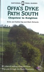 |
Distances
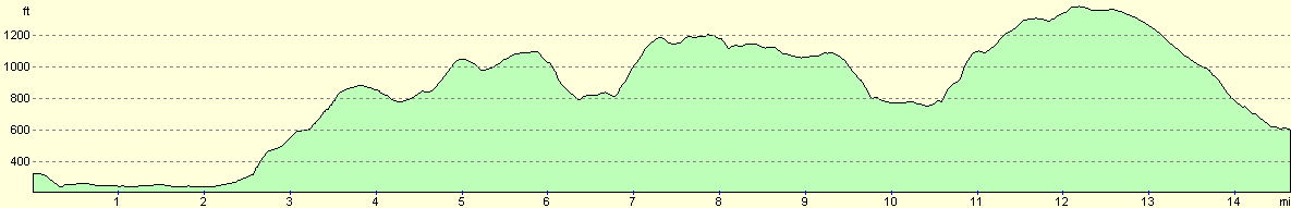
| From | To | Distance (m) | Ascent (ft) | Descent (ft) |
|---|---|---|---|---|
| Hay-on-Wye | Newchurch | 6.7 | 1161 | 650 |
| Newchruch | Gladestry | 3.6 | 535 | 604 |
| Gladestry | Kington | 4.4 | 696 | 866 |
This makes a total distance of 14.7 miles, with 2392 feet of ascent and 2120 feet of descent.
For more information on profiles, ascents and descents, see this page
Accommodation
I spent the night at the Royal Oak Inn, 24 Church Street, Kington, Herefordshire HR5 3BE. Tey can be contacted on (01544) 230484.
Disclaimer
Please note that I take no responsibility for anything that may happen when following these directions. If you intend to follow this route, then please use the relevant maps and check the route out before you go out. As always when walking, use common sense and you should be fine.
If you find any information on any of these routes that is inaccurate, or you wish to add anything, then please email me.
All images on this site are © of the author. Any reproduction, retransmissions, or republication of all or part of any document found on this site is expressly prohibited, unless the author has explicitly granted its prior written consent to so reproduce, retransmit, or republish the material. All other rights reserved.
Although this site includes links providing convenient direct access to other Internet sites, I do not endorse, approve, certify or make warranties or representations as to the accuracy of the information on these sites.
And finally, enjoy your walking!
This walk was mentioned in the following routes:
| Offa's Dyke |
Nearby walks
| # | Title | Walk length (miles) |
|---|---|---|
| 761 | Pandy to Hay-on-Wye | 16.4 |
|
|

|