Walk #791: A circular walk from Chilbolton to St Mary Bourne
 |
 |
|
General Data
| Date Walked | 25/10/2007 |
| County | Hampshire |
| Start Location | Chilbolton car park |
| End Location | Chilbolton car park |
| Start time | 09.01 |
| End time | 17.41 |
| Distance | 23.5 miles |
| Description | This was a long walk following the Test Way northwards, before looping back via the eastern outskirts of Andover. |
| Pack | Today I carried my 30-litre Karrimor rucksack, filled with waterproofs, a book and other odds and ends. |
| Condition | I am fairly tired after this walk, and my feet felt hot by the end of the walk - probably because they got slightly damp when I walked through the wet grass. |
| Weather | The weather today was cloudy, with occasionally long periods of light drizzle in the air. On a couple of occasions these became heavier, but never enough to force me to put my coat on. It was quite a warm day for the time of year, and there was little wind to chill me. |
| OS map | Landranger number 185 (Winchester & Basingstoke, Andover & Romsey) |
 |
 |
|
 |
 |
|
Map of the walk
Maps courtesy of Google Maps. Route for indicative purposes only, and may have been plotted after the walk. Please let me have comments on what you think of this new format. For a detailed table of timings for this walk, please see the table file.
 |
 |
|
 |
 |
|
Notes
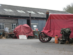
Now that I have moved down to Romsey I am keen to get some of the trails in the area completed, and the first of these is the Test Way. Already completed are the sections from Romsey to Chilbolton, and today I decided to do the next stretch northwards, from Chilbolton to St Mary Bourne. I set off later from home than I expected, and when I got to Chilbolton there was a lorry loading up with the recycling from the bins in the car park. It was unlucky to have reached the car park at the exact time that the bins were being emptied - it surely must only occur once every week or two - and I had to wait for the lorry to finish.
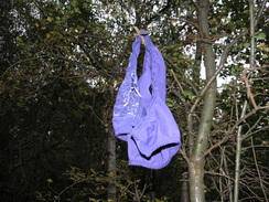
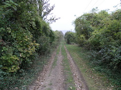
This extra delay meant that it was nine before I was ready to go,and immediately I started climbing along a footpath along a track. Within a few minutes, however, it became clear that I was on the wrong path, so I reluctantly headed back down towards the car park and took another path that headed up into the woodland. At one point there was a pair of lace panties hanging from a branch of a tree, leaving me wondering exactly how they had got there. It was fairly obvious that I was still on the wrong path, and at the top of the hill I took another path that led out onto a broad track, which seemed to be the correct path.
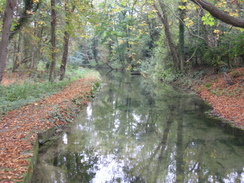
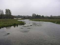
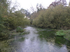
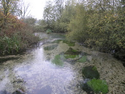
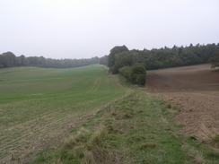
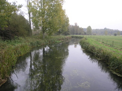
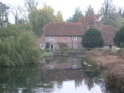
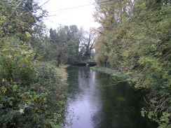
After passing an obviously little-used bench the path descended down from Westdown to meet a road in Chilbolton. So far the walk had not gone too well navigationally, so I made sure that I went the right way as I joined a footpath that ran northeastwards, with a little stream accompanying me to the left. The path soon reached a white house with a post box built into the wall, and then on to a footbridge over what I believe to be the River Dever - the river Dever and River Test meander so much on the map in this area that it is hard to tell which is which at many spots. Once across this short bridge a path led on to a much longer footbridge that passed over several streams of the River Test, with a remarkably clear water running below my feet.
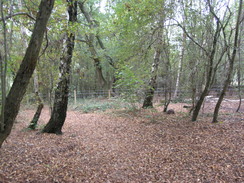
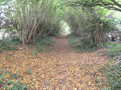
Another footpath took me along a field behind houses in Wherwell, in places skirting a disused railway line before taking New Barn Lane northwards. In places this was a sunken lane, with ivy-clad banks below the overhanging trees as it climbed and then fell to reach a pretty white cottage at New Barn., with what I guessed was the New Barn behind it. From here another path took me on, climbing uphill to meet the edge of some trees as what had been a light drizzle became slightly heavier, although not enough to force me to put my coat on. The edge of the trees were followed as far as Park Farm, where the sound of barking and howling dogs greeted me. Soon I passed a cage full of bloodhounds that gave me an accompaniment as a track led downhill into the woods.
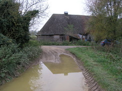
The next track was broad and the concrete surface was almost covered with fallen leaves as it headed through the trees but was blocked in a few places; firstly by a fallen tree that suspiciously looked as though it had been placed there, followed by a gate and finally some potentially dangerous chains draped below knee height. Soon afterwards the track emerged from the trees at Patchington Copse, where I was greeted by a slightly malodorous air and a large shed on my left. This was followed by two more of the long buildings, and a couple of workers told me that they housed chickens, as expected.
The track curved to head away from the barns and climb up towards Patchington Farm, where I was again greeted by a foul smell, this time the far worse smell of pigs as the farm is now a piggery. Examination of the map showed that the Test Way went through the piggery, but instead waymarkers pointed away from it towards the farm, the first of several route diversions during the day. The waymarking was clear and soon the track was taking me past a large barn that was under construction before passing under the old abutments of an old railway bridge to reach a road.
Again here the waymarkers showed a different route, with the Way following the road instead of heading down towards the river, which must be a better route. For a short distance the path skirted the road through the trees, making it an off-road route, before rejoining the road and using a long looping road that climbed up over the A303(T) road. On the other side of the main road a footpath was joined, which took me down to the road in Forton.
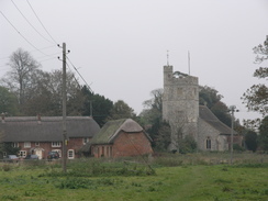
What followed was a fairly pleasant walk along roads and footpaths through Forton, passing the attractive area around the church before taking a path that headed off to the left (here I went slightly wrong; the Test Way took a slightly different route from the church). This track soon became fairly boggy, although as it slowly climbed it became firmer underfoot. A track junction was reached and the new track continued to climb through trees, crossing an old railway line on a bridge and continuing straight on through the woods. It proved easy to follow the track northwards, and soon the B340 road was reached, and the Way continued on along the other side.
From Fox Cottages the path twisted and curved as it headed in a rather indirect route to Faulkner's Down Farm, but a driveway led away from the farm towards a road. From here a combination of roads and tracks took me northwards, crossing a railway line to reach Lower Wyke Farm, from where tracks took over, passing Lower Wyke Barn before eventually starting to descend down towards the village of St Mary Bourne.
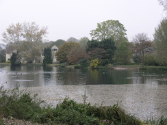
Here again the route diverted away from the one marked on the map, and a signpost at the junction with a path was marked as Inkpen Beacon being eleven miles away. The path headed along the southern side of a man-made lake, following a good path that was wheelchair accessible. The gates across the many small fields had an elegant ellipse design on them, and the whole path seemed pleasant.
When the school was reached I diverted off the path to try and reach a pub that was marked on the map. Fortunately this was open, and I went in to have a rest. The barmaid was friendly, and I had my usual - a pint of bitter followed by one of orange and lemonade, each one washing down a pack of crisps. There were many pensioners in and although the food looked good quality I really had to press on, and so I said goodbye and walked back up towards the church.
I only continued on the Test Way for about a third of a mile as the Way climbed out of the village to reach a road, which will leave me about ten miles to do to complete the northern end of the Way in the future. I felt sad to be leaving the Way as the return route that I had planned was not going to be as enjoyable as the Way had been, but I strode on southwards along the road, passing a complex road and track junction at Five Lanes before a footpath took me on southwards to reach the track that I had walked along earlier.
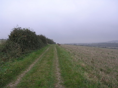
This took me on past Lower Wyke Farm, and then a road led on to the railway bridge and then to a road junction. Another road took me past a pub and golf course on the way towards Andover, before I took another road called Ox Drive that skirted the very eastern outskirts of the town. Once across the A3093 a footpath took me on along a track to a footbridge that passed high over the now-disused Micheldever Road below. The track was high on the hillside and there were some views down over Andover, but these were hazy and imperfect due to the low cloud and slight drizzle that was still hanging in the air.
When the track ended I took another one that started to head southwards, passing under the A303(T) via an underpass that was dark, noisy, boggy and smelly, hardly a nice location. Two car wheels in a puddle outside the underpass added to the ambiance, and I accelerated for a short distance until the smell and finally the noise retreated. A footpath running along a track took me southwards, and although in places the track was wide in others it was narrowed by overhanging vegetation, and as the drizzle started to get heavier I started to wish that the walk would end.
The drizzle was not heavy enough for me to put my coat on and my fleece and woolly hat were keeping me dry underneath, and so the drizzle was only an annoyance. In a couple of places I could see golfers at the adjacent Hampshire Golf Course, and as the path passed some woodland on the left it ended at another road. This was relatively busy, but fortunately it only had to be followed for a short distance until a car park was reached, and a footpath headed off westwards. Initially on the left of this path there is a fenced compound with some green tanks within; I wondered what these were for, and can only assume that they are something to do with the nearby sewage works. The path descended to meet the river, although any views of the water were blocked out by the thick hedges for most of the time, and soon the awful smell from the sewage works were assaulting my nostrils.
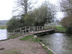
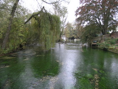
I sped on past the sewage works and soon reached a footbridge over the river Anton, which was a fairly pleasant spot. On the other side of the bridge the river crossed the floodplain to join an old railway trackbed, and I was hopeful of following this all the way back to the car park at West Down. Unfortunately the trackbed was blocked with a gate, and so I kept on the footpath as it started to climb uphill. The worst of the drizzle was now over, but there was still enough moisture in the air to spoil any views that there would have been.
The path levelled off and ended at a road, and after this had dropped downhill it joined a walk that I had done last week in Fullerton. The road took me back across the River Anton, with an attractive mill on the right and an old railway bridge on the left. Immediately afterwards the road ended at a main road, and instead of walking along this back to West Down I turned left and very carefully crossed an old bridge over the railway trackbed. The traffic was fairly busy and it was not too safe crossing the bridge, but once on the other side a surfaced driveway took me to the site of the old Fullerton station.
This was rather a dark, overgrown affair that was not helped by the overcast sky or the lateness of the hour. To the left there was a channel that looked as though it may be part of the old canal, but a little further on I saw that I was actually walking along an old railway platform, and on either side of me there were the spaces for the tracks. Fullerton station must have been a far bigger - and busier - station than the rural site warranted, perhaps because of the RAF station on the hillside above Chilbolton.
A gateway marked the start of a stretch of the Test Way, and once across a river bridge I reached the site of the old railway junction. By now it was quite dark in the overgrown cutting, and as I climbed the steps that led up to the car park from where I had started the walk it became brighter as I left the tree cover. It had been a long walk for the time of year, and had been a varied stroll - there were some boring stretches, but also some glorious ones,despite the bleak and overcast weather. I now only have two walks to do before I have completed the Test Way - one at the southern end, and the other at the very northern end. I am looking forward to both of these.
 |
 |
|
 |
 |
|
Directions
This walk starts off at the car park near the A3057 to the south of Chilbolton. From the car park take a footpath that heads uphill, paralleling the road that heads northwards. Do not take the track that heads uphill to the east. The footpath descends down to meet a road at SU386394; cross the road and take another footpath that heads northwards. This curves to the right and then the left, before settling on a northwesterly course. It crosses a stream before crossing Chilbolton Cow Common and reaching a bridge over the River Test. Cross this bridge, and then climb up to meet a road in Wherwell.
Turn left down this road, and after a few yards turn right along a footpath that climbs uphill. After a few yards turn right to head northeastwards behind houses. When the B3420 road is reached, turn right down it for a short distance, then turn left along another footpath. Head northeastwards along this until a track called New Barn Lane is reached.
Turn left and follow New Barn Lane as it climbs uphill to the north for 0.4 miles. At new Barn it curves to the right to head northeastwards for a little under half a mile. Some trees start on the left; when a large expanse of trees start on the left, turn right and follow the southern edge of the woodland eastwards to Park Farm.
At the farm turn left and head downhill for a short distance along a track, before taking another track that leads off to the right to head eastwards. Follow this track as it heads eastwards through the woods, passing a series of large barns on the left. Follow the track as it curves to the left to head up a slight hill, then passes through Pachington Farm before passing under an old railway line and reaching the B3048 road.
Turn left to head north up the B3048 for a short distance, then take the first road that leads off to the left. This road climbs up as it curves to the right to cross the A303(T). As it curves around to the right it passes a mast; turn left along a footpath, then right along another that heads eastwards across fields to reach the B3048 road in Forton. Cross the B3048. Then follow another road that heads sutheastwards for a hundred yards. Continue along it as it curves to the left to head northeastwards through Forton.
When the road curves to the left continue straight on along a footpath that heads northeastwards towards Middleton Church. Keep the church on the left, then walk the short distance to reach the B3048 road. Turn left for a few yards, then turn right along another footpath that heads northeastwards for a short distance. This reaches a track near Lower Farm at SU428441.
Turn left and follow this track as it heads uphill for a third of a mile. When it ends at a T-junction with another track, turn left and follow this track as it heads westwards for a quarter of a mile. Just before it meets a road, turn right and take another track that starts to head northwards. Continue along this for a mile and a quarter, as it crosses a bridge over an old railway line, becoming a footpath that keeps the trees to the left as it reaches the B3400 near Fox Cottages.
Cross the B3400 and then take a track on the other side; almost immediately this curves to the right, then left, to take a more northerly course. This meets a track; turn left to follow this westwards past Faulkner's Down Farm. On the west side of this farm follow the track as it curves to the right to head northwestwards to reach a road at SU408478. Cross this road and join a road that heads northwards, curving to cross a railway line.
When Lower Wyke Farm is reached turn right and start walking along a track. After 0.4 miles turn right, to join a footpath that heads slightly north of east for 0.8 miles, when it curves to the left to start heading downhill to the north along a track. Just before this track ends at the B3048 road in St Mary Bourne, leave the Test Way and turn left to walk northwestwards along a footpath with a lake on the right. The footpath continues on past the end of the lake, crossing a couple pf small fields before reaching a road.
Cross the road, and continue across several more fields until it reaches a lane. Turn left along this lane for a few yards, then turn right to join a footpath that heads northwestwards behind houses. Cross a couple of stiles, then turn left to walk along the lane, with the school on the right. When the lane curves to the left follow it as the road becomes slightly rougher underfoot. After a few yards turn right to cross a stile and take a footpath that turns behind houses, and just before a stile is reached ahead turn left to cross another stile and head diagonally uphill towards a stile in the upper-right hand corner of the field. Cross this stile, and walk through a small patch of woodland to reach a road at SU411508.
Turn left and start following this road as it heads southwards, climbing uphill for half a mile. The lane ends at a junction at Five Lanes; head straight on along another road, continuing south for a third of a mile. When the road curves sharply to the right, continue straight on along a green lane. This soon joins the Test Way that was walked earlier; follow this as the track ends at a road at Lower Wyke Farm. Turn left to head south along the road from the farm for half a mile; shortly after it crosses a railway line it ends at a T-junction with another road.
Turn right to start heading westwards along this road, after half a mile turn left along another road called Ox Drove, which heads southwestwards for about a mile and a half before ending at a T-junction wit the B3400 road. Turn right along this road to head westwards along the B3400 for a hundred yards until it ends at a roundabout with the A3093 on the outskirts of Andover.
Carefully cross the A3090 at the roundabout, then take a footpath that heads off on the opposite side. This climbs southeastwards parallel to the road for a short distance, before curving to the right to head southwestwards. After half a mile a lane is crossed on a footbridge called Iron Bridge. Cross the bridge, and on the other side continue along a track called Ladies Walk. After another half-mile a track comes in from the left; follow the track as it curves to the right to head downhill for a short distance, then turn left along another track at SU367445.
This track heads south for a couple of hundred yards to reach the A303(T). Carefully cross the busy road, then continue on southwards along a track. After 0.6 miles this crosses a minor road; continue on along the other side got 0.8 miles until the track ends at the B3420 road. Turn right to head westwards along the B3420 road until it ends at a T-junction with the A3057 road.
turn left to head south along the A3057 for a short distance, then turn right along a footpath that heads westwards down towards the River Anton. At the bottom of the field follow the footpath as it turns sharply to the left to start heading southward alongside the river. It squeezes between the river on the right and a sewage works on the left. Near SU370409 turn right to join another footpath that cross the River Anton on a footbridge before continuing on to an old dismantled railway line.
Turn left to head southeastwards along the old railway line for a few hundred yards, then at a gate turn right to join a footpath that heads southeastwards for 0.8 miles; it climbs uphill and skirts to the left of some trees before ending at a road. Turn left and follow this road as it heads downhill, joining another road near Fullerton Grange and continuing on to a bridge over the River Anton, then the A3057 road.
Carefully turn left and head north, crossing an old railway line on the road bridge. The road here is narrow and busy, so care is needed. As the roads descends back down to ground level, turn right along a driveway, then turn left to start following a footpath that heads southeastwards along the course of the old railway line. This crosses the River Test on a bridge, then reaches an underbridge. Just before this bridge, turn left and climb up to a road; the car park this walk start at is directly opposite.
Distances
| From | To | Distance (m) | Ascent (ft) | Descent (ft) |
|---|---|---|---|---|
| Chilbolton car park | St Mary Bourne | 12.3 | 919 | 817 |
| St Mary Bourne | Chilbolton car park | 11.2 | 781 | 883 |
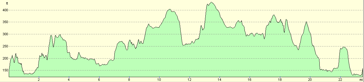
This makes a total distance of 23.5 miles, with 1700 feet of ascent and 1700 feet of descent.
For more information on profiles, ascents and descents, see this page
 |
 |
|
 |
 |
|
 |
 |
|
 |
Disclaimer
Please note that I take no responsibility for anything that may happen when following these directions. If you intend to follow this route, then please use the relevant maps and check the route out before you go out. As always when walking, use common sense and you should be fine.
If you find any information on any of these routes that is inaccurate, or you wish to add anything, then please email me.
All images on this site are © of the author. Any reproduction, retransmissions, or republication of all or part of any document found on this site is expressly prohibited, unless the author has explicitly granted its prior written consent to so reproduce, retransmit, or republish the material. All other rights reserved.
Although this site includes links providing convenient direct access to other Internet sites, I do not endorse, approve, certify or make warranties or representations as to the accuracy of the information on these sites.
And finally, enjoy your walking!
Nearby walks
| # | Title | Walk length (miles) |
|---|---|---|
| 100 | A circular walk including Inkpen, Walbury Hill and Pilot Hill | 10.4 |
| 789 | A circular walk from Mottisfont to Fullerton | 21.4 |
| 792 | A circular walk from St Mary Bourne to Inkpen Hill | 24.1 |
|
|

|