Walk #795: A circular walk around Hayling Island and Havant
 |
 |
|
General Data
| Date Walked | 06/11/2007 |
| County | Hampshire |
| Start Location | Langstone |
| End Location | Langstone |
| Start time | 07.37 |
| End time | 1.44 |
| Distance | 25.1 miles |
| Description | This was a very pleasant walk around Hayling Island and Havant. |
| Pack | Today I carried my 30-litre Karrimor rucksack, filled with waterproofs, a book and other odds and ends. |
| Condition | I feel absolutely fine after this walk. |
| Weather | The morning was clear and cloud, with no clouds in the sky. As the day went on there was some cloud cover, but there was still plenty of sunshine. |
| OS map | Landranger number 197 (Chichester & The South Downs, Bognor Regis & Arundel) |
 |
 |
|
 |
 |
|
Map of the walk
Maps courtesy of Google Maps. Route for indicative purposes only, and may have been plotted after the walk. Please let me have comments on what you think of this new format. For a detailed table of timings for this walk, please see the table file.
 |
 |
|
 |
 |
|
Notes
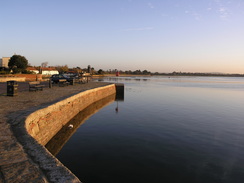
I set off early this morning to drive to Emsworth, in order to do a walk around Hayling Island. I missed this island off my coastwalk (as there is only one way on and off the island, breaking my rule), and as I now lived in the area it seemed like a sensible thing to do. Traffic meant that it too me longer than expected to get to the care park at the Ship Inn in Emsworth, where I wanted to park, but a virtually cloudless sky afforded me a great view when I arrived of white buildings reflecting in the water - it was superb. I became slightly melancholic as I remembered meeting Sam at the car park during the walk.
The initial part of the stroll took me over the causeway and bridge that carriers the only road onto the island. In the water to the right were a row of dots; the bases of the old bridge that once carried the railway line over the water. This view was fairly famous in railway circles, and amongst holidaymakers who took the train to the sea. Beyond were the towers of Portsmouth, a part of the walk that I remember well.
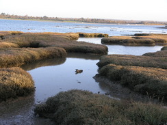
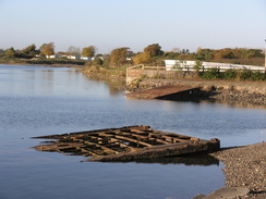
On the other side of the bridge I left the main road behind and took a series of roads that led past a marina to Eastney. Just before this I went to a Texaco garage where I nipped in to buy some chocolate and use their facilities; very useful. Before the marina the road skirted salt marshes on the left, with some good views to the north. Near the church in Northney there was the skeletal wooden remains of an old barn, looking sad and dejected in its nakedness. This would probably be ripe for conversion into a home by some willing entrepreneur; even that would be better than its current state.
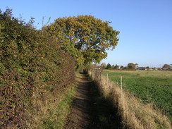
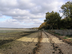
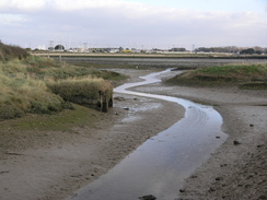
This part of the walk was a short distance away from the sea, with no views to be had over the water - this was a great shame that made this part of the walk a little too boring. Fortunately at Tye I followed a road that headed south to meet a little creek; this then allowed me to access a footpath that ran along the top of the floodbank beside the creek. The heavy smell of the mudflats - decaying seaweed and primordial oozing mud - was very evocative. Sadly this came to an end too soon, when a road was met near Fleet.
This road took me back to the main road, and I was forced to follow this southwards for a little over half a mile. Fortunately it was not too bad a stroll and the pavement was wide, although it was a relief when I could leave it and join an access road that led to a holiday village. A short distance along this I took a footpath that headed southwards, with the back gardens of houses on the right and a golf course on the left. Again I started to miss the sea. This brought me out onto a road in Tournerbury, and then another footpath took me southwards, eventually joining another road near Mengham House.
From there I was keen to take roads eastwards back towards the sea at Selsmore, and I wanted to join the footpath that runs along the seawall. Unfortunately I took a turn too early and ended up at a dead-end road called Salterns Close - although the footpath was only a hundred yards away at most, a slipway barred access. I had no alternative but to head back and find the proper route.
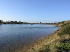
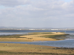
The area around Selsmore forms a little peninsular, and I could easily walk around the rest of this whilst enjoying the views over the water. Soon the path turned to follow the edge of a little creek; on the right was a little freshwater lake. This enjoyable stretch ended when then path reached a road in Eastoke, and I was forced to follow other roads eastwards, trying to keep as near as possible to the sea. It was hard to work the best route on the map, so I ended up taking a rather winding route through an estate, before eventually reaching the little peninsular that leads up to Black point.
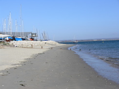
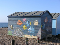
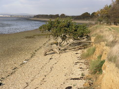
I followed the road northwards to Black point; I had hoped to walk all around the small headland, but signs warned me off in no uncertain terms. Instead, I turned around and followed the eastern side of the peninsular, passing the lifeboat station to reach Eastoke Point. Here, for the first time in the day I was facing much more open sea instead of Chichester Harbour. The beach underfoot was sandy, and I could not resist kneeling down and letting the sand run between my fingers. Off to the right was a nature reserve, complete with many dog walkers.
Unfortunately the beach became less sandy and more pebbly as I went on, making the going harder. I followed the beach through South Hayling, passing close to the East Hayling Light Railway. The temptation to stop off in one of the pubs was strong, but proved easy to resits - I still had a long way to walk, and the late autumn days were short. The going became easier as Gunner Point was reached, where the beach turned to hread northwards. Off to the left there was a small channel, on the other side of which was Eastney and, further on, Portsmouth.
Things became a little mnore complex a shoirt distance futher on. A ferry landing takes passengers across to Eastney, and I decided to stop off in the Ferry Inn for a drink. I was in need of a rest, but could not afford to stop too long, so I was soon heading off once more. Visible in the water to the north was a Mulberry Caisson, part of the artificial harbours built for D-Day. As I walked around the coast I had seen half-sunken parts of the harbour in strange places, including the west coast of Scotland. They had been made all around the country and towed down to the south coast just before the invasion. It is a nice reminder of the past.
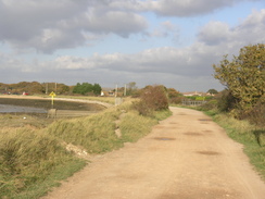
I followed a road past a little area of mudflats called The Kench, before turning to follow the foreshore past an old holiday village. This stretch of the walk was not too eash, with no real path and old piers and jetties blocking the way. It was a pleasant walk despite these problems, abd eventually I reached the course of the old Hayling Island railway. A gap in the hedge allowed me onto the old line, now called the Hayling Billy Coastal Path. As its name shows, the old line is now a cycle path. It was an enjoyable stroll, and is often the case there were occasional reminders of the old use - lumps of metal, posts and even an old platelayer's hut.
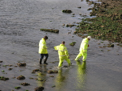
Sadly this stretch had to end when the southern edge of the old railway bridge was reached, the way across to Emsworth obviously being blocked. Instead the path headed inland to the main road, and then across Langstone Bridge back to the car park where I started the walk. On the way I saw some workmen in flouresecent yellow clothing wading across the mud and pebbles below the bridge - it did not look like the most pleasant job in the world!
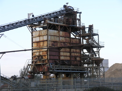
I could have finished the walk here, but as there was still a little daylight left I decided to continue onwards. Initially I walked into Langstone and then joined the Wayfarers Walk as it followed the coast northwestwards. I had done this as part of my coastwalk, and it felt good to be back. All too soon the oath started following a creek inland, reaching a fairly urban scene, including a gravel plant. A road was reached in Brockhampton, and, extending the walk again, I continued on along the Wayfarers Walk as it followed a railway line before heading north to reach a road in Bedhampton.
It was going to get dark soon, so I decided to follow the road that headed right through the centre of Havant. In the centre of the town there was a bridge carrying the road over the old railway line; again, I could have shortened the walk by following this back to Emsworth, but instead I walked on out of the town, soon reaching a pair of roundabouts above the A27(T).
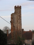
The noise of the dual carriageway was an unwelcome intrusion on what had been a fairly quiet walk, so it was a relief when a road took me south into Warblington. Near the farm a tower can be seen - the remains of an early 16th Century castle that was destroyed in the civil war. The obvious remains - a tall octagonal turretted tower that sticks above the surrouding farm and trees - is constructed partially of red brick. It looks unusual and strangely out of place - when I first saw it on the coastwalk, I thought it more likely to be a Victorian folly than something much older. Coincidentally, in Elizabethan times it was lived in by a George Cotton - I wonder if he was a distant relative of mine...
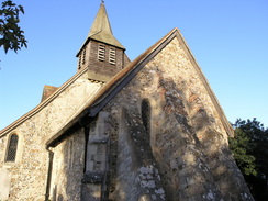
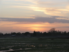
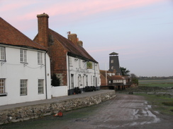
A red hue was starting to appear in the sky by the time I reached the little but perfectly-formed Warblington church. I hurried through the churchyard, following the Wayfarer's Walk, and then went down onto the foreshore for the short walk westwards. It was starting to get dark and I was keen to finish what had been a long day's walk, but I did have time to chat to a man who was walking in the same direction. By the time I reached my car the sky over the water was red, meaning that I had started and ended the day under a red sky. They were suitable book-ends to a very pleasant day's walk.
 |
 |
|
 |
 |
|
Directions
This walk starts off at Langstone Quay. Leave the car park by the quay and turn left, to start heading south across Langstone Bridge. When a road junction is reached at the southern end of the bridge turn left, to start heading east along Northney Road past North Common. After 0.4 miles the road turns to the right to start heading south and then east to head eastwards into Northney. In Northney the road curves to the right, to resume heading southwards once again through North Hayling, passing a church on the right before a road junction is reached near Upper Tye Farm.
At Upper Tye Farm (SU731023) turn left down a road that heads roughly southwards for a third of a mile. At a T-junction turn left to head eastwards for a few yards along a track, and when this ends turn right down a footpath that heads south to reach the sea after a short distance. Turn right, to start heading west along a footpath; it leaves the foreshore and heads inland. After half a mile it ends at a road. Turn left along this road and follow it westwards; after a few hundred yards at a road junction turn left to head southwestwards for a few hundred yards to the A3023 road.
Turn left to head south along the A3023 road. After half a mile the road curves to the right by a school on the left. At the bend continue straight on along a curved lay-by beside the school; at the middle of this turn left to head southwestwards down a track that leads towards a holiday village. After a short distance turn right to start following a footpath southwards for 0.4 miles, passing the gardens of houses on the right and then playing fields on the same side.
When this footpath ends at a road turn right to head westwards, before taking the second road off to the left. This heads southwards, and when it curves to the right continue straight on along a footpath that heads southwards. The footpath crosses a road by Mengham House and then curves to head southeastwards to end at a road. Turn left to head eastwards along this road through Mengham. At SZ734992 turn left to join a footpath that heads up towards the sea, then turns right to follow the foreshore southeastwards.
Continue along the foreshore as it turns to head southwestwards, eventually ending at a road in Eastoke. Turn left down this road southwards for a few yards, and then turn left to head eastwards along Southwood Road. After a quarter of a mile turn left along another Eastoke Avenue, which leads through a residential area, skirting slightly inland from the coast, with houses between the coast and the road. When Eastoke Avenue ends turn right down Haslemere Gardens, which turns to the right to end at Bosmere Road. Turn left to head south down Bosmere Road until it ends at a T-junction.
Turn left to head east along another road; at a junction turn left up Bracklesham Road. Follow this road until it ends, and then continue on towards the lifeboat station. Just before this is reached, turn left to head northwards towards Black Point. It is impossible to walk around the point, so join a track and start heading southwards. At the lifeboat station join the beach and continue on southwards. The beach curves to the right at Eastoke Point and starts heading westwards. Soon a promenade starts. Head west for about four miles towards Gunner Point, where the beach curves to the right to head north up to a ferry landing.
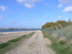
Turn right to join a road which heads past The Kench on the left; immediately after The Kench turn left along a footpath that heads northwards, before curving to the right to head eastwards. Stay on the foreshore for a mile and a half as it slowly curves to the left, and then when an old railway line is reached on the right join it. Follow the old railway line (the Hayling Billy Coastal Path) northwards for a couple of miles until the southern end of the old railway bridge is reached. Here turn right to walk along a path for a short distance back to the A3023 road.
Turn left and head northwards over Langstone Bridge. At the northern end of the bridge turn left along a footpath that runs along the old railway line. When this meets a local road, turn left to head westwards towards an old mill. Cross a stream and then turn let along a footpath that heads southwards along the stream before curving to the right to start heading northwestwards past South Moor. After a little over a mile the path curves to the right to head northeastwards along a tidal stream into Brockhampton; the path follows the eastern bank before changing over to the western bank and ending at a road.
Turn right along this road for a few yards and then turn left, to head northwards along a road that climbs up a bridge over the A27(T). Once across the bridge turn left to descend some steps, and then turn left along a footpath. Almost immediately this oath curves to the right to head westwards along the embankment of the A27(T), before curving away to the right past a car park on the left to reach a road. Cross this road, and then cross a meadow northwestwards, keeping some power lines on the right.
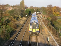
At the northern end of the meadow cross a stile, a track and then another stile; cross a stream on a bridge and then turn left to start walking along another footpath. This leads to a railway line; turn left and head southwestwards alongside the railway line until it passes under a bridge. Turn left on the other side of a bridge, and follow the path as it meets a road. Turn sharp-left to start heading northwards along the road northwards, crossing the railway line and descending to end at a T-junction. Cross the road and head straight on, passing a church on the left and heading diagonally across a small car park. Keep a recreation ground on the right and continue on along a footpath northwards.
The path ends at a road. Turn right along this road and start following it eastwards. When the road curves to the left head straight on along West Street, which passes Bedhampton station and continues on through the centre of Havant. Cross the B2149 road and continue on eastwards along a pedestrianised stretch of East Street. East Street becomes Emsworth Road; head eastwards along this to a roundabout near the A27. Pass under the A27 road bridge to another roundabout, and then tun right along Church Lane (do not go up the slip roads to the A27).
Church Lane heads southwestwards through Warblington, curving to head southwards before the road ends at Warblington church. At the end of the road turn right to enter a churchyards; head diagonally through the churchyard and leave through a stile in the southwestern corner, A path leads southwestwards across a field to reach the foreshore. Head west along the foreshore, and when a path starts on the right join this and continue southwestwards along this. It heads behind a couple of buildings with some lakes on the right, before heading in front of some houses to reach Langstone Quay, where this walk ends.
 |
 |
|
 |
 |
|
Distances
| From | To | Distance (m) | Ascent (ft) | Descent (ft) |
|---|---|---|---|---|
| Langstone car park | Black Point | 8.9 | 72 | 72 |
| Black Point | South Hayling Ferry | 5.1 | 52 | 52 |
| South Hayling Ferry | Langstone car park | 5.0 | 49 | 49 |
| Langstone car park | Langstone car park | 6.1 | 118 | 118 |
This makes a total distance of 25.1 miles, with 291 feet of ascent and 291 feet of descent.
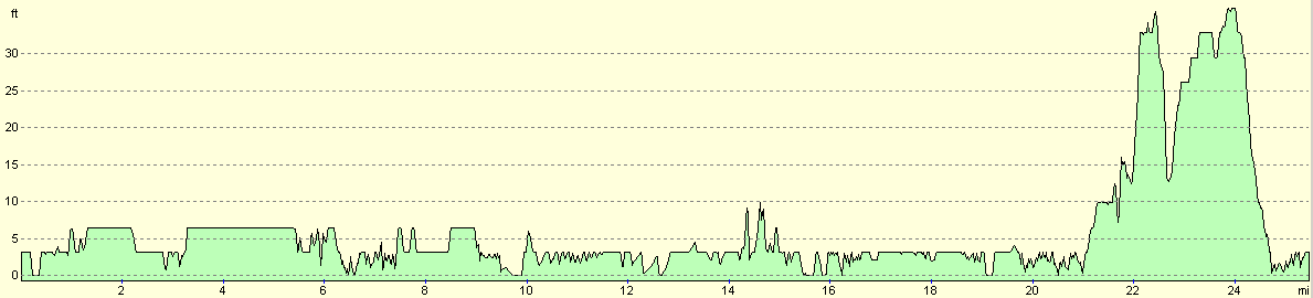
For more information on profiles, ascents and descents, see this page
 |
 |
|
 |
 |
|
Disclaimer
Please note that I take no responsibility for anything that may happen when following these directions. If you intend to follow this route, then please use the relevant maps and check the route out before you go out. As always when walking, use common sense and you should be fine.
If you find any information on any of these routes that is inaccurate, or you wish to add anything, then please email me.
All images on this site are © of the author. Any reproduction, retransmissions, or republication of all or part of any document found on this site is expressly prohibited, unless the author has explicitly granted its prior written consent to so reproduce, retransmit, or republish the material. All other rights reserved.
Although this site includes links providing convenient direct access to other Internet sites, I do not endorse, approve, certify or make warranties or representations as to the accuracy of the information on these sites.
And finally, enjoy your walking!
Nearby walks
| # | Title | Walk length (miles) |
|---|---|---|
| 301 | Pagham to West Itchenor | 19.4 |
| 302 | West Itchenor to Chidham | 14.9 |
| 303 | Chidham to Langstone | 16.0 |
|
|

|