Walk #799:A circular walk from Broad Chalke to Win Green Hill
 |
 |
|
General Data
| Date Walked | 16/11/2007 |
| County | Wiltshire |
| Start Location | Broad Chalke |
| End Location | Broad Chalke |
| Start time | 07.35 |
| End time | 15.33 |
| Distance | 23.0 miles |
| Description | This was a very pleasant walk following two ridges to the west of Salisbury, with some wonderful views. |
| Pack | Today I carried my 30-litre Karrimor rucksack, filled with waterproofs, a book and other odds and ends. |
| Condition | I am fairly tired after this walk, but aside from this have no problems. |
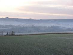
| Weather | The day started off bright and sunny, but also exceptionally cold. There was a little mist about first thing, but this soon disappeared. As the day wore on cloud started to gather and it became warmer. |
| OS map | Landranger number 184 (Salisbury & The Plain, Amesbury) |
 |
 |
|
 |
 |
|
Map of the walk
Maps courtesy of Google Maps. Route for indicative purposes only, and may have been plotted after the walk. Please let me have comments on what you think of this new format. For a detailed table of timings for this walk, please see the table file.
 |
 |
|
 |
 |
|
Notes
Today was a bitterly cold morning, and a thick frost lay on the ground as I drove away from home on this walk. For the first time I can remember my car did not warm up during the journey, and apparently it was -5 overnight. Fortunately I had packed my gloves, hat, balaclava and the other assorted equipment that I would need to keep warm. I parked on the roadside beside a chapel, quickly got my kit together and headed off.
Good views became visible behind me as the track climbed out of Broad Chalke, and the sky around me was red as the sun slowly rose. The front of my upper legs were freezing, and I wished that I had put some legging on under my trousers, although my fingers in my gloves soon warmed up. The views continued expanding behind me, but there were still no views ahead of me. At the end of this track I started walking westwards along Compton Down, and occasionally good views poked out over the plain to my right. As I strolled along a deer ran out in front of me; I was unsure who was most surprised; myself or the deer! It could not find a way out through the hedge, so it bounded down the track in front of me, its white tail bobbing up and down magnificently as it did so.
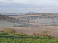
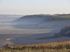
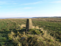
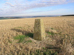
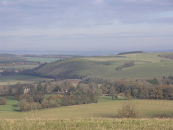
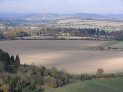
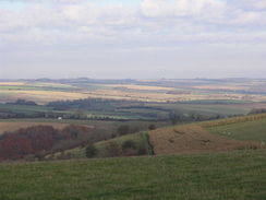
A little further on I passed a small gypsy camp, including an old Albion bus and a traditional-looking caravan. Shortly after this the stench of poultry sheds attacked me, and I could not wait to pass these. Some men were laying cables in a trench that ran for a long way along the track; I can only assume that it is cheaper to run them here than along a road. After this I diverted off along a track that skirted the eastern edge of Sutton Down, and the views over the valley below were superb, with the last vestiges of the mist hanging to the sides of the escarpment. The music I was listening to: "Judgement Day", by Army of Lovers, seemed suitably fitting. Just before the path plunged downhill I turned left to join another track, which took me past Sutton Down trig pillar. The views from here were fairly poor, where a few yards away they were superb - one of the vagaries of views when walking. I did not spend long here, and followed the track back to rejoin the track that ran along the top of the escarpment.
This crossed a road, and some of the views down into the misty valleys below were superb. I could see a great distance off to the right, including, I thought, Salisbury Plain. I continued on until the trig pillar on White Sheet Hill became visible on the right. Just before this, I passed a Cross Dykes, the ancient monuments just visible as a grassy ridge. Again the views from the pillar were disappointing, and I headed on before turning to the left and using footpaths to descend down to the south, At the top of the hill the path crosses another Cross Dykes, seemingly not attached to the one I had passed a few minutes before. The path curved around the top of the hill, and somehow I went slightly wrong and skirted the edge of the trees until a track took me downhill. I was starting to feel warmer, so I took me balaclava off for the first time today. The track is obviously walked a fair deal, as there was a good-quality bench waiting for me!
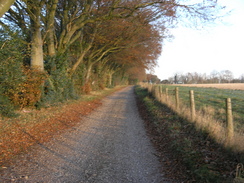
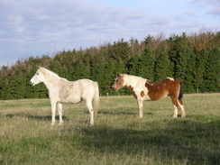
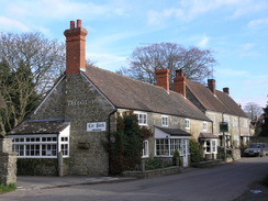
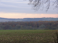
A lane took me down into the little village of Berwick St John. This was a lovely little village, although annoyingly the pub was shut. It is a pretty village with many thatched cottages, but I did not want to wait an hour for it to open. As I was doing well and feeling fine, I decided to extend the walk by three miles and visit the nearby Win Hill trig pillar. I talked to a few people who were also out on a walk, before heading along Ashcombe Lane out of the village, which in reality is a green lane. This passed an area jam-packed full of old vehicles, lorries and lorry bodies, many of which had vegetation growing through them. I found these of interest; I guess I have that sort of mind.
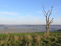
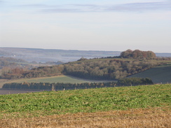
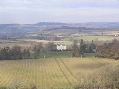
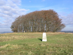
The lane became narrower as it climbed steeply up onto Monk's Down. It was a bit of a puff, but the views from the road at the top were well worth the effort. I took these in for a while before joining a goos track that took me westwards towards Win Green Hill. It was a great stretch of path with some superb expansive views, and I soon reached the circle of trees that crowns the top, Nearby was the trig pillar and toposcope, and I was tempted to stop here for a while to rest. It was still a cold morning, however, so I decided to walk on. A flock of sheep ran past the field beside me en mass, spooked by a Golden Labrador that was on the loose.
I enjoyed the views once again as I retraced my steps back to the road, and then I continued on eastwards along the road. This is the Ox Drove, and when the road curved around to the right the drove continued straight on along the track. What followed was a straightforward but slightly boring stroll along a combination of tracks and roads, heading eastwards across the countryside. There were some occasional good views, but aside from this it was a case if putting my head down and walking.
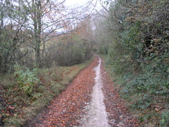
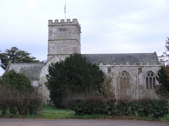
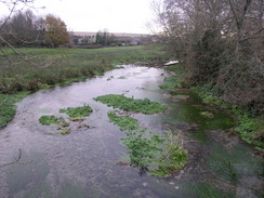
Shortly after passing Lodge Farm I reached a crossroads in tracks; here I turned left and followed a track that started descending back down to the north. This passed the Middleton Down Nature Reserve, but it seemed to take an age to reach the village of Broad Chalke. By the church was a car park, a much better place to park than the roadside location that I eventually chose. I was tired, but feeling quite elated after what had been a wonderful day's walking. I passed the church in the village and crossed the River Ebble. The sight of my car was a welcome relief.
 |
 |
|
 |
 |
|
Directions
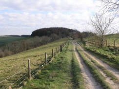
This walk starts off by the chapel in the village of Broad Chalke. Turn right to head westwards along the road from the chapel; almost immediately it turns to the right to take a more northerly course. When it curves to the left once again, continue straight on along a tarmac track that passes Chalk Pyt Farm. Do not turn left, and instead continue straight on as a the track climbs for 1.3 miles. When the track curves to the right, continue straight on along a rough track. This track ends at a T-junction with another track on Compton Down.
Turn left and follow this track as it heads in a rough westerly direction along the top of the ridge for a little under seven miles, crossing a couple of roads on the way. I made one diversion during this stretch; I headed off to the right at Sutton Down to visit a trig pillar.
When the track reaches White Sheet Hill at ST941240, turn left to start following a footpath slightly west of southwards. After half a mile it passes a Cross Dyke and then approaches a valley to the left; turn left along a footpath that skirts the top of the valley eastwards. Some trees start and it skirts the southern side of these for a short distance before turning to the right down a track that heads southeastwards. This heads downhill and ends at a green lane called Woodlands Lane.
Turn right to follow the lane southwards into the village of Berwick St John. When it ends at a road turn left and follow this road southeastwards for a short distance until it ends at another road near a pub. Turn right to follow a road westwards; it climbs uphill with the church on the right before curving to the left to take a southerly course. When the road curves to the left at Upton Farm take a bridleway that leads off to the right; this follows a track called Ashcombe Lane as it curves to the left to start heading southwestwards.
It skirts inside an area of woodland, climbing uphill and curving to the left before ending at a road on Monk's Down. Cross the road and turn right, not to follow the road but a track that heads westwards, along a little ridge or a mile towards the trig pillar on Win Green. Once there, turn around and head back east along the ridge towards the road at Monk's Down.
Once there continue on eastwards along the road for a mile. When the road curves to the right, continue straight on along the Ox Drove Track eastwards for two and a half miles. The track joins a road, which can be followed eastwards for a mile until it ends at a T-junction, Continue straight on, heading eastwards along a track for another three miles, crossing a couple of roads until a crossroads of tracks is reached at SU052229.
Here turn left and follow a track that heads downhill slightly west of northwards for 1.5 miles, passing through Church Bottom before ending at a road. Continue straight on along a road, and then at the next junction head straight on to pass a church on the left. The path crosses a river at Causeway Bridge and heads on to end at a T-junction in Broad Chalke. Here turn right for a few yards to the chapel, where this walk ends.
 |
 |
|
 |
 |
|
Distances
| From | To | Distance (m) | Ascent (ft) | Descent (ft) |
|---|---|---|---|---|
| Broad Chalke | Berwick St John | 10.2 | 837 | 630 |
| Berwick St John | Win Green hill | 2.3 | 535 | 118 |
| Win Green hill | Broad Chalke | 10.5 | 469 | 1093 |
This makes a total distance of 23.0 miles, with 1841 feet of ascent and 1841 feet of descent.
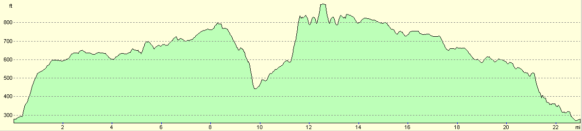
For more information on profiles, ascents and descents, see this page
 |
 |
|
 |
Disclaimer
Please note that I take no responsibility for anything that may happen when following these directions. If you intend to follow this route, then please use the relevant maps and check the route out before you go out. As always when walking, use common sense and you should be fine.
If you find any information on any of these routes that is inaccurate, or you wish to add anything, then please email me.
All images on this site are © of the author. Any reproduction, retransmissions, or republication of all or part of any document found on this site is expressly prohibited, unless the author has explicitly granted its prior written consent to so reproduce, retransmit, or republish the material. All other rights reserved.
Although this site includes links providing convenient direct access to other Internet sites, I do not endorse, approve, certify or make warranties or representations as to the accuracy of the information on these sites.
And finally, enjoy your walking!
Nearby walks
| # | Title | Walk length (miles) |
|---|---|---|
| 790 | A circular walk from Salisbury | 24.0 |
| 796 | Romsey to Salisbury via Dean Hill | 23.6 |
| 800 | A circular walk from Hindon to Ludwell | 20.6 |
|
|

|