Walk #810: A circular walk from Shapwick to Stourpaine
 |
 |
|
General Data
| Date Walked | 18/02/2008 |
| County | Dorset |
| Start Location | Shapwick |
| End Location | Shapwick |
| Start time | 08.28 |
| End time | 17.02 |
| Distance | 22.8 miles |
| Description | This was a pleasant walk heading to the west and northwest from Shapwick towards Stourpaine and Blandford. |
| Pack | Today I carried my 30-litre Karrimor rucksack, filled with waterproofs, a book and other odds and ends. |
| Condition | I feel absolutely fine after this walk. |
| Weather | Today was a day of bright sunshine with scarcely a could in the sky, with a slightly chilly wind at times. |
| OS map | Landranger number 195 (Bournemouth & Purbeck, Wimborne Minster & Ringwood) and Landranger number 194 (Dorchester & Weymouth, Cerne Abbas & Bere Regis) |
 |
 |
|
 |
 |
|
Map of the walk
Maps courtesy of Google Maps. Route for indicative purposes only, and may have been plotted after the walk. Please let me have comments on what you think of this new format. For a detailed table of timings for this walk, please see the table file.
 |
 |
|
 |
 |
|
Notes
It took me longer than I expected to drive to Shapwick this morning, the latest in a series of circular walks that are taking me westwards into Dorset. The latest of these looked like it would be a good walk; following riverside paths, old railway lines, tracks and paths in a long, circular walk. The traffic was surprisingly busy; it was one of those days that setting off ten minutes earlier could have got me to my destination half an hour earlier.
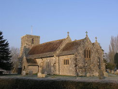
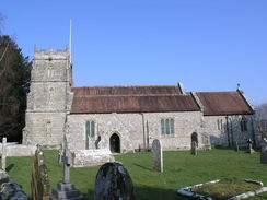
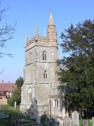
When I had walked through Shapwick on a previous walk I had seen what looked like a car park by the church, but as I headed through the village I could see no signs for it. The area certainly looked like a car park, but there were no other cars parked in it and I was slightly nervous. In the end I parked up and waited for five minutes as I listened to a segment of Radio Four. The adjacent church looked beautiful in the early-morning light, and the skies were clear, so I took a few photos before heading off.
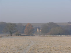
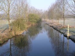
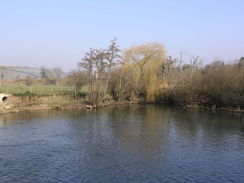
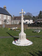
I walked for a short distance to the war memorial in the village and then headed on along roads and footpaths, following the Stour Valley Way westwards. As it headed along the floodplain of the River Stour there was a thick frost underfoot, making my feet crunch with every step. It was a lovely way to start the walk, and I felt really happy, even as my calves felt very cold as I clambered over a series of stiles. Soon the very attractive Crawford Bridge is reached over the river, and I headed uphill to join the trackbed of the old Somerset and Dorset railway line.
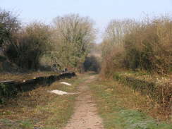
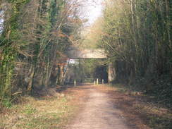
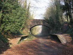
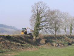
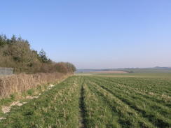
This was a pleasant and easy stroll, and there was plenty of interest to see as I walked along. In Spettisbury there were some ashes from a fire on the ground by the old platforms. I put my hands against these and was surprised to find that they were still warm - later on I came across a sign stating that clearance work had been going on the previous day. As I strolled I imagined the old 8F steam locomotives pulling express trains down to Bournemouth. The Somerste and Dorset is one of the more lamented railway lines that closed in the sixties, and enthusiasts still dream of reopening it.
Unfortunately the old line could not be followed all of the way to Blandford Forum, so I followed the Stour Valley Way as it headed down to the main road and along a track to the northwest of Charlton Marshall. As I walked this I ate a couple of chunks of beef that I had as leftovers from my meal yesterday, although it was fairly cold and tough. A slog along the A350 main road followed, and although there was a pavement this was far from enjoyable, the only thing of interest being snatched glimpses of Lower St Blandford Mary church on the other side of the road.
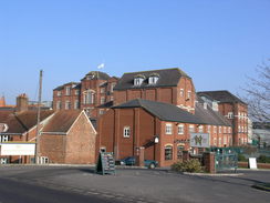
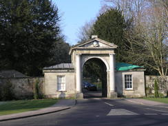
After crossing a roundabout I found myself suddenly dumped into an urban area, passing a supermarket and a complex of buildings to do with the Hall and Woodhouse brewery. These were at least an interesting complex of old and new, with modern factory buildings intermingled with older brick ones. A short distance further on Blandford Bridge was reached, and straight ahead was the entrance to Bryanston School. I diverted away from this, taking a road that climbed uphill, giving me the first expansive views of the day. I headed through the little hamlet of Forum View, descending before taking the ascent up to the school.
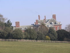
There were some good views to be had of the school, and here I went wrong. The Stour Valley Way headed to the west of the school complex, but I headed through towards the main school buildings. There were no obvious signs and no people around to ask, so I wandered around looking for the footpath that was shown on the map as heading north down to the valley floor. After a few minutes I found some builders working on a house, and I asked them where the footpath was. They were not sure, but after walking round a large gym-like building I finally found the path, and headed down through the trees.
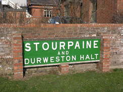
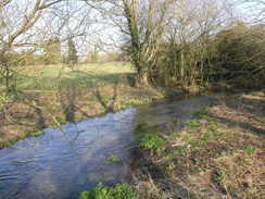
At the bottom there was a very attractive small lodge building called Middle Lodge, and a road took me on into Durweston. By the playing fields there was the old sign of the Stourpaine and Durweston station, the attractive white lettering on a green background suiting the setting. After this I headed through Durweston, and crossed the rover by the old mill buildings. After crossing two streams of the river the path passed under the old railway line once again, and up to the left there were signs of the old concrete platforms at the station.
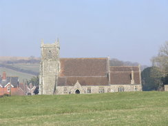
Stourpaine church was attractive, and looked identical to Durweston church that I had recently passed. In Stourpaine I diverted off to the shop to get something to eat, and then headed uphill along a green lane towards Downend Farm. A little while later as I crossed a stile into an area of woodland I met two women, and we chatted for a while about the local area. A series of roads and paths took me on down into Pimperne, and I stopped off at the Farquharson Arms for a drink. It was a pleasant place and it was an enjoyable rest; I read the newspaper as I let my feet recover; they had heated up despite the relatively low temperatures.
After setting off once more I climbed up to meet the path that runs along the edge of the Blandford Camp. There was a high fence to my left and stark signs warning people not to enter - there was no way that I would ever do that, considering the people on the other side were wearing fatigues and carrying guns. In a couple of places the path got narrow, and I passed some areas dedicated to motorbikes and storage of caravans. The path headed past the main gate, where there were a couple of guards carrying very visible guns. I said hello to one of the guards, who smiled back politely. I'm not quite sure what he made of me.
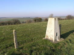
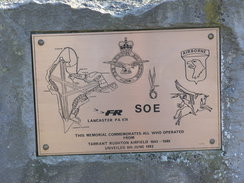
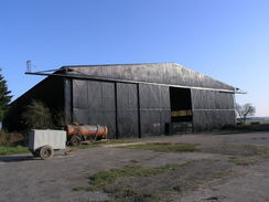
A long and not very distinguished path took me eastwards, before the long Luton Drove took me downhill. The next climb was fairly steep up The Cliff, but it was annoying when a cyclist overtook me despite the steep climb. Once the gradient levelled off I headed off the road to visit the trig pillar, which was fortunately easily accessible along a green track. Once back on the road I headed down to the entrance into the airfield, where I was surprised to see a memorial to the people who had worked there. Some of the large hangers were still in place, a sign that the airfield had still been in use until relatively recently.
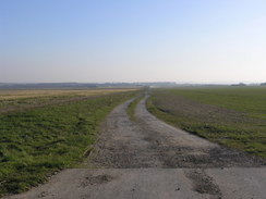
I decided to follow the long perimeter track around the airfield, and although in places much had been grubbed out it was still easily walkable. The main runway had totally gone, and was not just a dirt track that lorries pounded down. It was a pleasant walk, although I felt it was a shame that the place could not still be an active airfield, which I find to be fascinating places. It was an enjoyable stroll around the edge of the airfield, although it was longer than I expected. Eventually I left the complex and started following a track that led southwestwards down to the main road; a gate blocked the way onto the road, but this was easy to navigate around.
I was starting to get tired by this time and I wanted to get the walk over and done with. A series of paths took me down to the farm at Bishops Court Dairy, and on one of the buildings there was an interesting map showing the planting schedule for the surrounding fields - which crops were planted where. Although this was for a previous year, it was an interesting read - as far as I can recall this was the first time that I had seen anything like this. Another path and track took me on to a road, which then led me down to Shapwick. By the time I passed the war memorial and reached the car I was very tired, but felt exhilarated at having finished another long walk. There was hardly classic scenery during the day, but neither had there been any really poor bits. All in all, this walk had been well worth doing.
 |
 |
|
 |
 |
|
Directions
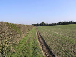
This walk starts off at the car park beside the church in Shapwick. Leave the car park and head up the road for a short distance to the war memorial in the centre of the village, joining the Stour valley Way. Here turn left to head northwestwards along the road; when it curves to the right continue straight in along a track. This curves to the left and then the right until a bridge if reached over a stream. Cross the bridge, and then head westwards across the floodplain of the River Stour, crossing a series of fields on the way.
The footpath ends at a road by Crawford Bridge. Turn left across the bridge to head southwards, crossing the river to reach the A350 road. Cross the road, and continue on uphill for a short distance until an old railway line is reached. Turn right, and follow the old railway line as it heads northwestwards for a couple of miles. When a couple of short platforms are reached by an overbridge in Charlton on the Hill, turn right to climb some steps up to the road. Turn right to head northeastwards along this road back to the A350.
Cross the A350, and on the other side join a track that immediately curves to the left to head northwards. When it ends at a T-junction with another track, cross a stile and head westwards across a field to another stile that leads onto the A350 opposite Littleton Farm. Join the A350 and start following it northwestwards for three-quarters of a mile; there is a pavement on the left-hand side of the road. At the roundabout with the A354 road head straight on along a road that passes a supermarket and brewery on the right until a road is reached immediately to the south of Blandford Bridge.
Turn left for a hundred yards to a road junction, and then turn right to start following a road slightly north of westwards, with woodland on the right. After a little over half a mile turn right along another road, that leads through Brynaston. After a quarter of a mile a footpath leads off to the left, angling downhill across a field to reach the same road once again. Head north along this road, and when it curves to the right turn left along a track, and then immediately turn right to climb northwards up to Brynaston School.
I got lost when heading through the grounds; the Stour Valley Way skirts to the west of the school, before curving around through some trees to meet a track at the bottom of the hill beside the River Stour. Turn left and start following this track northwestwards for about half a mile, as it becomes a road and ends at a T-junction in Durweston. Turn right along this road and then turn left along another; then right down another to reach the A357 road. Turn left along the A357 road for a few yards and then turn right down a lane. This leads toward a mill; follow a track that curves to the left past the mill, crossing a stream of the river in the process. On the other side it curves to the right, heading across to a footbridge over the main stream of the river.
A few yards further on there is a bridge under a railway line. Pass under this, and then turn left up some steps to join a footpath that heads northwards between fences towards Stourpaine church. Join a lane that heads northwards past the church for a short distance until a crossroads is reached. Here the Stour Valley Way is left. Turn right to head eastwards for a couple of hundred yards to the A350 road. Turn left along this road for a few yards, and then turn right to head up a road. This soon becomes a track, Bottom Road, that heads eastwards following the Jubilee Trail. After three-quarters of a mile Downend Farm is reached at the top of the hill; turn right down a bridleway that skirts the edge of the farm until a road is reached.
Turn right along this road to heads westwards for a few yards, before turning left to head southeastwards downhill. When some trees are reached at the end of the field cross a stile and turn left, to start heading northeastwards. Initially this skirts the edge of the trees, before cutting diagonally through the trees along a track until it emerges out onto a road. Turn right, and start heading eastwards along the road for a fifth of a mile until it ends at a T-junction. Turn right along this road for a few yards, and then turn left along another road that heads eastwards for three-quarters of a mile. A short distance along the road the Jubilee Way heads off to the left; ignore this and continue on along the road.
When the road curves to the left continue straight on along a footpath that heads downhill with a hedge on the left. When the footpath turns to the right at the bottom of the field go through a stile and head down, passing to the right of Pimperne church until a road is reached. Turn right down this road, and when a junction is reached after a few yards turn right to head southwards to the A354 road. Turn right down this road for a couple of hundred yards, and soon after a pub on the left turn left to join a footpath. This climbs uphill eastwards for three-quarters of a mile across fields.
When a T-junction is reached with a footpath by the boundary fence of Blandford Camp turn right and start following the path southwards. Keep the fence to the left as it passes a playing field on the other side of the fence, and then a series of buildings. In places the path was somewhat narrow, but after about a mile the path ends at a road by the main entrance into the camp. Turn right down this road for a few yards and then turn left down another footpath that heads southwards with a hedge on the right. After a fifth of a mile turn left along another footpath that heads eastwards. Continue on along this footpath as it heads eastwards, paralleling the southern edge of the army camp.
The path passes Race Down Plantation and continues on to a T-junction with another footpath at the edge of a file. Turn right for a short distance and then turn left to continue on eastwards along a track called Luton Drove. After a mile Luton Farm is reached; follow the track through the farm and then turn right and follow the driveway southeastwards until a road is reached. Turn right along this road to heads southwestwards for a couple of hundred yards until a road junction is reached on the right; turn hard right and follow the road as it climbs steeply up The Cliff. Continue along the road as it curves to the right at the top of the hill, before eventually settling on a southerly course.
When the road reaches a sharp left-hand bend at Windy Corner beside a memorial continue straight on to enter the old Tarrant Rushton Airfield. Turn to the right to start following a track that was the perimeter track around the airfield. It curves to the right and then the left to reach the northern end of the main runway (now removed); continue on along the western side of the airfield, passing Preston Farm before curving to the left to reach the southern end of the old runway. Continue on eastwards or a short distance, and at a track junction turn hard-right to start heading southwestwards along a track for half a mile to the B3082 road.
Cross the B3082 road, and on the other side continue on along a bridleway that runs along a track. When the field ends after a little under half a mile turn left along another footpath that heads southwards across a couple of fields before ending at a track. Turn right along this track down to Bishops Court Dairy. Pass through the film and then turn to the left, to head a little south of eastwards for half a mile along a footpath until it ends at a track called Swan Way. Turn right down this track for a couple of hundred yards to a junction, and then turn left to follow another track that shortly ends at a road to the northeast of Shapwick. Turn right and start following this road southwestwards into the village; at the crossroads in the centre continue straight on along a lane that curves to the right to reach the church, where this walk ends.
 |
 |
|
 |
 |
|
Distances
| From | To | Distance (m) | Ascent (ft) | Descent (ft) |
|---|---|---|---|---|
| Shapwick church | Blandford Forum | 5.3 | 344 | 308 |
| Blandford Forum | Stourpaine | 3.5 | 387 | 374 |
| Stourpaine | Shapwick church | 14.0 | 935 | 984 |
This makes a total distance of 22.8 miles, with 1666 feet of ascent and 1666 feet of descent.
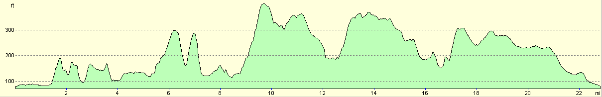
For more information on profiles, ascents and descents, see this page
 |
 |
|
 |
 |
|
 |
 |
|
 |
 |
|
 |
 |
|
Disclaimer
Please note that I take no responsibility for anything that may happen when following these directions. If you intend to follow this route, then please use the relevant maps and check the route out before you go out. As always when walking, use common sense and you should be fine.
If you find any information on any of these routes that is inaccurate, or you wish to add anything, then please email me.
All images on this site are © of the author. Any reproduction, retransmissions, or republication of all or part of any document found on this site is expressly prohibited, unless the author has explicitly granted its prior written consent to so reproduce, retransmit, or republish the material. All other rights reserved.
Although this site includes links providing convenient direct access to other Internet sites, I do not endorse, approve, certify or make warranties or representations as to the accuracy of the information on these sites.
And finally, enjoy your walking!
Nearby walks
| # | Title | Walk length (miles) |
|---|---|---|
| 313 | Hamworthy Station to South Haven Point | 18.0 |
| 809 | A circular walk from Wimborne Minster | 25.0 |
| 811 | A circular walk from Durweston to Woolland Hill and Milton Abbas | 22.9 |
|
|

|