Walk #905: West Highland Way: Milgavie to East Drumquhassle
 |
 |
|
General Data
| Date Walked | 30/06/2011 |
| County | Strathclyde, Central Scotland |
| Start Location | Milngavie |
| End Location | East Drumquhassle |
| Start time | 13.55 |
| End time | 17.27 |
| Distance | 11.1 miles |
| Description | This was a very pleasant walk following the southernmost stretch of the West Highland Way from Milngavie to near Drymen. |
| Pack | Today I carried my Macpac Glissade rucksack containing my North Face Westwind tent, spare clothes, waterproofs, water, and enough food to last three days. In total it weighed about thirty-five pounds. |
| Condition | I felt absoliutely fine after this short walk. |
| Weather | The morning was sunny in Cambridge, but the clouds started to gather as I headed northwards, and it was raining in Edinburgh. The rain relented as I approached Milngavie, although it was still trying to spit. The air felt damp enough for me to wear my coat, but aside from a couple of minutes of drizzle the rest of the day remained dry. It felt quite warm, and the clouds parted towards the end of the day. |
| OS map | Landranger number 64 (Glasgow, Motherwell & Airdrie) and Landranger number 57 (Stirling & The Trossachs) |
 |
 |
|
Map of the walk
Maps courtesy of Google Maps. Route for indicative purposes only, and may have been plotted after the walk. Please let me have comments on what you think of this new format. For a detailed table of timings for this walk, please see the table file.
 |
 |
|
Notes
I have wanted to do the West Highland Way for some time; I have happy memories of doing the northern third of the trail from Bridge of Orchy ten years ago and was keen to experience the rest. Everything was planned and my pack was packed at the beginning of June, but then an illness intervened for three weeks, meaning that I lost a great deal of my strength.
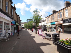
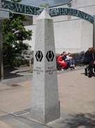
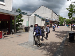
By the end of the month I was ready to go and bought the tickets to the southern end of the trail in Milngavie, immediately to the north of Glasgow. The journey went well and I shouldered my rather heavy pack at Milngavie station shortly after one in the afternoon. My first job was to get some lunch and water; a nearby supermarket provided me with some sandwiches and I sat down on a bench near the monument that marks the start of the trail.
I had been unsure what to expect about Milngavie; Glasgow is a city of many faces, some of which are rather disreputable. The centre of Milngavie was ever so slightly run down with the obligatory charity shops but also seemed rather well-kept. A couple of men chatted to me as I scoffed the sandwiches and we talked about the trail - they seemed quite proud that the trail started off in their town, and the monument seemed proof of that (so many trails do not even have set start and end points, yet alone a sculpture).
After shouldering my rucksack I posed for photos by the monument and set off along the trail. Almost immediately it passed a pretty stream through a car park before entering a green corridor - an old railway line that hid the suburbs from view. A young man with a large rucksack hove into view ahead, and we met as he stopped to study a fingerpost. We walked together as the path hugged the bank of Allander Water. He was a young German called Martin who was walking the trail as well - like me he was aiming for a campsite just to the south of Drymen for the night, but unlike me this was his first ever trail.
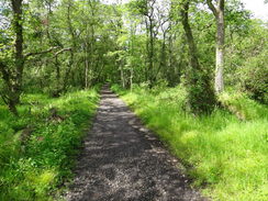
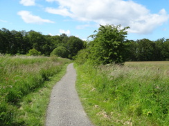
We chatted with some difficulty as we walked along - his English was good but he found my accent difficult to understand. The first ascent of the trail took us up a green slope to a track in Allander Park. Here we parted company as he stopped to take some photos of the view and I strode on along the good track. This made for good, easy walking as it entered the Mugdock Country Park. Trees blocked most of the views but it was an enjoyable stroll nonetheless - the locals are lucky to have such a well-kept park so near their homes.
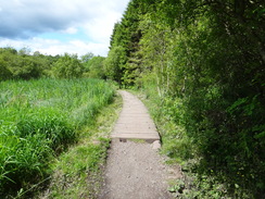
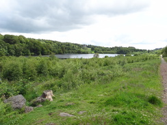
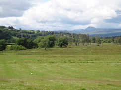
The track ended at a road, after which another path led northwards beside the bank of Allander Water. The track was of poorer quality than that through the park, but the boggiest stretches were crossed using boardwalks. It skirted the side of the wooded Scroggy Hill before settling to head north past Craigallian Loch. This was the first of the many lochs that the trail would pass, although many of the best views were spoilt by the trees that grew on its banks.
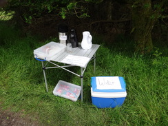
I soon came across a little picnic table with some refreshments on it - a jug of coffee and bottles of water and chocolate bars in a cooler. These had been left out for purchase - a kindly touch by someone. Only having just started the trail I was not in need of anything and so I plodded on. The trail passed a series of holiday lodges, little wooden cabins situated around Carbeth Loch. The loch itself only came into view for a short period before the track climbed up to meet a main road.
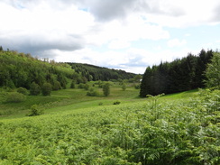
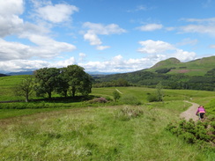
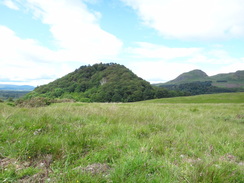
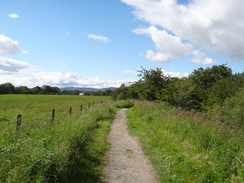
Unfortunately there was no pavement alongside the road, but traffic was light and proved no difficulty. It was a relief when the trail left the road and headed north along a track. This was the start of the first truly wild section of the trail, with the wooded hill of Dumgoyach and the dramatic outcrop of Dumgoyne ahead. It all made for good walking - it is unusual for a trail to get into such terrain within a few miles of the start, and the views helped me progress.
A few girls sped past me on bikes, a couple looking as if they were not used to off-road biking. They stopped at Dumgoyach Farm and we chatted for a few minutes before I continued on down to Dumgoyach Bridge over Blane Water. It was turning into the sort of day when you needed insect repellent, suntan lotion and a coat within a few seconds of each other; bouts of drizzle were soon followed by hot sunshine and swarms of insects blown along by the breeze.
What followed was a fairly straight forward stroll along the course of the Blane Valley Railway, a railway line that ran through the farmland to the north of Glasgow. This opened to passengers in 1867 and finally closed in 1951. Although trains no longer run along the line, something does: water in a massive pipe buried in a bank to the left. Brick manholes project from the top of the bank at regular intervals, some seeming rather the worse for wear. This is the Loch Lomond Water Supply Scheme, created in the 1960s to supply 18 million buckets of fresh water a day from Loch Lomond to the urban areas of Central Scotland.
This pipe was to remain close-by as I strode northwards. At Dumgoyne the old line crossed the A81 road; there was a pub here that looked very inviting - a sign stated that there was a picnic area for walkers use - but I was keen to get a few more miles under my belt and I was still feeling very fresh. Indeed, as there was still plenty of daylight I was considering walking past the campsite to wild camp on the hillside below Conic Hill. This would have extended today from a rather paltry ten or eleven miles (a good totl considering I started so late) to around sixteen. On the other hand I was still occasionally coughing and an easy first day seemed in order. I resolved to make my mind up later.
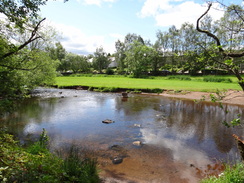
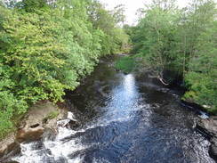
I soon overhauled a young couple ahead. They were German, and this too was their first trail; they had booked into a B&B at Drymen for the night and we chatted as we walked along. Soon the railway line ended and the trail took to roads, crossing the River Blane at a picturesque spot that just called out for photographs to be taken. There was another table outside a house in Gartness with provisions on it, but again I was in no need of what was so kindly offered.
The road climbed steeply, curving to the right to take a more northerly course. Some of the views over the surrounding hills were good, but all too soon I reached the campsite at Easter Drumquhassle Farm. I paused here after saying goodbye to the couple and prevaricated. There were still a good few hours of daylight left and I could easily walk further; on the other hand I was still feeling a little weak after my illness and was occasionally coughing. In the end I went into the small office and booked a pitch for the night - a very reasonable five pounds.
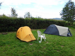
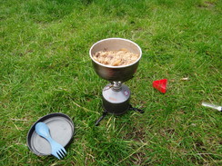
It is a perfect backpacking camping site. There was a slight slope and some good views; the toilets were slightly rustic but clean, and there was an undercover area in a shed. I pitched my tent near some wooden huts that were available for hire and started cooking, taking my time as there was still plenty of daylight. A couple of girls had pitched their tent nearby; they too were walking the way south to north, and one of the huts was filled with a jovial group of Scots who were walking it north to south, and had therefore nearly finished.
The German I met in Milngavie arrived after I finished washing my pots - he had taken his time and seemed very fresh, having enjoyed his walk. The campsite owner was willing to drive me into Drymen so that I could have a pint and a meal, but I was fairly full after my meal and could not face the walk back afterwards. Instead I hunkered down into my sleeping bag and started looking at the next days walk. With horror I discovered that I had misplanned the walk - I had written it down as being about nineteen miles to Inversnaid, whereas the guidebook took it as nearer twenty-five. The latter was obviously correct, so the next day promised to be a very long day if I was to stick to my schedule. Coughing slightly, I dropped off to sleep.
 |
 |
|
Directions
The official start of the West Highland Way is a granite obelisk in Douglas Street, Milngavie (NS553744). To reach the obelisk from the station, head through an underpass and up some steps to reach Station Road. Turn left along this; it becomes Douglas Street for a short distance before reaching the obelisk which sits on a bridge over a stream.
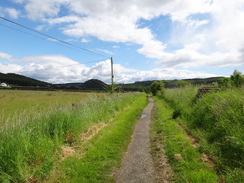
Leave the obelisk and take a sloping path that heads above the stream to reach a small car park behind the shops on Douglas Street. The path runs through the car park and heads straight on down its access road. Almost immediately there is a T-junction; here take a good surfaced path to the left for 100 yards with a stone wall to the right and Allander Water on the left. The path passes under a bridge under a road; take the right-hand fork in the underpass to reach a tree-lined lane that follows a disused railway line.
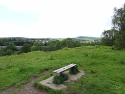
The path passes Milngavie Library and its car park on the left; shortly afterwards turn to the left to join another path that soon curves to the right to join the eastern bank of Allander Water. It follows the river for a distance and passes a bridge on the left; when the path forks take the right-hand branch which heads uphill across an area of grassland in Allander Park. After passing a bench at the summit it descends for about ten yards to reach a junction with a track.
Turn left to follow the obvious track north-northwestwards. After a couple of hundred yards it crosses a stream; continue on along the main path that heads northwestwards, soon entering an area of trees. It runs high above Allandale Water through Mugdock Wood with no strenuous ascents or descents. A little over a mile after the path junction go through an attractive pair of metal gates in a stone wall to reach a road above Craigallian Bridge at NS538770.
Turn left down the road for about twenty yards; as it swings to the left turn right past some boulders to join an unsurfaced track. Initially this heads in a north-northwesterly direction, crossing a stretch of wooden causey with woodland on the right and the floodplain on the left. At NS536774 it joins a track that comes in from the right before skirting the base of Scroggy Hill and crossing a bridge over a dark, peaty stream. The track heads northwards past Craigallian Loch on the right; at NS535789 the track forks; take the right-hand bend to continue along the larger track (do not continue on to the houses at Carbeth). This heads north, passing Carbeth loch and some chalets on the left. It descends to get a glimpse of the loch to the left before ascending once more. 1.8 miles after leaving the road, go through a metal gate to reach the B821 at NS537795.
At the B821 turn left and follow the road westwards for a quarter of a mile. There is no pavement and the verges are narrow so care needs to be taken; fortunately the road is not too busy. Turn right through a metal gate opposite the second entrance to Easter Carbeth Farm. A good path slowly rises in a northerly direction between two stone walls. Go through another metal gate and continue on. The path crests a hill and descends to cross a track at NS535802, with the ruined buildings of Arlehaven are out of sight on the left. Descend steeply downhill for a few yards to join another track; turn left to continue northwestwards along this.
The track twists and turns in a rough northwesterly direction. It passes the steep, wooded Dumgoyach Hill on the right; continue on as it swings to the right to climb northeastwards towards Dumgoyach Farm. Keep the farm buildings a short way away on the right to reach a metal gate. Go through this and continue on the other side.
A path heads between fences to the left of the access track to the farm, then heads through trees before joining the track. After a sixth of a mile it crosses Blane Water using a wooden bridge. On the other side of the bridge turn left through a metal V-gate to join a good path that runs along the old Blane Valley Railway line. Follow this north-northwestwards with a large bank on the left that blocks the views. The railway path slowly curves to take a more northerly direction and crosses a couple of tracks guarded by gates; the Glencoyne Distillery is in the distance to the right. After 1.3 miles it goes through a metal gate to reach the A81 at Dumgoyne (NS523834), with a pub on the right.
Turn left for a few yards and carefully cross the road, then turn right through a wooden gate to rejoin the old Blane Valley Railway line. This slowly curves to head northwestwards; after a while it parallels the A81 and passes under a few bridges (including one under the B834 road), passing through a number of gates on the way. At one point it rises up onto an old bridge over a railway line; do not cross the bridge but turn left through a wooden gate to rejoin the old line. Two miles from Dumgoyne it curves sharply to the right for a few yards to reach the A81 road at NS506862.
Carefully cross the A81 on the level and take another path directly opposite that goes through a gate to rejoin the old railway line. Follow this north-northwestwards for nearly half a mile until it approaches an old overbridge. Turn left through a metal gate to join a path that parallels Kirk Road; it emerges through another gate onto the road at NS502869. Turn left to follow the road westwards; it crosses Blane Water at Gartness Bridge and then curves sharply to the left.
The road heads westwards before slowly starting to curve to the right to take a more northerly course, climbing to reach the campsite at Easter Drumquhassle Farm on the left, where this walk ends.
 |
 |
|
Distances
| From | To | Distance (m) | Ascent (ft) | Descent (ft) |
|---|---|---|---|---|
| Milngavie | Dumgoyne | 7.2 | 633 | 715 |
| Dumgoyne | Easter Drumquhassle | 3.9 | 344 | 299 |
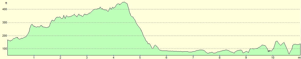
This makes a total distance of 11.1 miles, with 977 feet of ascent and 1014 feet of descent.
For more information on profiles, ascents and descents, see this page
Accommodation
I spent the night at Drymen Camping, whoch is situated at Easter Drumquhassle about a mile to the south of the village. This is a good site with basic facilities, and wooden wigwams are also available for groups. They have a website at drymencamping.co.uk and can be contacted at 01360 660597.
 |
 |
|
 |
 |
|
 |
 |
|
 |
 |
|
 |
 |
|
 |
Disclaimer
Please note that I take no responsibility for anything that may happen when following these directions. If you intend to follow this route, then please use the relevant maps and check the route out before you go out. As always when walking, use common sense and you should be fine.
If you find any information on any of these routes that is inaccurate, or you wish to add anything, then please email me.
All images on this site are © of the author. Any reproduction, retransmissions, or republication of all or part of any document found on this site is expressly prohibited, unless the author has explicitly granted its prior written consent to so reproduce, retransmit, or republish the material. All other rights reserved.
Although this site includes links providing convenient direct access to other Internet sites, I do not endorse, approve, certify or make warranties or representations as to the accuracy of the information on these sites.
And finally, enjoy your walking!
Nearby walks
| # | Title | Walk length (miles) |
|---|---|---|
| 460 | Fort Matilda to Dalreach | 21.1 |
| 906 | West Highland Way: East Drumquhassle to Inversnaid | 23.9 |
| 1014 | Milngavie to Glasgow Central, including the Glasgow branch of the canal: | 20.4 |
|
|

|