Walk #488: Duror to Fort William
 |
 |
|
General Data
| Date Walked | 02/07/2003 |
| County | Highlands |
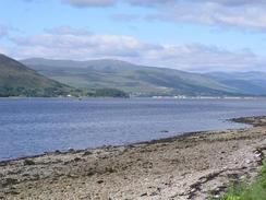
| Start Location | Duror |
| End Location | Glen Nevis Visitor Center |
| Start time | 09.24 |
| End time | 18.35 |
| Distance | 22.7 miles |
| Description | This was a fairly boring walk, mostly along roads, that I really would not want to repeat again if I can possibly avoid it. |
| Pack | Today I carried my 30-litre Karrimor HotRock rucksack, which was filled with my packed lunch, waterproof leggings, water bottle and a couple of spare shirts, together with the usual assortment of odds and ends. |
| Condition | I am absolutely shattered after this walk; I am fairly fatigued, but worst of all both shoulders were hurting by the end of he walk, and the right one was extremely painful at times. This is very annoying, and I can only hope that it gets better soon. |
| Weather | Today was a mostly sunny day, with only occasional clouds to spoil the day. It did not get too hot, however, although there was not much breeze, and all in all it was a superb walking day. |
| OS map | Landranger number 49 (Oban & East Mull) and Landranger number 41 (Ben Nevis, Fort William & Glen Coe) |
 |
 |
|
 |
 |
|
Map of the walk
Maps courtesy of Google Maps. Route for indicative purposes only, and may have been plotted after the walk. Please let me have comments on what you think of this new format. For a detailed table of timings for this walk, please see the table file.
 |
 |
|
 |
Notes
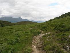
I was not looking forward to all the road walking that I had to do today, and so I decided that where possible I would avoid it. This led me to choose to walk along the road from Duror to Cuil, and then take a footpath that was marked on the map to Kentallen. As soon as the road ended at Greenfield I joined the path, but it soon became indistinct as it headed around the hillside. I soon found the path again, but it soon became boggy and wet in places, and when it entered some woodland it became even worse. To make matters harder, there were a fair few fallen trees blocking the path, and I had to clamber under or over these. I was wearing my new pair of trainers, and by the time I got onto a firm track once again they were very muddy, and my feet were quite wet.
The walk along the A82(T) was as horrid as I was expecting it to be. After a while I got used to having the wing mirrors of coaches rush seemingly six inches past my face, although it was always unnerving. Fortunately the stretch or road without pavement (from the ferry terminal at Inchree to the River Kiachnish) was only four or five miles long, and was therefore manageable.
By the time that I reached Fort William I was quite knackered, and my right shoulder was really aching. I met Sam at the first car park that I reached, and we walked together through the town until we reached NevisSport's shop. Weeks ago we had gone into their Glasgow shop to buy myself a new pair of boots, but they did not have any in the correct size and so they ordered some to be delivered to their Fort William shop. It was very kind of them to keep them on one side of us for such a long time, and this pair of boots should see me through until the end of the walk.
Afterwards we went to the Ellis Brigham shop, which is by the station, as I was considering buying a one-man lightweight tent. Sam had been looking at some in various shops and had rounded them down to a Mountain Hardwear TC1 tent. This was very lightweight and would make a big difference to the weight that I have to carry when compared with my present tent, but when I lay down in it I discovered that it was not quite long enough to be comfortable for more than one night's sleep. The next model up, the TC2 tent (the two-man version) was roomier and heavier, and I decided that the little weight difference from my existing tent (it was only 800 grams lighter). I really could not justify a £170 price tag for only 800 grams saved!
Going around the shops allowed me to relax a little, and I was ready for the last couple of miles along Glen Nevis Road to the Ben Nevis Visitors Centre. The time flew by and it was a lovely day, so there were some kids jumping off rocks into the river. Sam was waiting for me in the car park, and we jumped into Mervan and drove back into Fort William. I was fairly shattered, and so Sam walked into town to get us some fish and chips. I had wanted to go into the town for a celebratory drink, but I was so shattered that I really could not be bothered. Sometimes after a walk I feel totally shattered, and it is at times like this that Sam proves to be an absolute star.
Directions
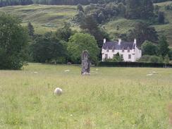
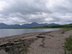
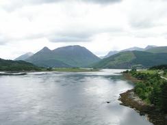
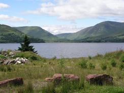
This walk starts off on the A828(T) road a few yards to the southwest of Duror, near a standing stone. Head northeastwards along the road to a road junction to the left near a primary school. Turn left down this road and follow it as it heads initially westwards, and the northwestwards past Cuil Bay. Follow the road as it turns to the right to Greenfield Farm. From the farm a path heads off to the left, initially heading northwestwards before turning around a hill to head in a more northeasterly direction. The path is extremely indistinct in places, especially when it enters an area of woodland, and is boggy underfoot, but it eventually ends at a track near Ardsheal Farm. Follow this track northeastwards until it meets the shore of Kentallen Bay, where it turns to head southwards around the bay until it meets the A828(T).
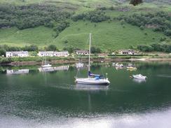
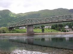
At the A828(T) turn left and head northeastwards for a few miles until the Ballachuish Bridge is reached. Under the bridge some steps lead up onto the bridge, and climb these steps and turn left to cross the bridge. Continue on along the A82(T) through North Ballachulish, where the road turns to head westwards through Onich. There is a pavement as far as the ferry terminal near Bunree, but after this you have to walk either along the foreshore or the busy road, which was not nice as times. Eventually the pavement restarts at the bridge over the River Klachnish, and this makes the walk for the last few miles easier into Fort William. When a roundabout is reached I turned to the right to walk through the high street through the town rather than follow a short stretch of dual carriageway, and this rejoined the road by the railway station. Rejoin the A82(T) and head along it northeastwards until a roundabout is reached. Continue straight on along a road that heads for a mile and a half down Glen Nevis to the Ben Nevis Visitors Centre, where this walk ends.
Distances
| From | To | Distance (m) | Ascent (ft) | Descent (ft) |
|---|---|---|---|---|
| Duror | North Ballachullish | 8.7 | 1132 | 1122 |
| North Ballachullish | Fort William Station | 12.3 | 935 | 961 |
| Fort William Station | Ben Nevis visitor's center | 1.7 | 161 | 125 |
This makes a total distance of 22.7 miles, with 2228 feet of ascent and 2208 feet of descent.
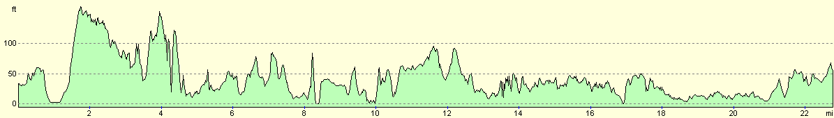
For more information on profiles, ascents and descents, see this page
Accommodation
We parked Mervan in a car park by the station in Fort William, which was the only place that we could find in the town that did not seem to have any parking restrictions. It was quite handy for the town, although we did not need to go in tonight.
Disclaimer
Please note that I take no responsibility for anything that may happen when following these directions. If you intend to follow this route, then please use the relevant maps and check the route out before you go out. As always when walking, use common sense and you should be fine.
If you find any information on any of these routes that is inaccurate, or you wish to add anything, then please email me.
All images on this site are © of the author. Any reproduction, retransmissions, or republication of all or part of any document found on this site is expressly prohibited, unless the author has explicitly granted its prior written consent to so reproduce, retransmit, or republish the material. All other rights reserved.
Although this site includes links providing convenient direct access to other Internet sites, I do not endorse, approve, certify or make warranties or representations as to the accuracy of the information on these sites.
And finally, enjoy your walking!
This walk was mentioned in the following routes:
| My walk around the coastline of Britain |
Nearby walks
| # | Title | Walk length (miles) |
|---|---|---|
| 153 | Kinlochleven to Fort William | 14.1 |
| 154 | Ben Nevis from Fort William | 11.8 |
| 185 | Fort William to Glenfinnan | 15.2 |
|
|

|