Walk #1003: Whitchurch to Yorton
 |
 |
|
General Data
| Date Walked | 14/06/2018 |
| County | Shropshire |
| Start Location | Whitchurch station |
| End Location | Yorton station |
| Start time | 07.11 |
| End time | 13.50 |
| Distance | 18.3 miles |
| Description | This was a varied walk: a stroll along the Llangollen canal and its Prees Branch was followed by a road walk into Wem, and then a stroll along the Shropshire Way to Grinshill. |
| Pack | Today I carried my 30-litre Karrimor rucksack, filled with water, my spare waterproofs, a book, trainers and other odds and ends. |
| Condition | I feel tired after this walk, but have no significant problems to report. |
| Weather | Last night was fairly wet, and when the rain ended the winds began. Aside from a couple of short periods of drizzle the day was dry, but the wind early in the morning was very strong and gusting. It was some of the worst wind I have ever walked in, but thankfully by midday it had died down. |
| OS map | Landranger number 117 (Chester & Wrexham, Ellesmere Port) and Landranger number 126 (Shrewsbury & Oswestry) |
 |
 |
|
Map of the walk
Maps courtesy of Google Maps. Route for indicative purposes only, and may have been plotted after the walk. Please let me have comments on what you think of this new format. For a detailed table of timings for this walk, please see the table file.
 |
 |
|
Notes
The pleasant weather of the last couple of days was replaced overnight by rain and wind. The rain had mostly ended by the time I awoke, but the wind was gaining in strength and had already managed to rip three tent pegs out of the ground. I replaced them and added a few more to secure it for the day, when the wind was forecast to get much stronger. In fact the forecast was so dire that I considered cancelling the day's walk, but little rain was forecast, and I figured I could cope with a bit of a breeze.
I made a mistake on the journey down to Whitchurch and traveled too far south. I soon realised my mistake, turned around and roared north to find the town's free station car park. This is the second time that entering 'Station Road' for a town has taken me to a different place, as if the Sat Nav thinks it knows where I need to be.
It did not take me long to get my kit together, and soon I was striding through the town. Instead of following the route to the canal I had walked yesterday, I decided to take a different route that turned out to be less interesting that I hoped. It started to drizzle, the wind blowing the water onto my face, and I started to regret my decision not to wear my coat, which was safely in my pack. Fortunately the drizzle soon ended, and I headed towards the watered stretch of the Whitchurch branch of the Llangollen canal.
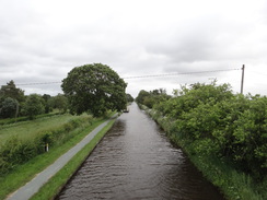
This took me back to the Lanngollen canal proper, which I had left towards the end of yesterday's walk. The last two days had been spent following canals, and so would the first half of todays. The wind gusted strongly as I strolled along the towpath, and leaves were blowing horizontally across the water from the swaying trees. Conditions were so bad that I started to fear I'd made the wrong decision in heading out.
I came across a man who was struggling to unmoor his narrowboat; he was holding onto a rope at the stern, but the moment he let go to untie the rope at the bow, the wind would blow the stern into the middle of the canal. I held onto the rope for him as he untied the bow, and it took much of my pitiful strength to stop the boat being blown out. He finished his work and jumped onto the boat, and I handed him the rope as he headed off. My good deed for the year done, I continued along the canal.
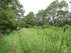
A fallen tree blocked the towpath a little further on; I guessed a victim of the morning's high winds. I managed to negotiate past it, and then headed on past a few more fallen branches. I was well aware when there were trees overhead, and I tried to pass them as quickly as possible. It would be terrible luck to get crushed by a tree, but there is little sense in tempting fate. I pressed on as the canal headed south; there were only a couple of boats on the river perhaps because of the early hour, or perhaps because of the high winds. The towpath left the canalbank for a while, heading along a track that paralleled it, whilst off to the right was Whixall Moss, an area of bog that seems oddly placed.
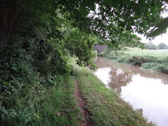
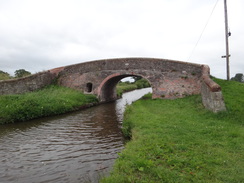
Eventually I came to Roving Bridge, where the Llangollen canal stops heading south and takes a more westerly course towards Wales. However I needed to continue south, and fortunately the Prees branch of the canal headed in roughly the correct direction. It was an easy and good walk for a mile or so, until a large marina was passed. After this the canal was reed-filled and evidently unnavigable; the rather enclosed and gloomy stretch of canal was a welcome change after the last few days of canalside walking. A short stretch of the canal at Boodles Bridge had been filled in to create a track bypassing the bridge, after which the canal became even more overgrown.
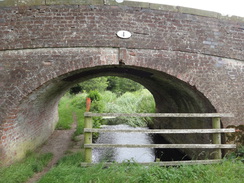
The towpath eventually squeezed past fences to reach a bridge at Waterloo, which was once a wharf (and I bet first constructed sometime shortly after 1815). My planned route took me southeastwards along the towpath for a short distance, before continuing along roads. However the first stretch of towpath appeared very overgrown, and so I decided to follow roads instead. I took a road southeastwards from Waterloo to Poolbank, and then took a road south into Wem. Thankfully the road was not too busy, and I could make good time down into the town, especially as by now the wind had now mostly died down.
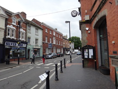
Wem is a small town that until now has utterly escaped my attention. I cannot recall hearing of it before, and knew none of its history. I was greeted with a rather unspectacular but workable town, and as I left I still knew very little about it.
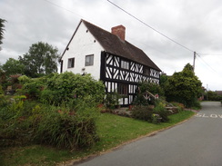
I was tempted to stop, but I could not find a sheltered place and did not feel like a pub visit. Instead I pressed on along roads out of the town, crossing the River Roden, and then heading along a local road into the small village of Tilley, to which I gave a small tip of my Tilley Hat. I made a small diversion to visit the village pub, which had sadly recently closed. A quick chat to Sencan over the phone raised my spirits, and more roads took me on to the Shropshire Way.
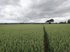
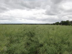
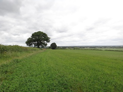
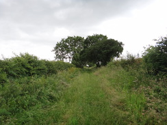
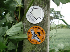
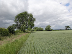
Named trails usually mean better waymarking and good conditions underfoot. Sadly this was not the case on the Shropshire Way, where I was soon wading through pea-like plants that were nearly as tall as me. It was not a pleasant walk, and the next few fields offered varied but equally difficult walking, with no clear route alongside fields and gates overgrown with nettles. I was thoroughly fed up by the time I reached a track that gave me a short relief, before heading towards houses to the east of the village of Clive. A better climb uphill followed, after which the trail entered woodland on the flank of Grinshill.
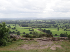
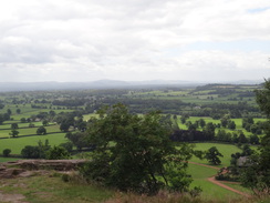
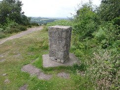
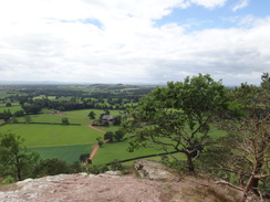
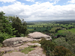
The path through the trees was somewhat unclear (although not to the man walking his dog who seemed to know exactly where he was going). I dropped down into a little dip and started climbing out the other side without checking my map. Soon I was heading fairly steeply uphill, and was surprised to find myself emerge at a clearing at the top of the hill, where there was a trig pillar and some very grand views. It was a good place to spend a few minutes.
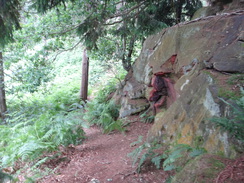
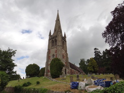
However perhaps I should have spent a little time thinking about the proper route down. Precipitous cliffs lay on two sides, and I could not quite remember which of two tracks I had climbed up. I took one that headed steeply downhill through the trees, but this soon split in a way I could not remember from my ascent. Instead of heading back to the summit, I followed another vague path that soon petered out at a precipitous drop. I headed back, and then decided to plunge straight down through the trees and bracken. It was a steep and dangerous descent, and just as I was telling myself, "David, you are a stupid idiot for doing this," I realised it was too late to head back up. I was afraid of getting crag-fast, so I angled down the slightest of the steep gradients I could find, and thankfully I soon reached a rough track that took me down past Grindshill church.
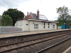
This is where I should have emerged from the woods, so thanking my lucky stars for having survived my stupidity, I joined a track that skirted the hill. In places this had been cut out of the hillside, and the surface was bare rock; it was an interesting walk that took me out into Clive. My target for the day was Yorton station, which is about half a mile away. I walked down to it, passing a pub that was for sale, and reached the station about forty minutes before the train was due; there is one every two hours during weekdays.
It had been a varied day's walk, with lots of interest if not a great deal to enjoy. I drove back to the campsite, showered and had a meal, and decided to plan a different route for tomorrow to avoid the overgrown Shropshire Way.
 |
 |
|
Directions
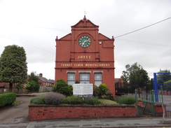
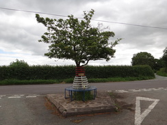
This walk starts off at Whitchurch railway station at SJ54984135. Leave the station and turn right to head uphill along Station Road; after 0.3 miles it ends at a T-junction with the B5395. Carefully cross the road using the pedestrian crossing, and on the other side head straight on down Green End. Follow this into the centre of Whitchurch; when the road curves to the right to become High Street, head straight on past the town clock tower to join a pedestrianised road. This soon ends at a bend in another road; turn right to head up Castle Hill; pass a mini-roundabout and continue along Newtown to a second mini-roundabout. Turn left down Sherrymill Hill to reach another mini-roundabout at the bottom, and then head straight on down Smallbrook Road for a quarter of a mile until Greenfields Way leads off to the right at SJ53334151.
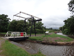
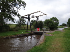
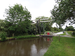
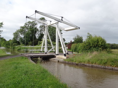
Turn right down Greenfields Way, and after a short distance turn left to join a gravel path that heads westwards across an area of grassland, passing under a concrete bridge and then the brick-arch Chemistry Bridge to reach the watered stretch of the Whitchurch Branch of the Llangollen Canal. Join the towpath and keep the canal on the left for a sixth of a mile to reach New Mills lift bridge (no. 31) over the Llangollen Canal at SJ52794155.
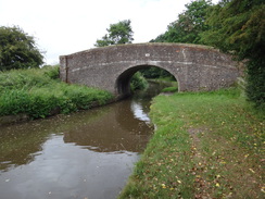
Cross the lift bridge to join the Llangollen Canal towpath, and then turn left to start following the canal southwards. After 5.6 miles Roving Bridge (no. 46) is reached at the junction with the Prees Branch of the canal at SJ48903521.
Cross Roving Bridge to join the towpath of the Prees Branch, and start following it southwards, with the canal on the right. After two-thirds of a mile Dobson's Bridge (No. 3) is reached; use this to cross the canal to reach the towpath that now runs on the other side. Continue along the canal past Whixall Marina, after which the canal becomes very overgrown and unnavigable. About a mile after Dobson's Bridge, a garden fence on the right leads to Waterloo Bridge at SJ49783314.
The towpath ends at the bridge; climb some steps and go through a gate to join the road, and then turn right to follow it. It immediately curves right and then left, and after a third of a mile ends at a crossroads with another road at Poolbank. Turn left to follow a new road southwards; after 1.6 miles it ends at a T-junction in Lowe. Turn left along the new road, and then immediately right to head south along Lowe Hill Road. This road heads southeastwards; curving to the right and after nearly a mile Pymms Road heads off to the left at SJ50762935.
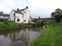
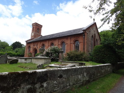
Turn left to join Pymm's Road, and follow it eastwards for nearly half a mile until it ends at a T-junction with New Street. Turn right to head south along New Street towards the centre of Wem; after a quarter of a mile it ends at a T-junction with the B5063. Turn right to head west through the centre of Wem for a couple of hundred metres until Mill Street leads off to the left at SJ51242887, immediately before the village church.
Turn left down Mill Street, passing the church on the right. The road heads south, descending to a bridge over the river Roden, and after 0.4 miles it curves to the left towards a bridge under a railway line. On the bend, turn right to join Tilley Road, which parallels the railway line away to the left. After a third of a mile the road ends at a T-junction in the attractive village of Tilley. Turn left down another road that heads towards the railway line; the road soon ends at a level crossing. Go through a gate and carefully cross the railway line, and go through a second gate on the other side to join a lane that ends at the B5476 road at SJ50952757 beside a bench and tree.
Carefully cross the road, and on the other side join a road that heads southeastwards. Ignore a road coming in from the right on a left-hand bend, and a little further on turn right down a road signposted Trench Farm. Just after a building on the left, turn right through a clappergate into a field, joining the Shropshire Way. Head straight across this short field to a second clappergate through a hedge, and then turn half-left to head to a third clappergate that leads into a third field. Head uphill across this field, aiming for a tree at the top. At the top of the field, pass a wooden enclosure on the left and then head on diagonally across a field, aiming for to the left of a clump of trees. When parallel with the end of some tennis courts on the left, the path curves slightly to the left to join a corner of a hedge at SJ51472659.
Go through a clappergate at the hedge corner and continue on, following the hedge on the left. About halfway down this field turn left through a clappergate in the hedge and then turn right, to follow the hedge on the right. In the corner of this field go through a clapper gate and continue following a hedge on the right past another field. The field narrows and the hedge on the right ends as it approaches another hedge ahead; turn left across the small gap for about twenty metres to reach a clappergate through the hedge at SJ51992550.
The gate leads into a green lane between hedges; turn left to follow this lane southwards for a little over 200 metres, and just before a slight right-hand bend, turn left through a gap. Follow a hedge on the right, and after a short distance go through a clappergate that leads into a scrubby area, passing a little pond on the left, to reach another clappergate that leads into a field. Continue following the hedge on the right to reach a clappergate beside a double field gate that leads out to a rough track. Cross the rough track to reach another clappergate that leads into a field. The path passes a pond on the left; at the end of this field go through another clappergate and then follow a hedge on the left. In the corner of this field, go through a pedestrian gate, cross a footbridge over a ditch, and then go through a second pedestrian gate to enter a field. Continue downhill with a hedge on the left, heading towards some houses. In the bottom corner of this field, go through a clappergate and ascend a couple of steps to reach a road to the east of the village of Clive at SJ52232445.
Turn right down the road for a short distance, and then turn left through a clappergate to enter a field. Follow a hedge on the right; at the corner of the field turn right through a clappergate beside a gateway into a second field, and then turn left to head uphill, following a hedge on the left. At the top of the field go through a clappergate to enter a garden, climb a bank and then head on across the garden, climb some steps beside a shed and head on to reach a track at SJ52212392.
Cross the track and join a path that immediately forks; take the right-hand fork that curves to the right through Corbet Wood. The path descends steeply through the trees to reach a low stone wall ahead.
I have no accurate directions for this stretch through the woods; I went wrong in a big way and ended up at the hill's summit, and made a bad decision on the descent. You need to follow the Shropshire Way southwards for a short distance until it reaches Grinshill Village Hall at SJ52112365. Make your own way there, and be careful!
Pass the village hall and take the track that leads away. When it curves to the left, head straight on along a rough track that heads westwards (carrying the Marches Way), skirting the southern side of the hill. It curves around as it heads northwestwards, and after half a mile ends at a road in Clive at SJ51432399, with Clive church away to the right.
Turn left down the road for a few metres, and then turn right up Back Lane. This soon curves to the right, and after a fifth of a mile ends at a T-junction with High Street in Clive. Turn left to follow High Street westwards; it becomes Station Road, and after a little over half a mile curves to the left. After a few metres turn right to head under a railway bridge, and on the other side turn left to climb up some steps to reach the northbound platform of Yorton railway station at SJ50452375, for trains back to Whitchurch.
 |
 |
|
Distances
| From | To | Distance (m) | Ascent (ft) | Descent (ft) |
|---|---|---|---|---|
| Whitchurch railway station | Whitchurch Branch Junction | 1.5 | 79 | 138 |
| Whitchurch Branch Junction | Roving Bridge | 5.6 | 115 | 112 |
| Roving Bridge | Wem Church | 5.4 | 157 | 190 |
| Wem Church | Yorton railway station | 5.8 | 666 | 623 |
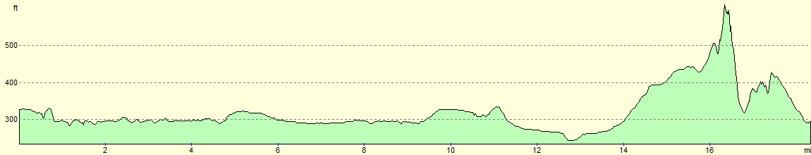
This makes a total distance of 18.3 miles, with 1017 feet of ascent and 1063 feet of descent.
For more information on profiles, ascents and descents, see this page
 |
 |
|
Transport
Trains run between Yorton and Whitchurch once every two hours during weekdays; see the National Rail Enquries website for more information. Yorton is a request stop.
Accommodation
I spent the night camping at the Cotton Arms in Wenbury, a few miles to the south of Nantchurch and right next to the Llangollen Canal. It cost me 5 pounds for the night for a single tent, and 1 pound for the shower. The food in the adjacent pub was nourishing and excellently priced.
 |
 |
|
 |
 |
|
 |
 |
|
 |
 |
|
 |
 |
|
 |
 |
|
 |
 |
|
 |
 |
|
 |
 |
|
 |
 |
|
 |
 |
|
 |
 |
|
 |
 |
|
 |
 |
|
Disclaimer
Please note that I take no responsibility for anything that may happen when following these directions. If you intend to follow this route, then please use the relevant maps and check the route out before you go out. As always when walking, use common sense and you should be fine.
If you find any information on any of these routes that is inaccurate, or you wish to add anything, then please email me.
All images on this site are © of the author. Any reproduction, retransmissions, or republication of all or part of any document found on this site is expressly prohibited, unless the author has explicitly granted its prior written consent to so reproduce, retransmit, or republish the material. All other rights reserved.
Although this site includes links providing convenient direct access to other Internet sites, I do not endorse, approve, certify or make warranties or representations as to the accuracy of the information on these sites.
And finally, enjoy your walking!
Nearby walks
| # | Title | Walk length (miles) |
|---|---|---|
| 1002 | Nantwich to Whitchurch | 19.1 |
|
|

|