Walk #1045: Maghull to Liverpool
 |
 |
|
General Data
| Date Walked | 21/10/2019 |
| County | Merseyside |
| Start Location | Maghull station |
| End Location | Liverpool Central station |
| Start time | 07.53 |
| End time | 15.28 |
| Distance | 21.2 miles |
| Description | This walk involves completing the westernmost 12 miles of the Leeds and Liverpool Canal, followed by a riverside stretch through the docks and then a return inland to central Liverpool. |
| Pack | Today I carried my 30-litre Karrimor rucksack, filled with water, my spare waterproofs, a book and other odds and ends. |
| Condition | I had no troubles with my knee today, but I did get a few twinges from my back - which was an old injury that I’d thought had healed. Aside from that, some of my toes are slightly sore. |
| Weather | Today was mostly sunny, with some cloud later on. There was no sign of any rain, and although it was cold early on, by midday it was warm enough for me to take my fleece off. |
| OS map | Landranger number 108 (Liverpool, Southport & Wigan) |
 |
 |
|
Map of the walk
Maps courtesy of Google Maps. Route for indicative purposes only, and may have been plotted after the walk. Please let me have comments on what you think of this new format. For a detailed table of timings for this walk, please see the table file.
 |
 |
|
Notes
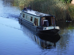
Today promised to be a bit of a red-letter day - I was finally going to finish walking the Leeds and Liverpool Canal, well over a decade after I started it. I had a good nights sleep, but awoke early, went down for breakfast at the hotel at half six, and then drove to Maghull station, arriving shortly after dawn. There were a few car parking spaces left, and I took one, got my kit together and set off.
I nipped into a shop near the station to get a few snacks for the day ahead, before setting off back to the canal, crossing a footbridge to reach the towpath at the point I had left it the previous day. Then, I’d been in a hurry to catch my train; now I could take my time and enjoy the stroll.
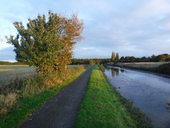
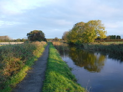
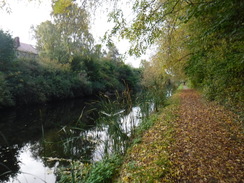
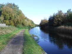
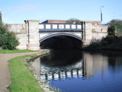
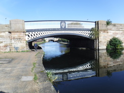
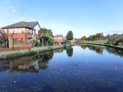
The canal passed under a rail bridge and then a motorway bridge, and what followed was a surprisingly rural stretch of towpath, with only the motorway’s low rumble saying we were near a city. A church was just visible over the canal, its tower rising above fields. Eventually housing started on the other side of the canal, and another motorway bridge marked the entrance to Liverpool’s suburbs.
The canal skirted a golf course, and then - at least according to the map - Aintree racecourse. I have walked past several racecourses - Newmarket has a footpath and ancient monument running across its middle - and have always enjoyed the view. Aintree however, was blocked off by concrete planks topped with barbed wire, a look that fitted better with heavy industry than racing. I know little about horseracing, but I do know that on five occasions - the last in 1962 - the British F1 Grand Prix was held there, powered by a very different form of horsepower.
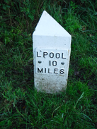
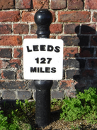
My knee was feeling fine, and the weather was just as fine, with blue skies and only a few clouds. The canal marched on through the suburbs, with little to remark on except for the decreasing numbers on the mileposts, marking my progress towards the canals end. A long and linear area of parkland the Primrose Country Park - appeared to my right, which must be a very good resource for the local population. A flock of geese flew overhead in a classic V-formation, and I wondered if the same bird flies miles at the point of the V or whether, like cyclists in a peleton, they swap around to take turns. My mind wandered to how this could be studied: perhaps a drone or low aircraft flying beneath or above them, recording their flight.
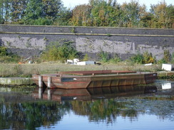
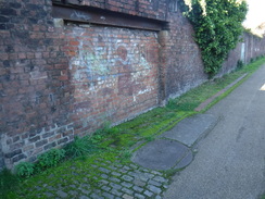
The canal turned to head southwestwards, and in places active industry intruded, whether it was old cars stored on racking in a scrapyard, or the smell of acetone drifting over the water. In such good weather, it was all rather enjoyable. As is often the case with canal walking, not much of the city was visible from the towpath, and in the end I decided I just wanted to see the canals end basin. In fact, I was feeling rather lacking in energy, and the miles were proving harder than they had yesterday.
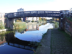
During yesterday’s walk, I wondered how few bridges there were between Maghull and the canal’s terminus in Liverpool; less than one per mile, at least if you went by bridge numbers. Surely, I thought, there must be many more than that in Liverpool? The answer came to me at Bridge 1, where the next bridge was Bridge P, meaning that there are more than 16 bridges (A to P) between the start of the canal and Bridge 1! That indicates how much Liverpool must have expanded since the canal opened.
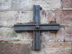
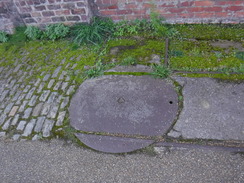
At one point there was a little circle of metal on the ground, with two sets of narrow-gauge rails leading to it, and another stretching towards a bricked-up doorway in a wall. This was a small wagon turntable, designed to ease the carrying of cargo from boat into building. Like the bent-up rail bufferstop I saw yesterday in Wigan, it was a wonderful reminder of our industrial past. I do hope it is kept.
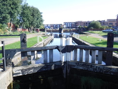
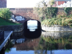
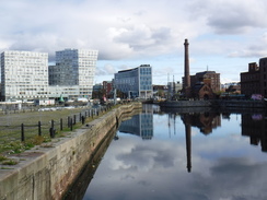
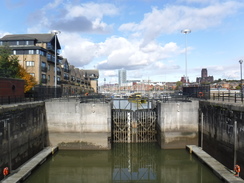
Eventually I reached the point where the canal made a hard right to descend down locks to the Mersey, but I crossed at a lock to continue on towards the end basin, passing a memorial to a young lad on the way. Originally the canal extended a short distance further south towards the city, but the terminus has disappeared under roads and housing. The new basin was unremarkable aside from some grannies who appeared to be eyeing me up, so I headed back to the locks and continued to a point where the canal disappeared into a tunnel under a road. There was no way of walking past here, so I joined the road.
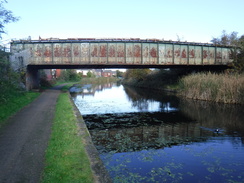
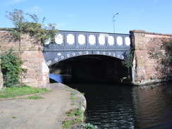
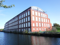
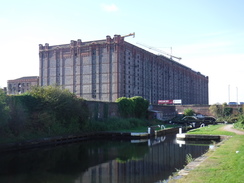
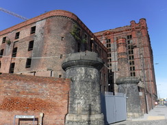
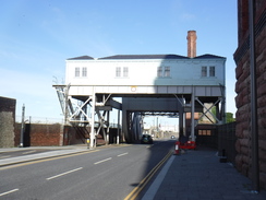
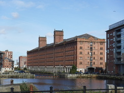
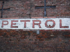
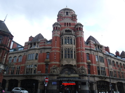
My plan had been to walk into the city centre and then do a loop around the city, but the main aim was to explore, so I changed my plans and took a rather narrow road past the Tobacco Warehouse, which is under restoration and had a couple of tower cranes hovering overhead. Im glad about this, as it is such a massive, imposing building that has a rich history. The road took me to the main docks road, where I managed to resist the temptation of a burger van. Instead I walked back too the point where the canal joins the docks, through a rather dramatic lift-bridge.
This also meant that I had linked this walk with my coastal walk. I remembered the docks road as being very bleak 16 years ago, with a car on its roof in the middle of the road. Now it seems to be very much under transition, with road works putting cyclepaths in, and old buildings under restoration. The canal too has been extended, with a link canal (the ‘Liverpool Link’) having opened a few years ago from these docks south, past the Three Graces, to the southern docks. It did not appear, however, that there was any public right-of-way along it for pedestrians. Besides, I quite enjoyed the walk that followed.
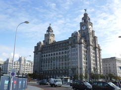
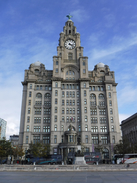
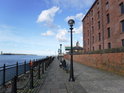
I headed south along the docks road as it slowly became more developed, with glass and steel buildings coming into view. Most of the architecture was harmonious, with one or two glaring exceptions - a successful reinvention of the city. Lots of people were about, especially when I approached the Liver building, where I stopped for an ice cream and a selfie. Again this year seems much livelier and richer than I remembered it, and the controversial Museum of Liverpool didn’t even seem too glaring.
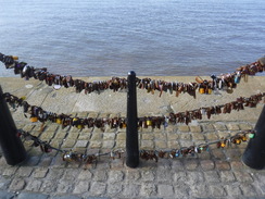
Further south, the chains preventing people from falling into the sea were festooned with padlocks, many rusted. Either Liverpudlians and visitors easily lose keys, or there is some other reason for this. Tens of thousands of padlocks, many in different colours, stretched for hundreds of metres on the three chains. Apparently they are love locks, placed there to signify an undying bond - until the Canal and Waterways Trust removes them!
I walked on south along the Mersey, and enjoyed the views across the river, where three Royal Fleet Auxiliary Tide-class ships were undergoing maintenance at Camel Laird in Birkenhead. I had walked along this promenade in the opposite direction 16 years earlier during my coastwalk, and try as I might, I could not remember much of that area from my stroll.
I have been to Liverpool twice before, and on both occasions I had had nasty or underwhelming experiences. This was very much proving to be third time lucky, and I enjoyed the stroll as I passed a series of smart, interesting buildings - Liverpool has certainly been granted a wave from the Good Architecture Fairy’s magic wand. A woman was walking a pony down a road, a mobile phone clasped to her ear; a strange sight, but one the locals seemed to accept without a glance.
The modern buildings gave way to smart, converted warehouses, and finally the water-filled Brunswick Dock gave an impression of the areas history - although the moored boats were smart yachts rather than rusty tramp steamers. It was all very pleasant, well-converted and interesting, so it was somewhat of a relief to find, further south, the waterfront crowded with standard identikit new-build housing - presumably the waterfront location also making them rather expensive.
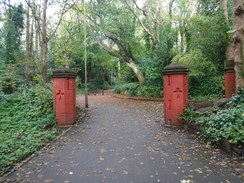
I waved goodbye to the sea and skirted a road past the site of Liverpool’s Garden Festival, and missed the path that was take me inland towards St Michaels. I backtracked to find the path, which took me through a pleasant wooded area and onto a road that led past the eponymous church. Now all I had to do was get back to central Liverpool, which involved following roads through southern Liverpool. On the way I passed through Toxteth, which I only know of because of the riots in the 1980s, and from what I saw did not deserve such a lowly impression.
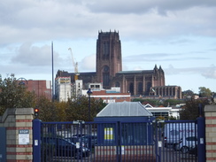
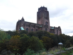
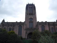
I walked right past Liverpool cathedral (the Anglican one), which is massive and dominating in bulk: imposing itself on the landscape in a way quite unlike most medieval cathedrals. Despite this, I liked it: it reminded me somewhat of Bankside Power Station in London, with the latter’s central chimney replaced by a tower. It turns out my impression was correct, as they were both designed by Giles Gilbert Scott, as was Cambridge library, which also has a large, imposing central brick tower. Whether his iconic phone box design shares any similarities is up to the reader to decide. I quite liked the cathedral, and its dominating presence seems fitting for such a modern city.
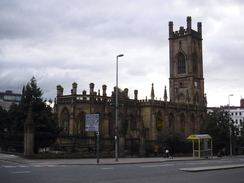
It was then simply a case of walking to Liverpool Central station, passing the ruins of a preserved bombed-out church on the way. The journey back to Maghull was quick, as was the drive back to my hotel, and I got into bed happy that I had finished the Leeds and Liverpool canal well over a decade after I had started it.
What is more, I have had a startling revelation: I quite like Liverpool!
I am a bit fed up with canalside walking now, having done rather a lot recently. Its therefore good that tomorrow - and the next day if I choose to do it - both contain hills.
 |
 |
|
Directions
This walk starts at Maghull railway station at SD38340148. Leave the station onto Station Road, and turn right to follow the road northwestwards; cross onto the left-hand side of the road when you can. After 150 metres turn left down Rutherford Road, and when this ends, climb a ramp that leads to a footbridge over the canal. On the other side, descend the ramp to join the towpath at SD38070142.
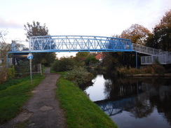
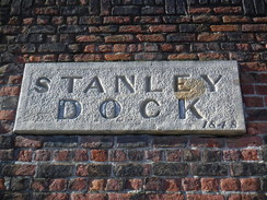
Turn right to follow the canal southeastwards, with the water on the left. It soon passes under a railway bridge, and then another bridge that carries the M58 overhead. Continue along the towpath as it curves around to take a more westerly course past Aintree, before gently curving to a southerly course through Bootle. After 14.9km the canal passes under the A567 Stanley road (Bridge 2) at SJ34329534; immediately on the other side of the bridge, turn hard-right to climb a ramp that leads to an iron footbridge over the canal that runs alongside the road bridge, and then down the ramp on the other side.
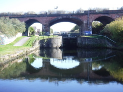
Continue along the towpath on the other side of the canal, with the water now to the right. It passes under another road bridge and then, after 350 metres and just before a railway bridge, pass under a footbridge and climb its ramp. Cross the canal on the bridge, and then descend the ramp to join the towpath on the other side, with the water now back on the left. Pass under the railway bridge and continue along the towpath. After 3.4km Stanley Dock Cut Junction junction is reached; turn right to head down to reach Stanley Top Lock (number 1) at SJ34209215. This is on the Stanley Dock Cut.
(Here, I crossed the lock and turned left to rejoin an arm of the canal that headed south for 300 metres to reach the canal basin in Vauxhall at SJ34239185. I then retraced my steps back to the lock. If you do not wish to do this, then you can shave about a third of a mile off the walk) Cross the footbridge at Stanley Top Lock, and turn left to follow the towpath down along the Stanley Dock Cut, with the water to the left. It passes a second lock, and then heads under a railway bridge. two more locks follow; at the fourth (bottom) lock, cross the lock using a footbridge, and then turn right along a narrow towpath and climb some steps to reach the A565 Great Howard Street at SJ33869210.
turn left to had south along Great Howard Syreet, and then take the first road off to the right, Saltney Street, which soon ends at a T-junction with Regent Road. (Here I turned right for a short distance to visit the Stanley Dock Bascule Bridge before retracing my steps). Turn left to follow Regent Road south; there is a pavement on the right. After 950 metres a roundabout is reached at SJ33679101.
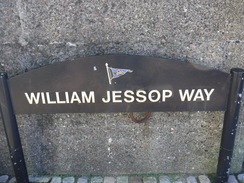
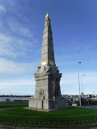
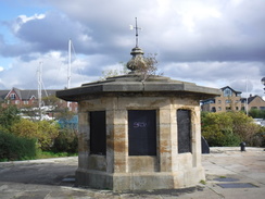
Turn right up William Jessop Way, and as the road curves immediately to the left, turn right to head straight on along Princes Parade. This soon curves left, to run between the Mersey on the right and Princes Dock on the left. After nearly 600 metres the road curves to the left; angle left to pass between the ‘The Memorial to the Engine Room Heroes of the Titanic’ on the right and the road on the left, and go through a gap in a brick wall. Go through a second gap ahead, and walk on for a few metres to reach the promenade in front of the Liver building at SJ33799029.
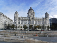
Continue south along the promenade, passing the Pier Head and the Museum of Liverpool. Beyond this, cross a footbridge over the entrance to Canning Dock and then angle right to pass the Piermaster's House on the left to rejoin the promenade. Continue south along the promenade, with the waters of the Mersey to the right. In a couple of places the promenade crosses dock gates, including the entrance to Bruunswick Dock. Eventually the buildings to the left become less commercial and more residential, and 3.8km after Canning Dock, the buildings end and the promenade is joined by a road, Riverside Drive, on the left at SJ35728696.
Either follow the promenade or join the road; however join the road before it curves away to the left near the Britannia Inn. The road curves left inland to a roundabout; head straight on along Riverside Drive until the entrance to the Festival Gardens is reached on the right beside a pedestrian crossing at SJ36688670.
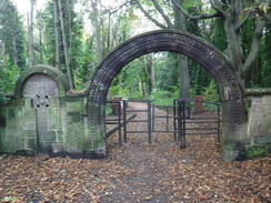
At the pedestrian crossing, turn left along a path that passes a barrier and leads into some woodland called Priory Woods. Go past a couple of gateposts, and when the path forks, head straight on through the woods to a clappergate under a stone archway that leads out onto the end of St Michael's Road. Follow this road north for nearly 500 metres until it ends at a T-junction with the A561 at SJ37078723.
Turn left to follow the A56 northwestwards; after 750 metres it ends at another T-junction. Carefully cross the road ahead, and then turn right up the B5342. After a few metres, veer left up the B5174 Belvidere Road. When this curves right after 520 metres, turn left along Devonshire Road West. This shortly approaches the Queens Arms pub, and curves right to take a northwesterly course, becoming Admiral Street and then Windsor Street. After 1.3km the road ends by Toxteth library on the left; continue along a short stretch of pavement to reach Upper Parliament Street at SJ35518916.
Carefully cross the road ahead, turn right for a few metres and then left up Hope Street, which passes Liverpool Cathedral on the left. When this road ends at a T-junction with Upper Duke Street, cross the road ahead and turn left downhill, passing the end of the cathedral on the left. Take the second road off to the right, Rodney Street, and follow this north. When it ends at the A5039 Leece Street, use the pedestrian crossing to cross the road and turn left down it. When a junction is soon reached opposite the ruins of a bombed-out church, angle right down Renshaw Street. When Ranelagh Street is reached on the left, turn left down it for a short distance to reach Liverpool Central railway station on the left at SJ34939025.
 |
 |
|
Distances
| From | To | Distance (m) | Ascent (ft) | Descent (ft) |
|---|---|---|---|---|
| Maghull station | Old Roan station | 4.1 | 2 | 25 |
| Old Roan station | A5036 | 3.9 | 0 | 10 |
| A5036 | Stanley Dock | 4.7 | 20 | 36 |
| Stanley Dock | St Michael's Hamlet | 5.6 | 62 | 10 |
| St Michael's Hamlet | Liverpool Central station | 2.9 | 141 | 184 |
This makes a total distance of 21.2 miles, with 225 feet of ascent and 265 feet of descent.
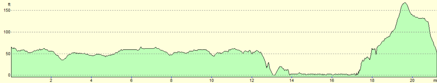
For more information on profiles, ascents and descents, see this page
Accommodation
I spent the night at the Holiday Inn Express in Wigan. This was a pleasant place to spend the night, with the added bonus of a very early breakfast, allowing me to get out of the door and walking at first light. It is not as characerful as a B&B, or as cheap as camping, but it is comfortable, clean and does what it does well.
Transport
Trains run regularly (every fifteen minutes during the week) between Liverpool Central and Maghull stations. See the National Rail Enquiries website for more information.
 |
 |
|
 |
 |
|
 |
 |
|
 |
 |
|
 |
 |
|
 |
 |
|
 |
 |
|
 |
 |
|
 |
 |
|
 |
 |
|
 |
 |
|
 |
 |
|
 |
 |
|
 |
 |
|
 |
 |
|
 |
 |
|
 |
 |
|
 |
 |
|
 |
 |
|
 |
 |
|
 |
 |
|
Disclaimer
Please note that I take no responsibility for anything that may happen when following these directions. If you intend to follow this route, then please use the relevant maps and check the route out before you go out. As always when walking, use common sense and you should be fine.
If you find any information on any of these routes that is inaccurate, or you wish to add anything, then please email me.
All images on this site are © of the author. Any reproduction, retransmissions, or republication of all or part of any document found on this site is expressly prohibited, unless the author has explicitly granted its prior written consent to so reproduce, retransmit, or republish the material. All other rights reserved.
Although this site includes links providing convenient direct access to other Internet sites, I do not endorse, approve, certify or make warranties or representations as to the accuracy of the information on these sites.
And finally, enjoy your walking!
Nearby walks
| # | Title | Walk length (miles) |
|---|---|---|
| 418 | Hoylake to Ellesmere Port | 20.0 |
| 419 | Ellesmere Port to Hale | 20.5 |
| 420 | Hale to Crosby | 19.5 |
|
|

|