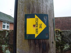
The Itchen WayThe Itchen Way is a 30-mile walk, following the River Itchen from its source to its confluence with Southampton Water. On the way it passes some beautiful stretches of chalk river, and also follows much of the Itchen Navigation. It passes through the centre of historic Winchester on the way, passing close to the Cathedral. Perversely, I am unsure where the Itchen Way either starts or ends. There are several sites on the web that point out different places for both the start and end, and for this reason I have picked the best bet from the 1:25,000 OS map. Therefore the start is on Harnham Hill, and the end is right at the mouth of the River Itchen into Southampton Water, at Weston Point. I am hoping someone can give me some proper answers to these questions. Likewise, I am unsure of the exact route that the path takes through Cheriton near the start of the walk, |
The walk in full:
| No. | From | To | Distance | Ascent | Descent |
|---|---|---|---|---|---|
| 1 | Harnham Hill | Itchen Abbas | 8.2 | 584 | 761 |
| 2 | Itchen Abbas | Winchester | 5.4 | 217 | 266 |
| 3 | Winchester | B3037 in Eastleigh | 7.4 | 217 | 289 |
| 4 | B3037 in Eastleigh | Woolston | 8.5 | 335 | 364 |
| 29.5 | 1353 | 1680 |
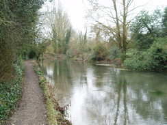
Leg 1 - Harnham Hill to Itchen Abbas
No. From To Distance Ascent Descent
1
Harnham Hill
Itchen Abbas
8.2
584
761
| No. | From | To | Distance | Ascent | Descent | 1 | Harnham Hill | Itchen Abbas | 8.2 | 584 | 761 |
|---|
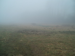
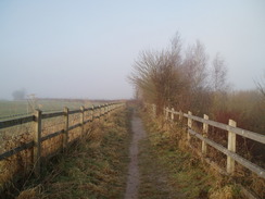
As far as I could work out, the start of the Itchen Way was at a lay-by on the A272 at the top of Harnham Hill, just south of the village of Cheriton.
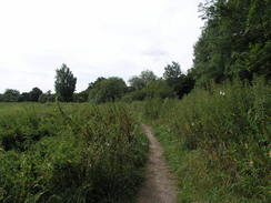
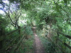
Turn right and follow the lay-by until it ends. Follow the A272 down the hill once more; there are frequent lay-bys that can be used to keep you off the road, When the B3046 is reached once again, turn left and follow it northwards. When it curves to the left after a few hundred yards, turn right along a footpath that heads northwards along a lane. This crosses another green lane, and after a third of a mile meets Upper Lamborough Lane at the top of the hill. Turn left and cross a stile to follow a hedge on the left; this curves to the right and reaches another stile. Cross this, and take another lane that heads down to end at a road ion Cheriton, near where this walk started.
Turn right along the road, then soon turn left near a bridge to head west for a few yards to the B3046 road; note, from here I am unsure of the correct route that the Itchen Way takes through the village, as there are several different waymarked paths that lead through it. Cross this road, and then continue westwards for another few yards. Just after a house on the right, turn right to take a footpath that carries the Itchen Way northwards. After 0.6 miles, it passes Cheriton Mill and ends at a road. Turn right along this road for a few yards as it crosses the River Itchen and reaches the B3046.
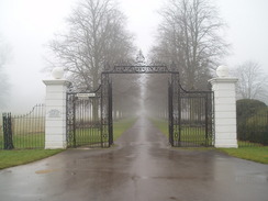
Turn left to head north along the B3046 for a few yards, then turn left to join a footpath that heads northwestwards across a field. It crosses into another field, where it takes a more northerly course to a band of trees. Continue through these, and the path joins a track that skirts immediately to the east of Tichborne House. From here a tree-lined track heads north; when the track curves away to the left, take a footpath that enters a field and crosses it northeastwards for nearly half a mile until it reaches the A31 road. The path turns to the left, staying at the edge of the field as it heads westwards for a few yards, before curving to the left once more, to head back southwestwards along a little sunken path with a hedge on the right and a field on the left.
This passes Vernal Farm before crossing the Itchen once more and reaching a minor road. Cross the roadm and on the other side head uphill along a footpath. It crosses through a hedge before reaching a band of trees called Trodd's Copse; turn right and follow the trees northwards until it descends slightly to reach the A31 road. Carefully cross the A31, and on the other side turn left down a lay-by. About halfway down this lay-by, turn right along another footpath. This heads through some trees before following the edge of a filed as it curves around. Soon some more trees start on the right, and the path heads west for a short distance to end at a road.
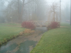
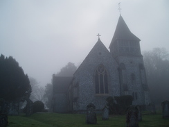
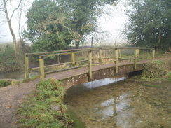
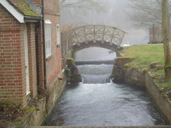
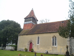
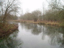
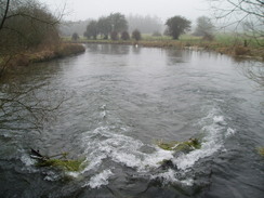
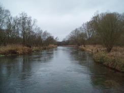
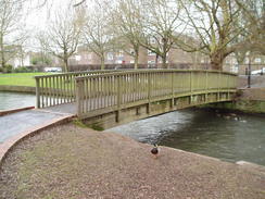
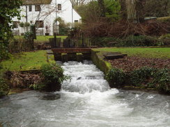
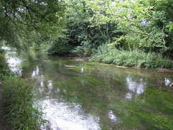
Turn right and follow this road as it heads northwards for a quarter of a mile into Ovington. Pass Ovington church and continue on. The road curves sharply to the right with a pub on the left; here continue straight on along a footpatht hat crosses part of the River Itchen to reach a raised bank in the middle of the river. Follow this footpath as it heads northwestwards for a quarter mile until it reaches another footbridge. Cross this, and follow a path north to reach the B3047 road in Itchen Stoke. Turn left to walk westwards along the road for a few hundred yards, then turn left to join a footpath that heads southwards across a floodplain to reach a couple of footbridges over the River Itchen.
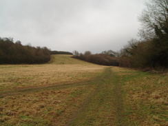
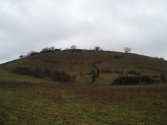
On the southern side of the river follow the path for a few yards, then take a footpath that heads off to the right. This heads westwards across a couple of field before curving uphill to reach Lovington Lane. It continues in the field for a short distance, skirting the lane, until Yavington Farm is reached. Join the road, and follow it westwards past the farm. Just before a right-hand bend, turn left up a footpath. This climbs uphill before curving to the right to head westwards along the top of a hill. This passes a car park for the golf club before ending at a track. Turn right along this track and follow it down to a road. Turn left along this road, then after a few yards turn right along another road that heads northwards, crossing the River Itchen and heading into Itchen Abbas.
 |
 |
|
 |
 |
|
 |
 |
|
 |
 |
|
 |
 |
|
 |
 |
|
 |
 |
|
 |
Leg 2 - Itchen Abbas to Winchester
No. From To Distance Ascent Descent
1
Itchen Abbas
Winchester
5.4
217
266
| No. | From | To | Distance | Ascent | Descent | 1 | Itchen Abbas | Winchester | 5.4 | 217 | 266 |
|---|
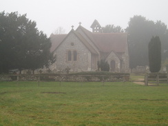
This stretch of the trail starts off at Itchec Abbas church. From the church take a path that heads off to the left, heading west for three-quarters of a mile to a road at Chilland. Cross this road, and take a footpath that continues on the other side for half a mile before it too reaches a road opposite Martyr Worthy church. Turn left down this road, and just before it ends take a footpath that leads off to the right. This passes a large garden of a house on the left, before dropping down to skirt near to the river bank. After a third of a mile Easton Lane is reached.
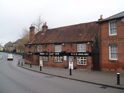
Turn left and follow Easton Lane southwards. It crosses the River Itchen; shortly afterwards a footpath leads off to the left. This heads past a large barn eastwards, before reaching another road in Easton near The Chestnut Horse' pub.
Leave the pub and turn left, following the road as it heads north. After a short distance it swings to the right; follow it eastwards for a hundred yards, and then, just before a house, turn left along a gravel driveway that carries a footpath. When the driveway ends, continue on along the footpath. This turns to the right and then the left, keeping a field boundary on the left, until it reaches a stile that leads to footbridges over the River Itchen.
On the northern side of the river the end of a road is reached in Martyr Worthy. Walk up this road for a few yards, and then turn left to climb up a bank that carries a footpath. This skirts the garden of the white house, turning left to descend down to near the riverbank, then right to parallel the river. Cross a series of fields for about a third of a mile until Easton Lane is reached. Cross the lane, and then continue westwards along a footpath on the other side for about half a mile; soon this crosses a stile and continues with a hedge on the left.
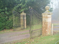
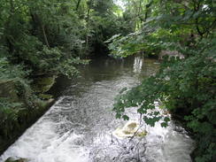
When the footpath reaches the embankment of the M3 motorway, turn left to cross a stile. The path heads south between hedges for a short distance, before turning to the right and joining a track that heads westwards under the M3. On the other side, continue along the faint track as it follows a hedge on the left, climbing up to reach the B3047 road. Turn left along the B3047 road and pass the twin gates of a large house on the left, then turn left down a footpath that heads diagonally across a scrubby field. This passes an old barn on the right before reaching a road. Turn left down this road, and follow it as it crosses the river. Continue on along this footpath as it crosses a patch of land between two tributaries of the river to eventually reach another footbridge. Cross this, and on the other side walk up a gravelled driveway of a large house on the left to reach the end of a road.
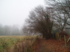
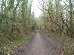
Here turn right, and start following a footpath that heads southwestwards for half a mile, skirting between the river on the right and the rise of Easton Down and the M3 on the left. When this reaches the A34(T), it heads down to pass under the bridge over the river using metal platforms built into the river. Immediately after this, the path turns to the left to start heading southwards, with the river a short distance away on the right, and an embankment of an old railway line on the left. This passes through an area of scrubby woodland as industrial buildings start at the top of the bank on the left; soon it breaks out of the trees and cuts across a couple of open, scrubby fields.
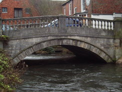
A track is then reached, which leads down to a road in Winnall opposite a car garage. Turn right and started following this road southwestwards. As it reaches a right-hand bend which takes the road over the rover, turn left down another road. This heads southwards with the river in close company on the right; it ends at a road in Winchester by the side of City Mill.
 |
 |
|
 |
 |
|
 |
 |
|
 |
 |
|
 |
 |
|
 |
 |
|
Leg 3 - Winchester to Eastleigh
No. From To Distance Ascent Descent
1
Winchester
B3037 in Eastleigh
7.4
217
289
| No. | From | To | Distance | Ascent | Descent | 1 | Winchester | B3037 in Eastleigh | 7.4 | 217 | 289 |
|---|
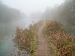
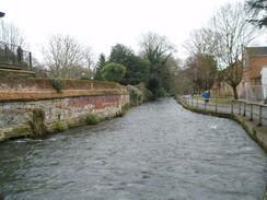
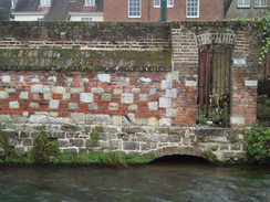
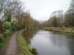
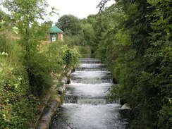
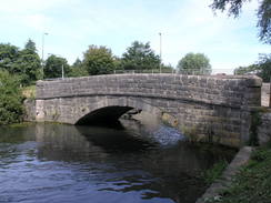
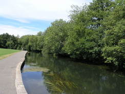
When City Mill is reached by the bridge over the River Itchen turn right along a footpath that runs alongside the river. At a mill building turn left for a few yards to join a road, then turn right along Wharf Hill Road. At the end of this turn left to head south along Domum Road. Near the end of this road, turn right to join the eastern bank to the Itchen Navigation.
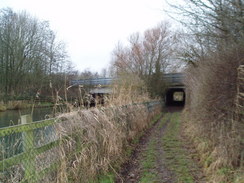
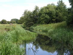
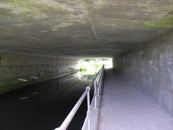
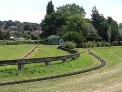
Follow a footpath that runs south along the bank of the navigation. This crosses a road at Tun Bridge, then skirts beneath the mass of St Catherine's Hill. The path passes under an old railway bridge, then ends at a road. Turn left to pass under the M3, then head south along the B3335 road for a short distance before turning right down another footpath.
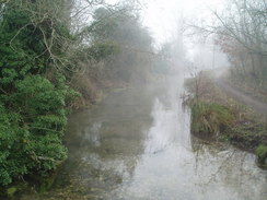
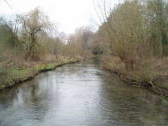
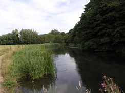
This leads back to the eastern bank of the Itchen Navigation. Follow this southwards for a mile to a road in Shawford; initially it follows the western bank of the old canal, which is in water, passing under a railway bridge and looping around to pass under another a little under half a mile later. After this bridge it continues on the eastern bank for a short distance, before crossing over to the western bank on a footbridge. It then follows the western bank southwards for 0.8 miles until it reaches the B3037 road in Bishopstoke.
 |
 |
|
 |
 |
|
 |
 |
|
 |
 |
|
 |
 |
|
 |
 |
|
 |
 |
|
 |
 |
|
 |
Leg 4 - Eastleigh to Woolston
No. From To Distance Ascent Descent
1
B3037 in Eastleigh
Woolston
8.5
335
364
| No. | From | To | Distance | Ascent | Descent | 1 | B3037 in Eastleigh | Woolston | 8.5 | 335 | 364 |
|---|
Continue following the Itchen Way southwards from the B3037. A footbridge is reached where the old towpath crosses over to the eastern bank at the site of the old Conegar Lock; then shortly after this another footbridge is reached that takes you across the canal and the adjacent Barton River.
For the next few miles the canal is dry; initially it follows a track southwards to the east of a sewage works, and after half a mile it passes under another railway bridge. The canal is little more than a depression to the right as the Itchen Way continues on along the old towpath, heading southwestwards for about 1.7 miles until it meets the northern bank of the M27. The path turns to the left to follow the base of the embankment eastwards for a couple of hundred yards until it reaches the bridge that carries a branch of the River Itchen under the motorway.
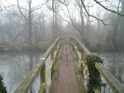
On the other side of the bridge, turn right to start following the southern embankment of the motorway westwards; eventually it meets the old canal, here in water, and follows the eastern bank southwestwards. It soon crosses over to the western bank, and continues on under the A27 until an old stone bridge called Mans Bridge is reached. Cross Mans Bridge, and follow the eastern bank of the canal, here in unison with the river, southwestwards for 0.6 mile until Woodmill Lane is reached.
The Itchen Way continues along the eastern bank of the river for nearly a mile until the large Cobden Bridge is reached over the river. Here the path leaves the side of the river; turn left and follow a path that climbs up onto the eastern approach to the bridge. Cross the road and turn left, passing a memorial on the left, then take the next road on the right, Whitworth Crescent. Follow this for a fifth of a mile until it jinks sharply to the left to head southeastwards along Whitworth Road. When this ends at a T-junction, turn right and follow Macnaughten Road as it curves to the left, passing Bitterne station and ending at a junction with the A3024 road.
Turn right along the A3024 and follow it as it crosses over the railway line, then turn right down Chafen Road. Follow this northwestwards for a short distance until it turns sharply to the left and becomes Vespasian Road. When this ends at a little area of parkland, head diagonally to the left to reach the A3024. Pass this, and on the other side join Quayside Road. Follow this eastwards as it skirts the estuary side. When the road ends, cross the railway line using a footbridge on the left that joins Athelstan Road.
Follow this road southeastwards, and just before it climbs up to end at a T-junction turn right down Chine Avenue. When this ends, continue straight on along another footpath that ends at another road. Continue straight on along this road, and follow it as it curves to the left to end at a T-junction with Gainsford Road. Turn right along this road, and when it curves to the right turn left to climb some steps that end at a road. Turn right along this road, and then turn left for a few yards up Osterley Road until it ends at a T-junction.
At the T-junction turn right along a surfaces track that heads away slightly to the right of Peartree Road, with parkland on the right. Follow this road southwestwards; the Itchen Way leaves he road and heads to the west of the houses on Peartree Green, but it ends up in the same place as the road. This descends downhill, passing under a railway bridge until ending at a T-junction.
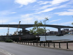
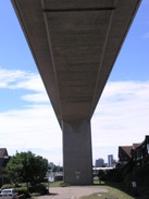
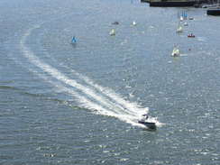
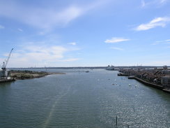
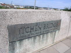
Turn left and follow Hazel Road southwards, passing under the Itchen Bridge, then continue south down Weston Road, to the end of the Ichen way at Weston Point.
 |
 |
|
 |
 |
|
 |
 |
|
 |
 |
|
 |
 |
|
 |
 |
|
 |
 |
|
 |
 |
|
 |
 |
|
 |
 |
|
 |
 |
|
 |
 |
|
 |
 |
|
 |
 |
|
 |
 |
|
Circular walks
The following circular and linear walks are based on the Wayfarers Walk:
