Walk #362: Ilfracombe to Lynton
 |
 |
|
General Data
| Date Walked | 20/02/2003 |
| County | Devon |
| Start Location | Ilfracombe |
| End Location | Lynton |
| Start time | 08.34 |
| End time | 16.52 |
| Distance | 18.0 miles |
| Description | This was an extremely enjoyable day's walk, although quite strenuous in places. Some of the scenery is quite fantastic, particularly the Valley of Rocks to the west of Lynton. |
| Pack | Today I carried my 30-litre Karrimor HotRock rucksack, which was filled with my packed lunch, waterproof leggings, water bottle and a couple of spare shirts, together with the usual assortment of odds and ends. |
| Condition | This was yet another day when I have not had any significant problems, and the only thing that I can find to mention is that my left ankle ached slightly once I had finally finished the walk. |
| Weather | The weather today was very different to the weather over the last few days. For one thing it was much warmer than it had been, and there was little sight of the sun at all during the day. There we some drizzle early on, and a bit more when I sat down for lunch, and neither of these were long enough or hard enough to make me want to put my hood up. The wind that has been ever present for the past few days was still present, although it was less fierce and cold than it has been. |
| OS map | Landranger number 180 (Barnstable & Ilfracombe, Lynton & Bideford) |
 |
 |
|
 |
 |
|
Map of the walk
Maps courtesy of Google Maps. Route for indicative purposes only, and may have been plotted after the walk. Please let me have comments on what you think of this new format. For a detailed table of timings for this walk, please see the table file.
 |
 |
|
 |
Notes
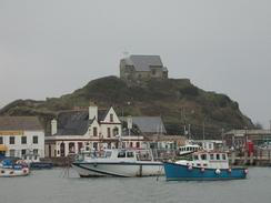
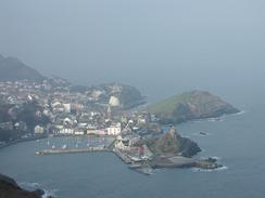
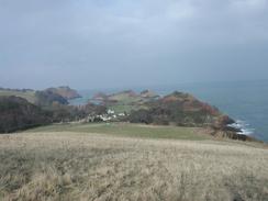
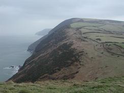
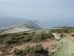
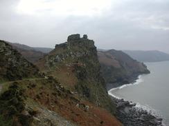
There were some wonderful views available at times on this walk, and in particular those from the Little Hangman, Great Hangman and the Valley of Rocks were truly superb. This made the entire walk extremely enjoyable, and well worth doing. The only downside is that once again the skies were hazy, which meant that I could not see as far as I wanted along the cliffs or across the sea to South Wales. This is a shame, as on my last trip along the cliffs in 2000 I really enjoyed being able to look across to Wales, but on this trip I have been unable to.
As I was approaching Lee Abbey I met a group of about ten people walking up the road towards me. The first man had a walkie-talkie, and as we chatted he was speaking into it and telling the others about what I was doing. I believe that they were a group from Lee Abbey, which is a Christian centre, and some of them gave me some large donations for the charity. This was very kind of them, but unfortunately I could not tell them where the path they wanted was!
I did a little experiment today and left my GPS unit on all day to see how far I walked. On this trip so far I have been measuring the distance that I have walked using a map measurer on a map (I had tried using a pedometer but it was far too innacurate), and the values that I have been getting recently for this correspond well with the distances given in the national Trail Guides. Measuring on a map should actually underestimate the distance walked slightly, so I decided to see what value my GPS would give me. The results are interesting - the distance from Ilfracombe Harbour to Combe Martin is given as 5.3 miles, and the GPS recorded it as being 5.96 miles. Likewise the distance from Combe Martin to Lynton is given as 12.3 miles and the GPS measured 13.9 miles. These differences are interesting, and could be due to the amount of ascending and descending that I did today. For the distances recorded on this website I have used the measured values; I will continue using my GPS for a few days to see if I can make any conclusions.
As we are travelling around the country it is amusing to see the way the television channels change as we move around the country. Just recently we have had southwest TV, Wales TV and other local channels. It is weird the way that we get reception of Welsh TV better than southwestern channels when we are in the southwest - unfortunately neither of us understands Welsh!
I am now coming to the end of the South West Coast Path, and tomorrow's walk will be the last complete day on the trail - I shall probably walk as far as Bossington, which will leave a six-mile walk over Bossington Hill to Minehead tomorrow. It will feel very strange to be off the National Trail and having to plan my own routes once more.
Directions
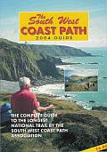
| During this walk I followed the South West Coast Path, the route of which is detailed in the Ordnance Survey National Trail Guide 8, Minehead to Padstow (ISBN 1-85410-774-7). Unfortunately the route description is written in reverse to the direction that I am walking, but the 1:25,000 maps in the book are clear and the signs on the ground are very good. Also to be recommended is the South West Coast Path Association guidebook (ISBN 0-907055-04-4), which has less concise directions and no maps, but includes accommodation details and grades each section of the walk according to difficulty. They also publish reverse directions, which are suitable for walking in the direction that I walked the route. They have a website at www.swcp.org.uk, which is well worth a visit. | 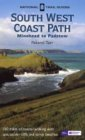
|
| 
| |
| |
| |
Distances
| From | To | Distance (m) | Ascent (ft) | Descent (ft) |
|---|---|---|---|---|
| Ilfracombe | Combe Martin | 5.4 | 1722 | 1706 |
| Combe Martin | Lynton | 12.6 | 4656 | 4528 |
This makes a total distance of 18.0 miles, with 6378 feet of ascent and 6234 feet of descent.
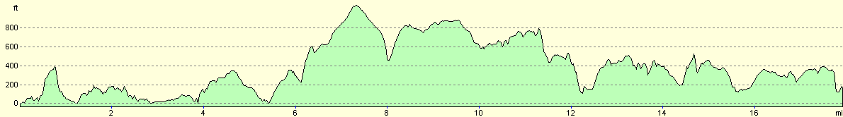
For more information on profiles, ascents and descents, see this page
Accommodation
We parked in a car park in Lynton, which was quite handy for all the local facilities. I am unsure about whether we are allowed to park here overnight, but I have not seen a sign prohibiting it, mainly because I have not looked.
Disclaimer
Please note that I take no responsibility for anything that may happen when following these directions. If you intend to follow this route, then please use the relevant maps and check the route out before you go out. As always when walking, use common sense and you should be fine.
If you find any information on any of these routes that is inaccurate, or you wish to add anything, then please email me.
All images on this site are © of the author. Any reproduction, retransmissions, or republication of all or part of any document found on this site is expressly prohibited, unless the author has explicitly granted its prior written consent to so reproduce, retransmit, or republish the material. All other rights reserved.
Although this site includes links providing convenient direct access to other Internet sites, I do not endorse, approve, certify or make warranties or representations as to the accuracy of the information on these sites.
And finally, enjoy your walking!
This walk was mentioned in the following routes:
| My walk around the coastline of Britain |
| South West Coast Path |
Nearby walks
| # | Title | Walk length (miles) |
|---|---|---|
| 88 | Barnstaple to Woolacombe | 11.9 |
| 89 | Woolacombe to Combe Martin | 13.0 |
| 90 | Combe Martin to Lynton | 13.6 |
|
|

|