Walk #808: A walk across the Lulworth ranges
 |
 |
|
General Data
| Date Walked | 10/02/2008 |
| County | Dorset |
| Start Location | Kimmeridge Bay car park |
| End Location | Kimmeridge Bay car park |
| Start time | 09.12 |
| End time | 16.53 |
| Distance | 14.5 miles |
| Description | This was a strenuous by highly enjoyable walk following the South West Coast Path across the Lulworth Ranges. |
| Pack | Today I carried my 30-litre Karrimor rucksack, filled with waterproofs, a book and other odds and ends. |
| Condition | I am tired after this walk, but feel fine. |
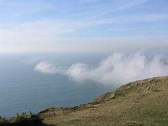
| Weather | The day started off foggy, sometimes very so, but when this burnt off there was bright sunshine, and it got quite warm. |
| OS map | Landranger number 195 (Bournemouth & Purbeck, Wimborne Minster & Ringwood) and Landranger number 194 (Dorchester & Weymouth, Cerne Abbas & Bere Regis) |
 |
 |
|
 |
 |
|
Map of the walk
Maps courtesy of Google Maps. Route for indicative purposes only, and may have been plotted after the walk. Please let me have comments on what you think of this new format. For a detailed table of timings for this walk, please see the table file.
 |
 |
|
 |
 |
|
Notes
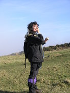
Sencan wanted to do another day of the South West Coast Path today, so after checking that the military ranges at Lulworth were open, we headed off on the long drive. The day's walking promised to be quite tough, with many ascent and descents and Sencan was understandably nervous about being able to complete a circular walk. I had devised a series of circular walks that we could take, but due to the tank range most of these followed the main roads for an annoyingly large distance.
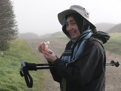
It was a very cold morning, and the car park at Kimmeridge was nearly deserted whe we arrived. We parked next to a camper van, and as we got our boots on we chatted to the couple of surfers within, who were looking nervously at the sea. There was scarcely any wind, and what waves there were looked utterly pittiful. We both needed the toilets, so we walked across a boggy area of grass to reach the toilet block; this was the worst patch of mud that we would encounter all day.
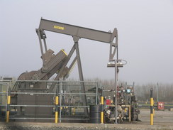
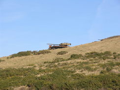
We were both in a good mood as we set off, walking the short distance to the nodding donkey of the woil well at Kimmeridge. This is a remote part of the nearby oil field, and has been in service since 1957 - apparently the longest continuously exploited oil well in the world. Its output is fairly low, however.
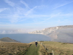
A level stretch took us through the gate that leads into the tank ranges and along to the start of the first climb up the flank of Tyneham Cap. Near the bottom of this climb we encountered a photographer. We chatted for a few minutes; he was taking shots of the foggy skies out to sea, and I looked at the same fog with dismay - it would certainly destroy any views if it did not burn off soon. How wrong I was...
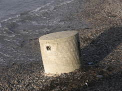
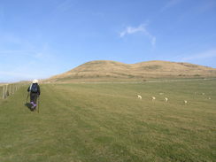
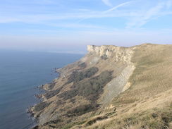
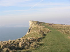
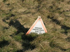
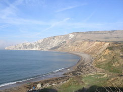
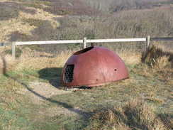
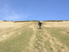
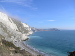
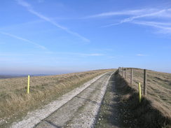
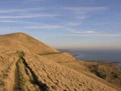
From Tyneham Cap a long and gentle walk along the top of the cliffs, and I enjoyed spotting as many of the triangular signs warning walkers to stay on the path and not to handle any extraneous pieces of metal that could be found. The warning were hardly needed, but I was annoyed that the views out to sea were being spoiled by the fog. A steep descent down to Worbarrow followed, and I enjoyed counting the large anti-tank concrete blocks that were still lined up on the beach. These Second World War devices were still present, and I wondered how long they would remain before the sea eventually claimed them. Unfortunately there was lots of litter scattered around on the ground, a horrible sight in what should be a beautiful spot. Nearby there was the rusting remains of a William's Turret, another Second World War fortification.
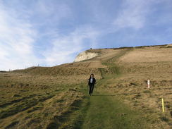
Sencan still seemed fit, and we took our time along the climb up to the fort at the top of Flower's Barrow. It was quite steep, but we took our time and were soon firmly within the thick fog at the top. I was cursing my luck at this as it was spoiling any views. We crossed the ramparts of the old fort and headed across, where we met a man walking in the opposite direction. He asked us where we were going, and he turned out to be a warden on the ranges, someone who checked that people did not stray from the paths onto the more dangerous parts of the ranges. We had a fascinating chat; he told us of a new path that had been opened up heading north from Arish Mell, and about a pipeline that headed out to sea from an old nuclear research plant further inland. We could see the latter as the fog momentarily lifted as it was marked out by a line of mist across the surface of the sea.
We said goodbye and headed on, but as we crossed the ramparts at the western edge of the fort I saw something through the corner of my eye. I stopped, and was overjoyed when I saw a Brocken Spectre projected against the grass bank of the rampart. This was the first time that I had ever seen one, and Sencan also managed to see hers. We stopped for a few minutes, during which I just managed to see a little halo around mine. Sencan seemed as amazed as I did, and we chatted excitedly as we descended down to the bay at Arish Mell, passing a couple of rusting and burnt-out tanks on the way.
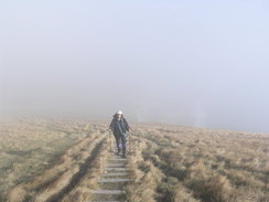
The climb up from Arish Mell onto Bindon Hill seemed exceptionally steep, and we got to see little as we sloely climbed. Halfway down we met a family walking down, who asked if we had seen four teenagers; they had lost track of them. We had not, and they asked us to tell them to huryr up if we came across them. At the top of the climb we saw more Brocken Spectre, and these were far more visible in the thicker fog. Again we stopped to study them, before heading off once more. On the ridge of Bindon Hill we met four teenagers, who seemed utterly unperturbed when we gave them the message.
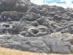
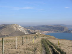
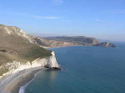
We stopped on a bench at the top of Bindon Hill so that Sencan could retie her laces, and we then headed down the exceptionally steep descent past Mupe Bay. This looked precipitous but was not too difficult, and soon we were on level ground. The mist was starting to life, and the rock strata were clearly visible in the cliffs above the bay. A short distance further on the path passed above a petrified forest, and neither of us thought mush of it; even from high up we could see the tree trunks, both in cross and longitudinal section, but they just did not seem particularly nice.
When I had walked this way on my Coastwalk I had walked to Lulworth along the beach around the bay, but Sencan wanted to continue along the South West Coast Path, and this involved another precipitous climb up the flank of Bindon Hill above the cove. I counted the steps all of the way up, and I was sweating heavily by the time the top was reached. Sencan was finding it hard going - so was I - but she soon joined me and we started the descent down to the cove. This had been an unneccessary ascent, but I was glad that we did it, despite the views not being particularly good.
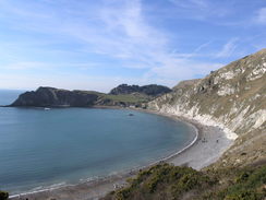
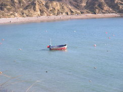
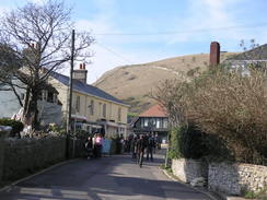
Lulworth Cove was bustling and lots of people were out in the sunshine. We used the toilets, and then found an area of grass to sit down on to eat our lunch. It had taken us about an hour longer to get to Lulworth than I had expected, but we still had enough time to complete the walk before it got dark. I bought a lovely ice cream, and as I scoffed it down we studied the map. Sencan felt relatively fine, so we decided not to take the largest loop along the main road and instead head back towards the coast. However, neither of us fancied the climb around the cove, so we headed towards West Lulworth along the main road and climbed up to the western end of Bindon Hill using a footpath. This removed one climb from the walk.
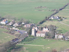
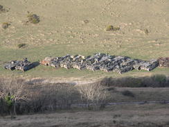
It was hard to believe that we had been in fog on the same hill a couple of hours before as the skies were more or less totally clear, and the Isle of Portland was clearly visible to the west. It was a very pleasant walk along the top of the ridge, and we passed a memorial from where there were good views over Lulworth Camp to the north. During the descent down to Arish Mell we could see long, straggling lines of old tanks and armoured personnel carriers lined up below; these had been totally obscured by the fog earlier. They were a sad sight; I would much rather see them roaring around, although hopefully not firing. I love large hunks of metal, and tanks are just one example.
Sencan was still feeling reasonable, so instead of heading along a diversion route we continue on along the path, climbing up back onto Flower's Barrow. We rested on a bench at the top for five minutes, and we both put our Walkmans on. Sencan was keen to try and finish the route by the harder, coastal route rather than diverting, so on tired legs we descended down to Worbarrow and started the final climb. The music seemed to give her a second wind, and we strode along the clifftop path enjoying the views that had been denied us earlier in the day.
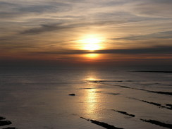
Before we knew it were heading downhill, heading along the coast back towards the gate out of the ranges at Kimmeridge. By the time we got back to the car we were both tired but elated. There was a lovely red sky over the sea as the sun sunk down, and Sencan was genuinely pleased at having fairly easily completed the hardest walk that she had ever done.
 |
 |
|
 |
 |
|
Directions
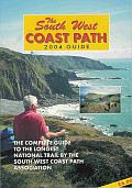
| During this walk I followed the South West Coast Path, the route of which is detailed in the Ordnance Survey National Trail Guide 11, Exmouth to Poole (ISBN 1-854109-88-X). Unfortunately the route description is written in reverse to the direction that I am walking, but the 1:25,000 maps in the book are clear and the signs on the ground are very good. Also to be recommended is the South West Coast Path Association guidebook (ISBN 0-907055-04-4), which has less concise directions and no maps but does include accommodation details and grades each section of the walk according to difficulty. They also publish reverse directions, which are suitable for walking in the direction that I walked the route. They have a website at www.swcp.org.uk, which is well worth a visit. | 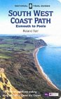
|
| 
| |
| |
| |
The only exception to this is at the middle of the walk, at Lulworth Cove. Instead of walking back from the cove straight across the ranges, we headed north along the B3070 towards West Lulworth; there was a pavement on the right for much of the way. When a track led up to the right we turned right along this for a few yards, then turned right along a path that started to climb uphill to the southeast, heading for the western end of Bindon Hill. When the ridge is reached, turn left and follow another footpath that continues on eastwards, passing a radar station on the right before joining a track that leads across the top of the ridge. At the eastern edge of the ridge that South West Coast Path is reached once again, which can be followed all the way east back to Kimmeridge.
 |
 |
|
 |
 |
|
Distances
| From | To | Distance (m) | Ascent (ft) | Descent (ft) |
|---|---|---|---|---|
| Kimmeridge Bay car park | Lulworth Cove | 7.6 | 2484 | 2451 |
| Lulworth Cove | Kimmeridge Bay car park | 6.9 | 1821 | 1854 |
This makes a total distance of 14.5 miles, with 4305 feet of ascent and 4305 feet of descent.
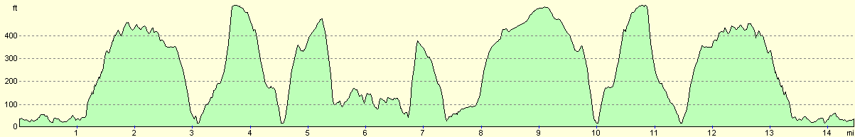
For more information on profiles, ascents and descents, see this page
 |
 |
|
 |
 |
|
 |
 |
|
 |
 |
|
 |
 |
|
 |
 |
|
 |
Disclaimer
Please note that I take no responsibility for anything that may happen when following these directions. If you intend to follow this route, then please use the relevant maps and check the route out before you go out. As always when walking, use common sense and you should be fine.
If you find any information on any of these routes that is inaccurate, or you wish to add anything, then please email me.
All images on this site are © of the author. Any reproduction, retransmissions, or republication of all or part of any document found on this site is expressly prohibited, unless the author has explicitly granted its prior written consent to so reproduce, retransmit, or republish the material. All other rights reserved.
Although this site includes links providing convenient direct access to other Internet sites, I do not endorse, approve, certify or make warranties or representations as to the accuracy of the information on these sites.
And finally, enjoy your walking!
Nearby walks
| # | Title | Walk length (miles) |
|---|---|---|
| 313 | Hamworthy Station to South Haven Point | 18.0 |
| 314 | South Haven Point to Worth Matravers | 16.7 |
| 315 | Worth Matravers to Lulworth Cove | 12.7 |
|
|

|