Walk #890: A circular walk through Rendlesham Forest
 |
 |
|
General Data
| Date Walked | 29/03/2011 |
| County | Suffolk |
| Start Location | Hollesley Common car park |
| End Location | Hollesley Common car park |
| Start time | 07.36 |
| End time | 15.33 |
| Distance | 21.7 miles |
| Description | This walk follows part of the Sandlings Walk, before returning mostly along roads. It runs through cool forests for much of the time, and skirts two former airfields. |
| Pack | Today I carried my 30-litre Karrimor rucksack, filled with water, my waterproofs, a couple of books and other odds and ends. |
| Condition | I feel fairly fatigued after this walk, but that might just be because of not having eaten enough. Otherwise I feel fine. |
| Weather | The day started off cold and misty; the mist soon burnt off, leaving a bright, sunny day. Cloud startedto gather in the afternoon, but rain only started once I had finished. |
| OS map | Landranger number 169 (Ipswich & The Naze, Clacton-on-sea) and Landranger number 156 (Saxmundham, Aldeburgh & Southwold) |
 |
 |
|
Map of the walk
Maps courtesy of Google Maps. Route for indicative purposes only, and may have been plotted after the walk. Please let me have comments on what you think of this new format. For a detailed table of timings for this walk, please see the table file.
 |
 |
|
Notes
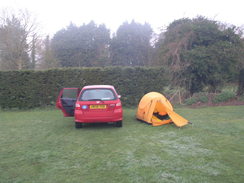
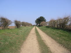
Last night had been bitterly cold, with a heavy frost sheening my tent white. A quick glance out of the flaps showed that there was a freezing fog, and that the inside of my flysheet was soaking wet. I cold not be bothered to cook breakfast, so I scoffed down an emergency pork pie and packed everything up before hitting the road. The day had proved to be hard to plan, with no obvious way of getting from start to finish using public transport. For this reason I planned a circular walk, and I pulled up at a car park on Upper Hollesley Common, a short distance way from the boundary fence of RAF Woodbridge.
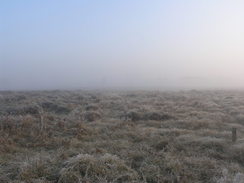
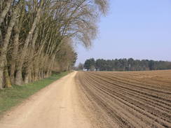
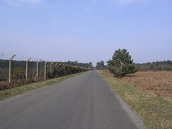
The first couple of miles were along the road past the airfield; this proved to be busier than it had been last night, a situation not helped by patches of thick fog and cars not using their lights. I managed to safely get to the place where I had left the Sandlings Walk yesterday, and rejoined the trail. Photos proved hard to take in the patchy fog, although there were signs that the sun was trying to burn through. It was good to be off the road and onto the sandy tracks.
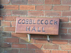
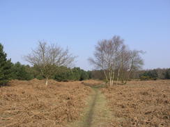
At the bottom of a small hill - there were no hills worthy of the name encountered at all during the day - there was a small fenced compound with olive-green buildings within, a sewage works related to the MOD base. A small gypsy camp was located at the top of the next hill, clean, tidy and out of the way. The sun finally burnt through the fog as I walked across the heathland, and turned back towards the main road. On the way I passed a place marked on the map as Gobblecock Cottage'; a name that shows my mental age as I smirked as I walked past. I could not resist taking a quick csnap of the wooden nameboard that hung on the wall.
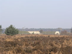
The trail brought me out near to the car park, and I headed towards the car so that I could take a swig out of the bottle of water I had left within. Hardened shelters within RAF Woodbridge were visible across the heathland, their rounded concrete tops arcing above the heather. Unfortunately the sandy track was soon replaced with tarmac, before another track took me to a visitor's centre. This is probably a busy place on a sunny summer's Saturday, but there were only a couple of cars scattered around the large car park as I passed. A little further on was a forestry campsite; again, there was no-ne about and the camp shop was closed.
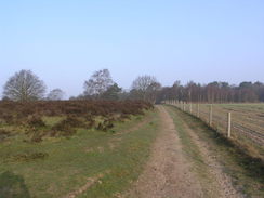
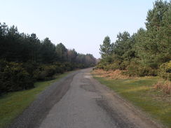
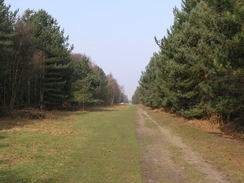
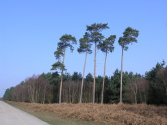
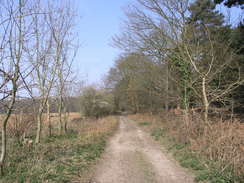
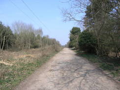
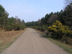
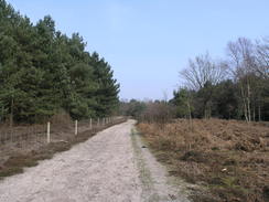
What followed were a series of long tracks through Rendlesham Forest. After a while the trees became a little monotonous, and I missed the glorious heathland that I had experienced earlier. I did keep my eyes out for UFOs, however - the forest was the location of perhaps the most feasible UFO sighting, the Rendlesham Forest Incident. Over the Christmas period in 1980 some military personnel from RAF Woodbridge saw a series of unexplained events within the forest. As an affirmed sceptic I doubt that little green aliens chose to visit the forest on that date, but it did not stop me looking! In all seriousness, although a welcoming place on a sunny day, I can easily imagine how creepy it could get on a winter's night.
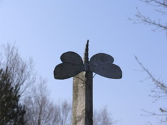
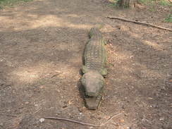
The council have erected a series of sculptures along the trail, and I passed one as I approached the southern side of RAF Bentwaters. This was the twin World War Two airfield to RAF Woodbridge, and like its neighbour was taken over by the USAF after the war. Unlike Woodbridge it did not find another military use after the US military pulled out in 1993, although it does have a wide number of industrial uses. Nothing could be seen through the trees, so I plodded on.
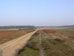
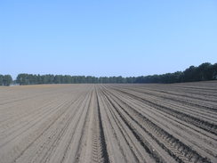
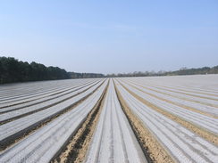
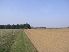
A ploughed field promised to slow down my pace. fortunately the farmer had kindly run a vehicle along the footpath route, compacting the sandy soil and making the going easier. The same was in the next field, where raised beds were covered in plastic. It was impossible to know what was growing underneath, but I can only assume that it was not plastic bushes! Such a large expanse of plastic must cost money both to buy and install, but I assume that the advantages more than outweigh the costs.
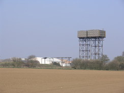
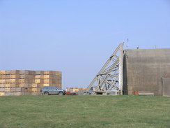
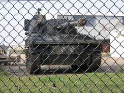
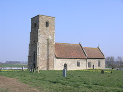
A massive Braithwaite tank water tower loomed overhead as I approached Bentwaters. At the main gate I took a sneaky look in, and saw high stacks of wooden crates near the old aircraft shelters. Surprisingly, there was an old military vehicle beside the fence, its gun pointing out through the chain-link. Nearby there was a small, attractive Norman church, St John's, Wantisden, which looked superb, complete with a Coralline tower. Indeed, with my back to the fence, it was hard to believe that there was an old military base so close by. If it was not for the base, then the church would literally be in the middle of nowhere, leading me to wonder who it had been built for.
I was faced with a choice when I reached the road. My feet were aching slightly by now, but more importantly I felt lethargic - a sure sign that I had not eaten enough after my long walk yesterday. The obvious choice was to head back to the car along roads, but that would have led to a short day. Additionally, there was nowhere obvious to leave my car, so I decided to continue northwards along the trail towards Tunstall, where there are some car parks.
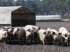
Annoyingly the trail heads south along the road, before heading along a farm track. The Suffolk Coast and Heaths Path - another trail I wish to do - is nearby, but before it was met the trail turned to head northwards through Tunstall Forest, meaning another mile or so through trees. It was somewhat of a relief when I emerged out onto the road. I had already done fifteen miles, and there was no way I was going to return via the same winding route. Therefore I left the Sandlings Walk behind for the moment, and walked southwards along the quiet country roads. I was feeling increasingly lethargic, and I even felt jealous of the pigs that were being fed by a tractor in a field.
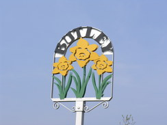
Fortunately relief soon came, in the form of the Oyster pub at Butley. Over the years I have learnt not to trust OS maps when it comes to pubs - many marked on the maps have been shut. Even if they are still pubs, then often they are only open at weird hours. Fortunately it was open, so I went in and ordered a pint of shandy from the barmaid, along with an emergency dish of chips. For some reason there was a roaring fire, and so I went outside to avoid the heat. A large bowl of delicious hand-cut chips arrived, and they deserved another pint of shandy. I had a pleasant chat with a couple of locals, who seemed to be amazed at what I was doing - they were even more amazed when I told them about the coastal walk I did. Their reaction was both unusual and pleasing - most people I tell never believe me...
A walk along the main road followed, but this was not too busy and relatively straight. What is more, the chips had given me more energy and I strode off in much better spirits. After the main road, a minor road that led down to the visitor's centre I had passed earlier. On the way I passed the fence belonging to RAF Woodbridge, near to where the UFOs were seen. Again there was no sign of any mysterious lights aside, perhaps, from the switched-off approach lights leading to the runway. At the visitor's centre I rejoined the Sandlings Way for the last couple of miles back to the car. It was a pleasant walk, even though the clouds were gathering.
It started to rain shortly after I reached my car, meaning that my decision to make this a two rather than a three-day stroll had been wise. Although today's walk had not been classic, it had been enjoyable; the Sandlings Walk is certainly turning out to be an interesting trail.
 |
 |
|
Directions
This walk starts off at the Upper Hollesley car park, just to the east of RAF Woodbridge at TM334471. Leave the car park and join the road; turn right to head northwestwards for a little over a mile and a half, keeping the base's fence to the right. When the westernmost boundary of the base is reached at TM311483, turn left to follow a sandy track south-southwestwards for a quarter of a mile, At a crossroads in the tracks, turn left to join another track. Initially this crosses heathland, before passing through trees and then fields. It descends into a low valley to pass a small sewage works on the right, then ascends and continues for another two-thirds of a mile to another junction at TM323463. Turn left and follow another track northeastwards for three-quarters of a mile; it passes through a deer fence and then past Gobblecock cottage before reaching the road once more, very near to the car park.
Turn right along the road, passing two bridleways off to the left. Just before the entrance to the car park is reached, turn left up another track. This heads northeastwards for half a mile; the path then takes a more easterly course as it head towards Tangham Cottages. Go through a gate to join a surfaced track; keep the cottage on the left as you head eastwards. When four red-and-white wooden posts are reached, turn left to join a path that heads northwards for a couple of hundred yards through the trees. Turn right along another track to pass a toilet block and enter the car park of a forest visitors' centre. Continue eastwards along the access track until a road is reached at TM354484.
Cross the end of the road, and head eastwards along a track, immediately passing a cottage on the left. Do not enter the forest campsite and keep to the track. After a third of a mile at TM359484, turn left to head north along another track through the forest. After half a mile a junction with another track is reached; turn left for a couple of hundred yards, and then turn right up another track. After another couple of hundred yards it reaches a junction of tracks at TM359495; here turn left to head westwards. This track eventually ends at a road at TM355496.
Cross the road and continue straight on west-northwestwards through the forest. When the good track curves to the left, turn right along a rougher, but still clear, track. Half a mile after the road another track is reached at TM346499; turn left and almost immediately right to continue west-northwestwards. This eventually curves to the right, soon reaching a road in the forest at TM340503. Cross the road and continue on northwards along a track through the forest; it curves to the right and the left before regaining the northerly course.
After three-quarters of a mile this path meets the fence guarding the southeastern corner of Bentwaters Airfield near to some tall water tanks. Head north along the path with the boundary fence on the left; this passes an entrance into the airfield and then Wantisden church on the right. Shortly after the church, turn right to take a track that heads southeastwards and then east-northeastwards for half a mile until a road is reached at TM369533. Turn right along the road to head southwards for a fifth of a mile. Ignore the first track off to the left, and take the second that is directly opposite Dale Farm.
The track heads east-southeastward for 0.8 miles until a junction with another track is reached at TM382526. Turn left and follow this track as it heads in a rough northerly direction for nearly a mile and a half, skirting the western edge of Tunstall Forest. It passes Bracken Farm before ending at the B1078 road at TM375548. Here the Sandlings Way is left behind. Turn left along the B1078 for a short distance, until a road junction is reached immediately to the east of the hamlet of Tunstall.
At the junction turn left to start following it as it heads in a rough southerly direction for a little over two miles, crossing the route that was passed earlier in the day near Dale Farm. The road eventually descends and ends at a T-junction with the B1084 at Wantiden Corner at TM367514. Turn right to essentially head straight on along the main road through Butley, passing the Oyster pub on the way. Stay on the B1084 road for 1.2 miles until a T-junction is reached at TM355500 (it is the second of two junctions). Turn left down this road, and follow it southwards for a mile as it passes the eastern end of Woodbridge airfield. It eventually ends at the entrance into the forest visitors' centre at TM354484. Here the route follows the path walked earlier in the day, except in the opposite direction.
Turn right to follow a track westwards towards the car park at the centre. After passing the pay booth for the car park, turn half-left to follow a path that heads past a toilet block on the left. Continue along the path for a short distance, and then turn left to head south for a couple of hundred yards until a surfaced track is reached. Turn right to head westwards along this track for half a mile Shortly after Tangham Cottages is passed on the right, go through a gate to join another track. This heads southwestwards for half a mile until the road is reached near the car park where this walk started. Turn left along this road for a few yards to reach the car park entrance, and follow it through to the car park, where this walk ends.
 |
 |
|
Distances
| From | To | Distance (m) | Ascent (ft) | Descent (ft) |
|---|---|---|---|---|
| Red Lodge car park | Red Lodge car park | 4.2 | 66 | 56 |
| Red Lodge car park | B1084 | 4.5 | 56 | 52 |
| B1084 | Tunstall Common | 6.5 | 197 | 217 |
| Tunstall Common | Red Lodge car park | 6.5 | 177 | 171 |
This makes a total distance of 21.7 miles, with 496 feet of ascent and 496 feet of descent.
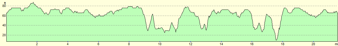
For more information on profiles, ascents and descents, see this page
 |
 |
|
 |
 |
|
 |
 |
|
 |
 |
|
 |
 |
|
 |
 |
|
 |
 |
|
 |
 |
|
 |
 |
|
 |
 |
|
 |
Disclaimer
Please note that I take no responsibility for anything that may happen when following these directions. If you intend to follow this route, then please use the relevant maps and check the route out before you go out. As always when walking, use common sense and you should be fine.
If you find any information on any of these routes that is inaccurate, or you wish to add anything, then please email me.
All images on this site are © of the author. Any reproduction, retransmissions, or republication of all or part of any document found on this site is expressly prohibited, unless the author has explicitly granted its prior written consent to so reproduce, retransmit, or republish the material. All other rights reserved.
Although this site includes links providing convenient direct access to other Internet sites, I do not endorse, approve, certify or make warranties or representations as to the accuracy of the information on these sites.
And finally, enjoy your walking!
Nearby walks
| # | Title | Walk length (miles) |
|---|---|---|
| 131 | Ipswich to Wickham Market Station | 16.7 |
| 132 | Wickham Market Station to Darsham Station | 12.7 |
| 260 | Southwold to Aldeburgh | 18.0 |
|
|

|