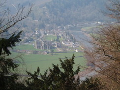
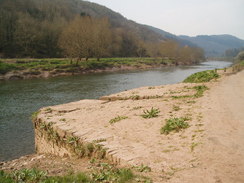
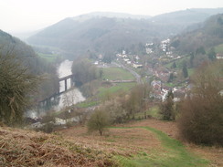
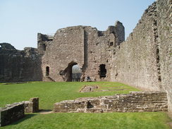
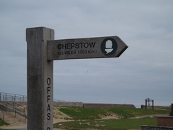
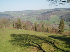
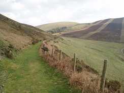
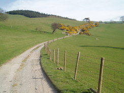
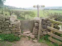
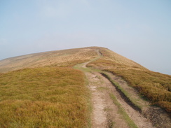
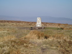
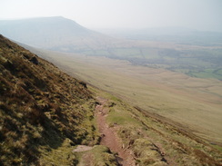
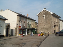
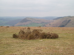
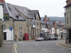
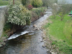
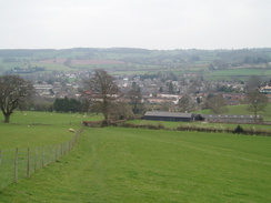
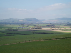
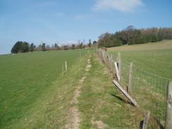
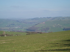
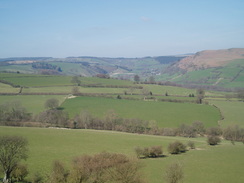
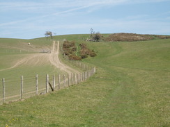
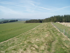
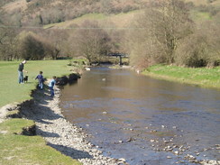
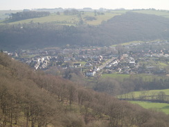
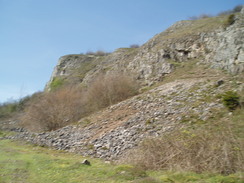
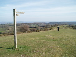
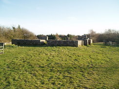
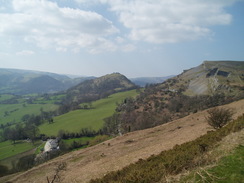
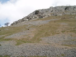
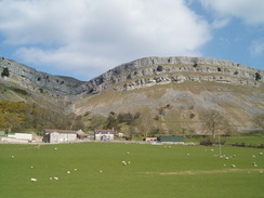
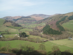
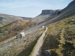
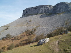
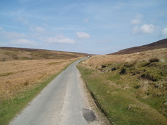
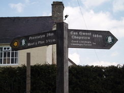
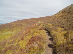
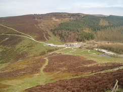
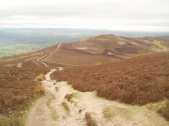
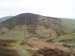
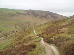
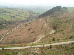
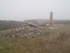
Home  1999-2001  2002-3  2004-6  2007-9  2010-17  2018  2019  2020
 Coastwalk  LE-JOG  Counties  Random Search within km of
Hiking in Britain

Offa's Dyke

Background

Offa's Dyke is a superb National Trail that threads its way along the English / Welsh border from Chepstow in the south to Prestatyn in the north. The terrain it crosses is rarely flat, and this makes for a strenuous walk, but one that gives great highs and lows as it frequently crosses the border between the two countries.

The trail is named after the Saxon King Offa, who ruled the Kingdom of Mercia from 757 to 796. The exact purpose of the dyke is unknown, but it is believed to possibly be a defensive barrier to protect Mercia's western reaches from the Welsh tribes. The exact extant of the dyke is also unknown, and although the trail follows it for long distances there are other areas, particularly in the north and south of Kington, where it will not be seen.

Although it is a fairly strenuous walk it is rarely remote, and there are few if any technical sections when compared to, for instance, the Pennine Way. The scenery is nearly always good, and accommodation is available over almost all of the route.


P20074020021	Heading north past Hatterrall Hill.
     
P20074050381	The steep climb up north from Churchtown.
P20074020021 Heading north past Hatterrall Hill.
     
P20074050381 The steep climb up north from Churchtown.


The walk statistics:

Planned Completed To do Percentage completed
Distance 183.3 miles183.3 miles0 miles100 %
Legs 11 11 0 100 %


Total duration of walk 3 days, 18 hours and 42 minutes
Stopped time 9 hours and 9 minutes
Shortest completed leg Bodfari to Prestatyn Station at 12.7 miles
Longest completed leg Spoad Hill to Buttington Bridge at 21.7 miles
Average distance per leg 16.66 miles


The walk in full:

No.From To Distance Status
1 Sedbury Cliffs Monmouth 20 Completed
2 Monmouth Pandy 16.4 Completed
3 Pandy Hay-on-Wye 16.4 Completed
4 Hay-on-Wye Kington 14.7 Completed
5 Kington Spoad Hill 20.4 Completed
6 Spoad Hill Buttington Bridge 21.7 Completed
7 Buttington Bridge Carreg-y-Big 21 Completed
8 Carreg-y-Big Dinbren-uchaf 13.4 Completed
9 Dinbren-uchaf Clwyd Gate 13.6 Completed
10 Clwyd Gate Bodfari 13 Completed
11 Bodfari Prestatyn Station 12.7 Completed


Directions

The walk is covered in detail in the Offa's Dyke National Trail Guide South (Chepstow to Knighton), by Ernie and Kathy Kay, and Mark Richards, ISBN 1-84513-274-2 published by Aurum Press Ltd. Click on the image to the right to go to the Amazon page for the book.

cover

The walk is covered in detail in the Offa's Dyke National Trail Guide North (Knighton to Prestatyn), by Ernie and Kathy Kay, and Mark Richards, ISBN 1-84510-976-6 published by Aurum Press Ltd. Click on the image to the right to go to the Amazon page for the book.

cover

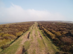
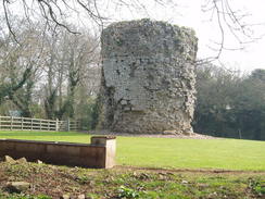
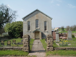
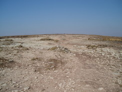
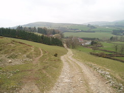
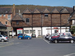
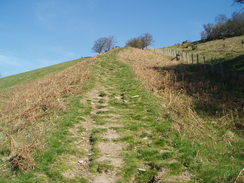
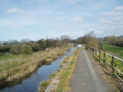
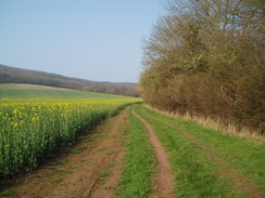
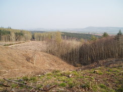
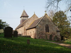
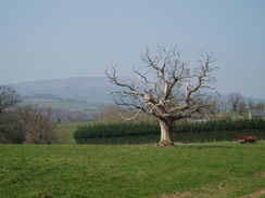
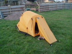
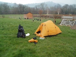
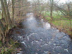
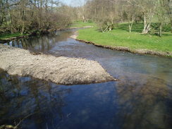
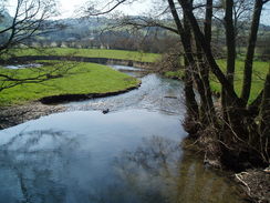
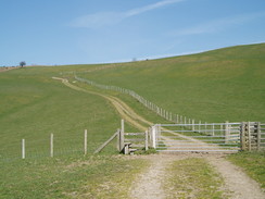
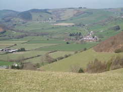
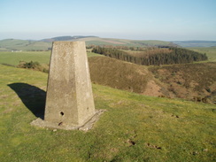
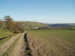
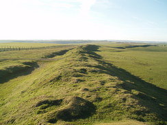
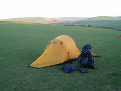
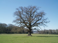
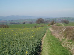
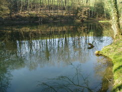
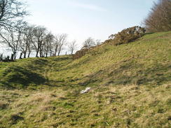
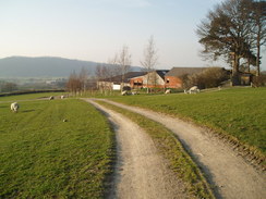
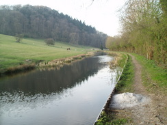
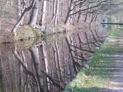
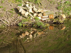
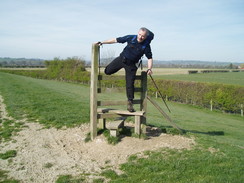
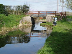
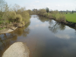
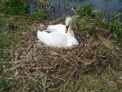
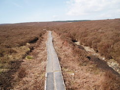
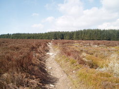
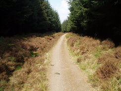
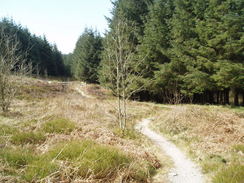
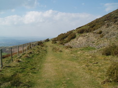
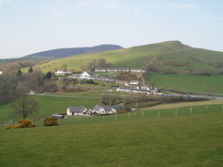
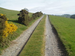
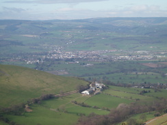
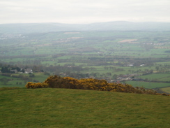
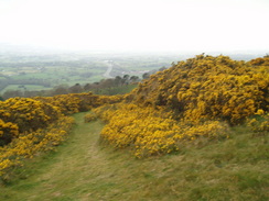
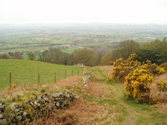
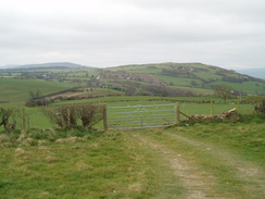
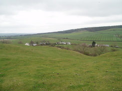
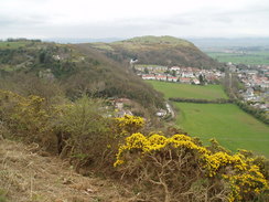
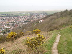
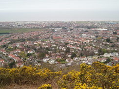
More Offa's Dyke photos


P20073310002	The stone marking the start of Offa's Dyke path on Sedbury Cliffs.
     
P20073310009	Tutshill Tower.
P20073310002 The stone marking the start of Offa's Dyke path on Sedbury Cliffs.
     
P20073310009 Tutshill Tower.


P20073310015	A bend in the River Wye from Wintour's Leap.
     
P20073310024	Looking down over Tintern Abbey.
P20073310015 A bend in the River Wye from Wintour's Leap.
     
P20073310024 Looking down over Tintern Abbey.


P20073310032	The River Wye at Brockweir.
     
P20073310048	The descent down into Redbrook.
P20073310032 The River Wye at Brockweir.
     
P20073310048 The descent down into Redbrook.


P20073310058	The Round House on the Kymin.
     
P20073310071	The bridge over the River Wye in Monmouth.
P20073310058 The Round House on the Kymin.
     
P20073310071 The bridge over the River Wye in Monmouth.


P20073310081	The Monmow Bridge in Monmouth.
     
P20073310084	My tent in the campsite in Monmouth.
P20073310081 The Monmow Bridge in Monmouth.
     
P20073310084 My tent in the campsite in Monmouth.


P20074010088	The Monmow Bridge in Monmouth.
     
P20074010091	Heading west towards Whitehill Wood.
P20074010088 The Monmow Bridge in Monmouth.
     
P20074010091 Heading west towards Whitehill Wood.


P20074010094	A clearing in Whitehill Wood.
     
P20074010099	St Michael's of the Fiery Meteor church.
P20074010094 A clearing in Whitehill Wood.
     
P20074010099 St Michael's of the Fiery Meteor church.


P20074010106	Fields to the west of Llantilio Crossenny.
     
P20074010115	White Castle.
P20074010106 Fields to the west of Llantilio Crossenny.
     
P20074010115 White Castle.


P20074010131	A chapel at Caggle Street.
     
P20074010146	My tent at the campsite in Pandy.
P20074010131 A chapel at Caggle Street.
     
P20074010146 My tent at the campsite in Pandy.


P20074020001	My tent at the campsite in Pandy.
     
P20074020002	The River Honddu in Pandy.
P20074020001 My tent at the campsite in Pandy.
     
P20074020002 The River Honddu in Pandy.


P20074020033	Heading north along the Black Mountain.
     
P20074020046	The 610-metre trig pillar.
P20074020033 Heading north along the Black Mountain.
     
P20074020046 The 610-metre trig pillar.


P20074020061	The path across the summit of Black Mountain.
     
P20074020078	The descent down from Hay Bluff.
P20074020061 The path across the summit of Black Mountain.
     
P20074020078 The descent down from Hay Bluff.


P20074020102	Hay-on-Wye.
     
P20074030114	The River Wye in Hay-on-Wye.
P20074020102 Hay-on-Wye.
     
P20074030114 The River Wye in Hay-on-Wye.


P20074030136	The descent down towards Newchurch.
     
P20074030137	The church at Newchurch.
P20074030136 The descent down towards Newchurch.
     
P20074030137 The church at Newchurch.


P20074030156	Gladestry Brook.
     
P20074030167	A pond on the Hergest Ridge.
P20074030156 Gladestry Brook.
     
P20074030167 A pond on the Hergest Ridge.


P20074030176	The descent from the Hergest Ridge.
     
P20074030184	Kington.
P20074030176 The descent from the Hergest Ridge.
     
P20074030184 Kington.


P20074040193	Back Brook in Kington.
     
P20074040195	Looking back south over Kington.
P20074040193 Back Brook in Kington.
     
P20074040195 Looking back south over Kington.


P20074040206	Offa's Dyke on Rushock Hill.
     
P20074040213	The descent down towards Herrock Hill.
P20074040206 Offa's Dyke on Rushock Hill.
     
P20074040213 The descent down towards Herrock Hill.


P20074040219	Ditchyeld Bridge.
     
P20074040221	The view west over the Radnor Valley.
P20074040219 Ditchyeld Bridge.
     
P20074040221 The view west over the Radnor Valley.


P20074040227	The view west over the Radnor Valley.
     
P20074040231	Offa's Dyke climbing onto Evenjobb Hill.
P20074040227 The view west over the Radnor Valley.
     
P20074040231 Offa's Dyke climbing onto Evenjobb Hill.


P20074040234	The view from near Hilltop Plantation.
     
P20074040239	The descent down towards Dolley Green.
P20074040234 The view from near Hilltop Plantation.
     
P20074040239 The descent down towards Dolley Green.


P20074040248	The River Lugg near Dolley Green.
     
P20074040250	The River Lugg near Dolley Green.
P20074040248 The River Lugg near Dolley Green.
     
P20074040250 The River Lugg near Dolley Green.


P20074040253	The ascent up from Dolley Green.
     
P20074040259	Heading north from Hawthorn Hill.
P20074040253 The ascent up from Dolley Green.
     
P20074040259 Heading north from Hawthorn Hill.


P20074040262	Heading north towards Hawthorn Hill.
     
P20074040269	Offa's Dyke on Hawthorn Hill.
P20074040262 Heading north towards Hawthorn Hill.
     
P20074040269 Offa's Dyke on Hawthorn Hill.


P20074040281	Knighton.
     
P20074040297	The River Teme in Knighton.
P20074040281 Knighton.
     
P20074040297 The River Teme in Knighton.


P20074040304	Looking back over Knighton from Panpunton Hill.
     
P20074040319	The trig pillar on Cwm-sanaham Hill.
P20074040304 Looking back over Knighton from Panpunton Hill.
     
P20074040319 The trig pillar on Cwm-sanaham Hill.


P20074040328	The ascent north from Garbett Hall.
     
P20074040333	Heading north along Offa's Dyke towards Llanfair Hill.
P20074040328 The ascent north from Garbett Hall.
     
P20074040333 Heading north along Offa's Dyke towards Llanfair Hill.


P20074040346	My tent on Spoad Hill.
     
P20074050354	Packing up my tent for the day.
P20074040346 My tent on Spoad Hill.
     
P20074050354 Packing up my tent for the day.


P20074050362	The River Clun.
     
P20074050365	Looking west over Newcastle.
P20074050362 The River Clun.
     
P20074050365 Looking west over Newcastle.


P20074050380	The steep climb up north from Churchtown.
     
P20074050408	Heading north from Brompton alongside Offa's Dyke.
P20074050380 The steep climb up north from Churchtown.
     
P20074050408 Heading north from Brompton alongside Offa's Dyke.


P20074050409	Heading north from Brompton alongside Offa's Dyke.
     
P20074050429	A pond on the Leighton Estate.
P20074050409 Heading north from Brompton alongside Offa's Dyke.
     
P20074050429 A pond on the Leighton Estate.


P20074050434	Ramparts at Beacon Ring.
     
P20074050450	The descent down to Buttington.
P20074050434 Ramparts at Beacon Ring.
     
P20074050450 The descent down to Buttington.


P20074050458	The Montgomery Canal in Buttington.
     
P20074060464	Heading north along the Montgomery Canal towards South Pool.
P20074050458 The Montgomery Canal in Buttington.
     
P20074060464 Heading north along the Montgomery Canal towards South Pool.


P20074060467	Heading north along the Montgomery Canal towards South Pool.
     
P20074060487	Gary crossing a stile across nowhere.
P20074060467 Heading north along the Montgomery Canal towards South Pool.
     
P20074060487 Gary crossing a stile across nowhere.


P20074060503	Following the canal towards the Vyrnwy Aqueduct.
     
P20074060510	The River Vyrnwy viewed from the Aqueduct.
P20074060503 Following the canal towards the Vyrnwy Aqueduct.
     
P20074060510 The River Vyrnwy viewed from the Aqueduct.


P20074060511	The Vyrnwy Aqueduct.
     
P20074060520	Swans by the canal.
P20074060511 The Vyrnwy Aqueduct.
     
P20074060520 Swans by the canal.


P20074060529	Llanymynech Hill.
     
P20074060548	The summit of Moelydd.
P20074060529 Llanymynech Hill.
     
P20074060548 The summit of Moelydd.


P20074060566	The old grandstand at Oswestry Racecourse.
     
P20074070004	A new-born lamb.
P20074060566 The old grandstand at Oswestry Racecourse.
     
P20074070004 A new-born lamb.


P20074070009	The track past Selattyn Hill.
     
P20074070021	Looking east from the descent down to Chirk Castle.
P20074070009 The track past Selattyn Hill.
     
P20074070021 Looking east from the descent down to Chirk Castle.


P20074070037	The Wrexham line railway viaduct.
     
P20074070044	Looking along the Pont Cysyllte aqueduct.
P20074070037 The Wrexham line railway viaduct.
     
P20074070044 Looking along the Pont Cysyllte aqueduct.


P20074070050	The River Dee viewed from the Pont Cysyllte aqueduct.
     
P20074070069	Castell Dinas Bran viewed from the Panorama Walk.
P20074070050 The River Dee viewed from the Pont Cysyllte aqueduct.
     
P20074070069 Castell Dinas Bran viewed from the Panorama Walk.


P20074070076	A view from the Panorama Walk.
     
P20074070078	Gary on the Panorama Walk.
P20074070076 A view from the Panorama Walk.
     
P20074070078 Gary on the Panorama Walk.


P20074070081	Crags viewed from the Panorama Walk.
     
P20074070094	The River Dee in Llangollen.
P20074070081 Crags viewed from the Panorama Walk.
     
P20074070094 The River Dee in Llangollen.


P20074080095	The marina at Llangollen.
     
P20074080102	Eglwyseg Crags.
P20074080095 The marina at Llangollen.
     
P20074080102 Eglwyseg Crags.


P20074080103	The path heading towards World's End.
     
P20074080108	Looking back up the valley.
P20074080103 The path heading towards World's End.
     
P20074080108 Looking back up the valley.


P20074080112	The path heading towards World's End.
     
P20074080116	The path heading towards World's End.
P20074080112 The path heading towards World's End.
     
P20074080116 The path heading towards World's End.


P20074080127	The road climbing north from World's End.
     
P20074080134	The causey heading towards the woodland.
P20074080127 The road climbing north from World's End.
     
P20074080134 The causey heading towards the woodland.


P20074080139	The path heading towards the woodland.
     
P20074080141	Looking down the path through the forest.
P20074080139 The path heading towards the woodland.
     
P20074080141 Looking down the path through the forest.


P20074080143	Looking down the path through the forest.
     
P20074080007	Prestatyn 29 miles!
P20074080143 Looking down the path through the forest.
     
P20074080007 Prestatyn 29 miles!


P20074080008	The River Alun to the north of Llandegla.
     
P20074080016	Heading west from the farm at Chweleiriog.
P20074080008 The River Alun to the north of Llandegla.
     
P20074080016 Heading west from the farm at Chweleiriog.


P20074080026	Looking south from the climb up onto Moel y Plas.
     
P20074080032	The track around the western flank of Moel Llanfair.
P20074080026 Looking south from the climb up onto Moel y Plas.
     
P20074080032 The track around the western flank of Moel Llanfair.


P20074080034	The track around the western flank of Moel Llanfair.
     
P20074080049	Looking down towards Clwyd Gate.
P20074080034 The track around the western flank of Moel Llanfair.
     
P20074080049 Looking down towards Clwyd Gate.


P20074090054	Looking northeastwards along the track heading past Gyrn.
     
P20074090055	Looking northeastwards along the track heading past Gyrn.
P20074090054 Looking northeastwards along the track heading past Gyrn.
     
P20074090055 Looking northeastwards along the track heading past Gyrn.


P20074090064	The view from Foel Famau.
     
P20074090069	The path along the western flank of Foel Famau.
P20074090064 The view from Foel Famau.
     
P20074090069 The path along the western flank of Foel Famau.


P20074090078	Looking north towards the car park at Bwlch Penbarra.
     
P20074090101	The trig pillar on Moel Fammau, with the Jubilee Tower behind.
P20074090078 Looking north towards the car park at Bwlch Penbarra.
     
P20074090101 The trig pillar on Moel Fammau, with the Jubilee Tower behind.


P20074090109	Looking down the descent from Moel Fammau.
     
P20074090124	Looking over towards Moel Arthur.
P20074090109 Looking down the descent from Moel Fammau.
     
P20074090124 Looking over towards Moel Arthur.


P20074090130	The path along the flank of Moel Arthur.
     
P20074090139	Looking towards Llangwyfan from the climb up towards Penycloddiau.
P20074090130 The path along the flank of Moel Arthur.
     
P20074090139 Looking towards Llangwyfan from the climb up towards Penycloddiau.


P20074090149	The path across Penycloddiau.
     
P20074090160	A gorse-covered field.
P20074090149 The path across Penycloddiau.
     
P20074090160 A gorse-covered field.


P20074090165	The River Wheeler in Bodfari.
     
P20074090171	The view south from the climb up to Sodom.
P20074090165 The River Wheeler in Bodfari.
     
P20074090171 The view south from the climb up to Sodom.


P20074090181	My tent at Fron Haul.
     
P20074100196	Looking down from the flank of Moel Maenefa.
P20074090181 My tent at Fron Haul.
     
P20074100196 Looking down from the flank of Moel Maenefa.


P20074100198	The descent down from the flank of Moel Maenefa.
     
P20074100209	The path leading past Pen-y-mynydd.
P20074100198 The descent down from the flank of Moel Maenefa.
     
P20074100209 The path leading past Pen-y-mynydd.


P20074100213	The path leading past Pen-y-mynydd.
     
P20074100220	The path up onto Marian FFrith.
P20074100213 The path leading past Pen-y-mynydd.
     
P20074100220 The path up onto Marian FFrith.


P20074100225	A stone stile on the descent from Marian FFrith.
     
P20074100239	Prestatyn Hillside.
P20074100225 A stone stile on the descent from Marian FFrith.
     
P20074100239 Prestatyn Hillside.


P20074100253	The path over Prestatyn Hillside.
     
P20074100254	Looking down over Prestatyn.
P20074100253 The path over Prestatyn Hillside.
     
P20074100254 Looking down over Prestatyn.


P20074100269	The signpost at the end of Offa's Dyke at Prestatyn Seafront.
     
P20074100274	Wetting my boots in the sea at Prestatyn beach.
P20074100269 The signpost at the end of Offa's Dyke at Prestatyn Seafront.
     
P20074100274 Wetting my boots in the sea at Prestatyn beach.

Back to walks index Back to walks index  Back to National Trails index Back to National Trails index 


Please visit my ramblings blog at: https://walkerramblings.blogspot.com/


Hosted by Spellings.net