Home  1999-2001  2002-3  2004-6  2007-9  2010-17  2018  2019  2020
 Coastwalk  LE-JOG  Counties  Random Search within km of
Hiking in Britain

The Great Outdoors Challenge 2005

Background

The Great Outdoors (TGO) Challenge is a challenge backpacking walk across Scotland, starting in one of twelve locations on the west coast and walking across to anywhere on the east coast between Fraserburgh and Arbroath. In 2004 I applied for the second time, and I was relieved to discover in October that my application had been successful.

2005 was the 26th year that the Challenge has been held. For full information on the TGO Challenge see their website, or look at The Great Outdoors magazine website.

The map.


P20055065551	The Waverley in Kyle.
     
P20055065552	The Skye Bridge.
P20055065551 The Waverley in Kyle.
     
P20055065552 The Skye Bridge.

Prologue, 05/05/2005

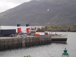
Rain was lashing down as the train pulled into Kyle of Lochalsh, exactly twelve hours to the minute from when I had set off from my home Great Shelford. The rain was a welcome sign, as when I had last been here on my coastal walk I had arrived in a torrential downpour. The thoughts gave me sad memories of good times with Sam, and so I tried to think of happier thoughts as I strode along the road to the Kyle Hotel, my pack feeling light on my shoulders (how long will that last, I wonder?)

The journey up to Kyle had been long and varied; a bus from Great Shelford to Cambridge Station that took over double the usual time due to rush-hour traffic and left me with a couple of minues to get the train to Stevenage. Mike, who was due to due the TGO with me but had had to pull out, drove me from Stevenage to Luton Airport, where I caught a flight to Inverness. Coincendentally I eneded up sitting next to another TGO'er, Tony Pugh, and he helped the 75 minute flight literally fly by. We ended up catching a taxi into the centre of Inverness with another couple of TGO'ers who were on the flight (at a cost of three pounds each), which was quite nice, although a squeeze with the four rucksacks as well!

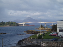
I had to wait for about three hours in Inverness for the Kyle train, and I spent the time by having a pint in a pub by the station (which was not serving food) and then wandering through the quiet city, failing in vain to find a pub that was serving food. I eventually settled into a Bella Italia where I had a nice pizza whilst chatting to the waitress. Being in Inverness was making me feel sad, as I remembered well walking through the town with Sam duringa rare day off on my coastal walk. They were sad memories of happy times, and rather than dwell on them I read the copy of Time magazine that I had not had the chance to read on the plane. I made my way to the railway station early, only to find a group of other TGO'ers waiting, their rucksacks sitting on the red circular metal bench. They seemed a nice crowd, and we chatted on the train all the way to Strathcarron, where they got off the train as they were all starting from there. My starting point is fairly unique as I will have to walk for eleven miles to reach one of the official starting points at the Duich Hotel in Dornie.

Naturally I am very much looking forward to the walk, which I have been planning for some time, and I can hardly wait for it to start tomorrow. I am hoping that my pack is not too heavy and that I will manage the walk with few problems. Excitement and adventure lies ahead.


P20055065573	The path heading east from Reraig.
     
P20055065584	Eilean Donan Castle.
P20055065573 The path heading east from Reraig.
     
P20055065584 Eilean Donan Castle.


The walk statistics:

Planned Completed To do Percentage completed
Distance 193 miles193 miles0 miles100 %
Legs 12 12 0 100 %


Total duration of walk 3 days, 11 hours and 54 minutes
Stopped time 6 hours and 58 minutes
Shortest completed leg Torgyle Bridge to Fort Augustus at 7.1 miles
Longest completed leg Fort Augustus to Monadhliath Hotel at 24.1 miles
Average distance per leg 16.08 miles


P20055065595	Loch Long.
     
P20055065599	The River Glennan at Bundalloch.
P20055065595 Loch Long.
     
P20055065599 The River Glennan at Bundalloch.


P20055065608	The path heading uphill eastwards alongside the River Glennan.
     
P20055065618	The top of Glen Glennan.
P20055065608 The path heading uphill eastwards alongside the River Glennan.
     
P20055065618 The top of Glen Glennan.


The walk in full:

No.From To Distance Status
1 Kyle of Lochalsh Camas-luinie 15.6 Completed
2 Camas-luinie Alltbeithe 15.6 Completed
3 Alltbeithe Torgyle Bridge 19.1 Completed
4 Torgyle Bridge Fort Augustus 7.1 Completed
5 Fort Augustus Monadhliath Hotel 24.1 Completed
6 Monadhliath Hotel Kingussie 13.9 Completed
7 Kingussie Aviemore 15.1 Completed
8 Aviemore Derry Lodge 18 Completed
9 Derry Lodge Braemar 8.9 Completed
10 Braemar Clova 18.2 Completed
11 Clova Brechin 24.1 Completed
12 Brechin Montrose 13.3 Completed


P20055065624	Looking down over Camas-luinie.
     
P20055075628	A stream in Camas-luinie.
P20055065624 Looking down over Camas-luinie.
     
P20055075628 A stream in Camas-luinie.


Epilogue, 28/05/2005

Well, the trip is over, and now, over a week from the end, I can look back on what was a very enjoyable trip with some sense of perspective. The trip was very different to my expectatins when I set off; the most surprising (and enjoyable) aspect of the walk was the way that ther were so many walked doing similar things; I am very much used to walking on my own, and meeting up with other walkers virtually every day was a marvellous experience, and in many ways made the trip even more memorable.

I would have preferred to have stuck to my original route over the Mondhaliath Mountains, and am slightly annoyed at having taken a easier route via the Corrieyarack Pass. However, given the circumstances, I think that I did the right thing. Aside from that I pretty much stuck to my planned route.

So will I do another TGO Challenge? I think that the answer to this is a yes, but it may not be for another few years. It is hard for me to get two week chunks off work, and there are other walks that I want to do, such as the Southern Upland Way and Offa's Dyke, which will take the majority of my holiday allotment. But do I see myself hoisting my rucksack onto my back on the west coast and walking over towards Montrose? Yes, certainly. I will be back.


P20055075644	Highland Cows in Glen Elchaig.
     
P20055075649	Glen Elchaig.
P20055075644 Highland Cows in Glen Elchaig.
     
P20055075649 Glen Elchaig.

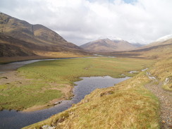
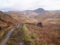
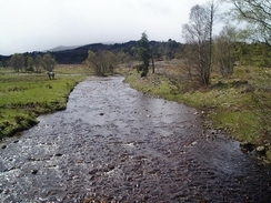
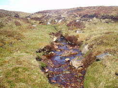
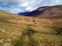
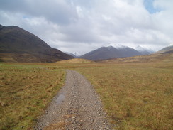
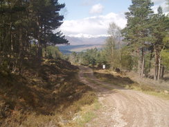
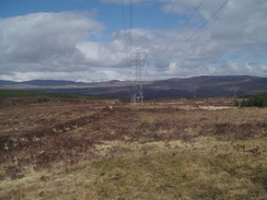
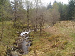
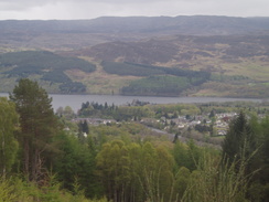
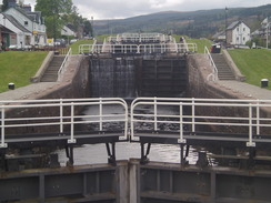
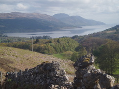
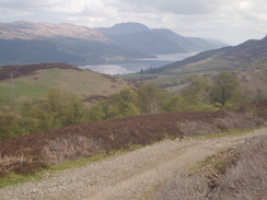
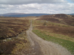
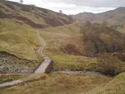
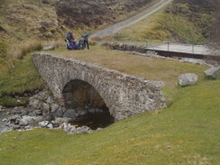
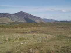
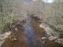
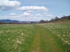
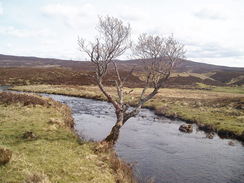
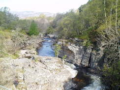
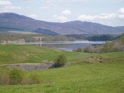
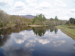
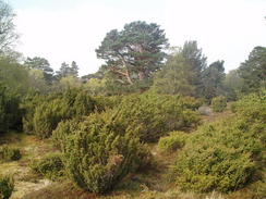
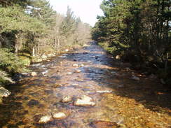
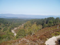
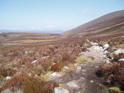
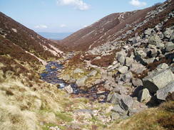
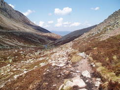
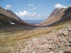
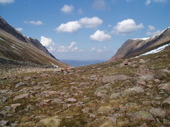
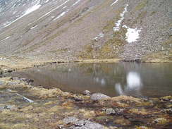
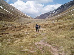
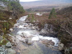
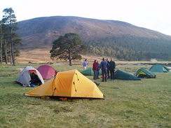
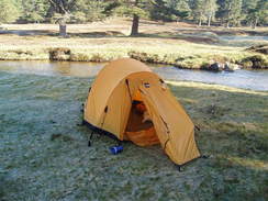
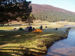
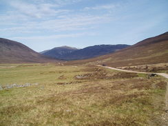
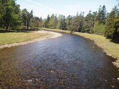
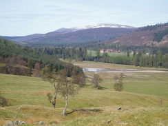
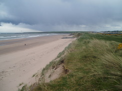
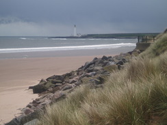
More TGO 2005 photos


P20055075655	Loch na Leitreach.
     
P20055075661	Looking back into Glen Elchaig from the climb uphill.
P20055075655 Loch na Leitreach.
     
P20055075661 Looking back into Glen Elchaig from the climb uphill.


P20055085704	Heading eastwards down Glen Affric.
     
P20055085726	The Allt Garbh.
P20055085704 Heading eastwards down Glen Affric.
     
P20055085726 The Allt Garbh.


P20055085733	The track heading eastwards towards Cougie.
     
P20055085745	The Allt Riabhach at Cougie.
P20055085733 The track heading eastwards towards Cougie.
     
P20055085745 The Allt Riabhach at Cougie.


P20055085759	Heading southeastwards across the moorland.
     
P20055085764	Heading southeastwards across the moorland.
P20055085759 Heading southeastwards across the moorland.
     
P20055085764 Heading southeastwards across the moorland.


P20055085777	Cutting downhill alongside the pylons.
     
P20055095785	The River Moriston at Torgyle Bridge.
P20055085777 Cutting downhill alongside the pylons.
     
P20055095785 The River Moriston at Torgyle Bridge.


P20055075672	Crossing the Allt Coire-lochain.
     
P20055075687	Heading east along Gleann Gnoimhaidh.
P20055075672 Crossing the Allt Coire-lochain.
     
P20055075687 Heading east along Gleann Gnoimhaidh.


P20055075688	Heading east along Gleann Gnoimhaidh.
     
P20055085703	Heading eastwards down Glen Affric.
P20055075688 Heading east along Gleann Gnoimhaidh.
     
P20055085703 Heading eastwards down Glen Affric.


P20055095793	The track heading uphill.
     
P20055095804	Looking down the pylons.
P20055095793 The track heading uphill.
     
P20055095804 Looking down the pylons.


P20055095810	A stream in the Inchnacardoch Forest.
     
P20055095816	Looking down over Fort Augustus.
P20055095810 A stream in the Inchnacardoch Forest.
     
P20055095816 Looking down over Fort Augustus.


P20055095828	The flight of locks in Fort Augustus.
     
P20055105841	The River Tarff
P20055095828 The flight of locks in Fort Augustus.
     
P20055105841 The River Tarff


P20055105853	Looking north towards Loch Ness from the military road.
     
P20055105860	Looking back over Loch Ness from the northern zig-zags.
P20055105853 Looking north towards Loch Ness from the military road.
     
P20055105860 Looking back over Loch Ness from the northern zig-zags.


P20055105866	The track leading south towards Blackburn Bothy.
     
P20055105880	The bridge over the Allt Lagan a' Bhainne.
P20055105866 The track leading south towards Blackburn Bothy.
     
P20055105880 The bridge over the Allt Lagan a' Bhainne.


P20055105883	General Wade's bridge over the Alt Coire Uchdachan.
     
P20055105889	Looking back down the military road.
P20055105883 General Wade's bridge over the Alt Coire Uchdachan.
     
P20055105889 Looking back down the military road.


P20055105917	A restored stretch of the military road.
     
P20055105947	The feeder supply for the loch.
P20055105917 A restored stretch of the military road.
     
P20055105947 The feeder supply for the loch.


P20055115960	The old church outside the Monadhliath Hotel.
     
P20055115972	Looking across the moorland.
P20055115960 The old church outside the Monadhliath Hotel.
     
P20055115972 Looking across the moorland.


P20055115978	The River Truim.
     
P20055115988	The track heading northeastwards from Phones.
P20055115978 The River Truim.
     
P20055115988 The track heading northeastwards from Phones.


P20055115997	A stream near Loch an Dabhaich.
     
P20055116011	Looking northeastwards over the Spey towards Kingussie.
P20055115997 A stream near Loch an Dabhaich.
     
P20055116011 Looking northeastwards over the Spey towards Kingussie.


P20055116015	Ruthven Barracks.
     
P20055116017	The River Spey near Kingussie.
P20055116015 Ruthven Barracks.
     
P20055116017 The River Spey near Kingussie.


P20055126024	Kingussie.
     
P20055126053	Ruthven Barracks.
P20055126024 Kingussie.
     
P20055126053 Ruthven Barracks.


P20055126059	The River Tromie at Tromie Bridge.
     
P20055126065	Looking towards Loch Insh.
P20055126059 The River Tromie at Tromie Bridge.
     
P20055126065 Looking towards Loch Insh.


P20055126071	The River Spey in Kincraig.
     
P20055126088	Aviemore.
P20055126071 The River Spey in Kincraig.
     
P20055126088 Aviemore.


P20055136101	Rothiemurchus Forest.
     
P20055136117	The river at the Cairngorm Club Footbridge.
P20055136101 Rothiemurchus Forest.
     
P20055136117 The river at the Cairngorm Club Footbridge.


P20055136142	Looking north back along the track.
     
P20055136156	The path into the Lairig Ghru.
P20055136142 Looking north back along the track.
     
P20055136156 The path into the Lairig Ghru.


P20055136163	The path into the Lairig Ghru.
     
P20055136171	The Lairig Ghru.
P20055136163 The path into the Lairig Ghru.
     
P20055136171 The Lairig Ghru.


P20055136183	The Lairig Ghru.
     
P20055136194	The top of the Lairig Ghru.
P20055136183 The Lairig Ghru.
     
P20055136194 The top of the Lairig Ghru.


P20055136207	One of the Pools of Dee.
     
P20055136210	Heading south out of the Lairig Ghru.
P20055136207 One of the Pools of Dee.
     
P20055136210 Heading south out of the Lairig Ghru.


P20055136254	The Luibeg Burn.
     
P20055136257	The Luibeg Burn by the bridge.
P20055136254 The Luibeg Burn.
     
P20055136257 The Luibeg Burn by the bridge.


P20055136282	Tents at Derry Lodge.
     
P20055146292	My tent at Derry Lodge.
P20055136282 Tents at Derry Lodge.
     
P20055146292 My tent at Derry Lodge.


P20055146294	My tent at Derry Lodge.
     
P20055146301	Glen Lui.
P20055146294 My tent at Derry Lodge.
     
P20055146301 Glen Lui.


P20055146305	The track leading down Glen Lui.
     
P20055146315	The River Dee from Victoria Bridge.
P20055146305 The track leading down Glen Lui.
     
P20055146315 The River Dee from Victoria Bridge.


P20055146322	Looking down over the Dee Valley.
     
P20055146325	Looking down over the Dee Valley.
P20055146322 Looking down over the Dee Valley.
     
P20055146325 Looking down over the Dee Valley.


P20055146326	Looking down over the Dee Valley.
     
P20055156348	Views across the valley from the A93.
P20055146326 Looking down over the Dee Valley.
     
P20055156348 Views across the valley from the A93.


P20055156378	Loch Callater.
     
P20055156381	Loch Callater.
P20055156378 Loch Callater.
     
P20055156381 Loch Callater.


P20055156392	The path up Glen Callater.
     
P20055156423	Looking down Glen Callater.
P20055156392 The path up Glen Callater.
     
P20055156423 Looking down Glen Callater.


P20055156431	Looking down Glen Callater.
     
P20055156441	The Knaps of Fafernie.
P20055156431 Looking down Glen Callater.
     
P20055156441 The Knaps of Fafernie.


P20055156453	The view from Crow Craigies.
     
P20055156471	Heading southeastwards from Crow Craigies.
P20055156453 The view from Crow Craigies.
     
P20055156471 Heading southeastwards from Crow Craigies.


P20055156498	Heading southeastwards down Jock's Road.
     
P20055156506	Heading southeastwards down Jock's Road.
P20055156498 Heading southeastwards down Jock's Road.
     
P20055156506 Heading southeastwards down Jock's Road.


P20055156522	A river in Glen Doll.
     
P20055166541	The River South Esk in Clova.
P20055156522 A river in Glen Doll.
     
P20055166541 The River South Esk in Clova.


P20055166542	The River South Esk in Clova.
     
P20055166551	The River South Esk.
P20055166542 The River South Esk in Clova.
     
P20055166551 The River South Esk.


P20055166585	A field of oil seed rape.
     
P20055166598	Findowrie trig pillar.
P20055166585 A field of oil seed rape.
     
P20055166598 Findowrie trig pillar.


P20055176623	Brechin.
     
P20055176650	Pitforthie trig pillar.
P20055176623 Brechin.
     
P20055176650 Pitforthie trig pillar.


P20055176664	The track heading east towards Kirkhill.
     
P20055176670	A farm at Langley park.
P20055176664 The track heading east towards Kirkhill.
     
P20055176670 A farm at Langley park.


P20055176680	The golf course in Montrose.
     
P20055176685	Montrose beach.
P20055176680 The golf course in Montrose.
     
P20055176685 Montrose beach.


P20055176685	Montrose beach.
     
P20055176697	Montrose beach, looking towards Scurdie Ness lighthouse.
P20055176685 Montrose beach.
     
P20055176697 Montrose beach, looking towards Scurdie Ness lighthouse.

Back to walks index Back to walks index  Back to long distance paths index Back to long distance paths index 


Please visit my ramblings blog at: https://walkerramblings.blogspot.com/


Hosted by Spellings.net