Walk #301: Pagham to West Itchenor
 |
 |
|
General Data
| Date Walked | 19/12/2002 |
| County | West Sussex |
| Start Location | Pagham |
| End Location | West Itchenor |
| Start time | 08.01 |
| End time | 15.14 |
| Distance | 19.4 miles |
| Description | This was a nice walk, passing Selsey Bill and then starting to head around the eastern edge of Chichester Harbour. |
| Pack | Today I carried my 30-litre Karrimor HotRock rucksack, which was filled with my packed lunch, waterproof leggings, water bottle and a couple of spare shirts, together with the usual assortment of odds and ends. |
| Condition | I felt very fatigued throughout this walk, and my legs felt leaden for most of the day, and this was particularly noticeable on the shingle section of beaches. I felt like stopping walking at East Wittering, but I forces myself to continue as I am attempting to get some large mileages completed to compensate for only having done ten miles on Sunday. |
| Weather | The weather today was mostly sunny with patchy cloud, but with a fierce, gusting wind that was most noticeable on the walk westwards to Selsey Bill. After this the landmass sheltered me from the worst of the wind and the walk became much easier. It was a fairly mild day and I was not cold, although I was wearing my fleece. |
| OS map | Landranger number 197 (Chichester & The South Downs, Bognor Regis & Arundel) |
 |
 |
|
 |
 |
|
Map of the walk
Maps courtesy of Google Maps. Route for indicative purposes only, and may have been plotted after the walk. Please let me have comments on what you think of this new format. For a detailed table of timings for this walk, please see the table file.
 |
 |
|
 |
 |
|
Notes
Pagham was the place where the Mulberry Harbour sections used in Operation Overlord were stored prior to the invasion. Fifty of the 6,000-ton structures were taken between Pagham Beach and Selsey between May 1944 and June 5th, and then sunk to hide them from the enemy. Apparently there is one that could not be raised again visible off the beach at low tide; I could not see it but there is another example I saw a few days earlier at Littlehampton near Dungeness. It is another sign of how much the south coast had been essential for the defence of Britain and also the recapture of Europe, and I find it amazing how much material there is still visible, from Mulberry Harbour sections and sound mirrors to pillboxes. Perhaps it would be nice of some of these were kept forever and not allowed to decay as a tribute to all the people in the country (not just the soldiers who had to go and fight) who worked together to win the war.
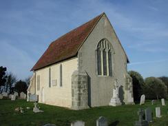
Everyone was very talkative today whilst I was walking, and I was often stopping to chat to people or to walk with people as I was walking. I have noticed that as I am slowly moving away from the influence of London people are getting more talkative and in a way more friendly; this may just be my imagination but it certainly appears to be the case. Outside St Wilfred's Chapel in Church Norton I met a gravedigger who I chatted to for ten minutes. He had lived in the area for all his life, and some of his family were buried in the graveyard. It was interesting chatting to him and seeing how the area and the people in it had changed over the years.
As I was waling around the western edge of Pagham Harbour and was approaching the B2145 road I came across a strange sort of pseudo-suspension bridge. This comprised of a large telegraph pole lying between the two banks and two cables dipping down on either side of it attached to the middle of the pole. There were no metal drop-ropes or handrails, and I was glad that I did not have to risk walking over the thing.
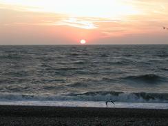
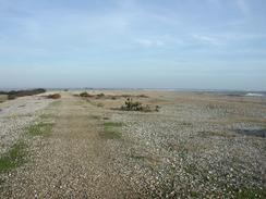
The sea was quite rough today, and the tide was high as I was passing through Selsey. These two factors combined to make it an interesting walk, with waves breaking over the sea wall and occasionally getting me wet. This was quite exciting in a way, and it was almost entrancing to watch the sea break on the shingle sea floor and then hit the sea wall. As soon as I got past Selsey Bill I was out of the prevailing wind and the sea became much calmer; indeed the difference between the two sides of Selsey was quite noticeable.
I am now two days away from having completed 25% of the walk, which is a major milestone on the walk This will be an early Christmas present for me, and one which I shall take an immense feeling of pride from. In a way it is quite overwhelming that I have walked so far and yet am not even a quarter of the way through, so it will be interesting in a couple of days time to see if I am elated or depressed about reaching that figure.
 |
Directions
This walk starts off at the seafront outside the yacht club in Pagham. Walk southwestwards along the seafront until just before the entrance to Pagham Harbour. Turn right and walk around the southwestern end of the lake and then continue on along a footpath that skirts the eastern edge of the harbour. When the footpath reaches a road to the west of Paagham Church continue straight on along another footpath past some houses before climbing up onto the top of a flood bank.
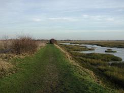
Turn left and walk westwards along the top of the flood bank. The bank turns sharply to the left; follow the bank as it does so. Shortly afterwards the bank turns to the left once more and the footpath continues along it and the edge of the harbour; however this footpath was shut when I walked this route so I had to turn right to head westwards along another footpath to Halsey's Farm. The path meets a road by the farm; turn left to head southwestwards down this road, passing the Crab and Lobster pub before skirting the harbour. Immediately beyond this and just before the road turns to the right turn to the left down a permissive bridleway, which follows the top of a flood bank until it approaches the B2145 road.
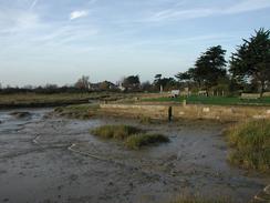
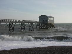
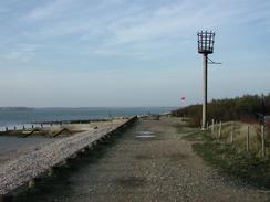
The path approaches the road but never joins it; instead it turns to the left to parallel it for a few yards before turning to the left once more. This footpath heads eastwards along the southern edge of the harbour before slowly turning around to head southeastwards and reaching the small Church at Church Norton. Go through the churchyard and then turn left along another footpath that joins the shoreline and follows it southwards. It soon leaves the harbour and joins the shingle beach beside the sea and heads through East Beach before eventually reaching the lifeboat station in Selsey.
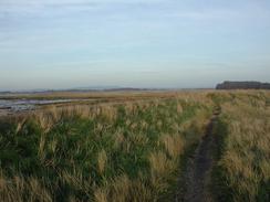
Continue on southwestwards, passing under the lifeboat station before reaching Selsey Bill. The beach starts to curve around to the right before heading northwestwards for about four miles to enter Bracklesham. It continues on through East Wittering and then on for another couple of miles until it reaches a spit called East Head. Do not go onto the spit but turn sharply to the right and follow a footpath that head northeastwards along the eastern shoreline of Chichester Harbour. The footpath passes Rookwood and continues on, slowly curving to head eastwards until it reaches the marina at West Itchenor. At the marina turn right down a track between buildings for a couple of hundred yards until a car park is reached, where this walk ends.
Distances
| From | To | Distance (m) | Ascent (ft) | Descent (ft) |
|---|---|---|---|---|
| Pagham | Selsey Bill | 8.5 | 89 | 89 |
| Selsey Bill | East Wittering | 5.1 | 85 | 85 |
| East Wittering | West Itchenor | 5.8 | 82 | 82 |
This makes a total distance of 19.4 miles, with 256 feet of ascent and 256 feet of descent.
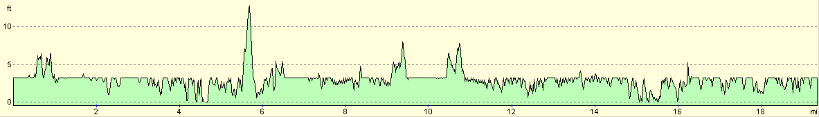
For more information on profiles, ascents and descents, see this page
Accommodation
We stayed at the Stubcroft Farm Camping and Caravan site in East Wittering, who can be contacted on 01243 671469. This was a nice little site with a powerful and hot shower. The site cost us nine pounds for one night, including electric hook-up.
Disclaimer
Please note that I take no responsibility for anything that may happen when following these directions. If you intend to follow this route, then please use the relevant maps and check the route out before you go out. As always when walking, use common sense and you should be fine.
If you find any information on any of these routes that is inaccurate, or you wish to add anything, then please email me.
All images on this site are © of the author. Any reproduction, retransmissions, or republication of all or part of any document found on this site is expressly prohibited, unless the author has explicitly granted its prior written consent to so reproduce, retransmit, or republish the material. All other rights reserved.
Although this site includes links providing convenient direct access to other Internet sites, I do not endorse, approve, certify or make warranties or representations as to the accuracy of the information on these sites.
And finally, enjoy your walking!
This walk was mentioned in the following routes:
| My walk around the coastline of Britain |
Nearby walks
| # | Title | Walk length (miles) |
|---|---|---|
| 300 | Worthing to Pagham | 18.7 |
| 302 | West Itchenor to Chidham | 14.9 |
| 303 | Chidham to Langstone | 16.0 |
|
|

|