Walk #722: A circular walk from Caxton to Abbotsley and Hilton
 |
 |
|
General Data
| Date Walked | 17/04/2006 |
| County | Cambridgeshire |
| Start Location | Caxton |
| End Location | Caxton |
| Start time | 09.14 |
| End time | 17.28 |
| Distance | 24.1 miles |
| Description | This was a long circular walk following roads and bridleways in west Cambridgeshire. |
| Pack | Today I carried my 30-litre Karrimor rucksack filled with my waterproofs, two litres of water, a book and various other odds and ends. |
| Condition | My right knee ached on a couple of occasions, but aside from this the largest problem that I had was with my feet, which were aching for the last few miles, although not as bad as the 23-mile walk I did a couple of weeks ago. |
| Weather | The day started off bright and sunny, and this allowed me to walk without my fleece on. There was a fair breeze, although this was not cold. As the day wore on the clouds started to gather, and the last half of the walk was a mixture of sunny periods and grey clouds. Some of these clouds threatened rain, and I could see rain falling in the distance, but fortunately I only encountered a couple of minutes of drizzle on two occasions. |
| OS map | Landranger number 153 (Bedford & Huntingdon, St Neots & Biggleswade) |
 |
 |
|
 |
 |
|
Map of the walk
Maps courtesy of Google Maps. Route for indicative purposes only, and may have been plotted after the walk. Please let me have comments on what you think of this new format. For a detailed table of timings for this walk, please see the table file.
 |
 |
|
 |
Notes
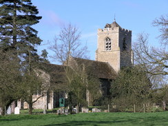
I had a desire to keep up the good run of long walks that I had done recently, but had no desire to get stuck in traffic on this Bank Holiday Monday. For this reason after looking at my map I decided to do a long walk near to my home in Cambridgeshire. The journey did not take me long, and I soon parked up in the village car park in Caxton, pleased to see that there was some bright sunshine overhead. It did not take me long to put all my kit together and shoulder my rucksack, which allowed me to start the walk along the road. This soon led me towards the church, which was very picturesque, and around a nasty bend in the road before I reached the start of a bridleway.
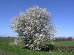
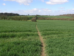
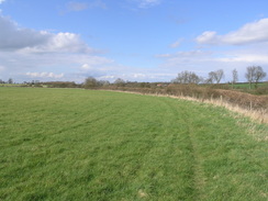
This was firm underfoot and the greens of the field contrasted well against the blue of the skies overhead as I strolled along towards Hardwicke Farm. Here there were some horse chestnut trees whose buds were just opening, making them look like an alien, unearthly shape. Another stretch of bridleway led on, and after passing a man who was walking a very inquisitive dog I reached a little industrial estate with HGV trailers parked outside. Soon afterwards I reached the village of Great Gransden, and I soon found myself standing at a mini-roundabout near the church. I was tempted to go and have a look at the church which was only a few yards away, but considering the distance that I still had to walk I decided not to, and headed on out of the village.
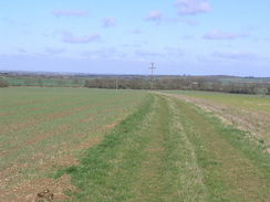
A short but confusing stretch of footpaths took me to another road, which I followed for a short distance before reaching a broad track that led down a slight hill across fields, the open sides of the track giving me some pleasant views in most directions. At the bottom of this track another road was crossed, and on the other side the bridleway climbed up towards the top of Lily Hill along a rutted green lane. I stopped periodically to have a look at the views to the east down the hill, which whilst not spectacular were nice. At the top of the hill the bridleway abruptly ended and dropped me onto a road, and I used this to take me west for a short distance before dropping onto another stretch of footpath that took me to Abbotsley.
I found it difficult to get my bearings through the village, but more by luck than judgement I found myself entering the churchyard and passing the church to reach the centre of the village. A road led downhill, and a footpath headed through a small recreation ground (which even had a rope slide) before leaving the village and continuing on westwards. The footpath ended at a bridleway just before a golf course; here I was tempted to cross the bridleway and continue along the footpath to reach another footpath half a mile away that I had walked in 2000, but I did not do this as the day's walk was already long enough, and I really did not want to extend it.
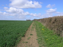
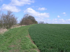
The next few miles proved to be very easy to walk, as the bridleway followed a green lane as it headed slightly east of north, and made for a very pleasant walk. Initially it descended to cross the B1046 before rising slowly on the other side. There were few views to be had but the walk was still slightly enjoyable as it crossed the A628 and continued onwards. The bridleway ended at the small hamlet of Toseland, and another bridleway led me on across fields; this soon ended and was replaced by a footpath. This soon deposited me in a field where it turned to the right; I walked along the hedge in that direction until it ended, to find no way through, I walked back to the northwestern corner of the field, were I found what was probably a stile letting me into the next field. This having been done, I thankfully found the footpath running along this side of the hedge.
The path led to a road, which I followed towards the village of Graveley. As I did so I approached a lady riding a horse, who was obviously having trouble keeping it under control. I kept back as hoses often get spooked by the walking poles strapped onto my rucksack, but after a couple of minutes she called me forwards and asked me if I could lead the horse. In agreed and she indicated where to hold the reigns, and I led the horse on. We had a nice chat as we walked, and after a few minutes she asked me to let go, and the horse trotted on ahead. Unfortunately after another hundred yards the horse got spooked again, and so she asked if I could lead again. I did so, and we had another quick chat as we entered the village before eventually she believed that the horse was settled and she asked me to let go.
The horse trotted on, leaving me behind as I strolled through the village. On the map there is a pub marked, but to my annoyance this proved to be shut when I walked past. I really wanted to stop for a while, but despite there being some benches near the village sign I decided to walk on through the pretty village. Attached to the village sign there were some plaques about the nearby Second World War airfield, commemorating the many young pathfinder aircrew who died during the war. The pathfinder squadron was created to guide bomber forces onto target, and the crews were hand-picked for their good navigational ability. During the war the crews perfected mechanisms for precision bombing, including devices such as the Oboe, a radio scheme that allowed blind bombing.
As the road headed out of the village the clouds started to gather, and in the distance I could see rain failing from dark grey clouds. I found myself hoping that the clouds would not catch me, and as I strolled on along a couple of roads towards the village of Hilton they started approaching closer and closer.
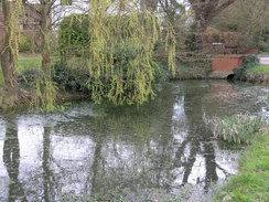
When I entered the village of Hilton I was surprised to find some strip ponds lining the right-hand side of the road, and as I approached them the sun briefly came out, making the water glisten in an attractive manner. The ponds ended at the B1040, aside from a small one immediately on the other side of the road, and I followed another road that became increasingly narrow southeastwards towards The Green. There were a few people playing an informal game of football in the area, and although there were benches I decided to walk on, leaving the village by a bridleway. This slowly climbed, and as it did so I sat down for the first and only break of the day, sitting with my back to a hedge during another sunny period.
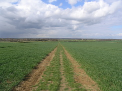
The break was welcome but I was generally feeling fit, so I once I set off I made good time as I strolled along towards Pitt Dene Farm. A good track led me to it, and then past it to another road near Elsworth Lodge. As I walked along this road it started to spit with rain, and although I considered putting my coat on I could see breaks in the cloud all around and I decided that it would soon end. Fortunately I was proved right, and by the time that I entered the village it had ended. The pub in the village was shut, but I did not have too far left to walk and so I would probably not have stopped even if it had been open. A long stretch of footpath took me southwards and I enjoyed this stretch of path, which eventually ended near Lawn Farm. At the farm there were a couple of fish ponds, and people were sitting around these fishing as I strolled past; one teenage girl looked at my rucksack and gave me a what the heck are you doing?' look.
After the farm a road was reached, and this led me onto the bridge over the A428 road. All of this area has changed massively over the last eight years as a result of the massive Cambourne housing development, and my map was not up to date. To reach the bridge I had to cross a slip road from the A428, and as this also carried a diverted bridleway there was a very complex - although well executed - combined pedestrian and horse crossing. Once on the other side of the bridge a signpost indicated the route of the diverted footpath and bridleway, and I started following this as it headed around the edge of the Cambourne development, initially passing through an area of newly-planted trees.
To my left were he office buildings of the Cambourne Business Park, but these were soon left behind and were replaced with some houses. It was a surprisingly pleasant stroll, and I was pleased to see that the developers had made such a wide path around the edge of the development. The bridleway diverted towards the development and a footpath continued on, and I exited through a hedge (which contained a rusted, very old car) to enter fields, and the Spartan surroundings seemed odd after half an hour of walking around the edge of Cambourne.
The footpath took me to a road that was not marked on my map (this is another access road into Cambourne from Caxton), and after crossing this the footpath became less clear, but I found my way with no problem to the A1198. I joined this road, and started heading through Caxton towards my car. As I walked I met an artist who was carrying some canvasses between wooden boards, and we chatted as we walked. He had a pleasant foreign accent, and unturned out that he had been painting in the centre of Cambridge all day. We discussed some of the finer points of the Fens, and when he reached his house I walked on with my own thoughts. It did not take me long to reach the car park where I had left my car, and when I finally reached it I was left with a pleasant feeling of satisfaction, and an overriding impression that you do not need to go into the hills to do a good walk. Add more info on Graveley airfileld and path finders.
Directions
This walks starts off at the car park by the village hall in the village of Caxton. Leave the car park and turn right, to start heading southwestwards along the road. This passes the church before curving to the right and a few yards later to the left; immediately after the left-hand bend turn right along a bridleway. This heads westwards and is easy to follow, aside from a slight left-right kink early on near a stream. The bridleway crosses a track before reaching Hardwicke Farm, where the bridleway skirts around the garden before turning left and then right to head westwards once again. It continues on for about a mile, eventually curving to the left and becoming surfaced before ending at a road to the northeast of Great Gransden.
At the road turn right and follow the road as it heads southwestwards into the village, until a roundabout is reached near the church. Here turn right and follow another road westwards for a few yards until the B1046 road is reached. Turn left along the B1046 and follow it south for a few yards until a track leads off to the right at a left-hand bend; join this track and when it ends join a footpath that heads westwards for a few hundred metres across a series of fields that proved to be surprisingly hard to navigate. When the footpath ends at a road turn left and walk southwestwards along the road for a couple of hundred yards until a track leads off to the right; join this track and follow it as it heads downhill across fields to reach the B1040 road.
Cross the B1040 and on the other side join a green lane that heads up towards the top of Lily Hill. At the top the lane ends at a road; head straight on and follow the road westwards for about a kilometre, descending to cross a stream before climbing up with some trees on the left. Near the end of the trees a footpath leads off to the right; turn right and follow this footpath northwards for a couple of hundred metres until a hedge is reached. Here turn left and walk westwards with the hedge on the right until a band of trees, and then turn right to follow the band of trees until the footpath ends at a road in Abbotsley. Walk along the road and when it ends turn right along another road and then left, to join a footpath that leads to the churchyards. Cross the churchyards and walk past the church to join the B1046 road in the village.
Turn left and head down a slight hill, turning left along a minor road to pass a pub on the left before ending at another road. Cross this road and on the other side take a road that leads westwards for a few yards before ending at a little recreation ground. A footpath crosses the ground, passing to the left of a rope slide before exiting into fields. The footpath is easy to follow as it heads westwards for a little under a mile, eventually meeting a bridleway that runs along a track immediately before a golf course is reached. Here turn right and follow the bridleway as it heads slightly east of north for a few miles, initially heading downhill to cross the B1046 before slowly rising for a couple of miles before reaching the A428 road.
Cross this road and continue on along the bridleway, which follows a surfaced track for about a kilometre; when this track turns sharply to the right continue straight on along the bridleway as it heads on for about another mile to end at a road in Toseland. Turn right along the road for a few yards and then turn left along a bridleway that skirts to the right of a house before entering open fields. The bridleway goes through a couple of fields before skirting some woods on the right. When these trees end the bridleway also ends, but a footpath continues on northwards, soon joining an area of woodland on the left. When a hedge is reached cross it (there is not a stile but it is easy to cross), and once on the other side turn right to follow the northern side of the hedge eastwards. The hedge soon ends and the footpath continues onwards across a field before ending after a hundred yards at a road.
Turn left and follow the road; it soon curves to the right slightly to take a more northeasterly direction for about a kilometre before descending to end at a T-junction with another road in the village of Graveley. Turn right and follow the road as it heads southeastwards passing a pub on the left before curving to head eastwards through the village. On the eastern outskirts the road curves sharply to the left and then after another hundred yards to the right to take a more northeasterly course for a couple of kilometres before ending at the A1198 road. Cross the A1198 and then carefully turn right to walk along the road for about fifty yards to a road junction on the left; turn left and follow this new road as it heads eastwards for a mile before ending at the B1040 in Graveley.
Cross the B1040 and follow another road that heads southeastwards along the northern outskirts of the village before ending at a T-junction. Here head straight on, crossing some playing fields to join a bridleway. This skirts some houses before turning to the right slightly to take a more or less southerly course. It slowly climbs uphill, initially with a hedge on the right, and after a kilometre it summit's the low hill and joins a track. Turn left along the track for a few yards until it curves to the left to continue on a southerly course, eventually curving to the left to reach Pitt Dene Farm. Pass some farm buildings and then turn right to join another track that heads south for about half a mile before ending at a T-junction with a road.
Turn left along this road and follow it as it heads eastwards, slowly descending downhill past Elsworth Lodge before curving sharply to the right and then left to enter Elsworth. Walk through the village until a road comes in from the right; turn right and pass a pub on the left, and follow this road as it heads southwards until it curves sharply to the right. Do not follow the road past the bend but head straight on along a bridleway that leaves the road and heads southwards across fields. As the bridleway approaches some power lines it curves to the right to head southwestwards with a hedge and stream to the left; it continues in this direction for a little under half a mile until it reaches a patch of trees, where it curves to the left once more to continue in a southerly direction.
The bridleway heads south for a little under a mile, crossing fields before joining a track that leads towards Lawn Farm, passing a couple of fishing lakes on the left at the farm. A surfaced track leads on from the farm for a short distance until it ends at a road. Turn left to walk east along the road for a few hundred yards until a junction is reached, and then turn right to cross a slip road and then the A428 dual carriageway via a bridge. On the other side of the bridge cross another slip road, and then turn right by an obvious bridleway sign. This bridleway initially heads westwards through an area of young woodland before curving to the left to head southwestwards along the edge of Cambourne Business Park.
The park is soon left behind, and houses from the new development join on the left, a wide strip of grass making for a good walk. Eventually the end of the Cambourne complex is reached, and a footpath continues on southwestwards, exiting through a hedge and entering fields. It crosses another access road into Cambourne (which is not marked on my OS map), and continues in the same direction on the other side. The footpath soon ends at a short residential road that can be followed for a few yards until it ends at the A1198 in Caxton. Turn left and start following the A1198 southwards; ignore the first road on the right and head through the village along the main road. Just before the village ends a road leads off to the right, heading downhill towards the church. Take this road and follow it southwestwards for a hundred yards until a car park is reached on the right near the village hall, which is where this walk ends.
Distances
| From | To | Distance (m) | Ascent (ft) | Descent (ft) |
|---|---|---|---|---|
| Caxton | Abbotsley | 6.3 | 272 | 275 |
| Abbotsley | Graveley | 7.0 | 262 | 257 |
| Graveley | Elsworth | 6.2 | 167 | 248 |
| Elsworth | Caxton | 4.6 | 187 | 108 |
This makes a total distance of 24.1 miles, with 888 feet of ascent and 888 feet of descent.
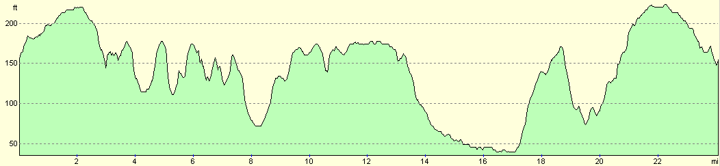
For more information on profiles, ascents and descents, see this page
Disclaimer
Please note that I take no responsibility for anything that may happen when following these directions. If you intend to follow this route, then please use the relevant maps and check the route out before you go out. As always when walking, use common sense and you should be fine.
If you find any information on any of these routes that is inaccurate, or you wish to add anything, then please email me.
All images on this site are © of the author. Any reproduction, retransmissions, or republication of all or part of any document found on this site is expressly prohibited, unless the author has explicitly granted its prior written consent to so reproduce, retransmit, or republish the material. All other rights reserved.
Although this site includes links providing convenient direct access to other Internet sites, I do not endorse, approve, certify or make warranties or representations as to the accuracy of the information on these sites.
And finally, enjoy your walking!
Nearby walks
| # | Title | Walk length (miles) |
|---|---|---|
| 108 | Waterbeach to Huntingdon | 21.6 |
| 119 | Huntingdon to St Neots | 11.8 |
| 120 | St Neots to Biggleswade | 13.0 |
|
|

|