Walk #815: A circular walk from Weymouth to Langton Herring
 |
 |
|
General Data
| Date Walked | 03/05/2008 |
| County | Dorset |
| Start Location | Weymouth Swannery |
| End Location | Weymouth Swannery |
| Start time | 09.25 |
| End time | 17.18 |
| Distance | 17.6 miles |
| Description | This was a pleasant and easy walk following the South Wets Coast Path through Weymouth and then northwestwards along the northern side of the Fleet, before returning back to Weymouth along roads. |
| Pack | Today I carried my 30-litre Karrimor rucksack, filled with waterproofs, water, and at various times either Sencan's trainers or her boots. |
| Condition | I have a couple of hotspots on my feet after this walk, but aside from this I have no other problems. Sencan had problems with her feet all day, and has another large blister on her heel despite the Compeeds and other plasters she put on. |
| Weather | The day was comfortably warm, with a hazy cloud overhead for most of the day that helped keep temperature down. There was a strong breeze which, if not chilly, was brisk enough to be annoying at times. |
| OS map | Landranger number 194 (Dorchester & Weymouth, Cerne Abbas & Bere Regis) |
 |
 |
|
 |
 |
|
Map of the walk
Maps courtesy of Google Maps. Route for indicative purposes only, and may have been plotted after the walk. Please let me have comments on what you think of this new format. For a detailed table of timings for this walk, please see the table file.
 |
 |
|
 |
 |
|
Notes
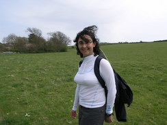
Despite the problems that she had last week, Sencan was keen to try another walk today. She strapped her heels up well, putting Compeeds over the places where the blisters had formed, and a little later than I hoped we set off for the drive to Weymouth. The car park in Weymouth cost an amazing £8.40 for a 12-hour stay - absolute extortion, but one that we had little choice but to pay, as we had no idea where other long-stay car parks may have been. The forecast had been for sunny weather, so it was a bit of a shame to see cloud, albeit thin, overhead.
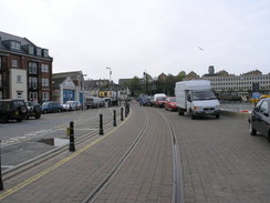
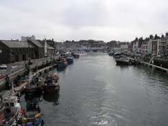
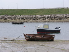
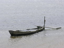
We followed a path alongside the river under a bridge towards the harbour, where there were many expensive-looking boats tied up. It was all fairly pleasant, and we enjoyed the walk as we walked along the edge of the harbour, passing scuba divers preparing for a trip and walking along the tracks of the disused railway line to the harbour station, which follows the streets through the town.
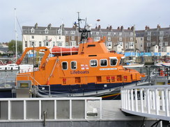
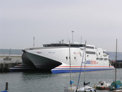
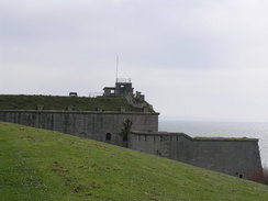
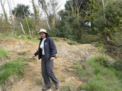
The Town Bridge is where we had finished yesterday's walk, and we crossed it to reach the southern side of the harbour. There was plenty to see as we followed the coast path, including the lifeboat and a very large ferry, before we started the climb up to Nothe Fort. The gardens around the fort are pretty, although it was annoying that the public toilets at the top were shut. The SWCP does not take the route nearest the coast, which is a promenade nearer sea level, and instead cuts back from the fort before descending through the gardens down toward Newton's Cove.
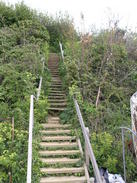
Here the path headed inland, climbing steeply away from the northern breakwater of Portland Harbour, and at the top of a little hill we started following a footpath that headed back towards the sea. There was no SWCP or Acorn symbol on the sign, but it seemed like a route that stuck more to the coast. We soon came across a large red sign stating that the footpath was shut 400 metres ahead. We chatted quickly, before deciding to head along the path. This was slightly overgrown, but was easily passable before we reached an area where a whole area of land had slumped down to the sea. It was easy to clamber down to the beach here, and we walked along it until we reached a boat store built of scaffolding, raised up off the beach. Here some rather rickety steps led back up to the path, and we continued along to reach a road.
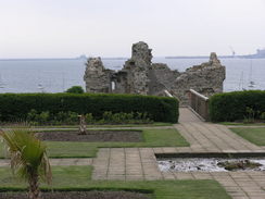
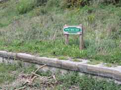
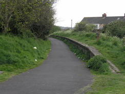
the road led us on past the remains of Sandsfoot Castle, built in the 1530's. Most of this has fallen into the sea, but the remaining ruins are situated in quite a pleasant little garden. Almost immediately after this, the trail leaves he road and joins the old Portland railway line to the right, which proved to be an easy walk southwards for about a mile. At Wyke Regis there is the remains of a platform with a sign on it; the trail is tarmac underfoot, which is good for cycling but not so pleasant for walking.
At a little bay called Small Mouth the trail leaves the old railway line, which is just as well, for the old railway bridge over the bay was removed years ago. Here Sencan started having trouble with one of her feet, so we sat down on a bench and she put some zinc oxide tape above the Compeed on her heel, and when she set off one more she seemed happy enough. The trail then crossed the A354 that leads onto the Isle of Portland by the Ferry Bridge pub. When I walked past over five years before on the Coastwalk, the pub kindly allowed us to park our motorhome in their car park. The pub was not open at this time, so we walked on, passing a little hut that sells oysters and other seafood.
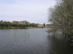
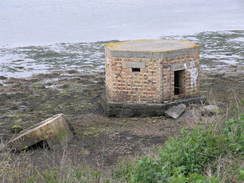
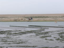
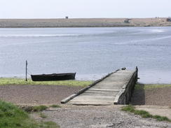
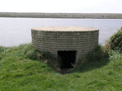
The Fleet is a large body of water that is protected from the sea by Chesil Beach - 18 miles long, and containing around ten million tons of pebbles. In the water there were diagonal lines of baskets, probably for oysters or mussels. The path climbed up onto some low cliffs, before heading around northwestwards towards the Royal Engineers bridging hard. This, the only such place in the country, was set up in 1928 to help the army train constructing bridges across water. The Fleet, being relatively protected by the bulk of Chesil Beach, must be ideal for such purposes. Nowadays they use it to practice with boat handling, bridge destruction and use of amphibious machines. The path went around the edge of the bridging hard and there was not much to see, aside from various bits of small kit (e.g. the sides of bailey bridges) and various buildings. There was a short section of railway track at what looked like an assault course in one corner of the complex.
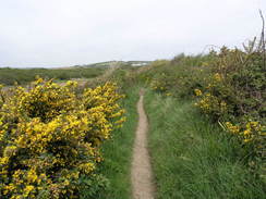
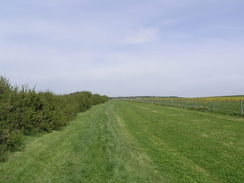
The path was relatively busy as we walked around to the Littlesea holiday park, with groups of walkers strolling around and one mountain biker struggling uphill. The park itself was neat and tidy, with a large group photo being organised on a patch of grass beside the path. A little further on there was a black and evil-looking stream running down Tidmoor Cove, and then there was the entrance to an army rifle range. The flags were down and it was safe to enter, so we passed the simple guard hut and followed the wide path around Tidmoor Point. Gorse bushes lined either side of the path, and the lovely buttery smell was blown over us by the wind. It took a surprisingly long time to get around the range, and after this we headed around towards Chickerell Hive Point.
By this time Sencan was having more trouble with her feet, so we sat down on a bench whilst she took her boots and socks off. She had two blisters on her heels - the same as on the last walk last week, that had formed despite Compeed plasters and other band plasters. She let her feet call whilst we ate our sandwiches, and as a couple of groups of walkers passed us we scoffed the food. She tried the boots on but they were to painful, so instead she put on her trainers that I was carrying in my pack. These proved to be much more comfortable, and as all the paths were relatively dry we set off once more. I asked her if she wanted to turn back, but she decided to carry on to get a decent distance done. It was here that I realised that my GPS was running out of juice, and for the first time ever that I recall, I had no spare batteries with me, This really annoyed me to a rather surprising amount, and I wanted to find a shop as soon as possible.
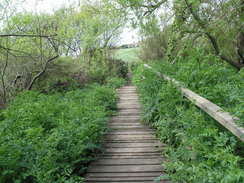
Initially her walking was a little stiff and troubled, but after about a mile she was walking more easily, and we chatted as we headed towards the Moonfleet Manor hotel and then past the little headland of Herbury. The fleet looked magnificent at times, especially when a yellow field of oil seed rape was reflected in the water, The path passed Langton Hive Point, where it started heading northwards to Rodden Hie, where the coast path leaves the Fleet behind. We continued inland for a few hundred metres, before leaving the coast path and following a footpath that led uphill, reaching a road that led into the little village of Langton Herring.
By this time it was a beautiful day, and we popped into the Elm Tree Inn for a rest. Sencan was starting to lag once again because of pain from her blisters, but we had a relatively easy road walk back. I had a pint of bitter and a pint of orange and lemonade, whilst Sencan had a couple of glasses of water. The breeze was surprisingly chilly once we had finished walking, so we sat inside as we drunk and ate some crisps.
Once we set off again we were faced with a long road walk eastwards back to Weymouth. The first part of this, following the road eastwards to Langton Cross, was easy enough, but after this we were faced with a long walk southeastwards along the B3157 road. The road was not too busy, but the traffic was moving fast, so we had to take to the wide verges every so often. Sencan started off well, but as we approached the village of Chickerell she started to flag once more. There was a bus stop in the village with regular bus services to Weymouth, but she wanted to walk on, so we passed the bus stop and walked on as a pavement started. This allowed us to walk faster as we were less aware of the traffic, and we were soon passing the entrance to the rifle range before we reached a shop.
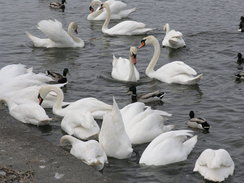
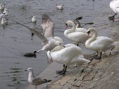
My GPS had finally run out of juice shortly after leaving the pub, so I bought some new batteries in the shop and continued on. Sencan was flagging again, but despite this she managed to keep up a reasonable pace as we entered the outskirts of Weymouth. Soon we reached the start of the Rodwell Trail, and crossed a bridge to get to the eastern side of the Backwater, from where it was a pleasant, short stroll back to the car past many swans that were being fed.
Sencan really suffered on this walk yet again, so we need to do some more trials to see why her blisters have suddenly started forming. Despite these she appears to have enjoyed herself and appears to have got a great deal of satisfaction from having pushed herself. I also enjoyed the walk, even though it is not the most classic walks along the South West Coast Path.
 |
 |
|
 |
 |
|
Directions
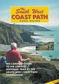
| During this walk I followed the South West Coast Path, the route of which is detailed in the Ordnance Survey National Trail Guide 11, Exmouth to Poole (ISBN 1-854109-88-X). Unfortunately the route description is written in reverse to the direction that I am walking, but the 1:25,000 maps in the book are clear and the signs on the ground are very good. Also to be recommended is the South West Coast Path Association guidebook (ISBN 0-907055-04-4), which has less concise directions and no maps but does include accommodation details and grades each section of the walk according to difficulty. They also publish reverse directions, which are suitable for walking in the direction that I walked the route. They have a website at www.swcp.org.uk, which is well worth a visit. | 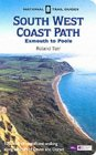
|
| 
| |
| |
| |
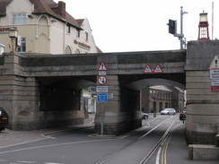
At the start of the walk, you need to reach the Town Bridge and the SWCP. From the Swannery car park take a footpath that heads under the A353 road bridge beside the river, and continue along this path as it becomes Commercial road, with the harbour off to the right. This road curves to the left to reach the town Bridge. Climb up onto the Town Bridge, and then turn left to cross the river. This is now on the course of the SWCP.
This walk leaves the SWCP just to the north of Rodden Hive. Follow the path northwards for a few hundred metres until a stile is reached on the left; here turn right, immediately cross a stile to the right that leads to a path that is initially enclose don either side before opening out. Head onwards up the small hill, before crossing a stile to join a dead-end road near a cottage. Follow this road as it heads eastwards before it curves sharply to the left to end at a T-junction. Here turn right, and start climbing uphill into the village of Langton Herring.
Follow the road eastwards through the village for about a kilometre until the B3157 road is reached at Langton Cross. Here turn right, and start following this road southeastwards. There is no pavement, so care needs to be taken, but the verges are wide for most of the time. The road passes the Victoria Inn, and then eventually climbs up Chickerill Hill to reach a roundabout in Chickerell. Turn left at this roundabout to continue southeastwards down the B3157 into the outskirts of Weymouth. From Chickerill onwards, there is a pavement.
At SY657790 the B3156 road heads off to the right; continue straight on for a few hundred metres, and when the B357 turns to the left continue straight on for about half a kilometre. At a road junction, turn let to follow Abbotsbury Road as it heads uphill. It slowly curves to the right to take a more easterly course. When this road ends at a roundabout you can cross the roundabout and follow the A353 road bridge to reach the car park; alternatively, instead of turning left to reach the roundabout, head straight on to reach and cross a causeway across the river, and then turn left to walk up to the A353 bridge.
 |
 |
|
 |
 |
|
Distances
| From | To | Distance (m) | Ascent (ft) | Descent (ft) |
|---|---|---|---|---|
| Weymouth Swannery car park | Wyke Regis | 3.5 | 344 | 348 |
| Wyke Regis | Langton Herring | 8.7 | 974 | 816 |
| Langton Herring | Weymouth Swannery car park | 5.4 | 279 | 433 |
This makes a total distance of 17.6 miles, with 1597 feet of ascent and 1597 feet of descent.
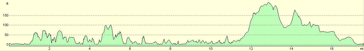
For more information on profiles, ascents and descents, see this page
 |
 |
|
 |
 |
|
 |
 |
|
 |
 |
|
 |
Disclaimer
Please note that I take no responsibility for anything that may happen when following these directions. If you intend to follow this route, then please use the relevant maps and check the route out before you go out. As always when walking, use common sense and you should be fine.
If you find any information on any of these routes that is inaccurate, or you wish to add anything, then please email me.
All images on this site are © of the author. Any reproduction, retransmissions, or republication of all or part of any document found on this site is expressly prohibited, unless the author has explicitly granted its prior written consent to so reproduce, retransmit, or republish the material. All other rights reserved.
Although this site includes links providing convenient direct access to other Internet sites, I do not endorse, approve, certify or make warranties or representations as to the accuracy of the information on these sites.
And finally, enjoy your walking!
Nearby walks
| # | Title | Walk length (miles) |
|---|---|---|
| 316 | Lulworth Cove to Wyke Regis | 13.7 |
| 317 | A circular walk around the Isle of Portland | 13.3 |
| 318 | Wyke Regis to West Bexington | 14.3 |
|
|

|