Walk #874: A circular walk between Hengistbury Head and Bournemouth
 |
 |
|
General Data
| Date Walked | 29/11/2010 |
| County | Dorset |
| Start Location | Hengistbury Head |
| End Location | Hengistbury Head |
| Start time | 09.22 |
| End time | 15.27 |
| Distance | 15.8 miles |
| Description | This was a varied walk, with some good views on the coastal sections and from Hengistbury Head. |
| Pack | Today I carried my 30-litre Karrimor rucksack, filled with water, my waterproofs, a couple of books and other odds and ends. |
| Condition | I feel absolutely fine after this walk. |
| Weather | Today was a very cold day, and the slight breeze felt fierce. The day was mostly sunny, although it started to cloud over during the afternoon. |
| OS map | Landranger number 195 (Bournemouth & Purbeck, Wimborne Minster & Ringwood) |
 |
 |
|
Map of the walk
Maps courtesy of Google Maps. Route for indicative purposes only, and may have been plotted after the walk. Please let me have comments on what you think of this new format. For a detailed table of timings for this walk, please see the table file.
 |
 |
|
Notes
The Stour Valley Way follows the River Stour from Christchurch to Stourton in Dorset. It has been on my to-walk list for some time, and today I decided to actually do something about it. My first pleasant surprise came at the car park for Hengistbury Head; in winter this only costs one pound to park all day. I parked up, got my kit together and walked over to the toilet block. The skies were clear but it was a bitterly cold morning, although thankfully none of the snow that had bedevilled the rest of the country.
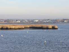
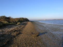
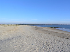
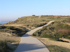
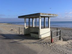
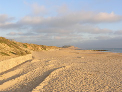
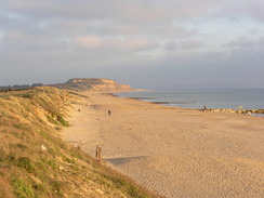
I walked past the Hungry Hiker cafe and continued on along a good track that headed towards the imposing mass of Hengistbury Head. After a short distance I discovered that I had dropped a glove; instead of going back I pressed on, knowing that I would have to return by the same route. I had walked this part of the coast twice before, the first as part of my coastal walk. I enjoyed the stroll as I left the track and a path took me on across a boggy area of ground, the frozen mud crunching under my boots. The path met the foreshore and headed on towards the spit of land that guards the southern mouth of Christchurch Harbour.
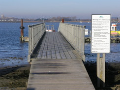
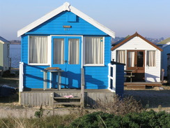
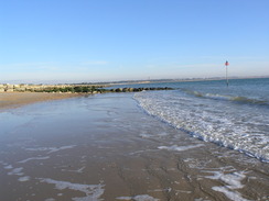
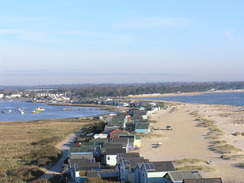
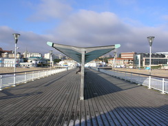
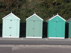
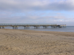
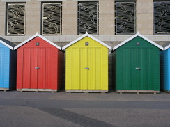
The Stour Valley Way appears to start halfway up the spit, near the jetty that serves the ferry across the harbour mouth. I walked up past rows of well-kept (and probably expensive) beach huts, before crossing the spit to reach the beach facing onto the English Channel. I stood for a few minutes admiring the view before heading south along the beach.
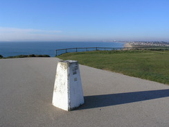
On both previous walks I had followed the shoreline around to the south of Hengistbury Head. The Stour Valley Way, however, climbs up to the top of the headline, and this is undoubtedly a better route. Expansive views unfolded as I reached the top of some steps, and again it was well worth a pause for what were the best views of the day. The walk westwards along the headland was pleasant, especially when the path approached the cliff edge. It took me past a coastguard remote radio station that was topped by a strange multi-pronged ariel, and then I reached the trig pillar at the highest point of the headland.
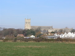
I paused again to admire the views, and then headed down. My route took me back towards the cafe; on the way I passed a land train that was just coming out of storage in a shed. I found my glove on a table outside the cafe, and I nipped in for a warming bacon bap and mug of hot chocolate. These did not last long, and soon I was heading along the familiar path that follows the River Stour upstream. The path underfoot was good, and the views across the river towards Christchurch Priory were good.
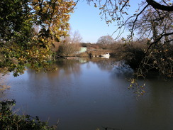
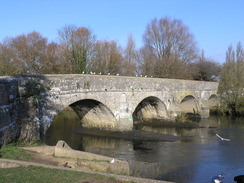
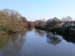
Unfortunately the good stretch had to end, and I was soon on a boring series of roads through Tuckton and Iford. This dreary stretch was one of the reasons that I had put off starting the Stour Valley Way, and the tedium was only partially broken by a small stretch of riverbank walking. By the time I reached the pretty old Ilford Bridge over the river I was feeling a little disheartened. The skies were still sunny and I did not fancy traipsing along the Stour Valley Way any longer. To be frank, I wanted to see the sea.
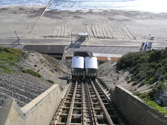
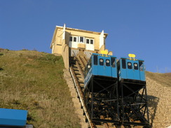
Instead of continuing along the trail, I diverted along the A35 towards Bournemouth. This was a boring walk, and I out my head down as I headed through Pokesdown and Boscombe. I took few photographs as, frankly, there was little of interest en route. Perhaps the most interesting thing was a philately shop that was, unfortunately, closed. It was therefore a relief when my route eventually met up at the coast once more at the top of the cliffs above a cliff lift. The views in either direction along the coast were good, and I took these in before descending down a slope towards Bournemouth Pier.
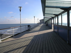
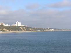
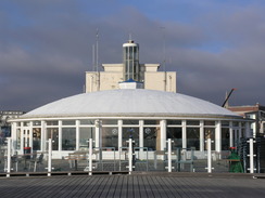
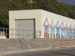
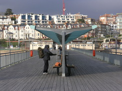
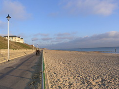
My route back to the car was simple enough: just follow the promenade back eastwards below the cliffs. First, however, I diverted off and walked along to the end of Bournemouth Pier. I was exposed to the chilly breeze at the end, but the views were more than worth the temporary discomfort. A quick stroll took me to Boscombe Pier, which seemed different from when I first saw it in 2002. An information board told me why - the theatre building at the end was removed during renovation works a few years ago. Again the views along the coast were good, but the wind soon caused me to head back to the promenade. The area around Boscombe Pier has recently been rebuilt, including an expensive and (failed?) attempt to create an artificial reef for surfers. Today, however, there were no surfers braving the cold water.
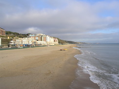
The sun started to sink lower behind me as I strolled along the promenade, giving the beach a lovely yellow glow. It was a marvelous walk, and the cliffs protected me from the worst of the northerly wind. The promenade soon ended, forcing me onto the top of the cliffs for the last stretch back to the car. The mass of Hengistbury Head shone ahead of me as a perfectly straight line of cloud - a front - moved towards me. It was a perfect end to what had been, for the most part, a highly enjoyable stroll.
 |
 |
|
Directions
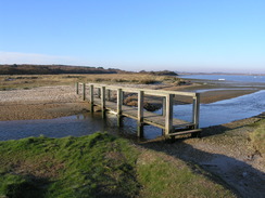
This walks starts off at the Hengistbury Head car park at SZ162911. Leave the car park and head past the toilets and the Hungry Hiker cafe. Continue on eastwards along a surfaced track; this passes a barn on the right and continue on as a track comes in from the right. The track skirts the foreshore for a while; when the track turns to the right, continue straight on through a gate. This path passes through some scrub woodland and emerges into a small boggy field on the other side, with the foreshore on the left. The shoreline is eventually met at SZ177910. Continue eastwards along the foreshore; the path crosses a footbridge over a stream and then onwards to a plank bridge. Shortly after this a track is reached in front of some beach huts. Turn left and follow this track northeastwards until a cafe is reached on the right, shortly after a jetty on the left.
Turn right at the cafe and pass two rows of beach huts to reach the beach. Turn right and follow the beach south for 0.4 miles until the hillside of Hengistbury Head is reached at SZ180906. Here some steps lead up onto the top of the hill. At the top turn left and follow an obvious path around the headland. This eventually nears the cliff edge; it descends slightly towards an old quarry before climbing once more. A track junction is reached shortly after the quarry; turn left to head westwards past a coastguard radio station to reach the trig pillar.
Continue on westwards from the trig pillar along a path that descends and turns to the right to head below a rocky slope. It then turns to the left; when it forks take the right-hand fork and soon afterwards turn right along a track that heads northwards for a couple of hundred yards until it ends at a T-junction with the track that was followed earlier. Turn left along this; when the barn is reached turn right along a path that heads across scrubland northwestwards for a short distance to end at another track.
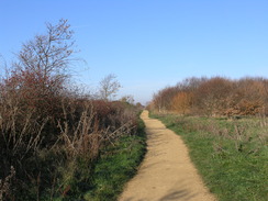
Turn right for a few yards to a junction; turn left through a gate to join a path (ignore the tracks off on either side). This path is easy to follow for half a mile north-northwestwards as it goes through a series of gates. It emerges out into a field; head straight on with some marshland on the right. Near the top of this field turn right through the hedge along an obvious path that swings to the left. Go through a gate as the path continues to swing to the left to join the southern bank of the river.
Continue westwards along this path as it roughly parallels the river bank; it passes a ferry landing and then a car park on the left before reaching an area of grass. The path forks twice; each time take the left-hand fork and continue on until the path climbs to end at Wick Lane at SZ150921. Turn right and follow Wick Lane for a short distance until it ends at a roundabout. Here head straight on along Tuckton Road. Take the second road off to the right, Iford Lane. As this curves to the left, head down a footpath to the right past the last house on the right.
This path heads down to reach the riverbank, and then turn left to follow a narrow path alongside the river. The path soon ends and rises to the left to reach Iford Lane once more. Follow the lane northwestwards; after a couple of hundred yards it curves to the right to take a more north-northwesterly direction for 0.6 miles. At SY137933 turn right down a dead-end lane; this rejoins the river bank and passes the old Ilford Bridge, soon afterwards ending at the A35.
Turn left and follow the A35 southwestwards; it soon reaches a roundabout. Head straight on along the A35 for 1.5 miles. At SZ116919 the road turns to the right; continue on along a pedestrian road through the town centre. When the pedestrianised section ends, continue on along the A35 for a little under a mile until it reaches a roundabout at SZ099914. Turn left down Gervis Road and follow it as it curves to the right with a church on the left.
After a quarter of a mile another roundabout is reached; turn left down Meyrick Road and follow it until it ends at a road at the top of the cliffs. Cross this road to reach a platform at the top of Eastcliff cliff lift. Turn right and follow a promenade that runs westwards along the top of the cliffs, with a road on the right. When the road curves to the right, continue straight on down a path that slopes downhill to end just to the east of Bournemouth Pier.
Turn left and follow the promenade eastwards for four miles until it ends at SZ152909; I made diversions to walk to the end of Bournemouth and Boscombe Piers. When the promenade ends climb up some steps to the left and then turn right to follow a path eastwards along the top of the cliffs towards Hengistbury Head. At SZ159910 turn left along a footpath that heads across an area of grass to reach the car park where this walk started.
Distances
| From | To | Distance (m) | Ascent (ft) | Descent (ft) |
|---|---|---|---|---|
| Hengistbury Head car park | Iford Bridge | 6.6 | 305 | 308 |
| Iford Bridge | Bournemouth Pier | 3.9 | 164 | 167 |
| Bournemouth Pier | Hengistbury Head car park | 5.3 | 482 | 476 |
This makes a total distance of 15.8 miles, with 951 feet of ascent and 951 feet of descent.
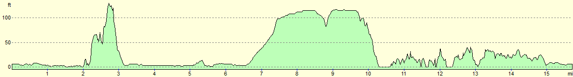
For more information on profiles, ascents and descents, see this page
 |
 |
|
 |
 |
|
 |
 |
|
 |
 |
|
 |
 |
|
 |
 |
|
 |
 |
|
 |
 |
|
 |
 |
|
 |
 |
|
 |
 |
|
 |
 |
|
Disclaimer
Please note that I take no responsibility for anything that may happen when following these directions. If you intend to follow this route, then please use the relevant maps and check the route out before you go out. As always when walking, use common sense and you should be fine.
If you find any information on any of these routes that is inaccurate, or you wish to add anything, then please email me.
All images on this site are © of the author. Any reproduction, retransmissions, or republication of all or part of any document found on this site is expressly prohibited, unless the author has explicitly granted its prior written consent to so reproduce, retransmit, or republish the material. All other rights reserved.
Although this site includes links providing convenient direct access to other Internet sites, I do not endorse, approve, certify or make warranties or representations as to the accuracy of the information on these sites.
And finally, enjoy your walking!
Nearby walks
| # | Title | Walk length (miles) |
|---|---|---|
| 311 | Milford on Sea to Southbourne | 16.9 |
| 312 | Southbourne to Hamworthy Station | 15.3 |
| 313 | Hamworthy Station to South Haven Point | 18.0 |
|
|

|