Walk #901: A circular walk between Fulletby and Donington on Bain
 |
 |
|
General Data
| Date Walked | 18/05/2011 |
| County | Lincolnshire |
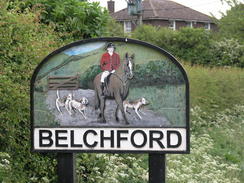
| Start Location | Belchford |
| End Location | Belchford |
| Start time | 07.32 |
| End time | 13.42 |
| Distance | 17.4 miles |
| Description | This rather oddly-shaped stroll is based around the Viking Way; it starts at Belchford before heading south along the trail to Fulletby and returning by the same route. It then heads north along thet rail as far as Donington on Bain, before returning via a more direct route along roads and footpaths. |
| Pack | Today I carried my 30-litre Karrimor rucksack, filled with water, my waterproofs, a couple of books and other odds and ends. |
| Condition | My feet are still aching after yesterday's walk, and consequently they caused me a little discomfort during the day. Aside from this I was fine. |
| Weather | The day was cloudy and grey, with not much sign of the sun. It looked as though it could rain at any timel, and indeed a downpour started when I was about five minutes away from the car. |
| OS map | Landranger number 122 (Skegness & Horncastle) |
 |
 |
|
Map of the walk
Maps courtesy of Google Maps. Route for indicative purposes only, and may have been plotted after the walk. Please let me have comments on what you think of this new format. For a detailed table of timings for this walk, please see the table file.
 |
 |
|
Notes
I had a good night's sleep - for the second night in a row there was no trace of condensation in the tent, perhaps a result of the warm weather allowing me to keep all the vents wide open. My feet were aching after yesterday's miles along stony tracks, and even the sight of ducks and ducklings waddling right beside my tent could lift my mood. The skies were more or less clear, but the forecast was for showers coming in from the north. As I had to get back to Cambridge later in the day it seemed sensible to get another early start.
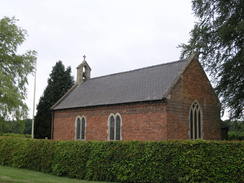
On yesterday's walk I had reached the church in Fulletby, and that seemed a sensible place to start the walk. However I had not seen a convenient place to park in the tiny village, so instead I drove to the larger village of Belchford, a couple of miles to the north. Fortunately there turned out to be a good place to park by the church, so I parked up and got my kit together.
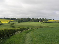
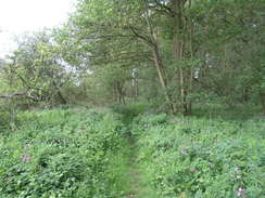
One disadvantage of my parking place was that I had to walk back to Fulletby so that I could join the Viking Way at the point that I had left it yesterday. The only convenient route was by following the trail in the opposite direction. This was a pleasant stroll; it descended to cross a stream before climbing up, although the views were not as expansive as they had been at times yesterday. It then descended before climbing up once more to reach Fulletby. The path was well-walked and easy to follow despite the small fields and frequent stiles.
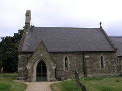
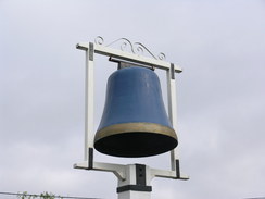
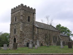
I did not spend long at the church in Fulletby before turning around and following the path back to Belchford. It was a good stroll, and the views were better heading back in this direction. After making a quick check of my car I continued north along the trail, passing the Blue Bell Inn on the way, outside of which is a large blue bell.
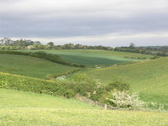
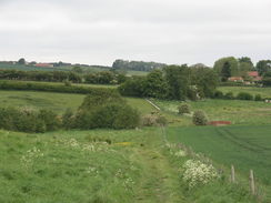
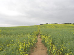
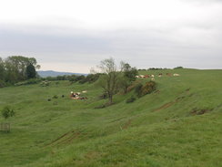
The next couple of miles was pleasant, if not spectacular walking, with paths across fields and only slight ascents and descents. It entered a small patch of woodland near a stream that stank; there was obviously a large dead animal somewhere nearby. The stench was utterly nauseating and I pushed on to get as far away as possible. The path took me onto a road that led me into the pretty little village of Scamblesby.
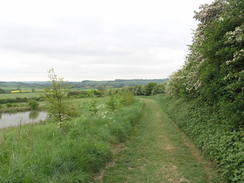
From here the path headed westwards across an area of wetland, with frequent drains criss-crossing the landscape. The path roughly stuck to the side of a stream including a stretch along a wooden boardwalk. It should have been good, interesting walking, but my heart really was not in it, particularly as I had to return in the same direction. It crosses a road near Asterby before continuing across dryer ground into Goulceby.
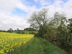
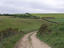
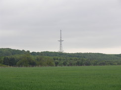
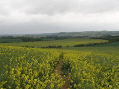
I was really tempted to cut the walk short and return to Fulletby from here, but that would have made a very short day's walk. Instead I continued along the trail as it turned to make a more northerly course. The scenery and the trail itself improved, and two large transmissions became visible; the one to the east at Stenigot having an unusual shape. It turns out that this is one of the old 'Chain Home' radar masts used in the Second World War. The second one to the north was a much more ordinary cable-stayed transmitter.
After crossing the course of the old Bardney to Louth railway line, which closed before 1960, the trail headed into the small village of Donington on Bain. This was a pretty village that was filled with facilities, including a pub and two shops. I had plans to walk another couple of miles northwards but I decided to head back a little earlier. My impression of the trail from Belchford had been distinctly underwhelming - perhaps more a result of my mindset than the trail itself - so I decided to head back along the road.
This soon passed the site of the old Donington on Bain railway station; the buildings still looked more or less intact and were obviously railway-related. It was strange to see Viking Way waymarkers on the bridge - obviously the path had once gone along this road before being diverted along the paths to the west.
A couple of miles down the road I came across a strange sight: a well-kept green Triumph drove past, and behind was a youth on a bicycle. He was holding something at an angle in the crook of his arm as he cycled; from a distance I thought that they were fishing rods in a long bag, but as he got closer I could see that it was a shotgun being held uncocked! I nodded hello and he smiled back, but I found the scene more than a little disconcerting.
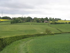
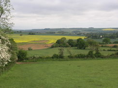
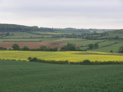
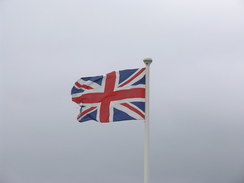
The road re-crossed the route I had taken earlier to the south of Asterby, and shortly after this I took a bridleway that headed southeastwards over a hill, paralleling the trail to the east. The climb was gentle and easy, and the views were far better than they had been from the trail earlier in the day - it is a shame that the trail sticks much more to the lower ground instead of this hill. A union jack was fluttering furiously in the breeze outside a farm, and this was followed by a slow descent to meet the road to the west of Belchford.
The clouds had solely been gathering throughout the day, and it started to spit with rain the moment I joined the road. This soon became drizzle and then heavy rain; I started laughing hysterically as I was only five minutes away from the car. My decision to turn back at Donington on Bain had, through luck more than good judgement, turned out to be correct, and my short time out in the rain felt like sticking two fingers up to the weather gods.
It had not been a bad day's walk, but my heart had really not been in it from the very beginning and this had made it hard to appreciate the good things this stretch of trail had offered. I got into the car and started the drive back to Cambridge looking back with satisfaction at what had been an enjoyable three days in Lincolnshire.
 |
 |
|
Directions
This walk sets off from Belchford church. Turn left to head westwards away from the church. As the road curves to the right towards the Blue Bell Inn, turn left down Dams Lane. Follow the lane as it winds southwestwards; shortly after a right-hand bend turn left to join a footpath that runs downhill to reach a bridge over a stream. Cross this, and on the other side immediately turn right and then left to head uphill with a fence on the left.
When a track is reached turn right to follow it southwestwards with a hedge on the left; when a gap in the hedge is reached turn left through the gap and walk straight on through a gap in another hedge. Continue on with a hedge on the left; it jinks slightly to the right and then the left before the field ends. Go through the hedge and turn left to continue on with a hedge on the left.
When this field ends turn half-right to join a hedge on the left; follow this southwards until a clappergate through the hedge ahead is reached. Go through this and head across a small field; aim for a gap in the hedge ahead to cross a stream. Climb up the hill on the other side, continuing south across a large field. Go through a clappergate at the top of the field and continue on south across a rougher field, aiming for a clappergate that leads onto a lane in Fulletby. Go through this gate and turn left to start following School Lane uphill. At a triangular junction turn right to walk a few yards towards the front of the church, which is on the right.
The next part of the trail heads back to Belchford via the same route. Head back down the road, and when this ends at a triangular junction turn left to head west-northwestwards down School Lane. Just before this road curves to the left turn right through a wooden clappergate to enter a field. Join a footpath that heads downhill northwards to a stile beside a gate at the bottom of the field. Cross the stile into the next field and descend to another clappergate that leads over a tiny stream into another field; turn half-right to head uphill towards a corner of the field. Go through another wooden clappergate and continue on north along this field with a hedge on the right; this soon curves slightly to the left.
About a hundred yards after the bend, turn right through a gap in the hedge to continue along the footpath with the hedge on the right. Head on in roughly the same direction for a third of a mile; the path goes through a broad gap in a hedge ahead and then a second to reach a rough field. Turn right to follow a track with a hedge on the right; when a fence is reached after a hundred yards turn left to head downhill. It meets a stream at the bottom; turn right and then immediately to the left to cross a bridge over the stream. Head uphill along a narrow path between hedges that soon reaches a clappergate. Cross this to meet a rough track called Dams Lane. Turn right and follow the lane as it curves around, becoming surfaced before it ends at a T-junction in Belchford at TF292754.
Turn left at the road and follow it northwestwards through the village, passing the Blue Bell Inn on the right. After a couple of hundred yards turn right through a clapper gate and continue north with a fence and then a hedge on the right. At the end of the field he path jinks to the left and then the right through a gap in the hedge to a plank footbridge across the stream. Continue northwards with the hedge on the right. It soon curves to take a more northwesterly course; after a short distance turn right to cross a footbridge over a stream and head northwestwards to the west of the summit of Juicetrump Hill. It crosses a field and continues on with a hedge on the left, falling into a dip and then rising up the other side before skirting the eastern edge of Belchford Wood. When the trees end head straight on across a field.
Cross a stream at the bottom and continue on along a rough track. After a while it follows a hedge on the left, heading northwards. The hedge on the left soon ends, and one eventually starts on the right. When the track forks take the right-hand fork to join a better track called Mill Street. It becomes a road near Brookside Farm; stay on this road for three-quarters of a mile as it heads northwestwards through Scamblesby.
When the road ends at a T-junction in the village with a school on the left, turn right to head northeastwards up the Old Main Road. Immediately before a bridge over a stream is reached turn left to cross a footbridge over a ditch. Keep the stream on the right until halfway across the field, and then turn right to cross a bridge over the stream. On the other side turn left to continue with the stream on the left until the A153 road is reached.
Carefully cross the main road; there is a path to the right leading to the end of the safety barriers, where a safer crossing can be made. On the western side of the main road the path turns to the right and then the left, still in the company of the stream on the left. It climbs up a slight hill away from the stream to pass through a small band of scrubby trees. After emerging from the trees turn left along the edge of a field to rejoin the stream. Follow this as the stream turns to the right to head westwards, still with the stream on the left.
As a small area of scrubland is reached turn left to cross a footbridge over the stream, and on the other side turn right to continue with the stream on the right. It curves to the left and then the right to head west-northwestwards before the path ends at Asterby Lane at TF264791.
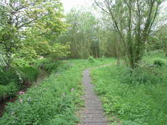
Turn right to cross a road bridge over the stream, and on the other side turn left to follow a footpath that heads westwards for a third of a mile, crossing a few plank footbridges and stiles through scrubland, joining a boardwalk for a short period. At the end of the third field after the road (TF259792), turn right to go through some trees to enter another field. Follow trees on the left, and when they end turn left to enter another field. Cut straight across this westwards, passing a pond on the left. At the end of the field cross a stile to reach a road. Cross this road and head straight on westwards along Shop Lane as it heads through Goulceby. When Shop Lane ends, turn left along Butt Lane which soon curves to the right to follow a stream on the left; at a triangular junction turn right to head north up Watery Lane.
Watery Lane ends after a fifth of a mile at a T-junction with Top Lane. Turn left to head west along Top Lane and just before the top of the hill take a gravel track to the right, Church Lane. This track soon curves in a rough northerly direction before curving to the left, always keeping a hedge on the right. Go through a wooden gate beside a metal gate to continue along the track, passing a cemetery on the right. Eventually the track meets a gate; cross a stile beside this gate to enter a field.
On the other side turn right to follow the hedge northeastwards for a short distance until it curves to the left to descend downhill northwestwards. Near the bottom of the hill turn left to climb up a low ridge paralleling some woodland on the right, before turning right to descend across a muddy patch to reach the woodland. The path crosses a stile and over a footbridge to head northwestwards through the woodland, soon emerging to head through a field with the woodland immediately on the left. The path eventually crosses a wooden clappergate to reach a road at TF241806.
Turn right to head northeastwards along this road for a couple of hundred yards and follow it as it curves to the left. This passes through a patch of woodland; when the trees end after a fifth of a mile turn left through a gap in a hedge to head west-northwestwards along a grassy track with a hedge on the left. This meets some woodland called Fox Covert on the left and then jinks slightly to the left. At the northern apex of the woodland the path jinks to the right to take a more northwesterly course alongside a hedge. The track curves sharply to the right to join a better track with a hedge on the left, and then sharply to the left to climb up to cross an old railway line.
On the other side of the line the track loops to the right into a hairpin; do not follow this and instead turn left to go through a metal gate continue north across a field with a hedge on the right. The path crosses a track and heads on between two fields. Go through a hedge at the end and then turn right to follow the hedge on the right; this soon curves to the left once more to continue in a more or less northerly direction with a hedge on the right. At the end of this long field continue straight on through the hedge and keep houses on the right before the path ends at Chapel Lane in Donington on Bain. Turn right down Chapel Lane and then turn left to head down a path northwards. Go through a wooden squeeze-stile to run between hedges. This path soon ends at a track; turn right down this for a few yards to reach Main Road in Donington on Bain opposite the village church.
This rest of this walk leaves the Viking Way and returns to Belchford via roads and paths. From the church turn right to follow the road southeastwards through the village. After a mile it rises to climb over an old railway bridge; after three and a half miles it ends at a T-junction with Raynard Lane at TF263785. Turn left to head southeastwards along the road for a third of a mile until it ends at a T-junction with the A153 road.
Carefully cross the main road and then turn left for a few yards, before turning right through a gap in a hedge to join a bridleway. Follow this as it heads southeastwards with a hedge on the right; at the end of the first field go through a gap in the hedge ahead and continue straight on across another field. At the end of this field go through the hedge and turn slightly to the right to follow a clear path uphill across another field. At the top go through another hedge and continue on across another field along the top of the hill.
It then enters a rough area of land; skirt the top of the slope to the left and keep a hedge on the right. Go through a gate to join a track that heads through Wood Farm. A green track continues on, curving to the left and then the right for three-quarters of a mile, becoming a firmer track as it goes. As it approaches East Farm the track curves to the right towards the farm; here continue on along a rougher track that soon ends at a road at TF286754. Turn left to follow this road eastwards for another half a mile until Belchford church is reached.
 |
 |
|
Distances
| From | To | Distance (m) | Ascent (ft) | Descent (ft) |
|---|---|---|---|---|
| Belchford | Fulletby | 1.8 | 308 | 125 |
| Fulletby | Belchford | 1.8 | 125 | 305 |
| Belchford | Donington on Bain | 7.6 | 430 | 463 |
| Donington on Bain | Belchford | 6.6 | 420 | 390 |
This makes a total distance of 17.8 miles, with 1283 feet of ascent and 1283 feet of descent.
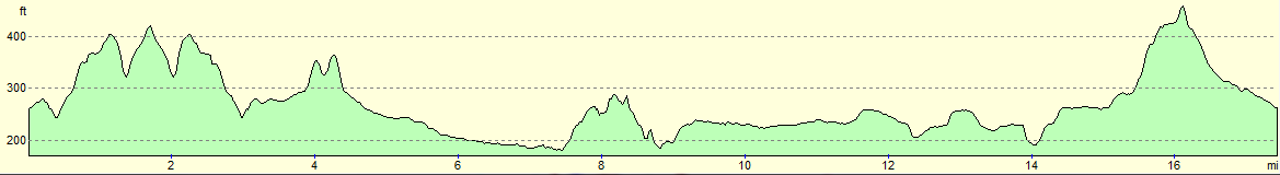
For more information on profiles, ascents and descents, see this page
Accommodation
I spent the night at the Woodhall Spa Camping and Caravanning Club site. This is situated a couple of miles out of the town. The facilities at the site were good, and the toilets and showers were clean and tidy.
 |
 |
|
 |
 |
|
 |
 |
|
 |
 |
|
 |
 |
|
 |
 |
|
 |
 |
|
 |
 |
|
 |
Disclaimer
Please note that I take no responsibility for anything that may happen when following these directions. If you intend to follow this route, then please use the relevant maps and check the route out before you go out. As always when walking, use common sense and you should be fine.
If you find any information on any of these routes that is inaccurate, or you wish to add anything, then please email me.
All images on this site are © of the author. Any reproduction, retransmissions, or republication of all or part of any document found on this site is expressly prohibited, unless the author has explicitly granted its prior written consent to so reproduce, retransmit, or republish the material. All other rights reserved.
Although this site includes links providing convenient direct access to other Internet sites, I do not endorse, approve, certify or make warranties or representations as to the accuracy of the information on these sites.
And finally, enjoy your walking!
Nearby walks
| # | Title | Walk length (miles) |
|---|---|---|
| 900 | A linear walk from Woodhall Spa to Fulletby and return | 22.0 |
|
|

|