Walk #914: Hereward Way: March to Ely
 |
 |
|
General Data
| Date Walked | 05/08/2011 |
| County | Cambridgeshire, Norfolk |
| Start Location | March station |
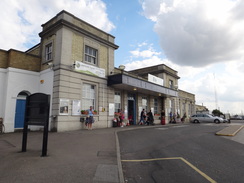
| End Location | Ely Station |
| Start time | 07.09 |
| End time | 17.00 |
| Distance | 27.0 miles |
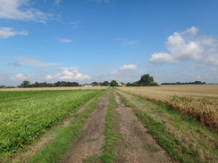
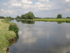
| Description | This was a long walk following the Hereward Way as it crosses classic Fenland terrain. |
| Pack | Today I carried my 30-litre Karrimor rucksack, filled with water, my waterproofs, a couple of books and other odds and ends. |
| Condition | I feel tired after this walk, but aside from that I feel fine. |
| Weather | Today started off sunny, but the clouds soon started to gether leaving me with a mixture of sunshine and cloud. It was rather a warm day but a slight breeze helped me to keep cool. |
| OS map | Landranger number 143 (Ely & Wisbech, Downham Market) |
 |
 |
|
Map of the walk
Maps courtesy of Google Maps. Route for indicative purposes only, and may have been plotted after the walk. Please let me have comments on what you think of this new format. For a detailed table of timings for this walk, please see the table file.
 |
 |
|
Notes
I was not looking forward to today's stroll. I first walked it in the opposite direction over eleven years ago, and did not have particularly fond memories of it. The day would be long; at least twenty-three miles, and would cross the flat plains of the Fens. With the idea that it was best to get it over and done with filling my mind, I drove to Ely and parked up in the new(ish) long-stay car park about a third of a mile from the station. It did not take me long to get to the station and to purchase my ticket to March.
The train dropped me off in March just after seven, a pleasant time to be starting a long day's walk. The skies overhead were sunny with a fair few clouds; the forecast said that there could be showers that would be heavy due to the warmth. I stopped off at the Tescos in the town to buy an extra bottle of water (to add to the couple of litres in my Platypus) before heading to join the Hereward Way and the River Nene (Old Course)
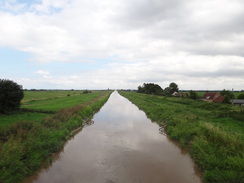
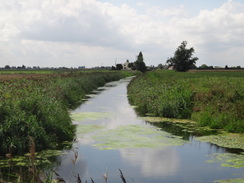
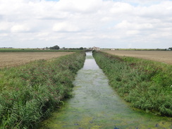
The parentheses at the end of the name gives a clue to the primary feature of the Fens - the hundreds of miles of drainage channels that have reshaped the landscape. The two major rivers in the area, the Great Ouse and Nene, once shared an outfall but they have been shifted over time. The Nene now flows several miles north of March on its way to the sea, leaving this remnant of the old river to flow towards Denver Sluice and the Great Ouse. However the relatively straight course of this river makes me think that it too is manmade.
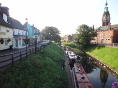
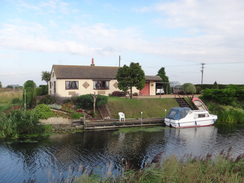
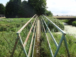
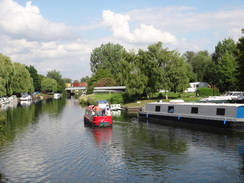
Initially the trail followed a road out of town past some pretty houses, with the river and moored narrowboats down a bank to my right. One of the major problems with walking so early in the morning soon reared its head - the fact that it is hard to take photos with the sun so low in the sky. I missed several good photos for this reason but had little alternative but to walk on. The trail crossed the river on what was a rather industrial footbridge, painted green as if a natural colour would lend it some elegance. It could not be doubted that the setting was pleasant however, with the river flowing slowly below.
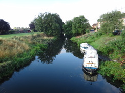
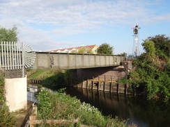
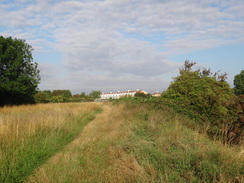
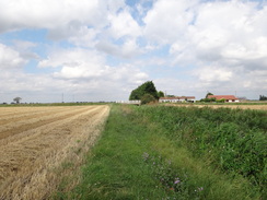
The path followed the southern riverbank northeastwards, soon passing under a railway bridge before continuing on with fields to my right and the river to the left. There had been some heavy rain over the last couple of days and my trouser legs were soon wet through with moisture from the tall plants beside the path. Indeed in places the path was nearly non-existent and overgrown with plants. Soon I passed the end of the Twenty Foot river, part of which I had walked along on the previous walk.
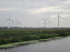
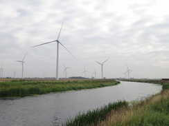
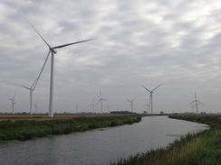
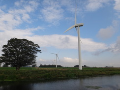
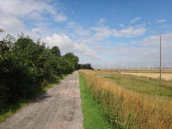
The tall, almost sculptural forms of a windfarm came into view ahead, on the other side of the river. It was a relief when the path joined a track that ran along the riverbank, and the towers of the turbines started to grow larger. It looked like there were about eighteen turbines of which four or five were not turning; indeed one was angled away from the wind, looking strangely out of place in comparison to the others. This was part of the Coldham Farm wind farm, the first of its kind to be run by the Cooperative on its own land. It was surprising how quiet they were in the light breeze, with the gentle thump-thump of a pumping station being far louder than the turning turbines.
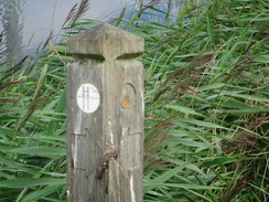
Soon I passed another pumping station that was altogether noisier - an alarm was blaring out from it, and I wondered what the point of the noise was as it was literally in the middle of nowhere with no-one to hear. The track ended after the pumping station and I was left once again to wade through vegetation, a time-consuming and wet business. My OS map showed the Hereward Way heading off across the middle of a field of cabbages, and there was no sign of the path on the ground. Not wanting to wade through the crops I walked on to a drainage channel at the end of the field where a path was shown heading in roughly the right direction. It was with some relief that I found a Hereward Way marker on a post - the first I had seen today.
The path soon became a track that curved away from the ditch to head in roughly the correct direction. I passed a tractor with flail that had been cutting the track's verges - it was a shame he could not have done the riverside path. Eventually the track curves around to reach Well Fen Farm, where I could not find the path. I walked past the farm and had a look around the track before eventually realising that the trail headed along the southern bank of a ditch. There were no waymarkers until I came to a little footbridge across a stream.
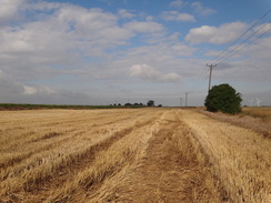
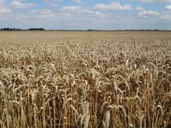
This stretch of path paralleled the Fen Causeway, a Roman Road that used to run between Denver in Norfolk and Ermine Street to the west of Peterborough. It ran alongside the channel between two slopes, the first hills of any sort I had seen all day. It was hard to work out exactly where the path went so I just kept the drainage ditch to the left until it reached a farm. The corn field to the right had recently been cut, which gave me an easier route than the overgrown bank. It was a relief when a better path started at Christchurch Farm, and this took me out onto a track that led to a bridge over the Sixteen Foot Drain and the B1098 road.
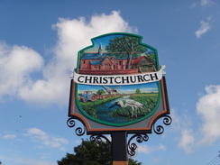
A road and track took me southeastwards to the first of the few settlements I would come across during the day - Christchurch. It seemed a pleasant enough place, a typical Fenland village with little to distinguish it. That was until I read a information board that stated the Dorothy L Sayers used to live in the Rectory in the village. Sayers was best known as the writer of the Lord Peter Wimsey stories, and is one of my wife's favourite authors. Since Sayers' book 'The Nine Tailors' is based on the village, I shall have to take my wife to the village one day soon.
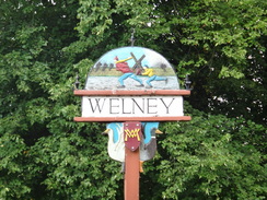
The pub in the village was not due to open for a couple of hours so I plodded on. A green lane - imaginatively called 'Green Lane' - took me out of the village before diverting to reach the B1100 road. What followed was the worst section of the day, nearly three miles of road walking through Tipps End to Welney. The roads were not too busy but I found the stroll dreary and utterly unremarkable. It was a relief when I finally joined the A1101 main road in the village of Welney.
The water tower that dominates the village looked grey and bland, the white paint in need of some work. I soon reached the village pub, the Lamb and Flag, but this was also not open. I had already walked twelve miles before eleven and was halfway through the walk and so it would have been a good place to stop for a rest, but not wanting to wait, I walked on. Soon after the pub the road crossed bridges over two more drainage channels before descending into a lower area.
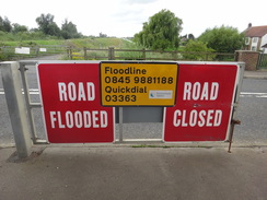
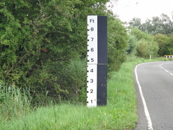
A large marker post beside the road was graduated to eight feet, well above my head. This shows the truth about this road - it regularly floods as it crosses the Welney Washes. This massive area of land - over twenty miles in length and half a mile wide - is used to store flood waters that the River Great Ouse cannot cope with. This closure of the road causes a great deal of trouble to the locals, and this stretch of the Hereward Way would be impassable at such times.
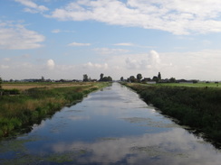
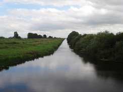
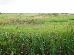
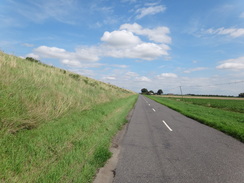
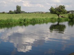
Fortunately there was no such risk of flooding at this time of year, and indeed the fields surrounding the road were verdant. The whole of the washes are an SSSI, an area rich in birdlife (the Welney Wildfowl Refuge is just to the north). Eventually the road rose once more to cross the New Bedford River at Suspension Bridge (sadly the bridge is no more exotic than an ordinary concrete structure). From here the trail follows the large floodbank southwestwards for nearly three miles; I was surprised to see that the New Bedford River to my right was flowing inland - presumably it is tidal.
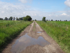
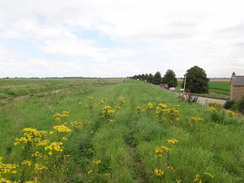
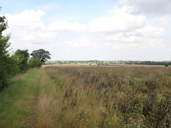
The going on the bank was not too hard; the vegetation was tall in places but a winding path was clear to see. Thankfully the relatively busy A1101 eventually dived off to the left, leaving me with a much quieter local road at the bottom of the bank. The views from the top of the bank were expansive, and after a while the towers of Ely Cathedral became visible to my left. Soon afterwards the path through the vegetation disappeared and I descended down the bank to reach the road. The bank seemed very high on this side, showing how low the surrounding land is when compared to the river.
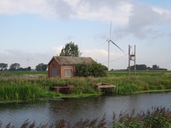
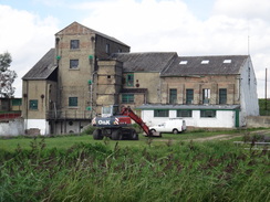
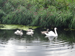
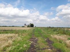
I soon approached a rather large building ahead - an old pumping station. Lots of the place names around it are reminiscent of the drainage - Engine Basin and Engine Farm amongst others. Here the path thankfully left the road and started following the Engine Basin southeastwards. A swan was swimming on the water along with some cygnets - it hissed at me as I stopped to take some photos of it. The footpath crossed a drain on a footbridge to reach Headfen Farm, after which the trail joined a road.
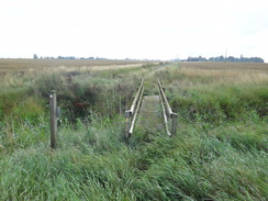
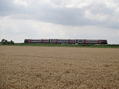
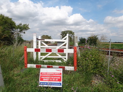
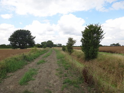
From here the trail would head almost directly southwards into Ely. The surfaced road was soon left behind and a track headed on along a green and slightly muddy track. Eventually it came to a level crossing over the railway line, and I was dismayed to see barriers protecting the gate. Apparently the crossing was subject to a safety inspection; there had been no signs further up the track, which would have been allowed me to make an early diversion. Annoyed, I squeezed past the barrier and went through the gate to cross the line. The gate on the other side was tied shut so I clambered over it and continued on. There was no indication if this closure was short-term or long-term, and a earlier indication would have been handy.
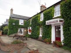
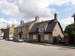
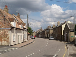
After another short stretch of road, another drove took me south towards the village of Little Downham. There were two pubs marked on my OS map, so once I met the main road through the village I turned left to head towards the nearest. Lots of people were out and about and I soon reached the Anchor with its whitewashed windows and locked doors. Yes, it had shut. Annotyed, I turned back and walked past the Costcutter shop to reach the Plough Inn, which thankfully was open.
The enticing smell of Thai food hung in the air, but I ignored this and got my usual order and went to sit outside. The clouds had parted enough for the sun to shine hotly through, and soon I went back inside to get some more drink on the basis that I needed to get lots of liquid inside me. Soon I was chatting to a regular, a Welshman who had done charity walks in the past. It was an interesting chat, but soon I had to say goodbye and head off down the road.
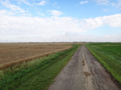
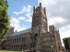
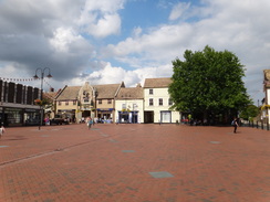
A long droveway took me south for a couple of miles from the village towards the A10 on the outskirts of Ely; the going underfoot was good but there was little to see or particularly remark on. After carefully crossing the main road I started walking towards the centre of the town. I have always loved Ely, and this unusual approach to the town was no disappointment, with the towers of the cathedral growing in front of me as I walked. Soon I was in the centre of the town.
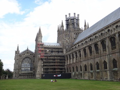
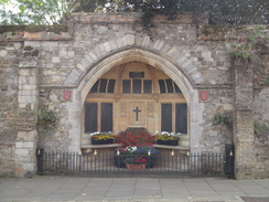
For some reason the trail did not pass the cathedral and instead followed the High Street, the buildings of which block the view of the cathedral. It is an odd choice, and I diverted off the road for a few yards to get some photos of the magnificent church. Sadly the frontage of the building looks strangely lop-sided due to the collapse of one wing many years ago; some large and obtrusive abutments were installed in its place to support the massive walls.
From here I had a choice; the direct route to my car near the railway station would take me off the trail and along roads that I knew well. However that meant that I would have to climb the hill into the centre of the town at the start of the next leg of the trail, and as I was feeling fit I decided to remain on the trail for another couple of miles. It followed a series of roads and paths northeastwards out of the town, slowly descending as it went. At one point there was a sign pointing off down a road to the right, a different route from that marked on the OS map. Instead I headed on in what I thought was the correct direction.
All too soon I was heading through a large paddock, trying to find the route out. After pacing up and down a fenceline a couple of times I gave up in disgust and decided to use a track that was clearly marked on the ma nearby. I headed to this only to find a Hereward Way sign; it has obviously been diverted and the sign I ignored earlier had been correct. Yet again my belief in the map over local directions had proved wrong.
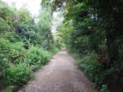
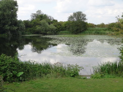
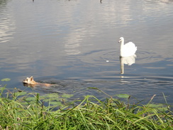
The track, Springhead Lane, proved to be firm underfoot as it passed a lake on the left. It was a pleasant stroll and all too soon I reached the point where the Hereward Way met the Fen Rivers Walk, another long-distance walk that I know well. I was still feeling fit despite a very long day and I considered extending the walk further, but eventually I decided to head back to my car. This meant following the Fen Rivers Way southwestwards alongside the Great Ouse, a wonderful walk with the river to the left and views over the cathedral to the right; if anything it was the best walk of the day. At one point I stopped to take a photo of a swan on the river; it started hissing at me but this time I could see the reason why; a Terrier was swimming past between the swan and the bank.
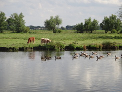
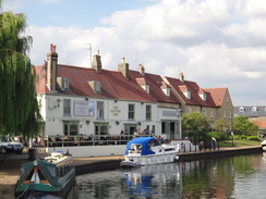
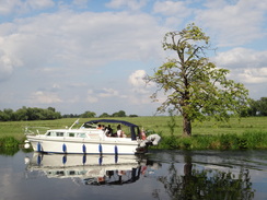
An ice-cream van was doing good business and I could not be bothered queuing with the many other people who wanted a lolly. Instead I walked on autopilot along familiar paths, passing an area where ducks, geese and swans are regularly fed. Lots of people were enjoying the sunshine, and a cruiser left a boatyard to join the river as I crossed a bridge overhead. Soon the riverside path ended at the main road and I got stuck at the level crossing whilst a train crossed before I could reach the station forecourt.
I still had a third of a mile to walk back to the car but this proved to be easy - I still had gas in the tank despite having walked twenty-seven miles during the day. I let out a whoop of joy as I reached the car, must to the amusement of two ladies who were unlocking their car. It had been hardly a classic day's walk, but I had thoroughly enjoyed it nonetheless: the distance had made up for the long stretches of road walking and expanses of uninteresting scenery.
 |
 |
|
Directions
This walk starts off at March railway station. The first mile takes you south through the town to reach the Hereward Way by the River Nene. Turn left out of the station and walk down the approach road to reach Station Road with a level crossing on the left. Turn right to head south down Station Road for a little over half a mile. The road starts curving to the right; follow it as it does so until a pedestrian crossing is reached. Use this to cross the road and continue on along the road for a short distance before turning left down the High Street until the bridge over the River Nene is reached.
Do not cross this and instead turn left down Nene Parade. Continue along this as it follows the northern bank of the river, winding northeastwards. It passes two sets of bollards as the road becomes pedestrianised before becoming open to traffic once more. When Wigstone's Road comes in from the left turn right to cross the river via a metal pedestrian bridge; on the other side turn left to start following the southern bank of the river northeastwards along a surfaced path past some parkland. As the path curves to the right continue straight on along a grassy path. A third of a mile after the bridge, it joins a surfaced pat that descends to pass under a railway bridge.
On the other side of the railway bridge continue along the path as it climbs to a metal clappergate. Go through this and follow the southern bank of the river northeastwards for another 2.8 miles after the railway bridge; for a long period there is a good track, although at other times you will need to go through vegetation on top of the bank. On the way you will need to cross several stiles and gates.
At TL463999 opposite a pumping station on the other bank, and just before the last wind turbine on the wind farm, turn right away from the river keeping a ditch on the left and a field on the right. The path becomes a track; it crosses a field drain to enter a second field. At the end of this second field the track curves to the right to head inland with a drain on the left or a short distance to TL464994, where the track curves to the left over the drain.
Follow the track southeastwards; it soon becomes surfaced. Continue along as it winds around for nearly a mile until it reaches a drain at TL470980 just before Well Fen Farm is reached; do not enter the farm. Cross the bridge over the drain and then turn left to start following the southern bank of the drain in a rough easterly direction, paralleling the course of an old Roman Road called Fen Causeway off to the right.
After the first field cross a drain using a small wooden footbridge, and in the next field turn right and then left to join a green track that heads east-southeastwards until it reaches Christchurch Farm. At the farm it crosses another track and continues straight on along a footpath, keeping some barns on the right. Go past a vehicle barrier as the footpath continues on between hedges with the farm on the right; the path soon emerges out onto a track that heads eastwards, passing a house on the left before reaching the Sixteen Foot Drain at TL484976.
Cross the bridge over the drain (the bridge is not marked on some 1:25,000 maps). On the other side cross the B1098 road and continue southeastwards along the surfaced Crown Road. Follow this southeastwards; as it passes Crown Lodge on the left it becomes unsurfaced. 0.6 miles after the B0198 the track becomes a public road once more. Continue along this for another 250 yards until it ends at a T-junction with another road in the small village of Christchurch. Continue straight on along this road; there is a pavement on the right. As the road curves sharply to the right after a little over 100 yards continue straight on down the surfaced Green Lane, immediately passing the Dun Cow pub on the left.
After three-quarters of a mile a track comes in from the right between fields; turn right to follow this track southwestwards for a fifth of a mile, soon joining a fence on the left. After a while it jinks to the left and then right to continue southwestwards before ending at the B1100 road at TL496951. Turn left to follow the road southwards, passing the Hole in the Wall Farm on the right. A road junction is met after a quarter of a mile; here turn left to continue along the B1100 road, signposted for Welney. Follow this as it twists and turns for 2.4 miles as it passes through Tipps End before finally ending at a T-junction with the A1101 at TL526940.
Turn right and follow this road as it heads southwards; it passes the Lamb and Flag Inn on the left before climbing up to cross the Old Bedford River and then the River Delph on two bridges. Immediately after crossing the River Delph the road descends to reach the Welney Washes. This next stretch of path may be closed by floodwater after heavy rain and in winter and care needs to be taken. If the barriers are erected across the road then do not attempt to continue further.
The road twists and turns southeastwards across the washes for two-thirds of a mile until it reaches the New Bedford River at the misnamed Suspension Bridge. The road is busy and the verge is narrow, so care needs to be taken on this stretch. Cross the bridge over the river, and on the other side follow the road as it curves sharply to the right to head southwestwards. The road can be busy and it is far better to follow the top of the bank to the right. When the A1101 curves sharply to the left after a mile continue straight on along the B1141 road or the bank for another 1.8 miles until a drain called Engine Basin is reached at TL507891. Just before a large white building containing an old pumping station is reached at the basin, turn left along a rough track. It crosses a ditch into another field and continue on with the drain to the right.
Follow the drain southeastwards for half a mile until a narrow footbridge over a stream is reached; cross this to reach a surfaced track beside Headfen Farm. Turn right along the track to cross the drain on a bridge and continue along the track southwards for a quarter of a mile before ending at a T-junction with another road at TL513881. Cross this and turn half-left to head south-southeastwards along a rough track called 'A Furlong Drove'. Follow this for 1.4 miles; it crosses a level crossing over the Ely to March railway line before ending at a road at TL520860.
Turn right to head west along this road for 250 yards; immediately after crossing the Thirty Foot Drain at Dunkirk Bridge turn left and follow a footpath with the Thirty Foot Drain on the left. At the end of this first field turn right for a short distance to reach a green metal footbridge over another ditch. Cross this and continue straight on along the footpath that runs across a field.
It crosses another drain and becomes a rough path that heads southwards. In places it passes between two hedges and at others through scrubland, before passing the end of a ditch on the left to enter a field. Continue on with a ditch on the right until it squeezes through a gap in a hedge into another grassy field. Turn half-left across the field towards the left-hand hedge; about halfway down this a gap between two concrete posts grants access to the recreation ground on the other side. Continue straight on across this to reach the surfaced car park and cross this to reach the exit of the recreation ground.
Do not join the lane and instead turn right along a grassy footpath that runs between hedges. The path becomes concrete as it continues west-southwestwards; after a fifth of a mile it curves to the left to end at a bend in Eagle's Lane. Continue straight on along this to head south-southeastwards for a couple of hundred yards until it ends at a T-junction with the B1411 road in Little Downham.
Turn left along the B1411 for a few yards and then almost immediately to the right to head down Chapel Lane, which soon ends at a T-junction with Cannon Street. Cross this and continue on down Hurst Lane, which passes Little Downham Nature Reserve on the right. After 0.4 miles the track curves to the left, passing The Paddocks on the right and passes through some metal gates. Here it becomes a green lane that heads southwards; it is easy to follow if you just stay on the main track. Eventually the track passes Hurst Farm on the right before ending at West Fen Road. Turn left and follow this road southeastwards for about fifty yards until it reaches the A10 at TL528809.
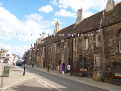
Carefully cross the A10 and continue on along West Fen Road for two-thirds of a mile as it approaches the centre of Ely. When West Fen Road ends at a T-junction with Downham Road, turn right to continue along West Fen Road for another 50 yards until it ends at another T-junction with St Mary's Street. Turn left and follow St Mary's Street as it curves to the right; when the Lamb Hotel is ahead, turn right into Minster Place and then immediately left down the High Street, with the cathedral behind buildings to the right until the Market Place is reached on the left.
Pass the Market Place and then turn left up Bray's Lane, keeping the market place on the left and at the northeastern corner of the square turn right along the Vineyards. This soon curves to the left to start taking a northeasterly course as it descends out of the city. When this curves sharply to the left turn right and then immediately left along a surfaced path called Vineyard Way that squeezes northeastwards between houses. When this reaches the end of a surfaced road called Springhead Lane on the left, turn right down a track that leads down to Lisle Lane at TL547804.
Carefully cross Lisle Lane and go through a wooden clappergate to join a gravel track called Springhead Lane that runs between hedges. This soon curves to the left to head east-northeastwards for a third of a mile, passing a lake beyond the hedge on the left. At TL553805 the path goes through a metal clappergate and joins a surfaced track called Kiln Lane. Turn right and follow Kiln Lane as it crosses a level crossing over a railway line and continues southeastwards.
When a factory is reached on the right, the day's walk leaves the Hereward Way and joins the Fen Rivers Way to head to Ely railway station. Turn right along a surfaced path with a car park on the left; this surfaced path soon diverts away from the car park to reach a metal clappergate. Go through this and join a gravel path on the other side.
Follow this path as it heads southwestwards with the River Great Ouse on the left. It is a very pleasant walk, and after half a mile it squeezes under a bridge that carries the railway line over the river. On the other side continue along the riverside path that passes a line of willows before squeezing past an art gallery on the right before reaching a bridge over the river. Turn right for a few yards and then turn left to rejoin the riverside path.
Continue on along this as it heads southwestwards; it passes the Cutter Inn on the right and then curves to the left to take a more southerly course. The path crosses a bridge over the entrance to a boatyard and then heads under another railway bridge. After crossing another bridge over the entrance to another boatyard the path rises to end at the A142 road. Turn right to follow the A142 road to a level crossing; cross this and on the other side carefully cross the road to reach Station Road, which can be followed for a short distance to reach Ely Station, where this walk ends.
 |
 |
|
Distances
| From | To | Distance (m) | Ascent (ft) | Descent (ft) |
|---|---|---|---|---|
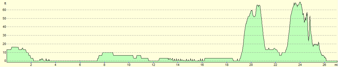
| March station | Christchurch | 8.3 | 30 | 33 |
| Christchurch | Welney | 4.0 | 3 | 13 |
| Welney | Little Downham | 8.1 | 108 | 52 |
| Little Downham | Ely station | 6.6 | 184 | 226 |
This makes a total distance of 27.0 miles, with 325 feet of ascent and 324 feet of descent.
For more information on profiles, ascents and descents, see this page
Transport
Regular railway services run between March and Ely. See the National Rail website for more information.
 |
 |
|
 |
 |
|
 |
 |
|
 |
 |
|
 |
 |
|
 |
 |
|
 |
 |
|
 |
 |
|
 |
 |
|
 |
 |
|
 |
 |
|
 |
 |
|
 |
 |
|
 |
 |
|
 |
 |
|
 |
 |
|
 |
 |
|
 |
 |
|
 |
 |
|
 |
 |
|
 |
 |
|
 |
 |
|
 |
 |
|
 |
 |
|
 |
 |
|
 |
Disclaimer
Please note that I take no responsibility for anything that may happen when following these directions. If you intend to follow this route, then please use the relevant maps and check the route out before you go out. As always when walking, use common sense and you should be fine.
If you find any information on any of these routes that is inaccurate, or you wish to add anything, then please email me.
All images on this site are © of the author. Any reproduction, retransmissions, or republication of all or part of any document found on this site is expressly prohibited, unless the author has explicitly granted its prior written consent to so reproduce, retransmit, or republish the material. All other rights reserved.
Although this site includes links providing convenient direct access to other Internet sites, I do not endorse, approve, certify or make warranties or representations as to the accuracy of the information on these sites.
And finally, enjoy your walking!
Nearby walks
| # | Title | Walk length (miles) |
|---|---|---|
| 3 | Littleport to Downham Market | 14.0 |
| 7 | Waterbeach - Burwell - Swaffham - Waterbeach | 17.1 |
| 15 | Waterbeach circular via river and Long Drove | 7.4 |
|
|

|