Home  1999-2001  2002-3  2004-6  2007-9  2010-17  2018  2019  2020
 Coastwalk  LE-JOG  Counties  Random Search within km of
Hiking in Britain

Walks in Norfolk

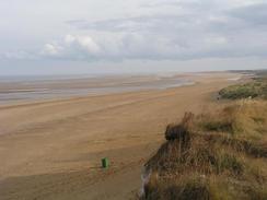
Norfolk is a low-lying county in East Anglia, and has a large coastlien stretching from The Wash to the Suffolk border. Norwich is the alrgest settlement, and ther are many other beautiful towns, such as Kings Lynn on the outfall of the Great Ouse.

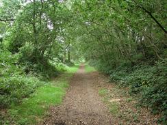
Although low-lying, there are some superb walks within the county, and the Peddar's Way and North Norfolk Coast Path national trail runs entirely in the county. The Broads National park also lies partly with Norfolk, although part is shared with the neighbouring county of Suffolk.


Below is a map showing all the walks that I have completed in Norfolk.

Completed walks in Norfolk

 
The view east from the cliffs at Hunstanton.

The cluniac Priory at Castle Acre.

The Weaver's Way passing through North Walsham Wood.


List of walks in Norfolk

Walk No. Description Distance (miles)
1010 Nene Way and Peter Scott Walk: Wisbech to Sutton Bridge, and then around the coast to King's Lynn25.1
986 Ouse Valley Way: Littleport to King's Lynn25.0
952 Angles Way: Lowestoft to Great Yarmouth21.4
934 Angles Way: Bungay to Oulton Broad21.7
933 Angles Way: Diss to Bungay24.7
917 Angles Way: Thetford to Diss23.6
916 Hereward Way: Brandon to Harling Road and on to Wymondham31.5
915 Hereward Way: Ely to Brandon23.1
914 Hereward Way: March to Ely27.0
904 A circular walk between Cromer and Sheringham10.3
903 Wells-next-the-Sea to Sheringham19.8
902 Hunstanton to Wells-next-the-Sea23.8
888 A circular walk from West Lynn to Sutton Bridge24.3
887 Littleport to Kings Lynn26.6
782 Icknield Way: King's Wood to Thetford18.9
756 A circular walk from Thetford to Brandon20.6
753 A circular walk from Thetford20.6
720 Diss to Norwich24.2
719 Stowmarket to Diss19.5
632 A circular walk from Brandon Creek17.4
574 Dovehill Wood to Hunstanton8.3
573 North Pickenham to Dovehill Wood20.8
572 Knettishall Heath to North Pickenham19.7
259 Gorleston-on-Sea to Southwold18.1
258 Caister-on-Sea to Gorleston-on-Sea11.1
257 Rudram's Gap to Caister-on-Sea17.5
256 Sheringham to Rudram's Gap15.1
255 Wells-next-the-Sea to Sheringham19.8
254 Hunstanton to Wells-next-the-Sea21.7
253 Kings Lynn to Hunstanton16.0
252 Sutton Bridge east bank car park to Kings Lynn13.2
221 Acle Station to Norwich via Wroxham21.2
215 Wroxham to North Walsham via Aylsham16.2
212 Bury St Edmunds to Thetford17.8
211 Attleborough to Norwich17.0
208 Thetford to Attleborough16.9
207 Shippea Hill to Thetford20.2
168 Cromer to North Walsham via Mundesley12.8
165 Cley-next-the-Sea to Cromer13.1
163 Sea Palling to Mundesley9.4
160 Wells-Next-The-Sea to Cley-next-the-Sea11.1
159 Snettisham to Hunstanton10.3
156 Kings Lynn to Snettisham14.6
155 Caister-on-Sea to Sea Palling12.5
136 Lowestoft to Caister-on-Sea14.4
134 Burnham Deepdale to Wells-Next-The-Sea9.5
133 Hunstanton to Burnham Deepdale10.3
54 Ely to March22.9
28 Kings Lynn to Watlington7.4
9 Old Hunstanton and Holme4.0
4 Downham Market to Watlington6.2
3 Littleport to Downham Market14.0

This was a total of 912.2 miles in 52 walks (an average of 17.54 miles per walk).


Back to counties index. Back to counties index 


Please visit my ramblings blog at: https://walkerramblings.blogspot.com/


Hosted by Spellings.net