Walk #934: Angles Way: Bungay to Oulton Broad
 |
 |
|
General Data
| Date Walked | 26/10/2011 |
| County | Suffolk, Norfolk |
| Start Location | Bungay Buttercross |
| End Location | Oulton Broad South station |
| Start time | 07.40 |
| End time | 14.51 |
| Distance | 21.7 miles |
| Description | This was a pleasant walk of two halves along the Angles Way: the first half did a big loop to the north of Bungay before heading east towards Beccles; the second half followed the River Waveney eastwards towards Oulton Broad near Lowestoft. |
| Pack | Today I carried my 30-litre Karrimor rucksack, filled with water, my waterproofs, a book and other odds and ends. |
| Condition | I feel fairly fine after this walk; I had far fewer problems with my left knee than on the last walk, and had no other problems to report. |
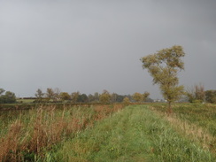
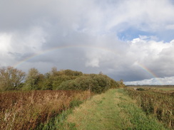
| Weather | Today's forecast was a little mixed, and for one it was correct: the day started off with some sunny periods, and it remained dry for the morning. In the afternoon the wind gained strength and sharp, blustery showers started. These never lasted too long but were fierce enough to get me thorougly wet. fortunately my fleece and hat managed to keep the worst off me. |
| OS map | Landranger number 156 (Saxmundham, Aldeburgh & Southwold) and Landranger number 134 (Norwich & The Broads, Great Yarmouth) |
 |
 |
|
Map of the walk
Maps courtesy of Google Maps. Route for indicative purposes only, and may have been plotted after the walk. Please let me have comments on what you think of this new format. For a detailed table of timings for this walk, please see the table file.
 |
 |
|
Notes
I fancied doing another day along the Angles Way today, so I set off stupidly early this morning for the long drive east to Bungay. I had left the trail a mile west of Bungay in Earsham on Friday's walk and so had no reason to do the mile to Earsham again. However Bungay has much better transport links so I felt it best to start there; this turned out to be a rather good decision. The drive went well, aside from nearly wiping myself out overtaking a lorry - I forgot that my Honda Jazz has the acceleration of a flea.
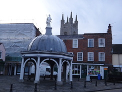
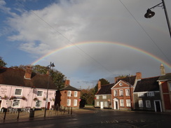
There were several car parks to choose from on Bungay, and I picked one that cost me £3 before walking around to the beautiful Butter Crosss in the centre. This was the exact spot that I ended the last walk, so I nipped into a shop to buy some snacks before heading off. Instead of following the road through the town I took side paths that headed past the ruins of the castle and then down to the Castle Inn - a much preferable route. Bungay is an impressive place - small but relatively unspoilt, with a good and somewhat eclectic collection of shops and buildings.
The walk to Earsham was easy as all I had to do was reverse last Friday's walk - I did not even need to glance at my map. Earsham just seemed to be waking up as I strolled through and the only people to be seen were the obligatory dog-walkers. A road took me up to the A143 main road, which the trail followed for a short distance before heading off along a track towards a farm. This was soon left behind as a path doubled back towards a minor road; this was a looping-U that was rather unnecessary, making me wonder why the people who had planned the trail chose that particular route instead of the much more direct one along the top of the U'.
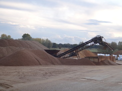
A walk north followed along the road; at one point I could see what looked like shiny railway lines off to the left. No railway was marked on the map and so I took a closer look - the lines were actually the shiny sides of a conveyor belt that climbed uphill away from the road. A lake was off to the right, so I assumed that it was something to do with sand and/or gravel extraction. This turned out to be the case a short distance on when a gravel yard appeared on the right.
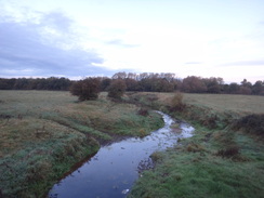
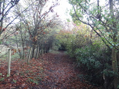
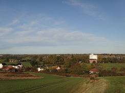
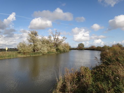
The road became quieter after passing the quarry and it soon ended by a house. A track and path headed on, slowly curving to the right with the River Waveney down to the right. At least the map indicated that it was there, but it was never really visible through the trees and vegetation beside the path. It was a pleasant walk despite this, especially when it climbed up onto the side of the valley. The path became narrower as the river continued curving to head southeastwards. Eventually it dropped down onto the floodplain, passed a lake before ending at a main road in Ditchingham.
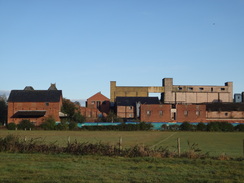
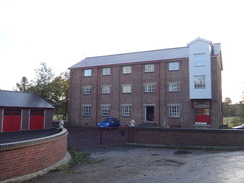
Some old malting a short way south had certainly seen better days; the buildings were abandoned and decayed. This gave some of the brick-built buildings a sombre character, but the tall concrete buildings behind seemed Stalanist; ugly and without any redeeming character. Indeed it was a shame that the concrete buildings had to be so near to the older brick ones.
I had now walked 4.5 miles, yet the looping nature of the walk meant that I was less then half a mile away from my startpoint in Bungay. A path headed eastwards across fields away from the road and here I went wrong for the first time on the trail, heading along the wrong edge of a field before realising and heading back, much to the amusement of the watching cows.
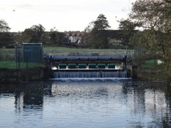
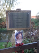
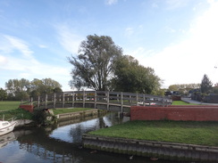
A road took me past another malting, this one still in use and busy, with a lorry tipping grain into an underground hopper. Nearby I came across the Waveney for the first time in the day, crossing its streams on a series of bridges. One of these had a plaque on it along with a picture of an attractive lady; a memorial to a woman who had died under the weir a few years ago. It was a sombre and saddening sight in what was a pretty spot.
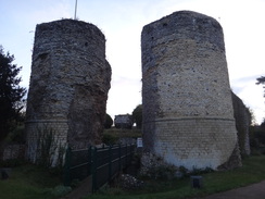
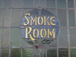
A pub marked on the OS map had suffered the same fate as so many pubs: it had been converted into a home, with the only indication of its original use being an intricate Smoke Room' glass in a window. Paths, roads and tracks took me southeastwards towards the ruins of Mettingham Castle, which remained out of view behind trees. Roads and tracks took me eastwards, after which a path along the edge of one of the longest fields I can remember took me north back up to the B1062 road, passing an attractive Mews building on the way.
The road was followed through the hamlet of Shipmeadow, passing the church before heading off along a path towards the floodplain of the Waveney. Sadly the river remained mostly out of view, with only a small glimpse of it becoming visible before trees and hedges intervened. Just north of Shipmeadow is a pub called the Lock Inn, which also marks the limit of navigation along the river. The paths were surprisingly popular, and I passed over ten people in several groups who were strolling along the trail.
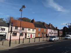
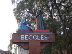
A police car approached as I walked down a rough track and I stepped onto the verge as it crept past. It seemed an odd place for it to be and I watched as it turned off towards Barsham Hall. The next stretch of track was fairly uninteresting; the track ended at the B1062 before local roads took me into Beccles. It was my first time in the town and I was impressed by what I saw - there are plenty of attractive buildings around the centre. I passed the bus station in the old market place, which would be useful as my return journey would depend on that.
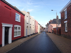
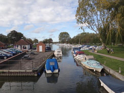
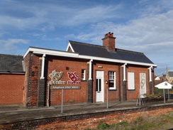
The trail headed north through the town, with the Waveney a short distance off to the left, mostly out of view except for tantalising glimpses. It seemed a very different creature from the small, trickling stream that I had followed earlier in the day and there were many boats moored alongside it. Soon the town's tourist information office came into view and next to it was a cafe. This seemed like a good post to take a break, so I went in and had a cheese and ham toastie and a cup of tea.
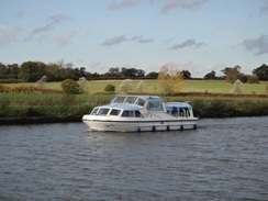
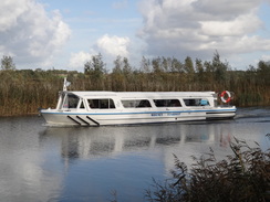
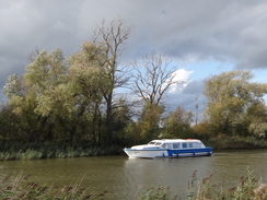
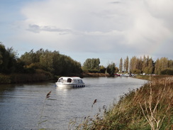
The second half of the day proved to be a very different creature from the first. It followed the southern bank of the river for most of the time and it made for a very pleasant walk. I listened to Prime Minister's Questions as I crossed a footbridge over a stream and passed a series of moored boats. This was the one disappointment that Beccles had in store for me - the majority of the boats were cruisers, and most of those were fairly ugly ones. The few wooden sailing boats or cruisers stood out like gems amongst the dirt.
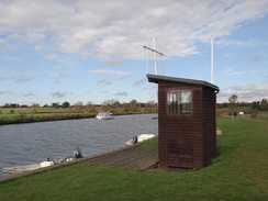
A steady stream of cruisers headed upstream as I passed under the A146 and started around Beccles Marshes. The noise of the traffic slowly subsided as the moored boats ended and fairly soon I was into a quiet area. It curves to take a more easterly course, passing a brick, streamlined pier of an old bridge that used to carry the Beccles to Great Yarmouth railway line over the river; other piers still remained in the water. The top of the piers were low to the water and I wondered how the boats got through; it turns out that it was a swing bridge which could be moved to allow boats past.
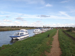
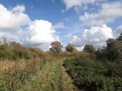
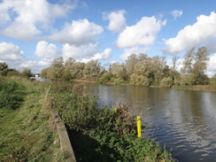
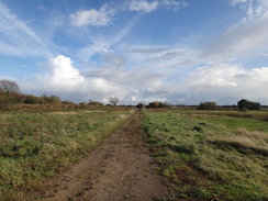
The next few miles were an easy walk along the southern bank of the river, with occasional grand views through the reeds and across the river. At Six Mile Corner I met a man who was sitting on the bank whilst pouring something out of a thermos flask; we chatted for a few minutes before I headed on. Time was pressing; I wanted to catch the 15.15 train, which was going to be tight.
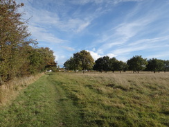
Eventually the trail left the river bank with an area of flat land called Peto's Marsh off to the left; I wonder if this had anything to do with Samuel Peto, the famous Victorian railway engineer who did many works in East Anglia. Peto deserves more recognition that he has now, and his rags-to-riches-to-rags story is fascinating. Brunel is rightly famous or the way he shaped the west of England; other engineers such as Peto did similar works elsewhere.
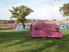
The trail left the flatlands and climbed slightly, heading past an area with garishly-painted caravans - red, blue and yellow - to reach the main road in Oulton Broad. The South station was only a few yards away, but I headed north for a short distance to a car park which would be a convenient place to start the next walk before heading back to the station.
I only had a twenty minute wait for the train, time which was pleasurably spent chatting to a fellow passenger. It dropped me off in Beccles exactly on time at 15.24, leaving me just six minutes to get to the bus station in the centre of the town. I ran the entire way and got to the bus station with a couple of minutes to spare. On the way I had seen a yellow bus going away down a street, and after waiting for half an hour my fears were proved correct - the bus had left ahead of schedule.
Annoyed and slightly depressed, I weighed up my options. The next bus was not for well over an hour and would take a very roundabout route to Bungay; in the end I walked to Tescos and used their phone to call a taxi. This arrived half an hour later; it cost me a tenner for the journey, which was more expensive than the bus but got me to Bungay much earlier. All in all it had been a good day, but the problems with the bus had been a big disappointment.
 |
 |
|
Directions
This walk starts off at the bus stop in Bungay at TM336897. From the bus stop opposite the Butter Cross in Bungay, take a narrow street that runs west, passing the Bungay Shopper shop on the left and the White Swan on the right. Pass a cafe and turn right along the path, passing the castle gateway on the right. Take a surfaced path that leads between walls before heading down a slope and curving to the left to reach the car park of the Castle Inn. Turn right through car park and pass the inn on the right to reach the Earsham Street.
Turn left down Earsham Street, passing the post office on the right. It descends to cross a stream and continues on with a pavement on the right-hand side of the road. It crosses two bridges over streams before entering Earsham; after a little under a mile the Queen's Head pub is reached turn right at TM322890. Just before the Queen's Head pub is reached turn right down Station Road; when this ends at a turning circle turn left to squeeze along a narrow path past the turning circle to reach the A143 road.
Carefully across the A143 road and then take a path that runs beside a fence on the left, with the road on the right. Pass some houses on the left, then just before a road junction turn left past a fence keeping the houses on the left. This joins an access driveway that soon ends at narrow road called Marsh Lane. Head on up this road; as the surfaced road curves slightly to the right before a house, turn left down a green path that soon swings to the left. The path soon emerges out into open fields with a hedge on the right before emerging out onto Bath Hills Road at TM318893.
Turn right down this road, soon passing house on the left. The road descends into a little dip before passing lakes on the right and passing the entrance to a gravel company on the right. Te surfaced road ends at Valley Farm and a good track continues on to reach a wooden field gate. Shortly after this the track curves to the right toward a house; here turn left along a path which skirts the track and the house on the right to reach a wooden pedestrian gate. Go through this and continue along the path. Squeeze past a wooden gate and continue on along a track, passing a house at TM322913.
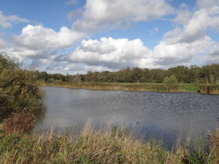
The track climbs uphill, passing some garage-style wooden barns on the left. At the top of the hill the track curves to the left, becoming a public road. Here turn right to continue straight on along a path, passing a wooden shingle house to the left. The hedge on the left ends and is replaced with a field; the path soon drops down so that the field is at head height for a tall person. After a while the path curves to the right and slopes slightly downhill, still with the field to the left, then curves to the left to head steeply downhill. At the bottom of the slope go through a wooden pedestrian gate and continue across grass to a track. Cross the track and head on to a clapper gate that enters some trees. Soon after entering the woodland the path curves to the left, following a fence on the left. The fence soon ends and is replaced with a field on the left; the path then reaches a track with a lake off to the right. Turn left along this track and follow it eastwards for a couple of hundred yards until it ends at the B1332 road in Ditchingham.
Turn right and follow the B1332 road for about ten yards to reach the roundabout. Carefully cross the A143 road and head straight on along a minor road that passes an old malting factory to the left. It crosses a bridge over a stream and then passes some playing fields on the left. Just before a little bridge over a stream is reached, turn left over a stile to enter a field. Head diagonally across the field, aiming for a filed gate in the far-left hand corner. Go through the gate and continue on across another field with a hedge to the left (the playing fields are on the other side of the hedge). At the end of this second field cross a stile beside a field gate and turn half-left to follow a hedge on the left. When the hedge curves to the left continue straight on across the field, soon joining a hedge on the right. As it approaches the end of the field, turn right through a field gate into another field. Follow a hedge on the left; after about twenty yards turn left across a stile to enter a field. Keep the hedge on the right; just before the end of the field cross a stile on the right. Angle diagonally across the field for short distance to reach a final stile that leads out onto Wainford Road at TM345905.
Turn right and follow this road as it heads southeastwards; it passes a malting on the left and then crosses streams of the River Waveney on a series of bridges. After 0.6 miles the road ends at a T-junction with the B1062. Carefully cross the main road and then turn left to start following it uphill. Shortly before the road curves to the left, turn right up a bridleway. Follow this as it enters a filed, following a hedge to the right, The path climbs uphill and the hedge on the right ends; the path continues on unfenced between two fields before it ends at a road at TM356895. Join the road and head straight on for about twenty yards until it curves to the right; as it does so continue straight on along another path between hedges. The path becomes a track that reaches a minor road at TM360894.
Turn right down the road for a few yards and then left along a footpath that runs between hedges; do not take an obvious track that continues straight on across the road. The path runs between these hedges in a rough southerly direction for nearly half a mile until it ends at a minor road near Mettingham Castle at TM362886. Turn left and follow this road as it heads eastwards. It passes a band of woodland on the right, and after half a mile it curves to the right. As it does so continue straight on along a track. Follow this eastwards with a hedge on the left. At the end of the first field the track curves to the left and then the right to run unfenced between fields. At the end of a very long field, pass a hedge on the left, then turn left to continue with a hedge on the left. Follow this hedge as it continues in a rough northerly direction, often twisting to the left and right. It passes some buildings (Viewpoint Mews) in the field to the right. When the hedge ends continue on alongside a ditch on the left. Shortly after passing the Mews the path crosses the ditch to join the B1062 once more at TM377899.
Turn right and follow the B1062 eastwards for a third of a mile; a pavement soon starts on the other (northern) side of the road. Pass Shipmeadow Church to the right and just before a house is reached on the left, turn left through a gateway to join a gravel track. When this immediately branches take the left-hand fork and follow a hedge on the left to reach a stile. Cross this stile into another field and follow a hedge on the left northwards. The path descends a slight slope; at the bottom of the field turn right to follow a fence to a stile across the fence
Cross a plank footbridge over a ditch on the other side, then turn right to join a green track with the ditch to the right. Go through a pedestrian gate beside a field gate and continue on as the track becomes better quality before ending at a T-junction with a minor road called Lock's Lane. Turn left along the lane and follow it as it immediately curves to the right; pass a fenced compound on the left and head straight on towards a field gate. Go through a pedestrian gate beside the field gate and continue on along a green lane. After a short distance the track curves to the left to a field gate; do not go through this and instead continue on to a pedestrian gate. Go through this and follow a path that runs through tree. The path soon curves to the left; turn right through a clapper gate into a field and continue on with a fence on the left.
Go through a pedestrian gate at the end of the field and turn left, keeping a fence to the left to reach a stile. Cross the stile and continue on with a field to the right. This soon reached some woodland on the left; keep this to the left. At the end of the field go through a gap in a hedge ahead and follow the path as it heads under power lines. A hedge starts on the right, protecting the path from a house. Shortly after this the path ends at a track immediately to the south of Barsham Hall at TM395901.
Turn left along the track for a few yards, then right down another track, keeping a hedge on the left. This soon passes a house on the right and continues on in a rough easterly direction. Shortly after passing the end of a dyke on the left it turns sharply to the right to pass a storage area for agricultural vehicles on the left. It then curves to the left; a mile after Barsham Hall go through a pedestrian gate beside a field gate and pass a house on the right to reach the end of the track at a T-junction with the B1062 at TM412899.
Turn left and follow the B1062 eastwards; a pavement soon starts on the left-hand side of the road. After a third of a mile turn left down a road called Puddingmoor. This road soon curves to the right to head northeastwards through Beccles, with the river behind buildings on the left. It passes a large retaining wall behind the church on the right, then curves to the right to end at a T-junction with Northgate immediately in front of the Old Market Place and bus station in Beccles (TM421905).
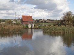
Turn left to follow Northgate northwards; after a third of a mile it reaches a crossroads with Beccles Old Bridge off to the left. Cross the road and continue straight on up Fen Lane. This soon reaches a marina next to the tourist information office; follow the road as it swings to the right and continue on for about twenty yards until a footbridge over an inlet is reached on the left. Cross the bridge and on the other side take a surfaced path that skirts the edge of the marina to reach the river. Once at the river bank turn right to follow the path towards the bridge that carries the A146 over the river.
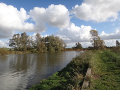
From here it is simply a case of following the riverbank for 6.5 miles; it initially heads north before curving to take a more easterly course. Initially the path is surfaced, but after passing a slipway it becomes grassy. Route finding is easy; just follow the obvious path with the river away to the left. The riverside is only left at TM494930, just to the south of a marina on the other side of the river. Here turn right to leave the flood banking, squeezing between two fences before turning half-right to heading southeastwards with a reed-filled ditch to the right.
At TM498927 turn right to reach a stile; this is hard to see through the reeds. On the other side continue on in the same direction along an obvious path. After a short distance the path curves to the right with a fence on the right; after this turn left along an obvious track. Go through a field gate and continue on along the track to a second field gate; go through a clapper gate beside the field gate and continue on towards White House Farm ahead.
Just before a car park is reached on the left after a short distance, turn left down a grassy path with the car park on the right. At the end of the car park join a path that soon curves to the right and continues on with a ditch to the left. As the main path curves off to the left continue along a minor path that soon curves to the right and then the left to cross a stile into a field. Keep a hedge on the left until a stile is reached ahead; cross this to reach a road below Ivy House Country Hotel at TM512921.
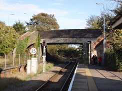
Cross the road and a stile on the other side to enter another field. Keep the hedge on the left; at the end of the field cross a stile beside a field gate and continue on, still with a hedge on the left. Cross a stile at the end of the field and continue between two fences for about twenty yards to reach a surfaced road inside a caravan park. Cross the surfaced road and a few parking spots to join a path across grass. This soon dives between hedges before ending at another surfaced road. Cross the road and head on, still between hedges. When the hedges end the trail emerges out onto a rough track; follow this until it reaches Oulton Broad South station at TM519922.
I extended the walk slightly by following the track as it curved to the left to end at a T-junction with the A1117 road; turn left and follow the A1117 north until a car park is reached on the left, which makes a convenient place to start the next leg of the Angles Way northwards.
 |
 |
|
Distances
| From | To | Distance (m) | Ascent (ft) | Descent (ft) |
|---|---|---|---|---|
| Bungay | Earsham | 1.1 | 13 | 30 |
| Earsham | Ditchingham | 3.2 | 226 | 236 |
| Ditchingham | Beccles | 7.7 | 226 | 213 |
| Beccles | Oulton Broad | 9.7 | 187 | 194 |
This makes a total distance of 21.7 miles, with 652 feet of ascent and 673 feet of descent.
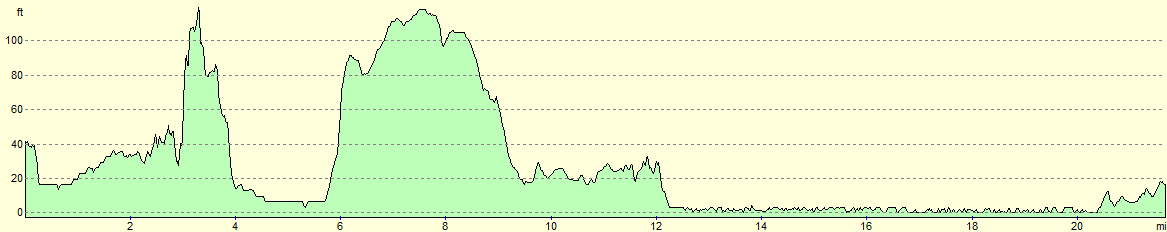
For more information on profiles, ascents and descents, see this page
Transport
In theory transport between Oulton Broad and Bungay is simple; as mentioned in the notes, in practice it was complex. A few train services a day travel between Oulton Broad South ang Beccles stations. To travel between Beccles and Bungay you can use Anglian Coach and Bus service 580, which travels between Beccles and Diss roughly every hour during the day.
 |
 |
|
 |
 |
|
 |
 |
|
 |
 |
|
 |
 |
|
 |
 |
|
 |
 |
|
 |
 |
|
 |
 |
|
 |
 |
|
 |
 |
|
 |
 |
|
 |
 |
|
 |
 |
|
 |
 |
|
 |
 |
|
 |
 |
|
 |
Disclaimer
Please note that I take no responsibility for anything that may happen when following these directions. If you intend to follow this route, then please use the relevant maps and check the route out before you go out. As always when walking, use common sense and you should be fine.
If you find any information on any of these routes that is inaccurate, or you wish to add anything, then please email me.
All images on this site are © of the author. Any reproduction, retransmissions, or republication of all or part of any document found on this site is expressly prohibited, unless the author has explicitly granted its prior written consent to so reproduce, retransmit, or republish the material. All other rights reserved.
Although this site includes links providing convenient direct access to other Internet sites, I do not endorse, approve, certify or make warranties or representations as to the accuracy of the information on these sites.
And finally, enjoy your walking!
Nearby walks
| # | Title | Walk length (miles) |
|---|---|---|
| 135 | Darsham Station to Brampton Station | 12.3 |
| 136 | Lowestoft to Caister-on-Sea | 14.4 |
| 167 | Brampton to Lowestoft | 12.3 |
|
|

|