Walk #1000: Chester to Flint
 |
 |
|
General Data
| Date Walked | 04/06/2018 |
| County | Cheshire, Clwyd |
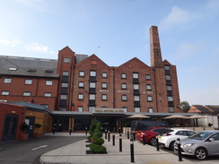
| Start Location | Mill Hotel, Chester |
| End Location | Flint railway station |
| Start time | 08.39 |
| End time | 14.43 |
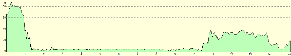
| Distance | 15.2 miles |
| Description | This was a varied walk following the Dee downstream from Chester. |
| Pack | Today I carried my 30-litre Karrimor rucksack, filled with water, my spare waterproofs, a book and other odds and ends. |
| Condition | I was wearing a new pair of boots today, and my left ankle started hurting towards the end of the walk. This is rather unusual, and I hope it is not a problem with the boots. |
| Weather | Today was generally cloudy with a few sunny periods; it was also quite warm, with little breeze to help us cool down. |
| OS map | Landranger number 117 (Chester & Wrexham, Ellesmere Port) |
 |
 |
|
Map of the walk
Maps courtesy of Google Maps. Route for indicative purposes only, and may have been plotted after the walk. Please let me have comments on what you think of this new format. For a detailed table of timings for this walk, please see the table file.
 |
 |
|
Notes
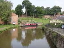
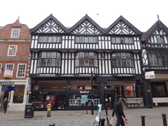
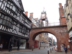
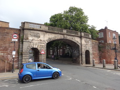
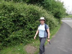
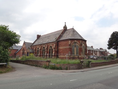
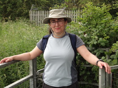
I had planned to go into the Peak District for my landmark 1,000th walk, but a short break in Chester and good weather meant a walk along the Dee seemed in order. Sencan wanted to come along, and so after breakfast we pulled our kit on and headed off. Our hotel is right beside the Shropshire Union canal, and we followed this for a short distance towards Chester's city walls, then climbed up and followed them past the cathedral. Before passing under the spectacular Eastgate clock, we nipped down to W.H.Smiths to buy a few snacks for the day, then clambered back to continue along the wall.
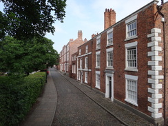
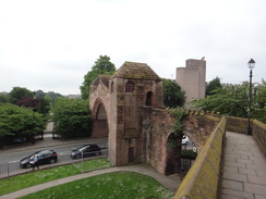
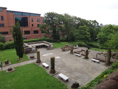
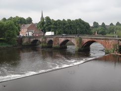
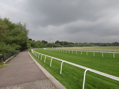
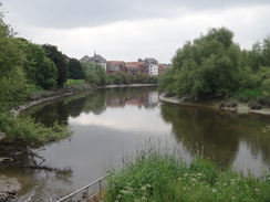
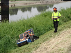
The walk around the city's walls is fairly spectacular: better and more spectacular than York's, although much of Chester's are medieval in date rather than Roman. We passed the site of a truncated Roman ampitheatre and continued marching along the wall. I have walked the vast majority of my thousand walks alone, and it was great to have Sencan alongside to chat and laugh with. Soon the tidal river Dee became visible down to the left, and then an old bridge over the river came into view. On the other side of this we left the walls and started walking past the racecourse. A man was mowing the border between the path and course, slaloming around the white posts that hold up the guard rails.
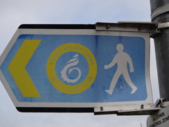
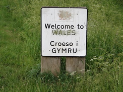
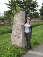
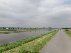
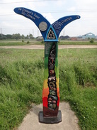
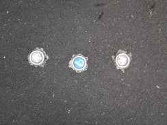
It was a pleasant stroll, but soon the path left the racecourse and headed under a railway viaduct before following the Dee's northern bank. We had to divert along a road past a new development, but we soon returned to the riverbank and a very good cyclepath. After a short distance we reached the Welsh border, where a few monuments commemorated not only the border, but also the start of the Welsh Coastal Path. For the rest of the day we'd see three small coin-sized symbols in pavements; two arrows pointing along the trail on either side of a central coastal path symbol. They were not particularly useful for routefinding, but were useful for confirmation that we were on the right path.
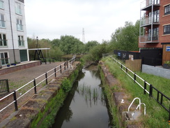
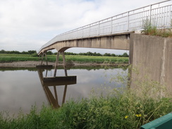
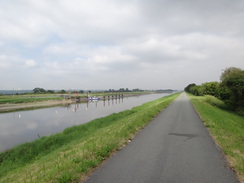
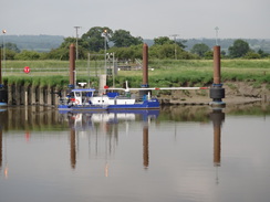
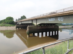
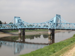
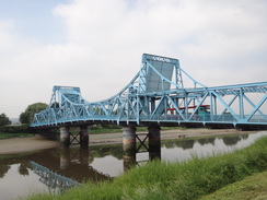
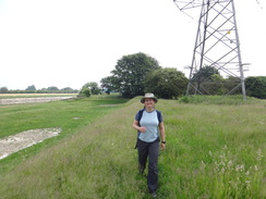
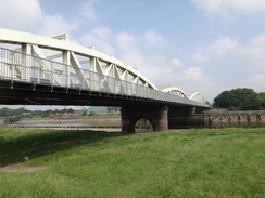
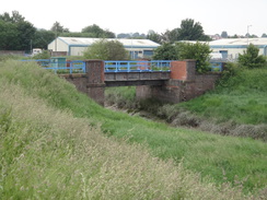
The trail passed a small footbridge over the river, after which the good surfaced path continued on northwestwards. After a while a series of metal posts - dolphins - stuck out of the water at an angle, by what appeared to be a short stretch of dock. The map showed Broughton aerodrome nearby and I made a guess that this was the dock where Airbus take wings out of their manufacturing facility - and for once I was correct. A large concrete bridge of virtually no architectural merit took the A494 over the river, partly concealing a much more interesting bridge behind - a bascule bridge that carries the quieter B5441 road across. It was not clear if the bridge opens nowadays - certainly it does not seem much lower than the adjacent concrete bridge - and alongside these two were the massive abutments of the Victoria Jubilee Bridge, which lasted less than thirty years before it was replaced.
I had used the bascule bridge to cross the Dee during my coastwalk, so it meant the point where this walk 'joined' the coastwalk, and much, although thanks to the new coastal path not all, of the rest of the day was on terrain that should have been familiar. However for some reason I could recall little of it, and when we got back to the hotel I had to re-read the relevant walk from my website. The path continued along floodbanks, the surfacing having ended. Sencan complained of a stone in her boot and sat on the ground to get it out. Wanting to help I picked the boot up as she straightened her sock, only to discover the boot's sole was covered in dog poo. With poo now all over my left hand, I had to place the boot on the ground and find some large leaves to try and clean it all off. A lot of water from my bottle helped clean most of it off, but my fingers still smelt slightly pungent.
The path passed under the Hawarden rail bridge, which now has a footpath alongside - I cannot remember whether it did fifteen years ago, but if it had I did not use it. The bank eventually followed a little inlet inland, where what looked like an old rail bridge spanned the inlet. This now carried a road, and it turns out it was indeed an old railway bridge that carried a line to Connah's Quay docks and on to Buckley Junction. A little further on we came across a small cafe in a portakabin - a quite eclectic sort of place, and we sat down outside after ordering some food - but only after I had nipped into the toilets to give my hands a thorough wash. The food was good, and we talked to an ex-fisherman for a while about the local area before setting off down the road.
We passed a group of men and women - perhaps in their early twenties - who were drinking lager and swearing loudly at each other, despite it being only one in the afternoon. They were not overtly threatening, but had a frisson that a wrong word or look could lead to problems. The childrens' play area they were standing by unsurprisingly did not appear well used. A little further on the trail crossed a bridge over the railway line and joined the B5129 road. This was not a particularly noteworthy or even pleasant stroll, and it was perhaps not the best walk with which to reintroduce Sencan to walking.
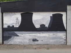
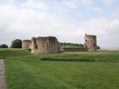
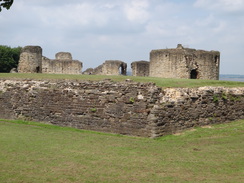
The trail passed under a main road and headed along a side road past a power station. It then joined the main road, and followed it to the outskirts of Flint. We were both suffering a little; Sencan had blisters forming on her toes, and my new boots were hurting my bad ankle. We soldiered on, and instead of taking the direct route along the road we followed the trail as it diverted off across the floodplain. This was a much more pleasant walk than the previous few miles along the roads, and we sat down for a short rest and to adjust our boots before heading towards Flint Castle.
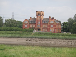
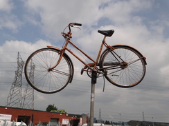
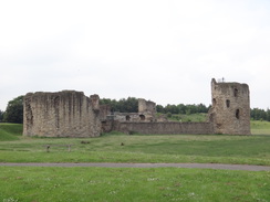
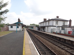
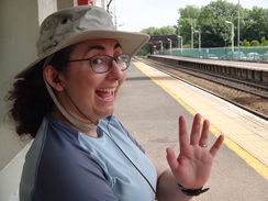
This had been the site of an interesting conversation on my previous walk, when a man had said he had been planning to steal our motorhome until he saw the charity sign in the window, and had decided against it! We did not visit the castle today, and instead walked on a short distance to the station, which for some reason has a massive metal sculpture of a foot outside it. We had twenty minutes to wait for the next train back to Chester, and we sat down and tried to cool our feet down.
It had not been a classic walk to mark my 1,000th stroll, but the company had been superb. The vast majority of my walks have been solitary affairs, and it was great to have Sencan alongside me once again. Perhaps when Robert leaves home in fourteen years we might be able to do a few more!
 |
 |
|
Directions
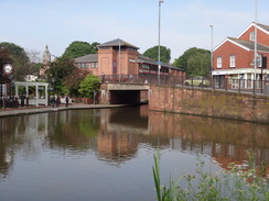
This walk starts off outside the Mill Hotel in Chester, which is beside the canal and near the railway station at SJ41006667 - the bus station is passed early on in the route, if that is a preferred alternative. Leave the main entrance to the hotel and turn left to reach Cement Place; turn left along the side of the hotel to reach the northern canal bank, and then turn right along Union Terrace, with the canal off to the left. This immediately passes under a large bridge carrying a road overhead, and heads on until it ends at a T-junction with Frodsham Street.
Carefully cross the road ahead; Chester bus station is a short distance away to the right. Turn left along the road and immediately cross the end of a road and a bridge over the canal. Turn right to head down some steps that lead back down to the canal towpath. Follow the towpath as it soon curves to the right and passes King Charles Tower Gardens on the left. When some steps through the gardens are reached on the left, climb them and a second set to reach some steps that lead up onto the top of the city walls at SJ40656663.
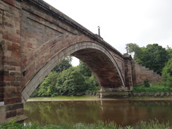
Turn left to walk west along the city walls; they soon pass Chester Cathedral off to the right and then reach the Eastgate bridge, which has an ornate clock above it. Continue on to the Newgate bridge, and follow the walls as they curve right to run parallel to the Dee. It crosses a bridge over the approach road to the Old Dee bridge, and immediately on the other side descend some steps. Cross the end of Castle Drive and then turn right to walk along the pavement that runs between Castle Drive on the right and the river on the left. When the road curves away to the right, continue along the surfaced path as it curves left, passing the Little Roodee car park on the right and passing under the spectacular single-arch Grosvenor Bridge at SJ40216558.
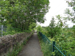
Pass under the bridge, and head on along a good path between the river on the left and Chester Racecourse on the right (note that this path is closed on a few days every year for the races). The path slowly curves to the right alongside the racecourse, and nearly half a mile after the bridge, it turns right and then left to head under a railway bridge. On the other side, continue on a good path alongside the river on the left. The path becomes a boardwalk that leads to new houses on the right, and just before an inlet is reached ahead, turn right up a walkway to reach New Crane Street. (Note: these directions from 2018 may alter once construction work on the flats finish). Turn left to follow the road northwards, soon crossing a bridge over a canal. Once a gap through the hedge on the left is reached, turn left to join a path that leads into a riverside park. Follow this to rejoin the riverside path, and continue on eastwards for a short distance until a sharp bend is reached at SJ39596667.
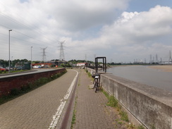
Follow the good surfaced path that heads southwestwards, with the Dee off to the right. After nearly a mile the Welsh border is reached; continue on for another mile until Higher Ferry footbridge is reached. At the bridge, turn right and go past a cycle barrier to meet the end of a road. Turn left past the end of the bridge, and then left beside the bridge approach ramp. Go past another cycle barrier and turn right to continue along the riverside cyclepath. Continue northwestwards along the cycle path for another 3.3 miles, until the Queensferry bridge carrying the A494(T) overhead is reached. Go past cycle barrier and pass under this bridge, and continue on for another 200 metres until the cycle path goes past a barrier and slopes up to reach the Blue Bridge at SJ32266871.
Carefully cross the road using the pedestrian crossing, and on the other side turn left to cross the Dee using the bridge. On the other, southern, side, go down the approach ramp and then take the first road off to the right (towards "Bridge Villas"), which nearly doubles back towards the bridge. Just before a house is reached ahead, turn left to follow a track that passes a garden hedge on the right. Continue along the track to reach a bridleway gate beside a field gate, after which a path continues to a clappergate beside a field gate. The path curves around between fences, with the river away to the right. It then curves left to reach a second clappergate that leads out onto a floodbank. Continue northwestwards along the floodbank, paralleling two sets of power lines on the left. The path curves to the left under the power lines, and then right to join a track on top of a floodbank at SJ31526894.
A few metres further on, turn right to follow a path that runs along the top of a smaller floodblank. The path passes back under the power lines and parallels the river to reach a clappergate beside a pylon. Go through this and head on along the bank; when the three-arch Hawarden rail bridge is reached at SJ31026927, turn left down the bank to join a concrete track.
The track passes under an arch of the bridge, and then curves left away from the river to head back under the power lines. It soon meets another track at the top of the bank; when it curves left through the trees, continue straight on along the grass on the top of the floodbank; after 0.4 miles it curves left beside an inlet called Wepre Gutter, heading back under the power lines to reach a clapper gate that leads onto a road at SJ30266943.
Turn right to cross a bridge over the inlet, and on the other (western) side angle right past cycle barriers to join a surfaced cycle path. Go past another barrier and head on; shortly afterwards go past another barrier and follow a broad path between a road on the left and the river on the right. The path and road soon curve to the left and then right, passing a small cafe in a portakabin on the left. Soon afterwards the road curves to the left once again; as it does so, turn right down Quay Lane towards the Old Quay House pub. Ignore the road as it curves left under the railway bridge, and instead continue a few metres towards the pub at SJ29356987. (Note: in 2018 this pub looks as though it is closed.)
Turn left to follow a path between a low stone wall and the pub towards the railway bridge; do not go under this, and instead follow the surfaced path as it curves right to parallel the railway line on the left. After a fifth of a mile the path turns left towards a bridge over the railway line; approach the bridge, but before it is reached turn right along another path that continues paralleling the railway line on the right. After another 200 metres, the path turns left to reach a footbridge over the railway line. Cross the bridge, and on the other side turn right along a surfaced path between stone walls. The path soon curves sharply left, passing an old chapel on the left to reach the B5129 road at SJ28817012.
Turn right to follow the road northwestwards. As a bridge is approached ahead after two thirds of a mile, carefully cross the road to meet the pavement on the other (left-hand) side. Continue on, and after another sixth of a mile carefully cross the road to rejoin the pavement on the right-hand side. Shortly after this the road curves to the left to meet a roundabout. Turn right to cross a sliproad heading down from the A548, pass under the A548 bridge, and cross a sliproad by a roundabout on the other side at SJ27567098.
After crossing the sliproad turn right down Kelsterton Road. Follow this westwards for a third of a mile; as the road curves to the right to cross a railway bridge, turn left to carefully cross the road and join a surfaced path that slopes downhill. The path emerges out onto the side of the dual carriageway. Continue along the road as it enters Flint; it passes a small roundabout on the left, the Yacht pub on the right, and after a little over a mile passes a chapel on the left. Shortly after the chapel at SJ25437227, turn right down a track.
The track passes between houses and leads down to a gate in front of a railway level crossing. Carefully cross the line and go through a second gate on the other side, and continue to a clappergate beside a field gate. Go through this and head straight on, following a hedge on the left At the end of the field, go through a gap in the hedge ahead and turn left along a grassy path. Cross a wooden causey over a boggy area, then a bridge over a dry ditch, and head on to a second footbridge and boardwalk. Continue on to a clappergate, and about twenty metres beyond the gate, turn right down a gravel path through scrubland. Go past a squeeze-stile beside a field gate, and then turn left along a surfaced path beside the sea wall. Follow the wall westwards; after a fifth of a mile it curves left; go past a vehicle barrier to enter a car park at SJ24837321, with Flint Castle away to the right.
Turn right to pass in front of a lifeboat station and walk on a few metres towards another car park. Follow the edge of the car park, and then turn left along another side to reach Castle Dyke Street. Turn right down this road, and when the entrance to the castle is reached on the right, turn left down Castle Street. Flint railway station is at the end of this road, at SJ24537312.
 |
 |
|
Distances
| From | To | Distance (m) | Ascent (ft) | Descent (ft) |
|---|---|---|---|---|
| Chester | Welsh border | 3.6 | 66 | 125 |
| Welsh border | Blue Bridge | 4.6 | 3 | 0 |
| Blue Bridge | Flint station | 7.0 | 131 | 128 |
This makes a total distance of miles, with 200 feet of ascent and 253 feet of descent.
For more information on profiles, ascents and descents, see this page
Transport
Regular train services run between Flint and Chester railway stations; Chester railway station is only a five-minute walk from the start of this walk.
 |
 |
|
 |
 |
|
 |
 |
|
 |
 |
|
 |
 |
|
 |
 |
|
 |
 |
|
 |
 |
|
 |
 |
|
 |
 |
|
 |
 |
|
 |
 |
|
 |
 |
|
 |
 |
|
 |
 |
|
 |
 |
|
 |
 |
|
 |
 |
|
 |
 |
|
Disclaimer
Please note that I take no responsibility for anything that may happen when following these directions. If you intend to follow this route, then please use the relevant maps and check the route out before you go out. As always when walking, use common sense and you should be fine.
If you find any information on any of these routes that is inaccurate, or you wish to add anything, then please email me.
All images on this site are © of the author. Any reproduction, retransmissions, or republication of all or part of any document found on this site is expressly prohibited, unless the author has explicitly granted its prior written consent to so reproduce, retransmit, or republish the material. All other rights reserved.
Although this site includes links providing convenient direct access to other Internet sites, I do not endorse, approve, certify or make warranties or representations as to the accuracy of the information on these sites.
And finally, enjoy your walking!
Nearby walks
| # | Title | Walk length (miles) |
|---|---|---|
| 416 | Point of Ayr to Shotton | 17.9 |
| 417 | Shotton to Hoylake | 19.0 |
| 419 | Ellesmere Port to Hale | 20.5 |
|
|

|