Walk #1007: Jurassic Way: Woodford Halse to Watford, and then down to Daventry
 |
 |
|
General Data
| Date Walked | 17/07/2018 |
| County | Northamptonshire |
| Start Location | Woodford Halse co-op |
| End Location | Daventry bus station |
| Start time | 06.16 |
| End time | 13.57 |
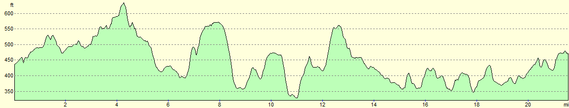
| Distance | 21.0 miles |
| Description | This was an enjoyable stroll following the Jurassic Way north from Woodford Halse to Watford, and then back along roads to Daventry. |
| Pack | Today I carried my 30-litre Karrimor rucksack, filled with water, my spare waterproofs, a book and other odds and ends. |
| Condition | I feel absolutely fine after this walk. |
| Weather | Today started bright and sunny, although there were occasionally cloudy periods. It became fairly hot later on, and there was not much of a breeze to cool me down. |
| OS map | Landranger number 152 (Northampton & Milton Keynes) and Landranger number 151 (Stratford-upon-Avon, Warwick & Banbury) |
 |
 |
|
Map of the walk
Maps courtesy of Google Maps. Route for indicative purposes only, and may have been plotted after the walk. Please let me have comments on what you think of this new format. For a detailed table of timings for this walk, please see the table file.
 |
 |
|
Notes
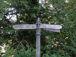
I really enjoyed last Friday's stroll along the Jurassic Way to Woodford Halse, and fancied doing the next leg north despite the forecast hot weather. Public transport on the Jurassic Way can be difficult, but I worked out that I could walk the trail north from Woodford Halse up to Watford (of Watford Gap fame), and then head south into Daventry, from where buses run every hour back to the start.
I got up early, and arrived in Woodford Halse before six. There was no space to park on the street where I parked on Friday, and I drove around for ten minutes trying to find somewhere suitable. In the end I went into a Co-Op store that had just opened, and the woman behind the counter said I could park in their car park for the day. This was very kind, and meant I did not have to park on the street.
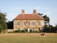
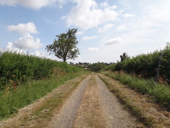
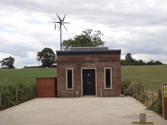
Roads took me to the point I had left the trail on Friday's walk, and then back past what was once the Great Central Railway main line. This is now an industrial estate and community woodland, and any chance of reopening the line seems remote, despite periodic talk and loose plans. The trail followed a track northwards, with occasional glimpses of the site of the old Great Central locomotive sheds off to the right - not that there was much to see besides grass. The trail skirted a hillside, on top of which sat Cherwelton Lodge, and headed to once again cross the course of the Great Central Railway.
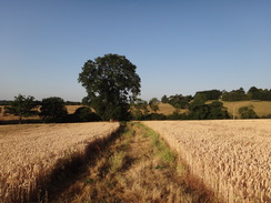
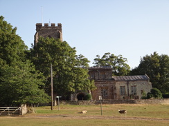
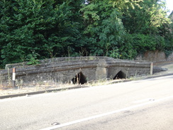
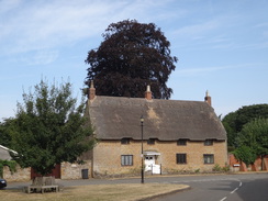
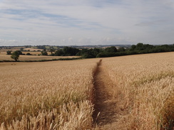
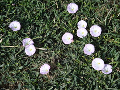
Church Charwelton proved to be a small place, although a rather large and striking house stood near the church. Another crossing of the old railway led to Charwelton itself, where an oddly-placed twin-arch stone footbridge stood parallel to the main road. This turned out to be a 13th Century Packhorse Bridge, and seems tiny compared to the road; there was also no sign of the stream it must once have spanned. The trail then crossed fields, skirting three small hills on its way into Hellidon. It was still early, and as I had been walking for a couple of hours I ate my first sandwiches of the day.
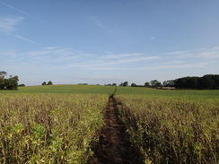
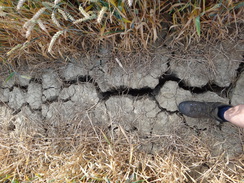
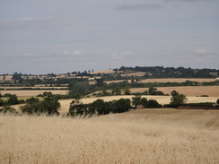
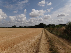
A road headed north into Lower Catesby, after which it headed northeastwards across fields towards Staverton. It was becoming hot despite the early hour, and the recent hot spell meant that some fields had cracks running along them, some so wide that I could almost put my foot in them. I was really enjoying the walk, and occasionally fine vistas unveiled themselves.
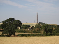
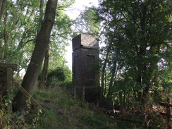
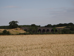
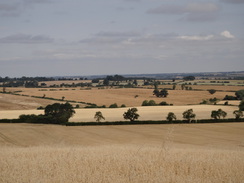
Soon another type of vista came into view on my left Catesby Viaduct. This 12-arch bridge was opened by the Great Central in 1898, along with the rest of the line I had come across today. Just to the south (and sadly out of view) is the 2,997-yard long Catesby Tunnel, which is in the process of being converted into an aerodynamic test facility – a very different form of tunnel! The viaduct is very impressive, although I was at the wrong angle to get a good photo of it. I climbed up onto the embankment and looked up and down the track, trying to imagine how it must have looked when steam expresses thundered past. It seems such a shame that it closed, even if the closure was understandable fifty years ago. A tall brick tower stood at the other side of the missing bridge, stretching up nearly as high as the embankment. It had pipes inside and I guess it was an old water tower, with the tank that once stood atop long removed.
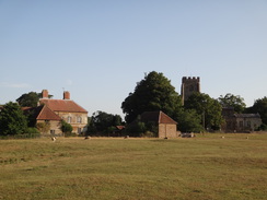
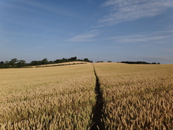
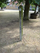
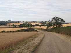
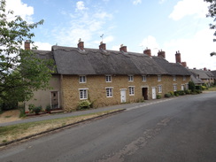
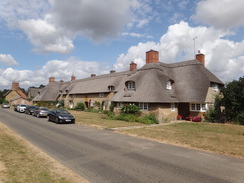
Another mile took me into the pretty little village of Staverton, where a post told me I had walked 22 miles from Banbury and had 66 miles to reach Stamford. The odd way I have walked this trail means that I'll probably have walked more like 120 miles by the time I finally complete it. The village was pretty, as is the case with many in Northamptonshire, as it seems difficult to make unattractive buildings out of the local stone. A road led north out of the village, although this soon became a track that had great views north as it descended down a hillside. It was a very pleasant walk in brilliant weather, and it was a shame when the track ended and a path continued on.
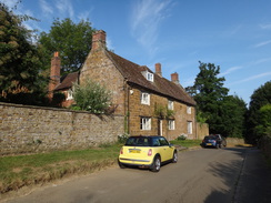
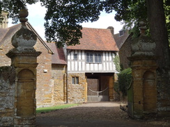
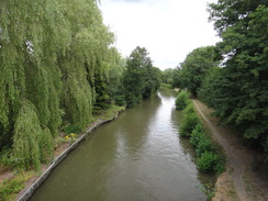
The path descended to cross another old railway line; this time not the old Great Central but an old line to Leamington Spa, and soon afterwards it reached the Grand Union Canal at Braunston. I have walked this stretch of canal several times in the past, and the water was bustling as I strode past. Sadly the canal was left behind as the trail climbed into the village, and then another good track took me on towards Abbey St Ledgers. This was another pretty village, and I had a quick chat with a couple sitting on a bench before eating some more sandwiches. A house by the church was part timbered above a driveway, and a nearby clappergate was very ornate. All in all it seemed a very pleasant place.
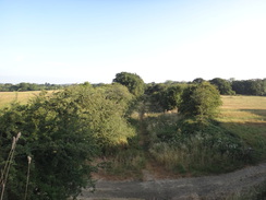
The trail headed east, but soon I came across a notice stating that, due to cattle, the farmer had diverted the footpath along a track. The track was made out of narrow pieces of concrete laid lengthwise, perhaps redundant concrete railway sleepers. The improvised track was bordered by electric fences, and I started to get annoyed by not being able to walk along the field nearby, which appeared empty. At one point I diverted back onto the 'proper' path through some woodland, but electric fences directed me back onto the concrete track. The track eventually ended, but the path was still diverted between an electric fence and a stream. I hope such diversions 'for your protection' do not become common on rights of way.
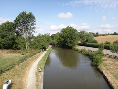
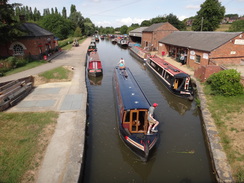
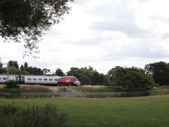
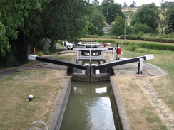
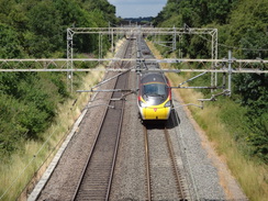
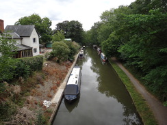
The constrained path approached the West Coast Main Line, and a surprising number of trains zipped past in the short time it took me to reach it. After passing under this, the trail crossed the A5 and reached the Leicester Arm of the Grand Union Canal at the Watford flight of locks. This was also busy, and several boats were making their way up or down the staircase of locks.
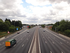
I felt very happy and relaxed as I bounded along the towpath. After this an underpass took me under the M1, and then onto the little village of Watford. The A5, motorway, canal and railway are all within half a mile of each other, which means this has been an important transport link from Roman times onwards - though I wonder what Romans would have made of Watford Gap services!
The rest of the day was a stroll along roads south towards Daventry. The traffic was not too bad, but it was still a bit of a let-down after the excellent walk so far. I skirted the village of Welton, crossed the Grand Union Canal on a high bridge and continued south. The area around the canal is being redeveloped with housing, and a good pavement and cycle path led on; when it swapped over to the other side I continued along a very narrow pavement, eventually joining a path on the northern outskirts of the town that led to the old railway line that I had encountered near Braunston.
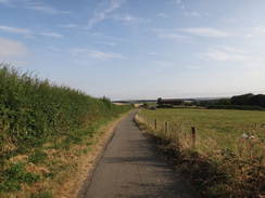
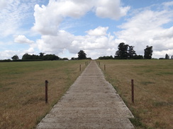
The trackbed had been converted into a path, and with a nice touch: old bridge coping stones had been made into seats. There were some other signs of the old railway, including a gradient board covered in graffiti. The path appeared to be well used, with lots of people enjoying the shaded area between the trees.
I did not have long before the next bus back to Woodford Halse, and I sucked up the last of my two litres of water as I strode through the town. I arrived at the bus station with under twenty minutes to spare, and I extended the walk slightly to join up with the walk I did earlier in the year, before heading back to the bus station. There is a Tesco store nearby, and I bought some drinks as I waited. It had been a very good day's walk, and now I have just one day to walk left before I have completed the Jurassic Way.
 |
 |
|
Directions
This walk starts off at the Co-Op store in Hinton, at SP53895262. Leave the store, walk through its car park and turn right up Phipps Road; there is a pavement on the left-hand side of the road. After nearly a third of a mile it ends at a T-junction with Byfield Road. The next section of directions is a diversion to join up with my previous walk along the trail; go to the next paragraph if you just want to continue on.. Turn right to follow Byfield Road eastwards for 150 metres until Great Central Way leads off from an industrial estate on the left; here the Jurassic Way joins from the right. Turn back to head westwards, and opposite Phipps Road at SP54025305 turn right up a surfaced track called Grants Hill Way.
This track soon crosses a road in a new housing development and continues northwards, passing farm buildings on the left to reach a bridleway gate beside a field gate. Go through this and continue north along the track. Three-quarters of a mile after the road, the track reaches a second bridleway gate beside a field gate; when the track curves left on the other side up towards Charwelton Lodge, turn right to head straight on along a grassy path with a hedge on the right. At the end of this field, go through a field gate to enter a second field, and continue along a rough track that heads uphill between fields. It starts to descend and joins a fence on the left to reach a field gateway that leads into an area of woodland. A ramp leads up to a bridge over the old Great Central Railway at SP54295490.
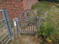
Cross the bridge and descend the ramp on the other side to reach a field gate. This leads into a field; head straight on across this, aiming for a barn on a hillside ahead. Descend a slight slope to a field gate at the end of the field, and then cross a bridge over a stream into a second field. Follow a hedge on the right uphill for a hundred metres, and then angle left away from the hedge, aiming towards Church Charwelton church ahead. Before the church is reached, cross a track; ignore a field gate on the left next to a barn, and instead follow a wall on the left for a few metres to reach a clappergate that leads into the churchyard at SP54465549.
Pass the church on the right, and head onto a gate that leads out of the churchyard. Head across a field to reach a clappergate through a hedge that leads into a second field. Continue straight across this, paralleling a hedge away to the left. At the end of this field, join a public road and immediately cross a stile beside a field gate to continue along westwards along the road; it soon crosses the old railway line once more at SP53845581.
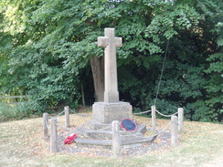
As the road curves sharply to the left after nearly three hundred metres, turn right through a field gate into a field. Follow a hedge on the left; at the end of the field cross a stile and continue down a slope to a footbridge over a stream. Cross this, and then a squeeze stile, and then angle slightly right across the next field, aiming for a wooden power pole ahead. Cross a stile beside a field gate and pass a war memorial to reach the A361 in Charwelton at SP53505606.
Carefully cross the A361 and start following a track northwards; when a bridleway gate is soon reached, go through this and roughly follow a fence on the left across the field; do not continue along the track or aim for an old railway bridge ahead. In the corner of the field, cross a stile through a hedge to reach a public road at SP53415637.
Turn left along the road for a few metres, and then right across a stile to enter a field. Angle half-left across the field, after a third of a mile squeeze through a gap in a hedge ahead and cross a stile to enter another field. Angle half-left across the field towards the far corner. Ignore a gateway on the left, and instead aim for a slight corner in the hedge, where a stile leads across a gap, about fifty metre to the right of the gateway. In the next field, follow a hedge on the left for a short distance before angling slightly away from the hedge to reach a stile beside a field gate. Angle left across another field; go through a field gate in a fence and then angle right to skirt a little slope on the left, roughly paralleling a fence at the bottom of the slope on the right to reach a stile at SP52635739.
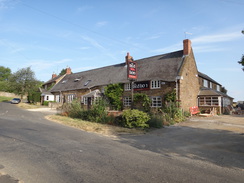
Cross a stile and then a decrepit bridge over a ditch to enter another field. Head diagonally cross this field, aiming for the far right-hand corner; cross a stile beside a double field gate and continue straight on across a second field. At the end of this field, go through abroad gap in a hedge and continue across a third field. At the far side of this field, cross a stile beside a field gate into a fourth field, and turn half-right down a slope. At the bottom of the field go through a clappergate in the hedge and then cross a stile into a fifth field. Head straight on, aiming for a beacon in the far corner of the field. Go through another clappergate and cross a little footbridge over a ditch to read a public road in Hellidon outside the Red Lion Pub at SP51855803.
Turn left along the road, and as it immediately curves left, turn right down another road (Stockwell Lane) that leads into the village. After nearly three hundred metres the road reaches a road leading off to the left towards Hellidon church; ignore this road and follow the one you are on as it curves left for about another sixth of a mile until a triangular junction is reached. Turn right along Catesby Lane; when the road soon forks, take the right-hand branch to reach a clappergate beside a field gate. Go through this and continue north along the road; it eventually curves right and then left and crosses a cattle grid. After nearly three-quarters of a mile it reaches another triangular junction in Lower Catesby at SP51715953.
As the road curves right, head straight on along another track. Shortly after the hedge on the right ends, go through a field gate on the right to enter a field, and head diagonally across the field to the far right-hand corner. Cross a stile beside a field gate into a second field, and follow a hedge on the right to reach another stile / field gate combination in the corner. In the third field, continue following the hedge on the right; at the end go through a field gate and head on past the hedge on the right towards a missing railway underbridge at SP52236021.
Head between the missing bridge's abutments, and on the other side cross a stile to enter a field. Head straight on across this field; at the far side descend a steep bank through a hedge to reach a plank footbridge over a stream; on the other side head up the other side into a second field. Head up a slight slope across the field, and at the far side descend a couple of steps, cross a footbridge over a stream, and then climb up to a stile that leads into a third field. Head across this field towards the far right-hand corner. A track is reached just before the corner; follow this track to a large gap in a hedge, and as the track curves right on the other side, head straight on up another field towards barns at the top. In the top corner, cross a stile beside a double field gate to reach Bates Farm at SP53026080.
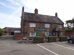
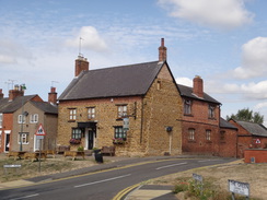
Pass the buildings of Bates Farm on the left and cross the farm's access track. Go through a stile on the left beside a double field gate to enter a field. Turn half-right across the field, aiming slightly to the left of the right-hand end of a band of trees. Cross a stile through a fence at the treeline and descend some steps through the woodland; at the bottom cross a footbridge over a stream, and then a stile. On the other side climb up out of the trees into a second field. Head straight on diagonally across this field, cutting the corner off; at the far side cross two stiles in a hedge to enter a third field. Head straight on diagonally across this field; at the far side cross a stile through a hedge and angle slightly to the left across a fourth field to reach two stiles through a hedge. This leads into a fifth field; angle half-left towards the field's corner. Near the corner cross a stile beside a field gate to reach the A425 in Staverton at SP53786110, opposite the Countryman pub.
Carefully cross the main road, and turn right past the pub to reach a road. Turn left along this road; it soon curves right to reach a triangular junction in Staverton. Head straight on along Oakham Lane, which ends at a T-junction with Braunston Lane. Turn right along this road and follow it northwards; after a couple of hundred metres the road is blocked by field gates. Go through a gap beside the gates and continue on along the old road. Follow this road as it becomes a track that heads northwards and starts to fall off the hillside; after 0.8 miles at SP54346282 a good track is reached.
Head straight on along this track, still heading northwards. It heads uphill, and after two-thirds of a mile it meets a surfaced track leading away to Berry Fields on the left. Head straight on along the surface track, and when it soon curves right towards another farm, angle slightly left across a field towards some trees ahead, ignoring a track leading off to the left. At the end of the field go through a gap in a hedge and head on downhill, angling slightly to the right across a scrubby area. The path crosses a stream and climbs up through some scrubby woodland. The path becomes less enclosed; follow the edge of the woodland on the left, with a hedge on the right. When the woodland on the left ends, continue straight on up a field towards a small clump of trees ahead. At the top go past a field gate into another field, and then follow a hedge on the right to reach a gap beside a field gate that leads out into the A45 at SP54616500.
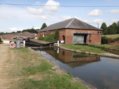
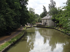
Carefully cross the main road, and turn left and immediately right through a field gate to join a track. Head along the track; go through another field gate and continue along the track, with a house ahead to the left and barns to the right. Continue along the track as it curves left and descends, passing through a gateway to reach a bridge over an old railway line. 0.6 miles after the main road, bridge #4 over the Grand Union Canal is reached at SP54856588 in front of the Admiral Nelson pub, and beside Braunston Lock #3.
Just before the bridge, turn left down some steps, and then right through a gate and down more steps to reach the canal towpath; turn left to follow the towpath westwards. Pass two more locks; after nearly a third of a mile Bridge #2 is reached. Cross the bridge, and when the path forks on the northern side, take the left-hand branch that heads towards a clappergate beside a field gate. On the other side, head on up a hill towards some trees. Go past a clappergate and join a gravel path that heads on through a second clappergate beside a field gate and on through a patch of woodland to a third clappergate beside a field gate. Walk between a fence on the left and wall on the right; the path emerges out into Welton Road in Braunston at SP54336629.
Turn left along the road for a few metres, and then right across the road past a triangular junction, and then turn right up Ashby Road. This heads slightly uphill; when the road curves right after a quarter of a mile, head straight on northeastwards along a track. After 0.6 miles a pedestrian gate is reached; go through this and continue along a path, with a hedge on the right. At the top corner of this field go through a second pedestrian gate and head on past a second field, still following the hedge on the right. At the top corner another pedestrian gate leads onto Daventry Road at SP55726754.
Turn right down the road, and after eighty metres turn left through a gap in a hedge leads into a field. Follow a hedge on the right; at the corner, go through a broad gap in a hedge ahead and continue following the hedge on the right. At the far corner of this second field, the path curves left for a few meres past a copse and then right and then follows a track for about fifty metres to reach a pedestrian gate beside a field gate that leads out onto the A3561 road at SP56586810.
Carefully cross the main road and head straight on up Main Street, which runs into the village of Ashby St Ledgers. As the road curves left after half a mile towards the church, turn right and then immediately left to join a track that passes the churchyard wall on the left. When the wall on the left ends, go through a clappergate beside a field gate and then angle half-left diagonally across a field. At the far corner, cross a stile through a fence into another field and turn right, past a fence on the left, up a field to reach another stile. Cross this to join a concrete track. Follow this eastwards (this is not the official path, but is a diversion made by the farmer), going through any electric fences on the way. After nearly half a mile at SP58376813 the track turns right up towards Bramleys Dairy Farm.
Turn left to head north along another concrete track; after about 150 metres a bridge over a stream is reached ahead. Do not cross the bridge, and instead turn right to follow a path that runs between the stream on the left and an electric fence on the right. Cross a track guarded by stiles and head on; after nearly half a mile the path reaches an embankment carrying the West Coast Main Line; turn right alongside it for a short distance and then turn left across a stile to reach a bridge under the railway line. On the other side cross another stile and turn half-right across a field, aiming for the left-hand side of a small car parking area. Pass the side of the car park and cross a stile through a hedge to reach the A5 at SP59216861.
Carefully cross the main road and turn left to cross the bridge that carries the road over a stream; immediately on the other side, turn right along a path that follows the stream on the right, climbing up to Watford Lock #2 on the Grand Union Canal. Cross the bridge in front of the lock and turn left to join the towpath. Follow the towpath northwards, with several canal locks on the left, for nearly 300 metres until the top lock #7 is reached. Immediately after the lock, turn right across a stile and descend into a field. Turn half-right across the field, heading towards the M1 ahead. Cross a stile beside a field gate and pass under the M1 at SP59486879.
On the other side, cross a stile beside a field gate and angle right across a field, aiming roughly towards houses ahead. Cross a stile and then a footbridge over a stream, and then a V-stile, and follow a fence on the left uphill across a second field. The path joins a track that leads to a clappergate beside a field gate; continue along the track on the other side as it runs between hedges and leads out onto a road in Watford. Head straight on eastwards down this road; after 250 metres a road leads off to the left at SP60336885. Here the Jurassic Way is left for the day.
Now the task is to get to Daventry. Turn around, and follow the road westwards back the way you came. When the Jurassic Way leads off ahead at a bend, turn left to continue down the road, which soon afterwards curves right as it leaves the village and climbs up to cross the M1, the canal, and then the railway immediately to the north of Watford Gap Services. After three-quarters of a mile, the road ends at a T-junction with the A5 at SP59556788.
Carefully cross the main road, and take a road that heads on the other side. This soon curves left; ignore a road leading off to the right. After 1.2 miles the road passes a crossroads and descends down into the village of Welton. As it leaves the village a pavement starts on the left. A mile after the crossroads the road crosses the Grand Union Canal on a high bridge and continues on for another third of a mile to reach a small roundabout. Cross this, and head on to a larger roundabout on the A425 at SP57576425.
Pass the roundabout, and on the southern side use a pedestrian crossing to cross to the other, western, side of the road. Follow the pavement south with the main road to the left; the pavement starts to angle away from the road, passes bollards to join the end of a local road called Welton Road. Walk along the pavement to the left of this, which soon starts climbing to reach an old railway trackbed beside a bridge. Turn left to join a path that runs along the old railway; after nearly half a mile the path leaves the old railway and curves right to reach Welton Road at SP57536295, near a large roundabout on the left.
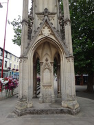
Turn right along the road for a short distance away from the roundabout, and when the road curves right, turn left to follow a path. Head under a road bridge and climb up the other side, passing a multi-store car park on the left. At the top of the road turn right along the B4036 Abbey Street towards the centre of Daventry; the road curves left beside the Burton Memorial cross, and then swings right to reach a mini-roundabout at SP57406243; Daventry bus station is ahead on the left.
 |
 |
|
Distances
| From | To | Distance (m) | Ascent (ft) | Descent (ft) |
|---|---|---|---|---|
| Woodford Halse | Hellidon | 4.7 | 257 | 147 |
| Hellidon | Staverton | 2.7 | 182 | 182 |
| Staverton | Braunston | 3.7 | 213 | 377 |
| Braunston | Watford | 4.7 | 275 | 268 |
| Watford | Daventry | 5.2 | 316 | 252 |
This makes a total distance of 21.0 miles, with 1243 feet of ascent and 1226 feet of descent.
For more information on profiles, ascents and descents, see this page
Transport
Stagecoach in Oxfordshire runs a useful bus service (route 200) between Daventry and Banbury. Watford, at the northern end of this route, has very few bus services.
 |
 |
|
 |
 |
|
 |
 |
|
 |
 |
|
 |
 |
|
 |
 |
|
 |
 |
|
 |
 |
|
 |
 |
|
 |
 |
|
 |
 |
|
 |
 |
|
 |
 |
|
 |
 |
|
 |
 |
|
 |
 |
|
 |
 |
|
 |
 |
|
 |
 |
|
 |
 |
|
 |
 |
|
 |
 |
|
 |
 |
|
 |
 |
|
 |
Disclaimer
Please note that I take no responsibility for anything that may happen when following these directions. If you intend to follow this route, then please use the relevant maps and check the route out before you go out. As always when walking, use common sense and you should be fine.
If you find any information on any of these routes that is inaccurate, or you wish to add anything, then please email me.
All images on this site are © of the author. Any reproduction, retransmissions, or republication of all or part of any document found on this site is expressly prohibited, unless the author has explicitly granted its prior written consent to so reproduce, retransmit, or republish the material. All other rights reserved.
Although this site includes links providing convenient direct access to other Internet sites, I do not endorse, approve, certify or make warranties or representations as to the accuracy of the information on these sites.
And finally, enjoy your walking!
Nearby walks
| # | Title | Walk length (miles) |
|---|---|---|
| 158 | Bugbrooke to Braunston | 15.1 |
| 162 | Braunston to Leamington Spa | 16.6 |
| 598 | A circular walk from Badby via Lower Shuckburgh | 21.4 |
|
|

|