Walk #1018: A circular stroll between Shipston-on-Stour and Chipping Campden
 |
 |
|
General Data
| Date Walked | 29/08/2018 |
| County | Warwickshire, Gloucestershire |
| Start Location | Shipston-on-Stour |
| End Location | Shipston-on-Stour |
| Start time | 06.38 |
| End time | 14.49 |
| Distance | 23.0 miles |
| Description | This was a pleasant walk, taking in Warwickshire's highest point and the beautiful village of Chipping Campden. |
| Pack | Today I carried my 30-litre Karrimor rucksack, filled with water, my spare waterproofs, a book and other odds and ends. |
| Condition | I feel absolutely fine after this walk. |
| Weather | The morning started off chilly, but it soon warmed up. There had been heavy rain overnight, but this had passed eastwards, and there were short sunny periods around lunchtime. |
| OS map | Landranger number 151 (Stratford-upon-Avon, Warwick & Banbury) |
 |
 |
|
Map of the walk
Maps courtesy of Google Maps. Route for indicative purposes only, and may have been plotted after the walk. Please let me have comments on what you think of this new format. For a detailed table of timings for this walk, please see the table file.
 |
 |
|
Notes
I do not have many days left in which I can walk midweek, as my son soon starts school with much less friendly hours than his nursery (having to pick him up before 15.30 means it is almost impossible to get a decent walk in). For this reason it seemed sensible to do a distant walk that required a long drive, and one linking Shipston-on-Stour to the end of the Cotswold Way at Chipping Campden seemed like a good option, especially as it could take in Warwickshire's highest point at Ebrington Hill.
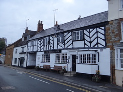
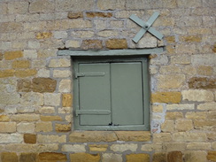
The drive took me an exhausting two hours, and I parked up in a free car park near the river in Shipston-on-Stour, only to find my water bottle had leaked half its contents onto the passenger floor mat and my Tilley hat. I cleaned up the best I could, got my kit together, and walked the short distance to the bus stop where I had finished a previous walk from Banbury. Shipston-on-Stour was just waking up for the day, and I enjoyed the architecture on some of the buildings as I started my GPS and walked off.
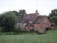
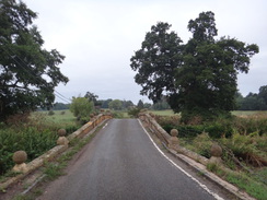
My route initially headed north along the main road out of the town, before joining the Centenary Way. This passed a new housing development and descended across a field to reach a footbridge over the River Stour near a pretty old mill, and then climbed up to reach a minor road. This was the start of many miles along roads; it took me north into Honnington, before turning to cross the attractive Honnington Bridge and climbing to rejoin the main road.
Fortunately there was a pavement alongside the road, which was starting to get busy in the build-up to rush hour. At times the pavement was vestigal, but the verge was wide and I made good time into Tredington. The only downside was that there was not much to see: the River Stour lay nearby to the right, but unseen through the hedges. It is a shame that there is no right-of-way through the grounds of Honnington Hall on the other side of the river.
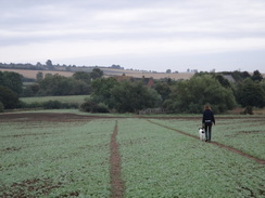
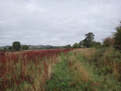
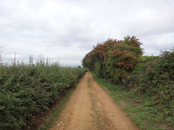
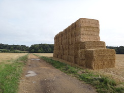
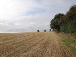
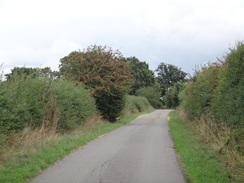
The trail barely touched Tredington before turning to head west towards a main road that runs along the course of the Foss Way Roman road. This was also busy, but I managed to cross it to join a thankfully quieter road that led into the village of Blackwell and out the other side. On the western side, the Centenary Way took a direct path that headed west across fields, with grand views of hills ahead not really compensating for stiles overgrown with brambles, or tall weeds wet from the overnight rain. The path was technically a short-cut from the slightly longer road route, although I think the road might well have been quicker.
It was a relief when the path met a road that led into Ilmington, which was another pretty little village. I diverted off the road to visit the church, which had a nice feature: the path through the churchyard had frequent lamps, the posts being big chunks of square timbers, and each timber had a small plaque commemorating a local person. It was a nice touch. Unfortunately the trees surrounding the church prevented me from getting a good photo of the building itself.
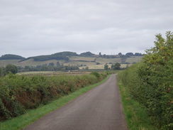
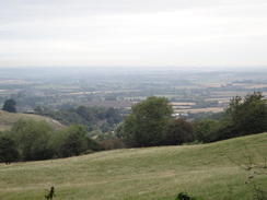
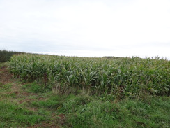
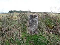
I was soon out of breath as I climbed a road that led steeply west out of the village, although the occasional splendid views back more than compensated for the effort. The gradient thankfully slackened, and I thought I had missed the bridleway leading off the road, and was just considering turning back when I saw its gate. The next stretch of path was quite pleasant, with occasional glimpses of views over the surrounding plains towards distant hills. It soon ended; Warwickshire's county top stood in a field off to the right, with corn seeming as tall as I was; I continued across a road into Gloucestershire and diverted off into a field to find a trig pillar.
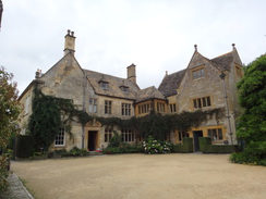
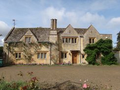
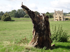
I ate my sandwiches on the long stroll down from the hill, and was dismayed to find that one of them was a prawn sandwich; whilst I quite like prawns, I don't when they are in sandwiches. I ate it regardless and was surprised to find two people in tabards directing cars in a car park. It turned out that this was the car park for Hidcote Manor, a National Trust property that is famed for its arts and crafts-inspired garden - although the buildings were spectacular enough.
Here I wanted to join the Monarch's Way down into Chipping Campden,, and on the map this headed south down a road past the manor before turning off to the right. However it was not obvious where to join the footpath and, not wanting to traipse down someone's immaculate driveway, I decided to follow the road instead. This was a bit of a diversion, but the extra distance didn't bother me as the road led south. There then followed a section of track that was surfaced in part, and rough in others, but it was still a welcome change from roads. The Heart of England Way joined the Monarch's Way on this stretch.
This led to another road, after which the trails continued towards a farm. Large overgrown mounds marked spoil from Campden Tunnel, which carries the Oxford to Evesham railway line under the Mickleton Hills. Construction of the tunnel proved troublesome for more than one reason, and led to the Battle of Campden Tunnel, when magistrates read the Riot Act to men working for the contractor, a situation that ended up in a fight between them and Brunel's men. I had walked this short stretch before, except in the opposite direction, although I could recall little of that previous walk.
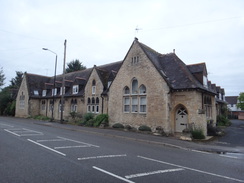
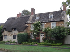
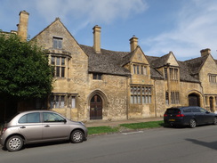
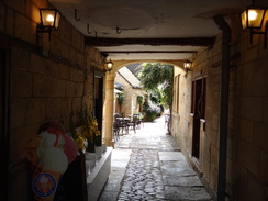
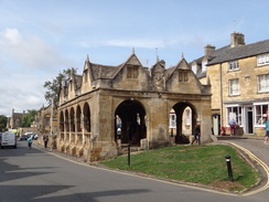
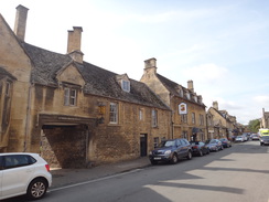
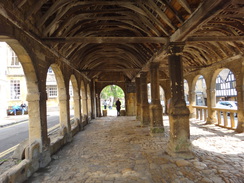
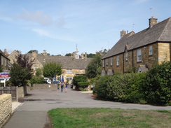
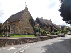
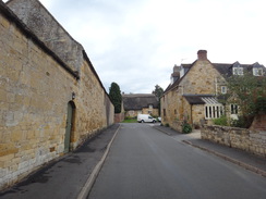
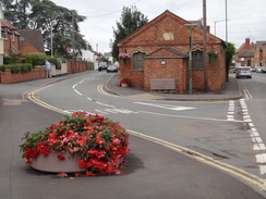
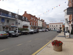
The path descended down from the hill, and I then made a little mistake, following a track across a field instead of the path along its edge. It was an easy mistake to fix, and the path led down into the town of Chipping Campden. I had been here before during my walk along the Cotswold Way, and I remember it as being filled to the gunwales with lovely stone buildings. If anything it was better than I remembered, and I walked slowly through it, studying all its buildings. It was filled with tourists, but they did not in any way demean its beauty (and after all, I was also a tourist). I found a Co-Op near the 1627-built columned market hall, bought some snacks, and sat down on a bench.
It is hard to describe quite how beautiful Chipping Campden is; perhaps it is best just to encourage you to visit it. The sun also came out for a rare visit as I sat, making the Cotswold stone shine. Beautiful buildings in many towns have been spoilt by the ground floors having been knocked out for large shop windows, topped by large glowing signs. Chipping Campden has been saved this fate, and most shops are marked only by small little signs.
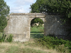
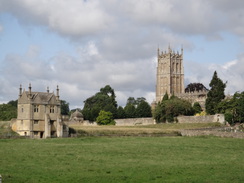
Eventually I shouldered my rucksack and started off, heading through a magical little gap under a building to reach its rear courtyard. I was looking for a path leading off, and figured it would not head through a small estate of new houses, all resplendent in their yellow stone. I headed uphill a little, before taking a footpath that came down to the edge of the houses, and then onto a little floodplain. This too was a beautiful spot, with the church and one of Campden House's two surviving Jacobean banqueting halls visible.
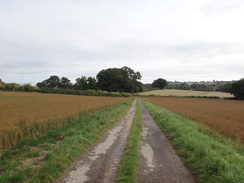
A road took me east, and then northeast, across a level crossing and on into the village of Ebrington, and then Charingworth. This was a bit of a let-down after the brilliance of Chipping Campden, but I still enjoyed the stroll. Another road led onto Stretton-on-Fosse, and then onto the Fosse Way itself. I had planned to take a path that headed east and then northeast over Hanson Hill back to Shipston-on-Stour, but as I was feeling fit I decided to extend the walk by following a path southeastwards. This crossed the old Stratford and Moreton Tramway, a light railway that opened in 1826. The path ended at a road at Ditchford Frary, and this took me eastwards. At one point I came across a tall, lean man wearing just swimming shorts and a shock of white hair on his head, carrying a bag. We exchanged pleasantries and continued on our ways.
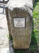
Another lane took me north, and ended at a main road immediately to the south of Shipston. My feet had just started to become a little sore as I walked into town and, with a two-hour drive ahead, I was keen to get on. I walked through the High Street and then down to the bus stop (which is opposite a rather lovely turnpike milepost), switched off my GPS, and walked back to the car.
It had been a good day's walk, with the highlights being Ebrington Hill and Chipping Campden. It is a shame that this area is so far away from home, as I am covetously eyeing other walks nearby.
 |
 |
|
Directions
This walk starts off at a bus stop in Shipston-on-Stour at SP25894073, opposite the old turnpike milepost on the A3400, just north of the Falcon Inn. Follow the road north out of the town; after 500 metres, and just before it starts climbing to a left-hand bend, turn right down the access road to some new housing, joining the 'Centenary Way'. As the access road immediately curves left, head straight on down a surfaced path that reaches a field gate. Go through a pedestrian gate beside the field gate and continue on along a tarmac path. The surfacing ends as it passes a little waterworks building on the right, and a vague track continues on alongside a hedge on the left. Go through a clappergate beside a double field gate through a fence and continue on. When the hedge ends, angle a few degrees to the left across a field to reach a bridleway gate that guards a footbridge over the Stour at SP26734137.
Go through the gate and cross the footbridge, and immediately on the other side turn left past a clappergate and follow the river on the left for about 50 metres to reach a footbridge guarded by gates across a mill leat. On the other side, head straight on across a field, passing a house about 50 metres away to the right. In the far corner of the field, go through a clapper gate at SP26914157.
This emerges out onto a road (Fell Mill Lane). Turn left to follow the road northwards; after nearly a kilometre it reaches a T-junction in Honington at SP26614244. Turn left to follow a road west through the village; it curves to the left as it leaves the village, and descends to cross a bridge over the Stour and starts climbing. Nearly 800 metres after the junction, the road ends at a T-junction with the A3400 at SP26044205.
Turn right to follow the man road northwards; there is either a pavement, or a wide verge, all the way. After 1.6 km it enters Tredington. Take the first road off to the left (opposite the church), called Blackwell Road, and follow it westwards. It passes a primary school on the right, leaves the village and then curves to the right; after 700 metres it ends at a T-junction with the A429 Foss Way. Turn left along the verge, and when you can carefully cross the road, and after 150 metres turn right down another road. Follow this as it winds around in a rough westerly direction for 750 metres until it ends at a T-junction in Blackwell at SP24334331.
Carefully cross the road ahead and follow it northwestwards through the village; it soon curves to the left to head westwards, and then ends at a road that angles in from the right. Continue straight on westwards along this new road; it leaves the village, and after 500 metres a road leads off to the right. Turn right along this road, and after 120 metres at SP23374343 turn left across a stile beside a field gate to enter a field.
Follow a hedge on the left along the first field, aiming for a stile in the hedge about 10 metres away from the left-hand corner of the field. Cross the stile to enter a second field and head diagonally across it, aiming for the far right-hand corner. Cross a stile about 20 metres form the corner, then turn right for a couple of metres and then left to enter a third field. Follow a vague hedge on the right westwards past this third field. At the far corner of this field, cross a stile into a fourth field and continue following the hedge on the right. At the far corner of this field, cross a stile into a fifth field. Continue following the hedge to a clappergate beside a field gate to enter a sixth field. At the far side of this field, cross a plank bridge over a ditch to reach a clappergate that leads out onto a road at SP21994336. Here the route of the Centenary Way is left.
Head straight across this road to join another road, signposted for Ilmington, and follow it as it heads in a rough westerly direction; it curves to the right, and after 800 metres ends at a T-junction in Ilmington near the Red Lion pub. Turn left down the road; just before it starts to curve right, turn right up Valenders Lane. When this ends, continue straight on along a surfaced path that follows a hedge and then a wall on the right until it enters Ilmington churchyard. Enter the churchyard and immediately turn left along a surfaced path, keeping the church on the right, and follow the path as it turns right to emerge out onto Back Street. Turn left down Back Street, and follow it as it curves left until it ends at a T-junction with Campden Hill road at SP20884336.
Turn right to head west along Campden Hill. It soon starts to climb steeply, but eventually the gradient slackens. When a track leads in from the left after 1.8km at SP19364262, just beyond a left-hand bend, turn right through a bridleway gate to enter a field. Follow a hedge on the right, but do not go through a gate on the right, and instead continue on uphill towards another bridleway gate. Go through this to reach a narrow path that heads uphill through an area of trees, before emerging out to run between hedges. Continue along the path until a bridleway gate is reached beside a field gate; go through this to reach a road on Ebrington Hill at SP18724259.
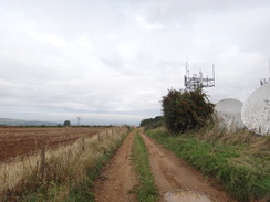
Cross the road and continue on along a restricted byway, soon going through or past a field gate. The track passes a compound housing transmitters on the right and heads on, slowly falling. After 300 metres the track curves to the right, continues north for 150 metres, and then curves left to resume a westwards course downhill. After another 600 metres it goes through a field gate, and 100 metres further on it reaches another field gate that leads into the car park for Hidcote Manor. Head straight on out of the car park onto a public road, and continue on straight on westwards (I could not find the path that carries the Monarch's Way past Hidcote Manor). After 350 metres the road ends at a T-junction; turn left to head southwestwards along another road. After 650 metres the road curves sharply to the left at SP16964251.
Do not follow the road around the bend, and instead head straight on down a track that is partly surfaced. Initially it heads southwestwards, before curving to the right to take a more westerly course. After 400 metres it forks; the right-hand fork goes up to a farm, but continue along the left-hand branch which heads southwestwards, initially following a hedge on the right. The track crosses a field and curves to the left to take a more southerly course, as the Heart of England Way joins in from the right; 1.1 km after the fork, the track ends at a road called Furze Lane. Turn right along the road and follow it westwards for 350 metres until a track leads off to the left at SP16154101.
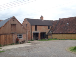
The track leads down towards Mickleton Hills Farm; go through a gate beside a cattle grid, and continue on to a second gate and cattle grid, after which the track approaches the farm. When the track ends, continue straight on across grass, keeping the farmhouse to the left, and then head towards a mound on the right (part of a spoil heap from Chipping Campden tunnel). Veer right slightly, heading down through trees, with the mound on the right. The path becomes less overgrown and enters a field on the right, following a fence and hedge on the left. It continues downhill to reach a bridleway gate that leads into a field at SP16144047.
Here I went wrong; the directions for the next few sentences are for the correct route, which follows both the Monarch's Way and Heart of England Way. Do not follow a track up the field, but instead turn right along the field boundary. When the corner is soon reached, turn left to start following a hedge on the right uphill. After 700 metres the field curves to the left, still following a hedge on the right. At the next corner, turn right up three steps and follow a path with a hedge on the left and a fence on the right, with a school beyond the fence. The path turns left to reach a clapper gate through the fence. Go through this and head down an access road to reach Station Road in Chipping Campden at SP15463947.
Turn right down the road, and follow it as it immediately curves left into the village. It soon curves right, passing Court Barn Museum on the left, and the curves right once more and passes the Eight Bells Inn to end at a T-junction with the B8041. Turn left to follow the road southwestwards into the centre of the village, reaching the spectacular Market Hall on the right at SP15133916.
Pass the Market Hall, and then just by the Town Hall and before the Noel Arms Hotel, turn left through an alley that heads under a building. Continue through a car park, and then on along its access road, which soon ends at a junction with a road. Turn right up this road, George Lane, and as it curves right continue straight on up a track (still called George Lane) between hedges. After nearly 100 metres, turn hard-left up three steps and through a clappergate at SP15233888 to enter a small field.
Turn right to follow a hedge on the right, with some new houses downhill to the left. The path curves left away from the hedge to reach a gate in a metal fence near the houses. Go through the gate and follow a surfaced path beside the houses on the left. When the houses end, go through another gate to enter a field and angle slightly right, heading for a gap between some trees on the right and a tree on the left, with the church high above away to the left. Head straight across this field. Pass a stone archway on the left, and a few metres beyond curve left to cross a farm bridge over a stream at SP15453905.
On the other side, curve slightly right to head across another field, angling towards (but never meeting) the hedge on the left. At the far side of this field, go through a pedestrian gate and a cross a footbridge and a second pedestrian gate into another field. Angle left up this field, keeping the church away to the left. At the top of the field, go through a clappergate beside a field gate to join a road at SP15753938.
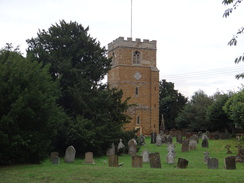
Cross the road to reach the pavement on the other side, and turn right to start following it eastwards. After 500 metres, turn left up Station Road (signposted for Ebrington), immediately passing a bowls club on the left. After 700 metres a level crossing is reached; cross this and head on uphill - the pavement on the left soon ends. Ignore a road angling off to the left at the top of the hill, and instead continue along the road as it curves right to head in a more easterly direction. The road enters the village of Ebrington, passing the church on the right, and 1.7km after the level crossing it curves to the right at SP18404013.
Follow the road around the bend, and shortly afterwards as it curves left near the Ebrington Arms to resume an easterly course out of the village. Follow the road as it enters Charingworth, and 1.8km from Ebrington a triangular road junction is reached on the right at SP20003961. Turn right to follow this road south for 500 metres until it ends at a T-junction with the B4035 at SP20103910.
Turn left to follow the main road eastwards for 300 metres until a road leads off to the right. Turn right down this road and follow it as it heads east-southeastwards. After 1.7km it enters the village of Stretton-on-Fosse; continue along the road as it passes the Plough pub on the right, and then curves right to pass the village church on the right. Shortly after the church, the road curves left and then left once more, to head eastwards out of the village. It soon ends at a T-junction with the A429 at SP22643814.
Carefully cross the main road, and on the other side cross a stile in a hedge to enter a field. Walk past a barn on the left, and parallel the hedge on the left downhill. At the bottom of the field go through a pedestrian gate into a second field. Head straight on for twenty metres across this field to a second pedestrian gate through a hedge. On the other side, cross a gap ahead to join a hedge on the right that heads southeastwards. As the hedge soon starts to curves to the right, angle left away from it, crossing the field diagonally towards some trees on the far side. Go through a gap to reach a farm bridge over a stream at SP23393770.
On the other side of the bridge, angle diagonally to the right across a smaller field, aiming for the right-hand edge of a small copse (ignore another path leading off to the right). Go through a gap in a hedge beside the copse and then angle right past trees to reach a stile. Cross this into a field, and follow the southern edge of the copse on the left. At the corner of this field, go through a gate to enter another field. Head across this for about 60 metres until it reaches an unfenced track. Turn right to head south down the track; cross a cattle grid and pass two houses on the right. After 180 metres the track emerges out onto the end of a road opposite a barn at Ditchford Frary at SP23673749.
Turn left to follow the road east-northeastwards. After 2.1km turn left up Shoulderway Lane. Follow this northwards; after 1.5km it ends at a T-junction with The A3400 on the southern outskirts of Shipston-on-Stour. Turn left to follow the A3400 north into the town; there is a pavement on the left. After 900 metres it passes the Coach and Horses pub and curves right; on the bend, turn left along a road and then immediately right down the High Street. At its end, turn right down Market Place, which merges with Sheep Street, and which soon ends at another T-junction with the A3400. Turn left to head north along the main road for 100 metres until the bus stop is reached at SP25894073, where this walk ends.
 |
 |
|
Distances
| From | To | Distance (m) | Ascent (ft) | Descent (ft) |
|---|---|---|---|---|
| Shipston-on-Stour | Ilmington church | 6.3 | 404 | 243 |
| Ilmington church | Chipping Campden | 6.8 | 643 | 542 |
| Chipping Campden | Stretton-on-Fosse | 5.7 | 535 | 633 |
| >Stretton-on-Fosse | Shipston-on-Stour | 4.2 | 154 | 318 |
This makes a total distance of 23.0 miles, with 1736 feet of ascent and 1736 feet of descent.
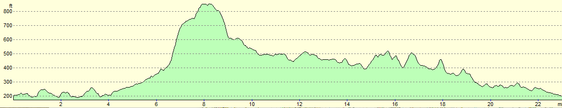
For more information on profiles, ascents and descents, see this page
 |
 |
|
 |
 |
|
 |
 |
|
 |
 |
|
 |
 |
|
 |
 |
|
 |
 |
|
 |
 |
|
 |
 |
|
 |
 |
|
 |
 |
|
 |
 |
|
 |
 |
|
 |
 |
|
 |
 |
|
 |
 |
|
 |
 |
|
Disclaimer
Please note that I take no responsibility for anything that may happen when following these directions. If you intend to follow this route, then please use the relevant maps and check the route out before you go out. As always when walking, use common sense and you should be fine.
If you find any information on any of these routes that is inaccurate, or you wish to add anything, then please email me.
All images on this site are © of the author. Any reproduction, retransmissions, or republication of all or part of any document found on this site is expressly prohibited, unless the author has explicitly granted its prior written consent to so reproduce, retransmit, or republish the material. All other rights reserved.
Although this site includes links providing convenient direct access to other Internet sites, I do not endorse, approve, certify or make warranties or representations as to the accuracy of the information on these sites.
And finally, enjoy your walking!
Nearby walks
| # | Title | Walk length (miles) |
|---|---|---|
| 620 | Cotswold Way: Dowdeswell Reservoir to Stanton | 19.8 |
| 621 | Cotswold Way: Stanton to Lower Quinton | 17.0 |
| 622 | Lower Quinton to Buckley Green | 22.2 |
|
|

|