Walk #993: Nene Way: Northampton to Wellingborough
 |
 |
|
General Data
| Date Walked | 20/04/2018 |
| County | Northamptonshire |
| Start Location | Northampton Drapery |
| End Location | Wellingborough Jacksons Lane |
| Start time | 06.41 |
| End time | 13.06 |
| Distance | 18.0 miles |
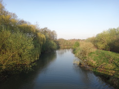
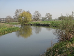
| Description | This was a very pleasant walk following the Nene Way from the centre of Northampton to Wellingborough, with long sections alongside the river. |
| Pack | Today I carried my 30-litre Karrimor rucksack, filled with water, my spare waterproofs, a book and other odds and ends. |
| Condition | Aside from my feet feeling a little warm, I feel absolutely fine after this walk. |
| Weather | Today's weather was very hot and sunny, with virtually no clouds in the sky and no breeze to cool me off. Fortunately I managed to complete the walk before the hottest part of the day. |
| OS map | Landranger number 152 (Northampton & Milton Keynes) |
 |
 |
|
Map of the walk
Maps courtesy of Google Maps. Route for indicative purposes only, and may have been plotted after the walk. Please let me have comments on what you think of this new format. For a detailed table of timings for this walk, please see the table file.
 |
 |
|
Notes
I had abandoned the Nene Valley Way for a few weeks due to the heavy flooding that had afflicted it this spring, choosing instead to walk the Jurassic Way. However today's weather forecast was for scorching hot sunshine, and I was keen to get back to the Nene. I had already walked the western stretch from Badby to Northampton, and the next stretch would take me east from Northampton to Wellingborough. I set off early this morning and parked up in Wellingborough's large (and thankfully free) long-stay car park. I walked the short distance to the bus stops and managed to get the first express bus of the morning to Northampton.
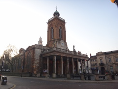
The bus arrived in Northampton a little after half past six in the morning, and I immediately set off down the road towards the river. I had forgotten my Tilley hat, and I wanted to get as many miles done as possible before it got too hot. The smell of hops in the air made me feel thirsty as I passed the Carlsberg brewery in the centre of the town, and I was soon dodging early-morning cyclists on the riverfront.
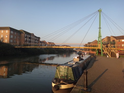
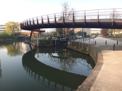
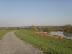
The riverside approach to Norrthampton from the west had been dirty and litter-strewn - not a pleasant introduction. The riverside path leaving the town was a different beast - neat, tidy and an enjoyable stroll. Signs of redevelopment were everywhere, from an old riverside warehouse that had been converted into apartments, to a brand-new sinusoidal bridge of pre-weathered metal over a lock linking a riverside park to a new university campus. A little further on a new road bridge spanned the river to the same campus. It all made a very pleasant early-morning walk.
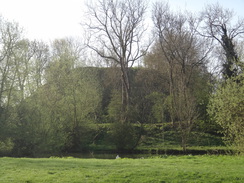
The trail passed a very long caravan park at Billing Aquadome, and a large mound was visible through the trees on the other side of the river - Clifford Hill, an old castle motte. At fourteen metres high it is one of the tallest mottes in England, but little is known about it - it was probably built to protect a ford across the river, but collapses might mean it was abandoned before anything substantial was built on top.
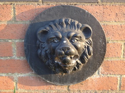
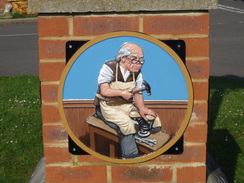
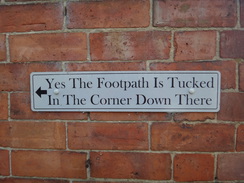
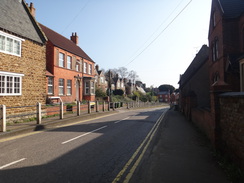
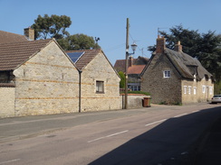
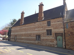
Soon afterwards the trail left the river and followed roads through the village of Cogonhoe. The first part was uninteresting, with relatively modern housing on both sides of the road and little of note to see. Things changed when the trail headed down towards the church, and suddenly I was surrounded by attractive stone houses. The path diverted off the road down a driveway that ended in a private house's parking area. I turned back towards the road thinking I had gone wrong, but a plaque on a wall stated that the path went through a corner of the parking area. I went back and soon discovered the path - the plaque being an amusing and helpful little feature.
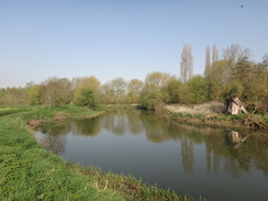
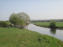
A pleasant riverside stroll followed, and as the sun rose higher in the sky I slathered another gloopy load of suntan lotion on my exposed skin. I hate suntan lotion; it is sticky, horrid stuff with an unpleasant smell. Yet it is better than the alternative of getting burnt, so I applied another layer and suffered the stickiness and smell.
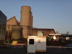
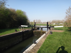
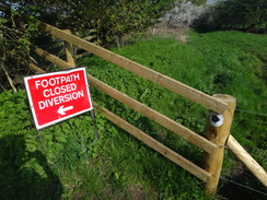
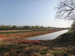
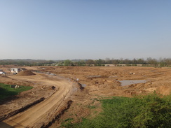
All too soon the trail reached a lock, where it headed away from the river. A sign warned that the footpath across the fields was closed, and a wide but boggy diversion followed the river and then a buried gas main. The reason for the diversion soon became clear: quarrying operations. Further on, newly-flooded pits, raw and devoid of vegetation, lay on one side of the diversion, whilst on the other side machinery was busy starting new pits.
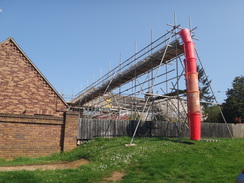
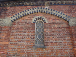
The track led to a long footbridge over the A45. On the other side a grassy track led on, finally depositing me on a road immediately to the south of Earls Barton. I headed on through the village, using the buildings to provide me momentary shade from the sun. The village has another motte, this one having being built in the middle of a Saxon defensive ditch. I could not see the motte from the road, but I could see the church which sits partially on it, and which also includes a rare 10th Century Saxon tower. Such ancient concerns were not for such a warm day, and instead I nipped into a shop to buy an ice lolly.
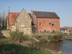
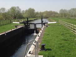
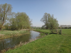
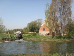
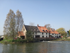
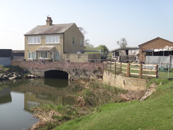
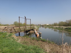
The trail left the village and headed back towards the river, crossing the A45 once more and reaching a house by the site of an old mill. A path crossed several river streams before heading across the floodplain to Earls Barton lock. Another pleasant riverside stroll followed across fields filled with little lambs and their mothers. Eventually a road was reached, with an old mill that had an unusual feature: a half-exposed water turbine, presumably generating power for the buildings. It is a rather modern - and noisy - version of the waterwheel that would once have powered the mill.
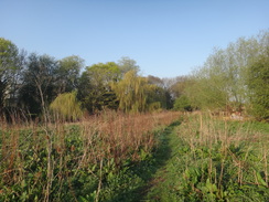
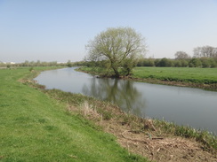
The path crossed the river and headed uphill into the village of Great Doddington, which was yet another attractive Northamptonshire village. A path then led down across fields back towards the river, and muckspreaders were busily moving from one side of a field to the other. So far today I had managed to remain mostly clear of mud, so I diverted around the edge of one field to avoid the worst. From there, the path followed the river all the way to the town of Wellingborough. Shimmering water was just visible over the river; flooded pits dug to obtain gravel deposited by rivers draining from ice-age glaciers.
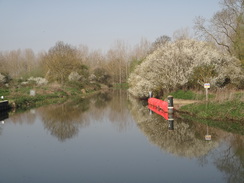
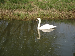
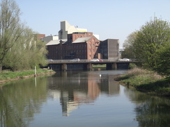
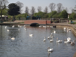
A lock was passed, after which the river headed under a large bridge that carried the A45 overhead. The riverside path started to be busier, with people enjoying the lunchtime sunshine. Massive buildings appeared across the river - Victoria Mills, a flour mill. Swans glided across the water's surface, seemingly unfussed by the noise from the mill, and neither were the people in the pleasant park opposite the mill.
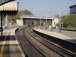
I had a choice to make now; I could head straight back to my car, or do a long diversion along the trail through a country park before heading back to the town. Whilst I had plenty of time to extend the walk, the sweat trickling down my neck told me it was getting warmer, and I decided to head back. However instead of going straight back to my car in the car park, I made a diversion to the railway station, mainly so that I can potentially start a future walk from there.
It had been a highly enjoyable riverside stroll, despite the war weather, and I can hardly wait to do the next leg of the trail further upstream.
 |
 |
|
Directions
This walk starts from the bus stop beside the McDonald's on the Drapery in the centre of Northampton, at SP75396049. Leave the bus stop and head south, passing the magnificent All Saints' church on the left. The road then starts to descend down Bridge Street, and at the bottom carefully cross a couple of roads coming in from the right. Continue on, passing the Carlsberg brewery on the right, until a roundabout is reached at SP75465979 just before a bridge over the river.
Here, cross over to the left-hand (eastern) side of the road using the pedestrian crossing, if not already on it, and head on a few metres towards the old Latimer and Crick building. Just before this is reached, turn right to join a cyclepath labeled 'Northampton Waterside'. This soon curves left to head in front of the building. It then passes under a couple of pedestrian bridges and past Northampton Lock before squeezing between Beckett's Park and the river. Eventually the path curves slightly left away from the river, passing a childrens' play area on the left before reaching Nunn Mills Road at SP76176000.
Carefully cross the road, and follow the path as it squeezes between a car park on the left and the river on the right. It soon passes under a new road bridge to the new university complex ('University Bridge'), and enters the Midsummer Meadow Recreation Ground. The path curves right and then left; shortly after passing a little car park on the left, a footbridge is reached on the right at SP76645981 over the old course of the Nene.
Turn right to cross the footbridge, and continue along a surfaced path with the river on the right. The path passes under twin large viaducts carrying the A45 over the river, and when it forks immediately after the viaduct, take the right-hand branch to continue beside the river. Soon afterwards it crosses a bridge over a small weir that provides water to a canoe slalom course on the left, to reach a larger bridge over the river on the right at SP77465954. Cross this onto the eastern bank.
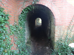
Immediately on the other, eastern, side of the bridge, turn right along a path that follows the river on the right. After 200 metres the path curves left to reach a footbridge over the River Nene Navigation. Immediately on the other side, turn left along a path that follows the navigation on the left; this is the first unsurfaced path of the day. It passes Rush Mills lock, and then at a path crossing turn left, keeping the river on the left, to head through a tunnel under a road bridge. Continue on to a second bridge that carries the A428 overhead, and continue on past Abington Lock towards a bridge ahead. Go through a clappergate and cross a footbridge over a ditch, to reach a bridleway gate; on the other side, turn left to join a bank that soon leads to a pedestrian bridge on the left at SP78085992.
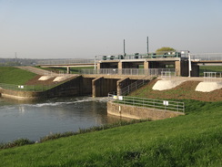
Turn right to cross a patch of gravel that soon ends, and then continue along the flood bank; it soon curves to the right to rejoin the southern bank of the river. It crosses a bridge over a small inlet and becomes a firm track; 0.8 miles after joining the bank, it reaches a long footbridge over a sluice on the left. Go through a gate, cross the footbridge and on the other side go through a second gate. Turn right along a rough track for a few metres, and then curve left beside a small building to reach a clappergate. Go through this gate to reach Weston Favell Lock at SP79236051.
Use a footbridge to cross the lock beside the guillotine gate, and on the other side turn right along a path that passes boat moorings, before turning left to run between fences. The path becomes a track that crosses a bridge over a river stream. Head north along the track until it reaches a field gate ahead; go through a clappergate in a fence about five metres to the right of the gate to reach Weston Mill Lane at SP79206083.
Turn right to follow the road for a few metres, and then right through a pedestrian gate to reach a path through a field that follows a stream on the right. The path soon meets the river and turns left to follow the river bank eastwards. Continue along the river bank as the path enters Billing Aquadome. After a while go through a clapperegate and join a track that roughly follows the river on the right, ignoring any paths leading off to the left or right. Keep on the track, and one and a quarter miles after leaving Weston Mill Lane, the track curves away to the left. Continue along a grassy path beside the river for a short distance and climb up to reach a footbridge near Billing Lock at SP81226107.
Cross the footbridge and follow the path as it curves sharply to the right to approach the lock. Turn left to walk alongside the lock, and at the far side turn right to cross a footbridge over it. On the other side, continue on along a very overgrown path through trees to reach a bridge over a river stream. Cross this, and on the other side go through a clappergate and descend a ramp into a field. Turn left to follow the edge of the field, with the river off to the left. The path approaches a road bridge over the river, and then turns to the right along the edge of the field, paralleling the road. At the corner of the field turn left through a clapper gate to join the road at SP81496097.
Cross the road and turn right to follow it southwards; there is a pavement on the left-hand side of the road. As the road curves right after 350 metres, turn left down Station Road; again, there is a pavement on the left. Follow the road as it climbs up into the village of Cogenhoe. After a mile a crossroads with Church Street on the left is reached at SP83146062, just before the Royal Oak pub.
Turn left down Church Street. When the road forks, take the right-hand branch called Mill Lane, that heads away from the church. As this soon curves to the right, head straight on down a surfaced access track that runs beside a house on the right. When the track ends at a parking area by a house, turn left to head between fences to reach a clappergate. Go through this to enter a field and descend downhill, paralleling a fence on the left. At the bottom of the field go through a clappergate and cross a little footbridge to rejoin Mill Lane immediately before a bridge over the river at SP83196125.
Walk a few metres along the road towards the bridge, and then turn right to join a footpath that leads out to a clappergate beside a field gate, with the river on the left. Continue along the path as it follows the river on the left; at the end of the first field go through a broad gap in the hedge ahead. At the end of the second field, go through another broad gap in a hedge. The path winds around as it roughly parallels the river through the third field. At the end of this field go through a clappergate and continue along the riverside path. A little over a mile after leaving the road, the path reaches Whiston Lock at SP84666176.
At the lock, turn left to cross a bridge over the lock. On the other side, walk a short distance to a second bridge over a river stream. A path then leads through trees to a long third bridge over a stream and a surrounding reedy area. On the other side, turn right (note that quarrying diversions means the next section has been altered from the route on the map), keeping a fence on the left. The path winds around between the fence and a reed-filled river stream on the right. It passes the end of a hedge across the fence to the left, and then immediately afterwards curves left away from the river along a broad path between fences. At the end of the field turn right between a hedge and a fence; after a few metres turn left to join a broad, rough track. As a main road is approached ahead, take a path that leads off to the left away from the track; this rises up to reach a long footbridge over the A45 at SP84736254.
Cross the footbridge and descend down the other side to join a broad track that runs between a hedge on the left and a band of trees on the right. Go through a gap in a fence, cross the access road to a nursery on the left, and then squeeze past a field gate to continue along the broad path as it runs between hedges. Go past a vehicle barrier and continue on until the track ends at the B573 road at SP84746342.
Carefully cross the road onto the right-hand side, and follow the pavement which slowly angles away from, and climbs higher than, the road to the left. It passes some bollards and becomes a surfaced road called Aggate Way. Follow this road until it ends at a T-junction with the B573 road in Earls Barton at SP84866378.
Turn right to follow the road eastwards through the village, crossing any roads met on the way. After 0.9 miles the buildings and pavement on the right end just before a triangular track junction. Turn right to follow this unsurfaced track as it heads downhill; after a third of a mile it crosses the A45 on a bridge. On the other side the track curves to the left and then right and continuing on until the track ends at a house on the right. Head straight on, crossing two footbridges over sluices to reach a clappergate into a field. Follow an obvious path to a farm bridge over a water-filled ditch, and then angle slightly to the right to reach a clappergate beside a field gate that leads to Earls Barton Lock at SP86776278.
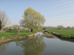
Cross the footbridge over the lock and turn left to go through a clappergate on the other side. Follow the river on the left, soon passing a large electricity pylon. As a lake on the right ends, go through a bridleway gate beside a field gate and continue on alongside the river on the left. The river splits; keep the right-hand stream on the left. Go through a clappergate through a fence and continue on; 0.9 miles after the lock, cross a stile beside a metal field gate to reach Hardwater Road at SP87676368.
Turn left along the road, and carefully cross a couple of bridges over river streams. Shortly after the second bridge, turn right through a clappergate beside a field gate to enter a field. Walk along the grass parallel to the river on the right. At the corner of the field, cross a plank bridge over a stream and go through a clappergate to enter a second field. Cross a track on the left, and angle diagonally across the field, aiming towards houses at the top of the field. Cross a little stream on a broad farm bridge and continue on to a clappergate in a wooden fence. This leads into a third field; head on up this, angling away from the hedge on the right. At a corner of the field, go through a clappergate beside a field gate to enter a fourth field. Climb uphill, roughly paralleling a fence on the right. At the top go through a gateway to enter a little paddock, with a green barn on the left. This leads to a tall clappergate that leads out onto Lower Street in Great Doddington at SP88086469.
Turn right to follow Lower Street as it winds around, before it ends at a T-junction with the B573 High Street. Turn right along this, and before a left-hand bend is reached, turn right down a surfaced drive that leads to a pedestrian gate beside a field gate. Continue on to reach a stile beside a field gate. Head on down the hill for about ten metres to reach a clappergate through the hedge on the right. Go through this and turn left to follow a path between fences. After twenty metres go through another clappergate into a field; head straight on across the field. At the end of this field, go through a clappergate to enter a second field. Head straight on as the path falls. At the end of this field go through a clappergate to enter a third field. Angle slightly left away from the fence on the right, aiming for the far end of a house at the bottom of the hill at SP88876461.
Ignore any paths leading to the right across the river, and instead continue along the northern side of the river. At the end of this field go through a clappergate beside a field gate into a second field, and continue following the river on the right. At the end of this field go through another clappergate beside a field gate into a third field, and then again, at the end of this field, go through another clappergate in a hedge to enter a fourth field. Immediately pass under some power lines. Continue along the riverbank; at the end of the fourth field go through a clappergate to follow a path between a fence guarding a lake on the left and the river on the right. Pass under a pipe bridge and continue on between fence and river. Cross a footbridge over an inlet and head on to reach Upper Wellingborough Lock at SP89936623.
Pass the lock on the right, and soon afterwards the path curves left to cross a concrete bridge over a tributary; on the other side it curves right to cross a small bridge over a ditch and then heads under the A45 road bridge. The path then curves left to cross another footbridge over an inlet and then right to continue alongside the river towards another road bridge, with a massive mill complex ahead. Pass under the road bridge and continue on along the riverside footpath past a park on the left. The park narrows, and the path then runs alongside a road on the left. When the road on the left turns left at SP90286687 the Nene Way is left for the day.
From here, I headed towards Wellingborough railway station and then my car. Join the road (called 'the Embankment') and follow it as it heads north away from the river; after a third of a mile a mini roundabout is reached. Cross the roundabout and continue up Senwick Road. When this ends at a T-junction, turn right up Midland Road, and follow it to the left until it reaches Wellingborough railway station at SP90326812.
Head back along Midland Road, and follow it into the town. When it curves to the left, continue straight on along the B572, with the Swansgate shopping centre on the left. This road soon ends at a T-junction; turn right up another road and follow it as it curves to the left and ends at a T-junction. Turn left up Church Street, passing some bus stops, and when this road also ends at a T-junction, turn right up the A5193 High Street. The Jacksons Lane car park is on the left about a hundred metres up the road at SP88826798.
 |
 |
|
Distances
| From | To | Distance (m) | Ascent (ft) | Descent (ft) |
|---|---|---|---|---|
| Northampton Drapery | Cogenhoe | 7.0 | 191 | 196 |
| Cogenhoe | Earls Barton | 3.4 | 161 | 164 |
| Earls Barton | Great Doddington | 3.2 | 194 | 171 |
| Great Doddington | B573 in Wellingborough | 2.4 | 10 | 151 |
| B573 in Wellingborough | Wellingborough Jacksons Lane | 2.0 | 142 | 32 |
This makes a total distance of 18.0 miles, with 698 feet of ascent and 714 feet of descent.
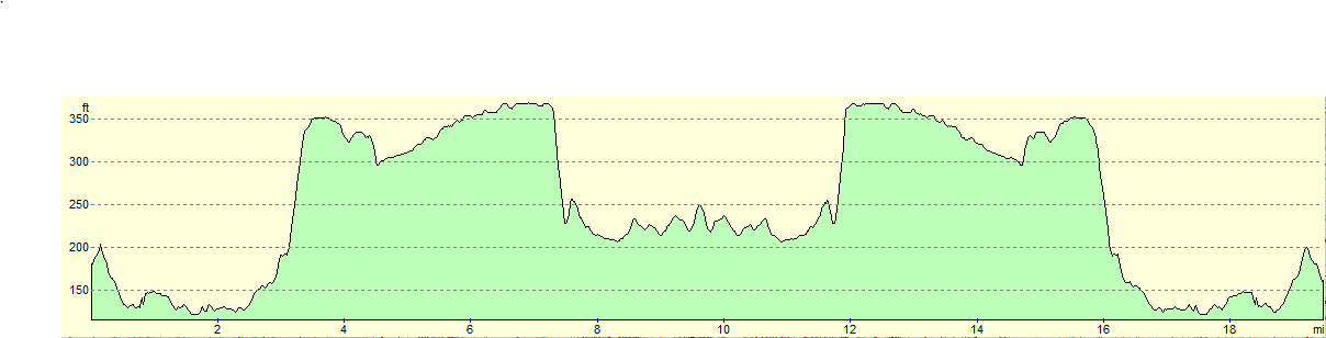
For more information on profiles, ascents and descents, see this page
Transport
Regular bus services run between Wellingborough Church Lane and Northampton Drapery. Stagecoach 47 and Stagecoach X4 Gold are the main two services.
 |
 |
|
 |
 |
|
 |
 |
|
 |
 |
|
 |
 |
|
 |
 |
|
 |
 |
|
 |
 |
|
 |
 |
|
 |
 |
|
 |
 |
|
 |
 |
|
 |
 |
|
 |
 |
|
 |
 |
|
 |
 |
|
 |
 |
|
 |
 |
|
 |
 |
|
 |
 |
|
Disclaimer
Please note that I take no responsibility for anything that may happen when following these directions. If you intend to follow this route, then please use the relevant maps and check the route out before you go out. As always when walking, use common sense and you should be fine.
If you find any information on any of these routes that is inaccurate, or you wish to add anything, then please email me.
All images on this site are © of the author. Any reproduction, retransmissions, or republication of all or part of any document found on this site is expressly prohibited, unless the author has explicitly granted its prior written consent to so reproduce, retransmit, or republish the material. All other rights reserved.
Although this site includes links providing convenient direct access to other Internet sites, I do not endorse, approve, certify or make warranties or representations as to the accuracy of the information on these sites.
And finally, enjoy your walking!
Nearby walks
| # | Title | Walk length (miles) |
|---|---|---|
| 137 | Market Harborough to Northampton | 18.3 |
| 157 | Wolverton to Bugbrooke | 16.6 |
| 158 | Bugbrooke to Braunston | 15.1 |
|
|

|