Walk #995: Nene Way: a walk from Wellingborough to Thrapston, and then down to Raunds
 |
 |
|
General Data
| Date Walked | 04/05/2018 |
| County | Northamptonshire |
| Start Location | Wellingborough Church Street |
| End Location | Raunds, The Square |
| Start time | 07.38 |
| End time | 16.18 |
| Distance | 22.5 miles |
| Description | This was a pleasant walk following the Nene Way northwards to Thrapston, followed by a road walk back down to Raunds. |
| Pack | Today I carried my 30-litre Karrimor rucksack, filled with water, my spare waterproofs, a book and other odds and ends. |
| Condition | I feel absolutely fine after this walk. |
| Weather | The day started off sunny, with not many clouds in the sky. The clouds gathered as the day progressed, but it was still a good day for a walk. |
| OS map | Landranger number 152 (Northampton & Milton Keynes), Landranger number 153 (Bedford & Huntingdon, St Neots & Biggleswade) and Landranger number 141 (Kettering, Corby & surrounding area) |
 |
 |
|
Map of the walk
Maps courtesy of Google Maps. Route for indicative purposes only, and may have been plotted after the walk. Please let me have comments on what you think of this new format. For a detailed table of timings for this walk, please see the table file.
 |
 |
|
Notes
I had not been able to do a walk for over a week due to wet weather and family commitments, so I was keen to hit the Nene Way again. I awoke late after a restless night, but decided I could still manage this long walk and get home in time too pick my son up from nursery - and more on that later. The free car park in the centre of Raunds is small, but very convenient, and I managed to park and put my boots on about four minutes before a bus to Wellingborough was due to leave. The bus took a rather roundabout route, but dropped me off in the centre of the town an hour later.
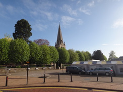
I decided to take a different and slightly shorter route out of Wellingborough. The toilet block near the market was not due to open for another quarter of an hour, but the door was open so I went in and used the facilities - a very welcome stop after the long bus journey! I've never been to Wellingborough before the recent walks, and it's a pleasant place: it's not a classically beautiful town, but it does have a certain charm. A plaque on the wall of a cabin near the market commemorated some people who died in a bombing in the war - a somber but welcome memorial.
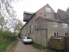
My route out of the town followed roads, passing Wellingborough School. A sign outside the school stated that it had first opened in 1595, and I can only hope they've changed the syllabus since then! Eventually I reached the riverside park opposite the massive (and noisy) Victoria Mills complex, and another short stretch of road took me to the riverside path I had walked on a previous trip.
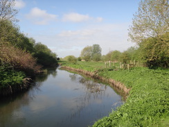
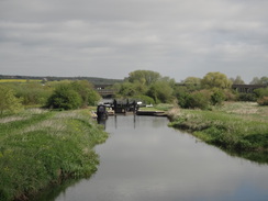
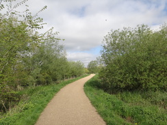
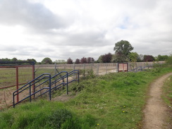
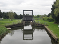
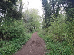
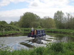
Here I had a choice to make: the 1:25k and 1:50k maps show different routes for the Nene Way: one has it looping through a park to the south of the town (much of which I have walked before), and another has it following the river. Since it is a river trail, and because I have not done the stretch before, I decided on the latter. The trail followed a good path out of the town, passing under a footbridge that used the abutments of an old railway bridge that once spanned the river. Shortly after this it passed a lock on the river that was surrounded by pallisade fencing - quuite why this particular lock deserves such security, when others are open to the public, remains a mystery to me.
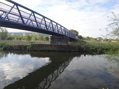
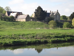
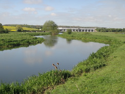
It was a pleasant walk, and several interesting features soon came into view - the footbridge over the river where the two alternative routes converge, a large railway viaduct, and a large house on the hillside across the river - Chester House, once the site of a Roman town, but now a farm and archaeological research centre. The footbridge appeared a substantial affair from a distance, with squat metal towers that glinted in the sun, making me wonder if it had some form of lift structure - an oddity on such a remote bridge. The truth became clear as I approached, as the metal was actually boarding to prevent anyone using the bridge. It was utterly derelict, with no walkway and rotten beams. A sign stated that it had been closed since 2011, and I'm surprised that the maps still show one route for the trail crossing it, especially as there is no alternative crossing for quite a distance.
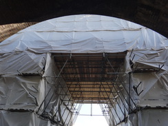
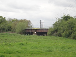
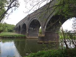
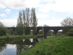
The railway viaduct was also of interest. Known as the 'Fourteen Arch Bridge', it was opened in 1957 by the Midland Railway as part of their extension to Leicester to Bedford, and later on to London St Pancras. Construction was troubled, with a slippage causing the death of several navvies. It was later doubled in width, and a new chapter in its life is due to soon begin when the line is electrified as far as Kettering. I did not get a good view of the bridge as it was sheathed in white plastic designed to stop dut and debris from the work falling into the river and the floodplain below. A rail-mounted digger rolled along a closed line as trains sped past on the other. The horses underneath seemed unfussed by either the trains or the work going on overhead.
Shortly before I reached the bridge, I got a phone call from Sencan. My son spends all day in a nursery on Wednesdays and Fridays, and when I go walking I set off early in the morning whilst she drops him off - the early start allow me to get home in time to pick him up. Unfortunately the nursery was closed for the day - a surprise to both of us - and there was no chance of my getting home in the next few hours. Instead, Sencan said she would grab her laptop from work and stay at home with him. Feeling very annoyed and slightly embarrassed at the mistake, I walked on.
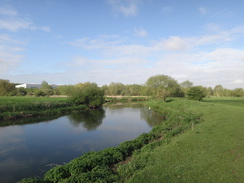
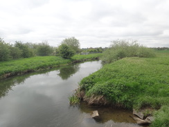
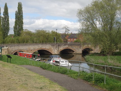
A pleasant walk took me on to Ditchford Bridge, after which a rather overgrown stretch of path led me alongside an old railway line (now carrying an access track to a sewage works), before rejoining the riverside. Eventually a long bridge took the trail over both the river and the noisy A45, from where a path took me up into Higham Ferrers. Waymarkers showed a different route than the one marked on the map, and I did not get to see much of the town. The trail followed roads away from the centre, and then down a good surfaced path, back across the A45, and then across a causeway through a nature reserve into Irthlingborough (I later saw that the recent maps have a different, longer route along this stretch that I shall have to investigate later).
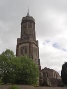
An ornate tower was visible ahead as I approached the village - Irthlingborough church is an unusual structure, with a separate tower that used to contain a lantern that would guide people across the valley. I did wonder if it was part of an earlier church, but it was apparently meant to be largely separate from the church's main body. A path took me on to the A6, and the site of Nene Park, the old Rushden and Diamonds football ground. This was a little sad, with a debris-strewn grassy patch where the pitch once sat, and steps leading down to non-existant stands. There was even a signpost pointing to the stands, for some reason left behind when the stadium was demolished last year.
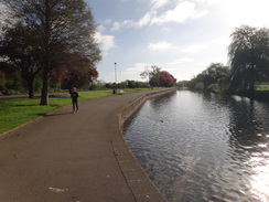
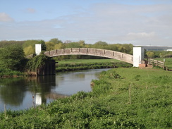
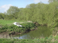
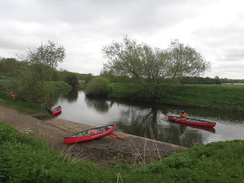
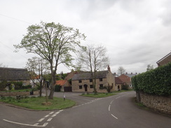
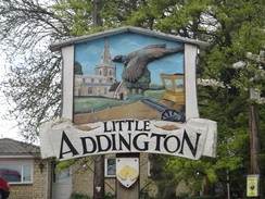
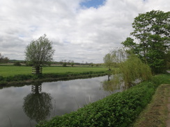
A long track took me on to a lock, from where a riverside path took me past an adventure centre and a long line of children who were waiting to go canoeing on the river. A little further on an oversized cycle bridge over the river marked the place the trail left the river, going uphill across a field and then past an industrial estate, from which a strong smell of acetone was drifting. Little Addlington looked a pleasant little village, but soon afterwards the path headed back down towards the river, crossing a patch of boggy ground to reach a lock. A series of bridges took me across river streams, after which a long road walk led on to another lock near Woodford Mill.
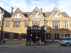
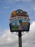
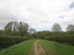
A good cycle path led on, recrossing the old railway line before diving off across fields to reach the little village of Woodford. Since I no longer had to pick Robert up from nursery I could take my time, and I decided to go into the Duke's Arms for a rest. My boots were muddy so I left them in the porch and went inside. It was a very pleasant pub with friendly staff, and a meal of sausage and mash was washed down with a couple of bitter shandies. My feet cooled down during the break (although perhaps not to the advantage of the other patrons), and I set off refreshed and revitalised.
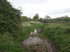
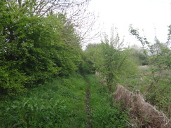
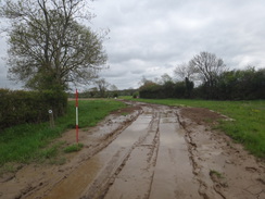
The trail left Woodford and headed through an area of woodland before rejoining the riverbank. It recrossed the old railway line once more, before continuing on towards Denford Lock. I was surprised to find a long causey of metal plates taking me across the somewhat boggy ground, leading to some men working by the lock. The causey was flooded with mud in a couple of places, and had evidently been well used. The stile to leave the track near the lock was within a works compound, but a little gap in the fencing allowed access to the stile. No-one saw me enter the compound and nip across the stile into the field.
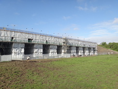
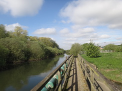
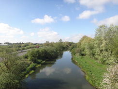
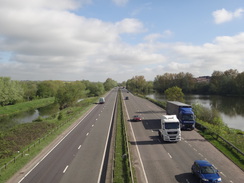
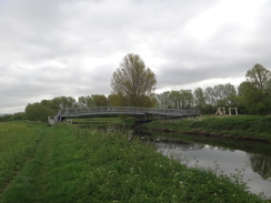
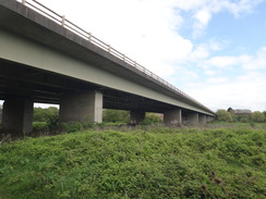
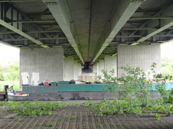
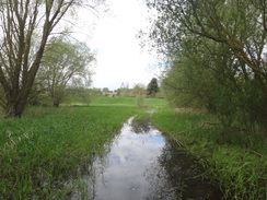
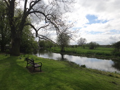
The next highlight of the day was to be two viaducts: one carrying the A14 overhead, and the other a series of blue-brick arches that once carried the Huntingdon to Kettering railway line. I've driven along the A14 regularly over the last couple of decades and have seen the spectacular railway viaduct each time, but have never visited it. In the end it was a little underwhelming, with only a few good views available from the riverside path. This was followed by a short stretch of path between lakes that was flooded. I had little alternative but to wade through, and headed on to a road in Islip.
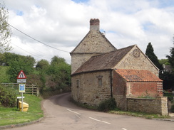
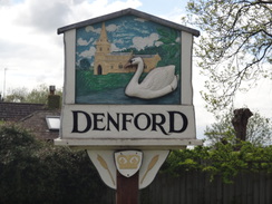
The path headed up into the pretty village, before descending back down towards the river. Here I left the Nene Way for the day, and headed on into Thrapston. The rest of the day was along roads; back towards the site of the old Midland station (which was extant until a few years ago, and is now a housing estate called 'the Sidings'), and then down into Denford. A road took me into Rignstead, and another into Raunds. On the way I passed a quarry for Mick George, similar to the one I passed recently on another walk.
I reached my car in the centre of Raunds rather late in the afternoon. It had been an enjoyable walk, except for the mix-up with my son's nursery that mucked up my wife's day. I won't let that happen again!
 |
 |
|
Directions
This walk starts off at the bus stops on Church Street in Wellingborough at SP89116798. Leave the bus stops and head westwards down the road, before it soon ends at a T-junction with the A5193 road ("High Street"). Turn left to follow the A5193 road as it heads southeastwards through the town. After half a mile a crossroads with the B571 is reached; cross over and continue along a path that runs separate from, but beside, the road. This passes the entrance to Wellingborough school and rejoins the road. After another half-mile a roundabout is reached at SP90006662.
Carefully cross the B573 road (the first road off to the left from the roundabout), and then turn left along the pavement beside the road, with a small public park away to the right. After 200 metres the road joins the River Nene on the right, and this is where the Nene Way is joined for the day. Leave the road to join the riverside path and head on with the river on the right. Soon a footbridge using the abutments of an old railway bridge is reached; head under this, and shortly afterwards the path becomes unsurfaced. A couple of hundred metres past the footbridge, go through a pedestrian gate and continue on to reach a footbridge guarded by gates over an inlet; shortly after this Lower Wellingborough lock is reached at SP90916712.
Pass the lock and head across a long footbridge over the mouth of the River Ise. On the other side immediately turn half-right over a concrete footbridge over a dry ditch. Continue on along the riverbank for about fifty metres to a second concrete bridge over a ditch. Head on, passing a currently disused (in 2018) footbridge over the river to the right, and three-quarters of a mile after the lock, twin railway viaducts are reached at SP92046727 that carry the Midland Main line overhead.
Head under the viaducts and continue along the river bank. Pass, but do not cross, Ditchford Weir on the right, and follow the lower level of the river on the right to a concrete farm bridge. An old railway line is reached on the left; go through a clapper gate and continue on alongside the river. It passes a factory on the other side of the river, and as it approaches Ditchford Bridge ahead, angle slightly left diagonally across a field to reach a pedestrian gate that leads onto Ditchford Road at SP93006838.
Carefully cross the road, turn right for a couple of metres, and then left to descend down to a clappergate beside a field gate. The path then curves left through a small area of scrubland to reach a rough track. Turn right to follow this track eastwards, with a hedge guarding a surfaced track to the left. Cross a stile beside a field gate and head on along a green track; keep the hedge on the left and go through a gateway and continue on, with a fence on the right. Cross a stile though a hedge and follow the path as it curves to the right back towards the river. It then curves left, keeping the river away to the right. When a fence guarding a sewage works is reached, head straight on through a gap, following a fence on the left. The path crosses some outlets to the sewage works, and then forks, take the right-hand branch to reach a footbridge over a spillway. Cross this and head on to reach a large bridge over the river leading to the Rushden Lakes shopping complex at SP94276856.
Cross the track leading up to the bridge and head on along a path signposted Higham Ferrers. Go through a clappergate and follow the river on the right to a gap beside a field gate and continue on. Half a mile after the Rushden Lakes bridge, a large footbridge is reached ahead; just before the bridge, turn left to reach the access ramp, and then turn right to cross the bridge over the river and the adjacent A45. On the other side, follow a good path that passes a lake on the left. It then crosses a footbridge over a stream, and immediately on the other side go through a clappergate to join the end of a road. Continue along the road for a few metres, and then turn left through a squeeze-stile beside a field gate into a riverside park at SP95266871.
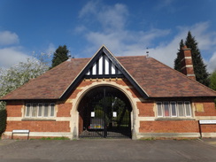
Angle half-right up a slope; after about fifty metres, at the top of the park, join a path that runs between fences, with houses on the right. This path leads out onto the end of Vine Hill Close; turn right for a few metres towards a turning circle, and at its throat turn left up another path that runs between fences. This ends at a road; cross the road and continue on up Vinehill Drive. This passes a recreation ground on the right before reaching a crossroads at SP95936873 in Higham Ferrers, with an ornate entrance to a cemetery on the left.
Turn left to head north along Saffron Road; when it curves to the left, continue straight on along another road that carries a path called the Greenway. After 100 metres, pass some bollards and continue along a surfaced path. Go past a second set of bollards to join the end of Kings Meadow Lane, and then turn left past a bollard to join another surfaced path. Cross a road (School Lane) in a new housing development, and continue on along the path as it reaches another footbridge over the A45 at SP95656962.
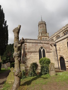
Cross the footbridge, and on the other side follow the path as it immediately crosses a bridge over the river. Continue along the surfaced path as it crosses an old railway line and heads between two lakes. It crosses a footbridge over a stream between the lakes, and soon reaches a second and then a third small bridge. The surfaced path then climbs until it ends at St Peter's Way in Irthlingborough. Follow the pavement on the right until it ends outside St Peter's Church at SP94717064.
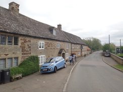
Walk past the churchyard, and then turn hard right to enter the churchyard through a gap (do not take the path that skirts the churchyard, but the one that enters it). Follow a surfaced path as it passes the church on the left and emerges out through a gateway onto a bend in a road. Head straight on down Nene View, passing houses on the left; when the road soon curves to the right, continue straight on along a narrow path that runs between walls before it ends at Lime Terrace. Follow this road for a short distance as it heads behind houses and ends at a bend in a road. Turn right to head down Lime Street past some stone houses on the right until this ends with an entrance to Hall Farm on the right at SP95037067.
Turn left through a clappergate beside a farm gate, and follow a path diagonally across a field, heading towards the road ahead. A stile through a fence leads into a second field, and the path continues on diagonally to a metal gate (once a clapper gate). Go through this and climb up a few metres to a stile across a safety barrier beside the A6. Turn left and follow the A6 towards a roundabout; just before this is reached, cross the road using the traffic-light controlled crossing. On the other side, turn left for about five metres and take the second path off to the right. Squeeze past a farm gate and head on. The path crosses an access road to a car park and continues on past the old site of a football stadium called Nene Park. It crosses a second access road called Diamond Way and continues along a track; half a mile after the A6, the track curves to the right to approach Irthlingborough Lock at SP96027144.
Immediately after the curve, and before the lock is reached, turn left to join a path (do not take the track that leads on from the bend) that runs along the river's northern bank. When a barrier is soon reached ahead, turn left to follow a fence with a small inlet to the right; this reaches a bridge over the inlet on the right. Turn right to cross the bridge and then curve right along the path beside the river; when the path forks, take the right-hand branch which soon goes through a gap to enter a field. Three-quarters of a mile after the lock, a large footbridge over the river is reached at SP96777237.
Walk past the bridge (do not cross it), and shortly afterwards the path curves sharply to the left to join a rough track that runs uphill between fields away from the river. After fifty metres, turn half-right off the track to head diagonally uphill across the field, aiming for halfway along the top hedge. Go through a gap in the top hedge and continue along a second field beside a hedge on the left. When the field boundary curves gently to the left, turn half-right, aiming for a hedge in the corner of the field ahead, with an industrial estate beyond. Cross a rough track at the corner, and angle across the field, away from the hedge and industrial estate on the left, aiming for about a third of the way along the hedge at the top. Go through a clappergate and cross a little plank footbridge to reach Irthingborough Road in Little Addington at SP95967335.
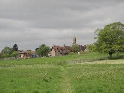
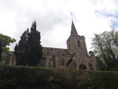
Carefully cross the road ahead to join Chapel Hill. This soon swings to the right by a small village green, becoming High Street, and passes Little Addington church and the Bell Inn on the right. After a third of a mile the road ends at a T-junction with Lower Street; turn left to follow it; there is a pavement on the left-hand side of the road. Shortly after a left-hand bend, turn right to carefully cross the road. Go through a gate beside double field gates to join a path that follows a hedge on the right downhill. When the hedge ends, continue on for five metres and then angle half-left across a meadow. At the far side, cross a footbridge over a stream and angle half right for fifty metres to meet a rough track in front of a lake. Turn right down this track to reach a footbridge over the river at SP96667456.
Cross the footbridge and pass through a little car parking area to join a track that soon leads to a bridge over another river stream just downstream of Upper Ringstead Lock. Walk on to a third bridge over Upper Ringstead Sluice, after which the track curves to the right and forks. Take the left-hand branch, which soon crosses a fourth bridge, and then passes another car park on the right before curving slightly to the left, crossing an old railway line to reach Station Road. Follow the road for nearly half a mile until it ends at a road junction with Ringstead Road; turn left down the new road for a third of a mile until it crosses a bridge near Lower Ringstead Lock at SP97397518.
Cross bridges near the lock, and as the road curves to the left immediately afterwards, turn right for about five metres through a car park, and then left to go through a gap in a hedge to reach a track. Cross the track, and then go through a clappergate into a field, following a fence on the right. The path soon descends slightly to cross an old railway line, and on the other side continue on to a clappergate beside a field gate. Go through this to continue on northwestwards along a cycle path between hedges. When the hedge on the right ends, turn half-right through a clappergate to head north diagonally down the field. In the bottom corner, go through a clappergate into a second field and follow a hedge on the left. When a track is reached, cross it and continue on along the path, following a hedge on the right. Go through a clappergate beside a field gate into a small field and angle slightly to the left away from the fence on the right, towards two trees ahead. In the field's far corner, join a gravel path that leads to a clappergate beside a field gate. Go through this and to reach Church Street in Woodford at SP96807651.
Turn right to join Church Street and follow it northwards; when the church is reached on the right, turn left up Church Green, passing the village green on the left. Immediately after De Capel Close is reached on the right, turn right along a footpath that follows a stone wall on the right away from the road. The path emerges out onto The Green in Woodford. Turn right along the road, keeping the triangular green to the left, and as the road curves to the left, turn right down High Street. Take the first road off to the left, Whittlesea Terrace, and just before this ends turn right down a track called Traili Lane that initially runs between houses. When the gardens on the left end, turn left through a clappergate in a fence and head diagonally eastwards across a field, aiming for the bottom right-hand corner of some woodland ahead. Cross a rough track to enter a second field, and head down this towards the woodland (which is called 'Woodford Shrubbery'). In the far corner of the field by the trees, go through a clappergate and turn left to join a track at SP97197706.
Follow the track for a short distance until it reaches a gate beside a field gate; go through the gate to enter the woodland. Follow the obvious path through the trees, until it leaves the woodland via a pedestrian gate beside a field gate, and on the other side turn right down a rough track that initially follows the edge of the woodland on the right. At the end of the field, go trough a broad gap in a hedge ahead to join another track. Immediately turn right down this track, keeping the hedge on the right. When the track soon curves to the right through the hedge, continue straight on downhill, still following the hedge. At the bottom corner of the field curve left to join a path running alongside the river on the right. Follow the riverside path eastwards for a third of a mile, passing near to Woodford Lock. A short distance afterwards an old railway trackbed is reached at SP98197694.
Cross the old railway line and head straight on eastwards along a track with a hedge to the left. The field narrows; join a hedge on the right, and after a few yards turn right through a gate into another field. Follow a hedge on the left eastwards. Eventually the hedge turns to the right to approach a bridge over the river; just before the bridge, turn left across a stile beside a field gate into another field, and then hard left to head north towards the field's far corner. In the corner, cross a footbridge over a ditch and then head across the field, aiming slightly to the left of the A14 viaduct ahead and angling towards the hedge on the left. At the corner of this field, turn left across a footbridge over a ditch and then right, to follow a hedge on the right. At the corner of this field, go through a gateway to reach a track that runs along the course of the old railway line. Turn right along this for a short distance; it crosses a bridge over a stream and meets the southern side of the A14 dual carriageway embankment. Follow the path as it curves right to parallel the A14 to the left, before curving to the left to pass under the A14's viaduct at SP99227790.
Ignore the path as it curves to the left on the northern side of the bridge, and instead continue along a less distinct path that heads north past trees on the left, with the river away to the right. It soon passes under a magnificent disused railway viaduct. Continue on, following the river on the right and passing a lake on the left. Shortly after passing the old abutments of a rail bridge in the river to the right, turn left along a path that heads between trees guarding lakes, and then cross an area of grassland to reach a floodbank ahead. Climb up onto the bank and turn right to head north along the bank. Go through a gap in a hedge, and as the path forks, take the left-hand branch that emerges out beside a field gate onto Kettering Road in Islip at SP98977860.
Cross the road, and head on up Chapel Hill, passing the Woolpack Inn at the road junction. The road curves to the right to become High Street; as it curves to the left beside The Rose and Crown, turn right along another road for a few yards, and then right down a track that runs down the side of the pub into its car park. Head down the car park, and at its end go through a small beer garden and join a path that heads downhill with a hedge on the right and a fence on the left. At the bottom of this path, go through a clappergate, cross a track and then angle slightly to the left to head diagonally across grass. Skirt a pond on the right, and continue straight on across a lawn to reach a clappergate in a fence. Head straight on across a field, aiming for a corner of a wall ahead. Go through a clappergate beside the wall to reach Mill Lane at SP99107924.
Here the Nene Way is left for the day; the rest of the walk is to get to Raunds.
Turn right along Mill Lane and follow it as it passes a mill on the right and then cross a footbridge over the river. Descend some steps off the footbridge and head straight on along a path, crossing a track at an angle to reach a second footbridge. Cross this and head on along a track; it becomes surfaced and ends at a T-junction with Green Lane in Thrapston. Turn right along this road, and follow it for a few metres to a second T-junction. Turn right down Chancery Lane, and follow this until it ends at a T-junction with the High Street at SP99567866.
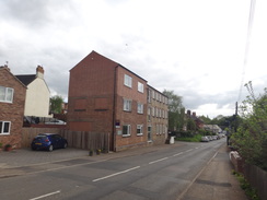
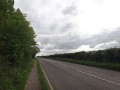
Turn right along the High Street, and when a mini-roundabout is reached, turn left down Midland Road. Follow this road as it heads southwards; it heads under the A14 viaduct and continues on. Initially there is a pavement on the left, but it swaps over onto the right before finally rejoining the left once more. After 1.3 miles it enters the village of Denford. Continue along the road as it curves left and then right in the village; shortly after it leaves the pavement ends and the road curves sharply to the left and then right to settle on a southerly direction - the verge is wide enough to walk on most of the time. After 0.8 miles the road enters the village of Ringstead and descends downhill; at the bottom it curves to the right and reaches a junction on the left with Raunds Road at SP98807510.
Turn left down Raunds Road and follow it as it heads south; there is a pavement on the left. After 0.8 miles a roundabout with the A45 is reached; follow the pavement as it curves to the left, and then carefully cross the A45. On the other side, cross the entrance to a service station and a McDonalds, and continue on south along the B663. Another roundabout is reached with an Asda across the road to the right. Head straight on at the roundabout down London Road. When Marshall's Road is reached on the left after a third of a mile, turn left along it. After nearly half a mile the road meets the square in Raunds at SP99747283, where this walk ends.
 |
 |
|
Distances
| From | To | Distance (m) | Ascent (ft) | Descent (ft) |
|---|---|---|---|---|
| Wellingborough | Higham Ferrers | 5.8 | 156 | 165 |
| Higham Ferrers | Irthlingborough | 1.5 | 72 | 107 |
| Irthlingborough | Little Addington | 3.1 | 142 | 123 |
| Little Addington | Woodford | 3.3 | 125 | 115 |
| Woodford | Islip | 3.6 | 82 | 131 |
| Islip | Raunds | 5.2 | 240 | 233 |
This makes a total distance of 22.5 miles, with 817 feet of ascent and 874 feet of descent.
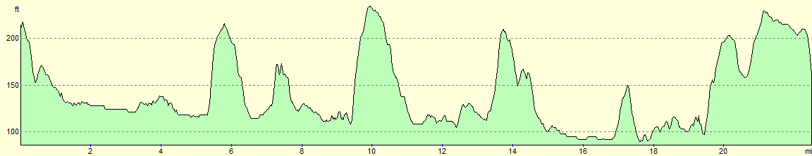
For more information on profiles, ascents and descents, see this page
Transport
Stagecoach X46 services offer regular (if slow) bus services between Raunds and Wellingborough, calling at several places on this route on the way.
 |
 |
|
 |
 |
|
 |
 |
|
 |
 |
|
 |
 |
|
 |
 |
|
 |
 |
|
 |
 |
|
 |
 |
|
 |
 |
|
 |
 |
|
 |
 |
|
 |
 |
|
 |
 |
|
 |
 |
|
 |
 |
|
 |
 |
|
 |
 |
|
 |
 |
|
 |
 |
|
 |
 |
|
 |
 |
|
 |
 |
|
 |
 |
|
Disclaimer
Please note that I take no responsibility for anything that may happen when following these directions. If you intend to follow this route, then please use the relevant maps and check the route out before you go out. As always when walking, use common sense and you should be fine.
If you find any information on any of these routes that is inaccurate, or you wish to add anything, then please email me.
All images on this site are © of the author. Any reproduction, retransmissions, or republication of all or part of any document found on this site is expressly prohibited, unless the author has explicitly granted its prior written consent to so reproduce, retransmit, or republish the material. All other rights reserved.
Although this site includes links providing convenient direct access to other Internet sites, I do not endorse, approve, certify or make warranties or representations as to the accuracy of the information on these sites.
And finally, enjoy your walking!
Nearby walks
| # | Title | Walk length (miles) |
|---|---|---|
| 142 | Huntingdon Station to Hargrave | 17.3 |
| 184 | A circular walk between Hargrave, Raunds and Rushden | 18.4 |
| 213 | Rushden to Northampton | 16.4 |
|
|

|