Walk #996: Oxford Canal and Jurassic Way: Hayford station to Banbury
 |
 |
|
General Data
| Date Walked | 09/05/2018 |
| County | Oxfordshire, Northamptonshire |
| Start Location | Heyford Station |
| End Location | Banbury station |
| Start time | 06.44 |
| End time | 14.34 |
| Distance | 23.5 miles |
| Description | This was a walk of two halves: a pleasant stroll along the Oxford Canal to Banbury was followed by a stretch of the Jurassic Way. |
| Pack | Today I carried my 30-litre Karrimor rucksack, filled with water, my spare waterproofs, a book and other odds and ends. |
| Condition | My feet suffered slightly on this walk, and I have a deep blister on the sole of my foot. Aside from this, I feel fine. |
| Weather | The day started gloriously sunny but a little chilly, with lots of dew on the ground. As the day progressed it became warmer and cloudier. |
| OS map | Landranger number 164 (Oxford, Chipping Norton & Bicester) and Landranger number 151 (Stratford-upon-Avon, Warwick & Banbury) |
 |
 |
|
Map of the walk
Maps courtesy of Google Maps. Route for indicative purposes only, and may have been plotted after the walk. Please let me have comments on what you think of this new format. For a detailed table of timings for this walk, please see the table file.
 |
 |
|
Notes
I decided to turn my attention to the southern stretch of the Jurassic Way from its trailhead in Banbury, following it northwards and connecting it with the eastern half of the trail that I have already completed. However there was a complicating factor: fifteen years ago I walked the Oxford Canal from Oxford to Lower Heyford, and as that was only a few miles away from Banbury, I decided to make this a combined walk: I would walk the Oxford Canal to Banbury, and then do the first few miles of the Jurassic Way.
Since Banbury is nearly two hours' drive from home, I set off very early this morning, and arrived at Babury station car park just as the first train of the day to Heyford was leaving. Fortunately there was another one in twenty minutes, so after a little confusion in how to pay for the car park (the coin slots were no longer operable, but fortunately I could buy a ticket at the same time as my train ticket) I got on the train a couple of minutes before it was due to leave.
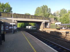
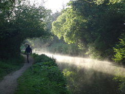
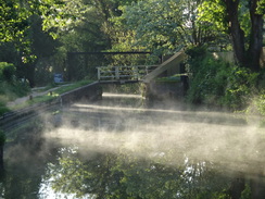
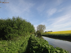
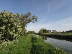
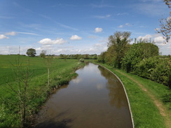
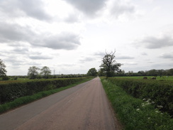
Heyford station is right alongside the canal, and I stepped off the platform directly onto the towpath. Since I had to pick my son up from nursery in the late afternoon I did not have much time to spare, so I headed off north along the towpath, which initially was trapped between the canal and the river Cherwell. It was a beautifully morning, with the sun's rays casting long shadows over the mist rising off the canal's still water. A man with a friendly dog overtook me as the towpath became more overgrown. The grass was sopping wet with dew, and the outside of my boots were soon wet despite the sun. I kept up a good (for me) pace as the going was easy, and the towpath soon passed under the railway line and continued northwards.
The path left the side of the canal, diverting into a field as the canal bank was covered in bushes and small trees. In one field a man told me to take care, as the nearby cows had trampled a woman the previous week! Although the going was good my feet started to feel damp, and then wet: my boots were not leaking, but the water was wicking down my socks.
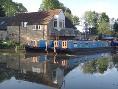
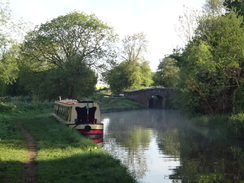
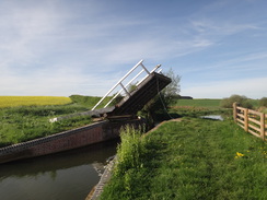
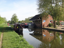
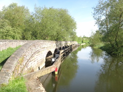
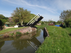
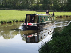
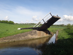
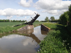
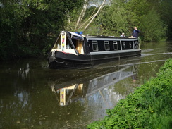
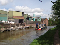
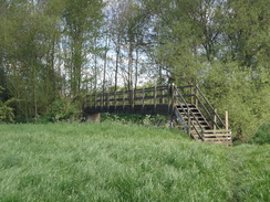
The canal was quite busy, with boats heading towards me, and a couple were patiently queuing to use a lock. It is a pleasant canal to walk, with lots of drawbridges across the water, their decks tipped as if saluting the sky. It was quite rural, with only a few places to stop, and only one of these appeared to be open at the early hour. Knowing that time was tight I pressed on, when I really wanted to stop, take my boots off and let my feet dry out. In the past I used to carry a spare pair of socks with me in my rucksack; I had not included any for my recent campaigns, and this is obviously a mistake.
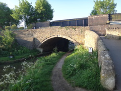
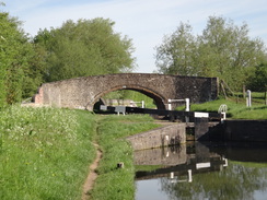
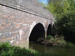
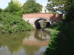
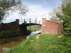
The towpath swapped over to the other side of the canal at Nell Bridge Lock, and then continued north to pass under a massive bridge that carries the M40 overhead. Shortly afterwards I passed the abutments of an old railway bridge over the canal; the bridge was long gone but three brick arches stretched across the adjacent river. King's Sutton station's footbridge was visible to the east over the floodplain, but there seems to be no easy way to access it from the canal towpath - annoying if you wanted to use it as a stop on the canal walk.
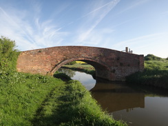
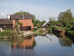
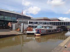
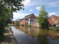
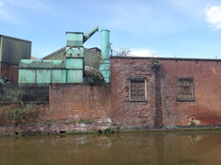
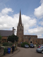
The canal got even busier as I passed under the M40 to reach an elegant arched bridge where the Jurassic Way leaves the canal and starts its journey north towards Stamford. However first I had to get to the start of the trail in Banbury. Some massive dumper trucks were moving earth on the other side of the canal - presumably the start of a new housing estate. After this I passed a wonderful stretch of slightly decrepit canalside industry, before entering the centre of Banbury.
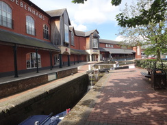
The towpath passed within a few metres of my car in the station car park, so I diverted off to take the fleece out of my rucksack, as there was no way I was going to need it today. I had intended to make the station the 'start' of the trail, but I decided to continue on a short distance into the town for a look around. On the way I found a Jurassic Way marker pointing further north along the canal, so I headed on towards an attractive canalside retail development. There were no obvious signs denoting the trailhead, and so I nipped into a cafe to buy an ice cream before heading back. When I got home, I discovered the trailhead is actually Banbury Town Lock, where I had stopped to take a few pebbles out of my boots. Both my socks had been wet, a bad sign with many miles still to walk.
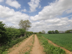
It was now a case of walking back along the canal, following the Jurassic Way to just before the M40 bridge, and then heading off to a long footbridge across the river and then under the M40 via a river bridge. I met a couple on a track leading uphill into the hamlet of Warkworth who were doing a couple of miles of the trail, and we stopped for a quick chat. Paths led on to Overthorpe and then onto the village of Middleton Cheney. The pub did not look open - and besides, I did not have enough time to spare. Instead I nipped into the nearby shop to buy a couple of bananas and continued along the trail.
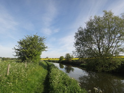
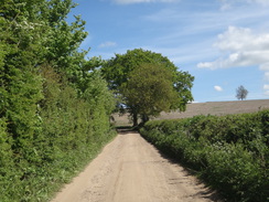
My feet were overheating as I followed the path north into Chacombe, and some cows took a lot of interest in me as I tried to find the correct route across a field. The Jurassic Way has been very well waymarked on previous trips, and a waymarker was waiting for me once I found the correct route. Eventually I descended down to a road just outside the village, where I left the Jurassic Way for the day.
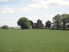
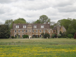
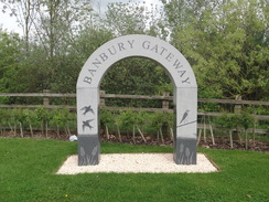
There was still a few miles to get back to my car at Banbury railway station, and I started by heading down a road. A magnificent building stood away to the right: Chacombe Priory, a large house that stands on the site of an old Augustinian priory. The road ended at a main road, after which a path running along a disused road led towards some recent flood defences on the Cherwell. A path then used the river bridge to pass under the M40 for the last time today. It then led past a large new shopping centre ('Banbury Gateway'), before roads took me on into the centre of the town and the railway station.
It had been an enjoyable walk of two halves, with the canal walk followed by a much hillier walk along the Jurassic Way. I managed to get back in plenty of time to pick my son up, but my left foot has suffered, and I appear to have a blister on my sole.
 |
 |
|
Directions
This walk starts off from Heyford railway station in Oxfordshire, at SP48282466. Leave the station's southbound platform and immediately join the towpath of the Oxford Canal. Turn left to start following the canal northwards; after 7.5 miles the B4100 road bridge is reached at SP49463429. Here turn right to cross the bridge over the canal, and then left to rejoin the towpath on the other, eastern, side. Continue following the canal on the left northwards for another 5.5 miles until Banbury Town lock is reached in the centre of Banbury at SP45884069.
Banbury Town lock is the southern trailhead of the Jurassic Way. Turn back and start following the canal southwards; after 1.7 miles the elegant arched Nadkey Bridge (number 172) over the canal is reached at SP47403874 (if you reach the M40 bridge then you have gone too far). Here the Jurassic Way leaves the canal; turn left to climb up onto the approach ramp onto the bridge, follow the ramp down into a field, and then curve right to reach the right-hand corner of the field ahead. Cross a farm bridge and go through a gateway into a second field; follow a hedge on the right to the next corner, and go through a gap into a third field. Angle slightly to the left across this field, heading towards a footbridge guarded by stiles at SP47603897.
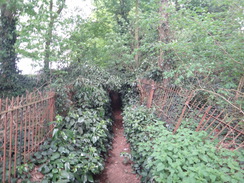
Cross the stile, climb the steps up to the footbridge, and on the other side descend steps and cross another stile to enter an overgrown area. The path curves to the right with the river down to the right to emerge out onto a track. Turn right along the track and follow it as it immediately turns left, heading under the M40 via the river bridge. On the other side of the bridge, turn left to parallel the M40, with a field off to the right. After 150 metres the path curves right to head across the field towards a bridge over a railway line at SP47853920. <> Cross the bridge into another field. Turn half-left across this field, skirting a pond on the right to reach a field gate through a hedge beside the pond. Go through the gate, and on the other side turn right along a rough track. Follow this as it heads northeastwards; it crosses an old railway line and becomes better quality as it climbs uphill. After two-thirds of a mile the track goes through a gate beside a field gate to reach a T-junction with a road in Warkworth at SP48544028.
Turn right along this road for nearly 300 metres, and then take the first road off to the left. Follow this as it heads northwards for another 300 metres; shortly after Manor Park is passed on the right, turn left through a gateway into a field. Follow a fence and then a hedge on the right. At the end of the field go through a broad gap in a hedge into a second field, and continue following the hedge on the right. At the end of this field, cross a track and go through a clappergate beside a field gate at SP48484062.
Go through the clappergate into a third field, with Warkworth church some distance away to the right. Head towards some trees ahead; go through a clappergate beside a field gate at the corner of the field and head on past a fourth field with a hedge on the right for about fifty metres to reach another clappergate through the hedge on the right. Go through this into a field, and head on following a hedge and then the wall of a building on the left. Continue along the path between fence and hedge; they eventually curve sharply to the right. Head on, and cross a stile and pass a lawn on the left. At the end of the garden cross a second stile to enter a field, and continue following the hedge on the right to reach a road at SP48754111.
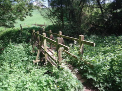
Cross the road, and continue on into a field. Follow a hedge on the right; just before the corner of the field is reached, angle left to cut across the corner, aiming for a little wooden barn ahead. Go through a clappergate in a fence into a paddock and pass the barn on the left to reach a clappergate through another fence. Go through this, cross a track, and then cross a stile in a hedge to enter another field. Angle slightly right across this next field, towards trees in the hedge on the other side. Go through a clappergate in the hedge into another field and head straight on down a slight slope towards another clappergate in the hedge ahead. Got through this to enter another field, and head straight on down the field. At the bottom, go through a gap into some woodland; follow the obvious path down to a footbridge over a stream at SP49594131.
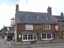
Cross the footbridge and continue on to a stile that leads out of the trees into a field. Follow a hedge on the right up this field; at the top corner, go through a stile beside a field gate and head on along a broad path between a hedge on the right and a fence on the left. The fence becomes a hedge with a bungalow behind it, before the path ends at Astrop Road. Turn left to head north along this road; it immediately crosses the A422 on a bridge. Follow the road north as it enters Middleton Cheney and ends at a T-junction opposite the Dolphin Inn at SP49854173.
Cross the road ahead and continue on up the High Street. When a triangular junction with Church Lane is reached on the left, turn left down it, and when it soon curves to the left, turn right to continue alomg Church Lane. After a few meres turn left down a track, initially with a house on the left, and when the track curves right head on, squeezing between two stone walls that lead out to a stile into a field. Head straight on down the field; at the bottom cross a footbridge guarded by pedestrian gates, and on the other side enter a second field. Head up this field; it soon joins a hedge on the right. At the field's corner, cross a stile into a third field and head on, following a hedge on the left. This leads to a gap in a hedge that leads out onto the B4525 Banbury Road at SP49234219.
Carefully cross the road, and then go through a gap in a hedge to enter a field. Angle slightly to the left across this field, and at the far side go through a gap in a hedge to reach a track. Cross this and go through another gap in a hedge to enter a second field. When a track is reached in front of a hedge, turn right to follow the track northwards. When the main track curves left through the hedge, continue on along a lesser track. At the bottom corner of the field, follow the track through a field gate and continue on, following a hedge on the right that protects a reservoir. At the bottom of this field, reach a bridleway gate beside a field gate and electricity pylon at SP48844267.
Go through the gate to enter another field. Continue on between two hedges to reach a farm bridge over a ditch and go through a bridleway gate into a field. Head straight on up this field towards some woodland ahead; skirt the first part of the woodland on the left, and ignore a footpath angling off to the left. Head towards the middle of the main body of trees, and go through a clappergate to enter the woodland. Follow a narrow path between fences through the trees. On the other side, cross a stile and continue on along a field, with the edge of the woodland to the right. The path falls downhill; at the bottom corner of the field go through a clappergate and continue on downhill across a field, aiming for a telegraph pole. Pass the pole and then angle left to head towards a barn. Pass the barn on the right, and head on across the field to reach a clappergate beside a field gate that leads out onto a road in Chacombe at SP48994378.
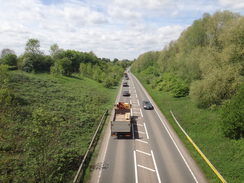
Here the Jurassic way is left for the day. Turn left to follow the road westwards away from Chacombe; there are no pavements, but the traffic was light. After 1.3 miles the road ends at a T-junction with the A361. Carefully cross the road, and on the other side take a cycle path that runs along an old road. This gently curves left and climb sup onto the top of a flood bank, with the river Cherwell off to the right. Descend down the slope on the other side, and just before the embankment carrying the M40 is reached, turn right and then left to head through a bridge under the motorway at SP46854240, with the Cherwell off to the right.
On the other side of the bridge the path curves left to pass between the motorway embankment and a large M&S building in the Banbury Gateway shopping complex. The path curves right past a McDonalds drive-through, before ending at the end of Acorn Way. Turn left down this road, crossing over to the right-hand side at a crossing. This road ends at a roundabout wit the A422 at SP46714175.
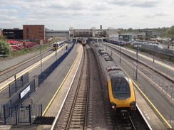
Follow the pavement around the roundabout to the right, to reach a pedestrian crossing on the A422 dual carriageway. Cross this, and on the other side turn left back towards the roundabout. Take a path leading off to the right from the roundabout, which becomes a dead-end road called Daventry Road. Follow this for about fifty metres to a mini roundabout. Cross this, and continue on down Daventry Road. After a third of a mile this road ends at a T-junction with Middleton Road. Turn right down this road, and follow it into the center of Banbury. After nearly half a mile it curves to the right and climbs up onto a bridge over a railway line; cross the bridge, and immediately on the other side turn left down the station approach. This leads to Banbury Station at SP46164042, where this walk ends.
 |
 |
|
Distances
| From | To | Distance (m) | Ascent (ft) | Descent (ft) |
|---|---|---|---|---|
| Heyford station | Banbury Town lock | 13.2 | 151 | 62 |
| Banbury Town lock | Nadkey Bridge | 1.7 | 0 | 0 |
| Nadkey Bridge | Middleton Cheney | 3.4 | 312 | 164 |
| >Middleton Cheney | Chacombe | 1.9 | 141 | 249 |
| Chacombe | Banbury station | 3.3 | 46 | 89 |
This makes a total distance of 23.5 miles, with 650 feet of ascent and 564 feet of descent.
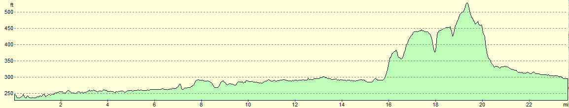
For more information on profiles, ascents and descents, see this page
Transport
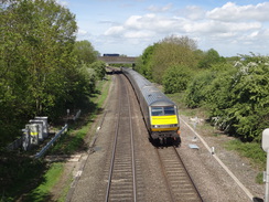
Train services run between Oxford and Heyford stations, currently (2018) run by GWR as part of services to Didcot, They do not run as regularly as they could, although it is stil a perfectly practical way of getting to the start of the walk.
 |
 |
|
 |
 |
|
 |
 |
|
 |
 |
|
 |
 |
|
 |
 |
|
 |
 |
|
 |
 |
|
 |
 |
|
 |
 |
|
 |
 |
|
 |
 |
|
 |
 |
|
 |
 |
|
 |
 |
|
 |
 |
|
 |
 |
|
 |
 |
|
 |
 |
|
 |
Disclaimer
Please note that I take no responsibility for anything that may happen when following these directions. If you intend to follow this route, then please use the relevant maps and check the route out before you go out. As always when walking, use common sense and you should be fine.
If you find any information on any of these routes that is inaccurate, or you wish to add anything, then please email me.
All images on this site are © of the author. Any reproduction, retransmissions, or republication of all or part of any document found on this site is expressly prohibited, unless the author has explicitly granted its prior written consent to so reproduce, retransmit, or republish the material. All other rights reserved.
Although this site includes links providing convenient direct access to other Internet sites, I do not endorse, approve, certify or make warranties or representations as to the accuracy of the information on these sites.
And finally, enjoy your walking!
Nearby walks
| # | Title | Walk length (miles) |
|---|---|---|
| 571 | Oxford to Lower Heyford | 16.4 |
| 631 | A circular walk from Cropredy | 17.8 |
| 1006 | Banbury to Woodford Halse | 17.4 |
|
|

|