Walk #997: A circular walk between Islip and Brigstock, taking in part of the Nene Valley Way
 |
 |
|
General Data
| Date Walked | 11/05/2018 |
| County | Northamptonshire |
| Start Location | Islip village hall |
| End Location | Islip village hall |
| Start time | 06.11 |
| End time | 14.13 |
| Distance | 22.3 miles |
| Description | This walk followed the Nene Way for a few miles north from Islip, before circling around to visit Lyveden Bewn Bield and taking roads back via Brigstock and Grafton Underwood. |
| Pack | Today I carried my 30-litre Karrimor rucksack, filled with water, a light running waterproof and spare trainers. |
| Condition | I feel absolutely fine after this walk. |
| Weather | Today started off sunny with a few clouds, and remained like that for the rest of the day. It was not too warm, with a slightly chilly breeze. |
| OS map | Landranger number 142 (Peterborough, Market Deeping & Chatteris) and Landranger number 141 (Kettering, Corby & surrounding area) |
 |
 |
|
Map of the walk
Maps courtesy of Google Maps. Route for indicative purposes only, and may have been plotted after the walk. Please let me have comments on what you think of this new format. For a detailed table of timings for this walk, please see the table file.
 |
 |
|
Notes
So far I had walked the Nene Way in a piecemeal fashion, and had completed some sections in the middle of the trail before those further south. Because of this, and the floods near Oundle I encountered at the beginning of April, there were two disconnected sections of about five miles remaining to be done. Annoyingly these were too far apart to be completed in one day, and so I decided to treat them both as parts of larger circular walks. Today was the first of these walks.
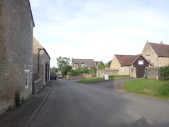
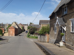
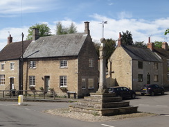
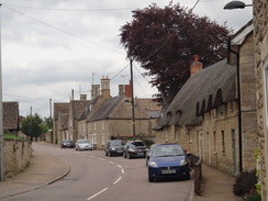
I arrived in Islip early in the morning, and parked my car in the village hall car park, hoping that was allowable. I had got a small blister on my left foot on the last walk, and I packed my running shoes in my rucksack, so if necessary I could change into them if I had any trouble with my boots. Islip appeared as attractive as it had during my last visit, and the buildings seemed to gleam in the early-morning sun. Soon I reached the point where I had left the trail previously, beside an old mill.
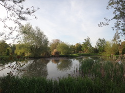
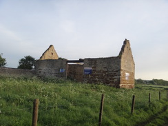
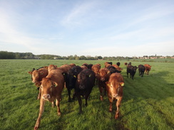
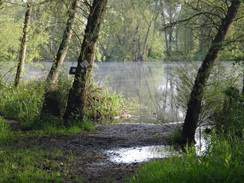
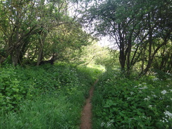
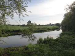
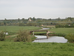
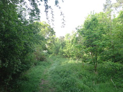
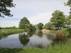
An old roofless barn held a large sign stating that it was for sale for conversion (and it would have to be a major conversion given its derelict state). A herd of cows followed me across the field, so close that I could feel their breath on my arms. They stopped at a farm bridge over a ditch, and the trail entered a small area of woodland along a muddy path. It emerged into a nature reserve, and a long walk followed along a good path between lakes. A bridge led across a stream to a track that ran up into the village of Aldwincle; this was slightly different from the route on my map, and I walked back to check before discovering the route I had taken was correct after all (this is another place where the route differs on 1:25,000 and 1:50,000 OS maps).
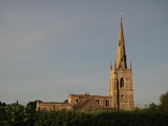
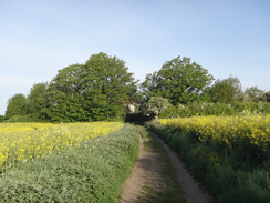
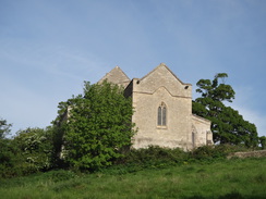
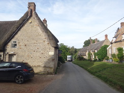
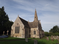
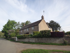
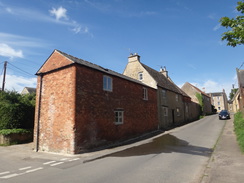
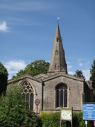
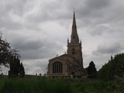
The road passed Aldwincle church and headed across fields before entering a long strip of linear woodland on a hillside, with the river below. This was a very pleasant walk through an area that might well become overgrown later in summer, but was beautifully shaded today. A more open area followed, with Wadenhoe church sitting barely visible at the top of a slope to the left. This marked the entrance to Wadenhoe, a small but perfectly formed village in which nearly every house appears to be listed - in fact, many of the houses are owned by a trust. Northamptonshire is stuffed to the gunnels with lots of superb little villages, of which Wadenhoe is a true gem.
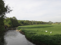
The trail left the village and headed past a mill to a footbridge onto the floodplain, where some cows were lazily blocking a gateway. Fortunately they paid me scant attention, and soon I was striding across the floodplain. Six weeks earlier I had stared down at the floodplain, which at the time was living up to its name and was covered in water; today it was nice and dry, aside from a slightly squelchy low section. A footbridge over the river led to a climb up to Achurch churchyard, which I had reached on a previous walk. The views back from the climb were good, and the church itself attractive - it had been a wonderful five miles of trail.
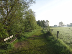
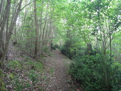
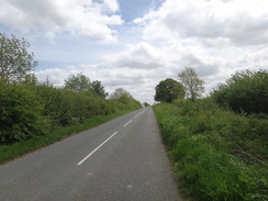
Next I faced a walk through some woodland called The Linches; it was a good walk, although not as pleasant as the woodland I had walked earlier. This led out to Lilford Bridge (actually two bridges), where I said goodbye to the Nene Way and started along roads for most of the rest of the day. Initially these took me northwestwards uphill into the hamlet of Pilton, where I stopped to take my boots off to empty them of a few pebbles. My feet were feeling warm, but the blister I obtained a couple of days ago wasn't causing me any problems.
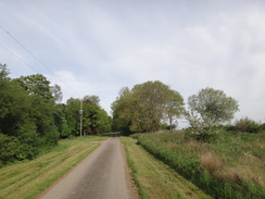
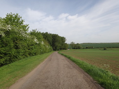
A very quiet road took me northwestwards; only one car passed me in a couple of miles, and when the road ended a green lane headed past woodland. An odd, intermittent noise sounded through the air; it sounded like machinery, but might also have been the wind whipping through the trees. The puzzle was solved when the lane descended down the hill and I saw a tractor spraying a field.
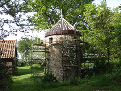
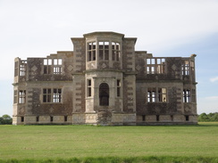
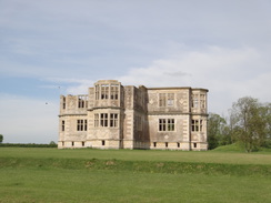
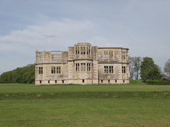
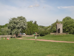
Another road took me southwestwards; I had intended to follow it as far as Brigstock, but a ruined building became visible on a hillside ahead. This was marked on the map as 'Lyveden New Bield', and I decided to go and visit it. A good track led uphill from the road, passing a cottage that seemed to be a visitor centre, and then I got the full glory of the 'New Beild'. It was a cross-shaped building; small in size and neatly derelict, set amidst some ornamental gardens. Some later research told me that it was built as a summer house for Sir Thomas Tresham, who also built the nearby Rushton Triangular Lodge. Like the lodge, it is apparently full of Christian symbiology, but unlike the Rushton structure, it was never completed. Thomas Tresham died in 1605 with the New Bield still under construction.
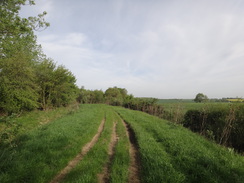
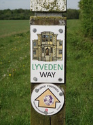
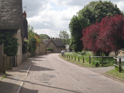
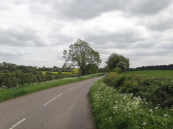
Instead of heading back down to the road, I decided to take a footpath that headed away from the New Bield complex. This was a pleasant walk, following the short Leveden Way across fields and then past woodland, before descending down to the Fermyn Woods Country Park. The cafe was open, so I nipped in and bought a delicious sausage roll, which I wolfed down on the footbridge whilst crossing the A6116 road. The outskirts of Brigstock were not too promising, with some rather 'ordinary' houses (and I mean no insult there), but the centre was stuffed with yet more stone houses, making it another pretty Northamptonshire village of the kind I have seen frequently on this trail. There appeared to be no shop, so I continued out of the village along a road.
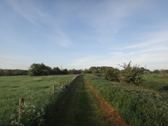
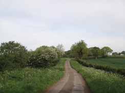
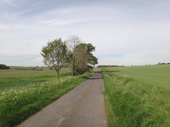
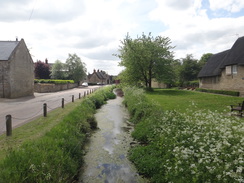
The rest of the day was spent road-walking. A long walk took me south, past a farm where people seemed to be setting up for some form of event - it turns out that this was the Brake Hill Farm Motocross site, and the scarred hillside bore testament to the bikes. A little further on the map showed a 'camp' with the wooded site of an old airfield beyond - RAF Grafton Underwood, although little of it could be seen from the road, and the remains of the camp appeared to be in industrial use. This led me into the village of Grafton Underwood, and this was - you've guessed it, - another village of pretty stone houses, although this one also had a stream running alongside the road.
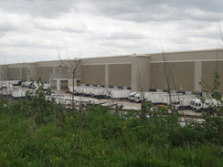
A short walk along the road took me on to a crossroads, from where I started the walk back to Islip. This road was busier than any of the previous ones I had walked today, but it was still a fairly safe walk. The Samuel Pepys pub in Slipton was open, so I nipped in for a quick shandy and took my boots off to let my feet cool down. Suitably refreshed, I headed on down the road, passing a massive distribution centre that I've regularly seen from the nearby A14 since it opened a couple of years ago. I'm amazed that such a large building is used by only one company - Primark - and it is one of several they own around the country. It's amazing how much trade goes on.
Thankfully a pavement started after the centre, and I quickly walked down into Islip, and then back up to my car at the village hall. It had been a fairly pedestrian day's walk, with the highlight being the surprise 'discovery' of the New Bield. Fortunately my feet have not suffered from all the miles along roads, despite the blister I got a few days ago. This walk is not one to be repeated, but a useful one to have done.
 |
 |
|
Directions
This walk starts off from the car park outside Islip village hall, at SP98687906. Leave the car park and turn left to head down a track called Old Farm Lane. This soon ends at a T-junction with the High Street. Turn left along High Street; as it curves to the left beside The Rose and Crown pub, turn right along Mill Road for a few metres, and then right down a track that runs down the side of the pub into its car park. Head down the car park, and at its end go through a small beer garden and join a path that heads downhill with a hedge on the right and a fence on the left. At the bottom of this path, go through a clappergate, cross a track and then angle slightly to the left to head diagonally across grass. Skirt a pond on the right, and continue straight on across a lawn to reach a clappergate in a fence. Head straight on across a field, aiming for a corner of a wall ahead. Go through a clappergate beside the wall to reach Mill Lane at SP99107924.
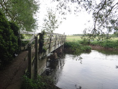
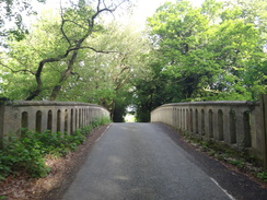
Turn right down Mill Lane, and after a few metres turn left through a clappergate into a field. The path skirts a ruined barn on the left and continues across the middle of the field, between the river on the right and a hedge on the left, towards some woodland ahead. Cross a farm bridge over a ditch and continue on to reach a stile in the field's far left-hand corner. Cross this and a footbridge over a ditch to enter an area of woodland, and turn right along a path that runs through the trees. The path curves to the left with a lake away to the left. Cross a small bridge and follow the path as it heads on to reach a footbridge over the river on the right at SP99747996.
Do not cross this, and instead go through a clappergate and follow a good path through Titchmarsh Wildlife Trust Nature Reserve. When the path soon forks, take the left-hand branch to follow a fence on the right towards a lake ahead. Follow the path as it curves to the right, still following the fence on the right; do not cross a bridge over a brook ahead. The path runs between the brook's southern bank on the left and a fence on the right. Cross a long causey and go through a clappergate with a bird hide off to the right, and continue following a fence on the right. Nearly a mile after meeting the brook, a bridge over the brook is reached at TL00788122. Go through a clappergate beside a field gate to reach the bridge.
On the other side, follow a track for about 100 metres until it ends at Lowick Lane on the outskirts of Aldwincle, with a small car park hidden away to the right. Turn right along this road; it soon curves to the right and then left. As it curves to the right once more, head straight on along a surfaced path called 'Baulk's Lane' that initially follows a low wall on the right. This runs between hedges before emerging onto Main Street in Aldwincle. Turn left down the road, and shortly after passing Aldwincle church on the right, Lowick Road comes in from the left. Opposite the junction turn right through a clapper gate beside a field gate into a field. Follow a stone wall on the left, and go through a clappergate to join a green track that passes a converted barn on the left before soon ending at a field at TL00708195.
Turn left to follow an intermittent hedge on the left; it soon squeezes through a gap in a hedge in the corner of the field to enter a second field. Follow the hedge on the left northwards. When the hedge jinks right and then left, head straight on to join a path that heads between hedges, with the second field through the hedge on the right. The hedge on the left soon ends and is replaced with a third field. Follow a hedge on the right downhill; at the bottom squeeze through a gap and immediately cross a footbridge over a stream to reach a clappergate. Go through this to enter a field. Turn half-right to follow the edge of the woodland on the right as they curves left, skirting the river away to the right. At the end of this field go through a clappergate at TL00658277.
Continue along an obvious path through a slightly overgrown area that skirts a sloping hillside. The path goes through a gateway and continues for about thirty metres; do not go through a gate ahead, and instead follow the path as it curves right. The area opens out to the left; continue on past Wadenhoe church above to the left. As a weir becomes visible to the right, go through a pedestrian gate and follow a fence on the right to enter a more open area. The path curves left to reach a surfaced footpath that leads up to the church; turn right along this and cross a footbridge over a ditch to reach a pedestrian gate. Go through this to reach a road with Wadenhoe village hall car park on the right at TL01058335.
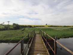
Pass the car park and head up Church Street, soon passing the King's Head on the right. When the road curves to the left, turn right down Mill Lane. This descends and curves to the left and then right before ending near an old mill beside the river. Walk straight on along a good path, keeping a low stone wall to the left to reach a footbridge over the river, which is guarded by gates. Cross the footbridge and then turn left to follow the river on the left downstream. At the end of the field go through a gateway and turn slightly to the right to head southeastwards across the floodplain, aiming for a footbridge over another river stream at TL01688310.
Cross the footbridge, and on the other side follow a fence on the right; the path starts to climb and then curves left to reach a clapper gate. Go through this into a field, and head up the field towards a church tower ahead. In the top corner of the field, go through a clappergate and turn left to join a path that runs between stone walls. The path leads into a churchyard; turn half-right to reach Achurch church at TL02138313.
Pass the church and leave the churchyard through its main gate to join a road. Head down this road for 150 metres, following a ramshackle wall on the left. Just before a house is reached on the right, turn left past a field gate to join a rough path that enters woodland. Follow the rough track through the trees; when a crosspath is reached after 370 metres, turn left down a rough path. This soon descends down steps and curves to the right. It slowly descends through the trees to meet a track in front of a fence. Turn right down the track, passing a house on the left (probably related to the adjacent lock), following the fence on the left to reach a clapper gate beside a gateway that leads onto a road at TL02688376.
Here the Nene Way is left for the day.
Turn left to head down the river and cross the twin bridges over the Nene. On the other side, follow the road as it climbs uphill, passing through the hamlet of Pilton. After three-quarters of a mile a crossroads with Oundle Road is reached at TL01648455. Cross the road and head straight on down a dead-end road; after 1.4 miles this ends at a Y-junction beside Bearshank Wood. Take the right-hand fork past a vehicle barrier and follow a green lane that passes the woods on the left. The track emerges out into a field as the woodland curves away to the left; follow an intermittent hedge on the right downhill. At the bottom of the field, cross a farm bridge over a stream and head on along the track as it climbs to reach a vehicle barrier that guards a road at SP99478677.
Turn left along the road, and follow it southwestwards. After nearly a mile, a good track leads off to the left, signposted for Lyveden New Bield. Turn left up this track and follow it uphill. As the main track curves left towards a car park, head straight on through a double gate along another track that curves to the left to pass a cottage on the right, and then right to pass the spectacular ruins of Lyveden New Beild. When the track ends, turn left through a gap to enter the car park at SP98478528.
Go through the hedge, and then turn right to follow the hedge on the right away from the car park. The hedge curves right with a field on the left; at the corner of the field curve left alongside a ditch towards some woodland ahead. At the next corner in front of the woodland, turn right over a farm bridge into a second field. Follow the edge of the woodland on the left; after 0.4 miles the path meets a track coming in from the right; join this and follow it, initially following the woodland on the left. When the woodland soon curves away to the left, continue on along an obvious path across the field towards a large gap in a hedge ahead at SP97078490.
Go through the gap in the hedge, cross a track, and head straight on westwards across a field, aiming for some woodland ahead. Once the edge of the woodland is reached, turn left to follow the trees on the right, with a field on the left. Just before the corner of the field is reached, the path turns right through the hedge and crosses a ditch; on the other side, turn right to follow the edge of the woodland on the right. The path descends into a dip and ascends the other side, before curving to the left, still following the edge of the woodland on the right. They curve right and left once more, and then starts to descend. At the bottom corner of the field, turn right through a pedestrian gate to enter the Brigstock Country Park. Head straight on past a little play area to join a good path; turn left down the path Pass a cafe on the right, and head on along the path to an old clappergate. The path approaches the A6116 road, and then curves left to reach a footbridge across the road at SP95168499.
Cross the footbridge, and on the other side turn right down some steps that lead onto Lyveden Road in Brigstock. Turn right down this road, and follow it uphill into the centre of the village. Lyveden Road becomes Stable Hill and ends at a T-junction; turn left past the Green Dragon Inn on the left. Follow the road as it passes the church on the right; when it curves to the left, turn right down Grafton Road. Follow this road as it heads in a rough southerly direction, passing through the village of Grafton Underwood, and after four miles the road ends at a T-junction at SP92147966. There is no pavement along this stretch of road.
Turn left along the new road, and follow it eastwards for 3.3 miles, passing through the hamlet of Slipton and its pub (the Samuel Pepys), before it ends at a T-junction at SP96697826. Again, there is no pavement on this stretch. Turn left along the new stretch; it passes a massive distribution depot on the right, and after a mile it reaches a roundabout with the A6116 at SP98337846. Carefully cross the roundabout and continue straight on down Kettering Road. Follow this downhill for 0.4 miles, and when the Woolpack Inn is reached on the left, turn left up Chapel Hill. Follow this road as it climbs up into Islip, curving to the right to become the High Street. Pass Islip church away to the left, and just before a red phone box, turn left up Old Farm Lane to reach Islip village hall, where this walk ends.
Distances
| From | To | Distance (m) | Ascent (ft) | Descent (ft) |
|---|---|---|---|---|
| Islip | Lilford Bridge | 5.7 | 236 | 322 |
| Lilford Bridge | Lyveden New Bield | 4.3 | 377 | 174 |
| >Lyveden New Bield | Brigstock | 3.0 | 98 | 187 |
| Brigstock | Grafton Underwood | 3.8 | 302 | 205 |
| Grafton Underwood | Islip | 5.5 | 259 | 384 |
This makes a total distance of 22.3 miles, with 1272 feet of ascent and 1272 feet of descent.
For more information on profiles, ascents and descents, see this page
 |
 |
|
 |
 |
|
 |
 |
|
 |
 |
|
 |
 |
|
 |
 |
|
 |
 |
|
 |
 |
|
 |
 |
|
 |
 |
|
 |
 |
|
 |
 |
|
 |
 |
|
 |
 |
|
 |
 |
|
 |
 |
|
 |
 |
|
 |
 |
|
 |
 |
|
 |
 |
|
 |
 |
|
 |
 |
|
 |
Disclaimer
Please note that I take no responsibility for anything that may happen when following these directions. If you intend to follow this route, then please use the relevant maps and check the route out before you go out. As always when walking, use common sense and you should be fine.
If you find any information on any of these routes that is inaccurate, or you wish to add anything, then please email me.
All images on this site are © of the author. Any reproduction, retransmissions, or republication of all or part of any document found on this site is expressly prohibited, unless the author has explicitly granted its prior written consent to so reproduce, retransmit, or republish the material. All other rights reserved.
Although this site includes links providing convenient direct access to other Internet sites, I do not endorse, approve, certify or make warranties or representations as to the accuracy of the information on these sites.
And finally, enjoy your walking!
Nearby walks
| # | Title | Walk length (miles) |
|---|---|---|
| 142 | Huntingdon Station to Hargrave | 17.3 |
| 184 | A circular walk between Hargrave, Raunds and Rushden | 18.4 |
| 643 | A circular walk from Thrapston to Oundle | 19.4 |
|
|

|