Walk #1032: London Loop: Rainham to Purfleet, then on to Basildon and Pitsea
 |
 |
|
General Data
| Date Walked | 12/01/2019 |
| County | London, Essex |
| Start Location | Rainham station |
| End Location | Pitsea station |
| Start time | 08.01 |
| End time | 15.56 |
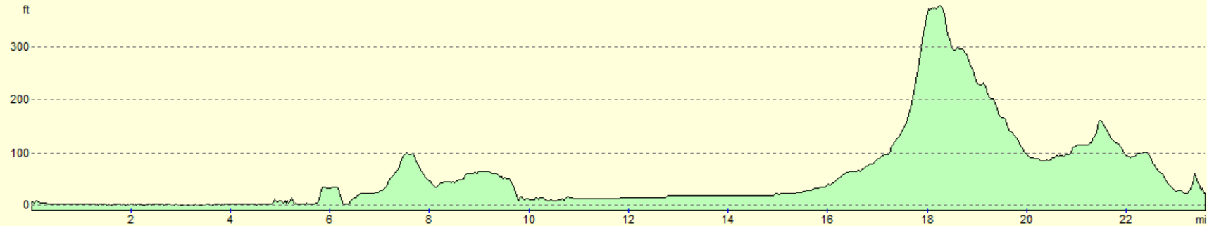
| Distance | 23.6 miles |
| Description | The first part of this walk followed the last few miles of the London Loop across an ex-industrial landscape to Purfleet; roads and a path beside the Mar Dyke took me on to Basildon and then Pitsea. |
| Pack | Today I carried my 30-litre Karrimor rucksack, filled with water, my spare waterproofs, a book and other odds and ends. |
| Condition | I have a couple of small blisters on my little toes; the first such for some months. Aside from this, I feel fine. |
| Weather | Today's weather was predominately a mixture of sunshine and cloud. It was mild for the time of year, albeit with a sometimes fierce and chilly breeze, and there was a few minutes of light drizzle around midday. |
| OS map | Landranger number 177 (East London, Billericay & Gravesend) and Landranger number 178 (Thames Estuary, Rochester & Southend-on-Sea) |
 |
 |
|
Map of the walk
Maps courtesy of Google Maps. Route for indicative purposes only, and may have been plotted after the walk. Please let me have comments on what you think of this new format. For a detailed table of timings for this walk, please see the table file.
 |
 |
|
Notes
My previous walk had left me with about five mile of the London Loop to complete to reach one of its trailheads at Purfleet. Since I started the trail near its end, I still have the majority of it to complete from the other trailhead at Erith on the Thames' southern bank to Barnet, in North London. However with no easy way to get across the river from Purfleet to Erith, my only option was to extend the walk beyond Purfleet. A quick look at the map showed a route from Purfleet to Basildon and then on to Pitsea, which I had walked past during my coastal walk.
I woke up far too early this morning, and instead of lying in bed I set off. I had checked out the car park by Rainham station on Google Maps, but when I arrived in the dark I couldn't locate it. I drove around for ten minutes before eventually pulling up in the nearby Tescos to buy some food. A security guard told me the station did not have a car park, and so I paid about eight pounds to park in a small car park by the Tescos. The car park had an awful phone-in system for paying, and it took me over five minutes to complete the process.
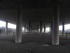
This all delayed me, and I missed about twenty minutes of daylight before I set off on the five minute walk back to Rainham station. As I arrived, a large lorry that had been parked up moved, revealing the entrance to the car park! Annoyed with myself, the lorry driver, and the world in general, I started my GPS and set off. A bridge led over the railway line and the adjacent HS1 line, and on the other side a long slope led down to a path that skirted the road southwards to a massive concrete viaduct that carried the A13 overhead.
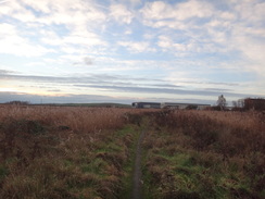
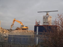
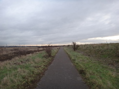
Another path led on, paralleling the road; it was nice not to be on tarmac, but the hammering noise of a concrete breaker – like an overloud woodpecker - and the gentle background buzz of traffic spoilt any illusion that we were in a rural area. The path eventually led out onto a road in an industrial estate, after which an overgrown path led up past a digger using a breaker on some concrete – the source of the sound earlier – beside a whirling radar system, which was presumably for London Airport. The path climbed up onto a bank, which gave me my first views of the Thames on this walk.
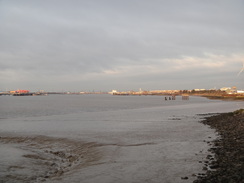
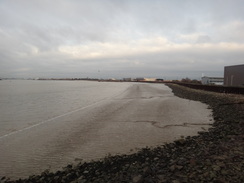
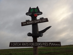
This stretch of coastal path was not open when I did my coastal walk sixteen years ago, so it felt good to be doing it now – although to be fair, it is not by any means a classic stretch of coast. The industrial estate soon ended, and the path sometimes went beside the wall, offering me pleasant views across the estuary, whilst at others it passed below it, blocking the views. The path jinked past a jetty to a factory inland – and a silo that had 'Tilda' on it – so that's where my rice comes from!
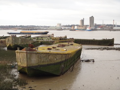
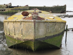
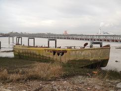
Some abandoned boats soon came into view. These were concrete barges made during the Second World War. They were abandoned here after the 1953 floods and did not look in bad condition, and certainly better than steel or wooden boats would be after so many decades. Some were stuck in the mud, whilst one looked as though I could just walk up to it and clamber on board. But my usual cowardice struck, and I took a few photos and walked on.
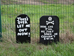
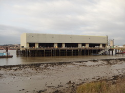
Someone had erected a few jokes nearby, poles converted into characters with the addition of mouths and eyes, with humourous words underneath. They were a pleasant touch, and I wonder how long they'd been there. The path continued south, past a large building on piles with tugboats and barges moored alongside – a waste-handling site, where barges loaded with detritus from Central London.
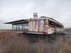
Soon afterwards Coldharbour Point was reached, where the coast turns to head eastwards. A public road alongside led to the waste-handling site, after which the path dived down below the sea wall once more – apparently this stretch of sea wall was only constructed in the 1980s, cutting of an old area of saltings. A couple of runners and several cyclists came past, and one birdwatcher had his binoculars set firmly onto the marshes. Shortly afterwards there was an RSPB visitors' centre with an interesting architectural style – far more glaring and obtrusive than I'd expect, and which was also fairly busy.
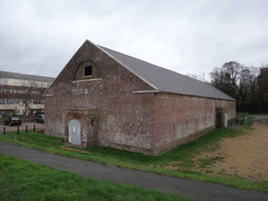
My dated map showed the path followed the Mar Dyke upstream for a short distance to a bridge, before returning down the other bank, but I came across a newish-looking cyclebridge across the stream's outfall. I crossed this, and was relieved to find a London Loop waymarker pointing across it – the trail has evidently been diverted. The Mar Dyke marks the western boundary of Purfleet, and the trail followed the seawall past some flats - aside from a large brick building with a number '5' written on its gable end, one of the gunpowder stores that existed here before the flats. It was a pleasant link with the past, and good to see it was not swept away like its four brothers, and is now a museum.
The London Loop passed a beacon and joined a road for the last few hundred miles to Purfleet station, which is officially the trailhead. It wasn't the best stretch of the trail – in fact the entire day so far had been a bit of a let-down, and it was a bit of a relief when I reached the station and could start the rest of the day. Since I started the trail in the middle, and there was no easy way of getting across the river to the other trailhead in Erith, I had decided to walk on to Basildon and then hopefully Pitsea. As I had walked to both Pitsea and Purfleet on my coastal walk, this would make the northern side of a loop through southern Essex.
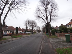
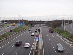
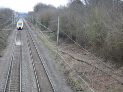
Unfortunately this meant a great deal of road walking. A road took me across the Mar Dyke and then over the HS1 railway line. A cafe was doing busy trade but I decided against going in, and instead followed a road that headed through Aveley, which was a rather unnoteworthy place. The same road took me over the M25 and on through Ockendon, which was a slightly more interesting and attractive town – at least on the route I took through it.
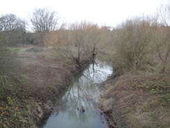
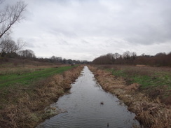
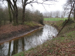
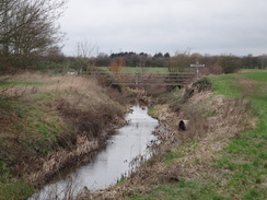
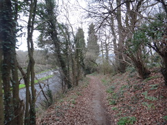
A winding and busy road took me a short distance down to a bridge over the Mar Dyke, where a footpath led down to the stream. The next few miles followed the stream northeastwards; it was a pleasant walk, and not too muddy, but again rather unremarkable aside from a footbridge whose planks were in need of repair. A few minutes of light drizzle hardly dampened me, although the stroll along the riverbank eventually became a little boring.
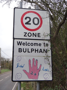
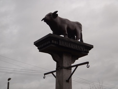
Respite came in the form of a road that took me east into Bulphan, whose road sign had been welcomingly altered by children. The road was busy and there was no pavement, but the verges were wide enough o avoid the worst of the traffic. A post in the village was topped by a carved wooden bull, presumably a play on the village's name.
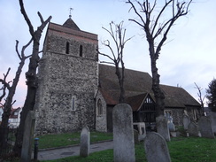
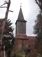
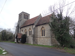
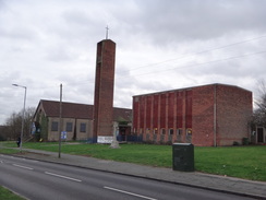
A quiet road led east to a busier one, which thankfully I only had to follow for a short distance before taking a lane that eventually headed steeply onto the Langdon Hills, passing a small church on the way. A main road then took me past another church - the two are remote, but within about a third of a mile of each other – and a pub, before heading downhill. It was another uninteresting plod that dumped me out in Lee Chapel. Another main road then led east into the centre of Basildon.
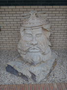
I went a little wrong in an underpass and ended up walking through a shopping centre, where there was a rather crudely carved figure of a head with flowing beard – perhaps King Edgar was an Essex lad. If so, then he isn't well-regarded by the locals, as the bust's position on a strip of gravel beside a wall is not very prestigious. I made my way to the town's railway station, where I could have finished the walk – but I was feeling fit and there was still enough daylight, and so I pressed on.
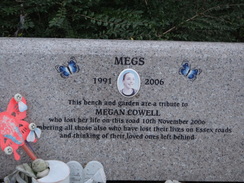
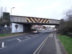
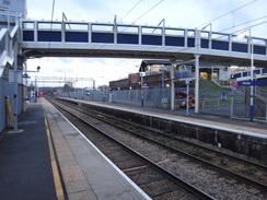
I stared into a chip shop's window as I considered whether to buy some, much to the apparent amusement of some people in the queue. Instead I walked on towards Vange, where a plaque on a bench opposite a hideous brick church commemorated a young girl who died near the spot a few years before. Soon afterwards the road passed under a rail bridge, passed a massive supermarket and then under the A13 viaduct before reaching Pitsea station. This meant that today's walk had linked to my coastal walk in a few places, and also meant the end of the day's walk.
It had not been a classic walk; the stretch of the London Loop to Purfleet had not been as pleasant as the previous two days on the trail, and the walk on to Pitsea had involved too many roads. But it is done, and I now have to decided whether to do my next walk from Erith, or to do the trail out-of-order and do another stretch in north London.
 |
 |
|
Directions
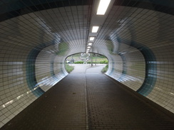
This walk starts off at Rainham station at TQ52098203. From the station's main entrance and ticket office, turn right for a few metres to reach Ferry Lane. Turn right past a barrier and along the lane for a few metres to cross the railway at a level crossing. As the lane immediately curves left, two ramps lead off to the right. Take the second of these, which leads to a footbridge that crosses the HS1 railway line. On the other side, take a long, sloping ramp that crosses Ferry Lane, becoming a path that parallels it. After about 500 metres, this path approaches a roundabout near a viaduct carrying the A13 overhead at TQ51728152.
Turn left away from the roundabout for a few metres to reach a pedestrian crossing across a sliproad. Cross this, and on the other side turn right back towards the roundabout and pass under the A13 viaduct. On the other side, follow the pavement as it curves left past a second roundabout to reach a pedestrian crossing over another sliproad. Cross this, and then turn right back towards the roundabout. After a few metres turn left across a footbridge over a ditch. On the other side, turn right along a gravel footpath that initially parallels Ferry Lane off to the right. The path slowly sweeps left to run south near Coldharbour Lane; after about 800 metres it curves right to cross another footbridge over a ditch to reach Coldharbour Lane at TQ51468088, near Harbour House.
Carefully cross the road, and on the other side take a footpath that heads alongside a fence and industrial building on the left; the path soon ends back at Ferry Lane. Cross the road, and on the other side take a ramp that slopes up to the left, towards a fence on the right. The path becomes slightly overgrown as it parallels the fence, but it soon becomes clearer as it approaches the Thames seawall on the right. Continue along the path as it runs south along the top of the bank, between the seawall on the right and Ferry Lane to the left, with an industrial estate on the other side of the road. After about 450 metres the path approaches the seawall on the right and climbs up to join a raised walkway that crosses over to the estuary-side of the seawall, to reach a jetty at TQ51438027.
The path is now unsurfaced as it runs between the seawall on the left and the estuary on the right. Follow the path along the side of the estuary as the seawall curves away to the left. The path passes a car park away to the left and some concrete barges on the mudflats. 1.4km after the jetty, a road leading to a jetty with a large building on it is reached. Cross the road and continue on down a ramp to rejoin the path beside the estuary. The beacon at Coldharbour Point is reached another 350 metres further on at TQ52017883.
At Coldharbour Point the path curves left to head eastwards, initially with industrial buildings over a fence on the left. These are then replaced with an access road. The path eventually curves left, and 1.9km after Coldharbour Point it enters a small car park. Head through the car park, and at its northern end continue along a path that slopes down for 50 metres to meet a junction with a cycle path at TQ53487928.
Turn right along the cycle path, which runs along the base of a flood bank on the right. It eventually climbs up to run along the top of the bank for a short distance before dropping down again. It then climbs back up onto the bank once more, and 1.5km after joining the path it passes an RSPB centre on the left. Immediately after this, turn right to reach a footbridge over the Mar Dyke at TQ54817872.
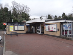
Cross the footbridge, and on the other side turn right to follow a surfaced path that runs alongside the estuary on the right, past blocks of flat to the left. When a little triangular path junction is reached 400 metres after the bridge, angle left to walk past the side of a hotel to reach London Road in Purfleet. Cross to the pavement on the other side of the road, and then turn right to follow the road southeastwards. When a mini-roundabout is soon reached, head straight on. After 430 metres Purfleet station is reached on the left at TQ55407815, where the London Loop ends.
Turn around and start heading back along London Road. Cross the mini-roundabout, and shortly after the London Loop heads off to the left, the road curves to the right, becoming Tank Hill Road. Continue along this road as it winds around in a rough northerly direction; it crosses a bridge over the Mar Dyke and then starts to climb to a bridge over a local railway line and HS1. It then ends at a T-junction with Arterial Road at TQ55257949.
Turn right for a few metres to a pedestrian crossing, and use it to cross the road. On the road's northern side, turn left to follow this road northwestwards; after 250 metres turn right up Purfleet Road. This soon ends at a T-junction; turn right to continue northeastwards along Purfleet Road. This soon crosses a bridge over the A13 dual carriageway and curves to take a more easterly course before it ascends up through Aveley. At a roundabout at the top of the hill in the centre of the village, continue straight on along High Street. This becomes Stifford Road, and 2.3km after joining Purfleet Road, a large roundabout is reached at TQ57278032.
A surfaced pavement bypasses the roundabout on the right, joining the B1335 on the other side (essentially heading straight on at the roundabout). Follow the road as it heads east, immediately crossing a bridge over the M25. Follow the road as it enters South Ockendon; it eventually crosses a bridge over a railway line, and 2.0km after the roundabout, the road ends at a junction with the B186 road. Turn right down this road (there is a pavement on the left), and follow it as it curves left and then right down a hill until it crosses Stifford Bridge over the Mar Dyke. Continue on for a few metres towards a roundabout; before it is reached, carefully cross over to the left-hand side of the road at TQ59488036.
On the other side of the road, take a bridleway that immediately curves left towards the bridge and the Mar Dyke's southern bank, before curving right to start following the river's southern bank. Follow the bridleway as it follows the stream on the left, negotiating any farm bridges over ditches or gates that are met on the way. It initially heads eastwards, before curving to take a more northeasterly course. After 6km the stream splits by the corner of a field at TQ61798490; follow the bridleway around to the right. When the stream soon splits again, continue straight on along the edge of the field, with the stream (now little more than a ditch) on the left. At the end of this field the bridleway emerges out onto a road. Turn left to follow this road north for 180 metres until it ends at a T-junction with Fen Lane at TQ62218523, with a road bridge a short distance away to the left.
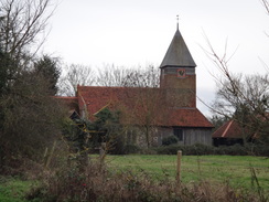
Turn right to follow Fen Lane northeastwards; there is no pavement, but the verges are generally wide. After 1.7km it passes a school on the left and curves right to enter the village of Bulphan; a short distance further on it reaches the village church on the right. At the church the road curves left to continue on eastwards through the village; after another 500 metres it ends at a T-junction with the A128 Bulphan Bypass. Turn right for a few metres and carefully cross the road, and then take a footpath that leads straight on eastwards away from the road. This soon becomes an access road; follow it straight on for a short distance until it ends at a T-junction with Brentwood Road at TQ64428602.
Turn left to head north up Brentwood Road, and after 100 metres turn right along Doesgate Lane. Follow it as it heads eastwards towards a hillside ahead; after 1.8km it ends at a T-junction. Turn right down another road; there is no pavement and it can be quite busy. After 350 metres turn left up Old Church Hill. This road heads eastwards, initially gently and then steeply climbing onto the Langdon Hills. After 1.4km it ends at a T-junction with the B1007 at TQ67748634.
Turn left to follow the road northwards, immediately passing a car park and then a church on the left. Initially there is no pavement, but one starts on the right shortly after passing a pub on the right. Continue down the road as it winds around past Langdon Nature Reserve on the left, slowly descending. After 2.4km a road merges from the left, and a roundabout is reached 150 metres further on. Turn right down Laindon Link, and carefully cross over to the pavement on the left-hand side of the road. Follow this road east into Basildon; after 840 metres the pavement starts to descend down to an underpass under a roundabout at TQ69988847.
Follow the pavement as it heads towards the underpass, and then turn right under the underpass to reach a sculpture at the centre of the roundabout. Turn left to aim for another underpass, and follow the path out from this as it passes a car park and shopping centre on the right. Continue past another underpass on the left, and then angle right up to meet a road called Westgate at TQ70098860.
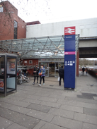
Turn sharply right to follow Westgate south; it soon curves left. As it does so, join a pavement on the right that runs between the road and a fence. When the road soon ends, the pavement becomes a pedestrianised shopping street. The shopping street soon reaches a large square that houses Basildon Market; turn right to head south. A road comes in from the right; head straight on for a short distance to reach Roundacre. Turn left for a few metres along Roundacre to reach a pedestrian crossing. Cross the road using this, and Basildon railway station is directly ahead at TQ70358834.
From Basildon station, turn back towards Roundacre and turn right, following it as it parallels the railway line to the right. After 280 metres take the first road off to the right, Clay Hill Road. This immediately passes under a railway bridge as it heads south. It continues south, before slowly curving left through Kingswood to take an easterly course. After another 1.4km it reaches a roundabout with the B1419. Continue straight on at the roundabout as the road curves right to head south into Vange. After another 650 metres it ends at a roundabout with the B1464 at TQ72488752.
Turn left to head east-northeastwards along the B1461 High Road. After 800 metres it passes under a railway bridge and reaches a roundabout. Turn right down Hazelmere to reach a second roundabout in front of a Tesco store. Head straight on; the road then curves left to run between the store on the left and a railway on the right, before heading under a viaduct that carries the A13 overhead. It then gently curves left to reach another roundabout. Turn right down Pitsea Hall Lane; this soon crosses a bridge over a railway line, and immediately afterwards turn left down Station Approach. Pitsea Station is at the end of this road at TQ73818759.
 |
 |
|
Distances
| From | To | Distance (m) | Ascent (ft) | Descent (ft) |
|---|---|---|---|---|
| Rainham station | Purfleet station | 5.5 | 128 | 121 |
| Purfleet station | Stifford Bridge | 4.3 | 213 | 217 |
| Stifford Bridge | Bulphan church | 5.4 | 30 | 13 |
| Bulphan church | Basildon station | 5.4 | 371 | 312 |
| Basildon station | Pitsea station | 3.0 | 144 | 213 |
This makes a total distance of 23.6 miles, with 886 feet of ascent and 876 feet of descent.
For more information on profiles, ascents and descents, see this page
Transport
C2C currently (2019) run train services between Pitsea and Rainham (Essex). Some services run direct, whilst on others you will need to change at Grays. The latter is no real problem, as there are frequent services on both legs of the journey. See the National Rail Enquiries website for more details.
 |
 |
|
 |
 |
|
 |
 |
|
 |
 |
|
 |
 |
|
 |
 |
|
 |
 |
|
 |
 |
|
 |
 |
|
 |
 |
|
 |
 |
|
 |
 |
|
 |
 |
|
 |
 |
|
 |
 |
|
 |
 |
|
 |
Disclaimer
Please note that I take no responsibility for anything that may happen when following these directions. If you intend to follow this route, then please use the relevant maps and check the route out before you go out. As always when walking, use common sense and you should be fine.
If you find any information on any of these routes that is inaccurate, or you wish to add anything, then please email me.
All images on this site are © of the author. Any reproduction, retransmissions, or republication of all or part of any document found on this site is expressly prohibited, unless the author has explicitly granted its prior written consent to so reproduce, retransmit, or republish the material. All other rights reserved.
Although this site includes links providing convenient direct access to other Internet sites, I do not endorse, approve, certify or make warranties or representations as to the accuracy of the information on these sites.
And finally, enjoy your walking!
Nearby walks
| # | Title | Walk length (miles) |
|---|---|---|
| 123 | Mile End to Dartford | 15.0 |
| 161 | Gravesend to Dartford | 7.2 |
| 176 | Gravesend to Rochester | 17.2 |
|
|

|