Walk #1039: London Loop: Coulsdon South to Hatton Cross
 |
 |
|
General Data
| Date Walked | 02/03/2019 |
| County | London, Surrey |
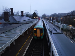
| Start Location | Coulsdon South station |
| End Location | Hatton Cross station |
| Start time | 07.14 |
| End time | 16.24 |
| Distance | 26.7 miles |
| Description | This was a pleasant walk following the London Loop trail. It had two halves: the first heading northwestwards towards the Thames in Kingston-upon-Thames, often following the Hogsmill River, and the second heading northewest through Bushy park towards Hounslow Heath. |
| Pack | Today I carried my 30-litre Karrimor rucksack, filled with water, my spare waterproofs, a book and other odds and ends. |
| Condition | I have a few small blisters after this walk, including one at the base of my big toes, where I can't recall ever having had one before. |
| Weather | The day started off grey and overcast, with lots of drizzle in the air and a stiff breeze. Things improved as the day wore on, and by early afternoon there were considerable sunny periods. It was fairly mild for the time of year. |
| OS map | Landranger number 187 (Dorking, Reigate & Crawley area) and Landranger number 176 (West London, Rickmansworth & Staines) |
 |
 |
|
Map of the walk
Maps courtesy of Google Maps. Route for indicative purposes only, and may have been plotted after the walk. Please let me have comments on what you think of this new format. For a detailed table of timings for this walk, please see the table file.
 |
 |
|
Notes
After a diversion up north for four walks, I was keen to get back to walking the London Loop. I set off ridiculously early this morning, parked at Loughton station before six, and started on my journey to Coulsdon South. This involved three tubes or trains, and I was incredibly lucky in that I did not have much of a wait for any of them, and I eventually arrived at Coulsdon Ssouth at 07.15 – about twenty minutes after first light.
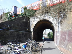
A light drizzle was falling as I got off the train – not enough for me to put my coat on as it was fairly mild, and I did not want to overheat – but enough that I would get very wet if it continued for hours. The dark clouds added to the gloom, and I took a few photos outside the station to test my new camera. The trail passed under some viaducts and then started to ascend roads through a residential area into Clock House, passing a pub on the way.
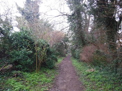
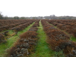
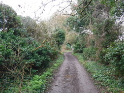
At the summit the trail left the road and headed down a narrow green lane between hedges. Before it reached a main road, the trail headed across a lavender farm, sadly looking grey and damp rather than aromatic purple, to reach the Oaks. This farm was created by the Earl of Derby as a model farm, and the gardens were pleasant even on an early-March morning. The trail wound through the gardens on what felt like a rather convoluted route, before joining a track.
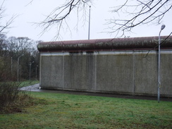
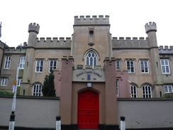
Here I made a mistake: I missed a waymarker and continued along the track; it was a pleasant walk, but after 500 metres I realised my mistake as houses appeared on my right, where there were none was on the map. Cursing, I turned around and headed back and joined the proper route that headed past the grey concrete walls of HMP High Down, which opened in 1992 on the site of the old Banstead lunatic asylum. I’ve never had occasionally to go to a prison, either as inmate or visitor, and I hope that I never have a need to!
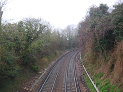
The area opened out after the rather depressing surroundings of the prison, and the light drizzle also stopped. The trail crossed a railway line and entered Banstead Downs, which is bisected by a dual carriageway near Banstead railway station. It then crossed a golf course that was busy with golfers, although fortunately none were teeing off as I approached. This marked the last greenery for a while, as the trail plunged through suburban East Ewell, eventually passing under a railway line via a path that was busy with runners walking back to their cars after a run – perhaps the result of a park run.
This marked entrance to the grounds of Nonsuch Palace, Henry VIII’s massive, palatial palace. Started in 1538, the palace was incomplete when Henry VIII died nine years later, and lasted a little over a century, before the owner – a mistress of Charles II – had it pulled down to pay off gambling debts! Few images of it remain, although those that do show a rather unique architectural style with tall octagonal towers and vivid decoration, rather different to other surviving palaces from the era. It’s hard to tell if its quick destruction was a tragedy or the removal of an experiment best forgotten!
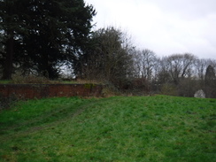
The trail took a slightly roundabout route through the park, and eventually passed some low stone walls that are the only remaining sign of the palace – the banqueting hall, from which the King could view events in the park. The walls are slightly overgrown, but enough was visible to imagine what it might once have looked like, in footprint at least.
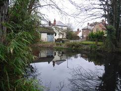
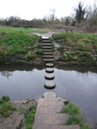
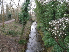
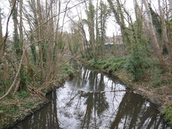
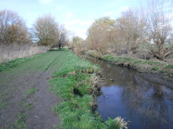
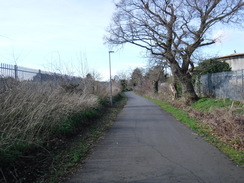
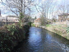
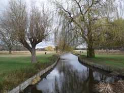
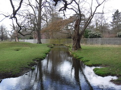
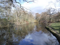
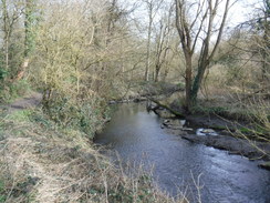
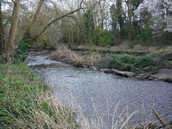
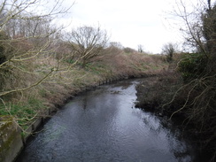
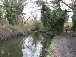
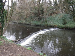
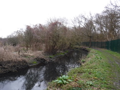
A dual carriageway separated the park from West Ewell, where the trail joined the banks of the River Hogsmill, which rises nearby. The trail would follow it for the next few miles until it drains into the Thames, a pleasant if indirect route through suburbia. The trail and river soon passed under a railway bridge; as there was no gap for the path, it had been built as a walkway over the river, sharing its bridge! The London Loop likes to follow rivers, and they certainly make good routes through the built-up areas. The river’s water was crystal-clear, and I really enjoyed the stroll, even when it passed above a go-kart track, where marshals were preparing for some running on the damp track.
Sadly it had to end, and the trail diverted up along roads to pass a stretch of the Hogsmill that had no right-of-way – at least according to my dated guidebook – whilst the latest 1:25,000 map shows a right-of way, and the latest official maps show it also following the river – so I shall have to come back and do the alternative riverside route sometime!
A little further on I made a mistake: the riverside footpath was vague and indistinct near a footbridge, and a fingerpost pointed across the bridge away from the river. I followed it and then roads for a short distance to reach the A3. I realised that I’d gone wrong, but was unsure if the route had continued along the river (I found out it did when I got home). I joined the proper route at the A3, where an underpass took me under the busy road, and for the rest of the journey into Kingston I’d come across fingerposts that pointed in somewhat random directions!
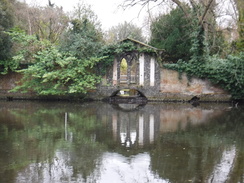
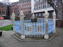
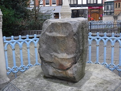
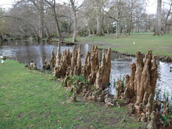
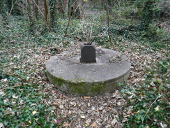
The stretch of walk north from the A3 to Berrylands station was pleasant, although the next stretch past sewage farms and a cemetery was somewhat less beguiling. More roads led back to the Hogsmill, which the trail tried to follow through Kingston. Eventually it squeezed past a large concrete plinth that had been built over the river, and a quick diversion showed this to find the ‘Chair of Majesty’, on which seven Saxon Kings of England were allegedly crowned. The large sandstone sarsen is now surrounded by seven carved stone columns, some of them more weathered than the stone! Kingston seems like and odd place for such a relic to be found – although it’s name - “King’s Town," and the fact it is England’s oldest royal borough, show it is hardly ridiculous.
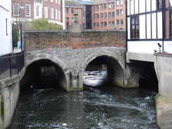
There was another treat immediately afterwards: the main road through the town crosses the Hogsmill on the Clattern Bridge, and from the surface this seems an utterly unremarkable bridge. However if you follow the trail as it squeezes down to the riverbank, then you see three ancient stone arches – built in 1175, it is one of the oldest bridges in the country. It was a rather unexpected but welcome sight.
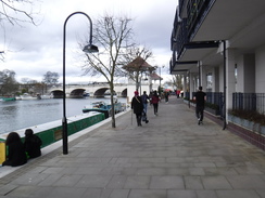
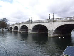
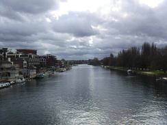
Soon afterwards the river ended at the Thames, which the trail had last seen many days ago. The smart area was bustling, perhaps because the drizzle had been replaced by periodic bouts of sunshine. It felt good to be beside the Thames once more, and I stopped for a minute on Kingston Bridge to stare upstream.
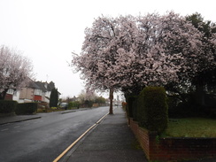
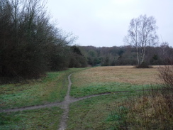
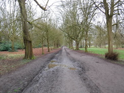
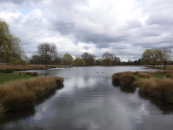
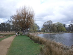
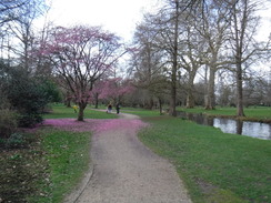
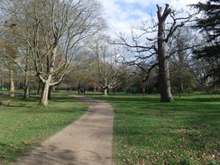
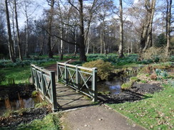
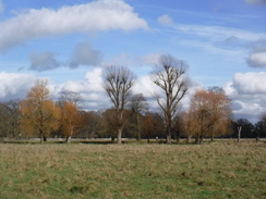
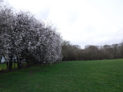
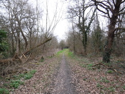
The next stretch of the trail was rather different, as it entered Bushy Park, part of the Hampton Court Palace complex (Henry VIII certainly liked his palaces). The trail cut across grass and past some ornamental ponds, which again were busy with families enjoying the sunshine. All of London’s parks are beautiful, and Bushy Park is no exception. The trail crossed the Chestnut Avenue and then entered the Waterhouse Woodland Gardens, where some early pink blossoms added some spring colour and scents to the day as the trail roughly followed a watercourse. It was all very pleasant, and must be spectacular later in the year.
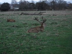
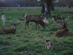
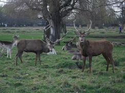
After leaving the gardens, a path led north past a couple of groups of deer – descendents of the ones Henry VIII introduced. They seemed very tame and allowed me to get fairly close to take photos, and did not even get too concerned when some idiot let their dog go yapping up to them – although given the small size of the dog and the large deer, it would have lost any combat! Just to the east of the park, and out of sight, is the National Physical Laboratory, where lots of interesting sciencey things occur.
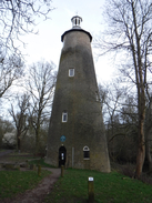
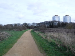
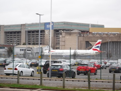
The trail left the park and entered Teddington, before following roads to join the River Crane. Unlike the two rivers earlier in the day, this was muddy and brown instead of clear and sparkling, the colour matching the mud underfoot as the trail passed through Crane Park. It passed a large Shot Tower, before leaving the main road and diverting across Hounslow Heath, which granted me good views of planes coming in to land at Heathrow.
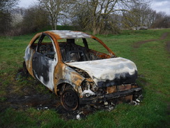
The trail rejoined the River Crane on the western side of Hounslow Heath after passing a couple of sad-looking burnt-out cars and some youths wildly riding trail bikes up and down the slopes. I was feeling rather tired by now, and my feet had developed a couple of hotspots. I just put my head down and walked, soon reached a road in North Feltham, where I had intended to walk to Feltham train station a short distance away. Instead I plodded on as the path crossed the Duke of Northumberland’s River and continued north, still with the Crane away to the right.
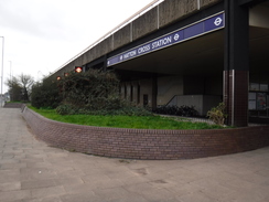
This led to another road bridge in Feltham. My map seemed to show the trail continuing along the river’s western bank, but the terrain was overgrown and marshy. Giving up, I headed up steps onto the bridge and crossed it, hoping to reach the end of the walk via roads. However a waymarker on the other side of the bridge pointed down, and a short path followed the river’s eastern bank to the A30. Here I left the trail for the day, and plodded along the road for about half a mile to reach Hatton Cross tube station: I was footsore, tired and in need of a break, but I had completed a varied and interesting walk. The journey back to my car at Loughton was long and annoying, with the tube line seemingly taking forever to reach Holborn, where I could change for the speedier Central Line. Despite this, it had been a very good day.
 |
 |
|
Directions
This walk starts off from Coulsdon South railway station, at TQ29875904. Leave the station by its main entrance, cross the approach road and descend some steps to reach the A237 road. Cross the road using the pedestrian crossing, and then turn right to follow the road as it passes under a railway viaduct, and then a second viaduct that carries the A23 overhead. Soon afterwards the road reaches a roundabout; continue straight on along the A237, and follow it as it curves left to pass through the town, before it ends at a T-junction with Chipstead Valley Road at TQ29655951.
Carefully cross the road using the pedestrian crossing to the left, and then head straight on up Woodman Road. This curves left as it climbs; after about 100 metres turn right up a surfaced access road. When this soon ends, angle left along a path that soon curves right to cross a railway line. Continue along the path as it heads north to ends at Woodmansterne Road. Turn left along this, and after about fifty metres turn right, still following Woodmansterne Road. This climbs uphill as it heads northwestwards and becomes Grove Lane as it enters Sutton; after 950 metres it reaches the Jack and Jill pub on the left at TQ28726024.
Continue along the pavement on the right; a short distance beyond the pub, the pavement curves right to become an off-road unsurfaced path that runs between hedges. Follow it northwestwards as it slowly descends. When it goes through a gateway and forks, take the left-hand branch that continues on between fences. The path passes two posts and joins a muddy track that comes in from the right. Then when the track curves left to a field gate, turn right to continue straight on between a fence and a hedge. A little over 1km after leaving the road, the path crosses a track coming in from the right. Head on for about 20 metres, and then turn left through the hedge to reach a squeeze-stile at TQ27936102.
Cross the stile into a rough field, and head straight on southwestwards across it. It passes through gaps in two bands of scrub, and after nearly 400 metres reaches a squeeze-stile beside a field gate that leads to the B278. Turn left along the road (there is a pavement on the left). Just before the pavement ends, turn right across the road to a stile that leads into a field. Follow a fence on the left, and when it ends after a short distance, angle slightly right to head north towards a hedge at TQ27526080.
Cross two stiles in this hedge, and head straight on along a grassy path between rows of lavender bushes. At the end of the lavender field, cross a stile in a fence. Ignore a second stile ahead, and instead turn right to follow the fence on the right, with a road away to the left. After about fifty metres cross a stile in a fence ahead, and then turn left to reach a crossing over the A2022 road at TQ27626109.
Cross the road using the pedestrian crossing, and then go through a pedestrian gate to enter The Oaks Park. Follow a track ahead; as it soon starts to curve right, turn left down a path that passes a small formal garden on the right. This soon joins a surfaced road; turn left down this track, and after a few metres, just before it reaches the public road, turn right down another surfaced track. The track becomes a path that enters some woodland; it curves around through the trees. As it approaches the public road once more the surfacing ends; angle right along a path that immediately curves right. At the bend turn left along a path that heads downhill through trees, away from the road. It meets a wall and fence on the left; angle left to follow these on the left. After a short distance the path curves left, following a fence on the left. Continue along this until it reaches an unsurfaced track at TQ27236101.
Turn right along the track as it heads northwestwards away from the road. After 150 metres pass a house on the left, and then turn left along another track. This heads straight to the west; after about 700 metres it passes the forbidding walls of a prison on the right. Head on; once past the prison the track becomes surfaced, and heads on to reach the A2218 Sutton Lane at TQ25786089.
Carefully cross this, and on the other side continue straight on along a path that descends down to reach a bridge over a railway line. Cross this, and when the path forks immediately on the other side, take the left-hand branch. Follow this as it descends through trees, soon emerging out onto a golf course. Head straight on as it bisects the golf course, with occasional hedges on both sides. When the trees end, angle slightly left across the greens; pass some trees to join a rough track that passes tees on the right. It then curves right to meet the A217 Brighton Road at TQ24886047.
Carefully cross the main road, and immediately on the other side turn right pas a couple of white posts to join a fairly overgrown path. This soon swings left to emerge out onto another green. Head straight on north across this green, aiming for trees ahead, keeping the club house away to the left. The path enters the woodland and starts winding northwards through the trees before they end at another green. Head straight on across the small gap to re-enter the trees, which soon end once more at a longer green. Head straight on towards a hedge and house at the far side; when the hedge is reached, continue straight on along a path, passing houses on both sides. The path soon ends at a road at TQ24696129.
Cross the road, and continue straight on down Sandy Lane. After 770 metres, turn left up Cuddington Way, and then after another 130 metres turn right along Cheyham Way, which in turn ends at Northey Avenue. Turn left to follow this westwards for 650 metres until it ends at a roundabout with the A232. Turn right to follow the pavement beside Cheam Road; the pavement soon joins the parallel access road on the right as it climbs. When a bus stop is reached after 240 metres, turn left to carefully cross the A232, and heads straight on along Bramley Road. When the road ends after 350 metres, cross the road ahead and continue on down a short stub road that leads to a bridge under a railway line at TQ23486281.
Head under the railway bridge, go past a gate and continue straight on along a surfaced path past the grassland of Warren Farm. The path curves gently right and enters some trees – there are a couple of tracks within the trees. Cross these and emerge out onto a track on the other side that runs along the southern edge of Nonsuch Park. Turn left to head along the track, with the park off to the right and trees to the left. After 550 metres a little lodge-style building is passed on the right at TQ22836304.
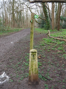
As the track curves right immediately afterwards, head straight on along a surfaced path that climbs a small slope. When this soon curves left, head straight on along the top of a bank. When the path forks near a concrete post marked ‘4’, head straight on through the trees, and when a post marked ‘5’ is reached, turn right down another path. This passes low brick walls to the left – the remnants of Henry VII’s old banqueting house. When the walls end, continue straight on for a few metres across grass, and then turn left to head downhill parallel an area of scrubland on the right. At the bottom of the field the path curves right to reach steps. Descend these and then turn left along a short path to reach the A24 at TQ22336287.
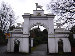
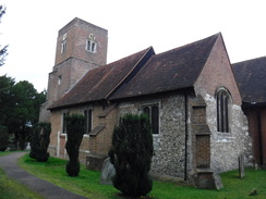
Carefully cross the dual carriageway (there is a crossing point with a wide median to help), and on the other side go through a gap in a hedge to reach an access road. Turn right along this for a couple of metres, and then left down a few steps to join a path that heads downhill beside a fence. The path ends at Church Street in Ewell. Head straight on down this road, immediately passing a turreted building – now Ewell Castle School – on the left, and a dislocated church tower on the right. This road eventually ends at a T-junction with the B2200 High Street in Ewell. Turn right along the road northwards for about 100 metres, and when a road comes in from the left, cross the High Street and head through a large white archway at TQ21956269 to enter the grounds of Bourne Hall.
Follow a surfaced path that immediately passes a lake on the right, and then curves right to keep alongside the lake, with the low circular edifice of Bourne Hall away to the left. When the lake ends, continue along the path until it emerges out through a gateway back onto the B2200. Carefully cross the road to reach the pavement on the other side, turn right to follow the road as it passes between lakes, and after a short distance turn left down a surfaced path that passes one of the lakes on the left. The path soon reaches an old mill on the left at TQ21876295.
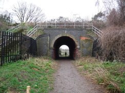
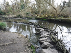
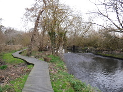
Turn left along a track that crosses a bridge over a millstream in front of the mill, and then turn right down a surfaced path, with the Hogsmill River to the right. When the surfaced path soon curves left back towards the mill, turn right to join an unsurfaced path that crosses two bridge over streams, with the river away to the right. Nearly 400 metres after the mill, the path joins a wooden walkway suspended above the river as both pass under a railway bridge. Duck under a pipe at the other side of the bridge to join a surfaced path. Turn right along this path for a few metres, and then angle left to join a grassy path that follows the river on the left. After 830 metres the path meets a path at TQ21016362.
Turn left along the path to reach a footbridge over the river; cross this, and immediately on the other side turn right to join a path that follows the river on the right. At a second footbridge beside a children’s play area, turn right across another footbridge add then left along an unsurfaced path, now with the river on the left. 650 metres after the second footbridge, the path emerges out onto the B284 Ruxley Lane at TQ20506420.
Cross the lane using the pedestrian crossing, and continue along a surfaced path, still with the river to the left. The path becomes unsurfaced for a period and passes a couple of footbridges over the stream; after nearly a kilometre it passes a vehicle barrier to reach the A240 Kingston Road at TQ20356507.
Turn right to follow the road for nearly 100 metres to a pedestrian crossing; cross the road using it, and then turn left to return to the river, carefully crossing two roads that come in from the right. Cross the bridge over the river, and on the other side immediately tun right past wooden barriers to join a path that follows the river on the right. This climbs up to pass a go-kart track on the left (Surbiton Raceway), and then some playing fields on the same side. 650 metres after leaving the main road, a bridge carrying a road over the river is reached on the right. Turn right to cross this to reach the B284 road at TQ20896545. Note: there are two possible routes for the trail from here; the following describes the one that does not follow the river.
Carefully cross this and head straight on up Cromwell Road, passing a pub on the left. When it ends at a T-junction, turn left up Grafton Road and follow this as it climbs uphill. When the top of the hill is reached after 450 metres, angle left along Royal Avenue. This soon becomes a path and then an unsurfaced access road. It finally becomes surfaced; when it curves left to become Barrow Hill, head straight on past a vehicle barrier, following a fence on the right that continues back to the B284 road at TQ21146614.
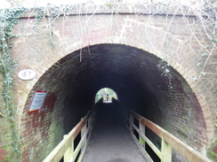
Carefully cross the main road to reach the pavement on the other side, and turn right along it. As the road soon curves right, turn left along a track signposted for St John’s church. After passing the church on the left, go through a clappergate beside a field gate to enter a little parking area. The path curves left to join a path that descends to join the river by a footbridge. Do not cross this, and instead angle right along a path, keeping the river on the left. This soon reaches a railway viaduct. Pass under this, and follow the river on the left for another 700 metres until it goes past a barrier to reach the A3 Malden way at TQ20546692.
Turn left to follow the road southwestwards for 250 metres until an underpass is reached. Go down this, pass under the road, and on the other side turn right to ascend the ramp that leads back to the northern side of the dual carriageway. Follow a road parallel to the dual carriageway back towards the river; just before it is reached after 130 metres, and just after passing a block of flats, turn left through a gap in a fence to join a surfaced path that soon rejoins the river on the right. Follow the river north for 1.1km until a footbridge is reached across the river on the right; here turn left along a path that soon leads to a roundabout at TQ19966785.
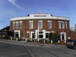
Head straight on, keeping the roundabout on the left, and head up Surbiton Hill Park. When another roundabout is reached in front of the Berrylands pub, turn right down Chittern Drive that leads down to Berrylands railway station at TQ19726807.
Pass through a bridge under the railway, and on the other side continue along a path. This passes a sewage works on the right, and then a cemetery on the left, and becomes a road. After 1.1km the road ends at a T-junction with Villiers Avenue. Turn right and immediately pass a roundabout and then the Duke of Buckingham pub on the left, and continue north along Villiers Avenue. It crosses the Hogsmill River once more on a bridge, and then a school on the left. 500 metres after joining the road, turn left down a surfaced path that follows the school fence on the left. This path passes a community garden on the left and then reaches a bridge on Mill Street at TQ18526876.
Turn left across the river, and then turn right down the Three Bridges Path. This passes an art gallery on the left and crosses a stream on a footbridge. Immediately on the other side of the footbridge, turn right to rejoin the river on the right. The narrow path squeezes past a school on the left until a bridge is reached ahead. Join the road, and turn left away from the bridge for a few metres, and then right down Denmark Road. Pass a block of flats on the right, and then turn right down a surfaced path that soon curves left to rejoin the river on the right. The path then curves left away from the river and ends at the A240 road at TQ18076886.
Turn left for a few metres to a pedestrian crossing. Use this, and then turn right towards a roundabout. Pass the roundabout to reach a second set of traffic light; cross these and then head down St James Road. When this immediately reaches a bridge over the river, turn left along a path that heads under buildings, with the river on the right. This path emerges out onto the High Street in Kingston-upon-Thames near the council offices. Carefully cross the High Street, and then turn right to cross the Clattern Bridge over the river at TQ17866909.
Cross the bridge, and immediately on the other side, go through a narrow gate and descend some steps to join the river on the left. Follow it; it soon crosses a road and becomes Charter Quay. Continue on until the Thames is reached, and then turn right to follow the riverside path north until Kingston Bridge is reached. Climb steps onto the bridge, and then turn left to cross the Thames at TQ17756935.
Continue along the road on the other side of the bridge; it soon passes a roundabout on the right and curves left. When you can, cross over to the right-hand side of the road, and then take the first road off to the right, Church Grove. When this soon reaches St John’s Church on the right, turn left to cross a pedestrian crossing and go through a gate to join a path that heads westwards down a tree-lined avenue to reach a gate that leads into Bushy Park at TQ17146934.
Go through the gate to enter the park, and after about ten metres angle right off the surfaced path across grass. This soon meets a track by some cricket practice nets; cross the track and take the righthand-most of two grassy tracks, which heads northwestwards towards the right-hand edge of some tees ahead. The path passes the trees, and then curves left to head towards the Leg of Mutton Pond. Head to the pond, and then almost immediately turn right over a footbridge at its end. On the other (northern) side, turn left to follow a stream on the left. This soon reaches a footbridge at the end of Heron Pond at TQ16396962.
Do not go over the bridge, and instead follow the path as it follows the edge of the pond. When the path curves right away from the pond, continue along a rough path with the water immediately on the left. The path then curves right to rejoin the main path by another footbridge. Ignore the footbridge and cross the path to follow a stream on the left. Follow this northwestwards until it disappears underground by some white railings. Head on, passing a large water pump on a plinth on the right, and then angle left along a grassy path through an avenue of trees to reach Chestnut Avenue at TQ15876969.
Carefully cross the avenue, and on the other side head straight on, paralleling a driveway away to the right. Meet some white railings where the stream re-emerges from underground, and follow this on the right until it flows under a fence. Keep the fence on the right; the path soon curves right to meet a gate that leads into some gardens. Turn left along an obvious path that heads in a rough westerly direction through the gardens, with the river away to the right. When the path forks, take the right-hand branch and follow it through to a gate that leads out of the garden to a path at TQ15076953.
Cross the path, and then go through another gate into another part of the gardens. Pass a little hut on the right . When the path soon branches, take the right-hand branch and follow it through the trees. Immediately afterwards take a second right hand branch, keeping the edge of the plantation away to the right. Follow the path until it reaches a little pond on the right. Turn right to pass the pond on the right, and then a little cottage. Head north along this path, following a fence on the right, for 300 metres until a gate is reached. Go through this, and turn right to reach a second gate at TQ14746997.
On the other side, immediately turn left to follow a path that heads north, with parkland to the right and a fence to the left. Follow the fence on the left; when it curves left continue along the path as it curves right, with a large building ahead. When it soon meets another path, turn right along it, with railings belonging to the building to the left. The path soon ends at a track; turn left to follow this north. When the track curves left, turn right along a surfaced path that crosses parkland to reach Laurel Road Gate at TQ14777101.
Go through the gate and follow a path that soon curves left to end at Laurel Road. Turn right to follow the road north until it ends at the A313. Carefully cross this (there is a pedestrian crossing off to the left), and then continue north along Kings Road. Take the first road off to the left, Connaught Road, and follow this westwards until it ends at the High Street in Teddington. Carefully cross the road ahead, turn left for a few metres, and then right along Burtons Road. Follow the road in a west-northwestwards direction for 1.1km until it ends at the A312 road at TQ13457177.
At the junction, turn right to cross Burtons Road and continue on for a couple of meters, and then turn right past a squeeze-stile to enter some scrubland. Follow an obvious path across the scrubland; ignore a path leading off to the right, and a few meters further on turn right and follow it into an open area. Pass a little play area on the right and continue on as the path curves left to join a surfaced path. Turn right along the path, keeping a fence on the left. The path crosses the access road leading to a David Lloyd centre, and then go through a clappergate. The path then curves right to a second clappergate that leads onto the A305 Twickenham Road at TQ13257217.
Turn right along the road; crossing to the left-hand side when you can. When a roundabout is reached after 370 metres, turn left up Court Close Avenue, and then right up River Meads Avenue. Head along this for a little over 100 metres, and then turn left up Bye Ways. When this road ends, turn right up Willow Way and follow it until it ends at a T-junction with the B358 Hospital Bridge Road at TQ13777257.
Turn left along the road, and follow it as it crosses the River Crane on a bridge. Continue along the pavement towards a roundabout, but just before it, turn left through a gap in railings to join a surfaced path across an area of grass. As the path curves right, angle left along a grassy path to meet another surfaced path on the northern bank of the River Crane. Turn right along this, and follow it as it immediately heads under a large and low bridge carrying the A316 overhead at TQ13597267.
Follow the path as it heads through the trees in Crane Park, with the river away to the left. Continue along the surfaced path, and as it curves right, angle left along a grassy path, still with the river to the left. It passes a large brick tower – an old shot tower – and joins another surfaced path. Continue along this until the path ends at the A314 Hounslow Road. Turn right down this to follow it northeaswards for about 1km until a recreation ground is reached at TQ12937401.
Turn left through a gap in a low fence and follow the path as it follows trees on the left. It soon enters trees, emerging out onto Hounslow Heath. Join a good gravel path and follow this west-northwestwards. When the path curves slightly to the right 430 metres after the road at TQ12567420, and just before a bench, turn left along a vague path that heads west-southwestwards across the heath.
The path eventually joins a fence on the right for a short distance, and when the fence curves away, continue on along the path. Shortly afterwards (600 metres after the gravel path) turn right along a rough track. After another 400 metres, turn left to go past a little barrier and then turn left again to join another path. This passes through a scrubby area with a bank to the right and crosses a bridge over the River Crane at TQ11747411.
Cross the bridge, and then a second over another river stream, and then turn right to follow the river on the right. As it approaches Baber Bridge after 880 metres the path turns left; go past a barrier and then turn right to reach the A315 at TQ11097451.
Carefully cross the road (there is a pedestrian crossing off to the left) and then go past another barrier to rejoin the riverside path, with the river on the right. The path curves right to cross a bridge over a stream, and then a second over the Duke of Northumberland’s River; immediately afterwards do not turn left, but head straight on through the trees, seemingly away from the river (the actual River Crane is away to the right through the trees). Head north through the woodland past an old overgrown industrial area, including a long stretch on a causey bridge. When a road bridge is reached ahead after about 1km, pass under it and then immediately turn left to climb steps up onto the A312 at TQ10627551.
Turn left to cross the bridge over the river, and on the other side turn left through a gap in a fence to join a path through the trees, with the river on the left. The path then climbs up to join the A30 dual carriageway at TQ10477574; here the London Loop is left.
To reach Hatton Cross station, simply turn left to follow the A30 west-southwestwards. After 1.1km Dick Turpin Way comes in from the left; cross thus and continue on to a second road coming in from the left. Immediately before this, turn right to cross the road at traffic lights, and then turn left to cross Faggs Road at more traffic lights to reach Hatton Cross tube station at TQ09647537.
 |
 |
|
Distances
| From | To | Distance (m) | Ascent (ft) | Descent (ft) |
|---|---|---|---|---|
| Coulsdon South station | A217 near Banstead station | 5.5 | 574 | 423 |
| A217 near Banstead station | Tolworth Court Bridge | 5.8 | 52 | 417 |
| Tolworth Court Bridge | Kingston Bridge | 5.3 | 161 | 203 |
| Kingston Bridge | A316 near Crane Park | 5.1 | 69 | 59 |
| A316 near Crane Park | Hatton Cross tube station | 5.0 | 108 | 102 |
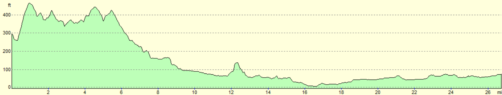
This makes a total distance of 26.7 miles, with 964 feet of ascent and 1204 feet of descent.
For more information on profiles, ascents and descents, see this page
Transport
Piccadilly line services run from Hatton Cross into the centre of London; if you take this to Green Park, then you can change for the Victoria Line to Victoria Station, where regular train services run to Coulsdon South on their way to Reigate. As ever with transport in London, there are several ways of making the same journey!
 |
 |
|
 |
 |
|
 |
 |
|
 |
 |
|
 |
 |
|
 |
 |
|
 |
 |
|
 |
 |
|
 |
 |
|
 |
 |
|
 |
 |
|
 |
 |
|
 |
 |
|
 |
 |
|
 |
 |
|
 |
 |
|
 |
 |
|
 |
 |
|
 |
 |
|
 |
 |
|
 |
 |
|
 |
 |
|
 |
 |
|
 |
 |
|
 |
 |
|
 |
 |
|
 |
 |
|
 |
 |
|
 |
 |
|
 |
 |
|
 |
 |
|
 |
 |
|
 |
Disclaimer
Please note that I take no responsibility for anything that may happen when following these directions. If you intend to follow this route, then please use the relevant maps and check the route out before you go out. As always when walking, use common sense and you should be fine.
If you find any information on any of these routes that is inaccurate, or you wish to add anything, then please email me.
All images on this site are © of the author. Any reproduction, retransmissions, or republication of all or part of any document found on this site is expressly prohibited, unless the author has explicitly granted its prior written consent to so reproduce, retransmit, or republish the material. All other rights reserved.
Although this site includes links providing convenient direct access to other Internet sites, I do not endorse, approve, certify or make warranties or representations as to the accuracy of the information on these sites.
And finally, enjoy your walking!
Nearby walks
| # | Title | Walk length (miles) |
|---|---|---|
| 60 | Slough to Alperton | 16.7 |
| 139 | West Drayton to Kings Langley | 16.6 |
| 217 | Greenwich to Whyteleafe | 17.9 |
|
|

|