Walk #1040: London Loop: Hatton Cross to Moor Park
 |
 |
|
General Data
| Date Walked | 17/03/2019 |
| County | London, Buckinghamshire, Hertfordshire |
| Start Location | Hatton Cross station |
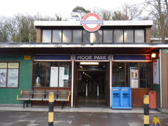
| End Location | Moor Park station |
| Start time | 08.18 |
| End time | 15.51 |
| Distance | 21.7 miles |
| Description | This stretch of the London Loop followed rivers and the Grand Union Canal - with some diversions - around the western side of London. |
| Pack | Today I carried my 30-litre Karrimor rucksack, filled with water, my spare waterproofs, a book and other odds and ends. |
| Condition | I feel very tired after this walk; I never really got myself into gear the entire day. One to be endured rather than enjoyed. |
| Weather | The day started off bright and sunny, with cloudless skies. By midday the clouds had gathered, and an occasional short hail storm was followed by periods of very heavy hail towards the end of the walk. It was quite a warm day for the time of year, but also very breezy. |
| OS map | Landranger number 176 (West London, Rickmansworth & Staines) |
 |
 |
|
Map of the walk
Maps courtesy of Google Maps. Route for indicative purposes only, and may have been plotted after the walk. Please let me have comments on what you think of this new format. For a detailed table of timings for this walk, please see the table file.
 |
 |
|
Notes
I set off for the drive down to Moor Park early this morning, and although I left plenty of time before the first southbound train in the morning, I found it hard to actually locate the station – the satnav was trying to take me down some roads that were blocked off, and others appeared to lead into a private housing estate. Eventually I found the station, parked up, and had a five-minute wait for the train.
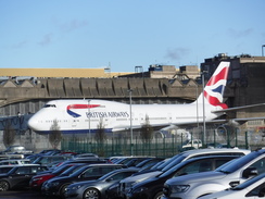
The journey to Hatton Cross involved three changes, and despite the early hour on a Sunday morning, I arrived at Hatton Cross ahead of schedule. I soon set off along the A30, on the other side of the road to the one I had followed on the previous walk. This proved a wise decision, as there was no footpath following the river under the road and railway. Instead, the trail following the road for a short distance before crossing over.
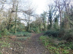
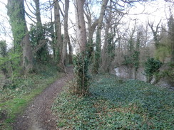
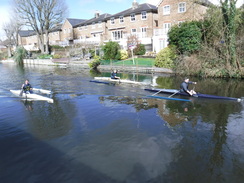
The first stretch of trail proper followed the River Crane north; this was boggy in places after the rain of the last week, and the river swept swiftly past. It was a bit of a relief when the ground became firmer and the trail joined a residential street. Planes were coming in to land at Heathrow, so low and loud that the residents must hate them – in fact one house was being worked on as part of a noise abatement scheme.
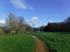
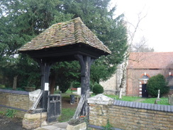
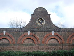
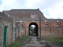
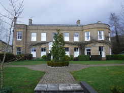
The streets led out onto the A4, and then a good path led me north through Cranford, and into Cranford Countryside Park. The park nestles in the grounds of the stately Cranford House, which was demolished in 1945. The only remnants are a low brick course and ditch – which presumably surrounded the house – the church, and a stable block. The latter appeared imposing from one side, but from the rear seemed very workaday and functional. Immediately after this the trail passed under the M4, and then headed north parallel to the Crane until it joined a road that led to a bridge over the Grand Union canal.
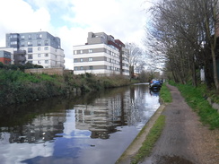
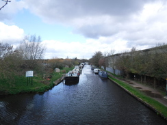
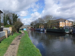
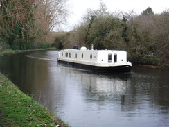
A winding slope led down to the towpath, and I was back on familiar ground. I walked this stretch of canal many times whilst in London 25 years ago, and this stretch through Hayes holds bittersweet memories of talking to a dear girlfriend on my early mobile phone, as Joan Armatrading's 'I'm not in love' played through my Walkman – that song still takes me back to that day and this stretch of towpath.
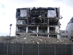
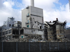
The towpath immediately passed the large Hayes Nestle factory, which was busily being ripped apart, its innards showing as the sides and ends of buildings had been removed. This was a bit of a shock to see, and it turns out that the site has been sold to developers to build yet more identikit blocks of flats. It's a shame that yet another piece of industry that relied on the canal in its heyday has gone.
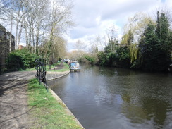
The trail does not stick to the canal for long, and I was heading along across a green band through the middle of a business park. This led to a golf course, and the path seemed to keep away from the greens – at least until a golf ball landed a couple of feet away from me! A bridge led over a main road, after which a path took me to a road, past a Tesla showroom (which was not exactly in a salubrious location), and back to the canal towpath.
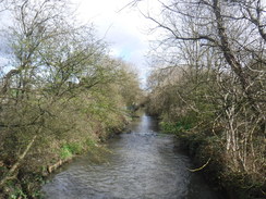
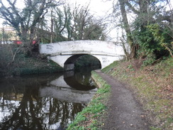
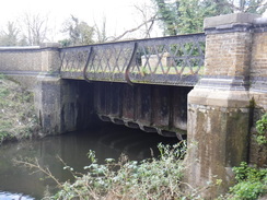
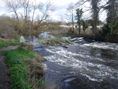
It had been sunny a day so far, but the clouds were starting to gather as the canal passed West Drayton station and curved to take a northerly direction, soon reaching Cowley Peachy Junction. This is the point where the Slough Arm of the canal leads west for five miles. It was a late arrival to the canal scene opening in 1882, and was built to transport bricks for the growing London. The trail crossed a rather nice aqueduct that I nipped down to photo, before leaving it to follow the River Colne north.
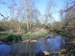
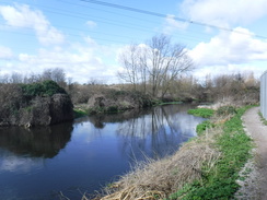
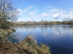
This was a pleasant walk, albeit a noisy one, with the M25 half a mile to the west. The areas is a mass of lakes – perhaps a result of clay extraction for brickworks – and the path was busy with people enjoying the last of the day's sunshine. The trail crossed over to the other side of the river and continued on to a main road, where it swapped back one more. It then squeezed between the river and a long pallisade fence, before heading back to rejoin the canal. This diversion from the canal had been much more enjoyable than the previous one, and allowed me to explore an area I'd never been to before.
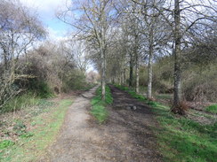
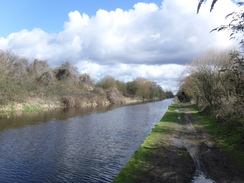
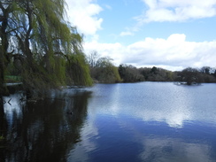
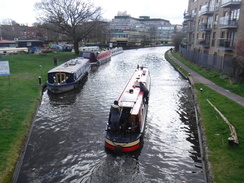
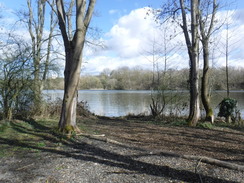
The canal headed north through Uxbridge, then under the M40 to Denham Lock. Shortly after this it turned inland to follow a path that ran between the canal on the left and lakes on the right; a slightly odd deviation from the canal towpath (which was only about fifty metres away), but a pleasant one. Canalside walking can get a little boring, and the London Loop does its best to keep that to a minimum! It then passed under a railway line, passed another lake, and diverted further away from the canal before rejoining it before Widewater Lock.
The clouds continued to gather as I followed the canal north, and I was protected from the worst of a heavy hail shower by the canalside trees. Eventually the trail reached a pub, where it left the canal and started a long climb uphill – the first appreciable climb of the day. This led to a road, and more paths led northeastwards to a road and then a pub. It started to hail more heavily, and I stopped at a little bench in the pub's lee to put my coat on – only for the hail to stop the moment I set off!
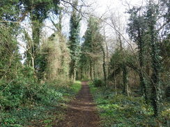
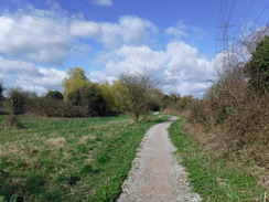
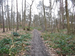
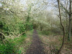
Paths took me east across fields, and the into woodland at Bishop's Wood Country Park. I was really starting to suffer now, and the general apathy and lack of energy that I had suffered from all day returned with a vengeance. To make matters worse, the path was very muddy in places, especially on a stretch of path that led up to the main road in Batchworth Heath. It started to hail again, but by this stage I was well beyond caring. Eventually the trail entered the private roads of the Moor Park estate, and I left it to follow roads back to my car at Moor Park station.
It should have been a pleasant walk, but my mood, rather than any deficiencies in scenery or weather, made it more of an ordeal than it should have been.
 |
 |
|
Directions
This walk starts off from Hatton Cross tube station at TQ09647537. Leave the tube station by its main entrance onto the A30 Great Southwest Road, and turn left, immediately crossing over Faggs Road which comes in from the left. Follow the A30 on the right; an access road soon starts on the left. After 700 metres the access road jinks slightly to the left, with a concrete wall on the right protecting a tube line that emerges from underground. Keep the tube lines and wall to the right as the road reaches a roundabout. Head straight on past (in 2019) a blocked road to reach a bridge over the River Crane at TQ10447580.
Cross the bridge, and on the other side turn left past a vehicle barrier and then a stile beside a field gate to join a path that heads north, with the River Crane off to the left. The path is easy to follow, and eventually emerges out through a stile beside a field gate into a clearing. Immediately turn left to continue following the river, which is away to the left. The path soon curves right, passing houses away to the left. After about thirty metres, turn left past a stile beside a field gate, and then a vehicle barrier, to join an alley that runs between houses before it ends at Waye Avenue. Turn left along the road, and follow it as it immediately curves right to head north. After 250 metres the road curves right once more, and after a short distance turn left to follow the road until it ends at a T-junction with the A54 at TQ10317687.
Cross the A4 using the pedestrian crossing to the right, and then turn left to follow the A4 westwards for 350 metres until it crosses the River Crane on a bridge. Continue for a short distance beyond the bridge, and then turn right through a metal clappergate to enter Berkeley Meadows. Follow the obvious path north across the meadows, passing a children's' play area on the right. At the end of the meadows, go through a clappergate beside a vehicle barrier to join Cranford Lane at TQ10007729.
Turn right along the road, which soon curves right. On the bend, turn left to join a path that heads into woodland. The path immediately forks; take the right-hand branch to a little plank bridge over a stream, before meeting the river on the right. Turn left, keeping the river to the right. The path eventually emerges out of the trees into a clearing on the left. Continue paralleling the river away to the right, but just before a gravel path leading to a footbridge over the river is reached ahead, angle left diagonally across the clearing, skirting an area of trees on the left. When the trees end, continue straight on towards a children's play ground. Pass this on the right, and go through a gate that leads into a small car park. Continue through this to a road, and then turn left along a road to reach a churchyard on the right at TQ10147815.
Pass the churchyard to reach a clappergate beside a field gate. Go through this and curve right to head through an arch under the old stable block belonging to Cranford House. Continue on to St Dustan's subway that leads under the M4. On the northern side of the underpass, go through a cycle barrier beside a field gate and turn right to head east, with the motorway to the right. The path soon curves left through the trees to head away from the motorway, with houses away to the left. After 550 metres it goes through a clappergate beside a fieldgate to join an access road. Turn left along this and follow it for a short distance until it ends at North Hyde Road at TQ10307886.
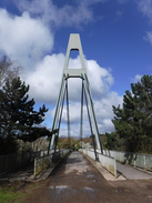
Carefully cross the road, and then turn right to follow it eastwards. Immediately cross a road coming in from the left, and just before a roundabout is reached, cross the river and then immediately turn left along a surfaced path. The path curves right; do not take a branch that heads down to an underpass. The path then curves left to join the side of the A312. Follow this north for a short distance as it climbs to reach a bridge over the canal. Immediately after the bridge, turn left along a sloping path that winds down to reach the towpath of the Grand Union Canal at TQ10547913.
Turn right to head under the A312 bridge and follow the canal northwestwards through Hayes; after 2.4km (shortly after passing under a brick-arch bridge), turn right through a clappergate to join a good path that heads north across grass, with buildings in a business park on either side. This soon reaches a broad road; cross this and immediately angle left along a path that skirts a golf course on the right, with a palisade fence on the left;. When the path forks, take the left-hand branch that heads away from the golf course past an avenue of trees. When it forks again, take the right-hand branch that leads into a little car park. Enter this, and turn left along its access road, passing a vehicle barrier to reach the buildings of Stockley Park Golf Club in the right at TQ08068047.
Immediately past the clubhouse, angle right along a broad path that heads northwestwards, with the golf course off to the right. This slowly climbs to pass tees and descends down to reach a footbridge over the A408. On the other side of the bridge, continue along the path as it climbs and then slowly curves left. As the path starts to curve right beside a little bank on the right, turn left to join a rougher path that immediately heads through a gap in a hedge into a clearing before entering some woodland. As this path curves right in the trees, head straight on along another path that soon joins a more distinct path. Head straight on along the right-most of two parallel paths. 300 metres after the last path junction, turn right along a rougher path for twenty metres that leads to a clappergate onto Horton Road at TQ07158033.
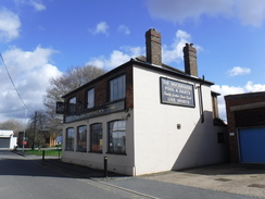
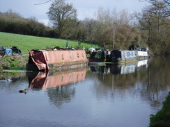
Turn right to follow this road west; it soon curves left and then right. After 450 metres, turn left down Horton Bridge Road, passing the Brickmakers pub on the left. This road soon reaches a bridge over the canal. Immediately before the canal, turn right down some steps to join the towpath. Turn right to follow the canal west; it soon passes West Drayton station across the water, and then curves to take a more northwesterly course through Yiewsley. After 1.5km a footbridge over the canal is reached at Cowley Peachy Junction at TQ05598094.
Climb the ramp on the right that leads onto the footbridge, and then turn left to cross the canal and join it's Slough Arm. Follow the canal westwards; pass under a footbridge and pass a marina on the right. 750 metres after the junction, a second footbridge over the canal is reached. Immediately before the footbridge, turn left along a path that curves right and climbs to reach a little gate that leads to a track. Turn right to cross the footbridge, which leads to a broad gravel path that winds around northwards for 400 metres, with the River Colne mostly out of view to the left. The path emerges out through a gap in a fence into a small car park. Cross the end of the car park and continue along a surfaced path with the river to the left and a lake to the right. This soon reaches a footbridge on the left over the river at TQ04768107.
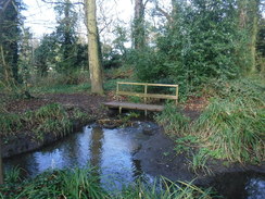
Turn left to cross the footbridge, and on the other side turn right along a path that heads north, with the river on the right. Continue following the river north, crossing a couple of footbridges over streams; after 1.2km go through a gate and climb steps to reach the B470 road. Turn right across the bridge, continue on for twenty metres, and then turn left along a path that heads back to the river. Go through a clappergate and follow the river (which is now on the left), and with a large fence to the right. The fencing eventually ends, and the path continues on with the river off to the left. 1.2km after the bridge, the path curves right away from the river at TQ04478326.
Follow a path alongside a stream on the left for a short distance until it reaches a vehicle barrier. Go past this to join a road that passes a trading estate on the left until it ends at a T-junction with Cowley Mill Road. Cross the road, turn right for a few metres, and then left down Culvert Lane. This ends back at the canal towpath at TQ04948348.
Turn left to follow the canal north as it heads into and through Uxbridge. After 1.4km Uxbridge Lock is reached. Use the bridge by the lock (#184) to cross the canal, and then turn left to continue following the towpath north, now with the canal on the left. After nearly 1km it passes under the A40(T), and soon afterwards the towpath crosses a bridge (#183) to rejoin the left-hand side of the canal. Continue north, now with the water on the right. It passes Denham Lock, and 950 metres after the bridge, another canal footbridge is reached at TQ05348669.
Cross the canal bridge and descend the steep slope on the other side. At the bottom turn left to follow a broad track north, with a lake off to the right and the canal through trees to the left. After 900 metres the track passes under a railway viaduct. The end of the lake is reached after another 600 metres; follow the track as it curves right alongside the lake, past a marina on the left. When the track curves left, head straight on along a path, still with the lake on the right. The path reaches the end of the lake at TQ05368826.
Here the path forks; take the minor left-hand branch that goes through a small gate and joins a track. Follow this track for about 10 metres, and then turn left off the track to join a path that heads through trees, with a lake away to the left. Houses start through the trees on the right; go past a field gate and then ten metres later through a gap in a wooden fence. After the gap, angle left through the trees. The path then squeezes through a narrow gap between concrete blocks, and then passes under an old height barrier to reach Moorhall Road. Turn left down the road, which soon reaches a bridge over the canal at TQ04978866.
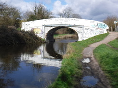
Cross the bridge, and on the other side turn left down some steps to reach the canal towpath. Turn left to head under the bridge, and start following the towpath north, with the canal to the right. After 2.7km the Coy Carp pub is reached at TQ04039115.
Climb a ramp that leads up onto a bridge beside the pub, and then turn right to follow the road across the bridge. The road curves sharply right and then left, and starts to climb uphill. Take the first road off to the left, Summerhouse Lane, and follow this north. After 300 metres turn right up a concrete track that leads away from the canal. As this track curves right, continue straight on up a surfaced access road, with houses to the left and a wooded bank to the right. The road reaches a gate leading into Park Wood farm; by the gate take a path that leads off to the left between fences. Follow this eastwards uphill; the fence on the left ends and is replaced with woodland. Cross a footbridge and continue on, uphill, still following a fence on the right. At the top of the hill, the path emerges from the trees and continues on between fences. The path then goes past barriers to reach Hill End Road at TQ05069145.
Turn left up the road into the hamlet of Hill End, and then turn right up Plough Lane. When this ends, cross a stile beside a field gate into a field, and then angle left to head diagonally across the field, keeping a barn away to the right. At the end of the field cross a footbridge into a second field, and continue on following a hedge on the left. At the bottom of this field, cross a stile into a third field, and continue following the hedge on the left. This heads downhill to a stile, and then cross a plank footbridge over a stream at TQ05379236 to enter a fourth field. Head uphill, following a hedge on the left.
At the top of the field, cross a stile by a small gate and continue between a hedge and a fence that leads to a stile beside a double field gate. Cross this, and head on along an access track, with a farm to the left. Just before a road is reached ahead, turn right along a path that heads up a slight slope with a fence on the right and houses behind a fence on the left. Go through an open gateway into another field; the fence on the right ends. Continue following the fence and hedge on the left uphill. The path goes through a gap in a fence into the car park of the Rose and Crown pub ; continue diagonally across the car park to reach the road in front of the pub at TQ06059239.
Turn left down the road for a few metres, and then right up a path that soon joins a fence on the right and a fence/hedge on the left. The path emerges out into a field; head straight on down the field towards trees ahead. At the bottom of the field, cross a stile and start following a band of trees on the right downhill into a small depression, and then up the other side. Pass a gap in the trees on the right, to join more trees on the right, and then turn right to enter the trees. Follow a path south straight through the trees. It goes past a field gate and becomes a wider track before descending down to reach a stream at TQ06879195.
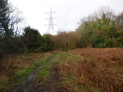
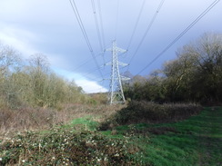
Immediately before the bridge over the stream, turn left through a gap in a fence to join a narrow path, with the stream to the right. The path soon crosses the stream on a footbridge and curves left to follow the stream down to the left. When a path junction is reached about 300 metres beyond the bridge, turn left along another path that continues through the trees. When this reaches an electricity pylon, turn left to follow the clearing carrying the electricity pylons northeastwards, with a road off to the right. It passes another pylon and enters another little clearing; angle right towards, but never join, the road, until the A404 is reached near Ye Olde Greene Manne pub at TQ07739243.
Turn right along the road, and follow it as it curves right past the Prince of Wales pub. Carefully cross the road beside the pub, and continue along the road for a few metres to a footpath that leads off left into trees, with pylons away to the right. The path meets a track; turn left for a metre along the track, and then right to continue down the path. Pass under the power lines and continue on as the path runs between intermittent fences and roads. Go past a cycle barrier to join Kewferry Road. Turn left to follow the road north; it soon ends at a T-junction with Batchworth Lane at TQ08549233.
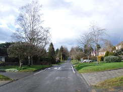
Carefully cross the road, and then pass a vehicle barrier to continue on north along Bedford Road, entering the Moor Park estate. When the road curves left after 280 metres, turn right along a footpath that heads between fences and walls; after 200 metres it goes through a gap in a fence to reach Wolsley Road at TQ08789270.
Here the London Loop is left. Turn left along Wolsley Road, and follow it as it heads north for 700 metres until it ends at a T-junction with Main Avenue. Turn right down this for a short distance to reach Moor Park tube station at TQ08579348.
 |
 |
|
Distances
| From | To | Distance (m) | Ascent (ft) | Descent (ft) |
|---|---|---|---|---|
| Hatton Cross station | Canal near Bull's Bridge | 3.7 | 79 | 49 |
| Canal near Bull's Bridge | Cowley Peachy Junction | 4.3 | 148 | 171 |
| Cowley Peachy Junction | The Coy Carp, Harefield | 8.4 | 100 | 67 |
| The Coy Carp, Harefield | Moor Park station | 5.3 | 395 | 322 |
This makes a total distance of 21.7 miles, with 722 feet of ascent and 609 feet of descent.
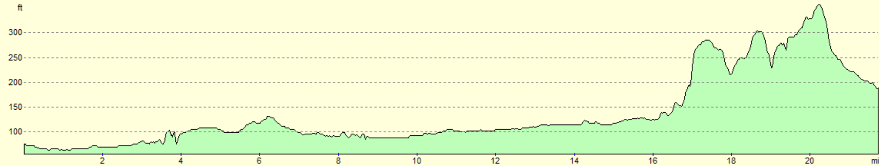
For more information on profiles, ascents and descents, see this page
Transport
Transport between Moor Park and Hatton Cross is surprisingly difficult, given both are well inside London. Moor Park is on the Metropolitan Line, whilst Hatton Cross is near the western extremity of the Picadilly. My early-morning journey required three changes. The TFL journey planner might be very useful for planning your journey.
 |
 |
|
 |
 |
|
 |
 |
|
 |
 |
|
 |
 |
|
 |
 |
|
 |
 |
|
 |
 |
|
 |
 |
|
 |
 |
|
 |
 |
|
 |
 |
|
 |
 |
|
 |
 |
|
 |
 |
|
 |
 |
|
 |
 |
|
Disclaimer
Please note that I take no responsibility for anything that may happen when following these directions. If you intend to follow this route, then please use the relevant maps and check the route out before you go out. As always when walking, use common sense and you should be fine.
If you find any information on any of these routes that is inaccurate, or you wish to add anything, then please email me.
All images on this site are © of the author. Any reproduction, retransmissions, or republication of all or part of any document found on this site is expressly prohibited, unless the author has explicitly granted its prior written consent to so reproduce, retransmit, or republish the material. All other rights reserved.
Although this site includes links providing convenient direct access to other Internet sites, I do not endorse, approve, certify or make warranties or representations as to the accuracy of the information on these sites.
And finally, enjoy your walking!
Nearby walks
| # | Title | Walk length (miles) |
|---|---|---|
| 60 | Slough to Alperton | 16.7 |
| 62 | Marlow to Slough | 16.3 |
| 65 | Alperton to Paddington | 6.4 |
|
|

|