Walk #1049: A circular walk between Sheffield, Woodhouse and Rotherham
 |
 |
|
General Data
| Date Walked | 14/03/2020 |
| County | South Yorkshire |
| Start Location | Sheffield Wellington Road |
| End Location | Sheffield Wellington Road |
| Start time | 06.47 |
| End time | 13.35 |
| Distance | 20.2 miles |
| Description | This was a surprisingly pleasant triangular walk, mainly following roads and canal towpaths around the area to the east and north of Sheffield. |
| Pack | Today I carried my 30-litre Karrimor rucksack, filled with water, my spare waterproofs, a book and other odds and ends. |
| Condition | Unfortunately I did not cut my toenails well enough before this walk, and so I have a little cut on one of my little toes. This is not too painful, and otherwise I feel fine. |
| Weather | There was torrential rain during my drive up to Sheffield, and the walk started with a light drizzle and grey, overcast skies. The clouds lifted as the day progressed, and it soon became slightly too warm for my coat. Aside from a few spots of drizzle later on, the afternoon was a much better time for walking. |
| OS map | Landranger number 111 (Sheffield & Doncaster, Rotherham, Barnsley & Thorne) |
 |
 |
|
Map of the walk
Maps courtesy of Google Maps. Route for indicative purposes only, and may have been plotted after the walk. Please let me have comments on what you think of this new format. For a detailed table of timings for this walk, please see the table file.
 |
 |
|
Notes
With the current Covid-19 crisis erupting around the world, I thought I would take what might be a last opportunity for a walk for many months. But which one? There was an annoying six-mile gap in my map of walks between Woodhouse (reached on walk 724 in 2006), and Sheffield (walk 686 in 2005), that I had always wanted to fill. Six miles is too short for a 'proper' walk, and so it has remained an annoying gap. I had planned to do it at the end of last year – just in time for the area to be struck by floods. Undaunted, I decided to do it today, and yesterday I printed out the maps and got my kit ready.
My sister phoned me in the evening, and during our chat she said that she was going to be in Sheffield today, visiting her son. She had booked a table at a restaurant for 13.30, and I said I'd make it if I could. I set off from home just after four in the morning, and drove north through torrential rain. The downpour lessened as dawn started to break, and not a single traffic light was against me on the entire journey. Unusually, I found the car park I wanted in Sheffield with no problems.
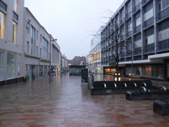
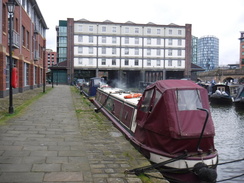
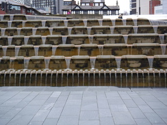
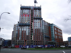
I parked up, got my kit together and started off through a city that was just awakening from its slumbers. I used to know Sheffield a little, and it has improved massively over the last couple of decades. I walked down to the station, which now has a wonderful water feature outside it – a series of water-lined steps. The area is very pleasant, and the port cochere has been converted into a neat retail space.
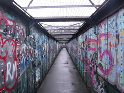
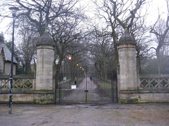
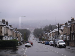
From the station, I crossed a footbridge that took me to the tram tracks, and then started a long walk uphill. I was soon puffing;, Cambridgeshire is not noted for its steep hills, and my legs were stiff after over two hours in the car. I did wonder whether to try to find a route through Norfolk Park, but instead stuck to my original route southeast out of the city. This was perhaps a missed opportunity, and I've seen enough of Sheffield's suburbs to be covetously eyeing up other walks.
A tramline joined the road for a while, before leaving it at the top of the hill. I passed a shop called 'Olivia's Trains', which sells model railway kit. Despite not being a modeller, I was glad it was closed as I might have nipped in to buy something! A long descent followed; I eschewed the route I had planned slightly further north, and instead followed a road past Richmond Park down to the A57. A subway took me under the dual carriageway, and the map showed 'Shirebrook Valley Nature Reserve' to the east; I assumed that this was part of the old colliery, but it was in fact an old sewage works that closed in the 1990s. In which case, it is a dramatic improvement!
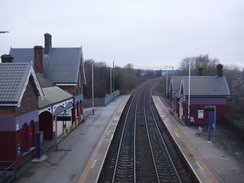
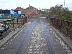
Sadly my route followed roads uphill into Woodhouse, before descending down along a fairly nondescript road to reach Woodhouse Station. This was the point I reached on a walk west from Retford 15 or so years ago, and therefore technically I had linked the previous walks up. But six miles was too short a day, so after nipping down to take some photos of the station, I rejoined the road and followed it to a dual carriageway and a bridge over the River Rother, which marked the start of the second third of the walk, which would follow one of the many branches of the Trans Pennine Trail.
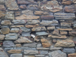
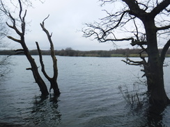
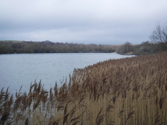
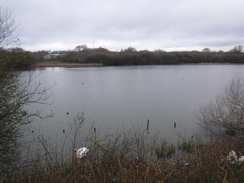
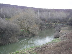
An access road and path took me to a lake called Treeton Dyke. This would have been a beautiful little stroll on a sunny spring or summer's day, and was pleasant enough with today's overcast skies and muddy ground. It certainly made a change from the road walking. I crossed a long footbridge – more of a causey than a bridge – and then started a long climb uphill into the village of Treeton. The road beside the small church had a wonderfully eroded stone wall whose blocks had all been changed into elegant curves. Then another road took me down over the railway once more and past a lake called Catcliffe Flash.
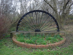
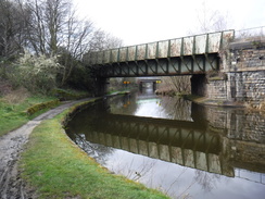
Soon I came across an old half-wheel – presumably a monument to an old colliery – beside what as obviously an old railway embankment, which turned out to belong to the Treeton Colliery Branch line. The area is crisscrossed by railway lines, extant and abandoned, and there have even been recent changes, with a railway viaduct to the Tinsley sidings I was about to pass under having only gone out of use in the last twenty years.
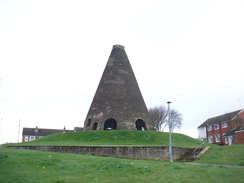
Just up the hill from the bridge was an odd conical brick structure. I hadn't seen anything quite like it before, and it turns out to be the oldest surviving glassworks cone in Western Europe. It is an odd-looking thing, but I'm glad it has survived for nearly 150 years after the glassworks closed.
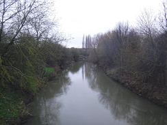
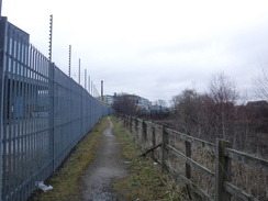
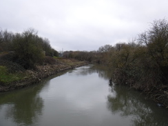
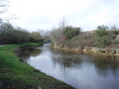
A fairly unremarkable suburban road took me up into Brinsworth, and then down to meet a main road. Thankfully the road walking ended here, and the Trans Pennine Trail started following the western banks of the River Rother northwards. Tall fences guarded industrial areas on my left, whilst the river was far below me on the right. Soon the fence on the left became electrified – an unusual sight – and it turns out that the land beyond houses AMG Superalloys. I am unsure why a metals company would require military-style protection!
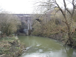
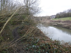
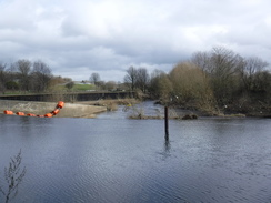
The path dropped down towards the river, and soon signs of the recent floods became visible, with a few fallen tree and debris trapped high up in branches. It passed under a road bridge, and soon emerged out onto a road by the Rother's confluence with the Don. I followed roads north into Rotherham, expecting to find a rather dreary town – after all, it has hardly had the best press recently!
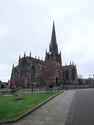
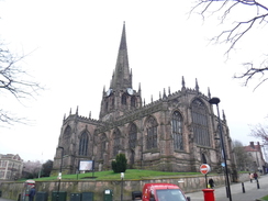
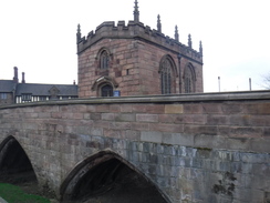
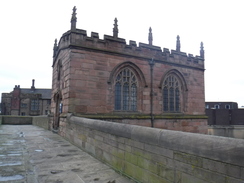
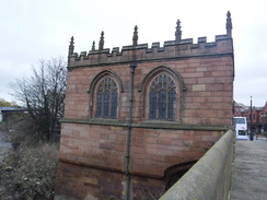
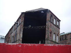
I was surprised to find that, whilst not a gem, Rotherham is not exactly a depressed northern hole – or at least the parts I walked through were not. The spectacular Rotherham Minster dominates the town – and it looked spectacular even on this overcast day. Further down the hill there was what looked like an abandoned shopping arcade and a burnt-out shop, before I reached a rather spick and span bus interchange and another gem – the Lady's Chapel on Rotherham Bridge over the Don. This dates back to 1483, and is believed to be the best preserved bridge chapel in the country. The bridge itself has been bypassed, and it is a spectacular find.
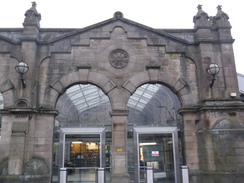
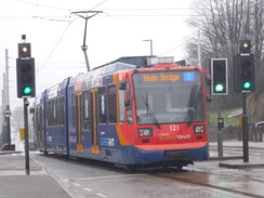
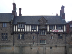
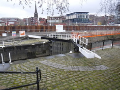
Almost immediately adjacent is the Rotherham Central station, built in 1988 to replace the out-of-town Masborough station. The station was gleaming in a rare period of sunshine, and even the adjacent flood works on the canal did not spoil it. The station has recently got the country's first train-tram services, where trams can run along railway tracks, and I can only hope this helps the town thrive. As it is, the area from the Minster to the bus station, and across the bridge to the railway station was surprisingly pleasant – if it was not for the two burnt-out buildings. Sort it out, Rotherham!
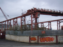
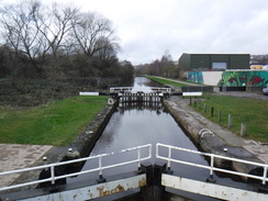
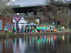
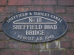
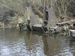
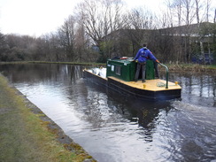
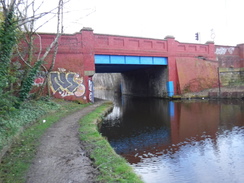
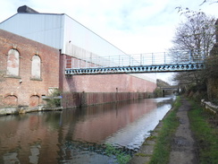
The Sheffield and Tinsley canal took me south from the station, passing the 'New York' stadium – so called because the area's steelworks used to export fire hydrants to New York! The canal soon left the River Don behind and passed Booth's scrapyard, which is famous for breaking up trains and buses. They are currently breaking up Pacer units that were so hated – wrongly IMO. This marked the start of a series of rail overbridges, and at one, Steel Street, beside a lock, I came across a 'turn around' sign and a couple of marshals. The bridge over the canal by the lock still had rails on it from an old line, which used to connect up with the steelworks to the north of the canal.
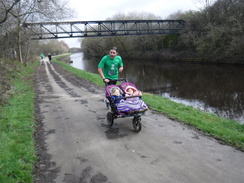
The marshals were part of an organised run from Meadowhall, and were at the halfway point. I was therefore passed by runners in one direction, who were soon coming back in the other, allowing us to exchange greetings twice! It certainly livened up the walk, especially the man running faster than I do whilst pushing a double buggy! Ordinarily I would have enjoyed this, but all the time had a certain amount of Covid-19 paranoia in my mind.
The runners were finishing (and starting) just under the double-decker M1 bridge at Meadowhall, and this also marked the end of the paved stretch of towpath. What followed was an occasionally muddy – and sometimes exceptionally smelly – stretch, and whilst there were fewer indications of the recent floods, the towpath was in poor condition. It is odd that the towpath near the city centre is unpaved, whilst that further out is!
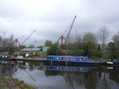
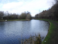
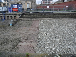
Eventually I reached the terminus basin of the canal, before which a short stretch was dewatered, with new stones being put in the bottom lining. The basin itself was well cared for and interesting, with a couple of original buildings spanning the water – presumably old wharfs. Like many inner-city canal basins nowadays, it seemed a haven of tranquility.
Nearby, footbridges took me across a large roundabout, and I followed a tram line and then a road back to Sheffield station. After that, it was simply a case of retracing my steps back to the car park, along streets that were far more bustling than they had been earlier in the morning. I got back to my car at one thirty, got changed into clean clothes (much to the amusement of two ladies who passed), and got to the restaurant half an hour after my sister arrived, and just in time to order a main course.
It had been an enjoyable, if slightly rushed, day's walk. I can see myself doing further walks from Sheffield in the future.
 |
 |
|
Directions
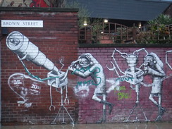
This walk starts off from the Wellington Street car park in Sheffield at SK35128697. Leave the car park by its entrance, and work your way around to its southern side at Furnival Gate, with Debenhams on the right. Turn left along the road, and follow it as it immediately curves right and continues down a slight slope to a roundabout. Head straight across a roundabout in Furnival Square, and continue down Furnival Street. As this curves right,turn let along Brown Street. Follow it as it passes an oddly-shaped students' union building on the left, becoming Paternoster Row. When Howard Street comes down from the left beside a half-timbered building, turn right across a pedestrianised stretch to reach a pedestrian crossing over the A61 Sheaf Street. On the other side, go down some steps beside a water feature to reach Sheffield station, straight ahead at SK35818688.
By the station, turn right to pass the taxi rank and head south along Cross Turner Street. After a short distance, turn left up some steps that lead to a footbridge over the station. Cross the footbridge, and on the other side turn right along Granville Street, taking care not to go onto the tram tracks! Cross the B6071 road, and continue following the tram tracks until they soon end at a T-junction with the A6135 Granville Road at SK35938653.
Turn left and start following the A6135 road as it heads uphill eastwards, initially passing a campus of The Sheffield College and then a school on the right. After 1km a T-junction is reached with City Road in Sheffield Park; turn tight to start following this uphill southeastwards; eventually tram tracks join it. After 1.8km a roundabout with the A6102 dual carriageway is reached; cross the A6102 using the pedestrian crossing, and continue straight on down Mansfield Road; when you can, swap over to the left-hand side. After 520 metres, turn left along the B6064 Woodhouse Road. After another 430 metres, turn right to start down Normanton Hill; there is a pavement on the left. After 1.8km this approaches a large roundabout on the A57 at SK40748450.
Just before the roundabout, follow the pavement as it curves left and then right to reach a subway under the road. On the other side of the subway, continue along the B6064 as it climbs up into Woodhouse. 1.6km after the subway, the road curves sharply to the right; shortly after this, turn left down Station Road. Follow Station Road downhill northeastwards; after 800 metres turn left down an access road that leads to Woodhouse Station at SK42858540.
At the station, use the footbridge to cross the railway, and on the other side turn right to follow a path that leads back up to the road. Turn left to follow the road northeastwards; after 320 metres it ends at a T-junction with the B6200 Retford Road. Turn right along the B6200, and when a pedestrian crossing is immediately reached, turn left to cross the road to reach its northern side. Follow the road east as it immediately crosses the River Rother; it then ascends to a bridge over a railway line. As the road curves right after the bridge, and 650 metres after joining the road, turn left along Falconer Lane at SK43798590.
Follow the road north past a row of houses on the left; when the road curves right after 180 metres, go through a clappergate beside a field gate to join a path. This heads north, and when it soon forks, take the right-hand branch to follow the eastern bank of a lake called Treeton Dyke. Go past a couple of squeeze stiles along the path; woodland starts on the right, and eventually a long footbridge is reached. At the far end of this the path joins a track at SK43578698.
Cross the track, and continue uphill across grassland towards a gap in a hedge. Pass some boulders in the gap, and continue straight on up a field towards another gap in a hedge ahead. Pass some more boulders, and then turn left to roughly follow a hedge on the left, aiming for a church tower ahead, and then angle slightly right to pass a third set of boulders and reach a little car park. Cross the car park, and in the far corner go through a clappergate between the corner of a fence on the right and a hedge on the left onto more grasssland. Cut diagonally across the grass, and at the far side climb some steps that lead out onto Washfield Lane in Treeton at SK43268757.
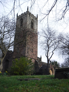
Turn right along Washfield Lane for a few metres, and then turn left along Church Lane, which soon passes Treeton Church on the right. Church Lane ends at a T-junction with the B6067 road; turn left along the B6067 and follow it as it winds downhill in a rough westerly direction, soon crossing a bridge over a railway line. At the bottom of the hill the road curves sharply right to head north, passing a lake called Catcliffe Flash on the left and then the River Rother on a bridge before ending at a roundabout with the B6066 in Catcliffe at SK42568849.
At the roundabout, turn right along the B6066, which immediately passes under an old railway bridge and then starts climbing uphill, passing an old glass cone (kiln) on the left. Continue north along the road; it climbs and passes under the A630 and then the M1. After 2km it ends at a T-junction with the A631 at SK42349042.
Turn right, and then carefully cross the road to reach the other side. The road immediately heads under a rail bridge; after this and before a river bridge is reached, turn left up along an access road that leads past a pylon to reach a clappergate beside a gateway. Go through this to join a path that runs with a series of fences on the left and the river down to the right. The waste ground on the other side of the fence on the left is replaced by factories; the path falls to near the river's level, and after 1.5 km passes under a road bridge. After another 450 meters, the path veers left away from the river and goes past a vehicle barrier to emerge onto the A6178 road at SK42449218, with a roundabout immediately to the left.
Turn right down the A6178, and change over to the left-hand side of the road when you can. The road immediately crosses the River Rother on a bridge. Follow the road as it heads towards the centre of Rotherham. It curves left to take a more northerly course, and then cross Main Street that comes in from over a river bridge down to the left. Shortly after this, curve left along Market Place. This soon becomes Corporation Street and passes Rotherham Minster on the right. When the road forks at the bottom of the hill, turn left to cross a bridge over the River Don. On the other side, continue over a bridge over a canal; Rotherham railway station is a few metres away on the left at SK42579301.
Immediately after the canal bridge, turn left down Central Road, passing the station on the right. The road becomes a car park, and then join the canal towpath as the canal turns left, soon reaching a lock on the left. Follow the towpath as it heads south, passing the New York Stadium and passing under a large road bridge before reaching a rail bridge after 1.2km. Pass under this, and immediately afterwards turn left up Brinsworth Street, which passes over the canal and then curves right. After about 100 metres, turn right past some bollards to join a surfaced path that soon rejoins the canal's southern bank. Continue with the water on the right for 900 metres until Steel Street is reached at SK41189225.
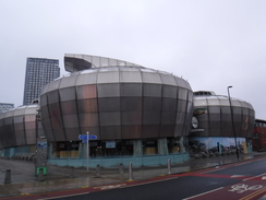
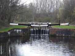
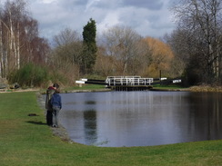
Turn right to recross the canal, and then left to start along the towpath, with the water on the left. Follow the canal in a rough southwesterly direction; it passes the Tinsley flight of locks and under the M1, and after 4.5 km it passes under the A6102 and reaches a lock opposite the FlyDSA arena. At the lock, the towpath climbs a sloping footbridge; at the top of the slope turn left to cross the canal, and follow the path for a few metres as it winds to reach Tinsley Park Road at SK38918928.
Turn right along the road for a few metres, and then right down some steps to rejoin the towpath. Turn left to follow the towpath southwestwards, with the water on the right. After 3.6km the canal's terminus basin is reached. Follow the towpath past one building spanning the basin, and just before a second turn left past a little car park to reach Wharf Street at SK35998762.
Follow Wharf Street south for a few metres, then turn right to join a looping slope that leads up to a footbridge over a road. The footbridge jinks left to reach the centre of the Park Square roundabout and some steps that leads to a tramline. Turn right to cross the branch of the tramway just before a viaduct, and then left to cross another branch of the tracks. Turn right to head south along a path, with the tracks on the right as they cross a road; after a short distance, turn right to cross the tracks and continue following the tram tracks south. Shortly after a footbridge leads off over the A61 road to the right, some steps lead off to the right down to reach the A61. Turn left to follow the pavement beside the road south to reach Sheffield station at SK35818688.
Now it is time to reverse the directions from earlier. Outside the station cross the A61 using a pedestrian crossing, and walk up a pedestrianised road to reach Paternoster Row. Turn left along this road, passing a students' union building, and the road becomes Brown Street. The road curves right to become Furnival Street as it heads uphill into the centre of Sheffield; head straight on at a roundabout at Furnival Square, and continue uphill. The Wellington Street car park is in front of you as the road curves left beside Debenhams, at SK35128697.
 |
 |
|
Distances
| From | To | Distance (m) | Ascent (ft) | Descent (ft) |
|---|---|---|---|---|
| Sheffield | Woodhouse station | 6.4 | 539 | 650 |
| Woodhouse station | Rotherham station | 6.1 | 314 | 384 |
| Rotherham station | Sheffield | 7.6 | 256 | 75 |
This makes a total distance of 20.1 miles, with 1109 feet of ascent and 1109 feet of descent.
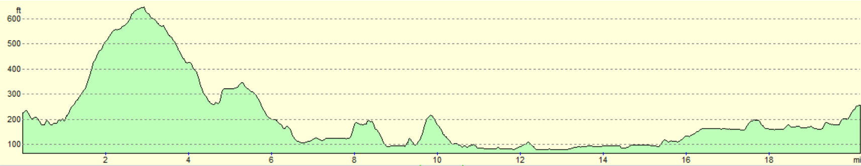
For more information on profiles, ascents and descents, see this page
 |
 |
|
 |
 |
|
 |
 |
|
 |
 |
|
 |
 |
|
 |
 |
|
 |
 |
|
 |
 |
|
 |
 |
|
 |
 |
|
 |
 |
|
 |
 |
|
 |
 |
|
 |
 |
|
 |
 |
|
 |
 |
|
 |
 |
|
 |
 |
|
 |
 |
|
 |
 |
|
 |
 |
|
 |
 |
|
 |
 |
|
 |
 |
|
Disclaimer
Please note that I take no responsibility for anything that may happen when following these directions. If you intend to follow this route, then please use the relevant maps and check the route out before you go out. As always when walking, use common sense and you should be fine.
If you find any information on any of these routes that is inaccurate, or you wish to add anything, then please email me.
All images on this site are © of the author. Any reproduction, retransmissions, or republication of all or part of any document found on this site is expressly prohibited, unless the author has explicitly granted its prior written consent to so reproduce, retransmit, or republish the material. All other rights reserved.
Although this site includes links providing convenient direct access to other Internet sites, I do not endorse, approve, certify or make warranties or representations as to the accuracy of the information on these sites.
And finally, enjoy your walking!
Nearby walks
| # | Title | Walk length (miles) |
|---|---|---|
| 588 | Grindleford to Brough via the eastern edges | 23.0 |
| 686 | Hope to Sheffield | 15.5 |
|
|

|