Walks in Anglesey
Anglesey is an island situated of the northwest coat of Wales, and is connected to the mainland by bridges over the fast-flowing Menai Strait. Traditionally the best cereal farming land in Wales, it was the last hold-out of the Druids againat the Roamsn in Wales, and there are many signs of neolithic occupation on the island. Off the northwestern tip of the island is Holy Island and the town of Holyhead, which is a traditional ferry gateway to Ireland.
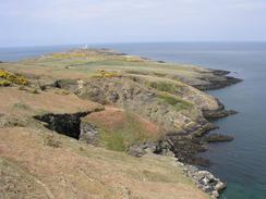
The main path in Anglesey is the Anglesey Coastal Path, and this gives a relatively easy walk as it passes low cliffs and some superb beaches, particularly Red Wharf beach on th eastern coast. There are also plenty of walking opportunities inland along many miles of footpaths.
Below is a map showing all the walks that I have completed in Anglesey.
Completed walks in Anglesey
List of walks in Anglesey
| Walk No. | Description | Distance (miles) |
|---|---|---|
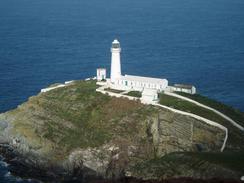
| 624 | South Stack to Carreglefn | 17.2 |
| 413 | Beaumaris to Penmaenmawr | 18.1 |
| 412 | Moelfre to Beaumaris | 18.1 |
| 411 | Cemaes to Moelfre | 19.1 |
| 410 | Llanfachraeth to Cemaes | 18.2 |
| 409 | Trearddu to Llanfachaeth | 19.0 |
| 408 | Aberffraw to Trearddur | 19.3 |
| 407 | Barras to Aberffraw | 18.3 |
| 406 | Caernarfon to Barras | 17.1 |
This was a total of 164.4 miles in 9 walks (an average of 18.26 miles per walk).
|
|
