Walk #986: Ouse Valley Way: Littleport to King's Lynn
 |
 |
|
General Data
| Date Walked | 14/03/2018 |
| County | Cambridgeshire, Norfolk |
| Start Location | Littleport Station |
| End Location | Kings Lynn Station |
| Start time | 05.52 |
| End time | 14.50 |
| Distance | 25.0 miles |
| Description | This was a long but pleasant walk following the Ouse Valley Way (and the coincident Fen Rivers Way) to its northern trailhead in King's Lynn. |
| Pack | Today I carried my 30-litre Karrimor rucksack, filled with water, my waterproofs, a book and other odds and ends. |
| Condition | My left knee gave me a little gip during the stroll, and my feet got a little overheated before my stop, but otherwise I was fine. |
| Weather | The day started off cold but sunny, and it slowly warmed up as the day progressed until it was quite a warm day, although with a bitter breeze. |
| OS map | Landranger number 143 (Ely & Wisbech, Downham Market) and Landranger number 132 (North West Norfolk, King's Lynn & Fakenham) |
 |
 |
|
Map of the walk
Maps courtesy of Google Maps. Route for indicative purposes only, and may have been plotted after the walk. Please let me have comments on what you think of this new format. For a detailed table of timings for this walk, please see the table file.
 |
 |
|
Notes
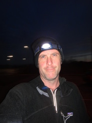
I had only 24 miles to do to complete the Ouse Valley Way. I have done the stretch between Littleport and King's Lynn several times before as it also carries the Fen Rivers Way, and it is possible to do it in a day. However I had to get back for mid-afternoon to pick my son up from school, and so I could not afford to be late. I therefore drove to Littleport station early, arriving whilst it was still dark. A minor annoyance was the fact that the car park did not take coins, and the only way of paying was to use a debit card over the phone - a time-consuming and annoying process that I don't enjoy doing for security reasons. Since it was still dark, I put my headtorch on over my hat and set off.
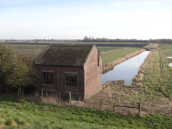
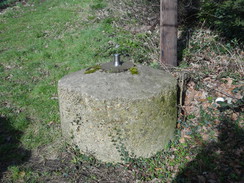
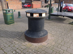
A couple of bats flittered past me near the signal box; a fairly magical sight, and it must have been fairly late for them as the eastern skies empurpled as dawn broke. The trail passes right by the station and then heads north along a road towards the A10; I chose to walk along the bank for a short distance, where there was yet another Blacker Bombard pedestal that seem very common in this area.
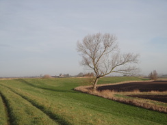
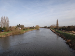
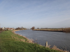
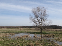
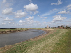
Unfortunately the first three miles of this walk are not the most pleasant; the trail follows a floodbank north with the busy A10 road adjacent on the right. Fortunately the banks were not overgrown and I could make good time as the sun started to rise to the east. It showed itself first as an orange arc on the horizon, slowly growing in size as the minutes passed. Bungalow roofs jutted above the floodbank on the other side of the river, as if taunting the river. Much of the surrounding land is below sea level, and the consequences of any flood would be severe.
I knew that there is usually a burger van in a little layby a couple of miles into the walk; the van was there, its generator was running, but at the early hour it was still sealed up despite the smell of frying bacon that hung in the air. I pressed on as the bank headed towards the Ship Inn, which is situated at the confluence of the Great Ouse and Little Ouse. I was keen to get away from the noisy A10, and in my haste I made a mistake despite having walked the trail before: I kept on the bank whilst the trail joins the A10 for a short distance. I soon realised my mistake and went back to the proper route. I find it slightly odd that the route follows the eastern riverbank when the western bank is also accessible, and has a minor road running at its base. It seems to me that it would make a much more quiet and pleasant route.
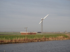
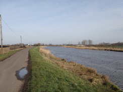
It was a relief when the trail and river left the A10 and started heading past fields. A two-blade wind turbine whirled around by a pumping station on the other side of the river, and the flat, treeless terrain meant that its blade would remain visible behind me for the next few miles. The grass on the bank was short and I made good time, eventually scrabbling up a bank to reach Hillgay Bridge. From here the trailed swapped banks to the western side, running alongside a local road. A sign warned me that the road ahead was closed; I decided to press on, even though it meant I might have to divert back.
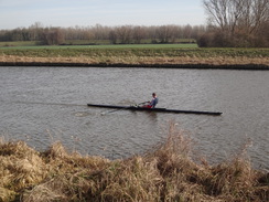
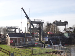
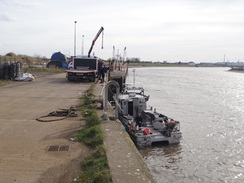
At times I walked along the road; at others on the floodbank, which was never far above the tarmac. My first guess was that the railway bridge over the road and river was being worked on, as I had seen bridge works on the previous walk and knew that two bridges were effected. However the bridge was fine, with no-one about aside from a single-scull on the river, presumably a long way from his boathouse. This meant that the road closure could only be at Denver Sluice, which would mean an even bigger diversion if I could not get past. Soon I saw a crane jib pointing high in the sky, and as the banks of the New Bedford River closed in on my left, I realised that the crane was sitting on the road.
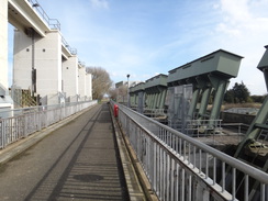
I had spent the last few miles planning an alternative walk if the road was closed, and I passed the Jenyns Arms to reach the bridge. The crane was motionless, and I caught the attention of an orange-clad workman. He had a quick look around and then waved me past. After thanking him, I stole a look at the works: the crane had a cradle attached to it to lift workmen into the adjacent lock, and a pump was throwing water out into the river - presumably it as something to do with this work to remove part of the Big Eye, a disused lock.
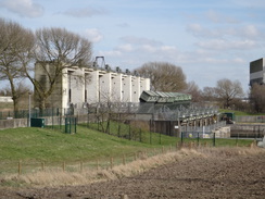
Denver Sluice is the point where several waterways meet up, all draining a vast area of the fens. As well as the Great Ouse, the Old and New Bedford Rivers (which the trail passed at Earith, which seemed a long time ago), the Cut-Off Channel and the Relief Channel all meet at or near the sluice. In fact, the New Bedford River is tidal here, as is the Great Ouse downstream. The sluice itself prevents the tidal waters from going down the Great Ouse towards Littleport and flooding the land: the banks are designed to cope with floodwaters coming downstream, not tidal surges. It is also one of a number of sluices nearby referred to as the 'Denver Complex', all of which work to keep the Fens dry.
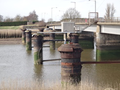
The main sluice was first built in 1951/2 by the famous water engineer Sir Cornelius Vermuyden, and has enjoyed a chequered life. Originally it just diverted tidal waters down the Old Bedford River to avoid it taking the more circuitous route via the Ouse, but later developed other functions. In 1713 it collapsed, and has been expanded and altered many times since then. It is therefore good to see maintenance being performed on this vital piece of infrastructure.
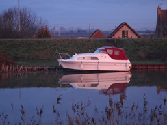
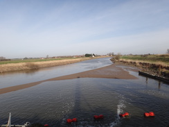
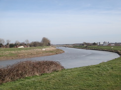
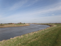
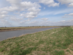
The trail crosses the bridge to regain the eastern bank of the river, which it followed all the way to King's Lynn. I settled in for the stroll, knowing that I had made good time so far. Mudflats on the river were revealed as the waters ebbed, and another, much straighter, river lay off to the right - the non-tidal Relief Channel that was built in 1964. Locks on the other side of the river guarded the navigable entrances to the Old Bedford River and Popham's Eau (in the former case, it is navigable in theory if not in practice, and soon I reached Downham Bridge. There are few stiles or gates on this stretch of trail - particularly when compared to the upstream sections - but some had an unusual feature on them, as the Fen Rivers Way markers stated how many miles it was to the next marker. This was a very useful feature, albeit possibly an expensive one.
Earlier in the day I'd made a decision that if I manged to do 15 to 18 miles before midday, then I would continue on to King's Lynn; otherwise I would stop at Downham Market or Watlington. So far I'd exceeded that target and so I plodded on, with my feet feeling rather hot and my left knee aching. At one point there was another Blacker Bombard pedestal below the ban, so I nipped down to take a photo. I wonder how many people pass these survivors from World War Two without giving them a second glance?
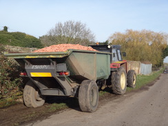
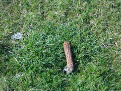
I had grown used to seeing occasional shells on the grass at the top of the floodbank, which I assume had been dropped there by birds wanting the meat inside. There had been more today, but soon I started seeing old corn-on-the-cob ears on the trail, stripped of their corn. The fields immediately adjacent were not arable, and the rivers would have prevented animals from bringing them over from far away. As unlikely as it seems to me, they could only have been brought here by birds.
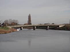
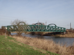
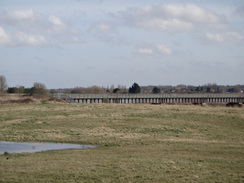
The trail continued between the Great Ouse and the Relief Channel, with the two waters sometimes close to each other, and at others more distant. Soon I was passing the bridge at Stowbridge and heading north. A large metal bridge became visible over the Relief Channel on my right; this was the remains of the old line from Watlington to Wisbech. This opened in 1848 and closed 120 years later; the bridge over the channel therefore only got four years use before it became redundant. An embankment spanned the gap between relief channel and the river, although the river bridge had long since gone, with only the stone abutments remaining.
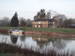
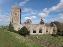
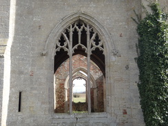
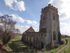
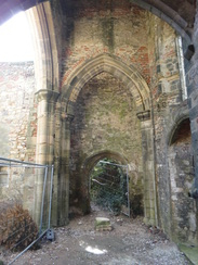
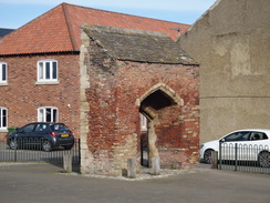
Shortly afterwards I reached Magdelan Bridge, and a quick check of my mobile showed me that the pub on the other side of the bridge was shut on Wednesdays. As I had made good time it had felt like a good idea to stop and rest my feet, but instead I had to plod on. I soon reached the ruins of Wiggenhall St Peter church; this is a rather magnificent ruin, and far more complete than the church the trail passed near Milton Keynes. It is a roofless shell, and I nipped off the floodbank to have a look around. Fences blocked off the nave, but I got a good look up the tower before heading back up the floodbank. The church gives a good impression of how the floodbanks have raised over the years, as when you walk past the church you look high into the windows.
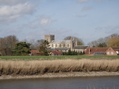
A little further on was Wiggenhall St Germans church, and beyond that a bridge over the river and an adjacent pub, the Crown and Anchor. It had opened a few minutes earlier, so I went in and ordered a pint of shandy whilst I chatted to the landlord. There was only a few miles left to walk, and so I also had a meal - an absolutely delicious plate of sausage and mash, served in a plate-sized Yorkshire pudding. A couple entered as I ate, and I left with them. They were on the last leg of the Fen Rivers Way, and we chatted for a few minutes before I pressed on.
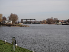
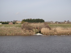
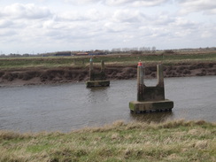
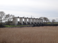
Eventually I reached the massive sluice gates that link the Relief Channel with the river. As I passed an automated voice blared a safety warning - it was so loud that is more likely to give unsuspecting visitors a heart attack than save lives! The next mile or so was along a good surfaced path past factories, some of which have sprung up in the years since I first walked this stretch. The path dived under the A47 bridge, and shortly beyond was 'Free Bridge'; which presumably was a toll-free bridge back in the day. Iron columns stuck out of the water beside it; the remains of the old King's Lynn to Sutton Bridge railway line. This single-track line opened in 1864 and was an early closure in 1959; it was never particularly successful. The bridge itself appears to have been demolished the year the line closed, leaving just the piers as a sad reminder.
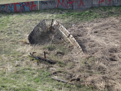
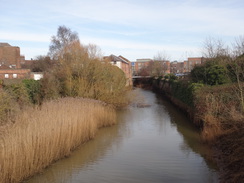
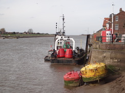
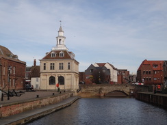
The area around the mouth of the River Nar had not changed much since I last walked past, and I hope to visit it again soon when I do the Nar Valley Way. An expanse of reedy land appeared to be a silted-up inlet, with vegetation enveloping a couple of decaying boats. Three trails end in King's Lynn - the Ouse Valley Way, the Fen Rivers Way, and the Nar Valley Way. In addition, soon the English Coastal Path will be passing through the town. There are different opinions on where the trails actually end, and a couple of information boards gave a different location nearer the Nar. For this reason I decided that the Custom House would be the place I called the trail's end: it is near the waterfront, beautiful, easy to find, and seems a fitting end to a long trail.
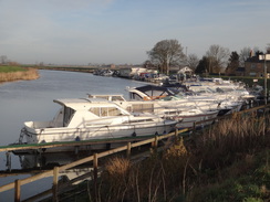
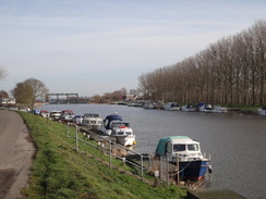
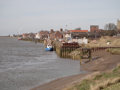
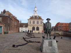
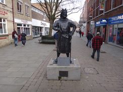
A couple of boats were moored at South Quay, but the area looked much quieter than I remember it in the past. This walk has been inland for so long that it felt slightly odd to be in a marine environment; King's Lynn has a very different feel to any of the towns upstream, as if its spirit faces out to sea rather than inland. I like the town a lot, and I took my time as I walked along the quay before passing the statue of George Vancouver, the King's Lynn-born naval officer who explored the pacific coast of the Americas, and after whom several cities are named. He stares out from in front of the Custom House, as if waiting for a ship to arrive.
Another statue stood in the middle of the town; this one to a more famous, but much nastier, character: King John, perhaps the worst monarch the country has ever had. The king stayed in the town just before he lost his crown jewels in the Wash, and he died a few days later. King's Lynn is perhaps the only place to remember King John in any way favourably, for he granted the town a charter that allowed it to become a busy port. In return, they gave him the dysentery that killed him.
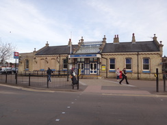
The railway station was a short stroll away, and I had only ten minutes to wait for the next train south. The station has been renovated rather well with pictures of trains and pleasing blue signs scattered about. It had been a pleasant day's walk; I had done it before several times, but there were still things to see and ponder as I walked. It was also good to know that my legs still have long days in them.
 |
 |
|
Directions
(As with the previous couple of walks, I only mention gates or stiles when they are of navigational interest.)
This walk starts off from the road outside Littleport railway station at TL57468744. Leave the station and turn left, crossing the line by the level crossing or under the low bridge alongside. Head along this road as it heads in a rough north-northeasterly direction for a third of a mile until it reaches a T-junction with the A10(T). Turn right to cross the river via the bridge, and before a roundabout is reached immediately on the other side, turn left to join a footpath that runs along the top of the floodbank. Follow this northeastwards, trapped between the river on the left and the A10(T) on the right. The path passes a lay-by and picnic area on the right, and after 3.2 miles Brandon Creek (and the mouth of the Little Ouse) is approached. Continue along the floodbank and go through a clappergate beside some private moorings to reach the rear of the Ship Inn. At the pub, the bank and curves to the right towards the road bridge over the Little Ouse. Once in front of the pub, leave the bank and head down the pub's access road to join the A10(T) immediately before the bridge at TL60699170.
Turn left along the main road, and use the road bridge to cross Brandon Creek into Norfolk. Once on the northern side, cross the safety barrier to rejoin the floodbank, with the river on the left. The floodbank soon curves to the left away from the A10(T), with a minor road on the right. After half a mile the minor road ends and the bank rejoins the A10(T). Leave the bank before it reaches houses ahead, and carefully follow the A10(T) northwards; a pavement soon starts in front of the houses on the left.
After a couple of hundred metres, when a hedge on the left ends and just before Sedge Fen Road comes in from the right, turn left along a path that squeezes along a narrow gap between gardens; at times this path has been very overgrown. After ten metres the path climbs up onto the floodbank; turn right to head north along the bank. Go through a couple of gates and continue on the floodbank with the river on the left; the bank and river soon curve away from the main road past moorings on the left. Go through another couple of gates by the moorings and continue along the bank. After 2.7 miles Hillgay Bridge is reached at TL60409702. Do not go under the bridge, and instead either follow the track that heads to the right to join the approach road, or climb the bank ahead and cross the crash barrier that guards the road by the bridge.
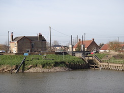
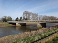
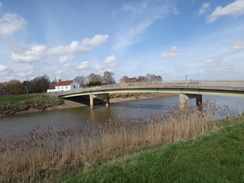
Turn left to cross the river on the bridge, and on the other side turn right to start following the banking in a rough north-northwesterly direction, with Church Road on the left. At times the road runs along the bank, so it may be easier just to walk along the road. When a railway bridge is reached after 1.2 miles, leave the bank and join the road to head through an underbridge, rejoining the bank shortly afterwards. Continue on along the floodbank; the bank and road passes moorings on the right and curves to the left; 2.8 miles after Hilgay Bridge, the road passes the Jenyns Arms and curves to the right to reach Denver Sluice at TF58760099.
Use the road bridge to cross the sluice. On the other side, turn left through a clappergate to join a footpath that follows the eastern bank of the river in a rough northerly direction. After 1.4 miles the A1122 is reached beside Downham Bridge at TF59760289.
Do not cross the river at Downham Bridge, and instead cross the road to follow a footpath that runs along the river's eastern floodbank, initially passing between the river and some houses on the right. After 2.7 miles it crosses a road to the west of Stowbridge (with the Heron pub a short distance to the right) and continues on for another 2.8 miles, reaching a road beside Magdalen Bridge at TF60101136 to the northeast of Wiggenhall St Mary Magdalen.
Cross the road and continue on, passing a sewage works and immediately behind the ruined church of Wiggenhall St Peter. After two miles the decidedly non-ruined Wiggenhall St Germans church is reached, beyond which is another road at TF59621406, with the Crown and Anchor pub alongside.
Cross the road and continue on along the eastern river bank as it heads in a rough northerly direction for another 2.3 miles until it curves to the right to reach a clappergate beside a field gate. Go through this to reach a sluice over the Relief Channel at TF60451729. Cross the bridge beside the sluice (beware of the automated safety announcement) to reach the eastern bank of the channel. As the path curves to the right on the other side, turn left to join a surfaced cycle path that runs along the top of a floodbank; follow this past some reed beds on the left. Do not head towards the power station to the south. The path soon rejoins the eastern bank of the river; after 0.8 miles it passes under the A47(T).
The path continues on northeastwards for a few metres towards Free Bridge. When the path forks immediately before the bridge, take the left-hand fork towards a road that leads onto the bridge. Cross the road, and on the other side continue on northeastwards along the cycle path for 0.6 miles until the bank and path curve sharply to the right to reach a bridge over the mouth of the River Nar at TF61801932.
Turn left to join the cyclepath across the bridge, and on the other side turn left to join a footpath that runs along the top of a bank, with a reed-strewn old channel to the left. This starts following a low concrete flood barrier on the right that soon curves to the left. When the wall curves sharply to the right, continue straight on for about twenty metres, crossing a track to reach Boal's Quay at TF61691956.
Turn right along the quay for a few metres, and just before it ends, cross a small strip of grass to reach a bridge over an inlet that carries a road. Cross the bridge and join the quayside; head north for a third of a mile until a little footbridge over an inlet on the right is reached at TF61562001, with the Custom House off to the right.
Cross the footbridge and turn right towards the Custom House, passing the statue of George Vancouver and the Custom House to reach King Street. Cross this and head on up Purfleet Street. When this curves to the left, continue straight on up a pedestrianised street. This crosses another pedestrianised street and curves to the right. Take the first path off to the left after the bend, which curves to the right to reach King's Lynn bus station. Turn right to pass the station on the left and King's Lynn museum on the right to reach Old Market Street. Turn left along Old Market Street; when it soon ends at a T-junction, cross the road and head straight on up Waterloo Street. This ends at a T-junction with Backfriars Road; cross the road ahead using the pedestrian crossing to reach King's Lynn railway station at TF62342009.
 |
 |
|
Distances
| From | To | Distance (m) | Ascent (ft) | Descent (ft) |
|---|---|---|---|---|
| Littleport station | Brandon Creek | 4.0 | 20 | 13 |
| Brandon Creek | Denver Sluice | 6.9 | 26 | 23 |
| Denver Sluice | Downham Bridge | 1.5 | 3 | 0 |
| Downham Bridge | Magdalen Bridge | 5.5 | 30 | 33 |
| Magdalen Bridge | King's Lynn Station | 7.1 | 69 | 64 |
This makes a total distance of 25.0 miles, with 148 feet of ascent and 133 feet of descent.
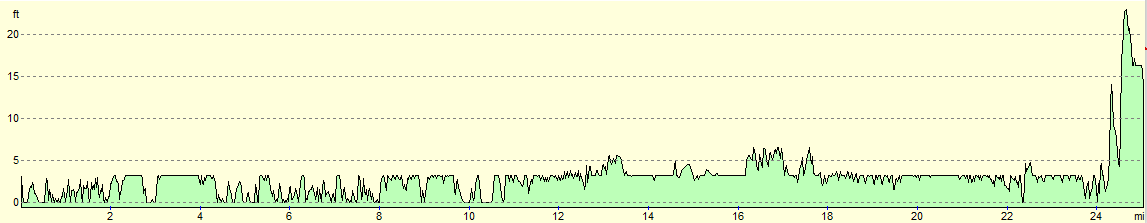
For more information on profiles, ascents and descents, see this page
Transport
Regular hourly services run from King's Lynn station to Littleport, calling at Downham Market (about twelve miles into the walk) and Littleport (18 miles) on the way.
 |
 |
|
 |
 |
|
 |
 |
|
 |
 |
|
 |
 |
|
 |
 |
|
 |
 |
|
 |
 |
|
 |
 |
|
 |
 |
|
 |
 |
|
 |
 |
|
 |
 |
|
 |
 |
|
 |
 |
|
 |
 |
|
 |
 |
|
 |
 |
|
 |
 |
|
 |
 |
|
 |
 |
|
 |
 |
|
 |
 |
|
 |
 |
|
 |
 |
|
 |
 |
|
 |
 |
|
Disclaimer
Please note that I take no responsibility for anything that may happen when following these directions. If you intend to follow this route, then please use the relevant maps and check the route out before you go out. As always when walking, use common sense and you should be fine.
If you find any information on any of these routes that is inaccurate, or you wish to add anything, then please email me.
All images on this site are © of the author. Any reproduction, retransmissions, or republication of all or part of any document found on this site is expressly prohibited, unless the author has explicitly granted its prior written consent to so reproduce, retransmit, or republish the material. All other rights reserved.
Although this site includes links providing convenient direct access to other Internet sites, I do not endorse, approve, certify or make warranties or representations as to the accuracy of the information on these sites.
And finally, enjoy your walking!
Nearby walks
| # | Title | Walk length (miles) |
|---|---|---|
| 3 | Littleport to Downham Market | 14.0 |
| 4 | Downham Market to Watlington | 6.2 |
| 18 | Waterbeach to Ely | 10.9 |
|
|

|