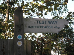
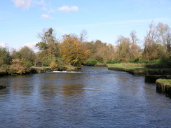
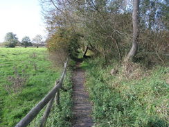
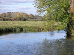
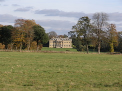
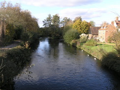
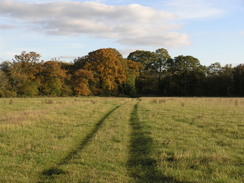
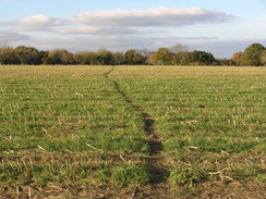
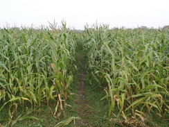
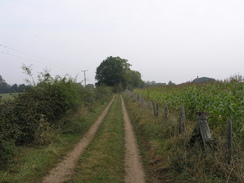
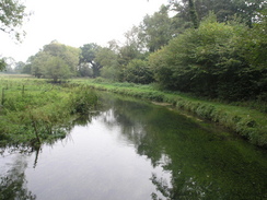
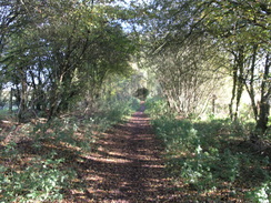
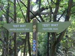
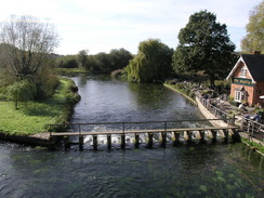
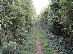
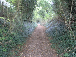
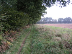
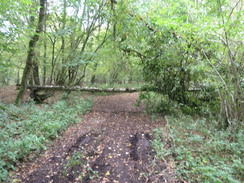
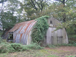
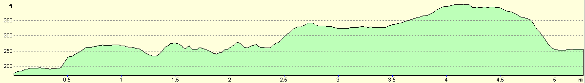
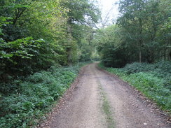
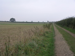
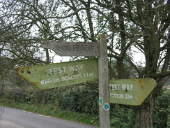
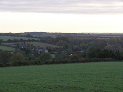
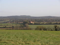
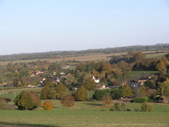
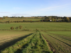
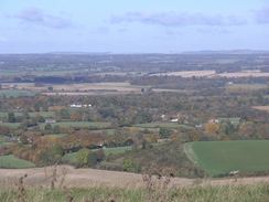
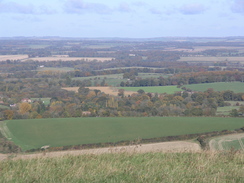
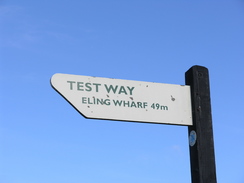
The Test WayThe Test Way is a 47-mile trail in Hampshire, following the River Test from Eling Wharf near Southampton to near its source at Inkpen Beacon at the north of the county. Unfortunately it is only occasionally in touch with the river, and often diverts off into the surrounding countryside. On the way it passes through pretty villages such as Hurstbourne Tarrant, St Mary Bourne, Longparish, Chilbolton and Mottisfont, and passes close to the town of Romsey. At the southern end of the trail it passes through the centre of the town of Totton. Waymarking is generally easy to follow, in the form of circular discs, with 'TW' on a green arrow. These will be stuck onto any stationary furniture found on the route, such as gateposts, lampposts and marker posts. |
The map. |
The walk in full:
| No. | From | To | Distance | Ascent | Descent |
|---|---|---|---|---|---|
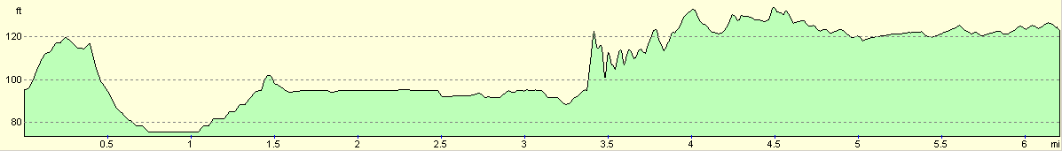
| 1 | Eling Wharf | A27 in Romsey | 9.0 | 180 | 151 |
| 2 | A27 in Romsey | Mottisfont | 5.4 | 351 | 289 |
| 3 | Mottisfont | Stockbridge | 6.2 | 187 | 157 |
| 4 | Stockbridge | Chilbolton | 3.3 | 135 | 92 |
| 5 | Chilbolton | Middleton | 5.7 | 377 | 364 |
| 6 | Middleton | St Mary Bourne | 5.3 | 390 | 312 |
| 7 | St Mary Bourne | Hurstbourne Tarrant | 3.8 | 433 | 354 |
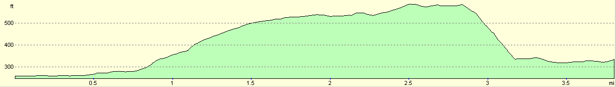
| 8 | Hurstbourne Tarrant | Inkpen Beacon | 8.2 | 971 | 449 |
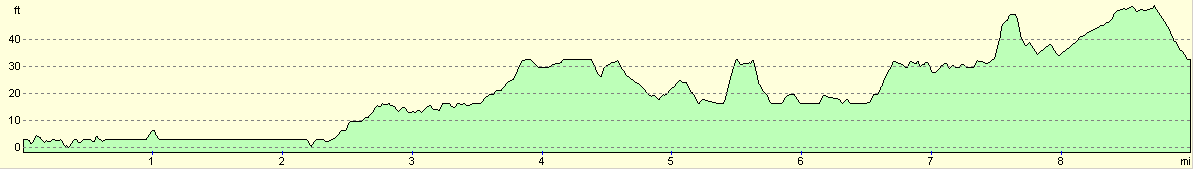
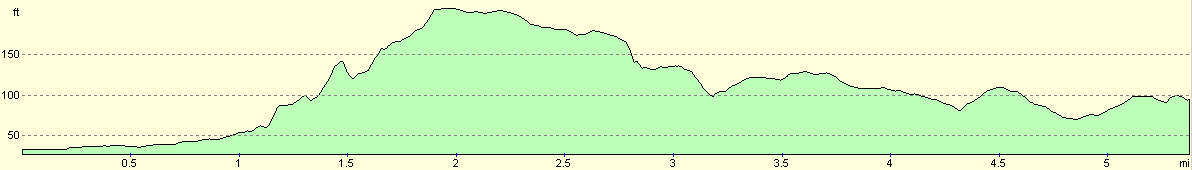
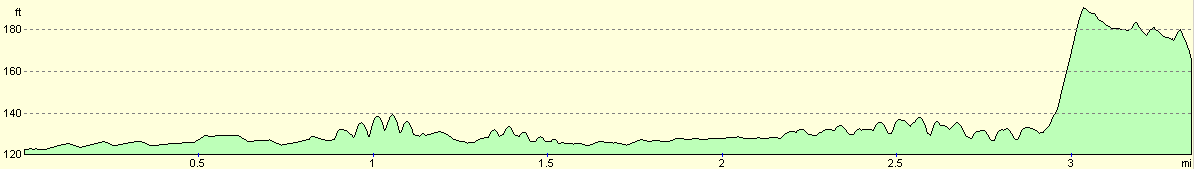
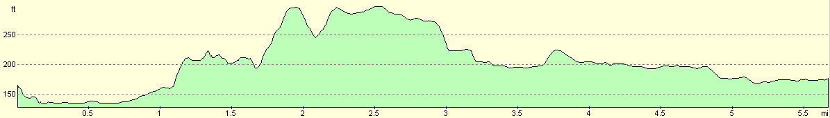
| 46.9 | 3024 | 2168 |
Leg 1 - Eling Wharf to A27 in Romsey
No. From To Distance Ascent Descent Profile
1
Eling Wharf
A27 in Romsey
9.0
180
151
| No. | From | To | Distance | Ascent | Descent | Profile | 1 | Eling Wharf | A27 in Romsey | 9.0 | 180 | 151 |
|---|
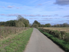
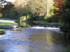
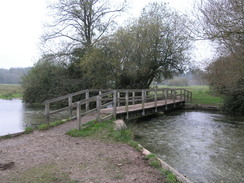
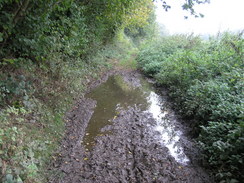
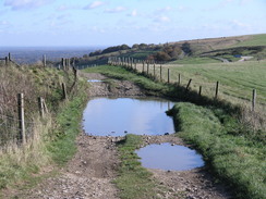
From Eling Wharf head back along the road towards the tide mill and bridge. From here, continue on westwards along a road with Eling Creek on the left. When the road soon ends, continue through a gate and continue along a footpath with Bartley Water on the left. When a footridge over the water is reached, do not cross it but turn right to start heading northwards with the water still on the left. A path runs along the top of the little flood bank, and this is drier than the surrounding grass. The bank ends at a recreation ground; continue straight across this, aiming to the right of the pavilion. Pass the pavilion and head out to the A35 road.
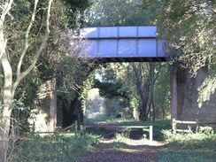
Turn left and walk westwards for fifty yards to reach Rum bridge. Cross the road using the pedestrian crossing, and then head along a footpath that runs northwards along the western bank of the river. Soon a footbridge is reached; cross this, and follow the footpath as it reaches a footbridge over a railway line. Cross the bridge to Maynard Road on the other side. Turn left up this for a few yards until it ends at a T-junction with the A336 Ringwood Road. Turn right along the A336 to a large roundabout; continue straight on, and then turned left up Testwood Lane.
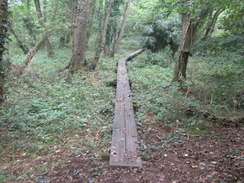
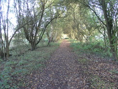
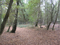
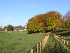
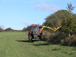
Follow Testwood Lane as it heads north through Totton, and when it curves to the left turn half-right to join a footpath that carries the Test Way slightly east of north. It immediately passes a pub, before reaching a bridge over the river. It turns to the left to skirt the eastern bank of the river northwards for a short distance until a causeway is reached on the left. Here turn right, and start following a footpath that heads northeastwards across the Lower Test Nature Reserve for a little over half a mile, crossing tributaries of the river on bridges before reaching a railway line.
Turn left and skirt the western side of the railway line northwards for a short distance, before the footpath curves away to the left to head northwestwards, with what I believe to be the remnants of the old Andover to Redbridge canal to the right. Eventually the path curves to the right before ending at a road. Turn left and follow Mill Lane northwestwards for a few hundred yards, and then opposite Manor House Farm turn right along a track. This heads northwards for 0.4 miles until it suddenly reached the embankment that carries the M27. Here the path turns sharply to the right, and heads eastwards for a fifth of a mile, skirting between the embankment on the left and fences on the right.
The path ends at a road. Turn left to follow the road northwards for a short distance as it passes under the M27 until a crossroads is reached. Turn left here, to head westwards down a road for a third of a mile, passing Nursling church on the right. When the road ends, turn right along a tack. This heads northwards, soon skirting to the west of an area of woodland. After a mile the track passes immediately to the west of Longbridge Farm, and then turn left to cross the River Test on a bridge. Continue on along a track that soon turns to the left to head southwards, before curving to the right to head westwards towards a farm at Moorcourt.
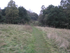
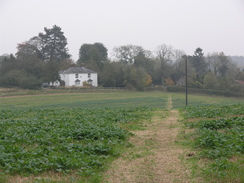
Pass through the farm and continue on for a short distance until the track ends at a road immediately to the north of Wade Bridge over the River Blackwater. Turn right to had north along this road, and after a few yards when the road turns to the left continue straight on along a footpath. This skirts some woodland on the left, before entering open fields. A little over two miles after the road, the footpath ends at the A3090 to the west of Romsey.
 |
 |
|
 |
 |
|
 |
 |
|
 |
 |
|
 |
 |
|
 |
 |
|
 |
 |
|
 |
 |
|
 |
 |
|
 |
 |
|
 |
 |
|
 |
 |
|
 |
 |
|
 |
 |
|
Leg 2 - A27 in Romsey to Mottisfont
No. From To Distance Ascent Descent Profile
2
A27 in Romsey
Mottisfont
5.4
351
289
| No. | From | To | Distance | Ascent | Descent | Profile | 2 | A27 in Romsey | Mottisfont | 5.4 | 351 | 289 |
|---|
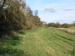
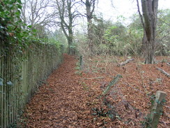
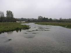
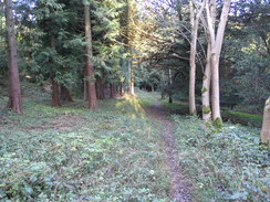
Turn right to head northeastwards, passing a roundabout until the River Test is reached. Just before the bridge turn left to follow a track northwards, with the river on the right. When Saddler's Mill is reached turn left and then right, to join a footpath that heads northwestwards along the floodplain of the river, heading to the east of the sewage works. A couple of small plank footbridge lead over a couple of streams, and three-quarters of a mile after the mill the path reaches Squabb Wood near Monk's Cottages.
Enter the woodland, and follow a footpath that leads northwestwards through the trees, heading to the west of Roke Manor. At SU333222 turn right down a path that heads northeastwards off the main path; this soon leaves the trees into a small clearing, before re-entering the trees for a short period. After it leaves the trees again it turns to the left, skirting the northern edge of the woods to the edge of a field, and then turning right to head northwestwards for a short distance to Old Salisbury Lane.
Cross Old Salisbury Lane and head across two fields; halfway across the second the Test Way heads off to the right to head northeastwards. Follow the path as it joins a track, passing Hilberry Farm before reaching the B3084 road. Cross the B3084, and then turn right to join another footpath that soon turns to the left to head behind some houses, before quickly ending at a road. Turn right to head eastwards down this road, and as it curves to the right turn left along a track. A short distance along this turn left, to head northwestwards along another footpath for a little over half a mile, crossing a stream and then climbing up a slight hill before the path ends at the B3084 road once more.
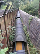
Turn right to follow the B3084 road northwards for about a third of a mile, then turn right along a narrow footpath that heads northwards, skirting a pond on the left before it soon ends at another road. Turn right down this road for a short distance until it approaches a level crossing over a railway line. Just before the crossing turn left along another footpath; this heads westwards, and when a crossing is reached with another footpath turn to the right. This crosses the railway line on a footbridge (with a conveyor belt beside it).
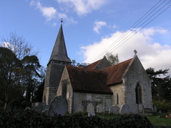
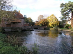
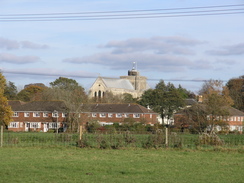
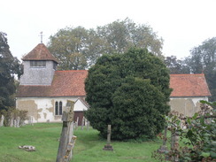
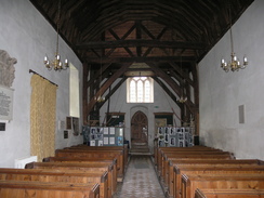
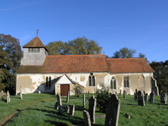
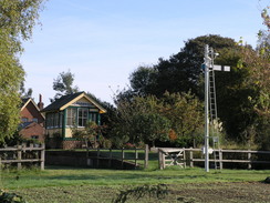
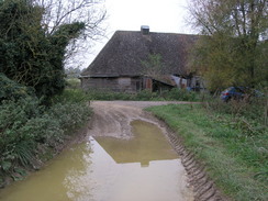
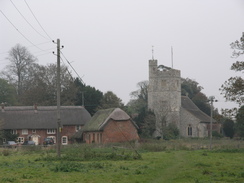
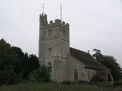
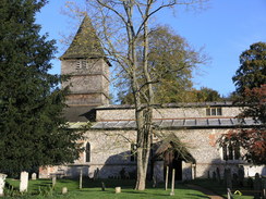
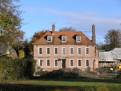
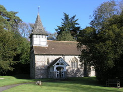
On the other side the path descends down a slight slope to a footbridge over the River Dun; cross this and then continue on northwards on the other side. This becomes a track as it continues for a little under half a mile. It curves sharply to the left and then the right to reach Mottisfont Church. Continue on past this for a few yards until the track ends at a road in Mottisfont.
 |
 |
|
 |
 |
|
 |
 |
|
 |
 |
|
 |
 |
|
 |
 |
|
 |
 |
|
 |
 |
|
 |
 |
|
 |
 |
|
 |
 |
|
Leg 3 - Mottisfont to Stockbridge
No. From To Distance Ascent Descent Profile
3
Mottisfont
Stockbridge
6.2
187
157
| No. | From | To | Distance | Ascent | Descent | Profile | 3 | Mottisfont | Stockbridge | 6.2 | 187 | 157 |
|---|
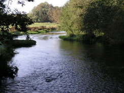
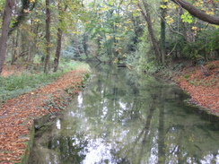
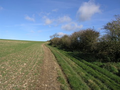
Leave Mottisfont Church and head a few yards down the track to the road. At the road turn left, and follow it as it curves around to the right to head northwards. At SU325273 turn right to join a footpath. Initially this heads across a field for a little under half a mile, initially eastwards before curving to the left to head northeastwards. This ends at a road immediately to the east of Oakley Farm. Turn right; the road ends and a track continues onwards, crossing a tributary of the River Test. Follow this track for a little over half a mile, until it crosses the River Test proper.
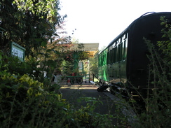
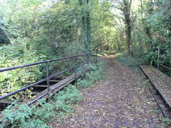
On the other side of the river bridge turn left to follow the course of an old railway line northwards as it passes through Horsebridge. After nearly five miles the path reaches a large roundabout on the A30 immediately to the east of Stockbridge.
 |
 |
|
 |
 |
|
 |
 |
|
 |
 |
|
 |
 |
|
 |
 |
|
 |
 |
|
 |
 |
|
Leg 4 - Stockbridge to Chilbolton
No. From To Distance Ascent Descent Profile
4
Stockbridge
Chilbolton
3.3
135
92
| No. | From | To | Distance | Ascent | Descent | Profile | 4 | Stockbridge | Chilbolton | 3.3 | 135 | 92 |
|---|
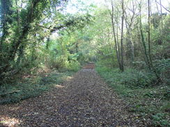
Head straight on at the roundabout, continuing on northwards along the A30. Walk on the left-hand side of the road until another roundabout is reached with the A3057. Continue straight on for a short distance, and then rejoin the old railway line on the left
Follow the old railway line for about 2.5 miles, passing through Leckford. The path eventually passes under a large road bridge at SU382389; on the other side turn right and follow a path that goes up to join the A3057.
 |
 |
|
 |
 |
|
 |
 |
|
 |
Leg 5 - Chilbolton to Middleton
No. From To Distance Ascent Descent Profile
5
Chilbolton
Middleton
5.7
377
364
| No. | From | To | Distance | Ascent | Descent | Profile | 5 | Chilbolton | Middleton | 5.7 | 377 | 364 |
|---|
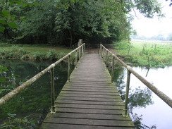
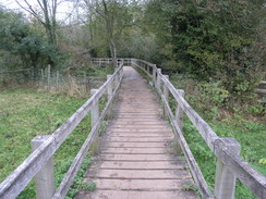
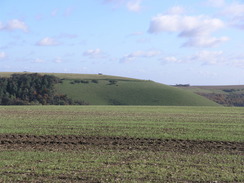
This leg starts off at the car park near the A3057 to the south of Chilbolton. From the car park take a footpath that heads uphill, paralleling the road that heads northwards. Do not take the track that heads uphill to the east. The footpath descends down to meet a road at SU386394; cross the road and take another footpath that heads northwards. This curves to the right and then the left, before settling on a northwesterly course. It crosses a stream before crossing Chilbolton Cow Common and reaching a bridge over the River Test. Cross this bridge, and then climb up to meet a road in Wherwell.
Turn left down this road, and after a few yards turn right along a footpath that climbs uphill. After a few yards turn right to head northeastwards behind houses. When the B3420 road is reached, turn right down it for a short distance, then turn left along another footpath. Head northeastwards along this until a track called New Barn Lane is reached.
Turn left and follow New Barn Lane as it climbs uphill to the north for 0.4 miles. At new Barn it curves to the right to head northeastwards for a little under half a mile. Some trees start on the left; when a large expanse of trees start on the left, turn right and follow the southern edge of the woodland eastwards to Park Farm.
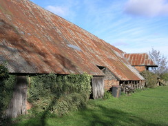
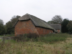
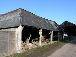
At the farm turn left and head downhill for a short distance along a track, before taking another track that leads off to the right to head eastwards. Follow this track as it heads eastwards through the woods, passing a series of large barns on the left. Follow the track as it curves to the left to head up a slight hill, then passes through Pachington Farm before passing under an old railway line and reaching the B3048 road.
Turn left to head north up the B3048 for a short distance, then take the first road that leads off to the left. This road climbs up as it curves to the right to cross the A303(T). As it curves around to the right it passes a mast; turn left along a footpath, then right along another that heads eastwards across fields to reach the B3048 road in Forton. Cross the B3048. Then follow another road that heads sutheastwards for a hundred yards. Continue along it as it curves to the left to head northeastwards through Forton.
When the road curves to the left continue straight on along a footpath that heads northeastwads towards Middleton Church. Keep the church on the left, then walk the short distance to reach the B3048 road. Turn left for a few yards, then turn right along another footpath that heads northeastwards for a short distance. This reaches a track near Lower Farm in Middleton at SU428441.
 |
 |
|
 |
 |
|
 |
 |
|
 |
 |
|
 |
 |
|
 |
 |
|
 |
 |
|
 |
 |
|
 |
 |
|
 |
 |
|
 |
 |
|
 |
 |
|
 |
 |
|
 |
 |
|
 |
 |
|
Leg 6 - Middleton to St Mary Bourne
No. From To Distance Ascent Descent Profile
6
Middleton
St Mary Bourne
5.3
390
312
| No. | From | To | Distance | Ascent | Descent | Profile | 6 | Middleton | St Mary Bourne | 5.3 | 390 | 312 |
|---|
Turn left and follow this track as it heads uphill for a thirsd of a mile. When it ends at a T-junction with another track, turn left and follow this track as it heads westwards for a quarter of a mile. Just before it meets a road, turn right and take another track that starts to head northwards. Continue along this for a mile and a quarter, as it crosses a bridge over an old railway line, becoming a footpath that keeps the trees to the left as it reaches the B3400 near Fox Cottages.
Cross the B3400 and then take a track on th other side; almost immediately this curves to the right, then left, to take a more northerly course. This meets a track; turn left to follow this westwards past Faulkner's Down Farm. On the west side of this farm follow the track as it curves to the right to head northwestwards to reach a road at SU408478. Cross this road and join a road that heads northwards, curving to cross a railway line.
When Lower Wyke Farm is reached turn right and start walking along a track. After 0.4 miles turn right, to join a footpath that heads slightly north of east for 0.8 miles, when it curves to the left to start heading downhill to the north along a track. This track ends at the B3048 road in St Mary Bourne.
 |
 |
|
 |
 |
|
 |
 |
|
 |
 |
|
 |
 |
|
 |
 |
|
Leg 7 - St Mary Bourne to Hurstbourne Tarrant
No. From To Distance Ascent Descent Profile
7
St Mary Bourne
Hurstbourne Tarrant
3.8
433
354
| No. | From | To | Distance | Ascent | Descent | Profile | 7 | St Mary Bourne | Hurstbourne Tarrant | 3.8 | 433 | 354 |
|---|
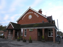
This walks starts off at the Coronation Inn in St Mary Bourne. Leave the pub and turn left up School Lane to meet the Test Way by some gates leading into Haven Hill.Turn right and walk along the lane, with the school on the right, and when the road curves to the left follow it as the road becomes slightly rougher underfoot. After a few yards turn right to cross a stile and take a footpath that turns behind houses, and just before a stile is reached ahead turn left to cross another stile and head diagonally uphill towards a stile in the upper-right hand corner of the field. Cross this stile,and walk through a small patch of woodland to reach a road.
Turn right along the road for a couple of yards and then turn left, to climb up some steps and cross a stile and follow the footpath along with a hedge on the right, slowly climbing. The path then turns to the right and immediately to the left to continue on with a hedge on the left as the views open out to the right. At the end of the field the path turns to the left to head through some trees, and then after a couple of yards turn right across a stile to walk along with a fence on the right and a hedge on the left. Continue straight on as the path crosses six stiles with the hedge remaining on the left; the last stile is beside a gate that leads out onto a road.
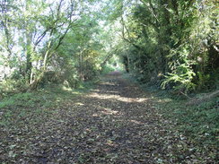
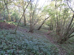
Turn right down this road for about ten yards and then turn to the left to walk up a surfaced lane. When this forks through the gateway into Stokehill Farm take the left-hand fork, and after about twenty-five yards take another right-hand fork that leads up to a gate. Go through the gate and turn right, to continue on along the right-hand side of the field. Keep the hedge to the right as it passes a little patch of trees until the corner of the field is reached, and then go through a clapper gate. In the next field keep the hedge to the right and continue on to another stile. On the other side follow the hedge for a short distance to another stile by a gate, and go through this to enter the woods on Wallop Hill Down.
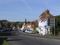
On the other side of the stile the path follows a track through the woods. When the track turns to the left the path plunges on through trees. When the tree cover becomes sparser take another footpath that leads off to the right, heading downhill steeply through the woods to cross a track before emerging out into an open field. Turn left and then immediately to the right to head straight down a track until this reaches the bottom of the slope, and then turn left to walk along another grassy track until a farm building is reached. Then turn right to walk down to Lower Farm. Walk past the farm and join a road that passes a school on the left to reach the B3048 Church Street in Hurstbourne Tarrant opposite the village church. Turn left and follow the road westwards for a couple of hundred yards until a junction with the A343 road is reached in the centre of the village.
 |
 |
|
 |
 |
|
 |
 |
|
 |
 |
|
 |
 |
|
 |
 |
|
Leg 8 - Hurstbourne Tarrant to Inkpen Beacon
No. From To Distance Ascent Descent Profile
8
Hurstbourne Tarrant
Inkpen Beacon
8.2
971
449
| No. | From | To | Distance | Ascent | Descent | Profile | 8 | Hurstbourne Tarrant | Inkpen Beacon | 8.2 | 971 | 449 |
|---|
Turn right to walk northeastwards along the road for about fifty yards. Just before the post office is reached the Test Way leads off to the left, and follow the path as it heads over a series of gates before entering a paddock with a small stream to the left. Continue on along the path through more clapper gates before reaching a stretch of path with fences on either side. Head down this path, and when it ends at a track turn left and soon after it curves to the right it ends at a road. Turn right and start following a road northwards with a large house on the right. The road soon curves to the left, and when it curves to the left once more turn right up a track that heads past a series of farm buildings.
Continue along this track as it continues to climb, When the track forks take the main track to the left, eventually passing a large barn on the right before passing under some electricity pylons. The track becomes more enclosed as it starts to heads northwestwards, passing under the electricity pylons once again to reach a junction of tracks. At this junction turn right to head northwards, passing under the pylons once more as it climbs uphill, before curving to the left to head northwestwards to end at a road. Turn right and follow this road as it heads northwards for a few hundred yards until it passes Manor Farm on the left to reach the little hamlet of Linkenholt.
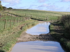
At a road junction turn left and walk westwards to pass Linkenholt church, and when the road curves to the left take a path that heads off to the right along a surfaced drive. When this curves sharply to the left continue straight on along an unsurfaced track. When this enters a field continue straight on with a fence to the right. At the bottom of this field and enter some trees as the path plunges downhill before joining a track that emerges out from the trees with what looks like a house on the right. When this track ends at a junction with another track near the house, turn left and start following a track northwestwards along the bottom of the valley.
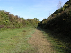
The track passes a little brick building on the right before entering trees and slowly becomes rougher as it heads on until it emerges from the woods at the intersection of several tracks. Here turn right and start following a path steeply uphill with the trees on the right;the gradient soon slackens and continue along this track northwards. At times the path follows a track and others it is a path; keep the hedges to the right, the left and then the right as the path slowly climbs before ending at a junction with another track on Inkpen Hill.
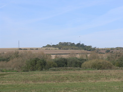
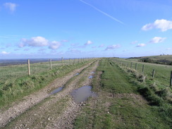
Turn right and follow this track as it heads eastwards, initially climbing up to pass Combe Gibbet before descending down to reach a road and, on the other side, a car park. This marks the end of the Test Way and the start of the Wayfarers Way.
 |
 |
|
 |
 |
|
 |
 |
|
 |
 |
|
 |
 |
|
 |
 |
|
 |
 |
|
 |
 |
|
 |
 |
|
 |
 |
|
 |
 |
|
 |
 |
|
 |
 |
|
Circular walks
The following circular and linear walks are based on the Test Way:
- Walk 793 (Eling Wharf to Romsey)
- Walk 788 (Romsey to Mottisfont)
- Walk 789 (Mottisfont to Fullerton)
- Walk 791 (Chilbolton to St Mary Bourne)
- Walk 792 (St Mary Bourne to Inkpen Hill)
Other resources
- The official Test Way website at Hampshire County Council
- The Southern Walks webpages covering the Test Way
