Walk #832: A circular walk around the coast from Birdham
 |
 |
|
General Data
| Date Walked | 26/02/2009 |
| County | West Sussex |
| Start Location | Birdham |
| End Location | Birdham |
| Start time | 08.19 |
| End time | 17.20 |
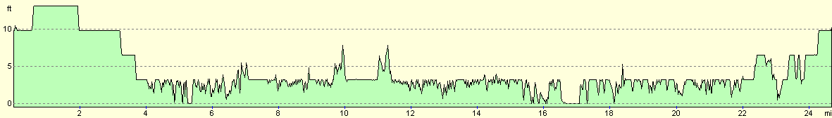
| Distance | 24.8 miles |
| Description | This was a very pleasant walk, for much of the time following the sea past Selsey into Chichester harbour. |
| Pack | Today I carried my 30-litre Karrimor rucksack, filled with waterproofs, a book and other odds and ends. |
| Condition | I feel absolutely fine after this walk; a little tired, but with no problems to report. |
| Weather | The day started off grey and overcast, but as the day went on occasional sunny periods started. It was quite a warm day for the time of year, although the breeze was chilly at times. |
| OS map | Landranger number 197 (Chichester & The South Downs, Bognor Regis & Arundel) |
 |
 |
|
 |
 |
|
Map of the walk
Maps courtesy of Google Maps. Route for indicative purposes only, and may have been plotted after the walk. Please let me have comments on what you think of this new format. For a detailed table of timings for this walk, please see the table file.
 |
 |
|
 |
 |
|
Notes
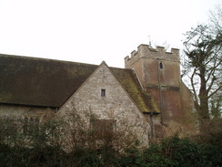
I decided to continue my walk back along the coast today, and I chose my next stretch to be the section around Selsey Bill. This is ideal for a circular walk, as the western, southern and eastern sides of the peninsular are all coastal. I therefore sketched out a route, ignored the pain from my toothache and headed off. When I reached the place that I wanted to start the walk, Birdham, I stopped off to buy some batteries from a shop. Whilst there I asked the owner if I could park in their large car park all day - after getting a negative reply, I got back into my car and parked outside the church.
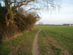
The first stretch of the walk took me southeastwards, following a series of roads to Highleigh. As I was feeling good I chose to yomp it, and this allowed me to make good time. There was little to see and, if I was being honest, little of interest on this stretch. At Highleigh a footpath took me to Sidlesham, and from there yet another road took me down to Sidlesham Quay.
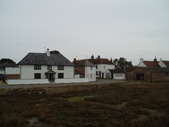
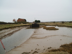
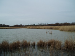
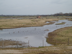
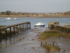
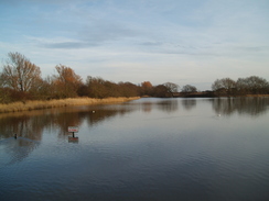
This was where the walk started to get interesting. I had walked through here on my coastal walk, and as I saw the pub I got a brief glimpse of the place in my memory. The quay was once the site of an old tidal mill, now long since gone. The Quay is on Pagham Harbour, a large expanse of low-lying mudflats with only a narrow connection to the sea. That connection was a spit, which the sea broke through in 1910 to flood grazing land. No attempt was ever made to reclaim the lost land, and so a new harbour was formed (although one that is of little use to anyone aside from birds). The harbour was only reclaimed from the sea in the 1870s, so the land was only devoted to agriculture for a few decades.
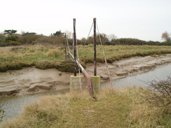
On the other side of the quay I joined a permissive bridleway that skirts the eastern edge of the harbour. This is the trackbed of the old Selsey tramway, which ran south from Chichester. Apparently this section of line had to be totally rebuilt once the sea inundated the land - an expensive process. Off to the right there was the tall, triangular frame of a drilling rig, taking core samples for a new visitor centre that is being planned for an old tip. Then, as the old railway line approached a stream, the path diverted off to the right to reach a road. Here there was a strange structure that I had noted on my previous walk - a pipe bridge across the stream, exactly on the line of the old railway. I now know that this was actually the site of the old railway bridge, which had been replaced with this rather austere structure.
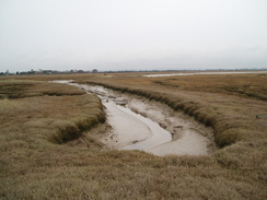
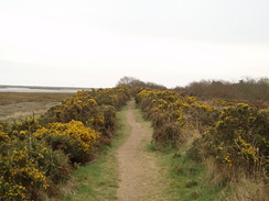
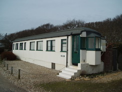
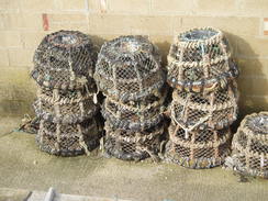
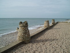
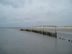
A very pleasant walk followed as the path followed the floodbanks as it slowly curved to the right towards the spit that protects the harbour from the sea. At one point the path descended down to the foreshore, which was firm and easy to walk along. At some steps near Church Norton I descended down onto the foreshore and walked on past a number of birdwatchers, their attention focussed firmly on the mudflats. Once the shingle spit was reached I started to walk southwards; progress over the shingle was very hard on my feet. Soon a grassy path started behind the bank, and this made progress easier, especially when the path became a track. On the way it passed a couple of cottages, one of which looked as though it had doors from a railway carriage, and another that was more evidently based on an old carriage. Soon a promenade started on the left, and this allowed me to go down past a number of fisheries. The smell of fish and the stacks of lobster pots seemed like a perfect image of the working sea. There were also some heavy plant that looked as though they were being used to reconstruct the shingle banks.
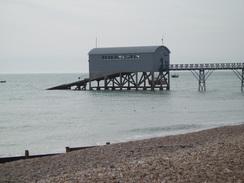
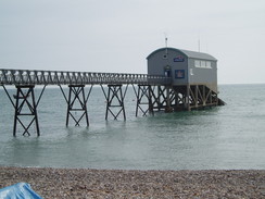
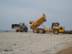
In Selsey I passed the lifeboat station; strangely, this is built out to sea, with an overhead walkway granting access to it. After this I had to divert inland slightly to get around Selsey Bill - the tide was high, preventing access to the foreshore. The foreshore was soon rejoined, and a path took me onwards. After a while there were signs forbidding people from the foreshore, but the tide was so high that it was unwalkable anyway, so I was forced to divert inland. I rejoined the sea near the coastguard station, and after this a footpath took me onwards towards a caravan park. On the way I saw a large dumper truck dumping off a pile of shingle, and a tracked digger levelling the pile out. The dumper truck followed a track inland of the bank northwestwards through the holiday park, and I followed behind it.
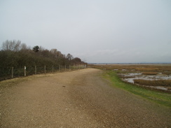
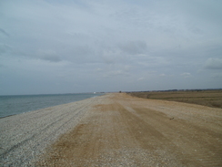
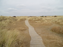
There is a large club in the caravan park, looking slightly out of place and overlarge. After the park ended I followed a track inland of the bank, before climbing up onto the bank and heading on. Fortunately the many machines running along the top of the bank had bedded the shingle in. It was a pleasant walk, and the sound of the waves against the shingle was mesmeric. Some large piles pf shingles were reached near Bracklesham, and after this the going became harder. The shingle was loose, and each step took much more energy. In a few places I could see the railings of a promenade that was totally buried beneath the shingle. The going became so difficult that I followed a road inland for a short distance before rejoining the beach.
About this time I decided I was in need of a rest, from the endless pounding of the shingle against my feet if nothing else. The only pubs marked on the map were further inland, so I plodded on and kept my eyes open. Then, just down a side-street from what passed for a promenade, I saw a pub, The Shore Inn. I collapsed in and was greeted with a wave of heat - it was extremely stuffy inside. After ordering a pint of orange and lemonade (due to the antibiotics), I sat down and started to ready my book. Before I did so, I unfurled the OS map on the table in front of me so that I could sketch out my route.
The first pint scarcely touched the sides, so I bought another one and sat back down. Just as I was getting to the bottom of this one the door opened, and a man clutching an OS map entered. I looked at him, and he looked at me; I daresay I carried the air of a long-distance walker, and I was amazed when it turned out that he read my website. We chatted for a while; he is walking the coast in sections. We chatted for a few minutes, then when he came back from the bar he sat down next to me and we resumed our conversation. We continued talking when his food came, and as it slowly cooled I said goodbye and left.
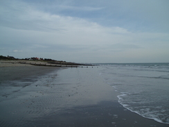
The chance meeting really buoyed me, and I walked on with a spring in my step. Almost immediately the terrain became easier; a grassy path started just behind the shingle, and by the time this ended a wide expanse of firm sand was available to walk along. I felt like I was in heaven as I strolled along; walking on a good beach with the sea on my left brought back so many memories; I felt like I could have carried on forever.
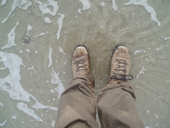
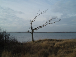
I was feeling so good that when East Head was reached I diverted to head around the sandy headland; the tide was receding, and I took a long, looping route that added one and a half miles onto the walk. When I got home, the GPS log actually indicated that I had been walking in the sea! The sand dunes were high in places, and the views in all directions pleasant - I could see the tall buildings of Portsmouth to the west, including the Spinnaker Tower.
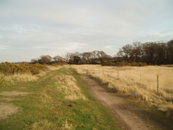
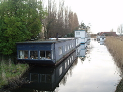
My feet had been aching slightly before my break in the pub, but now they felt fine. A short walk along the foreshore was followed by a longer one across floodbanks, up past Rookswood House and on towards Chalkdock point, from where I got good views across to Cobnor Point, where I walked last week. I strolled on into West Itchenor, and then a fairly nondescript stretch of paths and roads took me on eastwards towards Birdham Pool, where there were many yachts in the marina. After this I eventually reached Salterns Lock on the Chichester Canal, and I seriously considered extending the walk. Unfortunately it was starting to get dark, so I plodded on back towards the Egremont swing bridge over the canal, then back along roads to the car at Birdham church.
This was a very pleasant walk, and it is brilliant that I have managed such a long distance - nearly 25 miles - with very few problems. The stretch to and around East Head was a particularly superb beach walk.
 |
 |
|
 |
 |
|
Directions
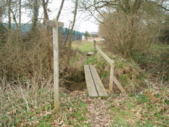
This walk starts off at the church in Birdham. Leave the church and walk southeastwards down a road, passing the parish pump on the left. The road curves to the left, then turn left down a lane. This heads east-northeastwards; when it curves to the left after a couple of hundred yards, continue straight on along a footpath. This skirts the edge of a field with a hedge on the left, before curving to the right to head southeastwards towards the A286 road. Cross a plank bridge over a ditch to reach the road.
Carefully cross the road, and on the other side turn left for a few yards, before turning to the right down a road. This heads southwards for two-thirds of a mile; when a road comes in from the left near Hillands Farm, turn left to head eastwards along a road for nearly a mile; at Highleigh Farm continue southwards along a road into Highleigh. At SZ844982 turn left along a footpath; head eastwards along a lane enclosed on either side by hedges, then at a lane continue straight on eastwards. Initially this passes a series of greenhouses on the right before breaking out into open fields. After two-thirds of a mile the footpath ends at the B2145 road in Sidlesham.
Carefully turn right along this road to follow it southeastwards for about fifty yards, then turn left along another road. This heads southeastwards for two-thirds of a mile, before curving to the right to head down to Sidlesham Quay. Continue on past the old quay, and on the western edge turn left down a permissive bridleway that follows the embankment of an old railway line. This skirts the western edge of the harbour before turning to the right to reach the B2145 road.
Turn left along the B2145 road to head south for a few yards across a bridge, then turn left once more along a footpath that runs along the top of the floodbank. Initially this heads eastwards, before curving around to take a more southeasterly course. On one occasion the path drops down to the foreshore for a short distance before climbing up once more to rejoin the floodbank. When some steps are reached at about SZ872959 go down them, and continue on southwards along the foreshore. This soon reaches the southern edge of the spit that protects the harbour, and the path becomes shingle. Follow the coast southwards; the going on the shingle is hard, but soon a path starts on the inland side of the bank. This becomes a track that skirts the bank southeastwards.
On the northern side of Selsey a promenade starts; join this and follow it southeastwards, passing the lifeboat station before reaching Selsey Bill. If the tide is high turn right here up a footpath for about fifty yards, then left once more past a recreation ground to reach the foreshore once more.Turn right and follow the foreshore westwards. As the tide was high I had to divert inland along a road, before joining West Street to rejoin the coast by the coastguard station.
From here continue on along the foreshore or shingle back northwestwards for three miles into Bracklesham. If the shingle gets too much then there are roads paralleling the shore that you can walk along, but with these you will not get the views. Continue on through East Wittering and then on westwards towards the mouth of Chichester Harbour. When a beacon is reached at the neck of East Head you can either turn right to head eastwards towards Snow Hill and West Wittering, or alternatively go around East Head as I did. To do this, walk north for as long as possible (depending on tide state) to the northern end of the head, then follow it around to start heading southwards towards the neck. This diversion can add up to a mile and a half onto the walk.
Follow a path that runs along the foreshore eastwards towards Snow Hill and West Wittering. At Snow Hill a path starts just inland for the foreshore, and this heads northwards towards Ella Nore, where it turns to the right and curves around to head northwards once more. At Rookswood House the path heads inland for a short distance, before rejoining the floodbank. Continue on to Chalkdock Point, and then on eastwards towards West Itchenor, passing through a boatyard before reaching the end of a road. Here turn right up a road, then when a pub is reached on the right turn left down a footpath that heads eastwards back to the foreshore.
Follow the path along the foreshore southeastwards for a couple of hundred yards, until the path turns inland to join a track. Follow this eastwards, then when a little copse is reached turn right to head southeastwards, skirting past Westlands Farm before joining a track. Follow this eastwards; after a road is reached turn left down another footpath that follows a track down to the foreshore once more. From here the path heads eastwards, leaving the foreshore behind to reach a road. Turn left along this road and follow it eastwards through a boatyard, crossing a causeway across Birdham Pool.
On the other side of the lake the road curves to the right; here continue straight on along a footpath northeastwards towards Salterns Lock. Cross the lock, and on the other side turn right to head eastwards with the canal on the right. When Egremont Bridge is reached after a hundred yards turn right to cross the bridge, then continue on southwards along a footpath towards a road. At the road turn left, and follow this road as it curves around to the right to take a south-southwesterly course. At Broomer Farm the road curves to the right to continue on towards Birdham. When this road ends at a T-junction turn right and follow it for a short distance towards the church, where this walk ends.
 |
 |
|
 |
 |
|
Distances
| From | To | Distance (m) | Ascent (ft) | Descent (ft) |
|---|---|---|---|---|
| Birdham church | Sidlesham Quay | 4.1 | 3 | 10 |
| Sidlesham Quay | Selsey Bill | 5.0 | 62 | 62 |
| Selsey Bill | East Head | 9.0 | 141 | 140 |
| East Head | Birdham church | 6.7 | 75 | 69 |
This makes a total distance of 24.8 miles, with 281 feet of ascent and 281 feet of descent.
For more information on profiles, ascents and descents, see this page
 |
 |
|
 |
 |
|
 |
 |
|
 |
 |
|
 |
 |
|
Disclaimer
Please note that I take no responsibility for anything that may happen when following these directions. If you intend to follow this route, then please use the relevant maps and check the route out before you go out. As always when walking, use common sense and you should be fine.
If you find any information on any of these routes that is inaccurate, or you wish to add anything, then please email me.
All images on this site are © of the author. Any reproduction, retransmissions, or republication of all or part of any document found on this site is expressly prohibited, unless the author has explicitly granted its prior written consent to so reproduce, retransmit, or republish the material. All other rights reserved.
Although this site includes links providing convenient direct access to other Internet sites, I do not endorse, approve, certify or make warranties or representations as to the accuracy of the information on these sites.
And finally, enjoy your walking!
Nearby walks
| # | Title | Walk length (miles) |
|---|---|---|
| 300 | Worthing to Pagham | 18.7 |
| 301 | Pagham to West Itchenor | 19.4 |
| 302 | West Itchenor to Chidham | 14.9 |
|
|

|