Walk #882: Yarmouth to West Cowes
 |
 |
|
General Data
| Date Walked | 27/01/2011 |
| County | Isle of Wight |
| Start Location | Yarmouth |
| End Location | West Cowes ferry landing |
| Start time | 08.27 |
| End time | 15.34 |
| Distance | 17.4 miles |
| Description | This was an enjoyable stroll following the Isle of Wight coastal path around the northwestern part of the island. There is a fair amount of road walking, and much time is spent away from the coast. |
| Pack | Today I carried my 30-litre Karrimor rucksack, filled with water, my waterproofs, a couple of books and other odds and ends. |
| Condition | I feel absolutely fine after this walk. |
| Weather | Today was dominated by a chilling northeasterly wind, which at times was accompanied by snow and sleet flurries. It was a bitterly cold day, and there was no sign of the sun. |
| OS map | Landranger number 196 (The Solent & The Isle of Wight, Southampton & Portsmouth) |
 |
 |
|
Map of the walk
Maps courtesy of Google Maps. Route for indicative purposes only, and may have been plotted after the walk. Please let me have comments on what you think of this new format. For a detailed table of timings for this walk, please see the table file.
 |
 |
|
Notes
I had only got the seventeen-mile stretch of path between Yarmouth and West Cowes to walk to complete the entire Isle of Wight coastal path. After the stupendously scenic walk on Monday, I was keen to complete this stretch. Today's weather forecast was for grey cloud and no rain, so Sencan dropped me off at the ferry terminal in Southampton in time to catch the 6.45 sailing to West Cowes. Unfortunately there was no direct bus service from West Cowes to Yarmouth, so I had to go up to Newport and change there; I only had a fourteen minute wait for the Yarmouth bus.
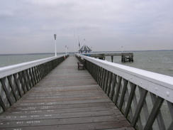
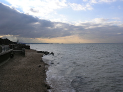
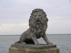
The bus dropped me off at Yarmouth as the Lymington ferry was offloading its cars, the same sailing that I got over on Monday for my previous walk. Unlike Monday today bitterly cold, with a frigid northeasterly breeze that, to my surprise, carried a few flurries of snow. I nipped into a shop near the ferry terminal to buy a few snacks before making my way to the pier. It seemed like a good idea to nip down to the end of the pier to take some shots of the Solent; big mistake. I paid the thirty pence fee and strolled along the boards, taking photos as I went. My hands were soon blocks of ice, and my cheeks were cold despite my beard.
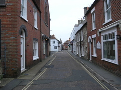
I walked to the end and bade a hasty retreat back to the path. Yarmouth's High Street is very pretty and secluded, with the buildings encroaching over the narrow road. The Solent was just on the other side of the buildings, but could only be seen when an occasional lane led down towards it. The buildings protected me from the worst of the wind and a brisk pace allowed me to warm up.
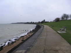
Eventually the buildings on the left opened up, allowing me to access the promenade that runs along the foreshore to the east of the town. This meant that I was exposed to the wind once more, and it was a chilly stroll along the promenade. I was unsure where the trail left the promenade to join the road, so I climbed up the steps the moment that the green ended. The walk along the road was easy enough initially, and when the pavement ended the verges were wide enough to safely walk along.
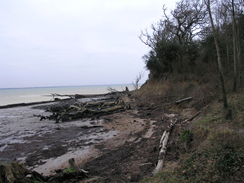
A track headed back to the shore, giving me my first sight of the dominant feature of the day - mud. It reached the shore by some woodland on top of low, fast-eroding cliffs, with mature trees lying on the foreshore. I stopped to change the batteries on my GPS just as a woman walking a golden retriever came past. The dog mistook the batteries in my hand for food and started to run excitedly round my feet, ofrcing me to stop until the owner dragged it away.
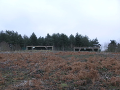
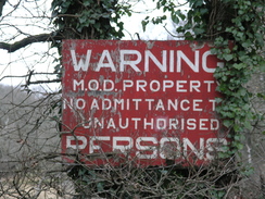
The path headed through the woodland, with some minor diversions due to the clifffalls. Much of the area had recently been cleared, and unfortunately this seemed only to have made the mud worse. A couple of open concrete structures lay at the top of the slope, looking out to sea. They looked military in nature, and indeed a battery was marked on the map. I wondered what the open-fronted structure could have been - they certainly offered little protection from frontal attack.
Unfortunately the trees off to my left blocked most of the views over the Solent, and I got only occasional glimpses. It was a vast difference to the expansive views available on the cliffs at the southern side of the island. The ascent was so slow that I hardly realised that I was climbing; it was hardly the most strenuous climb on the island. Soon the woodland was left behind, and was replaced with a bunch of widely-scattered houses. There was a trig pillar nearby, but as this appeared to be in some gardens so I decided not to visit. I was only a few miles into the day but I was already feeling tired and soporiphic, as if I had already completed ten times the distance. Perhaps this was an effect of the cold on my legs, but already the day was turning into a bit of a drag.
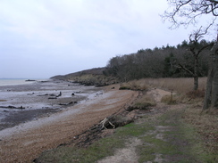
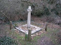
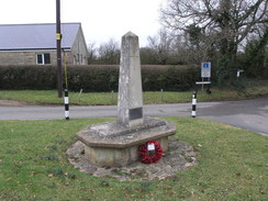
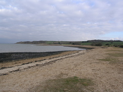
The trail kept high as it started across fields, eventually starting to drop down towards Hamstead Point. More erosion was evident where the side of the track had fallen away onto the foreshore below. It felt good to have some views of the sea once more, and soon I was walking along a path beside the foreshore. A memorial was marked on the map although not on the ground, and it was more or less by accident that I saw a white cross in the overgrowth to my right. I squeezed through to the little clearing in which it stands; shells were scattered around its base, and although the engraved writing was hard to read, it seems to remember two men who died in the water near here.
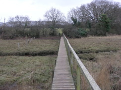
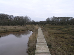
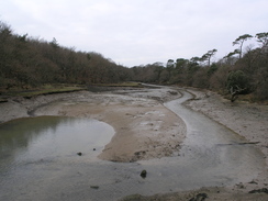
A sailing boat was coming out of the Newtown river ahead of me, its white hull looking magnificent even against the cloudy skies. Here the trail left the sea to head around the large tidal inlets around the river; the first couple of miles to Shalfleet was a particularly unremarkable walk through more woodland and across saltflats. The latter in particular were slippery even where they had built boardwalks, and in one place I slipped over whilst avoiding a boggy patch, somehow managing to land in the only dry patch of ground in the area! Once the shoreline was left behind, the trail went through woodland that was so uninteresting that it was a relief when the main road was reached.
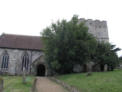
This took me down to Shalfleet, where I diverted off to have a quick look at the church, which seems to have a massively strong, squat square tower that is out of proportion with the nave. The pub in the village was not yet open, so I headed down the road that headed towards a small car park before diving off down towards Shalfleet Mill, which seems to have been slightly over-restored. For some reason it seemed a little too modern, without much of the character expected for a watermill.
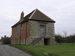
A long road walk took me north towards Newtown, whose name contains two misnomers: it is more a hamlet than a town, and it is scarcely new. The highlight of the village is the Town Hall, a large 17th Century building set at the top of a little hill beside the road. This is now in the care of the National Trust, and its size shows how important Newtown was as a port a few centuries ago - it one returned two MPs.
More footpaths and road took me eastwards towards Porchfield. On the way I met three people walking in the other direction, fellow walkers who were also completing their walk around the island today. Their last leg stretched from Cowes to Shalfleet, so they did not have much further to go. We wished each other luck and plodded away from each other.
There was a pub beside the road, the Sportsmans Rest, and I decided to go in for a little rest. It was warm inside, a much preferable environment to the breeze outside. I ordered a pint and, rather on the spur of a moment, a meal. This came promptly, and it was a relief to see that the plate was large and well-stocked. I wolfed it down with the pint, after which I really did not feel like leaving. The place had a friendly atmosphere, an archetypal country pub. The trail called, however, so I wearily shouldered my rucksack and headed out into the wind.
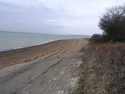
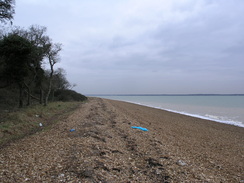
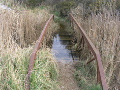
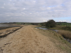
A road and a muddy track took me north towards Great Thorness, after which the trail entered a holiday park. Initial progress was easy with signs pointing the way through the park; soon, however, I realised that I had gone wrong. I cut across a grassy area to reach the proper track, and continued on down to the beach beside Thorness Bay. The wind was not as perishing as it had been first thing in the morning and the stroll along the shingle and sand was enjoyable. The recent rain had left another casualty: an old footbridge across a stream was submerged in water. Fortunately my route did not take me across it, and a much dryer route was reached nearby, needing a mere hop over the waters.
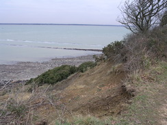
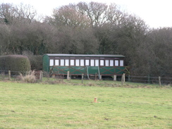
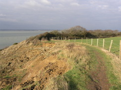
Unfortunately the lovely beach was soon left behind and a path started uphill along the cliff edge. Some holiday cottages lay across the fields to the right, including one that was obviously an old railway carriage, painted in a lovely shade of green. Another looked as though it might once have been a carriage, but one that had been heavily altered. It was a good walk, the only downside being the problem that had plagued my walk around the island: erosion. In a couple of places the path had obviously disappeared down the cliff during the winter, although in both places it proved relatively simple to bypass the falls.
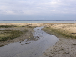
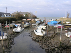
The views out to sea were splendid, and I soaked these up as the path started to descend once more to reach a road by a pretty little harbour at the mouth of the Gurnard River, the small boats anchored to wooden stakes. Although the tide was out, exposing the mud banks, it was a pleasant spot, and must be magnificent at high tide and in the sunshine.
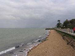
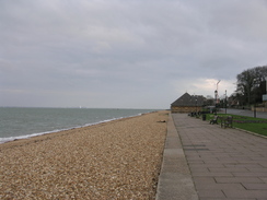
Unfortunately more road walks took me on northwestwards, eventually dropping me down to reach a promenade beside a cafe. This marked the last stretch of the entire coastal path; I spent most of the time on the way to Egypt Point looking out to sea, enjoying the views. On a couple of occasions I nipped down into the surf, using the shingle and water to wash the cake of mud off my boots.
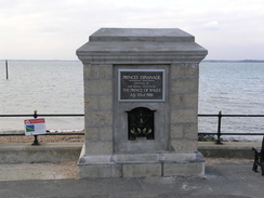
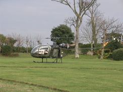
A large house dominated the landward side of Egypt Point, and surprisingly a helicopter sat on the grass in the garden. Nearby there was a plaque on the ground stating that the house opposite, Rosetta Cottage, had been where Randolph Churchill had proposed to his soon-to-be-wife; a union that gave birth to Winston Churchill. The pretty whitewashed house overlooking the Solent did not seem to be grand enough for such a momentous event, but it certainly fitted with Churchill's love of the sea and his time as First Sea Lord.
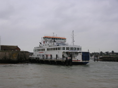
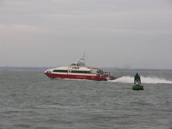
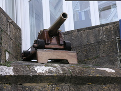
A RedJet headed out of East Cowes as I strolled along. I had been considering extending the walk by continuing along the Medina into Newport, but the wind made me decide against it. I was not cold, but my legs felt tired and heavy. Instead I took my time as I passed Cowes Castle, which is now the headquarters of the Royal Yacht Squadron. A little cannon was visible just above head height; this is the starter's gun, used to set off, amongst other things, the round-the-island race. Signs warned pedestrians that it could go off at any time.
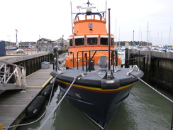
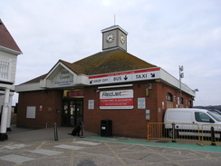
The RNLI are going to be moving into a building in West Cowes within the next couple of years, their current site in a marina in East Cowes not being ideal. The trail headed inland at this building, heading towards the high street. This seemed as quiet in the mid-afternoon as it did in the early morning, and I can only wonder how it copes with the crowds that must congregate in the town for Cowes Week. The ferry terminal was a short distance further on, marking the end not only of this walk, but also of the Isle of Wight Coastal Path. It had been a surprisingly mixed trail, with the northern half of the island having fairly unremarkable walking, whilst the southern and western sides had spectacular views. I will be returning to the island soon.
 |
 |
|
Directions
This walk starts off at the ferry landing in Yarmouth. Turn left out of the ferry terminal and head east along Quay Street. When Pier Street is reached opposite The Bugle Inn, turn right and then take the first road off to the left, the High Street. Follow the High Street eastwards for a fifth of a mile; after the last house on the left, turn left to join the promenade.
Follow the promenade eastwards for a third of a mile; when a patch of scrubland is reached at ST363897, turn right to ascend some steps up onto the A3054 road. Turn left and follow this road as it curves eastwards through Bouldnor for about half a mile; the pavement soon ends, but the verges are wide enough to allow you to safely walk along them. At SZ371897 turn left down an unsurfaced track called Victoria Road.
This soon ends at the coast. Turn right to join a footpath that starts heading eastwards through woodland along the top of the cliffs; due to erosion it is best to be careful and follow the obvious paths and keep away from the edge. It soon descends to meet the foreshore before climbing up once more, slowly ascending with the remains of a concrete bunker - part of a battery - up the hill to the right, which might be obscured by trees. The path becomes easy to follow as it runs along the top of the cliffs, although they descend down to disturbed landslips rather than the sea.
Eventually it emerges from the woodland at SZ387905. A path heads eastwards with a hedge on the left; it soon curves to the left to meet a track called West Close. Turn right and start following this eastwards; when a junction is reached turn left to head northeastwards along Cranmore Avenue for about a fifth of a mile until SZ391908. Turn right down a footpath with a driveway on the left; when the driveway ends continue on along the footpath as it heads eastwards across fields.
It skirts around to the south of Hamstead Farm, keeping the hedge on the left. Before another hedge is reached turn right to head eastwards with a hedge on the right. Continue roughly in the same direction across three fields until a track is reached at SZ398911. Head down this track northeastwards towards Hamstead Farm; keep the majority of the farm buildings on the right. Immediately after the farm, turn left down another track. This heads northeastwards, descending to meet the edge of the cliff and after half a mile reaches the foreshore by Hamstead Ledge.
Continue eastwards along the foreshore, passing Hamstead Point. At SZ408919 turn right up some steps and take a footpath that head south across a field, with a hedge on the left. It then continues across an area of marshland for a short distance before climbing up into another field. Head southeastwards across this field with the marshland a short distance away to the left. When a hedge is reached pass through it, then turn right to head south with the hedge on the right.
This emerges onto the edge of some more marshland at SZ411913. A set of boardwalks carries the path south along the edge of the marshland, before turning sharply to the left to head eastwards along the southern edge. The boardwalk soon ends and a muddy path continues on; this can be slippery after wet weather. It is a relief when the path turns to the right to enter a field, then turns left to follow a hedge on the left eastwards until it ends at a track at SZ414912, with a jetty a short distance away to the left.
Turn right and follow this track as it heads southwestwards, passing Lower Hamstead Farm on the left. After a quarter of a mile the track curves to take a more westerly course, and after further three-quarters of a mile it ends at a junction with another track at SZ400903. Turn left and follow the track southwards for a little over half a mile; it descends to cross Ningwood Lake.
Shortly after this the track starts to climb and curves to the right; as it does so take a footpath that heads off to the left, entering the trees. It soon descends to meet a footbridge over a stream; cross this and enter a field. Keep the hedge on the left as you head eastwards; at the corner of the field turn right and follow the hedge southwards until a stile is reached. Cross this stile to gain access to the A3054 road at SZ405892.
Turn left and started following this road eastwards for half a mile. Again there is no pavement, but the verge is wide enough to allow you to keep away from the traffic. The road enters Shalfleet; shortly after the church on the right, turn left down Mill Road past the New Inn. This heads northwards for a couple of hundred yards. When the track splits just after a car park on the left, turn right to take a track that leads down towards Shalfleet Mill.
Keep the mill on the right as the track becomes a path that crosses a stream. Continue along the track on the other side as it climbs steeply; at the top it curves to the right to meet another track at about SZ416895. Turn left and follow this track eastwards for a few hundred yards until it ends at a T-junction with Corf Road.
Turn left and follow Corf Road northeastwards for nearly half a mile; shortly after it curves to the right turn left along Town Lane. Follow this northwards for 0.4 miles; it descends to cross the end of Causeway Lake and then climbs to pass to the left of the Town Hall. When a road comes in from the left shortly after this, turn right to go through a pedestrian gate beside a larger gate.
This footpath heads east-southeastwards across a series of long fields. Initially there are hedges on either side; it eventually opens out and the path becomes vague on the ground as it continues in roughly the same direction. It passes through a band of trees before reaching a road at SZ429903. Turn right and follow this road as it curves to the left to take a more easterly course. After a mile it curves to take a more northerly course, passing the Sportsman's Rest pub in Porchfield. Continue on for half a mile after the pub until he road starts to curve to the right at SZ451917.
Cross a stile and head north, initially with some woodland on the right. At the end of the field cross a stile and continue on with a hedge on the right, becoming a muddy track as it continues northwards. When a caravan park is reached, turn right to head south of South Thorn Farm to reach Thorness Lane at SZ451925. Turn left and follow this road as it heads northwards for a short distance before it curves to the left. Immediately after the bend turn right along another footpath that heads across some pasture before ending at a track in a holiday park.
Turn right and start following a track northeastwards through the park; there is good signage. The track passes the main park buildings on the right and continues northeastwards until the beach is reached at SZ454933. Turn right and start following the path as it runs between the beach on the left and the marshland on the right. When a concrete bridge across a stream is reached after 0.4 miles at SZ459936 turn right to cross the bridge, and then turn immediately to the left to join a footpath.
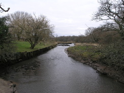
This footpath starts climbing uphill with a field on the right and the cliff edge on the left; it remains stuck to the cliff edge for over a mile, slowly climbing. Cliff erosion is a problem here, so care needs to be taken. It eventually starts to descend, curving to the right to reach a road beside the mouth of the River Grunard at SZ470953.
Follow this road as it heads eastwards parallel to the coast for half a mile, eventually heading uphill before ending at a junction with Worsley Road at SZ477955. Turn left along this road and follow it as it curves to the right; shortly after the bend turn left down a paved footpath. This descends to meet the same road; continue straight on along Shore Road. This crosses a stream and then curves to the left to head north, becoming Prince's Esplanade.
Prince's Esplanade soon meets the coast; leave the road and join the esplanade as it heads northeastwards along the coast for half a mile to Egypt's Point, becoming Egypt Esplanade on the way. Continue on eastwards for another half a mile until Cowes Castle is reached. The esplanade curves to the right and continues on southeastwards towards West Cowes.
The esplanade ends at SZ495963. Turn right to had along a narrow lane that passes the Union Inn to reach another road in the centre of the town. Turn left along this road, and follow it as it winds southwards for a few hundred yards. Just before the Fountain Inn is reached on the left, turn left through an archway to reach the ferry landing, where this walk ends.
 |
 |
|
Distances
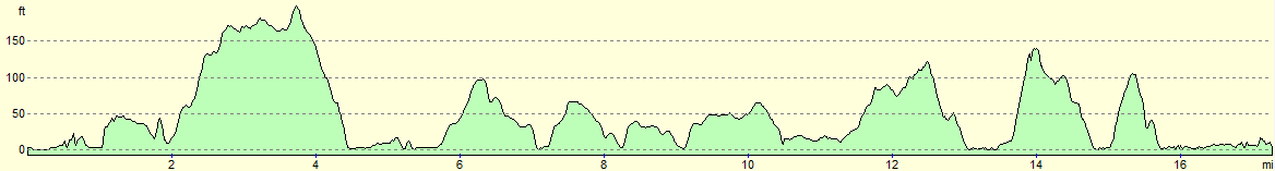
| From | To | Distance (m) | Ascent (ft) | Descent (ft) |
|---|---|---|---|---|
| Yarmouth | Shalfleet | 8.0 | 571 | 545 |
| Shalfleet | Great Thorness | 4.4 | 266 | 194 |
| Great Thorness | West Cowes | 5.0 | 374 | 472 |
This makes a total distance of 17.4 miles, with 1211 feet of ascent and 1211 feet of descent.
For more information on profiles, ascents and descents, see this page
Transport
It is possible to travel between West Cowes and Yarmouth. Southern Vectis route 1 travels frequently between West Cowes and Newport; you will then need to change to the hourly route 7 to reach Yarmouth.
 |
 |
|
 |
 |
|
 |
 |
|
 |
 |
|
 |
 |
|
 |
 |
|
 |
 |
|
 |
 |
|
 |
 |
|
 |
 |
|
 |
 |
|
 |
 |
|
 |
 |
|
 |
 |
|
 |
 |
|
Disclaimer
Please note that I take no responsibility for anything that may happen when following these directions. If you intend to follow this route, then please use the relevant maps and check the route out before you go out. As always when walking, use common sense and you should be fine.
If you find any information on any of these routes that is inaccurate, or you wish to add anything, then please email me.
All images on this site are © of the author. Any reproduction, retransmissions, or republication of all or part of any document found on this site is expressly prohibited, unless the author has explicitly granted its prior written consent to so reproduce, retransmit, or republish the material. All other rights reserved.
Although this site includes links providing convenient direct access to other Internet sites, I do not endorse, approve, certify or make warranties or representations as to the accuracy of the information on these sites.
And finally, enjoy your walking!
Nearby walks
| # | Title | Walk length (miles) |
|---|---|---|
| 305 | Tipner to Browndown | 18.9 |
| 306 | Browndown to Bursledon | 12.9 |
| 307 | Bursledon to Southampton | 9.2 |
|
|

|