Walk #975: Pennine Bridleway: Blackwell to Hayfield
 |
 |
|
General Data
| Date Walked | 06/03/2013 |
| County | Derbyshire |
| Start Location | Blackwell |
| End Location | Hayfield |
| Start time | 07.09 |
| End time | 14.53 |
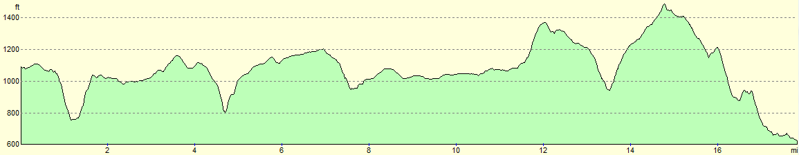
| Distance | 17.8 miles |
| Description | This was a vaied stroll; a descent into the beautiful Chee Dale was followed by rather too much road and track walking to Rushup Edge, albeit through some pleasant scenery. The last few miles north from Rushup Edge were very enjoyable and easy, with some great views. |
| Pack | Today I carried my 30-litre Karrimor rucksack, filled with water, my waterproofs, a book and other odds and ends. |
| Condition | I had shooting pains in my lower back at some times during this stroll that made progress dififcult at times. |
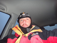
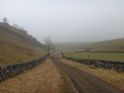
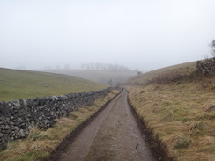
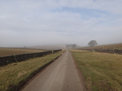
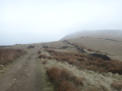
| Weather | Fog and low cloud dominater today's weather, athough the sun did make valiant attempts to burn through during the day. It was not a warm day, forcing me to keep my coat and balaklava on until the end. |
| OS map | {OSMap OL24 and OSMap OL1} |
 |
 |
|
Map of the walk
Maps courtesy of Google Maps. Route for indicative purposes only, and may have been plotted after the walk. Please let me have comments on what you think of this new format. For a detailed table of timings for this walk, please see the table file.
 |
 |
|
Notes
I awoke this morning to be greeted to a warmer morning, but the price of that was a thick fog. As today's walk left from the campsite I faffed around for a while, before getting my kit together and heading off.
There were a series of steep climbs to be done today, and I was not really looking forward to any of them. The trail down the first descent into Chee Dale was not obvious from the map, and it looked an unlikely route for a bridleway. Instead of worrying about it, I relied on the national trail waymarking as a track slowly fell.
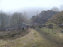
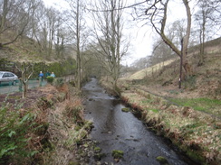
Soon a waymarked path headed off to the left across fields, away from the route on the map. I followed the markers as the noise of the A6 intruded. It led to the top of a steep-sided valley that led down into the dale. On a sunny day it would have been a wonderful day; however in the fog it was far from pleasant. The trail crossed the western end of the Monsal Trail on a bridge, before descending to meet the trail. Here the Pennine Bridleway forks as a wet-weather route follows the old railway line for times when the River Wye is flooded. I ignored this and headed down a steep path that led to the lovely little hamlet of Cheedale, situated in a triangle of railway lines.
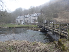
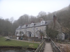
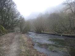
The houses were built by the Midland Railway to house workers on the line, and are situated in one of my favourite places in Derbyshire. I crossed the footbridge over the river, annoyed that I could not take very good photos in the fog, and then followed a narrow riverside path that easily floods when the river is up.
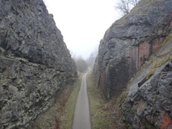
Every descent is rewarded with a climb, and soon I was struggling out of the valley. The path passed under an old railway line before rejoining the wet-weather route. What followed was a series of zig-zags up the hillside that proved to be surprisingly easy to climb, although sadly the views, which should have been spectacular along the valley were obscured by fog. I tried to imagine a steam train making its way below the spectacular cliffs and felt a moment of dismay that I had never seen such a sight.
Eventually the gradient slackened. The trail headed through a farm, and then continued along a track that was nearly obscured by stones that had fallen from the walls on either side. A short path across a field then led to a surfaced track that headed north. It was a fairly uninteresting stroll and time seemed to drag. Off to the left is the Old Moor quarry, which is part of what has been called Britain's first superquarry that produces 5.5 million tonnes of limestone each year. The Old Moor part opened in 1980, and controversially lies just within the boundaries of the National park.
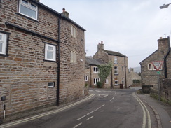
The trail passed a small row of houses, two of which were dilapidated; I guess living in this remote area is not too popular. It was a relief when the trail left the road and a track and paths led east, climbing and then falling to reach the hamlet of Wormhill. It did not spend long there, and soon headed off once more along a track that soon started to fall steeply. The stones underfoot were slippery and I had to take more than a little care, but eventually I reached the road that led down into Monk's Dale.
Here I met the Limestone Way, which the trail would flirt with for the next couple of miles. However I would be walking it in the opposite direction, meaning a steep climb uphill along the road. Eventually the gradient slackened and a road and track headed north towards Wheston. I was getting a bit fed up of road walking by now, and sadly there was another mile of road north. The sun was making valiant attempts to burn through the fog, and there was the merest transitory hints of blue sky overhead.
A track then led off, descending down into Hay Dale. Again the stones on the descent were slippery and I took my care, but despite this I started getting sharp pains in my lower back if my feet slipped. Sadly the trail did not enter the beautiful Hay Dale itself, and instead climbed up out of the valley to reach a road. This road headed north for over a mile before reaching the A623 road in Peak Forest.
A bench by the road proved too tempting to ignore, and I took my rucksack off and tied stretching my back. It was not a particularly pleasant place to stop as it faced the main road, so I soon reshouldered my rucksack and continued along the trail. Soon I passed a long string of other walkers, and we exchanged pleasantries before I continued on. It was not a particularly notable stretch of road, although things improved when it started the descent down Perry Dale, whose low grassy hillsides were at least scenic.
The road ended at Perryfoot, after which yet another road took me north past a long pond on the right. I wondered if this was some form of flash pond used in mining. The road started climbing slowly, reaching Rushop Hall (which for some reason has a different spelling from the famous Rushup Edge a short distance to the northeast), and then climbed steeply to end at another road.
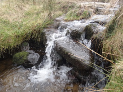
This marked the point where the nature of the trail changed. So far the trail had been dominated by hard surfaced underfoot; for the next few miles I would be following tracks of various qualities. The track descended to cross a little stream, before climbing once more and repeating for a second stream. I was feeling rather elated despite the occasional spasms of pain in my back. A long descent then started down into Roych Clough; on the way I passed another band of intrepid walkers who were making their way up in fine fettle. The path was a curious mixture of loose rocks and sand, and also carefully carved bedrock.
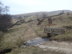
Eventually I reached the bottom, where two streams were crossed on footbridges. I stopped at a small bench between the two streams, took my pack off and lay on the grass to stretch my back. It was a wonderful spot, and at least the weather was improving slowly. Eventually I got up, put my boots and rucksack back on and started the long climb out of the valley. I had expected this to be hard but it proved remarkably easy; it also gave me good views back over the descent into the clough.
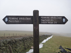
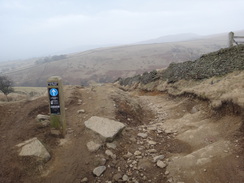
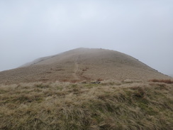
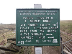
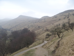
Eventually the small hill of South Head was reached, from where a path leads towards Brown Knoll and Kinder Scout. My route started descending down towards Hayfield, now only a couple of miles away. The views over the surrounding hills were very pleasant (despite one being called Mount Famine), although these reduced as the trail descended. It joined a track for a short distance, before heading off across fields.
The descent down to Hayfield took much longer than I expected along paths and tracks that never seemed to end. It neared a road at one point before diverting away and passing the woodland on Elle Bank. Eventually a campsite became visible in the valley below, and the path joined a road beside the River Kinder. From here it was simply a case of following the road into the centre of Hayfield.
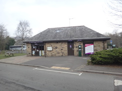
I had a slight problem in the village, as I did not know where the bus back to Buxton would depart from. I walked around a while before a local pointed me towards the bus station, which is on the site of the old Hayfield station. I went down there, and only had a five minute wait for the bus. It had been a good day's walk despite the foggy weather; however the highlight had to be the stretch from Rushup Edge to South Head, which was an easy but picturesque stroll.
 |
 |
|
Directions
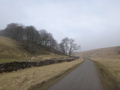
This walk starts at a bend in a road in the little hamlet of Blackwell at SK123720, with a campsite a few yards away. Leave the road through a bridleway gate beside a field gate to join a track that runs between stone walls. At SK119722 go through a bridleway gate beside a field gate. Ignore a track leading off to the right and instead head straight on along another track for twenty yards to reach another bridleway gate/field gate combination. The track then curves to the left; at SK116723 go through a farm gate and follow a wall on the right. As the main track curves to the left continue straight on; the path soon curves away from the wall and passes a dew pond on the right to reach a bridleway gate, with the A6 a short distance away.
Go through a bridleway gate and turn right to head northwestwards down a steep-sided valley. Go through a bridleway gate at the bottom and cross a bridge over the Monsal Trail at SK112726. On the other side of the bridge follow the path as it curves left and then right downhill; if the river is high then you may want to take a waymarked alternative route from the bridge. At the bottom the path crosses a little parking area before reaching a footbridge over the River Wye in front of the wonderful cottages in Chee Dale at SK112726.
Cross the footbridge, and on the other side turn right to follow an obvious path alongside the river on the right. When the path forks, take the left-hand branch which immediately starts to climb uphill. This curves left to pass under a railway bridge, and on the other side right to reach a bridleway gate. Go through this and follow the path as it turns left and continues climbing with the old railway trackbed down to the left. The path soon curves to the right, then left and finally right once more in a series of hairpins up the hillside. A wall on the left is soon joined by one on the right as the gradient slackens; this leads to a farm gate.
On the other side of the gate, turn right along a track that passes Moseley Farm on the right. As the track curves to the right, turn left to head away from the farm to reach the start of a track that runs between two stone walls. Follow this north; when a farm gate is reached after 150 yards, turn right through a gap in a wall to enter a field. Keep some trees on the left as you head east across the field to reach another bridleway gate.
Go through the brideway gate to reach a surfaced track at SK116731. Cross this track and go through a second gate to join a path that runs between two stone walls. Turn left to follow this path as it heads north parallel to the track; when it ends after about 150 yards go through another bridleway gate ahead to join the track. Continue following the track northwards as it twists and turns; after nearly a mile it joins a public road at a sharp right-hand bend at SK110743. Continue along the road as it heads north, passing some houses on the right.
After a sixth of a mile, turn right along a track that climbs uphill between stone walls. At the end of the track go through a farm gate to enter a field. Follow a wall on the right uphill; go through a farm gate ahead to join a rough track that follows a wall on the left. At the end of this field go through a gateway and continue along the track starts to fall, reaching another gate. Go through this and follow the track as it heads through Old Hall Farm, swinging to the left and then right past the buildings before descending to reach a road in the hamlet of Wormhill at SK122745.
Turn right to follow the road south for a short distance, before taking a track that leads off to the left. This track soon becomes rougher as it continues between stone walls. This heads eastwards uphill; after a quarter of a mile follow the path as it curves to the right to reach a field gate at SK126745. On the other side the path turns left and continues between walls before jinking once more to reach a bridleway gate. On the other side follow the path as it curves to the left and continues downhill northeastwards between stone walls. After a short distance a rough track crosses the path; turn half-left to continue downhill between walls. The walls end at a gate at SK130750; go through this to enter a field. Instead of following a wall downhill on the right, turn slightly to the left and follow the hillside gradually downhill to reach a field gate that leads out onto a road at SK129752.
Turn right to follow the road down into Monk's Dale; on the other side it climbs steeply uphill before the gradient slackens. After half a mile on the road, a junction with another road is reached beside a cottage at SK136752. Turn left to follow this road as it heads north-northwestwards. When the road curves to the right after a third of a mile, continue straight on along a rough track that runs between stone walls as it climbs gradually uphill before summiting and starting to descend once more. When the track forks, take the right-hand branch that heads down past a farm before ending at a road at SK133763 in Wheston.
Turn left along the road for a few yards, and then right up another road. Follow this as it winds around in a rough northerly direction for a mile. At SK127778 turn left down a rough track that runs between walls. Follow this track as it descends west-southwestwards; the gradient steepens as it curves to the left to reach Hay Dale. When the bottom is reached after 0.7 miles, do not go through a gate ahead and instead turn hard right to follow a track that leads back uphill to the west; after a third of a mile this reaches a road opposite a junction at SK112773.
Turn right and follow the road north; after 1.2 miles this ends at a T-junction with the A623 road in Peak Forest. Turn right for a few yards to reach a pedestrian crossing that can be used to cross the road. On the other side, head straight on up Church Lane. After a quarter of a mile the rod swings to the left to head northwestwards; it crosses a cattle grid and some farms before entering Perry Dale. After 1.3 miles it approaches some barns; go through a bridleway gate beside a cattle grid and continue to reach a road junction in Perryfoot at SK100812.
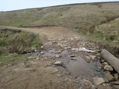
Carefully cross the road, and on the other side join a path that curves left to parallel the road; this soon ends at another road. Turn right to follow the road; initially this heads north before curving to take a more northwesterly course and climbing steeply uphill past Rushop Hall. After nearly a mile it ends at a road junction at SK091824. Cross the road and go through a bridleway gate beside a farm gate to join a rough track. This descends and curves around to ford a stream before climbing once more to reach a field gate. Follow a wall on the left and a fence on the right past another couple of field gates.
Pass a little patch of woodland on the left and follow the track as it curves to the right to descend down to cross another stream on a bridge. On the other side the track climbs once more and goes through another couple of field gates, after which it starts to fall. Go through another gate and continue down the rather rough track into Roych Clough. At the bottom cross a footbridge over a stream, then go through a field gate to reach another footbridge. Cross this and follow the track as it starts to climb in a long left-hand bend which leads to a right-hand curve, after which it settles on a northwesterly course.
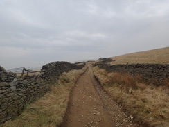
Go through a bridleway gate at SK071837 and continue on between wide-set walls. Pass a track coming in from the left and then go through a bridleway gate beside field gate and continue up to reach the summit of the path by South Head at SK061846. The track curves to the left to descend past the hill. Go through a field gate at SK056846 and continue on, following a stone wall on t he left that leads to a bridleway gate beside a field gate. On the other side immediately turn left through a second gate, and then right between stone walls for five yards to a third gate.
Continue down the track which soon joins another track; turn right down the new track. Just before a track junction ahead, turn right through a bridleway gate to join a footpath that runs between a wall on the left and a fence on the right. It climbs slightly uphill to reach a bridleway gate. On the other side the fence ends; continue following the wall for about a hundred yards to reach another bridleway gate. The path the curves around downhill to the left. When the track forks, take the left-hand, upper, branch that heads towards a surfaced track ahead.
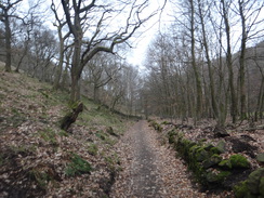
Join the track and follow it ahead for about five yards before turning off left along another footpath that climbs along a rough track up a slight slope. Go through a bridleway gate in a stone wall, after which the path runs between a wall and some woodland on the left, and a fence on the right. The fence is soon replaced by a wall. Continue between the walls, which are sometimes broken-down or non-existent, as the path curves past a house away to the right. The path drops to reach a bridleway gate at SK045866.
go through the gate to reach a road, with the River Kinder away to the right. Follow the road as it heads west; it sometimes climbs and falls, but after half a mile it reaches a road junction in Hayfield at SK037868. Turn right along Church Street and follow the road downhill. Just before the church is reached, turn left along a narrow lane that passes the Bulls Head on the left. This lane soon ends at a small turning area. Pass though this and go past the end of a low stone wall to reach the A624 road. Cross this using the pedestrian crossing, and on the other side cross a small access road to reach Hayfield car park and bus station at SK036869, where this walk ends.
 |
 |
|
Distances
| From | To | Distance (m) | Ascent (ft) | Descent (ft) |
|---|---|---|---|---|
| Blackwell | Peak Forest | 9.3 | 1220 | 1407 |
| Peak Forest | Hayfield | 8.5 | 1253 | 1634 |
This makes a total distance of 17.8 miles, with 2473 feet of ascent and 3041 feet of descent.
For more information on profiles, ascents and descents, see this page
 |
 |
|
Accommodation
I spent the night at Beech Croft Farm Caravan Park & Camp Site, a lovely caravan and camping site near Taddington. This is a lovely little campsite that is situated just off the A6 between Bakewell and Buxton. They can be contacted on 01298 85330.
Transport
Two buses are required to get back from Hayfield to the start of the walk.
The first is the High Peak 61 service from Glossop to New Mills. This can be caught from Hayfield bus station to Buxton Market Place. It runs roughly every hour during the week, and takes a little under an hour for the journey.
The High Peak Transpeak bus service follows the A6 from Buxton Market Place to a bus stop near the campsite in Taddington ("Blackwell Turn"). It runs roughly every hour during the week, and takes under an hour for the journey.
 |
 |
|
 |
 |
|
 |
 |
|
 |
 |
|
 |
 |
|
 |
 |
|
 |
 |
|
 |
 |
|
Disclaimer
Please note that I take no responsibility for anything that may happen when following these directions. If you intend to follow this route, then please use the relevant maps and check the route out before you go out. As always when walking, use common sense and you should be fine.
If you find any information on any of these routes that is inaccurate, or you wish to add anything, then please email me.
All images on this site are © of the author. Any reproduction, retransmissions, or republication of all or part of any document found on this site is expressly prohibited, unless the author has explicitly granted its prior written consent to so reproduce, retransmit, or republish the material. All other rights reserved.
Although this site includes links providing convenient direct access to other Internet sites, I do not endorse, approve, certify or make warranties or representations as to the accuracy of the information on these sites.
And finally, enjoy your walking!
Nearby walks
| # | Title | Walk length (miles) |
|---|---|---|
| 13 | Edale and Kinder Scout | 11.0 |
| 17 | Alport circular | 11.8 |
| 19 | Castleton circular via Lose Hill and Mam Tor | 7.7 |
|
|

|