Walk #1034: London Loop: Orpington to Coulsdon
 |
 |
|
General Data
| Date Walked | 03/02/2019 |
| County | London, Surrey |
| Start Location | Orpington station |
| End Location | Coulsdon South station |
| Start time | 07.24 |
| End time | 15.26 |
| Distance | 22.3 miles |
| Description | This was a very pleasant, if surprisingly strenuous, stroll following the London Loop west through South London. |
| Pack | Today I carried my 30-litre Karrimor rucksack, filled with water, my spare waterproofs, a book and other odds and ends. |
| Condition | I feel fairly tired after this walk, but am otherwise fine. |
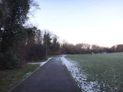
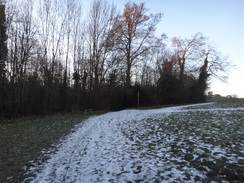
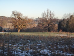
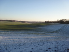
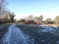
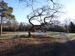
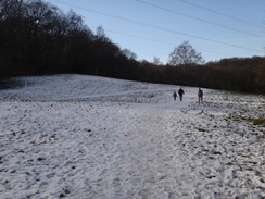
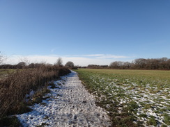
| Weather | The day started off cold; well below freezing, and with remnants of snow lying on the ground. There was barely a cloud in the sky all day, and by the afternoon the temperature was at about four or five degrees. All in all a superb day for a walk. |
| OS map | Landranger number 177 (East London, Billericay & Gravesend) and Landranger number 187 (Dorking, Reigate & Crawley area) |
 |
 |
|
Map of the walk
Maps courtesy of Google Maps. Route for indicative purposes only, and may have been plotted after the walk. Please let me have comments on what you think of this new format. For a detailed table of timings for this walk, please see the table file.
 |
 |
|
Notes
I missed a walk last week, due to Sencan being ill. The chances of walking this week did not look much better, as we had had some snow during the week, and even London had got a heavy load. However it was thawing fast, and the forecast was for a bright, sunny day, if cold at first. I had been annoyed that my photos of my first four days on the London Loop had been somewhat spoilt by grey skies, so I resolved not to waste a sunny day. I drove down to Orpington, arriving slightly after seven, and just as dawn was breaking. I was relieved to see the car park cost only one pound for the day on Sunday.
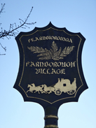
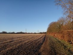
My first mile retraced my steps from the previous walk, up from Orpington to meet the London Loop in Farnborough. It was an unremarkable stroll, especially as the town had yet to wake from its Sunday slumbers. A lorry was stationed under a bridge outside the station, with cables stretching up from generators on its loadbed up to the bridge. I paid little notice to it, but its presence was a sign of a problem later in the day.
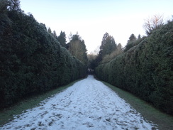
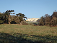
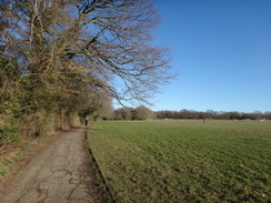
From Farnborough the trail led past houses and then cut across farmland, with patchy snow and ice in the lee of some woodland, to reach the High Elms Country Park. A manor house was built on the site in 1842 by the Lubbocks family, who sold it to the council in 1938. The building burnt down in 1967, which was probably a relief to the council who owned it. The formal gardens remain, and were popular even at this early hour. The route through the gardens was not well waymarked, but I found by dead-reckoning the correct route. This passed an Eton Fives court, which caused a flashback to my schooldays (not, I hasten to add, at Eton – we plebs played Rugby Fives!). A pleasant avenue of tall conifers, the ground between covered in snow, led to a golf course car park and a road.
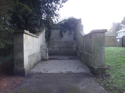
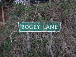
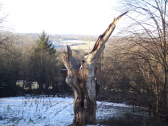
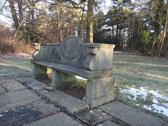
An unsurfaced lane called 'Bogey Lane' led off the road; it was appropriately named as in places it was muddy and unpleasant, and a concessionary footpath that ran alongside offered occasional good views to my right. This led down to another road, and then a path headed steeply uphill past the entrance to Holwood House, and on to the Wilberforce Oak. This is now little more than a shattered hulk, but was the scene of an important meeting in 1787 between William Wilberforce and William Pitt the Younger, who owned Holwood House at the time. They sat beneath the ancient tree and resolved to bring forward a bill to abolish the slave trade. That meeting was the start of the process to abolish the slave trade, and a nearby stone seat – sadly fenced off – was built shortly afterwards to commemorate the event.
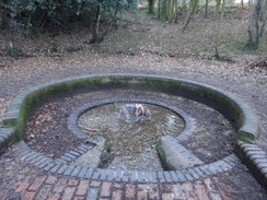
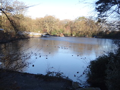
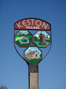
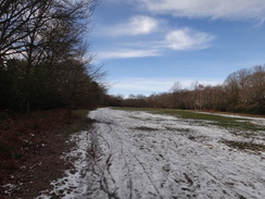
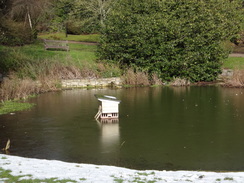
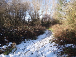
A circular building was visible through the leafless trees – apparently an apartment block – as the path headed down through the trees to a main road and into another country park. A path descended past a car park slippery with snow and ice, to reach a circular spring called 'Caesar's Well' – the source of the River Ravensbourne. A dog was splashing around in the spring, whilst the path headed on down past a couple of ice-covered lakes and entered Keston itself. It was an enjoyable stretch of walk, but I was all too aware that there was some strenuous walking to come, so I nipped into a local shop to buy some snacks.
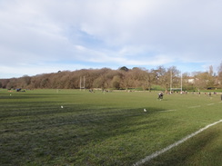
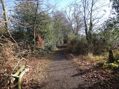
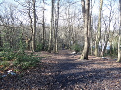
Another pleasant stretch of walk followed through woodland on Keston Common, skirting the fences of Coney Hall. This led to an area of earthworks in a clearing, which was apparently an old hillfort that was never completed, and which later was used for warrening. A steep descent led down into Coney Hall, after which the trail crossed some rugby pitches that were busy with player practicing, before climbing west through a series of woods, never far away from houses.
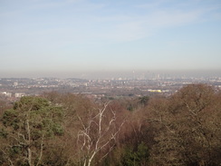
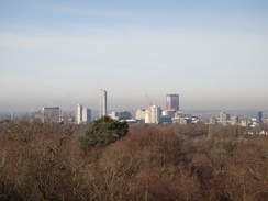
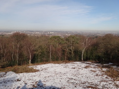
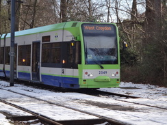
The trail skirted the road in Shirley, before starting a steep climb through trees onto the Addington Hills, where a viewpoint offered superb views north over London, including Canary Wharf, the city and, nearer, tower cranes over Croydon. The trail continued on past a Croydon Tramlink stop before diving down to a little lake at Heathfield, and then climbing more steps on the other side – a nasty descent and climb that seemed to have little point given there was probably a more direct route through the houses.
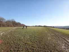
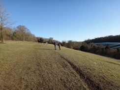
For some reason I was starting to feel more fatigued than usual after such a distance – perhaps a result of the ascents or having not eaten enough food. I pressed on as the trail continued alternating through parks, woodland and housing estates. Londoners are lucky to have this sort of terrain literally on their doorsteps – it isn't the Highlands or the Lakes, but it is great walking.
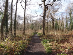
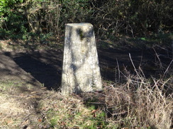
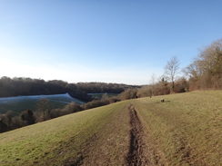
The trail climbed up through Selsdon Woods, and descended the other side towards the Surrey border, before taking a series of paths and tracks through to Hamsey Green. Another good – if occasionally icy – track led towards a trig pillar, the only one on the trail, and then steeply down Riddlesdown, crossing a railway bridge that had evidently just been restored, and on to the A22 in the valley. I've driven down this road many times on the way to visit friends nearby, and walked along it before, but it was still good to see it again. Behind me, a railway viaduct that stretched in front of a gleaming white face of an old chalk quarry looked almost like a model railway diorama.
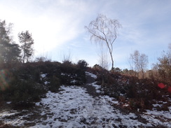
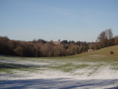
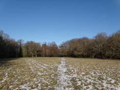
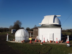
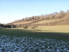
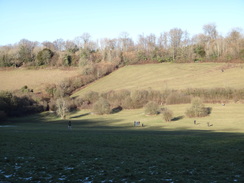
The trail crossed another railway line – the valley being an important transport route – and then ascended steeply up onto Kenley Common and past the remains of Kenley Airfield, which apparently is the best preserved of all London's World War 2 airfields. All I saw was the mound of an old air-raid shelter. More prominent was a glistening white dome belonging to Kenley Observatory. The trail continued into Old Coulsdon, and then through an area that I was surprised to discover was bustling with people. The reason soon became clear as I approached a beautiful grassy valley called 'Happy Valley'.
I had to skirt around a very icy slope to get to the valley bottom, but the south-facing slope on the other side was thankfully free of ice. It was a spectacular location, especially this near London, and lots of people were taking advantage. This was the last climb of the day, and it was a gentle one as the path approached a road that ran along the top of Farthing Down. I strode along the road, eschewing the grassy paths on either side, and eventually descended down into Coulsdon and its station.
This was where I had planned to finish the day's stroll, and 22 miles was a good distance to end at. However I had two options: to continue on for another four mile to Banstead, or to walk two miles to Purley to see if some friends of mine were in. I considered both of these, but as a train was due in a few minutes, and I was already tired, I decided to call it a day.
A train took me south to East Croydon, where I just had time to nip into a shop to buy a bottle of water before catching a Croydon tramlink tram to Beckenham Junction. Again the Gods of train timetabling shone favourably on me, as I had a few minutes to wait for a train that should have taken me to Orpington. Those Gods had a last laugh, however, and this train stopped at South Bromley as the line onwards was shut – which was probably why I'd seen the workmen at the beginning of the day. A bus eventually took me on to Orpington, but it probably cost me a forty minute delay.
It had been an excellent day's walk, and one that I will definitely want to walk again sometime in the future. London can be a superb city.
 |
 |
|
Directions
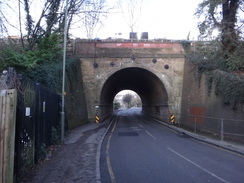
This walk starts off at Orpington railway station, at TQ45476583. Leave the station and walk down to reach the A232. Turn left down the road; depending on which entrance you left from, you might have to go under a rail bridge. Cross over to the right-hand side of the road at a pedestrian crossing and continue on, passing the Maxwell pub on the right. Shortly after this, turn right up Tubbenden Lane. After 1.5km a roundabout is reached with the A21; turn right for about 70 metres along this road, until the London Loop comes in from the right at TQ44616464.
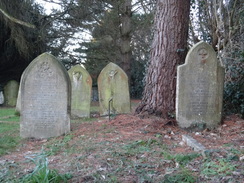
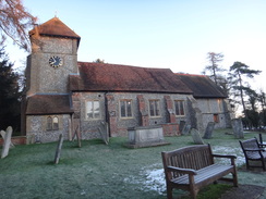
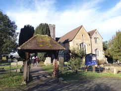
Carefully cross the road, and on the other side take a surfaced path that continues between a fence and a hedge. This passes a small car parking area, and on the other side continues between fences to emerge out onto a road. Cross the road ahead, and then continue straight on along Gladstone Road. This eventually curves left and ends at a T-junction with the B2158 in Farnborough. Carefully cross the road, and on the other side turn right for a few metres and then left along Church Road. Join the pavement on the right, which becomes a raised walkway that curves right through a lych gate to reach Farnborough church at TQ44376412.
Follow the path as it curves right and then left, passing the church on the left, and then descends south through the churchyard. Go through a gateway to leave the churchyard into a field. Head south downhill along the field, keeping the edge of some woodland to the left. After nearly 400 metres the woodland curves sharply right; head straight on into the trees. Cross a minor path, and continue on for a few metres to reach Shire Lane. Cross the road, and on the other side go through a gap to continue along a path, signposted High Elms. This soon emerges out into a car park at TQ44566353.
Skirt the left-hand side of the car park, and at the far end go past a vehicle barrier beside an information board. Head up a surfaced path for about thirty metres, and when this meets a surfaced track, turn right along it. This soon curves left and climbs a slight slope, passing a Fives court on the left. Go past a vehicle barrier and continue along the track as it curves right. The track ends at a little turning area; continue across a grass terrace (the site of the old High Elms mansion) and then along a grassy path between two high hedges. When the hedges soon end, go through a clappergate beside a field gate to enter a golf club car park. Skirt the left-hand side of the car park, and follow its access road for a few metres. As the access road curves right, continue straight on down a muddy path that angles across to meet a road at TQ44346308.
Cross the road and go through a gap in a fence opposite to join a path, and then immediately turn left along another footpath that follows a hedge on the left (with the road behind it). The path soon curves right and starts to climb, sometimes through a band of trees and sometimes in gaps between sections of the golf course. It finally settles into the trees as it crests a hill and starts to fall; ignore any paths leading off the path. After 500 metres the path emerges out onto North End Lane. Turn left to follow the road southwestwards for 100 metres until the junction with the unsurfaced Bogey Lane is reached at TQ43766310.
Turn right to follow Bogey Lane uphill; after a few metres steps lead up into the field on the left. This is a permissive path, to avoid the boggiest sections of Bogey Lane. Once in the field turn right to follow the hedge on the right, with the lane below the hedge. When the field's corner is reached after about 500 metres, turn right down some steps to rejoin the lane, and turn left as it runs between hedges; ignore any paths leading off. After another 300 metres the lane ends at a junction with the surfaced Farthing Street. Turn right along this, and follow as it winds downhill. After 350 metres it ends at a T-junction with Farthing Lane at TQ42666312.
Carefully cross the road, and go up a few steps to join a path. This immediately curves left to run beside a hedge on the left, with the road behind the hedge. After 200 metres the path curves right to a stile; cross this, and head on between fences. It soon curves left, still running between fences with houses behind the fence on the left. After another 120 metres go through a clappergate and head past a field gate on the right, before turning right along a path that runs between fences. The path climbs steeply and crosses the access road leading into Holwood House, and continues climbing along an obvious track through woodland. When the gradient slackens it passes the Wilberforce Oak down the slope to the left, and then descends to meet the A233 Westerham Road at TQ41726367.
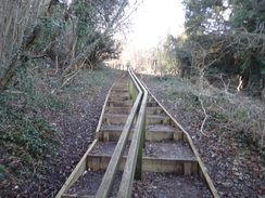
Carefully cross the road, and take the rightmost of two paths that lead into woodland. After about ten metres turn right along another path that descends northeastwards, with the road above to the right. The path passes a vehicle barrier to enter Keston Common Car Park. Head through the car park, passing the entrance to the right, and then head down a long flight of steps to reach Caeser's Well, the source of the River Ravensbourne, at TQ41956402.
Turn right to cross the spring, and then left to pass a lake on the left. At the end of this lake, turn left to walk between the lake and another lower one, and then turn right down a few steps to walk past the second lake on the right. This path reaches Fishpond Road. Cross this, and take a good track that passes a third lake off to the right. The track slowly curves left, joining a school fence on the left. It then joins the end of Lakes Road; head straight on down the road for 250 metres until ti ends at a T-junction with the B265 Heathfield Road at TQ41276447.
Turn right along the main road; pass a mini-roundabout, and at a second turn left down West Common Road. After a few metres turn left down a surfaced track, and as this immediately curves right, turn right along a path through trees. This heads northwestwards, with the road away to the right. After about 300 metres this path rejoins West Common Road; turn left to follow it northwestwards – there is a path on the verge. When the road forks, continue on down Baston Manor Road. The path veers left away from the road, crosses a surface track leading to Hast Hill, and heads on through the trees, with the road some way away to the right. Follow the path through the trees; go past a little barrier and follow fences on the left, guarding houses. After about 500 metres it reaches Hartfield Crescent at TQ40246515.
Cross the road, head on between fences for ten metres to a gate. Continue along the path, still with fences to the left. After about 250 metres a gravel path veers right away from the fences to approach a clearing containing West Wickham Common earthworks. Keep to the left-hand side of the clearing. The path curves right at the far side of the clearing and starts to descend northwestwards and becomes rough. It finally curves left to descend to a pedestrian gate beside a vehicle barrier that lead out onto Cates Green Road at TQ39596537.
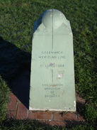
Turn left along the road for a few metres, and then turn right down a surfaced path that runs between fences. The fence on the right is replaced by a car park, before the fence resumes and the path ends at a road. Cross the road, and continue straight on up Church Drive. When this ends at the gates leading into a recreation ground, head through them and follow a surfaced track through the recreation ground, initially with a car park on the left. At the end of the car park, go past a vehicle barrier and head straight on along a surfaced path. The path passing a Greenwich Meridian marker and some buildings, before the playing fields end at Layhams Road. Cross this, and continue straight on up an access road. When this curves left, head straight on for a short distance to reach Wickham Court church at TQ38906483.
Go through the lych gate into the churchyard, and then immediately turn right along a surfaced path that passes the eastern end of the church on the left. Go down some steps and continue along the path through the churchyard. Go through a clappergate into a field, and head straight on north across the middle of a field. At the bottom of the field, go through a clappergate to reach Addington Road at a roundabout at TQ38906511.
Carefully cross the road, with the roundabout immediately to the right, and go through a gate ahead to enter some playing fields. Turn left along a path that parallels a fence on the left, with the road behind it. After 150 metres angle half-right across the pitches, aiming for the corner of some woodland on the far side at TQ38526510.
Once there, ignore the larger path heading to the right through the trees, and instead take a smaller one just before it. This heads uphill, with a little fence on the right and the woodland on the left. When a fence is reached ahead, the path curves left to start heading southwestwards through the woodland. The fences soon end, but the path continues straight on. The track starts to climb and curves right through the trees; after 1.2km it meets another path. Turn left along the new path, which soon emerges into a clearing at TQ37556468.
Follow trees on the left, keeping the clearing on the right. When it ends, turn half-right along an obvious path through a gap in the trees into a larger clearing. Again follow the treeline on the left. At the far end of this clearing, continue along the path as it heads back into the trees. It soon meets a broad track; turn right along this track and follow it as it curves right. After 150 metres turn left off the track to join a footpath that heads through the trees. It curves right for abut twenty metres to meet another path, and turn left along this path. When the path forks, take the right-hand branch and follow it as it curves right. A while later, turn right along another path, with Shirley Church Road off to the left. The path then meets the road at TQ36676475.
Turn right to follow the road northwestwards; initially there is a pavement on the right-hand side. When a pavement starts on the left-hand side, swap over to it. When a children's playground and tennis courts are reached on the right after 900 metres, turn left up a surfaced path through trees, with a fence guarding a school on the right. After 200 metres the fence and path curve right and then right once again, to join the end of Sandpits Road. Head on down Sandpits Road until it ends at Upper Shirley Road beside the Sandrock pub at TQ35646487.
Carefully cross the road, turn right for a few metres, and then turn left down Oaks Road. After about 100 metres, turn left through a pedestrian gate into some woodland. After a few metres, turn right along another path which initially parallels the road on the right. The path winds around for about 250 metres through the trees, still with the road away to the right, before turning left to start climbing. When the path forks, take the left-hand branch that continues steeply uphill, including a stretch of steps, to reach the Addington Hills viewing platform at TQ35216444.
Pass the viewing platform on the right, and then angle left along a good path across the top of the hill. Just before a car park is reached ahead, turn right along another path, initially with a hedge on the left. The path heads into trees; when it forks take the left-hand branch and follow it as it curves right. After a while, turn left off this path onto another path which emerges by Coombe Lane tram stop. Carefully cross the tram tracks, and before the road is reached ahead turn left down a surfaced path that parallels the road on the right. This becomes the A212's pavement; follow this to a traffic-light controlled crossing at TQ35426398.
Carefully cross the main road, and on the other side turn right to double back for a short distance before turning left down Ballards Way. After a few metres turn left through a gateway, and then angle left towards a small lodge-style building. Immediately before the lodge, turn right to join a path that runs south through the trees; this soon descends a long flight of steps to emerge out onto a road beside a pond near Heathfield House. Turn left for a few metres, and then right along an access road, skirting the pond on the right, and then angle right to reach the bottom of a long flight of steps. When the steps soon fork, take the right-hand branch and continue up to emerge out into a car park. Head through this, and then under a vehicle barrier to reach a small lane at TQ35276382.
Turn left to head south down this lane, but when it soon curves left, continue straight on through a clappergate into woodland in Bramley Bank Nature Reserve. Follow the obvious path south through the trees after about 500 metres; it descends to a pedestrian gate that leads out into a small grassy clearing near houses at TQ35376323.
Turn right along the edge of the clearing, away from a road on the left. Go through a gap in a railing to join a surfaced path, and then turn left up this path. After a few metres turn right along another path that enters some trees. After a few metres the path emerges from the trees; turn right to head down a slope through the centre of a clearing. Immediately under some power lines, angle left past a tiny copse of trees, and then re-enter the trees once more at TQ35206296.
A few metres into the trees, turn left to join a path that heads uphill through the trees. The path climbs steeply and crests the hill. As it starts to fall, angle left along another path. The path passes a large water tower on the left as it descends; shortly after this turn right down another path. When it forks, take the left-hand branch and follow it through the trees. The path passes under power lines as it descends, and immediately after passing a pylon on the right it joins a surfaced path for a few metres before reaching Addington Road at TQ35776271.
Carefully cross the road, and head on down Ashen Vale on the other side. Just before this road curves right, head straight on along a path that runs between fences. This path soon crosses a road; cross this and continue down the path, which is still between fences. This meets a second road; cross this and continue along the path. Shortly after the fence on the left ends, go through a gateway to enter Selsdon Wood at TQ36356232.
Immediately turn right along a path for ten metres, and then left along a path that climbs steeply uphill. Continue along the path through the trees; it crests the hill and starts to descend downhill along a larger track. At the bottom go through a gate and then turn right up a bridleway, with a fence to the left – do not go ahead onto the golf course. The lane emerges from the woodland and continues on between hedges; it curves right and then left, and 1.1km after joining the bridleway, it goes past a vehicle barrier to meet the golf course's access road at TQ36346076, with a busy road off to the right.
Cross the access road and head straight on along a path, with a hedge guarding a road on the right. The path eventually joins the road's verge; 300 metres after the access road, and opposite Elm Farm, turn right to cross the road and join a track. This track passes a farm; as it curves left, continue straight on downhill along a footpath between hedges. When a field gate is reached, curve right to continue downhill along the path. It reaches the bottom of the valley and starts to climb uphill, winding as it does so. At the top, cross a stile to enter a field and follow a hedge on the left. At the far end of the field, cross a stile to meet a track called Kingswood Lane at TQ35586013.
Turn left down this track, which is initially rough. It improves as it curves right and houses start on the right. After 900 metres the lane – now a public road – ends at a T-junction at TQ35015951. Cross the road ahead, and head straight on up Tithepit Shaw Lane. When this curves left by a school, continue straight on past a vehicle barrier to join a path. Follow this path westwards across a field, initially with a hedge on the left. Once the hedge ends the path curves slightly right, and at the end of the field a hedge is joined on the left. The path then heads northwestwards between hedges; pass a trig pillar on the left, and a little further on turn left into a field at TQ33565991.
Follow a path downhill, with a hedge to the right and a field away to the left. At the bottom follow a fence on the left steeply downhill; go through a clappergate and then turn left along a path. When the path soon forks, take the right-hand branch that angles down the grassy slope. This meets a track; go through a bridleway gate beside a field gate to join the track. Follow this downhill; it crosses a bridge over a railway line and ends at the A22 at TQ33635926.
Carefully cross the road, and then turn right down Old Barn Lane. When the road ends, continue straight on to cross a footbridge over another railway line. On the other side New Barn Lane continues uphill, passing a school on the right; it crosses a road ahead, and when it ends angle left up steps that enter woodland. The steps zigzag uphill; after a left-hand bend turn right up some more steps. At the top of the steps enter Kenley Common and angle right uphill, following a field boundary on the right until the clearing ends at TQ33215889.
Go through a gap in the hedge ahead and continue on through trees. When the track forks, take the left-hand branch, and emerge out of the trees into a field. Go past a free-standing pedestrian gate and angle diagonally across the field. At the far side go past another free-standing gate and continue on into some trees. The path cuts across the corner of the woodland and meets a track; turn right down the track for a few metres to a gap in a fence that leads onto Golf Road. Follow this for 250 metres until it ends at Hayes Lane at TQ32525828.
Turn right along Hayes Lane for 100 metes, and then turn left down a footpath. The path soon curves right and then left and emerges into an open area. Angle left across a corner of this field to a gap in a hedge on the left; turn left through this gap and then curve left, along the edge of a field on the left. Near the corner of the field angle right across the corner of the field to reach a gap in a hedge that leads down a couple of steps onto Old Lodge Lane at TQ32255818.
Cross the road, and then a stile to enter a field. Head south across this field, initially following a hedge on the left. As the hedge curves left, continue straight on across the field, rejoining the hedge further on as it curves back. At the end of the field cross a stile and pass a dome belonging to Kenley Observatory to join a track. Follow the track past a field gate; as it curves left, turn right down another path that heads downhill through trees, emerging out onto Caterham Drive at TQ32265757.
Cross the road and continue straight on up Rydons Lane; it climbs up, and after 500 metres ends at Stites Hill Road. Cross this and on the other side take a path that heads through some woodland across Coulsdon Common; it curves slightly right, and after 250 metres passes a field gate to reach the B2030 Coulsdon Road. Cross this, and head straight on down Fox Lane. After passing The Fox pub away to the left, follow a track that curves right and then left, to pass a large car parking area on the left and then a vehicle barrier at TQ31655680.
The path enters a field; follow a hedge on the right. At the end of the field it enters an area of woodland. Continue as the path heads downhill, curving right to emerge onto a grassy valley side. Angle downhill across the path along the obvious path; this goes back into some trees, before emerging out into Happy Valley. Turn left to follow the edge of some trees on the left downhill to reach the bottom of the valley at TQ31275663.
Cross a path at the bottom of the valley, and head straight on uphill past some trees on the left. At the top, curve right to follow the treeline northwestwards, with the valley down to the right. When the treeline curves right, enter the trees. The path becomes a track that slowly climbs uphill through the trees. It approaches a house on the left; continue straight on past a vehicle barrier, and then curve left to reach a road in front of the Happy Valley car park at TQ30155715.
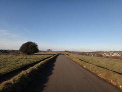
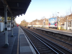
Turn right to follow the road northwards across Farthing Down; there are paths that parallel the road on the grass to the left, and which offer better views. The road starts to descend; after 1.6km it crosses a cattle grid and continues past houses on the left to end at Marlpit Lane. Turn left along the road for a few metres, and then left down Reddown Road. As this starts to curve left after 100 metres, turn right down steps to join a footpath that runs between fences to reach Coulsdon South station at TQ29875904. The northbound platforms to Central London are across the footbridge.
 |
 |
|
Distances
| From | To | Distance (m) | Ascent (ft) | Descent (ft) |
|---|---|---|---|---|
| Orpington station | Keston | 5.4 | 607 | 505 |
| Keston | Coombe Lane tramstop | 6.0 | 574 | 495 |
| Coombe Lane tramstop | A22 in Kenley | 6.0 | 627 | 814 |
| A22 in Kenley | Coulsdon South station | 4.9 | 561 | 564 |
This makes a total distance of 22.3 miles, with 2,369 feet of ascent and 2,378 feet of descent.
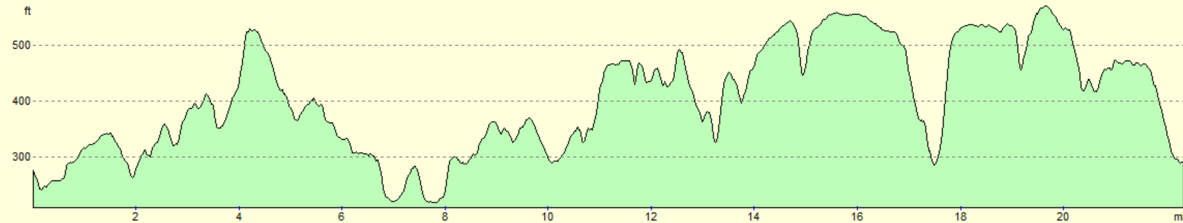
For more information on profiles, ascents and descents, see this page
Transport
Perhaps the quickest way to get from Coulsdon South back to Orpington is to take a train north to East Croydon, change for a Tramling service to Beckenham Junction, and then take another train south to Orpington. This should take between an hour and an hour and a half, depending on the frequency of services.
 |
 |
|
 |
 |
|
 |
 |
|
 |
 |
|
 |
 |
|
 |
 |
|
 |
 |
|
 |
 |
|
 |
 |
|
 |
 |
|
 |
 |
|
 |
 |
|
 |
 |
|
 |
 |
|
 |
 |
|
 |
 |
|
 |
 |
|
 |
 |
|
 |
 |
|
 |
 |
|
 |
 |
|
 |
 |
|
 |
 |
|
 |
Disclaimer
Please note that I take no responsibility for anything that may happen when following these directions. If you intend to follow this route, then please use the relevant maps and check the route out before you go out. As always when walking, use common sense and you should be fine.
If you find any information on any of these routes that is inaccurate, or you wish to add anything, then please email me.
All images on this site are © of the author. Any reproduction, retransmissions, or republication of all or part of any document found on this site is expressly prohibited, unless the author has explicitly granted its prior written consent to so reproduce, retransmit, or republish the material. All other rights reserved.
Although this site includes links providing convenient direct access to other Internet sites, I do not endorse, approve, certify or make warranties or representations as to the accuracy of the information on these sites.
And finally, enjoy your walking!
Nearby walks
| # | Title | Walk length (miles) |
|---|---|---|
| 123 | Mile End to Dartford | 15.0 |
| 217 | Greenwich to Whyteleafe | 17.9 |
| 601 | A circular walk along the North Downs from Whyteleafe | 21.6 |
|
|

|