Walk #1025: Evesham to Worcester
 |
 |
|
General Data
| Date Walked | 03/11/2018 |
| County | Worcestershire |
| Start Location | Evesham station |
| End Location | Worcester Shrub Hill station |
| Start time | 07.09 |
| End time | 14.29 |
| Distance | 21.5 miles |
| Description | This was a long walk northwest from Evesham to Worcester, followed by a little loop around the town. |
| Pack | Today I carried my 30-litre Karrimor rucksack, filled with water, my spare waterproofs, a book and other odds and ends. |
| Condition | I feel absolutely fine after this walk. |
| Weather | Today started off sunny and chilly, with a bit of a breeze. The clouds gathered as the day progressed, although thankfully the threatened rain never arrived. |
| OS map | Landranger number 150 (Worcester & The Malverns, Evesham & Tewkesbury) |
 |
 |
|
Map of the walk
Maps courtesy of Google Maps. Route for indicative purposes only, and may have been plotted after the walk. Please let me have comments on what you think of this new format. For a detailed table of timings for this walk, please see the table file.
 |
 |
|
Notes
The next walk on my plan was to connect a recent walk to Evesham with three others that centred on Worcester, the last of which I had walked over ten years ago. The drive to Evesham went well, and I arrived at the station car park just as dawn was breaking.
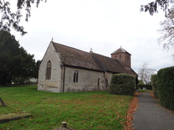
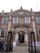
The town was just waking up for the day as I headed through it. There were some interesting buildings, but the lack of people at the early hour made it feel a little characterless, as though I was walking through a model. Three churches sat close-by each other, staggered back in distance from the road; I have seen two churches close together before, but never three, and I wonder what led to such close proximity in what is a small town. (it turns out this is two churches close by each other, with a Bell Tower in between, which is the last remnant of Evensham Abbey).
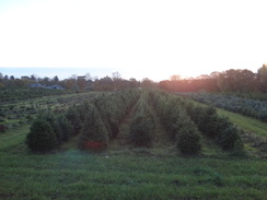
Christmas trees were growing on a large plot of land near the river, and I can only imagine how busy it will get in a month’s time during the run-up to Christmas. Large red poppies had been stuck to uprights on the river bridge, and their presence, along with ones on surrounding lampposts, seemed a little jarring. I know this remembrance Sunday marks the 100th anniversary of the end of the First World War, and is therefore a special one, but I cannot help but feel that people are going a little overboard.
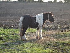
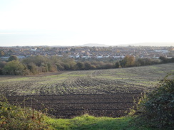
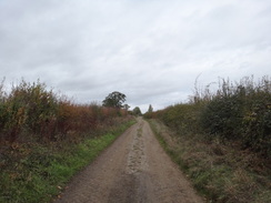
A road took me west through Hampton, after which another took me north through the village. A track continued on from the end of the public road, passing a travellers’ camp complete with horses. The rounded outline of the Cotswold Hills were visible to my right, and as the track rose, the top of the Malvern Hill started peaking over the fields to my left. Today’s walk would mainly be across the plain between these two superb hill ranges, and one or the other would remain a presence through most of the day.
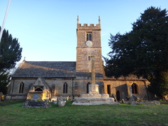
The track curved to take a westerly direction, and became a public road as it headed into the little village of Charlton. This was a fairly attractive place, and at one point had a stream running down the middle of a green, with a footbridge arching over the water. The village church was a curious affair, a stone (perhaps Cotswold stone) building alongside the road, of a basic rectangular plan more reminiscent of a chapel than a church. Research tells me it was actually an Elizabethan barn until it was converted into a church in 1872 for the villagers’ use.
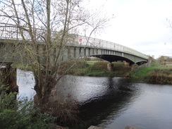
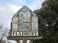
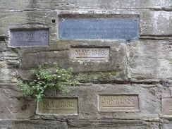
A road headed west out of the village and on to Jubilee Bridge over the Avon. This was a fairly unspectacular steel or iron bridge, with an adjacent viewpoint. It was older that I had thought, being built in commemoration of Victoria’s Jubilee in 1897. On the other side the road led into Fladbury, and a convenient path in a field alongside allowed me to avoid the traffic. A stone wall fronting a garden in the village had flood level markers on it, showing how high the Avon can get when it bursts its banks.
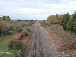
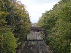
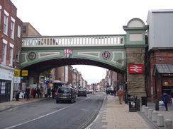
Fladbury seemed a rather unspectacular village, but there was one thing of note: a pie shop proved irresistible, and I bought a sausage roll with a girth so vast that I could not get my hand around it. I munched this as I walked through the village, crossing the railway line before taking a path that paralleled the line. A section of low brickwork on the other side was all that remained of the platform of Fladbury station, which closed in 1966.
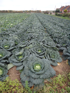
The path took me to the village of Lower Moor, where roads and paths took me westwards through the village. At one point a path passed a field full of massive cabbages, some looking more like alien lifeforms than food. This led to another road which used to be a busy main road before a new bypass had been built. The old road I was following had been demoted, and a bridge over the railway line had been closed to all but emergency vehicles and buses.
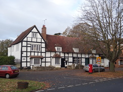
The bridge led me into the rather sniggerworthy village of Wyre Piddle. Some rather expensive-looking houses stood above the river, and the sound of shots echoed from the woodland across the water. The village looked like an expensive place to live, perhaps helped by the fact that the road through it is now a quiet backwater. I am obviously not the only person who finds the village’s name funny, as a bar was called the ‘Piesse of Piddle’ !
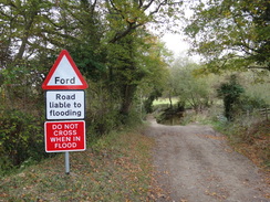
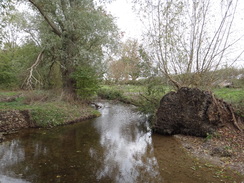
The stretch of main road past Pershore was not a pleasant walk, with no pavements and traffic streaming past. It was a relief when I could take a path that led north across fields to the little village of Peopleton. A road led me through the village, after which a track led off to the west, descending to a ford over a stream. A footbridge allowed me to keep my feet dry, but a large road sign warning cars not to cross if the stream was in flood seemed very out of place for such a rural scene, especially as few cars could probably get down to the water!
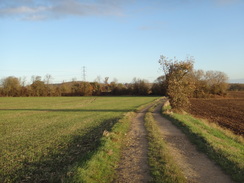
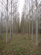
The track eventually led to a farm, and then onto a public road and then the A4538. Tracks and footpaths then took me westwards; when I reached a small lake I could not match what I was seeing with the map, as if the lake has increased in size. I took a rather safe route across the field, where I could join another path I could see. This took me back to the correct route, which headed past some new woodland – boring rows of bored-looking trees – and then on through a farm. A good track then led me under the M5 and onto the eastern outskirts of Worcester.
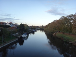
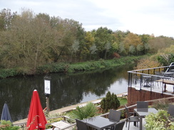
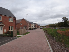
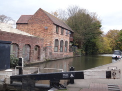
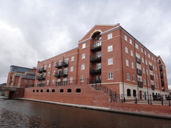
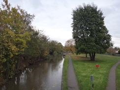
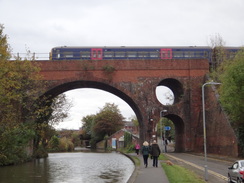
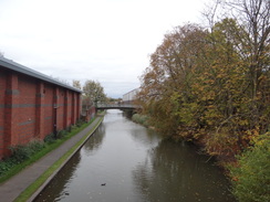
I was feeling fit so I decided to extend the walk slightly, passing a brand-new estate of houses parallel to the A4440. This led me to more roads, which took me west towards the centre of town. Eventually I reached the Birmingham and Worcester Canal beside The Commandery, a museum based in the building that served as the Royalist Headquarters during the Battle of Worcester in 1651. I joined the canal towpath, and followed it towards its junction with the Severn. This passed a large building on the other side of the river with ‘Royal Worcester’ written at the top. It was now an apartment building, and the brickwork looked so new that it might be a modern building. If it is a conversion of an old factory then all original character has been lost; if it is a modern then it is a very unsuccessful pastiche. The very neat-looking and modernised Diglis marina thankfully had retained some character, and I diverted around this to reach the lock with the River Severn.
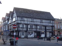
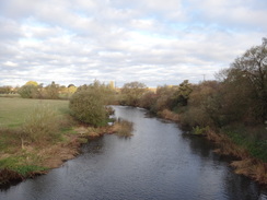
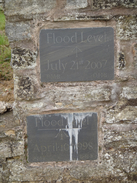
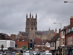
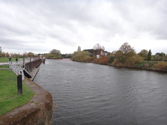
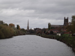
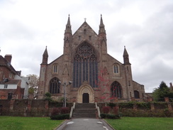
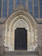
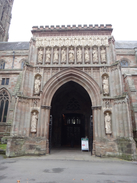
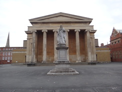
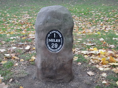
I have walked parts of the Severn Way in the past, and would love to do the whole trail if I ever have a week or more to spare. But for the moment I turned right, ignoring the milepost showing places upstream and downstream, and followed the trail towards the centre of town. I diverted off towards the Cathedral, passing a gateway that had a series of plaques on marking various flood levels, some so high that much of the town must have been under water. This led me to the dramatic western end of the Cathedral, and then past a couple of flying butresses towards the town. Unfortunately trees prevented me getting a good photo of this side of the Cathedral. Instead I strode on through the town along a pedestrianised street, trying to avoid the hordes of people enjoying a Saturday afternoon out – a dramatic contrast to the quiescent Evesham I’d encountered this morning.
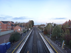
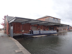
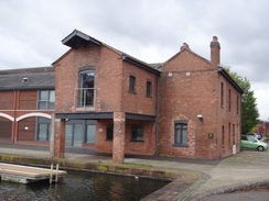
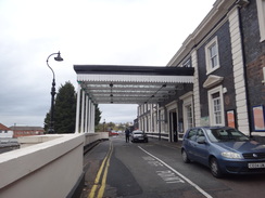
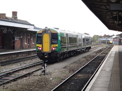
I arrived at Foregate Street station with a little under an hour before the next train back to Evesham. Instead of waiting, I decided to walk on to Shrub Hill station, taking roads back to the canal in the northern outskirts of the city, then following it back south towards the centre past some wonderfully derelict canalside industrial buildings. I was feeling fit and considered walking further, but with a two hour drive home after my train, I decided not to push it. Another road then led me to Shrub Hill station, where I had a short wait for my train back to Evesham.
It had been a very pleasant day’s walk through an area of country that’s probably not much walked, with the glories of the Malverns and the Cotswolds so close to hand.
 |
 |
|
Directions
This walk starts off from Evesham railway station at SP03694446. Leave the station and follow the station approach road to reach the A4184 High Street. Turn right to follow this south through the town for 800 metres until it reaches a roundabout beside the Almonry Tourist Information office. Take the first road off the roundabout to continue south along the A4184 Abbey Road; it climbs to cross the River Avon on a bridge to reach a crossroads on the river’s south bank at SP03384308.
Turn right to follow the B4084 Pershore Road westwards, initially with the river below to the right. The road climbs and passes a church on the right; after 750 metres (and just before the Cider Mill pub) turn right down School Road. Follow this road as it curves slightly to the right to head north through Hampton; after 600 metres the surfacing ends and a rough track continues on, climbing up Clark’s Hill and passing a telecoms tower and then a travellers’ camp. Continue on along the track as it heads northwards; when it curves right 880 metres after the mast, head straight on along a lesser track. This passes Rawlings Farm, and after another 930 metres it reaches Ryden Farm, where the track becomes a surfaced public road. Continue along the road as it curves to take a more southwesterly course as it slowly falls, before curving left to enter the village of Charlton. After anotehr 1.3km the road ends at a T-junction at SP01054572.
Head straight on westwards along The Strand, with a little stream away to the left. The road leaves the village and curves sharply left and then right, before winding around in a rough westerly direction to reach the Jubilee Bridge over the River Avon after 1.1km. Either continue along the road, or thirty metres after the bridge, go through a clappergate on the right to enter a field. Turn left to follow the fence on the right, with a road on the other side of the fence. The road and fence curve right; continue following them to reach a stile beside a field gate on the left, just before the field’s corner is reached. Turn right along the road and follow it as it enters Fladbury before reaching the village church on the right at SO99574626.
Continue north along the road through Fladbury; nearly 500 metres after the church, the road climbs to cross a bridge over a railway line. Immediately on the other side, turn left down some steps that lead down to a path that runs west, with the railway line on the left. The path becomes an unsurfaced track; after 700 metres it curves right away from the railway line, following a hedge on the left across fields before ending at a road. Carefully cross this road and continue straight on down Blacksmiths Lane, which immediately enters the village of Lower Moor. The road curves right and then left through the village, passing a recreation ground on the right before it curves to the right beside the Old Chestnut Tree Inn at SO97914727.
On the bend, turn left to head straight on along Maytree Road. When it soon starts curving right, turn left down Church Lane for a couple of metres, and then right along a track that follows a hedge on the right. The hedge soon ends and the track continues on between fields. A hedge guarding houses starts on the right, and then the track turns right. Immediately after the bend, turn left to enter a field. Follow a fence on the left, with a field to the right. The path curves right before ending at a road at SO97314743.
Turn left along the road, and follow it as it heads westwards. It soon becomes closed to most traffic as it curves to cross the railway line on a bridge, and then enters the village of Wyre Piddle. Head westwards along the road through the village, and it starts to curve to the right. After 1.2km the road reaches a roundabout with the B4083. Head straight on at this roundabout and follow Worcester Road as it climbs slightly and crosses the railway once more. 700 metres after the B4082 junction, a large roundabout is reached with the A44. Carefully cross the A44 that comes in from the right, and continue northwestwards along the A44 for another 450 metres until the B4082 Main Street comes in from the right at SO95224838.
Carefully cross Main Street at the junction to head straight on along the A44. After 730 metres, and opposite the entrance to Glebe farm, turn right up a track that also carries a footpath. This crosses the course of an old road, and becomes an unfenced track that heads north between fields. When the track turns sharply right, turn left to head westwards across the field, aiming for the end of a hedge ahead. At the far side of the field, cross a stile and turn right to walk past a field alongside a hedge on the right. At the northern end of the field, cross a stile and head on for five metres to a second stile that leads into a second field. Continue following the hedge on the right. At the end of this field, cross another stile and follow the path as it heads north between a fence on the left and a hedge on the right. Both the fence and hedge soon end, and the path follows a ditch and some woodland on the left. When this field ends, go through a clappergate and continue on past the trees on the left. This emerges out to a pedestrian gate beside a field gate that leads out onto a road at SO94034989.
Turn right to follow this road northwards; it passes through the village of Peopleton. After leaving the village it passes the village hall on the right, and 200 metres further on, turn left down an unsurfaced track. This heads westwards, jinking about, and after 350 metres reaches a footbridge called Barrel Bridge over a stream, with a ford alongside. Cross the footbridge, and on the other side turn left through a clappergate into a field, and immediately turn right to follow a fence on the right, with the track on the other side. The field narrows; at the tip, turn right through a pedestrian gate beside a field gate to rejoin the track. Follow the track it as it heads slightly uphill northwestwards. The track twists around, initially to take a westerly course before taking a more northerly one. 1.4km after rejoining the track, it passes Aston Hall Farm on the left, and then reaches the end of a public road by Moat Farm at SO92455198.
Turn left along this road, which after 200 metres ends at a T-junction with another road. Turn left south down this road, and it soon curves right to head west. 700 metres after the bend, the road ends at a T-junction with the A44. Turn right to carefully follow the A44 northwestwards; when it is safe to do so, change over to the left-hand (western) side of the road. After 300 metres, and immediately past a company on the left, turn left down a bridleway at SO91455182.
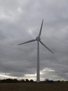
The bridleway passes a barn on the right and becomes a green track. Soon after the barn it curves right through a gap in a hedge into a field. Follow a ditch and hedge on the left. At the end of the field, go through a second broad gap in a hedge into another field. Continue following the ditch and hedge on the left; when the bridleway forks, take the right-hand branch, angling slightly to the right of a wind turbine ahead. The path reaches a track leading down to a lake on the left; cross the track and head straight on across the corner of a field, aiming for a solitary tree ahead. Pass the tree and continue on to the far corner of the field at SO90415192.
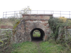
In the corner of the field, turn half-left to head straight on between a hedge on the left and some woodland to the right. Go through a small gate and follow the hedge on the left as it slowly curves to the right. When the woodland ends, go through a field gate into a field and continue alongside the hedge on the left past a field for 100 metres to reach a field gate that guards a rail underbridge at SO89785199.
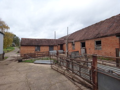
On the other side of the rail bridge, go through another field gate and continue following a hedge on the left. An area of woodland soon starts to the right, the path following a broad gap between hedge and woodland. It heads up a slope and then down; when the woodland on the right ends, a field gate is reached. Go through this into another field and roughly parallel the hedge on the left, heading for a farm ahead. Pass the end of a hedge on the right, and continue on towards the farm. Go through a farm gate and pass between a barn on the left and some farm buildings on the right to join a track that reaches a farmhouse on the left at SO89185222.
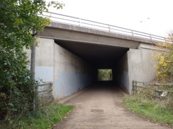
Continue west along the track, with a hedge to the left. When the track soon curves left, turn half-right to join a path that runs to the right of another track, with a depression between the track and the path (do not follow the track, which soon ends at a house). The path passes behind the house to reach a bridleway gate that leads into a field. Follow the path northwestwards, with a hedge on the right. About halfway across this field the hedge curves away to the left; follow it to join a track that runs along a sunken lane between hedges. Continue along this track, with a hedge to the left as it heads downhill towards the M5 downhill. At the end of the field, go through a broad gap in a hedge ahead and continue on along the track, still following the hedge on the left. Just before the motorway is reached, go through a field gate and head through a bridge under the M6 at SO88235326.
Continue along the track on the other side of the M6 underbridge; it passes some buildings on the right and passes a field gate and curves left, becoming a surfaced road. When Berkeley Close comes in from the left, turn right down Walkers Lane. Follow this as it turns right and then left, and after 500 metres ends at a T-junction with the A4440 dual carriageway on the eastern outskirts of Worcester. Turn left down the dual carriageway for 130 metres towards a large roundabout with the A44; just before the roundabout, use a traffic-light controlled crossing to cross over to the road’s northern side at SO87395329.
At the roundabout, take the first road off to the right, the A44 Whittington Road, and then after a short distance turn right down Walkers Lane (which must be a spur when the A44 cut through the road). The road soon goes through a squeeze and becomes Cooke Close and curves left; on the bend, head straight on along a paved path across grass, paralleling the A4440 away to the right. The path soon ends a the end of Willnott Way; head on along this, past houses on the left. When the road ends after about 100 metres, continue straight on along a surfaced path, still paralleling the main road to the right. The path curves left, passing houses on the left and a play park on the right, and then turn right to follow Honeywood Place around to the right, passing houses on the left. It passes a flood relief pond on the right, and when the road ends join a gravel path that soon curves left away from the main road at SO87775375.
The path parallels a stream on the right; at a footbridge over the stream, turn left for about ten metres to reach Leslie Walk, and then turn right to pass houses on the left. Cross a road ahead, and join a short section of path that ends at Staplow Road. Head on down Staplow road, which curves left to parallel Spetchley Road to the right. Staplow Road then ends at a T-junction with another road. Turn right down this road for a few metres, and then left to join Spetchley Road. Follow this west-southwestwards for 500 metres until it ends at a roundabout with the A44 at SO86935375.
Take the first road off the roundabout to the right, the A44 London road, and follow it as it heads west-northwestwards into the centre of Worcester. After 1.8km it reaches a bridge over the Birmingham and Worcester Canal near the Commander at SO85255438. Immediately before the bridge, turn right along a narrow path that squeezes between the Commandery on the right and railings on the left, and after a few metres turn left through a gap in the railings to reach the canal’s towpath. Turn left to follow the towpath past a lock, and immediately down steps under the road bridge.
Follow the canal south-southwestwards; after 470 metres Diglis Basin is reached. Follow the towpath as it turns left past the basin, the Anchor Inn and then a wharfside building. Immediately on the other side of the building, turn right to pass the building on the right, with a marina extension on the left. Cross a footbridge over the marina entrance. Just before a road is reached ahead, turn right across a second footbridge and continue on for a few metres to reach Diglis top lock. Turn left to follow the towpath for a short distance to Diglis Bottom Lock, which is the end of the canal. Pass the lock to reach a footbridge over the lock beside the River Severn at SO84835383.
Turn right over the footbridge, and on the other side follow the path beside the Severn northwards. After 570 metres turn right through a gateway and then turn left up steps; cross the end of a road, and then turn right along a path towards arches ahead, paralleling the river below to the left. Go through an arch and up some steps to reach the western end of Worcester Cathedral. Turn right up some steps to reach the end wall, and then left and right and go through a gateway to walk past the cathedral’s northern side. Go past an entrance to the cathedral on the right, and then turn left along College Yard, with houses to the left. The road soon curves right and ends at a t-junction with a road at SO85025458.
Turn left along the road to reach a pedestrian crossing across the road, which leads to a pedestrianised street. Follow this street northwards, immediately passing a statue to Edward Elgar on the right. After 360 metres a road swings in from the right; continue straight on north along this for another 250 metres until Worcester Foregate Street railway station is reached on the right at SO84935521, beside a bridge over the road.
The walk can be ended here, but the following is a long extension to Worcester Shrub Hill station. Continue north along the road for another 230 metres after the bridge, and then turn right down St Mary’s Street. When this soon ends at a T-junction in front of a large church, turn left to head north up Sansome Walk. This curves to the right and becomes Chestnut Walk, and curves to the right in front of the Chestnut Tree Inn to become Lansdowne Road. Follow this east until it reaches a bridge over the Birmingham and Worcester Canal at SO85185595.
Immediately before the bridge, turn right to descend down steps to reach the canal towpath. Head straight on south away from the bridge, keeping the canal to the left. Head south, passing under a large railway bridge and a couple of road bridges. A smaller road bridge is reached; continue on a short distance to reach a footbridge 5A after 1 kilometre on the canal at SO85505503.
Turn right off the towpath up some steps, and then left to cross the footbridge over the canal. This leads into a car park of an retail estate. Head through the car park, keeping the shops to the left, and ascend a ramp into a smaller upper car park. At the top of the ramp, turn left to reach a zig-zag ramp that leads up onto the B4205 road. Carefully cross the road using the pedestrian crossing, and then turn right and immediately left up an access road. After a few metres turn right up another road that curves left to reach Shrub Hill railway station at SO85785517.
 |
 |
|
Distances
| From | To | Distance (m) | Ascent (ft) | Descent (ft) |
|---|---|---|---|---|
| Evesham station | Fladbury | 5.2 | 197 | 223 |
| Fladbury | Peopleton | 5.0 | 138 | 131 |
| Peopleton | A4440 roundabout | 5.9 | 253 | 164 |
| A4440 roundabout | Worcester Foregate Street station | 3.8 | 105 | 210 |
| Worcester Foregate Street station | Worcester Shrub Hill station | 1.6 | 82 | 39 |
This makes a total distance of 21.5 miles, with 775 feet of ascent and 767 feet of descent.
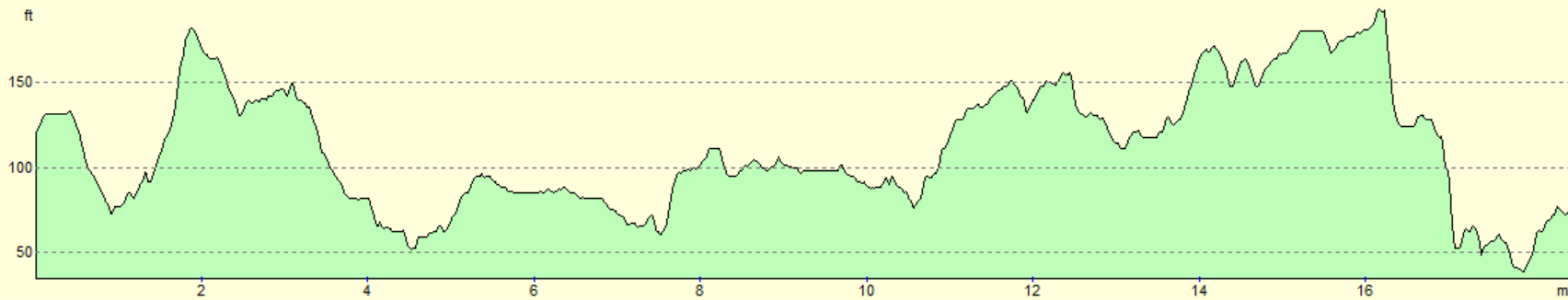
For more information on profiles, ascents and descents, see this page
Transport
Trains run regularly between both stations in Worcester (Foregate Street and Shrub Hill) back to Evesham. See the National Rail Enquiries website for more details.
 |
 |
|
 |
 |
|
 |
 |
|
 |
 |
|
 |
 |
|
 |
 |
|
 |
 |
|
 |
 |
|
 |
 |
|
 |
 |
|
 |
 |
|
 |
 |
|
 |
 |
|
 |
 |
|
 |
 |
|
 |
 |
|
 |
 |
|
 |
 |
|
 |
 |
|
 |
 |
|
 |
 |
|
 |
 |
|
 |
Disclaimer
Please note that I take no responsibility for anything that may happen when following these directions. If you intend to follow this route, then please use the relevant maps and check the route out before you go out. As always when walking, use common sense and you should be fine.
If you find any information on any of these routes that is inaccurate, or you wish to add anything, then please email me.
All images on this site are © of the author. Any reproduction, retransmissions, or republication of all or part of any document found on this site is expressly prohibited, unless the author has explicitly granted its prior written consent to so reproduce, retransmit, or republish the material. All other rights reserved.
Although this site includes links providing convenient direct access to other Internet sites, I do not endorse, approve, certify or make warranties or representations as to the accuracy of the information on these sites.
And finally, enjoy your walking!
Nearby walks
| # | Title | Walk length (miles) |
|---|---|---|
| 620 | Cotswold Way: Dowdeswell Reservoir to Stanton | 19.8 |
| 621 | Cotswold Way: Stanton to Lower Quinton | 17.0 |
| 622 | Lower Quinton to Buckley Green | 22.2 |
|
|

|